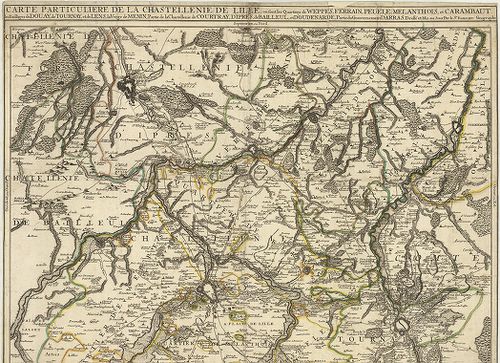
2701. Carte Particuliere de la Chastellenie de Lille… [B V a 120]
Institute and Museum of Military History •
B V a
•
B V Franciaország
•
B I–XV. Európa
| Title | Carte Particuliere de la Chastellenie de Lille… |
| Main title | A franciaországi Lille-i várbirtok térképe a körülötte elhelyezkedő várakkal (Weppes, Ferrain, Peuelle, Melanthois, Carambaut, Douday, Tournay, Lens, Menin…) a 18. században. |
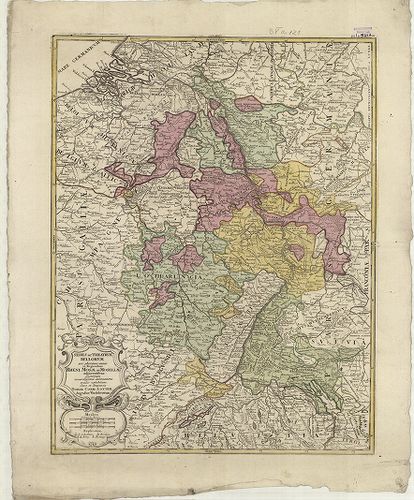
2702. Sedes ac Theatrvm Bellorvm per plurimos annos in Regionibus ... [B V a 121]
Institute and Museum of Military History •
B V a
•
B V Franciaország
•
B I–XV. Európa
| Title | Sedes ac Theatrvm Bellorvm per plurimos annos in Regionibus Rheni, Mosae ac Mosellae… |
| Main title | A Rajna-torkolat térképe a 18. században. |
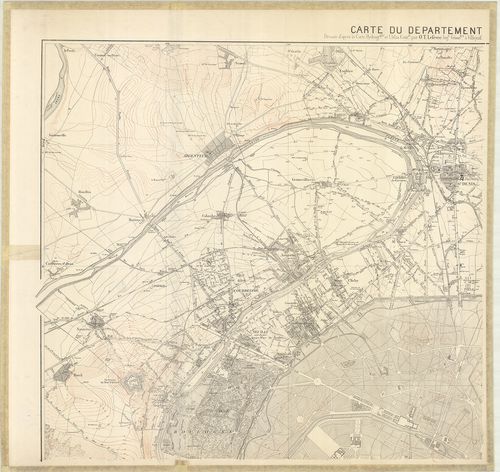
2703. Carte du Departement de la Seine. [B V a 132/3]
Institute and Museum of Military History •
B V a
•
B V Franciaország
•
B I–XV. Európa
| Title | Carte du Departement de la Seine. |
| Main title | Franciaország: a Szajna-kerület topográfiai térképe 1871-ben. |
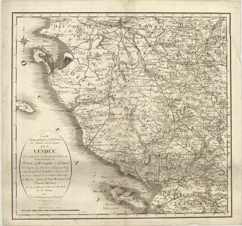
2704. Carte Topographique et Militaire du Theatre de la Guerre dan... [B V a 135]
Institute and Museum of Military History •
B V a
•
B V Franciaország
•
B I–XV. Európa
| Title | Carte Topographique et Militaire du Theatre de la Guerre dans la Vendée Qui comprend la plus grande Partie des Gouvernemens de Poitou, de Bretagne et d’Aunis… |
| Main title | Franciaország: a Vendé-kerület topográfiai térképe 1795-ben. |
2705. Bell’Isle, avec partie des Côtes de Bretagne et les Isles vo... [B V a 136]
Institute and Museum of Military History •
B V a
•
B V Franciaország
•
B I–XV. Európa
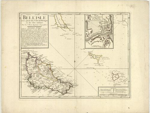
| Title | Bell’Isle, avec partie des Côtes de Bretagne et les Isles voisines. |
| Main title | Mt.: Plan de la Citadella de Bell’ Isle et du Palais. (A Bell’ Isle fellegvára és a palota alaprajza.) |
| Subject | Belle Isle (Fr.) sziget általános térképe 1761-ben. |
2706. Le Gouvernement General de Provence divisé en ses Vigueries ... [B V a 138]
Institute and Museum of Military History •
B V a
•
B V Franciaország
•
B I–XV. Európa
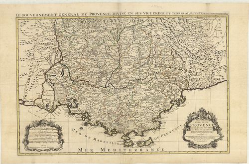
| Title | Le Gouvernement General de Provence divisé en ses Vigueries et Terres Adjacentes. |
| Main title | Franciaország: a Provence-i tartomány térképe az 1700-as évek elején. |
2707. Carte Topographique tres Exata des Pais-Bas. [B V a 140]
Institute and Museum of Military History •
B V a
•
B V Franciaország
•
B I–XV. Európa
| Title | Carte Topographique tres Exata des Pais-Bas. |
| Main title | Németalföld: Franciaország és Belgium - Luxemburg határvidékének topográfiai térképe 1784-ben. |
2708. [A Lotharingia-i Hercegség, Saarvidék, Bitche, Rockenhausen,... [B V a 141]
Institute and Museum of Military History •
B V a
•
B V Franciaország
•
B I–XV. Európa
| Title | [A Lotharingia-i Hercegség, Saarvidék, Bitche, Rockenhausen, Sierck, St. Avold közötti terület általános térképe a 18. században.] |
2709. Alsatia tam Svperior, quam Inferior una cum Svndgovia… [B V a 143]
Institute and Museum of Military History •
B V a
•
B V Franciaország
•
B I–XV. Európa
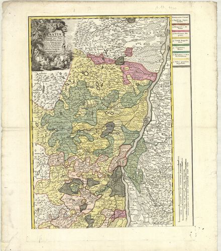
| Title | Alsatia tam Svperior, quam Inferior una cum Svndgovia… |
| Main title | Felső-Elzász és Südgau terület térképe a 18. században. |
2710. Propriae Lugudunensis Generalitatis Mappa Chorographica… [B V a 148]
Institute and Museum of Military History •
B V a
•
B V Franciaország
•
B I–XV. Európa
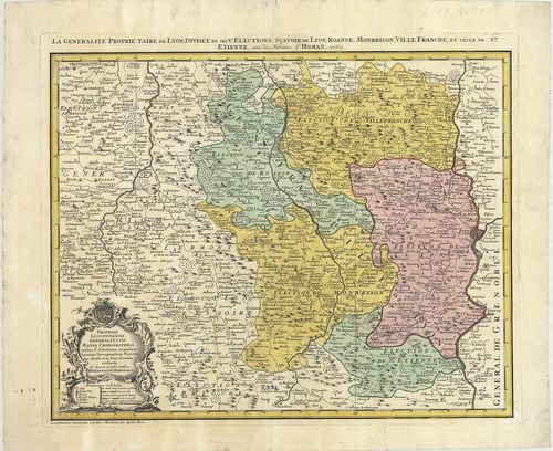
| Title | Propriae Lugudunensis Generalitatis Mappa Chorographica… |
| Main title | Franciaország: Lyon-kerület térképe 1762-ben. |
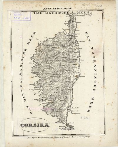
2711. La Corsica. [B V a 149]
Institute and Museum of Military History •
B V a
•
B V Franciaország
•
B I–XV. Európa
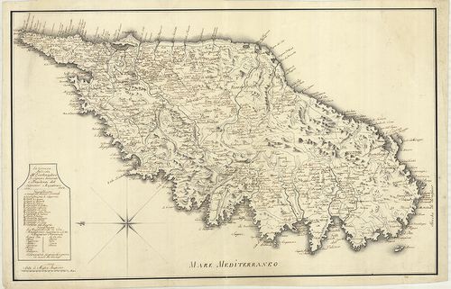
| Title | La Corsica. |
| Main title | Korzika térképe 1764-ben. |
2712. Carte de Lisle de Corse divisée par Jurisdictions. [B V a 150]
Institute and Museum of Military History •
B V a
•
B V Franciaország
•
B I–XV. Európa
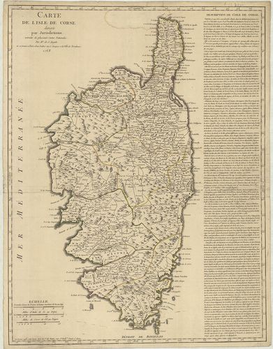
| Title | Carte de Lisle de Corse divisée par Jurisdictions. |
| Main title | Korzika közigazgatási térképe 1768-ban. |
2713. Kriegstheater oder Graenzkarte zwischen Frankreich und Itali... [B V a 151]
Institute and Museum of Military History •
B V a
•
B V Franciaország
•
B I–XV. Európa
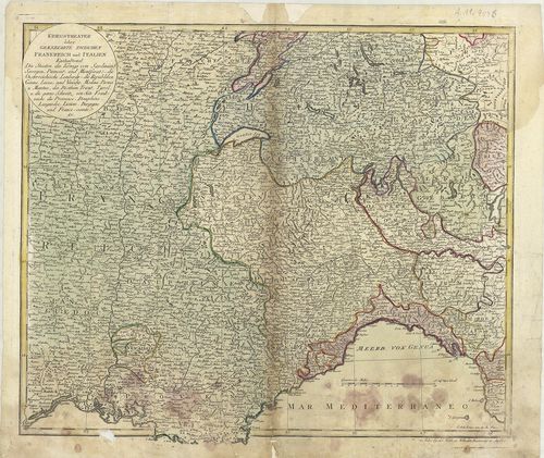
| Title | Kriegstheater oder Graenzkarte zwischen Frankreich und Italien. |
| Main title | Franciaország és Olaszország határtérképe a 18. században. |
2714. Corsika. [B V a 155]
Institute and Museum of Military History •
B V a
•
B V Franciaország
•
B I–XV. Európa
| Title | Corsika. |
| Main title | Korzika térképe az 1800-as években. |
2715. [Korzika térképe.] [B V a 156]
Institute and Museum of Military History •
B V a
•
B V Franciaország
•
B I–XV. Európa
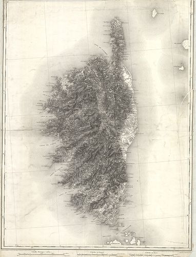
| Title | [Korzika térképe.] |
2716. Evesché de Meaux… [B V a 158]
Institute and Museum of Military History •
B V a
•
B V Franciaország
•
B I–XV. Európa
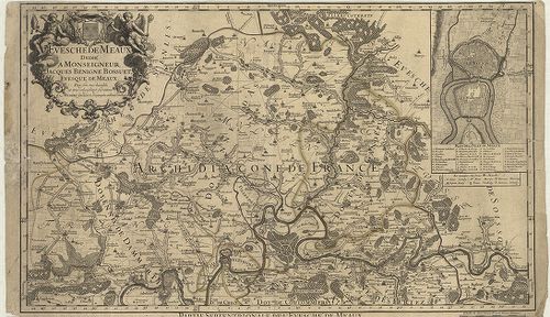
| Title | Evesché de Meaux… |
| Main title | Mt.: Plan de Ville de Meaux. (Meaux város térképe.) |
| Subject | Franciaország: Meaux érsekség terület É-i része a 18. században. |
2717. I. Isola D’Oleron, Nelle Piaggie Occidentali Della Francia… [B V a 159]
Institute and Museum of Military History •
B V a
•
B V Franciaország
•
B I–XV. Európa
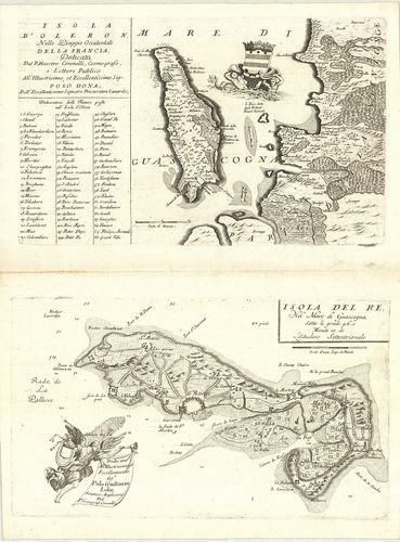
| Title | I. Isola D’Oleron, Nelle Piaggie Occidentali Della Francia… |
| Main title | Oleron sziget (Fr.) általános térképe a 18. században.II. Isola del Re… |
| Subject | Re sziget (Fr.) általános térképe a 18. században. |
2718. Carte Géometrique du Comte de Nice et de la Vallée de Barcel... [B V a 161]
Institute and Museum of Military History •
B V a
•
B V Franciaország
•
B I–XV. Európa
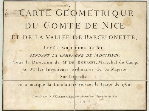
| Title | Carte Géometrique du Comte de Nice et de la Vallée de Barcelonette… |
| Main title | Franciaország: Nizza grófság és a Barcelonette-völgy térképe 1760-ban. |
2719. Le Gouvernement General de Picardie, ou sont le Pays Reconqu... [B V a 161/1]
Institute and Museum of Military History •
B V a
•
B V Franciaország
•
B I–XV. Európa
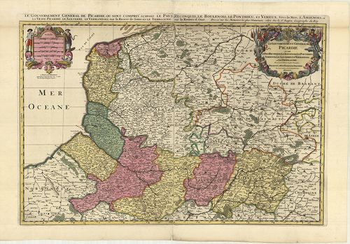
| Title | Le Gouvernement General de Picardie, ou sont le Pays Reconquis, Le Boulenois Le Ponthieu l’Amienois, Le Santerre, Le Vermandois, et Le Trierrasche. |
| Main title | Franciaország: Picardia francia tartomány általános térképe tartományi színezéssel 1692-ben. |
2720. Le Comte de Haynaut, divisé en Chatellenies, Balliages, Prev... [B V a 162]
Institute and Museum of Military History •
B V a
•
B V Franciaország
•
B I–XV. Európa
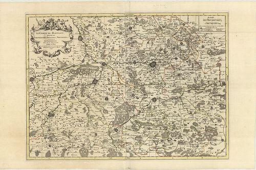
| Title | Le Comte de Haynaut, divisé en Chatellenies, Balliages, Prevostés etc. |
| Main title | Hainaut grófság térképe (Chatelleine, Baillages, Prevost kerületekkel) 1692-ben. |