2941. Mogg’s New Map of England and Wales with part of Scotland. [B VI a 48]
Institute and Museum of Military History •
B VI a
•
B VI Anglia, Skócia és Írország
•
B I–XV. Európa
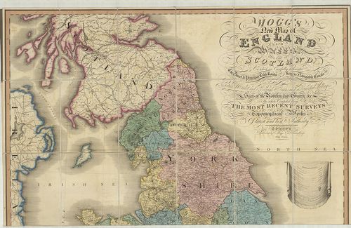
| Title | Mogg’s New Map of England and Wales with part of Scotland. |
| Main title | Anglia, Wales és Skócia egy részének térképe 1823-ban. |
2942. Velikobritanija i Irlandszkaja Reszpublika. [B VI a 51]
Institute and Museum of Military History •
B VI a
•
B VI Anglia, Skócia és Írország
•
B I–XV. Európa
| Title | Velikobritanija i Irlandszkaja Reszpublika. |
2943. Brit-szigetek. [B VI a 52]
Institute and Museum of Military History •
B VI a
•
B VI Anglia, Skócia és Írország
•
B I–XV. Európa
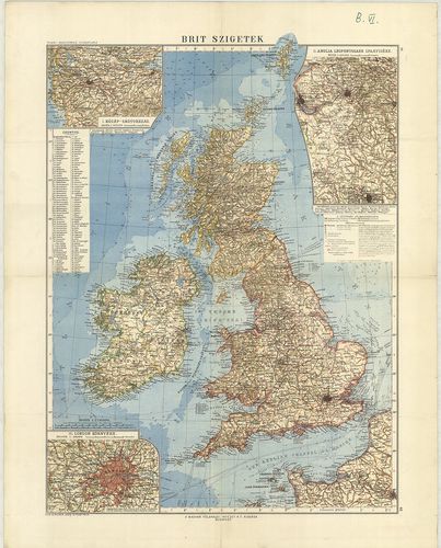
| Title | Brit-szigetek. |
| Main title | 3 mt. 1. Közép-Skótország. 2. Anglia legfontosabb iparvidéke. 3. London környéke. |
2944. Brit-szigetek. [B VI a 53]
Institute and Museum of Military History •
B VI a
•
B VI Anglia, Skócia és Írország
•
B I–XV. Európa
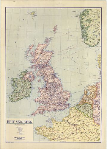
| Title | Brit-szigetek. |
2945. Nagybritannia és Írország. [B VI a 54]
Institute and Museum of Military History •
B VI a
•
B VI Anglia, Skócia és Írország
•
B I–XV. Európa
| Title | Nagybritannia és Írország. |
2946. Grossbritannien und Irland. – Great Britain and Ireland. Fle... [B VI a 55]
Institute and Museum of Military History •
B VI a
•
B VI Anglia, Skócia és Írország
•
B I–XV. Európa
| Title | Grossbritannien und Irland. – Great Britain and Ireland. Flemmings Generalkarte Nr. 14. |
| Main title | 6 mt.: 1. Höhen- und Tiefenschichten. (Hipszometrikus térk.) 2. Geolog. Formationen. (Geológiai térk.) 3. Niederschläge – Isothermen. (Hőmérséklet – csapadék.) 4. Nutzplanzen, Viehzucht und Küstenfischerei. (Növényzet, állattenyésztés, halászat.) 5. Bodenschätze und Industrien. (Ásványi és ipari térk.) 6. Das Britische Weltreich. (A Brit világbirodalom.) |
2947. Scotland. [B VI a 56]
Institute and Museum of Military History •
B VI a
•
B VI Anglia, Skócia és Írország
•
B I–XV. Európa
| Title | Scotland. |
2948. Index to the Ordnance Survey of Yorkshire. [B VI a 61]
Institute and Museum of Military History •
B VI a
•
B VI Anglia, Skócia és Írország
•
B I–XV. Európa
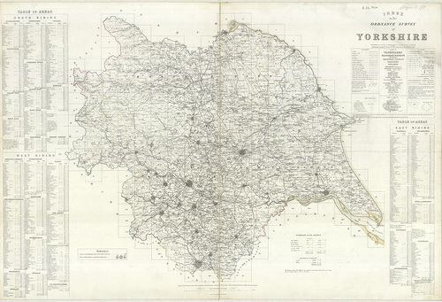
| Title | Index to the Ordnance Survey of Yorkshire. |
| Main title | Yorkshire topográfiai térképeinek áttekintő és csatlakozó térképlapjai 1854–56-ban. |
2949. Department of Employment and Productivity Local Offices Area... [B VI a 62]
Institute and Museum of Military History •
B VI a
•
B VI Anglia, Skócia és Írország
•
B I–XV. Európa
| Title | Department of Employment and Productivity Local Offices Areas. – Map of Great Britain. |
| Main title | Mt.: Greater London. |
| Subject | Nagy-Britannia déli részének kerületi beosztása. |
2950. The Border – Administrative Areas Edition. [B VI a 63]
Institute and Museum of Military History •
B VI a
•
B VI Anglia, Skócia és Írország
•
B I–XV. Európa
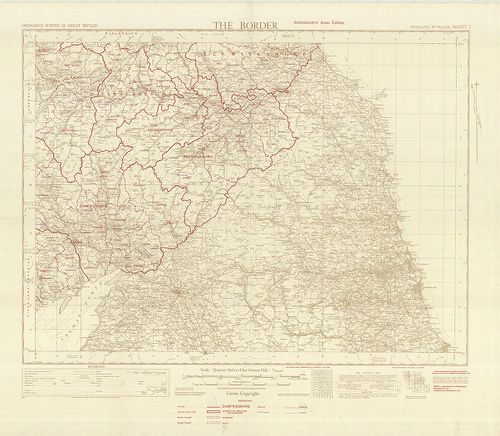
| Title | The Border – Administrative Areas Edition. |
| Main title | Közép-Anglia közigazgatási térképe, autóutakkal 1950-ből. |
2951. Index to the Ordnance Survey of the County of Durham. [B VI a 64]
Institute and Museum of Military History •
B VI a
•
B VI Anglia, Skócia és Írország
•
B I–XV. Európa
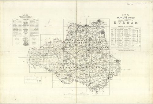
| Title | Index to the Ordnance Survey of the County of Durham. |
| Main title | Durham-grófság topográfiai térképeinek áttekintő lapja 1878-ban. |
2952. Bartholomew’s Contoured Road Map of the British Isles. [B VI a 68]
Institute and Museum of Military History •
B VI a
•
B VI Anglia, Skócia és Írország
•
B I–XV. Európa
| Title | Bartholomew’s Contoured Road Map of the British Isles. |
| Main title | 2 mt.: 1. London. 2. System of Road Numbers. (Nagy-Britannia főútvonalai.) |
2953. Map of Britain and Northern Ireland. [B VI a 69]
Institute and Museum of Military History •
B VI a
•
B VI Anglia, Skócia és Írország
•
B I–XV. Európa
| Title | Map of Britain and Northern Ireland. |
| Main title | 2 térk.: 1. Central London. 2. Central Edinburgh. |
| Subject | Nagy-Britannia és É-Írország térképe 1960 körül. |
2954. Britische Inseln. [B VI a 70]
Institute and Museum of Military History •
B VI a
•
B VI Anglia, Skócia és Írország
•
B I–XV. Európa
| Title | Britische Inseln. |
2955. Velká Britanie, Irako a Státy Beneluxu. Soubor Map. „Poznává... [B VI a 71]
Institute and Museum of Military History •
B VI a
•
B VI Anglia, Skócia és Írország
•
B I–XV. Európa
| Title | Velká Britanie, Irako a Státy Beneluxu. Soubor Map. „Poznáváme svét”. |
| Main title | 5 mt.: 1. Politický přehled. (Politikai áttekintő.) 2. Hospodařsky Přehled. (Gazdasági áttekintő.) 3. [Manchester.] 4. [Birmingham.] 5. [London.] |
| Subject | 21 térk.: 1. Tepelné a srazkové poměry. (Hőmérsékleti és csapadék viszonyok.) 2. Lidnatost. 1851. (Népesség 1851-ben.) 3. Lidnatost 1957. (Népesség 1957-ben. 4. Počet sněžných dnů a počátek jara. (A havazás kezdetétől tavaszig.) 5. Rozsah zaledněni v ledových dobách. (Jegesedés terjedése.) 6. Lidnatost 1951. (Népesség 1951-ben.) 7. Jazyky a dialekty. (Nyelv és nyelvjárás.) 8. Půdni typy. (Talajviszonyok.) 9. Kvétena. (Növényzet.) 10. Letecká doprava. (Légi közlekedés.) 11. London. 12. Baile Atha Cliath. (Dublin). 13. Glasgow. 14. Edinburgh. 15. Liverpool. 16. Amsterdam-Haarlem a okoli. 17. Bruxelles Brussel. 18. Luxembourg Luxemburg. 19. Rotterdam. 20. Antwerpen. 21. Atomovy průmysl velké Británie. (Az atomgyártás NBr.-ban.) |
2956. Ten-Mile Aviation Map of Great Britain. – Ten Mile Map of Gr... [B VI a 75]
Institute and Museum of Military History •
B VI a
•
B VI Anglia, Skócia és Írország
•
B I–XV. Európa
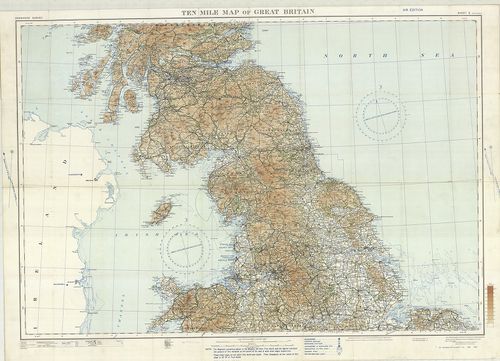
| Title | Ten-Mile Aviation Map of Great Britain. – Ten Mile Map of Great Britain. Sheet 2. |
| Main title | Nagy-Britannia középső részének térképe 1930-ban. |
2957. Contoured Road Map of East Kent. – East Kent. Sheet 117. [B VI a 77]
Institute and Museum of Military History •
B VI a
•
B VI Anglia, Skócia és Írország
•
B I–XV. Európa
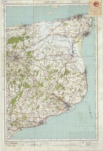
| Title | Contoured Road Map of East Kent. – East Kent. Sheet 117. |
| Main title | Kent-tartomány K-i részének térképe 1928-ban. |
2958. Map of Barnard Castle and District. – Barnard Castle and Kir... [B VI a 78]
Institute and Museum of Military History •
B VI a
•
B VI Anglia, Skócia és Írország
•
B I–XV. Európa
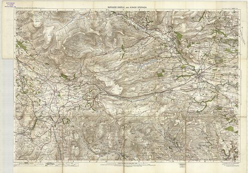
| Title | Map of Barnard Castle and District. – Barnard Castle and Kirk by Stephen. Sheet 14. |
| Main title | Barnard Castle és környékének térképe 1907-ben. |
2959. Ordnance Survey „Ten Mile” Map of Great Britain Sheet 2. – R... [B VI a 79]
Institute and Museum of Military History •
B VI a
•
B VI Anglia, Skócia és Írország
•
B I–XV. Európa
| Title | Ordnance Survey „Ten Mile” Map of Great Britain Sheet 2. – Route Planning Map. |
| Main title | 3 mt. 1. [Manchester és környéke.] 2. [Birmingham és környéke.] 3. [London kerületei.] |
| Subject | Nagy-Britannia déli részének általános térképe úthálózattal 1964-ben. |
2960. Ordnance Survey „Ten Mile Map of the Great Britain Sheet 1–2... [B VI a 79/1]
Institute and Museum of Military History •
B VI a
•
B VI Anglia, Skócia és Írország
•
B I–XV. Európa

| Title | Ordnance Survey „Ten Mile Map of the Great Britain Sheet 1–2. – Roads. |
| Main title | Mt.: London Area… (London területe.) |
| Subject | Nagy-Britannia térképe úthálózattal 1956-ban. |