3101. Carta topografica della provincia di Como. [B VII a 66]
Institute and Museum of Military History •
B VII a
•
B VII Olaszország
•
B I–XV. Európa
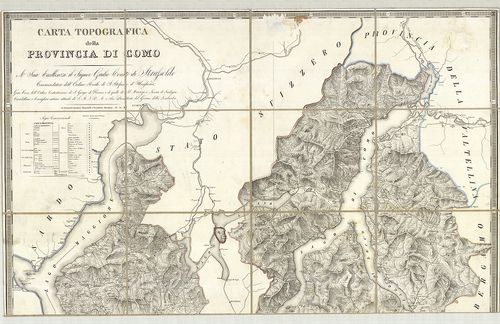
| Title | Carta topografica della provincia di Como. |
| Main title | Mt. Pianta della R-a Citta di Como (Como várostérkép). |
| Subject | Como tartomány topográfiai térképe 1816-ban. |
3102. Nouvelle Carte du terrotoire de Créme. [B VII a 67/1]
Institute and Museum of Military History •
B VII a
•
B VII Olaszország
•
B I–XV. Európa
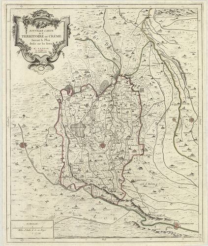
| Title | Nouvelle Carte du terrotoire de Créme. |
| Main title | Crema környékének térképe 1779-ben. |
3103. [A Milanoi Hercegség, Pavia Fejedelemség térképe a környező ... [B VII a 78]
Institute and Museum of Military History •
B VII a
•
B VII Olaszország
•
B I–XV. Európa
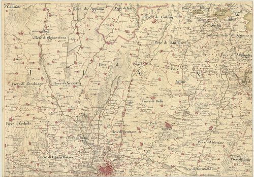
| Title | [A Milanoi Hercegség, Pavia Fejedelemség térképe a környező városokhoz tartozó vidékek határaival.] |
3104. Carta del Dipartimento dell’ Adige e di una parte dei Dip.-t... [B VII a 80]
Institute and Museum of Military History •
B VII a
•
B VII Olaszország
•
B I–XV. Európa
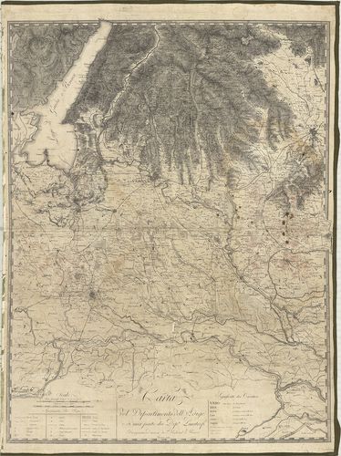
| Title | Carta del Dipartimento dell’ Adige e di una parte dei Dip.-ti Limitrofi. |
| Main title | Adige megye térképe 1812-ben. |
3105. Carta del Dipartimento dell’Adige e di una parte dei Dip. ti... [B VII a 80/1]
Institute and Museum of Military History •
B VII a
•
B VII Olaszország
•
B I–XV. Európa
| Title | Carta del Dipartimento dell’Adige e di una parte dei Dip. ti Limitrofe. |
| Main title | Mantova környékének térképe. |
3106. Carta Topografica della Lombardia. Che comprende Le Provinci... [B VII a 84]
Institute and Museum of Military History •
B VII a
•
B VII Olaszország
•
B I–XV. Európa
| Title | Carta Topografica della Lombardia. Che comprende Le Provincie di Milano, Brescia, Mantova, Cremona, Bergamo, Lodi, Como, Pávia e Sondrio. |
| Main title | Mt.: Supplimento ossia Carta della Provincia di Sondrio (Sondrio tartomány). |
| Subject | Lombardia topográfiai térképe a 19. században. |
3107. Carta Topografica dello Stato di Milano. [B VII a 85]
Institute and Museum of Military History •
B VII a
•
B VII Olaszország
•
B I–XV. Európa
| Title | Carta Topografica dello Stato di Milano. |
| Main title | Milano tartomány topográfiai térképe 1777-ben. |
3108. Foglio Nord-Ovest dei quattro che compongono i Contorni di M... [B VII a 85/1]
Institute and Museum of Military History •
B VII a
•
B VII Olaszország
•
B I–XV. Európa
| Title | Foglio Nord-Ovest dei quattro che compongono i Contorni di Milano… – Foglio Sud-Est dei quattro che compongono i Contorni di Milano… |
| Main title | Milano ÉNY-i és DNY-i környékének térképe a 19. században. |
3109. Carta Topografica del Milanese e Mantovano… [B VII a 90]
Institute and Museum of Military History •
B VII a
•
B VII Olaszország
•
B I–XV. Európa
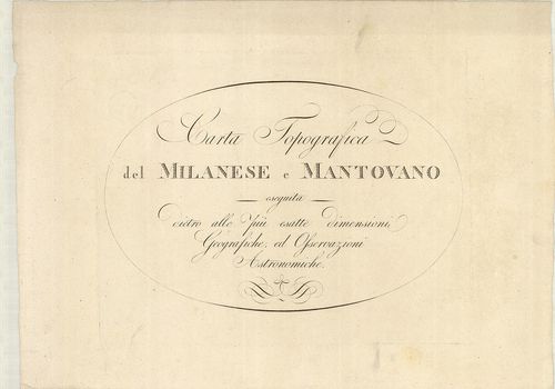
| Title | Carta Topografica del Milanese e Mantovano… |
| Main title | Milano és Mantova tartományok térképe a 18. század második felében. |
3110. Il Corso del Po dal Mantovano fino al Mare… [B VII a 91/1]
Institute and Museum of Military History •
B VII a
•
B VII Olaszország
•
B I–XV. Európa
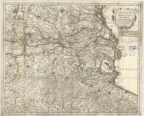
| Title | Il Corso del Po dal Mantovano fino al Mare… |
| Main title | Mantova tartomány és a Pó torkolat környékének térképe 1792-ben. |
3111. Il Milanese con parte de’ Paesi… [B VII a 91/2]
Institute and Museum of Military History •
B VII a
•
B VII Olaszország
•
B I–XV. Európa
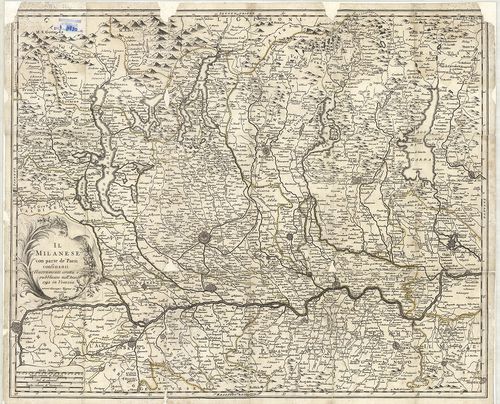
| Title | Il Milanese con parte de’ Paesi… |
| Main title | Milano tartomány és a Pó környékének általános térképe 1792-ben. |
3112. Carta Topografica Dei Contorni di Milano… [B VII a 92]
Institute and Museum of Military History •
B VII a
•
B VII Olaszország
•
B I–XV. Európa
| Title | Carta Topografica Dei Contorni di Milano… |
| Main title | Milano tartomány topográfiai térképe 1807-ben. |
3113. Nuova Carta dei Contorni di Milano e delle Provincie di Como... [B VII a 96]
Institute and Museum of Military History •
B VII a
•
B VII Olaszország
•
B I–XV. Európa
| Title | Nuova Carta dei Contorni di Milano e delle Provincie di Como, Bergamo, Lodi-Crema, Pavia, Cremona e parte di Brescia. |
| Main title | Milano tartomány térképe 1832-ben. |
3114. Carta Topografica Statistica della Provincia di Milano. [B VII a 97/1]
Institute and Museum of Military History •
B VII a
•
B VII Olaszország
•
B I–XV. Európa
| Title | Carta Topografica Statistica della Provincia di Milano. |
| Main title | Milano tartomány topográfiai és statisztikai térképe 1809-ben. |
3115. Ducatus Mantuani. [B VII a 99/4]
Institute and Museum of Military History •
B VII a
•
B VII Olaszország
•
B I–XV. Európa
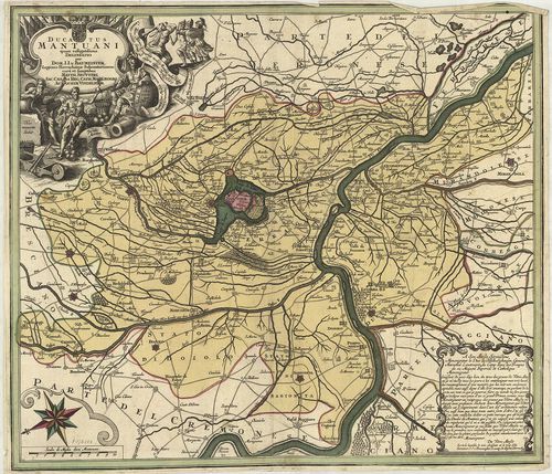
| Title | Ducatus Mantuani. |
| Main title | Mantova hercegség térképe 1740 körül. |
3116. Mappa geographica continens Ducatum Mantuanum cum partibus f... [B VII a 107]
Institute and Museum of Military History •
B VII a
•
B VII Olaszország
•
B I–XV. Európa
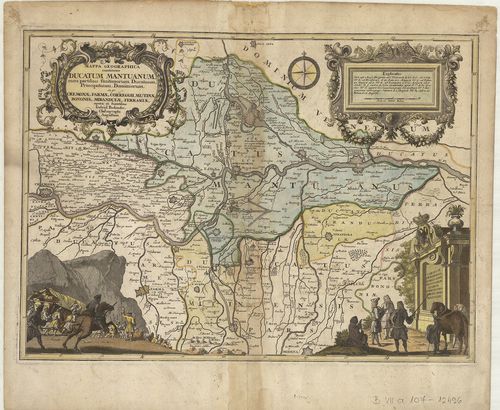
| Title | Mappa geographica continens Ducatum Mantuanum cum partibus finitiorum Ducatuum, Principatuum, Dominiorum ex gr. Cremonae, Parmae, Correggii, Mutinae Bonaniae, Mirandulae, Ferrariae. |
| Main title | Mantova hercegség és a környező részek általános térképe 1734-ben. |
3117. Carta Topografica della Provincia di Mantova. [B VII a 109]
Institute and Museum of Military History •
B VII a
•
B VII Olaszország
•
B I–XV. Európa
| Title | Carta Topografica della Provincia di Mantova. |
| Main title | Mantova tartomány topográfiai térképe 1818-ban. |
3118. Carta Topografica della Provincia di Pavia. [B VII a 113]
Institute and Museum of Military History •
B VII a
•
B VII Olaszország
•
B I–XV. Európa
| Title | Carta Topografica della Provincia di Pavia. |
| Main title | Mt.: Pianta della R. Citta di Pavia. |
| Subject | Pavia tartomány topográfiai térképe a 19. században. |
3119. Topografia della Provincia di Sondrio. [B VII a 114]
Institute and Museum of Military History •
B VII a
•
B VII Olaszország
•
B I–XV. Európa
| Title | Topografia della Provincia di Sondrio. |
| Main title | Sondrio tartomány topográfiai térképe 1825-ben. |
3120. Plan der Haide le Grovane bei Barlassina. [B VII a 117]
Institute and Museum of Military History •
B VII a
•
B VII Olaszország
•
B I–XV. Európa
| Title | Plan der Haide le Grovane bei Barlassina. |
| Main title | Grovane vidék (Milanótól északra) térképe a 19. században. |