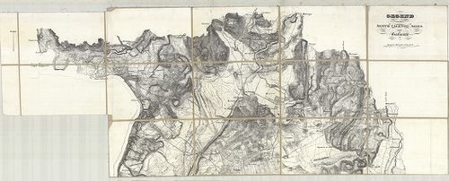
3121. Plan der Gegend zwischen Cantu und Meda. [B VII a 120]
Institute and Museum of Military History •
B VII a
•
B VII Olaszország
•
B I–XV. Európa
| Title | Plan der Gegend zwischen Cantu und Meda. |
| Main title | Cantu és Meda (Milanótól északra) környékének általános térképe a 19. században. |
3122. Landesstricht zwischen der Chiese und der Etsch… [B VII a 121]
Institute and Museum of Military History •
B VII a
•
B VII Olaszország
•
B I–XV. Európa
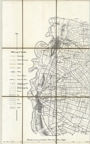
| Title | Landesstricht zwischen der Chiese und der Etsch… |
| Main title | Chiese és Adige folyó közötti terület térképe 1837-ben. |
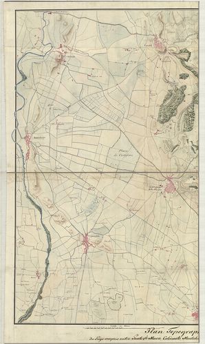
3123. Gegend zwischen Lonato, Castiglione, Monte-Chiari, und Caste... [B VII a 125]
Institute and Museum of Military History •
B VII a
•
B VII Olaszország
•
B I–XV. Európa
| Title | Gegend zwischen Lonato, Castiglione, Monte-Chiari, und Castenedolo. |
| Main title | Olaszország: Észak-Brescia-tól délkeletre eső terület általános térképe 1832 körül. |
3124. Gegend Diess und jenseits des Mincio Flusses zwischen Peschi... [B VII a 127/1]
Institute and Museum of Military History •
B VII a
•
B VII Olaszország
•
B I–XV. Európa
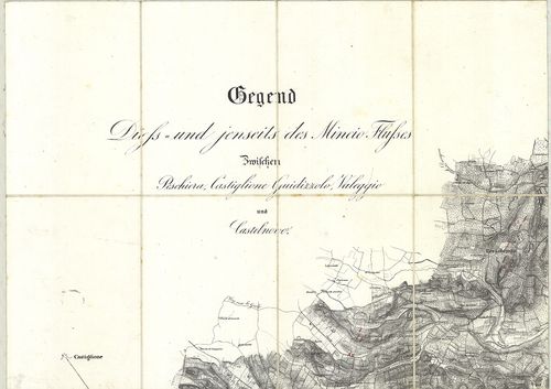
| Title | Gegend Diess und jenseits des Mincio Flusses zwischen Peschiera Castiglione Guidizzolo, Valeggio und Castelnovo. |
| Main title | Olaszország: Észak-Mincio folyó és környékének általános térképe 1835 körül. |
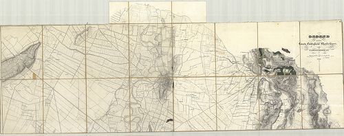
3125. Plan Topographique du Pays compris entre Ponte st. Marco, Ca... [B VII a 131/2]
Institute and Museum of Military History •
B VII a
•
B VII Olaszország
•
B I–XV. Európa
| Title | Plan Topographique du Pays compris entre Ponte st. Marco, Calcinato, Montechiaro, Carpenedolo, Medole, Cavriana, Castellaro et Pozzolengo. |
| Main title | Észak-Olaszország: a Garda-tótól délre eső terület általános térképe 1810 körül. |
3126. Gegend zwischen Sesto Calende, Soma und Gallarate. [B VII a 132]
Institute and Museum of Military History •
B VII a
•
B VII Olaszország
•
B I–XV. Európa
| Title | Gegend zwischen Sesto Calende, Soma und Gallarate. |
| Main title | Észak-Olaszország: Sesto Calende, Somma és Gallarate (Ticino és Lago Maggiore) környékének általános térképe 1831 körül. |
3127. [Észak-Olaszország: a Piave és Livenza folyók környékének ka... [B VII a 138]
Institute and Museum of Military History •
B VII a
•
B VII Olaszország
•
B I–XV. Európa
| Title | [Észak-Olaszország: a Piave és Livenza folyók környékének katonai térképe.] |
3128. Charte von der Provinz Venedig und den Oesterreichischen Küs... [B VII a 141]
Institute and Museum of Military History •
B VII a
•
B VII Olaszország
•
B I–XV. Európa
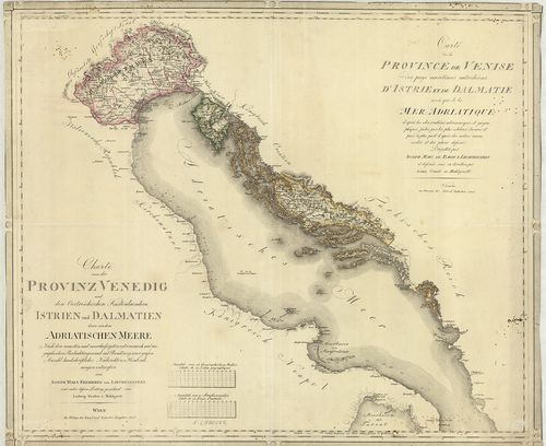
| Title | Charte von der Provinz Venedig und den Oesterreichischen Küstenlaendern Istrien und Dalmatien… Adriatischen Meere… – Carte de la Province de Venise… d’Istrie et de Dalmatie… Mer Adriatique… |
| Main title | Velence tartomány, az Osztrák-tengerpart, az Isztriai-fsz., Dalmácia és az Adriai-tenger térképe 1805-ben. |
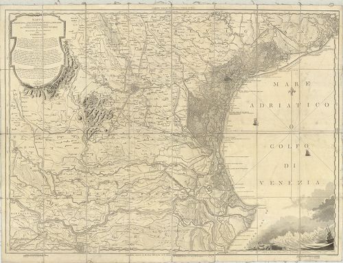
3129. Mappa Generale delle Lagune di Venezia. Dalla Joce dell’Adig... [B VII a 141/2]
Institute and Museum of Military History •
B VII a
•
B VII Olaszország
•
B I–XV. Európa
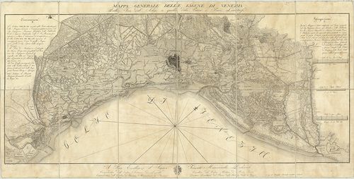
| Title | Mappa Generale delle Lagune di Venezia. Dalla Joce dell’Adige a quella della Piave e Paesi Limitrofi. |
| Main title | Velence térképe a tervezett kikötővel, csatornákkal 1818-ban. |
3130. Special-Karte des Lombardo-Venezianischen Königreichs. – Bor... [B VII a 141/4]
Institute and Museum of Military History •
B VII a
•
B VII Olaszország
•
B I–XV. Európa
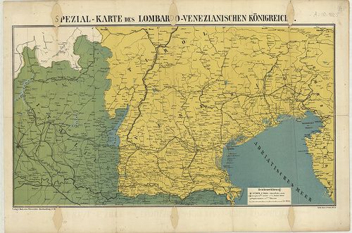
| Title | Special-Karte des Lombardo-Venezianischen Königreichs. – Borítócím: … Triest und Südtirols sowie der italienischen Gebietscheile bis Mailand… Nr. 2. |
| Main title | A Lombard-Velencei Királyság általános térképe 1866-ban. |
3131. Veneto. [B VII a 141/7]
Institute and Museum of Military History •
B VII a
•
B VII Olaszország
•
B I–XV. Európa
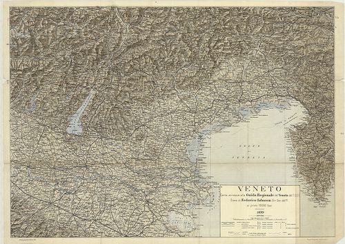
| Title | Veneto. |
| Main title | Velence és környékének térképe 1899-ben. |
3132. [Velence tartomány közigazgatási és vasúthálózati térképe.] [B VII a 141/10]
Institute and Museum of Military History •
B VII a
•
B VII Olaszország
•
B I–XV. Európa
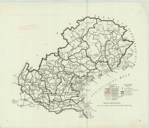
| Title | [Velence tartomány közigazgatási és vasúthálózati térképe.] |
3133. Les Provinces du Veronese du Vicentin, du Padovan, de Polesi... [B VII a 142]
Institute and Museum of Military History •
B VII a
•
B VII Olaszország
•
B I–XV. Európa
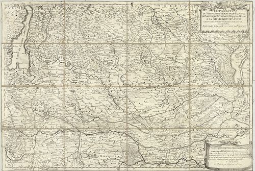
| Title | Les Provinces du Veronese du Vicentin, du Padovan, de Polesine de Rovigo et du Dogado ou Duché a la Republique de Venise… |
| Main title | Verona tartomány (Ol.) és a környező területek általános térképe 1736 körül. |
3134. Das Herzogthum Venedig. – Il Ducato di Venezia. [B VII a 143/1]
Institute and Museum of Military History •
B VII a
•
B VII Olaszország
•
B I–XV. Európa
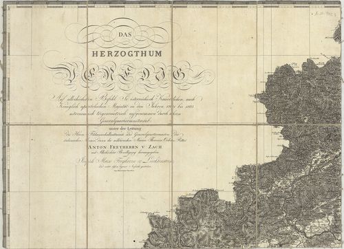
| Title | Das Herzogthum Venedig. – Il Ducato di Venezia. |
| Main title | A Velencei Hercegség térképe 1805-ben. |
3135. Carta corografica delle Provincie Venete… [B VII a 143/3]
Institute and Museum of Military History •
B VII a
•
B VII Olaszország
•
B I–XV. Európa
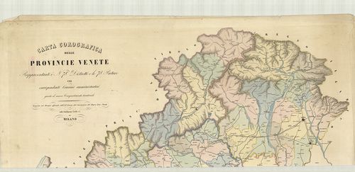
| Title | Carta corografica delle Provincie Venete… |
| Main title | Velence tartomány térképe 1853 körül. |
3136. Carta Corografica d’Italia. [B VII a 144]
Institute and Museum of Military History •
B VII a
•
B VII Olaszország
•
B I–XV. Európa
| Title | Carta Corografica d’Italia. |
3137. Le Bellunése le Feltrin, et le Cadorin. P II 14 [B VII a 152]
Institute and Museum of Military History •
B VII a
•
B VII Olaszország
•
B I–XV. Európa
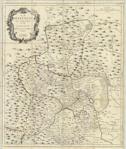
| Title | Le Bellunése le Feltrin, et le Cadorin. P II 14 |
| Main title | Észak-Olaszország: Belluno, Feltre és Piave di Cadore környékének térképe 1777-ben. |
3138. Carte du Padouan, du Dogado, et de la plus grande partie du ... [B VII a 156]
Institute and Museum of Military History •
B VII a
•
B VII Olaszország
•
B I–XV. Európa
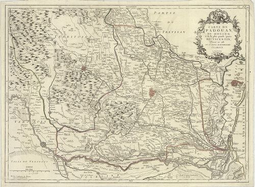
| Title | Carte du Padouan, du Dogado, et de la plus grande partie du Vicentin… P. II. 12. |
| Main title | Padova tartomány térképe 1776-ban. |
3139. Mappa del Padovano del Polesine di Rovigo del Dogado della p... [B VII a 158]
Institute and Museum of Military History •
B VII a
•
B VII Olaszország
•
B I–XV. Európa
| Title | Mappa del Padovano del Polesine di Rovigo del Dogado della parte meridionale del Vicentino del Trevigiano e della parte settentrionale del Ferrarese. |
| Main title | Padova, Polesine, Ferrara közötti terület általános térképe 1801-ben. |
3140. Nouvelle carte du Territoire de Polesine. [B VII a 160/1]
Institute and Museum of Military History •
B VII a
•
B VII Olaszország
•
B I–XV. Európa
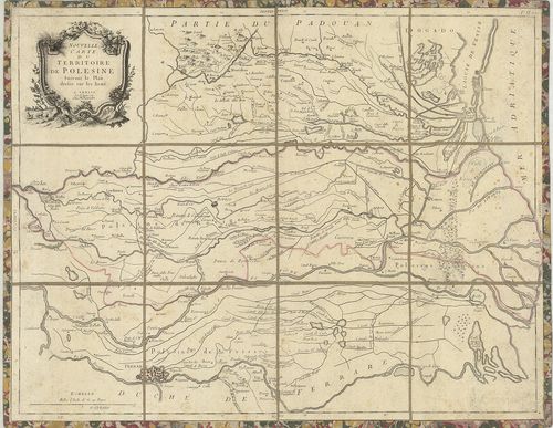
| Title | Nouvelle carte du Territoire de Polesine. |
| Main title | Polesine vidékének térképe 1780-ban. |