1881. Preussische Provinz Sachsen. [B IV a 214]
Institute and Museum of Military History •
B IV a
•
B IV Német birodalom
•
B I–XV. Európa
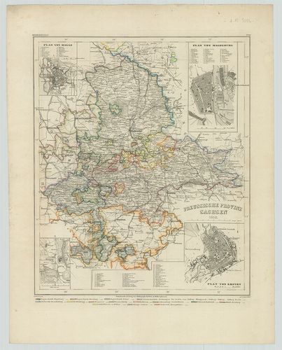
| Title | Preussische Provinz Sachsen. |
| Main title | 4 mt.: 1. Plan von Halle. 2. Plan von Magdeburg. 3. Torgau. 4. Plan von Erfurt. |
| Subject | A szász tartományok általános térképe 1852-ben. |
1882. Provinz Ostpreussen. [B IV a 215]
Institute and Museum of Military History •
B IV a
•
B IV Német birodalom
•
B I–XV. Európa
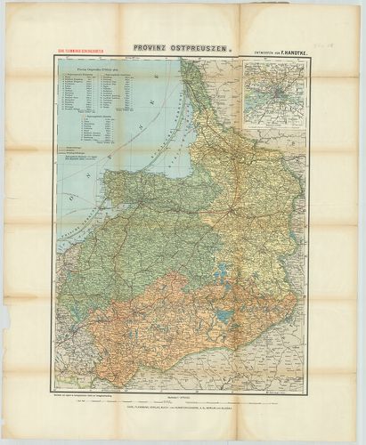
| Title | Provinz Ostpreussen. |
| Main title | Mt.: [Königsberg (Kalinyingrád) és környéke.] |
| Subject | Kelet-Poroszország tartományainak térképe. |
1883. Charte vom Königreich Preussen, nach seiner dermaligen Einth... [B IV a 215/1]
Institute and Museum of Military History •
B IV a
•
B IV Német birodalom
•
B I–XV. Európa
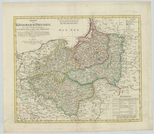
| Title | Charte vom Königreich Preussen, nach seiner dermaligen Eintheilung in Ost-West-Süd und Neu-Ost-Preussen. |
| Main title | A Porosz Királyság térképe 1805-ben. |
1884. Kétold. térk. I. Ostpreussen und Litauen. II. Kurland und Li... [B IV a 216]
Institute and Museum of Military History •
B IV a
•
B IV Német birodalom
•
B I–XV. Európa
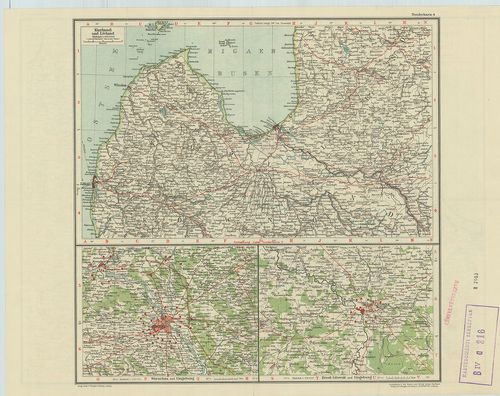
| Title | Kétold. térk. I. Ostpreussen und Litauen. II. Kurland und Livland. |
| Main title | 2 mt.: Warschau und Umgebung. (Varsó és környéke.) 2. Brest-Litowsk und Umgebung. (Breszt és környéke.) |
| Subject | I. Kelet-Poroszország és Litvánia. II. Kurföld és Livonija térképe. |
1885. Tabula Geographica Totam Borussiam ut et Districtum Notecens... [B IV a 216/1]
Institute and Museum of Military History •
B IV a
•
B IV Német birodalom
•
B I–XV. Európa
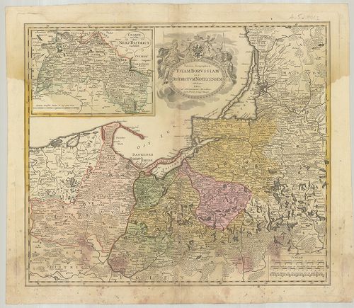
| Title | Tabula Geographica Totam Borussiam ut et Districtum Notecensem. |
| Main title | Mt.: Charte welche den Netz District vorstellet. (Kujawy terület térképe.)Poroszország térképe kerületi beosztással. |
1886. Karte von den Königl. Preussischen Provinzen Preussen und Po... [B IV a 217]
Institute and Museum of Military History •
B IV a
•
B IV Német birodalom
•
B I–XV. Európa
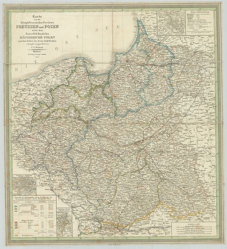
| Title | Karte von den Königl. Preussischen Provinzen Preussen und Posen nebst dem Kaiserlich Russischen Königreiche Polen. |
| Main title | 3 mt.: Umgebung von Königsberg. (Kalinyingrád és környéke.) 2. Umgebung von Danzig. (Gdansk és környéke.) 3. Umgebung von Warschau. (Varsó és környéke.)A Porosz Királyság tartományai és Lengyelország térképe 1847-ben. |
1887. Ost- und West-Preussen. [B IV a 218]
Institute and Museum of Military History •
B IV a
•
B IV Német birodalom
•
B I–XV. Európa
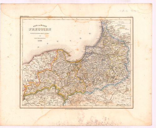
| Title | Ost- und West-Preussen. |
| Main title | Kelet-és Nyugat-Poroszország térképe 1847-ben. |
1888. Provinz Brandenburg. [B IV a 219]
Institute and Museum of Military History •
B IV a
•
B IV Német birodalom
•
B I–XV. Európa
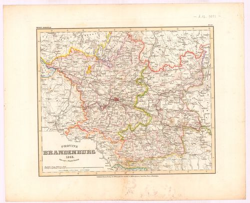
| Title | Provinz Brandenburg. |
| Main title | Brandenburg tartomány térképe 1846-ban. |
1889. Provinz Posen. [B IV a 220]
Institute and Museum of Military History •
B IV a
•
B IV Német birodalom
•
B I–XV. Európa
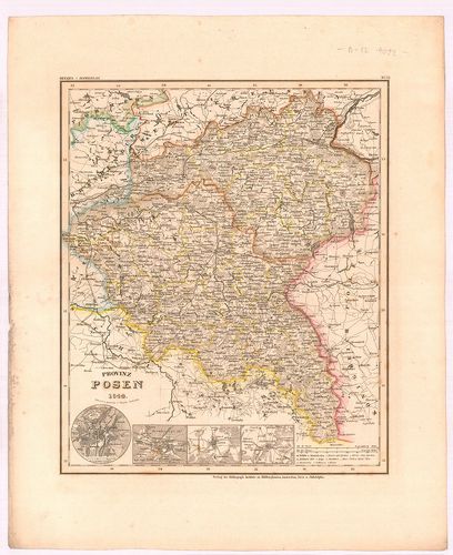
| Title | Provinz Posen. |
| Main title | 4 mt.: 1. Posen (Poznan) 2. Bromberg, (Bydgoszcz) 3. Lissa, (Leszno) 4. Fraustadt, (Wschowa) Várostérk. |
| Subject | Posen tartomány térképe 1844-ben. |
1890. Provinz Pommern. [B IV a 221]
Institute and Museum of Military History •
B IV a
•
B IV Német birodalom
•
B I–XV. Európa
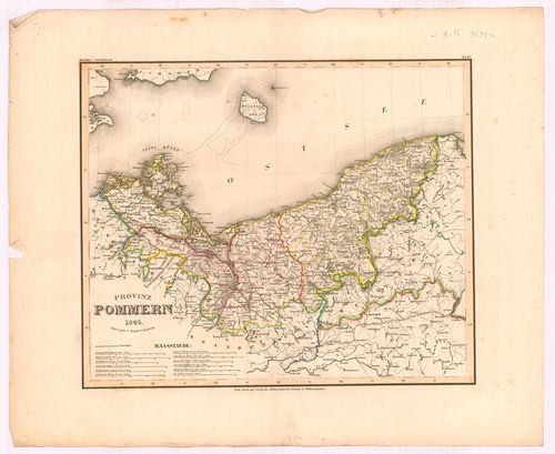
| Title | Provinz Pommern. |
| Main title | Pomerániai tartomány térképe 1845-ben. |
1891. [A Pomeránia-i hercegség térképe.] [B IV a 225]
Institute and Museum of Military History •
B IV a
•
B IV Német birodalom
•
B I–XV. Európa
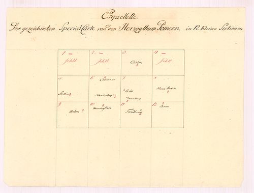
| Title | [A Pomeránia-i hercegség térképe.] |
1892. Special Karte des Deutschen Reiches. [B IV a 226]
Institute and Museum of Military History •
B IV a
•
B IV Német birodalom
•
B I–XV. Európa
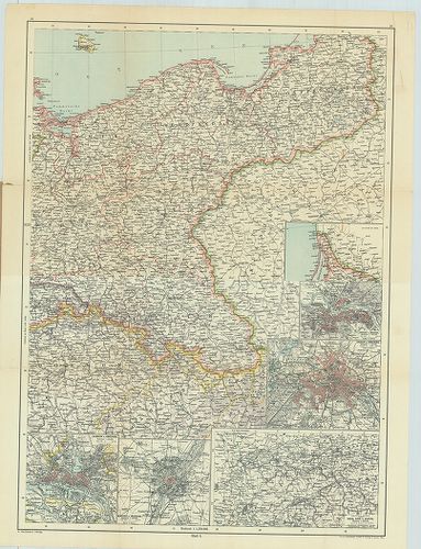
| Title | Special Karte des Deutschen Reiches. |
| Main title | 5 mt.: 1. Hamburg u. Umgebung. (Hamburg és környéke.) 2. München u. Umgebung. (München és környéke.) 3. Industrie-Bezirk zwischen Rhein, Ruhr u. Wupper. (A Ruhr-vidék.) 4. Dresden u. Umgebung. (Drezda és környéke.) 5. Berlin u. Umgebung (Berlin és környéke.)Németország keleti részének térképe. |
1893. Charte vom Königreiche Preussen dem Herzogthum Warschau und ... [B IV a 232]
Institute and Museum of Military History •
B IV a
•
B IV Német birodalom
•
B I–XV. Európa
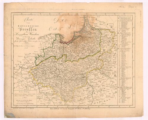
| Title | Charte vom Königreiche Preussen dem Herzogthum Warschau und dem neuen Danziger Gebiethe für die Österreichischen Schulen. |
| Main title | A Porosz Királyság, a Varsói hercegség és Gdansk térképe 1806-ban. |
1894. Pomerania Utraque cum insertis vicinisqus distionibus. [B IV a 233]
Institute and Museum of Military History •
B IV a
•
B IV Német birodalom
•
B I–XV. Európa
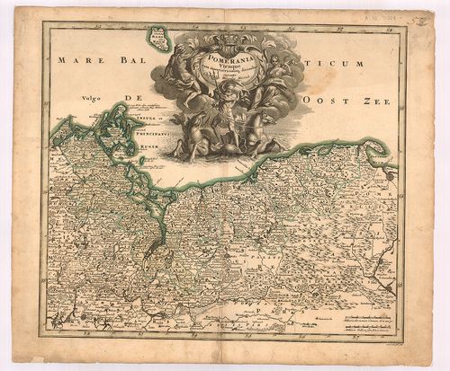
| Title | Pomerania Utraque cum insertis vicinisqus distionibus. |
| Main title | Pomeránia térképe. |
1895. Nova Illustrissimi Principatus Pomeraniae des Criptio cum ad... [B IV a 234]
Institute and Museum of Military History •
B IV a
•
B IV Német birodalom
•
B I–XV. Európa
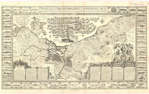
| Title | Nova Illustrissimi Principatus Pomeraniae des Criptio cum adjuncta Principum Genealogia et Principum veris et potiorum Urbium imaginibus et Nobilium Insignibus. |
| Main title | A Pomeránia hercegség térképe. |
1896. Karte des Königl. Preuss. Herzogthums Vor- und Hinter Pommer... [B IV a 235]
Institute and Museum of Military History •
B IV a
•
B IV Német birodalom
•
B I–XV. Európa
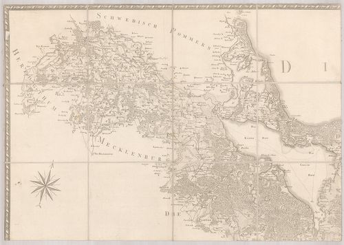
| Title | Karte des Königl. Preuss. Herzogthums Vor- und Hinter Pommern. |
| Main title | A Pomeránia hercegség térképe 1789-ben. |
1897. Special Charte vom Herzogthum Pommern... [B IV a 236]
Institute and Museum of Military History •
B IV a
•
B IV Német birodalom
•
B I–XV. Európa
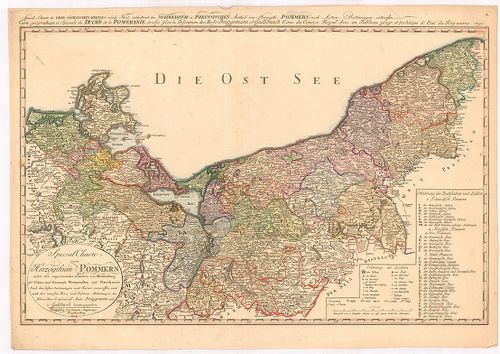
| Title | Special Charte vom Herzogthum Pommern... |
| Main title | A Pomerániai hercegség általános térképe 1804-ben. |
1898. [Karte von der Provinz Pommern.] [B IV a 239]
Institute and Museum of Military History •
B IV a
•
B IV Német birodalom
•
B I–XV. Európa
| Title | [Karte von der Provinz Pommern.] |
1899. Preussische Provinz Pommern. [B IV a 240]
Institute and Museum of Military History •
B IV a
•
B IV Német birodalom
•
B I–XV. Európa
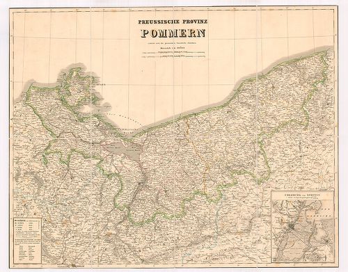
| Title | Preussische Provinz Pommern. |
| Main title | Mt.: Umgebung von Stettin. (Szczecin és környéke.) |
| Subject | A pomeránia porosz tartomány térképe. |
1900. Der Preussische Staat und das Deutsche Reich. [B IV a 241/3]
Institute and Museum of Military History •
B IV a
•
B IV Német birodalom
•
B I–XV. Európa
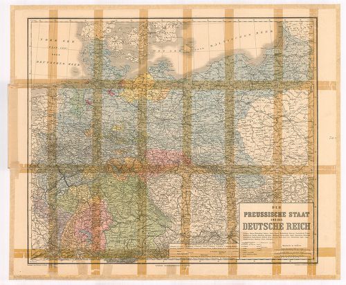
| Title | Der Preussische Staat und das Deutsche Reich. |
| Main title | A porosz államok és a Német Birodalom térképe. |