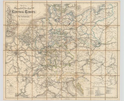
601. Reise-Karte mit Angabe der Distanzen. – Zum Allgemeinen Gebr... [B II c 28]
Institute and Museum of Military History •
B II c
•
B II Európa, nagyobb részek és országcsoportok
•
B I–XV. Európa

| Title | Reise-Karte mit Angabe der Distanzen. – Zum Allgemeinen Gebrauche so wie zur Uebersicht aller Eisenbahnen und der Dampfschiffahrts-Verbindungen in ganz Deutschland… |
| Main title | Közép-Európa út- és vasúttérképe 1847-ben. |
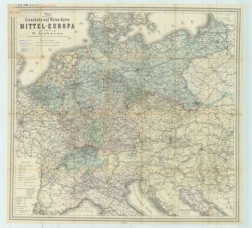
602. Postkarte von Mittel Europa enthaltend: Deutschland, die Nie... [B II c 30]
Institute and Museum of Military History •
B II c
•
B II Európa, nagyobb részek és országcsoportok
•
B I–XV. Európa
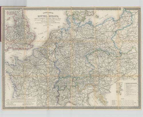
| Title | Postkarte von Mittel Europa enthaltend: Deutschland, die Niederlande, Belgien… |
| Main title | Közép-Európa postatérképe 1871-ben. |
603. Zapadnaja Evropa poszle pervoj Mirovoj vojnü (1918–1923 gg.) [B II c 32]
Institute and Museum of Military History •
B II c
•
B II Európa, nagyobb részek és országcsoportok
•
B I–XV. Európa
| Title | Zapadnaja Evropa poszle pervoj Mirovoj vojnü (1918–1923 gg.) |
| Main title | Mt.: Izmenenie politicseszkoj kartü mira poszle pervoj mirovoj vojnü (Változások a Világ politikai térképén az I. világháború után.) |
| Subject | Európa az I. világháború után 1918–1923-ig. |
604. Spezial-Karte der Eisenbahn-, Post-, u. Dampschiff-Verbindun... [B II c 33]
Institute and Museum of Military History •
B II c
•
B II Európa, nagyobb részek és országcsoportok
•
B I–XV. Európa
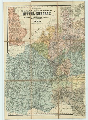
| Title | Spezial-Karte der Eisenbahn-, Post-, u. Dampschiff-Verbindungen Mittel-Europas… |
| Main title | Közép-Európa vasút-, posta- és hajózási térképe. |
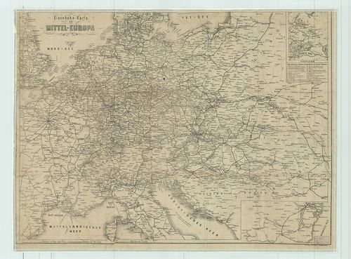
605. Eisenbahn-Karte von Mittel-Europa nebst Angabe der wichtigst... [B II c 34]
Institute and Museum of Military History •
B II c
•
B II Európa, nagyobb részek és országcsoportok
•
B I–XV. Európa
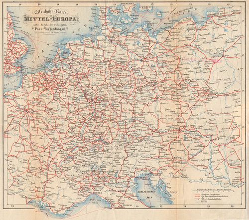
| Title | Eisenbahn-Karte von Mittel-Europa nebst Angabe der wichtigsten Post-Verbindungen |
| Main title | Közép-Európa vasúti térképe. |
606. Marsch-Karte von Mittel-Europa. [B II c 35/1]
Institute and Museum of Military History •
B II c
•
B II Európa, nagyobb részek és országcsoportok
•
B I–XV. Európa
| Title | Marsch-Karte von Mittel-Europa. |
| Main title | Közép-Európa menettérképe 1848-ban úthálózattal. |
607. Autokarta Srednje Evrope. [B II c 36]
Institute and Museum of Military History •
B II c
•
B II Európa, nagyobb részek és országcsoportok
•
B I–XV. Európa
| Title | Autokarta Srednje Evrope. |
| Main title | Közép-Európa autóúttérképe. |
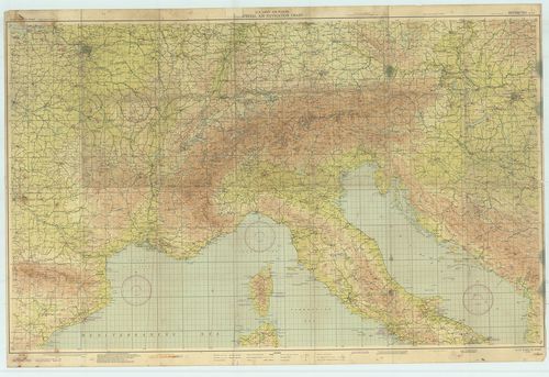
608. Közép-Európa repülőtérképe. [B II c 38]
Institute and Museum of Military History •
B II c
•
B II Európa, nagyobb részek és országcsoportok
•
B I–XV. Európa
| Title | Közép-Európa repülőtérképe. |
609. Carte de la navigation a vapeur dans le bassin de la Méditer... [B II c 39]
Institute and Museum of Military History •
B II c
•
B II Európa, nagyobb részek és országcsoportok
•
B I–XV. Európa
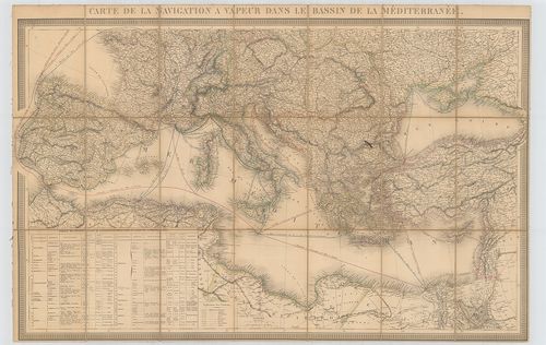
| Title | Carte de la navigation a vapeur dans le bassin de la Méditerranée. |
| Main title | A Földközi-tenger medencéjének térképe a gőzhajózási vonalakkal. |
610. Classical Lands of the Mediterranean. [B II c 39/1]
Institute and Museum of Military History •
B II c
•
B II Európa, nagyobb részek és országcsoportok
•
B I–XV. Európa
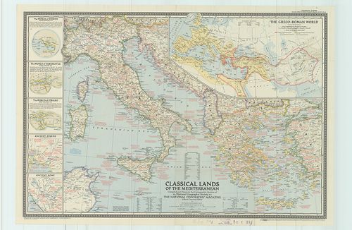
| Title | Classical Lands of the Mediterranean. |
| Main title | 6 mt.: 1. The Greco-Roman World. (A görög és római világ) 2. The World of Homer ninth Century B. C. (Homérosz földképe az i. e. a 9. században.) 3. The World dof Herodotus fifth Century. (Hérodotosz földképe az i. e. 5. században.) 4. The World of Strabo tirst Century (Strabo földképe az első században.) 5. Ancient Athens. (Az antik Athénai). 6. Ancient Roma. (Az antik Róma) |
| Subject | A Földközi-tenger környéke az ókorban. |
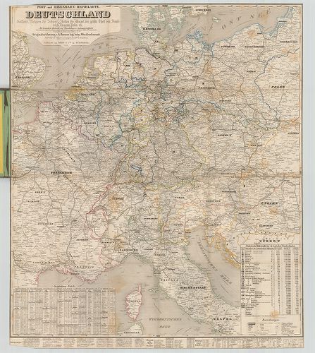
611. Meilenberechnungs- und Post-Karte von Mittel-Europa. – A Pos... [B II c 40]
Institute and Museum of Military History •
B II c
•
B II Európa, nagyobb részek és országcsoportok
•
B I–XV. Európa
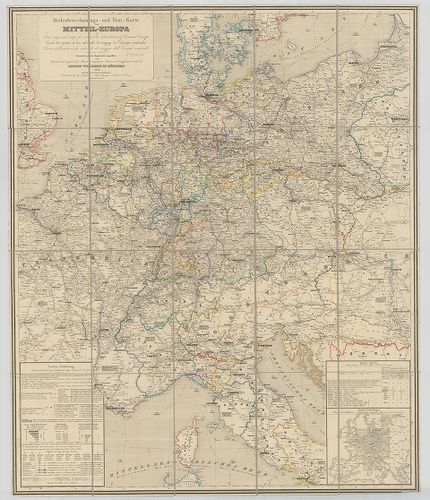
| Title | Meilenberechnungs- und Post-Karte von Mittel-Europa. – A Post-map and map for travels calculation of Central Europe. – Carte des postes et des calculs de voyage de l’Europe centrale. – Carte delle poste e dei calcoli di viaggio dell’ Europa centrale. |
| Main title | Mt.: Haupt-Verbindungen (Főútvonalak.) |
| Subject | Közép-Európa mérföld számítási és posta térképe 1845-ben. |
612. Carte de la Méditerranée Montrant la Route Maritime Minimum ... [B II c 41]
Institute and Museum of Military History •
B II c
•
B II Európa, nagyobb részek és országcsoportok
•
B I–XV. Európa
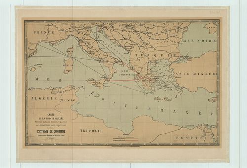
| Title | Carte de la Méditerranée Montrant la Route Maritime Minimum vers Constantinople aprés le percement de l’Isthe de Corinthe concession donnée au Général Türr. |
| Main title | A Földközi-tenger országainak úttérképe 1881-ben. |
613. Post- und Eisenbahn-Reisekarte Deutschland, Holland, Belgien... [B II c 42]
Institute and Museum of Military History •
B II c
•
B II Európa, nagyobb részek és országcsoportok
•
B I–XV. Európa
| Title | Post- und Eisenbahn-Reisekarte Deutschland, Holland, Belgien, die Schweiz, Italien bis Neapel, der grösste Theil von Frankreich, Ungarn, Polen etc. ... |
| Main title | Közép-Európa: Németország, Hollandia, Belgium, Svájc, Olaszország, Franciaország, Magyarország, Lengyelország posta- és vasúttérképe 1862-ben. |
614. Prehl’adné automapy. Socialistických krajin. Bulharsko Rumun... [B II c 43]
Institute and Museum of Military History •
B II c
•
B II Európa, nagyobb részek és országcsoportok
•
B I–XV. Európa
| Title | Prehl’adné automapy. Socialistických krajin. Bulharsko Rumunsko Juhoslavia Maďarsko NDR. Pol’sko ZSSR-sever ZSSR-juh. |
| Main title | A szocialista országok autótérképe: (Bulgária, Románia, Jugoszlávia, Magyarország, NDK, Lengyelország, SzU) |
615. Neueste Eisenbahn-Karte von Central-Europa mit genauer Angab... [B II c 44]
Institute and Museum of Military History •
B II c
•
B II Európa, nagyobb részek és országcsoportok
•
B I–XV. Európa
| Title | Neueste Eisenbahn-Karte von Central-Europa mit genauer Angabe aller Stationen und der influirenden Post-Verbindungen. |
| Main title | Közép-Európa vasúti térképe. |
616. Neueste Eisenbahn-Karte von Central-Europa mit genauer Angab... [B II c 45]
Institute and Museum of Military History •
B II c
•
B II Európa, nagyobb részek és országcsoportok
•
B I–XV. Európa
| Title | Neueste Eisenbahn-Karte von Central-Europa mit genauer Angabe aller stationen und der influirenden Post-Verbindungen |
| Main title | Közép-Európa vasúti térképe 1873-ban. |
617. Eisenbahn-Karte von Mittel-Europa. [B II c 46]
Institute and Museum of Military History •
B II c
•
B II Európa, nagyobb részek és országcsoportok
•
B I–XV. Európa
| Title | Eisenbahn-Karte von Mittel-Europa. |
| Main title | 2 mt.: 1. Russland (Oroszország). 2. (Duna torkolata) |
| Subject | Közép-Európa vasúti térképe. |
618. Eisenbahn- und Reise-Karte von Mittel-Europa. [B II c 47]
Institute and Museum of Military History •
B II c
•
B II Európa, nagyobb részek és országcsoportok
•
B I–XV. Európa
| Title | Eisenbahn- und Reise-Karte von Mittel-Europa. |
| Main title | Mt.: Mittel-Italien. (Közép-Olaszország.) |
| Subject | Közép-Európa vasút és úttérképe 1888-ban. |
619. Eisenbahnkarte der Kriegsschauplätze von Mitteleuropa. [B II c 48]
Institute and Museum of Military History •
B II c
•
B II Európa, nagyobb részek és országcsoportok
•
B I–XV. Európa
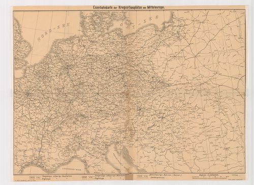
| Title | Eisenbahnkarte der Kriegsschauplätze von Mitteleuropa. |
| Main title | Melléklet: a „Handbuch für Heer und Flotte Berlin, Leipzig, 1909.” c. műhöz. |
| Subject | Közép-Európa vasúti térképe 1909-ben. |
620. Eisenbahn-Routen-Karte von Mittel-Europa [B II c 49]
Institute and Museum of Military History •
B II c
•
B II Európa, nagyobb részek és országcsoportok
•
B I–XV. Európa
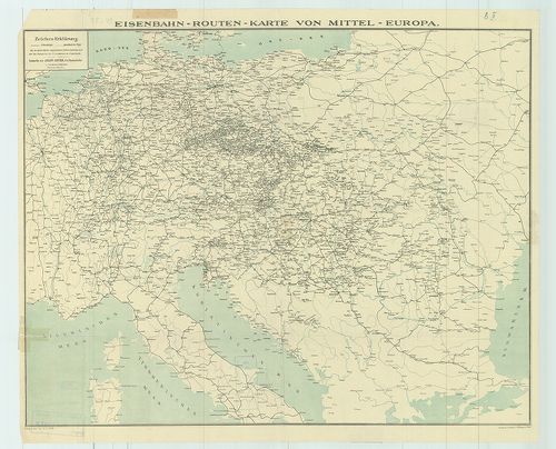
| Title | Eisenbahn-Routen-Karte von Mittel-Europa |
| Main title | Közép-Európa vasút és úttérképe. |
621. [Európa egyes részeinek vasúti térképe 1914–1918 között.] [B II c 50]
Institute and Museum of Military History •
B II c
•
B II Európa, nagyobb részek és országcsoportok
•
B I–XV. Európa
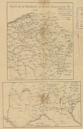
| Title | [Európa egyes részeinek vasúti térképe 1914–1918 között.] |
| Main title | 4 térk. egy lapon: 1. Übersicht über das Eisenbahnnetz auf dem Westl. Kriegsschauplatz 1914. |
| Subject | (Nyugati hadszíntér vasúti térképe 1914-ben. 2. Eisenbahnkarte von Ober-Italien 1918. |
622. Közép-Európa vasúti fővonalai. [B II c 51]
Institute and Museum of Military History •
B II c
•
B II Európa, nagyobb részek és országcsoportok
•
B I–XV. Európa
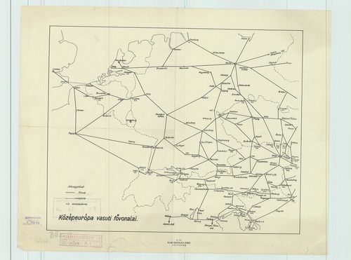
| Title | Közép-Európa vasúti fővonalai. |
623. Közép-Európa vasúti térképe. [B II c 52]
Institute and Museum of Military History •
B II c
•
B II Európa, nagyobb részek és országcsoportok
•
B I–XV. Európa
| Title | Közép-Európa vasúti térképe. |
| Main title | 6 mt.: 1. [Délkelet-Európa vasúthálózata.] 2. [Olaszország vasúthálózata.] 3. [Spanyolország–Franciaország vasúthálózata.] 4. [Svédország vasúthálózata.] 5. Wien (Bécs) [vasútállomásai.] 6. Budapest [vasútállomásai.] |
624. Közép-Európa vasúti térképe. [B II c 52/1]
Institute and Museum of Military History •
B II c
•
B II Európa, nagyobb részek és országcsoportok
•
B I–XV. Európa
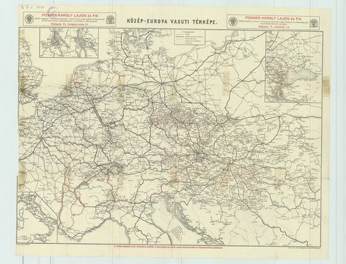
| Title | Közép-Európa vasúti térképe. |
| Main title | 4 mt.: 1. [Bécs vasútállomásai] 2. [Budapest vasútállomásai.] 3. [Olaszország vasúthálózata.] 4. [Délkelet-Európa vasúthálózata.] |
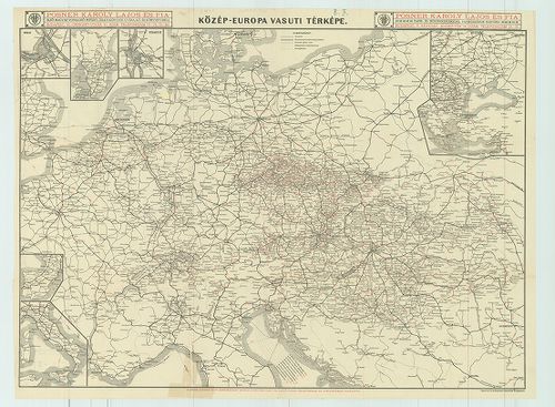
625. Közép-Európa vasúti térképe. – Eisenbahnkarte Mitteleuropas.... [B II c 53]
Institute and Museum of Military History •
B II c
•
B II Európa, nagyobb részek és országcsoportok
•
B I–XV. Európa
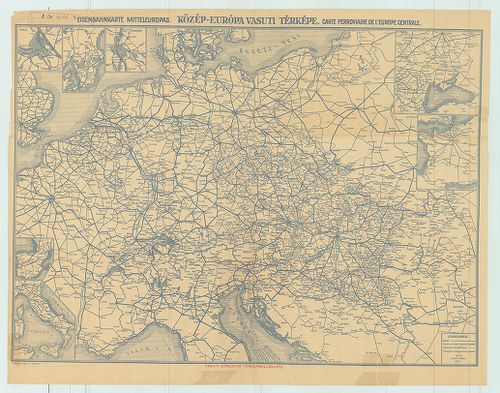
| Title | Közép-Európa vasúti térképe. – Eisenbahnkarte Mitteleuropas. – Carte Ferroviaire de l’Europa centrale. |
| Main title | 7 mt.: 1. [Bécs vasútállomásai.] 2. [Svédország vasúthálózata.] 3. [Budapest vasútállomásai.] 4. [Spanyolország vasúthálózata.] 5. [Olaszország vasúthálózata.] 6. [Délkelet-Európa vasúthálózata.] 7. [Franciaország vasúthálózata.] |
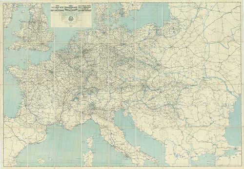
626. Eisenbahn-Übersichtskarte von Mittel-Europa. [B II c 54]
Institute and Museum of Military History •
B II c
•
B II Európa, nagyobb részek és országcsoportok
•
B I–XV. Európa
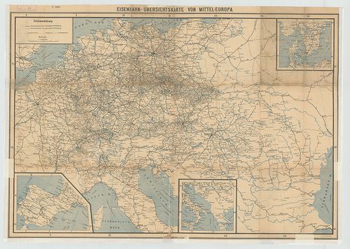
| Title | Eisenbahn-Übersichtskarte von Mittel-Europa. |
| Main title | 3 mt.: 1. [Spanyolország vasúthálózata.] 2. Dél-Olaszország és Jugoszlávia vasúthálózata.] 3. [Svédország D-i részének vasúthálózata.]Közép-Európa vasúttérképe. |
| Subject | Eisenbahn-Route-Karte für Österreich-Ungarn. 13. mt.: 1. Krakau. 2. Olmütz. 3. Salzburg. 4. Graz. 5. Triest. 6. Teplitz. 7. Dux. 8. Aussig. 9. Pressburg. 10. Budapest. 11. Bodenbach-Teschen. 12. Prag. 13. Wien. Vasútforgalmi térképek. |
627. Główniejsze linje komunikacyjne Europy. [B II c 55]
Institute and Museum of Military History •
B II c
•
B II Európa, nagyobb részek és országcsoportok
•
B I–XV. Európa
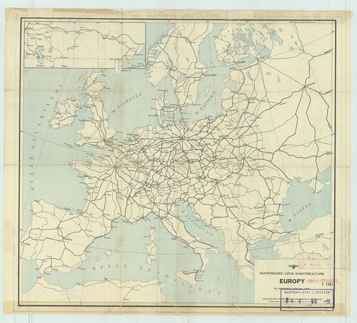
| Title | Główniejsze linje komunikacyjne Europy. |
| Main title | Mt.: [Moszkva–Peking–Tokio vasútvonal.] kétold. térk. hátold.: Mapa Polskiej sieci kolejowej. |
| Subject | 5 mt.: 1. Warszawa. 2. Zagłebie weglowe. (Katowice környék szénmedencéje.) 3. Lwów. 4. Łódz. 5. Toruń. Vasútforgalmi térképek. |
628. Kelet-Európa autótérképe. [B II c 56]
Institute and Museum of Military History •
B II c
•
B II Európa, nagyobb részek és országcsoportok
•
B I–XV. Európa
| Title | Kelet-Európa autótérképe. |
629. Kelet-Európa autóúttérképe. [B II c 56/1]
Institute and Museum of Military History •
B II c
•
B II Európa, nagyobb részek és országcsoportok
•
B I–XV. Európa
| Title | Kelet-Európa autóúttérképe. |
630. Tripolis und das östliche Mittelmeer, der Schauplatz des ita... [B II c 57]
Institute and Museum of Military History •
B II c
•
B II Európa, nagyobb részek és országcsoportok
•
B I–XV. Európa
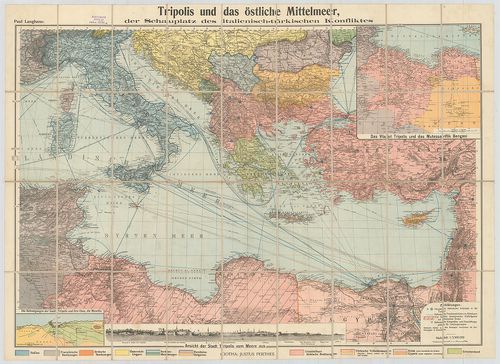
| Title | Tripolis und das östliche Mittelmeer, der Schauplatz des italienisch-türkischen Konfliktas. |
| Main title | 2 mt.: 1. Das Vilajet Tripolis und das Mutessariflik Bengasi |
| Subject | (Líbia tartomány.) 2. Die Befestigungen der Stadt Tripolis und ihre Oase, Die Mnschîa. |
631. A földközi-tengeri hadszíntér térképe. [B II c 58]
Institute and Museum of Military History •
B II c
•
B II Európa, nagyobb részek és országcsoportok
•
B I–XV. Európa
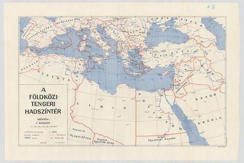
| Title | A földközi-tengeri hadszíntér térképe. |
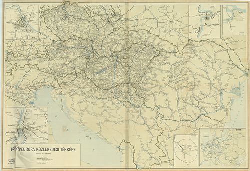
632. Közép-Európa közlekedési térképe (vasúti). [B II c 60]
Institute and Museum of Military History •
B II c
•
B II Európa, nagyobb részek és országcsoportok
•
B I–XV. Európa
| Title | Közép-Európa közlekedési térképe (vasúti). |
| Main title | 5 mt.: 1. Wien. |
| Subject | 2. Budapest. |
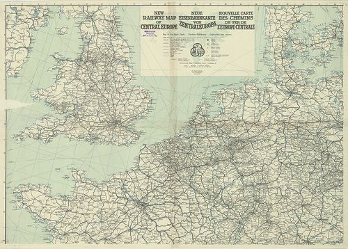
633. Neue Eisenbahnkarte von Zentraleuropa. – New Railway Map of ... [B II c 62]
Institute and Museum of Military History •
B II c
•
B II Európa, nagyobb részek és országcsoportok
•
B I–XV. Európa
| Title | Neue Eisenbahnkarte von Zentraleuropa. – New Railway Map of Central Europe. – Nouwelle Carte des Chemins de fer de l’Europe Centrale. |
| Main title | Közép-Európa vasúti térképe 1924-ben. |
634. Neue Eisenbahnkarte von Zentraleuropa. – New Railway Map of ... [B II c 62/1]
Institute and Museum of Military History •
B II c
•
B II Európa, nagyobb részek és országcsoportok
•
B I–XV. Európa
| Title | Neue Eisenbahnkarte von Zentraleuropa. – New Railway Map of Central Europe. – Nouvelle Carte des Chemins de fer de l’Europe Centrale. |
| Main title | Közép-Európa vasúttérképe 1923-ban. |
635. G. Freytags Automobil- und Radfahrerkarten. Borítócím: Freyt... [B II c 63]
Institute and Museum of Military History •
B II c
•
B II Európa, nagyobb részek és országcsoportok
•
B I–XV. Európa
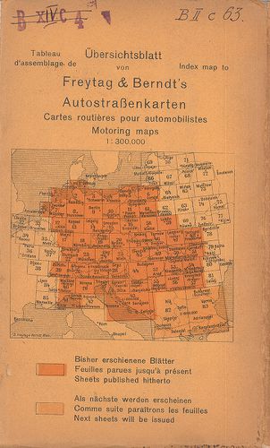
| Title | G. Freytags Automobil- und Radfahrerkarten. Borítócím: Freytag–Berndt’s Autostrassenkarten. – Cartes routieres pour automobilistes. – Motoring maps. – Auto Road Maps. |
| Main title | Európa nagy részének autótérképei 1922–1935 között. |
636. Közép-Európa közlekedési térképe. [B II c 65]
Institute and Museum of Military History •
B II c
•
B II Európa, nagyobb részek és országcsoportok
•
B I–XV. Európa
| Title | Közép-Európa közlekedési térképe. |
| Main title | 6 mt.: 1. Wien. |
| Subject | 2. Budapest. |
637. Automobil-Routenkarte von Mittel-Europa [B II c 67]
Institute and Museum of Military History •
B II c
•
B II Európa, nagyobb részek és országcsoportok
•
B I–XV. Európa
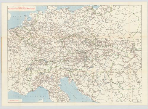
| Title | Automobil-Routenkarte von Mittel-Europa |
| Main title | Közép-Európa autótérképe. |
638. Artaria’s Eisenbahnkarte. Borítócím: – – vom südöstlichen Mi... [B II c 68]
Institute and Museum of Military History •
B II c
•
B II Európa, nagyobb részek és országcsoportok
•
B I–XV. Európa
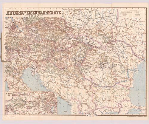
| Title | Artaria’s Eisenbahnkarte. Borítócím: – – vom südöstlichen Mitteleuropa. |
| Main title | 2 mt.: 1. Wien u. Umgebung. |
| Subject | (Bécs és környéke.) 2. Ober-u. Niederösterreich mit dem Burgenland. |
639. Europa Touring: Oesterreich, Ceskoslovensko, Magyarország. A... [B II c 70]
Institute and Museum of Military History •
B II c
•
B II Európa, nagyobb részek és országcsoportok
•
B I–XV. Európa
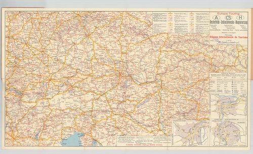
| Title | Europa Touring: Oesterreich, Ceskoslovensko, Magyarország. Automobilkarte |
| Main title | 3 mt.: 1. Wien, 2. Praha. 3. Budapest. |
| Subject | Ausztria–Csehszlovákia–Magyarország autótérképe. |
640. Karte von Südosteuropa. [B II c 71]
Institute and Museum of Military History •
B II c
•
B II Európa, nagyobb részek és országcsoportok
•
B I–XV. Európa
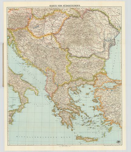
| Title | Karte von Südosteuropa. |
| Main title | Délkelet-Európa térképe. |
641. Hauptstrassenkarte von Mitteleuropa für Auto- und Radfahrer. [B II c 72]
Institute and Museum of Military History •
B II c
•
B II Európa, nagyobb részek és országcsoportok
•
B I–XV. Európa
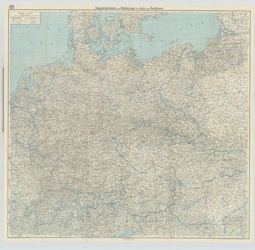
| Title | Hauptstrassenkarte von Mitteleuropa für Auto- und Radfahrer. |
| Main title | Közép-Európa közlekedési térképe az autósknak. |
642. Schenkerova Transportna Organizacija [B II c 73]
Institute and Museum of Military History •
B II c
•
B II Európa, nagyobb részek és országcsoportok
•
B I–XV. Európa
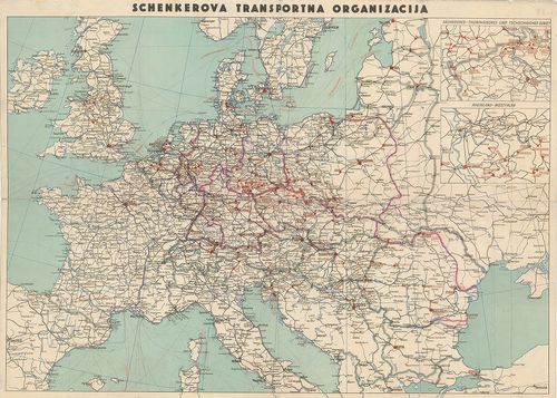
| Title | Schenkerova Transportna Organizacija |
| Main title | 2 mt.: 1. Sächsische-Thüringisches u. Tschechisches Gebiet (Szász-Svájc vidéke) 2. Rheinland-Westfalen. (Rajna-vidék és Wesztfália.) |
| Subject | Közép-Európa vasúttérképe. |
643. Kriegsschauplatz im Jahre 1813. [B II c 74]
Institute and Museum of Military History •
B II c
•
B II Európa, nagyobb részek és országcsoportok
•
B I–XV. Európa
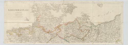
| Title | Kriegsschauplatz im Jahre 1813. |
| Main title | Közép-Európa hadszíntér térképe 1813-ban. |
644. Gran Carta del Teatro della Guerra in Italia ed in Germania. [B II c 75]
Institute and Museum of Military History •
B II c
•
B II Európa, nagyobb részek és országcsoportok
•
B I–XV. Európa
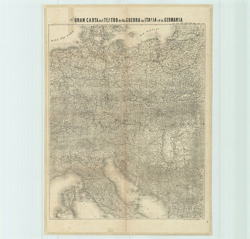
| Title | Gran Carta del Teatro della Guerra in Italia ed in Germania. |
| Main title | Közép-Európa: a németországi és olaszországi hadszíntér térképe 1866-ban. |
645. VW-Dienst... überall in Europa. [B II c 76]
Institute and Museum of Military History •
B II c
•
B II Európa, nagyobb részek és országcsoportok
•
B I–XV. Európa
| Title | VW-Dienst... überall in Europa. |
| Main title | Volkswagen szervizállomások É-, ÉNY-, és D-Európában 1957-ben. |
646. Übersichtskarte der Binnenschiffahrt-strassen von Mitteleuro... [B II c 79]
Institute and Museum of Military History •
B II c
•
B II Európa, nagyobb részek és országcsoportok
•
B I–XV. Európa
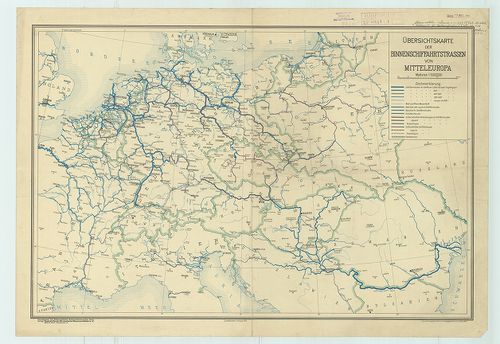
| Title | Übersichtskarte der Binnenschiffahrt-strassen von Mitteleuropa. |
| Main title | Közép-Európa hajózási útvonalainak térképe 1935-ben. |
647. A Duna-medence és szomszédos országok néprajzi térképe. [B II c 81]
Institute and Museum of Military History •
B II c
•
B II Európa, nagyobb részek és országcsoportok
•
B I–XV. Európa
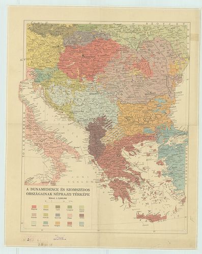
| Title | A Duna-medence és szomszédos országok néprajzi térképe. |
648. Völker und Staaten in Mitteleuropa. [B II c 82]
Institute and Museum of Military History •
B II c
•
B II Európa, nagyobb részek és országcsoportok
•
B I–XV. Európa
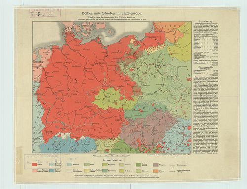
| Title | Völker und Staaten in Mitteleuropa. |
| Main title | Közép-Európa nemzetiségi térképe az 1930-as országhatárokkal. |
649. G. Freytags Völker- und Sprachenkarte von Mittel-Europa nebs... [B II c 83]
Institute and Museum of Military History •
B II c
•
B II Európa, nagyobb részek és országcsoportok
•
B I–XV. Európa
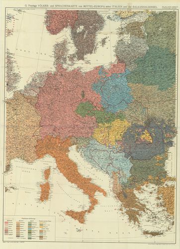
| Title | G. Freytags Völker- und Sprachenkarte von Mittel-Europa nebst Italien u. der Balkanhalbinsel. |
| Main title | Közép-Európa, Olaszország és a Balkán-félsziget néprajzi és nyelvjárástérképe. |
650. Ethnographische Übersichts des Europäischer Orients. 1876. [B II c 84]
Institute and Museum of Military History •
B II c
•
B II Európa, nagyobb részek és országcsoportok
•
B I–XV. Európa
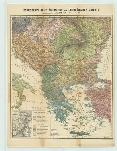
| Title | Ethnographische Übersichts des Europäischer Orients. 1876. |
| Main title | Mt.: Constantinopel u. der Bosporus. |
| Subject | (Istanbul és a Boszporusz) |
651. 9. Die Fernhandelsstrassen in Ostmitteleuropa um 1000. [B II c 85]
Institute and Museum of Military History •
B II c
•
B II Európa, nagyobb részek és országcsoportok
•
B I–XV. Európa
| Title | 9. Die Fernhandelsstrassen in Ostmitteleuropa um 1000. |
| Main title | Középkelet-Európa kereskedelmi útjai 1000 körül. |
652. Słowianie w IX wieku. [B II c 86]
Institute and Museum of Military History •
B II c
•
B II Európa, nagyobb részek és országcsoportok
•
B I–XV. Európa
| Title | Słowianie w IX wieku. |
| Main title | A szlávok elhelyezkedése Európában a IX. században. |
653. Österreich-Ungarn und Bosnien-Hercegovina [B II c 89]
Institute and Museum of Military History •
B II c
•
B II Európa, nagyobb részek és országcsoportok
•
B I–XV. Európa
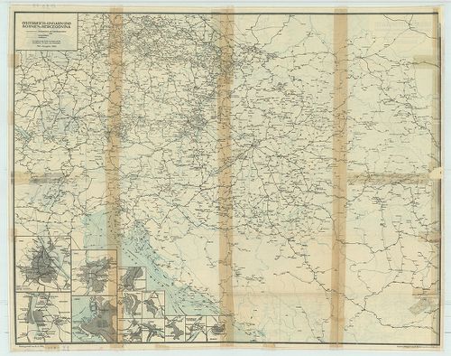
| Title | Österreich-Ungarn und Bosnien-Hercegovina |
| Main title | 2 mt.: 1. Schiffskurse nach Indien und China. 2. Transsibirische-Eisenbahn + 7 várostérk. |
| Subject | Ausztria–Magyarország és Bosznia-Hercegovina közlekedési térképe 1914. (osztrák menetrend mellékete) |
654. Übersichtskarte über den Stand der systematischen Lothabweic... [B II c 90]
Institute and Museum of Military History •
B II c
•
B II Európa, nagyobb részek és országcsoportok
•
B I–XV. Európa
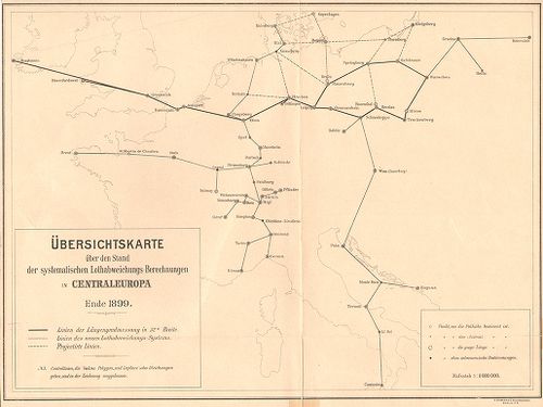
| Title | Übersichtskarte über den Stand der systematischen Lothabweichungs–Berechnungen in Centraleuropa. Ende 1899. |
| Main title | Közép-Európa rendszeres mérővonal-kiegyenlítési állásai 1899 végén. |
655. Luft-navigations Karte in Merkatorprojection. [B II c 91]
Institute and Museum of Military History •
B II c
•
B II Európa, nagyobb részek és országcsoportok
•
B I–XV. Európa
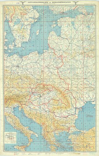
| Title | Luft-navigations Karte in Merkatorprojection. |
| Main title | Kelet- és Dél-Európa repülőtérképe 1940-ben (Keleti-tengertól a Balkán-félszigetig). |
656. Direzione generale per il turismo. [B II c 92]
Institute and Museum of Military History •
B II c
•
B II Európa, nagyobb részek és országcsoportok
•
B I–XV. Európa
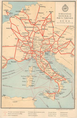
| Title | Direzione generale per il turismo. |
| Main title | Közép-Európa vasút- és hajóutak térképe 1935-ben. |
657. U. S. Army Air Forces. Special air navigation chart. (S. 132... [B II c 92/1]
Institute and Museum of Military History •
B II c
•
B II Európa, nagyobb részek és országcsoportok
•
B I–XV. Európa
| Title | U. S. Army Air Forces. Special air navigation chart. (S. 132.) Paris to Rome 1944. |
| Main title | Közép-Európa repülőtérképe 1944-ben. |
658. Reichs-Luftkursbuch. 1929–30. [B II c 93]
Institute and Museum of Military History •
B II c
•
B II Európa, nagyobb részek és országcsoportok
•
B I–XV. Európa
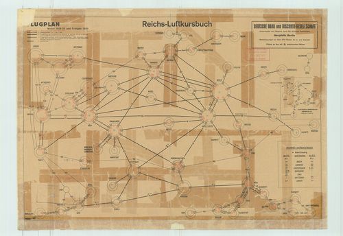
| Title | Reichs-Luftkursbuch. 1929–30. |
| Main title | Közép-Európai repülőjáratok útvonalai, Luft Hansa és más rep. társaságok, érkezései, indulásidők táblázata 1930-ban, a járatok vázlatával. |
659. Jancourt’s railway and steamship tourist map of Europe. [B II c 94]
Institute and Museum of Military History •
B II c
•
B II Európa, nagyobb részek és országcsoportok
•
B I–XV. Európa
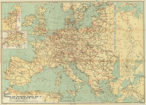
| Title | Jancourt’s railway and steamship tourist map of Europe. |
| Main title | 4 mt.: 1. [Nederland-Belgique] (Hollandia, Belgium) 2. [Schweiz] (Svájc) 3. [Európa] 4. From Europe to China and Japán via Reans-Siberia. (Szibéria–Kína–Japán vasúthálózat.) |
| Subject | Európa vasúti és hajózási térképe 1930 körül. |
660. Die Front im Osten. Karte der Deutsche Allgemeine Zeitung. [B II c 98]
Institute and Museum of Military History •
B II c
•
B II Európa, nagyobb részek és országcsoportok
•
B I–XV. Európa
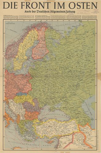
| Title | Die Front im Osten. Karte der Deutsche Allgemeine Zeitung. |
| Main title | Kelet-Európa 1941-ben. |
661. Deutsche Heereskarte. Operationskarte Ost-Blatt II. Ausg. Nr... [B II c 99]
Institute and Museum of Military History •
B II c
•
B II Európa, nagyobb részek és országcsoportok
•
B I–XV. Európa
| Title | Deutsche Heereskarte. Operationskarte Ost-Blatt II. Ausg. Nr. 4. |
| Main title | Közép-Európa hadműveleti térképe 1945-ben. |
662. Übersichtskarte über den Stand der Lotabweichungsberechnunge... [B II c 100]
Institute and Museum of Military History •
B II c
•
B II Európa, nagyobb részek és országcsoportok
•
B I–XV. Európa
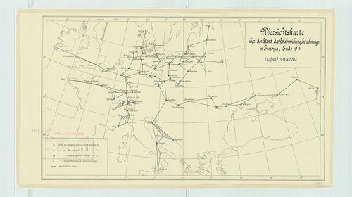
| Title | Übersichtskarte über den Stand der Lotabweichungsberechnungen in Europa, Ende 1911. |
| Main title | Európa mérővonal kiegyenlítési állásai 1911 végén. Geodéziai hálózat. |
663. Alpenländer, Autokarte-Road Map. – Alpine Countries – Pays A... [B II c 101]
Institute and Museum of Military History •
B II c
•
B II Európa, nagyobb részek és országcsoportok
•
B I–XV. Európa
| Title | Alpenländer, Autokarte-Road Map. – Alpine Countries – Pays Alpins, Carte Automobile – Paesi Alpini, Carta Stradale. |
| Main title | Az Alpok országainak autótérképe. |
664. Übersicht über die geographische Verteilung der Schwerestati... [B II c 102]
Institute and Museum of Military History •
B II c
•
B II Európa, nagyobb részek és országcsoportok
•
B I–XV. Európa
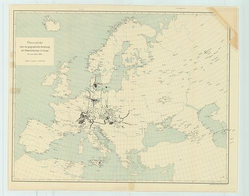
| Title | Übersicht über die geographische Verteilung der Schwerestationen in Europa, bis zum Jahre 1909. Blatt I. |
| Main title | Európa nehézségi állomásai 1909-ben. |
665. Csonkamagyarország és a környező államok közlekedési térképe... [B II c 104]
Institute and Museum of Military History •
B II c
•
B II Európa, nagyobb részek és országcsoportok
•
B I–XV. Európa
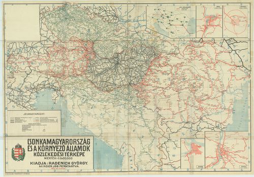
| Title | Csonkamagyarország és a környező államok közlekedési térképe. |
| Main title | 5 mt.: 1. Légi közlekedés. 2. Prága. |
| Subject | 3. Bukarest. |
666. Carte ethnographique de L’Europe Centrale. [B II c 105]
Institute and Museum of Military History •
B II c
•
B II Európa, nagyobb részek és országcsoportok
•
B I–XV. Európa
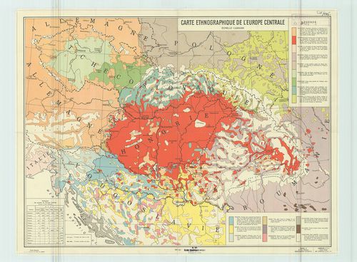
| Title | Carte ethnographique de L’Europe Centrale. |
| Main title | Közép-Európa néprajzi térképe 1938-ban. |
667. A dunai államok néprajzi térképe. [B II c 106]
Institute and Museum of Military History •
B II c
•
B II Európa, nagyobb részek és országcsoportok
•
B I–XV. Európa
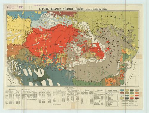
| Title | A dunai államok néprajzi térképe. |
668. A Duna völgy és környéke. [B II c 107]
Institute and Museum of Military History •
B II c
•
B II Európa, nagyobb részek és országcsoportok
•
B I–XV. Európa
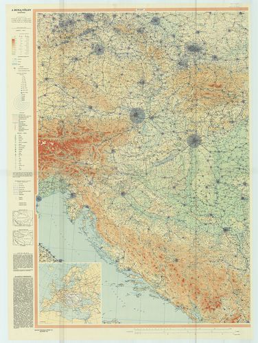
| Title | A Duna völgy és környéke. |
| Main title | Mt.: [Európa] |
| Subject | Országhatárok 1914-ben és 1930-ban. |
669. Ostalpen: Dolomiten – Tirol. Automobilkarte. „Alpina I.” [B II c 108]
Institute and Museum of Military History •
B II c
•
B II Európa, nagyobb részek és országcsoportok
•
B I–XV. Európa
| Title | Ostalpen: Dolomiten – Tirol. Automobilkarte. „Alpina I.” |
| Main title | Keleti Alpok: Dolomitok. Tirol autótérképe 1963-ban. |
670. Westalpen: Riviera. Provence Automobilkarte. „Alpina II.” [B II c 108/1]
Institute and Museum of Military History •
B II c
•
B II Európa, nagyobb részek és országcsoportok
•
B I–XV. Európa
| Title | Westalpen: Riviera. Provence Automobilkarte. „Alpina II.” |
| Main title | Nyugati-Alpok: Riviera, Provence autótérképe 1963-ban. |
671. Alpina I. Ostalpen, – Alpes Orientales, Dolomiti, – Veneto, ... [B II c 108/2]
Institute and Museum of Military History •
B II c
•
B II Európa, nagyobb részek és országcsoportok
•
B I–XV. Európa
| Title | Alpina I. Ostalpen, – Alpes Orientales, Dolomiti, – Veneto, Österreich. – Ostalpen, Dolomiti, – Veneto., – Tirol. Hallwag Strassenkarte – Road Map. |
| Main title | A Keleti-Alpok, a Dolomitok-Veneto vidék, Tirol és Ausztria úttérképe 1971-ben. |
672. Alpina II. Ovest-West. – Westalpen. Provence, – Riviera, – S... [B II c 108/3]
Institute and Museum of Military History •
B II c
•
B II Európa, nagyobb részek és országcsoportok
•
B I–XV. Európa
| Title | Alpina II. Ovest-West. – Westalpen. Provence, – Riviera, – Savoie. – Westlapen. Riviera, Provence, Savoie, Piemonte. Hallwag Carte Automobile – Autokarte. |
| Main title | A Nyugati-Alpok, Provence, – Savoie vidék, Piemont vidék és a Riviera autótérképe 1970-ben. |
673. Alpina III. Schweiz–Tirol–Oberitalie. – Zentralalpen. La Sui... [B II c 108/4]
Institute and Museum of Military History •
B II c
•
B II Európa, nagyobb részek és országcsoportok
•
B I–XV. Európa
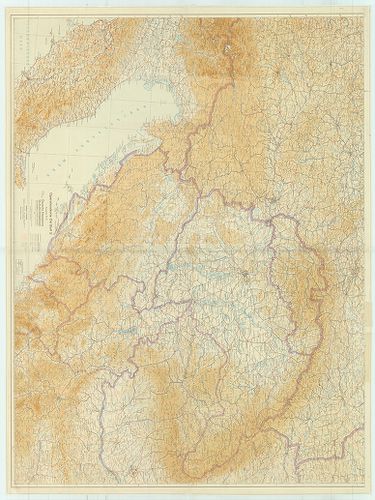
| Title | Alpina III. Schweiz–Tirol–Oberitalie. – Zentralalpen. La Suisse-Alta Italia-Oberitalien. Hallwag. Strassenkarte. |
| Main title | A Közép-Alpok, Svájc és Felső-Olaszország úttérképe 1971-ben. |
674. Alpen. Schweiz–Österreich–Oberitalien–Rhônetal. Grosse Autok... [B II c 109]
Institute and Museum of Military History •
B II c
•
B II Európa, nagyobb részek és országcsoportok
•
B I–XV. Európa
| Title | Alpen. Schweiz–Österreich–Oberitalien–Rhônetal. Grosse Autokarte. No. 87. |
| Main title | Az Alpok (Svájc–Ausztria–Felső-Olaszország és a Rhône-völgye) autótérképe 1960 után. |
675. L’Europa au temps de Charles Quint. No. 517. (1535). [B II c 110]
Institute and Museum of Military History •
B II c
•
B II Európa, nagyobb részek és országcsoportok
•
B I–XV. Európa
| Title | L’Europa au temps de Charles Quint. No. 517. (1535). |
| Main title | La France a la Mort de Saint Louis. (Franciaország IX. Szent Lajos halála után 1270-ben.) |
| Subject | Európa V. Károly idejében 1535-ben. |
676. Italija, Svejcarija i Avsztrija. Ucsebna ikonomicseszka kart... [B II c 111]
Institute and Museum of Military History •
B II c
•
B II Európa, nagyobb részek és országcsoportok
•
B I–XV. Európa
| Title | Italija, Svejcarija i Avsztrija. Ucsebna ikonomicseszka karta. |
| Main title | Olaszország, Svájc és Ausztria gazdasági térképe 1963-ban. (Iskolai térkép.) |
677. Grosse Handkarte der Grenzländer Österreich–Ungarn Italien. [B II c 112]
Institute and Museum of Military History •
B II c
•
B II Európa, nagyobb részek és országcsoportok
•
B I–XV. Európa
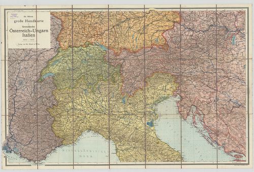
| Title | Grosse Handkarte der Grenzländer Österreich–Ungarn Italien. |
| Main title | Ausztria, Magyarország, Olaszország és a szomszédos területek közlekedési térképe. |
678. Generalkarte von West-Russland und den angrenzenden Ländern ... [B II c 113]
Institute and Museum of Military History •
B II c
•
B II Európa, nagyobb részek és országcsoportok
•
B I–XV. Európa
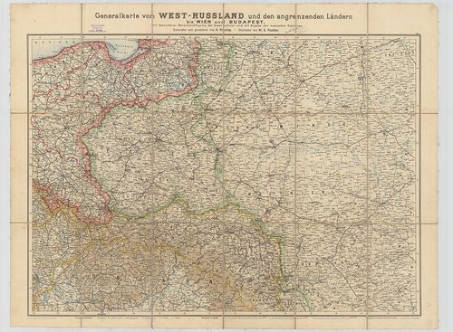
| Title | Generalkarte von West-Russland und den angrenzenden Ländern bis Wien und Budapest mit besonderer Berücksichtigung der Eisenbahnen und mit Angabe der russischen Stationen. |
| Main title | Nyugat-Oroszország és a szomszédos államok vasúttérképe 1914-ben. |
679. Europa Autokarte. Road map ... Gulf [B II c 115]
Institute and Museum of Military History •
B II c
•
B II Európa, nagyobb részek és országcsoportok
•
B I–XV. Európa
| Title | Europa Autokarte. Road map ... Gulf |
| Main title | Európa autótérképe 1963-ban. |
680. Südost-Europa. [B II c 116]
Institute and Museum of Military History •
B II c
•
B II Európa, nagyobb részek és országcsoportok
•
B I–XV. Európa
| Title | Südost-Europa. |
| Main title | Délkelet-Európa autótérképe. |
681. Europa Atlante Automobilistico [B II c 117]
Institute and Museum of Military History •
B II c
•
B II Európa, nagyobb részek és országcsoportok
•
B I–XV. Európa
| Title | Europa Atlante Automobilistico |
| Main title | Európa autóatlasza. |
682. Kelet-Európa autótérképe. [B II c 118]
Institute and Museum of Military History •
B II c
•
B II Európa, nagyobb részek és országcsoportok
•
B I–XV. Európa
| Title | Kelet-Európa autótérképe. |
| Main title | Mt.: [Szovjetunió NY-i része.] |
683. Road Map of eastern Europa. – Europe de l’Est Carte Routiére... [B II c 118/1]
Institute and Museum of Military History •
B II c
•
B II Európa, nagyobb részek és országcsoportok
•
B I–XV. Európa
| Title | Road Map of eastern Europa. – Europe de l’Est Carte Routiére – Autokarte von Osteuropa. |
| Main title | Mt.: [Kelet-Európa.] |
| Subject | Kelet-Európa autótérképe 1967-ben. |
684. Nyugat-Európa autótérképe. [B II c 119]
Institute and Museum of Military History •
B II c
•
B II Európa, nagyobb részek és országcsoportok
•
B I–XV. Európa
| Title | Nyugat-Európa autótérképe. |
| Main title | 2 mt.: [Dánia–Skandinávia D-i része.] |
| Subject | 2. [Olaszország D-i része és Szicília szg.] |
685. Kriegstheater oder Graenzkarte Oesterreichs, Russlands und d... [B II c 120]
Institute and Museum of Military History •
B II c
•
B II Európa, nagyobb részek és országcsoportok
•
B I–XV. Európa
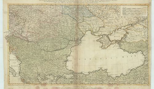
| Title | Kriegstheater oder Graenzkarte Oesterreichs, Russlands und der Türkey... |
| Main title | Az Osztrák Birodalom, Oroszország és Törökország határvidékének térképe (a Fekete-tenger országai) 1788-ban. |
686. Projectirte Bahnen durch Siebenbürgen in Verbindung mit den ... [B II c 121]
Institute and Museum of Military History •
B II c
•
B II Európa, nagyobb részek és országcsoportok
•
B I–XV. Európa
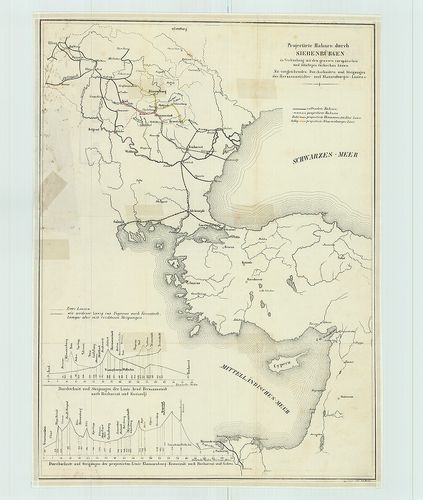
| Title | Projectirte Bahnen durch Siebenbürgen in Verbindung mit den grossen europäischen und künftigen türkischen Linien. |
| Main title | Vasútvonal tervezet Erdély és az európai Törökország összeköttetéséről. |
687. Pregledna Karte Evropskih železnica sa prelaznim stanicama ž... [B II c 122]
Institute and Museum of Military History •
B II c
•
B II Európa, nagyobb részek és országcsoportok
•
B I–XV. Európa
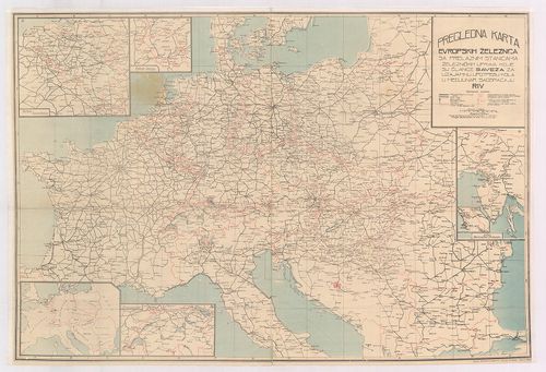
| Title | Pregledna Karte Evropskih železnica sa prelaznim stanicama železničkih uprava koje su članice saveza za uzajamnu upotpebu kola u medjunar. saobraćaju RIV. |
| Main title | 6 mt.: 1. Belgija i Luxemburg (Belgium és Luxemburg.) 2. Područje Saara. (Saarvidék) 3. Švajcarska (Svájc.) 4. Istra Slovenačko Primorje (Isztria félsziget) 5. Trst (Trieste) 6. [Közép-Európa.] |
| Subject | Közép-Európa vasúttérképe 1949-ben. |
688. Fina Europa Atlas. [B II c 123]
Institute and Museum of Military History •
B II c
•
B II Európa, nagyobb részek és országcsoportok
•
B I–XV. Európa
| Title | Fina Europa Atlas. |
| Main title | Európa közlekedési atlasza az 1950-es években. |
689. Strassenkarte Nordwesteuropa. [B II c 124]
Institute and Museum of Military History •
B II c
•
B II Európa, nagyobb részek és országcsoportok
•
B I–XV. Európa
| Title | Strassenkarte Nordwesteuropa. |
| Main title | Road map Northwestern Europe. – Carte routiére Europe du Nord-Ouest... |
| Subject | Északnyugat-Európa úttérképe 1956-ban. |
690. Western Europe and adjacent North Africa. [B II c 125]
Institute and Museum of Military History •
B II c
•
B II Európa, nagyobb részek és országcsoportok
•
B I–XV. Európa
| Title | Western Europe and adjacent North Africa. |
| Main title | Road map and Pictorial Guide. Follow the „Esso Route” Hátl.: 1. Relief map. 2. Pictorial Guide. |
| Subject | Nyugat-Európa és Észak-Afrika egy részének autótérképe 1956-ban. |
691. Western Europe and adjacent North Africa. [B II c 125/1]
Institute and Museum of Military History •
B II c
•
B II Európa, nagyobb részek és országcsoportok
•
B I–XV. Európa
| Title | Western Europe and adjacent North Africa. |
| Main title | Road map and Pictorial Guide. Follow the „Esso Route” Hátl.: 1. Relief map. 2. Pictorial Guide. |
| Subject | Nyugat-Európa és Észak-Afrika egy részének autótérképe 1959-ben. |
692. Central Europe. Bartholomew’s World Series. Road map. Carte ... [B II c 127]
Institute and Museum of Military History •
B II c
•
B II Európa, nagyobb részek és országcsoportok
•
B I–XV. Európa
| Title | Central Europe. Bartholomew’s World Series. Road map. Carte Routiére ... |
| Main title | Közép-Európa közlekedési térképe 1963-ban. |
693. Continental Atlas, Deutschland, Benelux- und Alpenländer. [B II c 128]
Institute and Museum of Military History •
B II c
•
B II Európa, nagyobb részek és országcsoportok
•
B I–XV. Európa
| Title | Continental Atlas, Deutschland, Benelux- und Alpenländer. |
| Main title | Európa: Németország, Benelux államok és az Alpok országai autóatlasza 1956-ban. |
694. Europa. Cartoguide Européen SHELL Touring [Borítócím] [B II c 129]
Institute and Museum of Military History •
B II c
•
B II Európa, nagyobb részek és országcsoportok
•
B I–XV. Európa
| Title | Europa. Cartoguide Européen SHELL Touring [Borítócím] |
| Main title | Közép-Európa közlekedési térképe 1960-ban. |
695. Europe. Europa Autokarte. – Road map. – Carte Automobile. – ... [B II c 130]
Institute and Museum of Military History •
B II c
•
B II Európa, nagyobb részek és országcsoportok
•
B I–XV. Európa
| Title | Europe. Europa Autokarte. – Road map. – Carte Automobile. – Carte stradale. |
| Main title | Mt.: [Dél-Skandinávia.] |
| Subject | Európa autótérképe az 1950-es években. |
696. Europe Atlas Routier. – Strassenatlas. – Road Atlas. – Atlan... [B II c 131]
Institute and Museum of Military History •
B II c
•
B II Európa, nagyobb részek és országcsoportok
•
B I–XV. Európa
| Title | Europe Atlas Routier. – Strassenatlas. – Road Atlas. – Atlante Stradale. Kötéscím: Europa im Automobil. Reiseführer und Atlas. Internationaler Automobilführer. |
| Main title | Európa autóatlasza. |
697. Strassen – Roads – Veje – Carreteras – Routes – Wegen – Stra... [B II c 132]
Institute and Museum of Military History •
B II c
•
B II Európa, nagyobb részek és országcsoportok
•
B I–XV. Európa
| Title | Strassen – Roads – Veje – Carreteras – Routes – Wegen – Strade – Vägar. Europa |
| Main title | Európa és Németország autóatlasza 1962-ben. |
698. Europe. Europa. Strassenkarte zur Planung von Autoreisen etc... [B II c 133]
Institute and Museum of Military History •
B II c
•
B II Európa, nagyobb részek és országcsoportok
•
B I–XV. Európa
| Title | Europe. Europa. Strassenkarte zur Planung von Autoreisen etc. |
| Main title | 2 mt.: 1. [Európa hegyvízrajzi térk.] 2. [Európa km. táblázata.] |
| Subject | Európa autótérképe 1962-ben. |
699. Europe road map. [B II c 134]
Institute and Museum of Military History •
B II c
•
B II Európa, nagyobb részek és országcsoportok
•
B I–XV. Európa
| Title | Europe road map. |
| Main title | Európa úttérképe. |
700. Freytag–Berndt Strassenkarte Südwesteuropa. Road map Southwe... [B II c 135]
Institute and Museum of Military History •
B II c
•
B II Európa, nagyobb részek és országcsoportok
•
B I–XV. Európa

| Title | Freytag–Berndt Strassenkarte Südwesteuropa. Road map Southwestern Europa. Carte routiére Europe du Sud-Ouest... |
| Main title | Délnyugat-Európa közlekedési térképe 1954-ben. |