201. [A Keleti (Balti)-tenger térképe.] [B I b 59]
Institute and Museum of Military History •
B I b
•
B I Európa
•
B I–XV. Európa
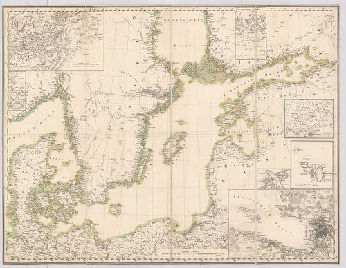
| Title | [A Keleti (Balti)-tenger térképe.] |
| Main title | 7 mt.: 1. Stockholm 2. Kieli-öböl, 3. Helsing Fors (Helsinki) 4. Reval (Tallinn) 5. Christiansö (Christiansř) 6. S[ankt] Petersburg (Leningrád) 7. [Düna (Dvina) folyó torkolata]. |
202. Európa hegy- és vízrajzi térképe. [B I b 80]
Institute and Museum of Military History •
B I b
•
B I Európa
•
B I–XV. Európa
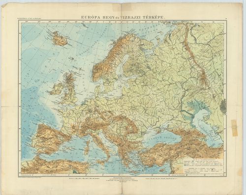
| Title | Európa hegy- és vízrajzi térképe. |
203. Sztenna Mapa Evropü. [B I b 81]
Institute and Museum of Military History •
B I b
•
B I Európa
•
B I–XV. Európa
| Title | Sztenna Mapa Evropü. |
| Main title | Európa iskolai falitérképe 1923-ban. |
204. Európa felszíni vizeinek vízföldrajzi szaktérképe. [B I b 83]
Institute and Museum of Military History •
B I b
•
B I Európa
•
B I–XV. Európa
| Title | Európa felszíni vizeinek vízföldrajzi szaktérképe. |
205. Európa fali abrosza. [B I b 90]
Institute and Museum of Military History •
B I b
•
B I Európa
•
B I–XV. Európa
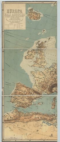
| Title | Európa fali abrosza. |
| Main title | Mt.: Európa politikai felosztása. |
206. Európa hegy- és vízrajzi térképe. [B I b 95]
Institute and Museum of Military History •
B I b
•
B I Európa
•
B I–XV. Európa
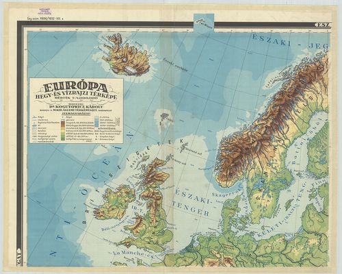
| Title | Európa hegy- és vízrajzi térképe. |
207. Schulwandkarten: Europa. [B I b 96]
Institute and Museum of Military History •
B I b
•
B I Európa
•
B I–XV. Európa
| Title | Schulwandkarten: Europa. |
| Main title | Európa iskolai térképe. |
208. Nástenná mapa evropy. [B I b 97]
Institute and Museum of Military History •
B I b
•
B I Európa
•
B I–XV. Európa
| Title | Nástenná mapa evropy. |
| Main title | Európa hegyvízrajzi térképe. |
209. Karta Evrope. [B I b 98]
Institute and Museum of Military History •
B I b
•
B I Európa
•
B I–XV. Európa
| Title | Karta Evrope. |
| Main title | Európa hegyvízrajzi térképe. |
210. Die Mittlere Steinzeit (etwa 12 000–3000 v[or] d[em] Kr.) [B I b 100]
Institute and Museum of Military History •
B I b
•
B I Európa
•
B I–XV. Európa
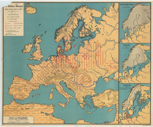
| Title | Die Mittlere Steinzeit (etwa 12 000–3000 v[or] d[em] Kr.) |
| Main title | 3 mt.: 1. Südschwedischer Eishalt. (A dél-svéd eljegesedés). 2. Yoldia Zeit (Yoldia időszak) 3. Ancylus Zeit. (Ancylus-időszak). Karten zur Vorgeschichte. |
| Subject | A középső kőkor Európában (i. e. 12 000–3000). |
211. Eiszeitalter. Die ältere Steinzeit. (etwa 400 000–12 000 v[o... [B I b 101]
Institute and Museum of Military History •
B I b
•
B I Európa
•
B I–XV. Európa
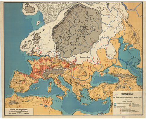
| Title | Eiszeitalter. Die ältere Steinzeit. (etwa 400 000–12 000 v[or] d[em] Kr.) |
| Main title | Az őskor Európában (i. e. 400 000–12 000). |
212. Evropa. Fizicseszkaj karta. [B I b 103]
Institute and Museum of Military History •
B I b
•
B I Európa
•
B I–XV. Európa
| Title | Evropa. Fizicseszkaj karta. |
| Main title | Európa hegyvízrajzi térképe 1949-ben. |
213. Európa domborzata és vizei. [B I b 104]
Institute and Museum of Military History •
B I b
•
B I Európa
•
B I–XV. Európa
| Title | Európa domborzata és vizei. |
214. Sredozemlje. [B I b 105]
Institute and Museum of Military History •
B I b
•
B I Európa
•
B I–XV. Európa
| Title | Sredozemlje. |
| Main title | A Földközi-tenger európai és afrikai partvidéke. |
215. Europa. [B I b 106]
Institute and Museum of Military History •
B I b
•
B I Európa
•
B I–XV. Európa
| Title | Europa. |
| Main title | Európa hegyvízrajzi térképe. |
216. Evropa. [B I b 107]
Institute and Museum of Military History •
B I b
•
B I Európa
•
B I–XV. Európa
| Title | Evropa. |
| Main title | Európa hegyvízrajzi térképe 1957-ben. |
217. Európa. [B I b 107/1]
Institute and Museum of Military History •
B I b
•
B I Európa
•
B I–XV. Európa
| Title | Európa. |
| Main title | Európa hegyvízrajzi térképe 1964-ben. |
218. Carte Tectonique Internationale de l’Europe. [B I b 110]
Institute and Museum of Military History •
B I b
•
B I Európa
•
B I–XV. Európa
| Title | Carte Tectonique Internationale de l’Europe. |
| Main title | Európa tektonikai térképei. |
219. ZSSR. Mapa przegladowa Europy. [B I b 111]
Institute and Museum of Military History •
B I b
•
B I Európa
•
B I–XV. Európa
| Title | ZSSR. Mapa przegladowa Europy. |
| Main title | Mt.: Moskva. |
| Subject | Európa átnézeti térképe. A hátlapon: hegy és vízrajza. |
220. Európa földhasznosítási térképe. [B I b 112]
Institute and Museum of Military History •
B I b
•
B I Európa
•
B I–XV. Európa
| Title | Európa földhasznosítási térképe. |
221. Európa domborzata és vizei. [B I b 113]
Institute and Museum of Military History •
B I b
•
B I Európa
•
B I–XV. Európa
| Title | Európa domborzata és vizei. |
222. Dél-Európa: – Appennini és a Balkán-fsz. [B I b 114]
Institute and Museum of Military History •
B I b
•
B I Európa
•
B I–XV. Európa
| Title | Dél-Európa: – Appennini és a Balkán-fsz. |
| Main title | Melléktérk.: Ciprus–A Pireneusi(Ibériai)-fsz. |
223. Európa. [B I b 115]
Institute and Museum of Military History •
B I b
•
B I Európa
•
B I–XV. Európa
| Title | Európa. |
224. Európa. 2010-es, 2013-as naptár. Dombortérkép. [B I b 116]
Institute and Museum of Military History •
B I b
•
B I Európa
•
B I–XV. Európa
| Title | Európa. 2010-es, 2013-as naptár. Dombortérkép. |
225. General karte über alla in Europa vorkommenden Eisenbahnen… ... [B I c 1]
Institute and Museum of Military History •
B I c
•
B I Európa
•
B I–XV. Európa
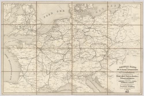
| Title | General karte über alla in Europa vorkommenden Eisenbahnen… Haupt-u. Poststrassen, Canälen u. Dampfschiffahrten… |
| Main title | Európa közlekedési térképe. |
226. Römisches Reich. [B I c 2]
Institute and Museum of Military History •
B I c
•
B I Európa
•
B I–XV. Európa
| Title | Römisches Reich. |
| Main title | Mt.: Krise und Niedergang des Röm. Reich. (III.–V. Jahrhundert.) (A Római-Birodalom hanyatlása és bukása, V.–III. században.) |
| Subject | A Római Birodalom térképe. |
227. Römisches Reich. [B I c 2/1]
Institute and Museum of Military History •
B I c
•
B I Európa
•
B I–XV. Európa
| Title | Römisches Reich. |
| Main title | Mt.: I A Római Birodalom válsága és hanyatlása a III.–V. században.] |
| Subject | A Római Birodalom. |
228. Imperio Romano. [B I c 2/2]
Institute and Museum of Military History •
B I c
•
B I Európa
•
B I–XV. Európa
| Title | Imperio Romano. |
| Main title | Mt.: Crisis y caida del Imperio Romano. (Siglos III.–V.) (A Római Birodalom válságai és bukása az V.–III. században.) |
| Subject | A Római Birodalom (Európa és Afrika északi partvidéke) térképe az V.–III. században. |
229. Eisenbahn- und Dampfschiffrouten-Karte von Europa [B I c 3]
Institute and Museum of Military History •
B I c
•
B I Európa
•
B I–XV. Európa
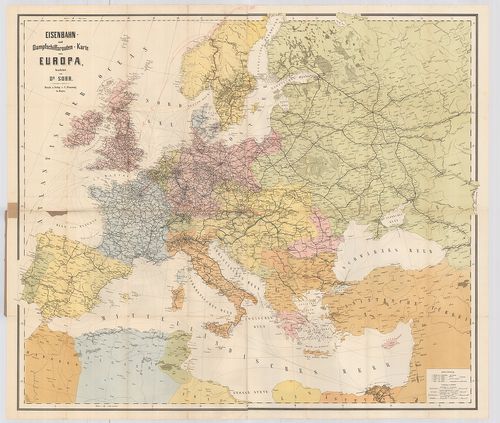
| Title | Eisenbahn- und Dampfschiffrouten-Karte von Europa |
| Main title | Európa közlekedési térképe 1881-ben. |
230. Európa in de zestiende eeuw. Brill’s Historische Wandkaarten... [B I c 4]
Institute and Museum of Military History •
B I c
•
B I Európa
•
B I–XV. Európa
| Title | Európa in de zestiende eeuw. Brill’s Historische Wandkaarten. |
| Main title | Európa a 16. században. |
231. Europa in de zeventiende eeuw. Brill’s Historische Wandkaart... [B I c 4/1]
Institute and Museum of Military History •
B I c
•
B I Európa
•
B I–XV. Európa
| Title | Europa in de zeventiende eeuw. Brill’s Historische Wandkaarten. |
| Main title | Európa a 17. században. |
232. Europa in de achttiende eeuw. Brill’s Historische Wandkaarte... [B I c 4/2]
Institute and Museum of Military History •
B I c
•
B I Európa
•
B I–XV. Európa
| Title | Europa in de achttiende eeuw. Brill’s Historische Wandkaarten. |
| Main title | 4 mt.: 1. Verdeling van Polen. (Lengyelország felosztása.) 2. Barriéresteden. (Országhatárok.) 3. [Gyarmatok eloszlása a földön.] 4. [Gyarmatok a mai USA területén.] |
| Subject | Európa a 18. században. |
233. Europa tijdens de Carolingen. Brill’s Historische Wandkaarte... [B I c 5]
Institute and Museum of Military History •
B I c
•
B I Európa
•
B I–XV. Európa
| Title | Europa tijdens de Carolingen. Brill’s Historische Wandkaarten. |
| Main title | Európa a Karolingok idején. (1000 előtt.) |
234. Europa: Die Umgestaltung durch Napoleon I. (1799–1815.) [B I c 6]
Institute and Museum of Military History •
B I c
•
B I Európa
•
B I–XV. Európa
| Title | Europa: Die Umgestaltung durch Napoleon I. (1799–1815.) |
| Main title | Európa I. Napoleon alatt 1799–1815-ig. |
235. Carte itinéraire de l’Europe. [B I c 7]
Institute and Museum of Military History •
B I c
•
B I Európa
•
B I–XV. Európa
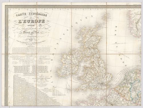
| Title | Carte itinéraire de l’Europe. |
| Main title | Európa közlekedési térképe 1842. |
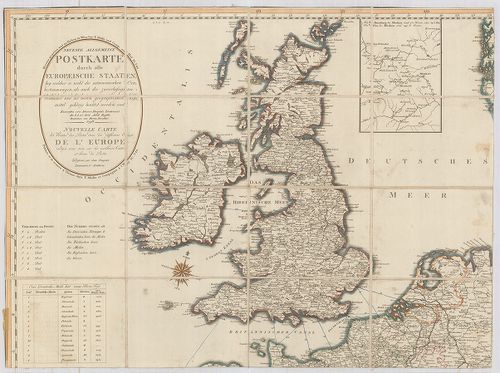
236. Neueste Allgemeine Postkarte von Europa … [B I c 8]
Institute and Museum of Military History •
B I c
•
B I Európa
•
B I–XV. Európa
| Title | Neueste Allgemeine Postkarte von Europa … |
| Main title | Mt.: [Moszkva környéke.] |
| Subject | Európa postaúthálózatának térképe 1805-ben. |
237. Neueste Allgemeine Postkarte durch alle Europaeische Staaten... [B I c 8/a]
Institute and Museum of Military History •
B I c
•
B I Európa
•
B I–XV. Európa
| Title | Neueste Allgemeine Postkarte durch alle Europaeische Staaten… Nouvelle Carte des Routes des Postes dans les différens États de l’Europe… Véste: Hieron. Benedicti. |
| Main title | Mt.: [Moszkva környéke] |
| Subject | Európa postaúthálózatának térképe 1798-ban. |
238. Vereinigte Eisenbahn-Routen- und Lademass-Karte von Mittel-E... [B I c 9]
Institute and Museum of Military History •
B I c
•
B I Európa
•
B I–XV. Európa
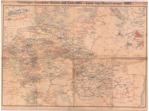
| Title | Vereinigte Eisenbahn-Routen- und Lademass-Karte von Mittel-Europa. |
| Main title | 6 mt.: 1. Eisenbahnen im Ruhr kohlen Gebiet 2. Eisenbahnen in Mittel-u. Unteritalien, Serbien, Bulgarien, Türkei und Griechenland 3. Wien, 4. Berlin, 5. Budapest, 6. Frankfurt. |
| Subject | Közép-Európa közlekedési térképe 1892-ben. |
239. Europa: Bündnissysteme Bismarcks (1871–1890). [B I c 10]
Institute and Museum of Military History •
B I c
•
B I Európa
•
B I–XV. Európa
| Title | Europa: Bündnissysteme Bismarcks (1871–1890). |
| Main title | Európa, a Bismarck-i szövetségi rendszer ideje alatt 1871–1890-ig. |
240. Europa 1939–1945. Brill’s Historische Wandkaarten. [B I c 11]
Institute and Museum of Military History •
B I c
•
B I Európa
•
B I–XV. Európa
| Title | Europa 1939–1945. Brill’s Historische Wandkaarten. |
| Main title | Mt.: [Az Ardenni ellentámadás 1944-ben.] |
| Subject | Európa (az Észak-Afrikai és Kis-Ázsiai harcok térképe) 1939–1945-ig. |
241. Telegraphen-Karte von Europa… [B I c 12]
Institute and Museum of Military History •
B I c
•
B I Európa
•
B I–XV. Európa
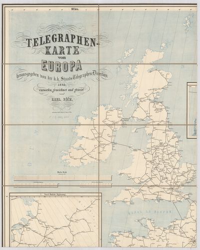
| Title | Telegraphen-Karte von Europa… |
| Main title | 2 mt.: 1. Nord-östliche Ergänzung 2. Nördliche Ergänzung. |
| Subject | Európa távíró térképe 1864-ben. |
242. Karte des Europaeischen Telegraphen-Netzes. [B I c 12/1]
Institute and Museum of Military History •
B I c
•
B I Európa
•
B I–XV. Európa
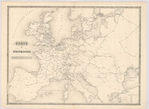
| Title | Karte des Europaeischen Telegraphen-Netzes. |
| Main title | Európa távíróhálózatának térképe. |
243. Eisenbahn-Post und Dampfschiffs-Karte von Europa. – Railway ... [B I c 13]
Institute and Museum of Military History •
B I c
•
B I Európa
•
B I–XV. Európa
| Title | Eisenbahn-Post und Dampfschiffs-Karte von Europa. – Railway Steam-Boat and Post Map of Europe. – Carte des Chemins de Fer voies navigables et Routes Postales de l’Europe. |
| Main title | 5 mt.: 1. Der Rhein von Mainz bis Wesel. 2. London 3. Paris. 4. Die Schweiz 5. Die belgischen Eisenbahnen. |
| Subject | Európa közlekedési térképe 1867-ben. |
244. Germanorum [et] Slavorum per medium aevum Orbis Christianus.... [B I c 14]
Institute and Museum of Military History •
B I c
•
B I Európa
•
B I–XV. Európa
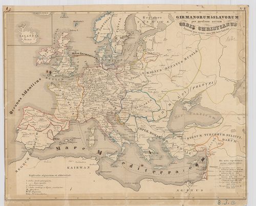
| Title | Germanorum [et] Slavorum per medium aevum Orbis Christianus. Regnorum quae exeunte anno 1100 fuere limitatio. |
| Main title | Európa történelmi térképe i. u. 1100-ban. |
245. Hauptverkehrslinien von Europa. [B I c 15]
Institute and Museum of Military History •
B I c
•
B I Európa
•
B I–XV. Európa
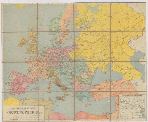
| Title | Hauptverkehrslinien von Europa. |
| Main title | 1 mt.: Eisenbahnkarte von Sibiren. (Szibériai vasútvonalak).Európa fő vasutainak térképe. |
246. Europa w okresie wypraw krzyżowych (XII–XIII w.) [B I c 16]
Institute and Museum of Military History •
B I c
•
B I Európa
•
B I–XV. Európa
| Title | Europa w okresie wypraw krzyżowych (XII–XIII w.) |
| Main title | 2 mt.: 1. Mapa gospodarcza Europy średniowiecznej. |
| Subject | (A középkori Európa gazdasági térképe.) 2. Ważniejsze wyprawy krzyżowe. (Keresztes hadjárat.) |
247. Europa in de Middeleeuwen 1300–1500. Brill’s Historische Wan... [B I c 17]
Institute and Museum of Military History •
B I c
•
B I Európa
•
B I–XV. Európa
| Title | Europa in de Middeleeuwen 1300–1500. Brill’s Historische Wandkaarten. |
| Main title | Mt.: De Bourgondische Nederlanden. (Burgundiai Németalföld, Hollandia.) |
| Subject | Európa a középkorban 1300–1500-ig. |
248. Europa 1815–1871. Brill’s Historische Wandkaarten. [B I c 18]
Institute and Museum of Military History •
B I c
•
B I Európa
•
B I–XV. Európa
| Title | Europa 1815–1871. Brill’s Historische Wandkaarten. |
| Main title | Mt.: Koninkrijk der Nederlanden 1815–1830. Belgie na 1830. (Hollandia 1813–1830-ig. Belgium 1830-ban.) |
| Subject | Európa 1815–1871-ig. |
249. Dislokationskarte der Heere Europas. [B I c 19]
Institute and Museum of Military History •
B I c
•
B I Európa
•
B I–XV. Európa
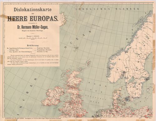
| Title | Dislokationskarte der Heere Europas. |
| Main title | Európai hadseregek elhelyezési térképe 1895-ben. |
250. Europa vor und nach dem ersten Weltkrieg 1914 und 1937. [B I c 20]
Institute and Museum of Military History •
B I c
•
B I Európa
•
B I–XV. Európa
| Title | Europa vor und nach dem ersten Weltkrieg 1914 und 1937. |
| Main title | Európa az I. Világháború alatt és után 1914–1937-ig. |