661. N. R. B’lgarija. – Oficialen ptevoditel. [B III c 97]
Institute and Museum of Military History •
B III c
•
B III Balkán-félsziget
•
B I–XV. Európa
| Title | N. R. B’lgarija. – Oficialen ptevoditel. |
| Main title | 2 mt.: 1. [Bulgária vasútvonalai.] 2. Bulgária európai vasúti összeköttetései.] |
| Subject | Bulgária vasúti menetrendje 1959-ben. |
662. România. Harta strarei Drumurlor. – Carte de l’état des Rout... [B III c 98]
Institute and Museum of Military History •
B III c
•
B III Balkán-félsziget
•
B I–XV. Európa

| Title | România. Harta strarei Drumurlor. – Carte de l’état des Routes. – Strassenzustanskarte. – Roads Map. |
| Main title | Románia autóúttérképe 1936-ban. |
663. Bucuresti. [B III c 100]
Institute and Museum of Military History •
B III c
•
B III Balkán-félsziget
•
B I–XV. Európa
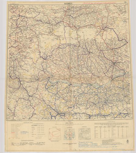
| Title | Bucuresti. |
| Main title | Románia – Bulgária (Olténia – Munténia és a környező területek) úttérképe 1943-ban. |
664. Republica Populară Romină Oficiul National de Turism Carpati... [B III c 101]
Institute and Museum of Military History •
B III c
•
B III Balkán-félsziget
•
B I–XV. Európa
| Title | Republica Populară Romină Oficiul National de Turism Carpati. Harta Turistică. |
| Main title | A Román Népköztársaság turista térképe 1960-ban. |
665. Ethnografical map of Rumania of 1930. Carte ethnographique d... [B III c 102]
Institute and Museum of Military History •
B III c
•
B III Balkán-félsziget
•
B I–XV. Európa
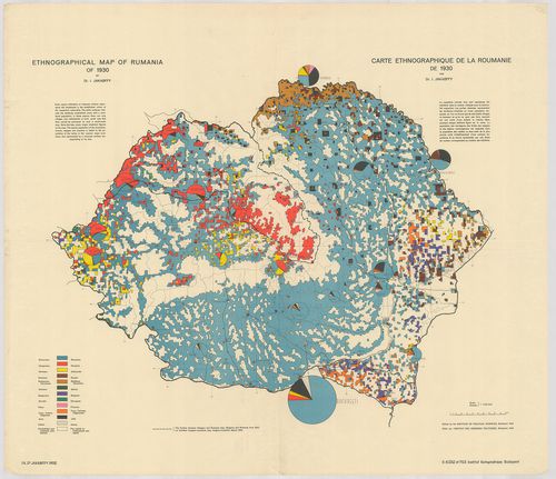
| Title | Ethnografical map of Rumania of 1930. Carte ethnographique de la Roumanie de 1930. |
| Main title | Románia etnográfiai térképe 1930-ban. |
666. A moldvai csángók néprajzi térképe. – Carte Ethnographique d... [B III c 103]
Institute and Museum of Military History •
B III c
•
B III Balkán-félsziget
•
B I–XV. Európa
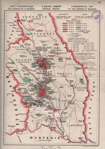
| Title | A moldvai csángók néprajzi térképe. – Carte Ethnographique des Csángós de la Moldavie. – Ethnographical map of the Csángos of Moldvia. |
667. Románia települési térképe 1930. [B III c 104]
Institute and Museum of Military History •
B III c
•
B III Balkán-félsziget
•
B I–XV. Európa
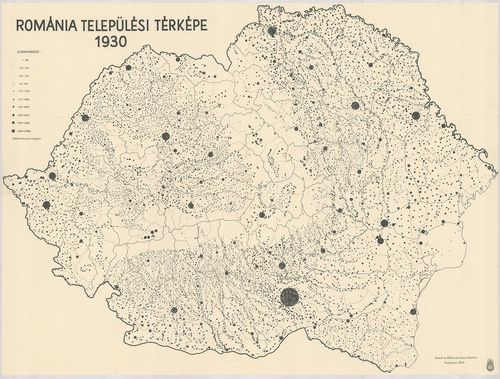
| Title | Románia települési térképe 1930. |
668. Harta Drumurilor din România pentru Automobilişti şi turişti... [B III c 107]
Institute and Museum of Military History •
B III c
•
B III Balkán-félsziget
•
B I–XV. Európa
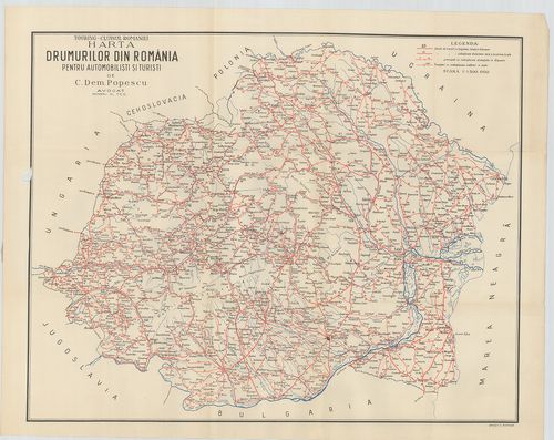
| Title | Harta Drumurilor din România pentru Automobilişti şi turişti. Touring-Clubul Romaniei. – Borítócím: Drumurile din România şi distanţele lor kilometrice. |
669. Harta Căilor Ferata Române 1938. [B III c 108]
Institute and Museum of Military History •
B III c
•
B III Balkán-félsziget
•
B I–XV. Európa

| Title | Harta Căilor Ferata Române 1938. |
| Main title | Románia vasúti térképe 1938-ban. |
670. Románia vasútvonalainak teljesítő képességi vázlata. [B III c 109]
Institute and Museum of Military History •
B III c
•
B III Balkán-félsziget
•
B I–XV. Európa
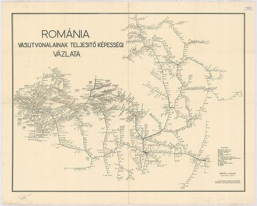
| Title | Románia vasútvonalainak teljesítő képességi vázlata. |
671. Canevas Géodésique de la Carte de Roumanie. [B III c 110]
Institute and Museum of Military History •
B III c
•
B III Balkán-félsziget
•
B I–XV. Európa

| Title | Canevas Géodésique de la Carte de Roumanie. |
| Main title | Geodéziai, háromszögelési térképvázlat Romániáról 1900-ban. |
672. Travaux Géodesiques et Nivellement de Précision en Roumaine ... [B III c 110/1]
Institute and Museum of Military History •
B III c
•
B III Balkán-félsziget
•
B I–XV. Európa

| Title | Travaux Géodesiques et Nivellement de Précision en Roumaine 1900. |
| Main title | Románia geodéziai (pontos szintezéssel felmért) térképvázlata 1900-ban. |
673. Dévéloppement de la Carte de Roumanie. Sun le Meridien de Bu... [B III c 110/2]
Institute and Museum of Military History •
B III c
•
B III Balkán-félsziget
•
B I–XV. Európa
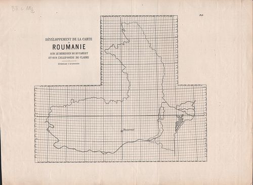
| Title | Dévéloppement de la Carte de Roumanie. Sun le Meridien de Bucurest et sur l’Ellipsoide de Clarke. |
| Main title | Románia 1:25 000 térképeinek szelvényezése, fokhálózat beosztása, (Bucuresti kezdő meridián) 1900 körül. |
674. Nivellement Geometrique 1907. [B III c 110/3]
Institute and Museum of Military History •
B III c
•
B III Balkán-félsziget
•
B I–XV. Európa

| Title | Nivellement Geometrique 1907. |
| Main title | Románia felsőrendű szintezése 1907-ben. |
675. La Triangulation Géodésique pour la Jonction des Réseaux Rus... [B III c 110/4]
Institute and Museum of Military History •
B III c
•
B III Balkán-félsziget
•
B I–XV. Európa
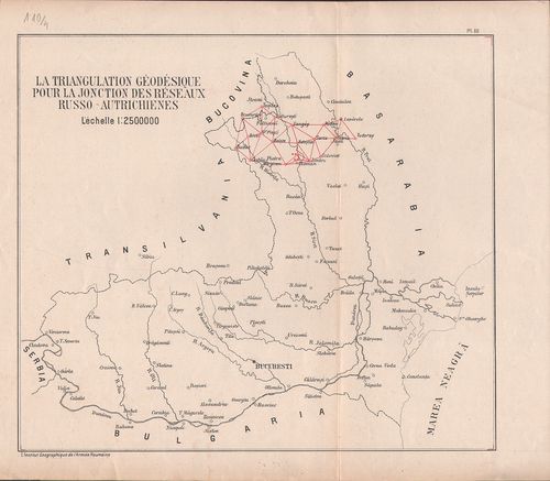
| Title | La Triangulation Géodésique pour la Jonction des Réseaux Russo-Autrichiennes. |
| Main title | Románia geodéziai háromszögelési hálózata, csatlakozva az orosz–osztrák hálózathoz, 1900 körül. |
676. Bases-Géodésiques. [B III c 110/5]
Institute and Museum of Military History •
B III c
•
B III Balkán-félsziget
•
B I–XV. Európa
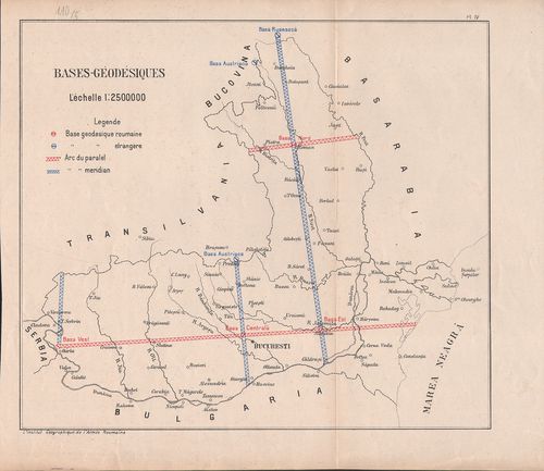
| Title | Bases-Géodésiques. |
| Main title | Geodéziai-bázisok Romániában 1900 körül. |
677. Izaszacsal (Säcel, Rom.) környékének földtani térképe. – Car... [B III c 111]
Institute and Museum of Military History •
B III c
•
B III Balkán-félsziget
•
B I–XV. Európa
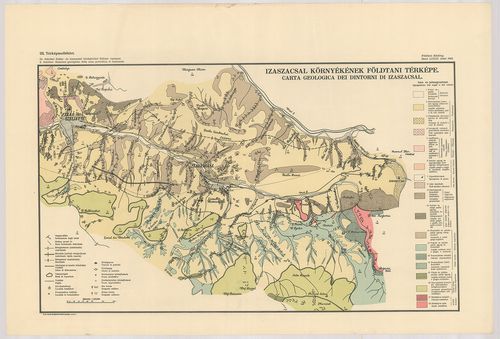
| Title | Izaszacsal (Säcel, Rom.) környékének földtani térképe. – Carta Geologica dei Dintorni di Izaszacsal. III. térk. mell. |
678. Graficki Daljinar. Graphische kilometer zeiger. Zeljeznicke ... [B III c 112]
Institute and Museum of Military History •
B III c
•
B III Balkán-félsziget
•
B I–XV. Európa
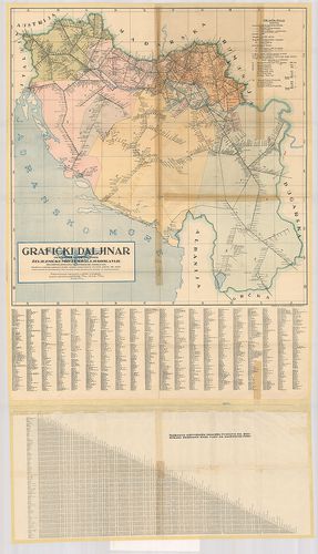
| Title | Graficki Daljinar. Graphische kilometer zeiger. Zeljeznicke Mreze Kralj. Jugoslavije. – Des Eisenbahnnetzes im Königreiche Jugoslavien. |
| Main title | Jugoszlávia vasúthálózatának térképe km-távolság jelöléssel 1930 körül. |
679. Au volant á travers la Roumanie. [B III c 113]
Institute and Museum of Military History •
B III c
•
B III Balkán-félsziget
•
B I–XV. Európa
| Title | Au volant á travers la Roumanie. |
| Main title | Románia úttérképe. |
680. Harta turistică a masivelor Godenau – Retezat – Tarcu. Touri... [B III c 114]
Institute and Museum of Military History •
B III c
•
B III Balkán-félsziget
•
B I–XV. Európa
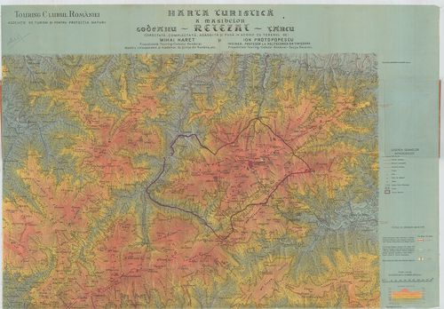
| Title | Harta turistică a masivelor Godenau – Retezat – Tarcu. Touring Clubul Romaniei. Borítócím: Harta turistică a masivelor: Godenau-Tarcu şi Retezatul. |
| Main title | A Retyezát, Godjan, Tarcu (Szárkő) turistatérképe 1930 körül. |