121. General-Karte von der europäischen Türkei… [B III a 62]
Institute and Museum of Military History •
B III a
•
B III Balkán-félsziget
•
B I–XV. Európa
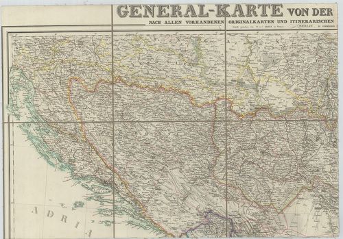
| Title | General-Karte von der europäischen Türkei… |
| Main title | 3 mt. 1. Das Wladikat zrnagora oder Montenegro. (Montenegró térképe.) |
| Subject | 2. Der befestigte südliche Theil der Dardanellen Strasse. (Dardanellák). |
122. Karte des Bosporus und der Bithynischen Halbinsel… [B III a 62/1]
Institute and Museum of Military History •
B III a
•
B III Balkán-félsziget
•
B I–XV. Európa
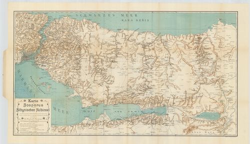
| Title | Karte des Bosporus und der Bithynischen Halbinsel… |
| Main title | Boszporusz és a Bithyniai-félsziget térképe 1900-ben. |
123. Karte der asiatischen Türkei. [B III a 62/2]
Institute and Museum of Military History •
B III a
•
B III Balkán-félsziget
•
B I–XV. Európa
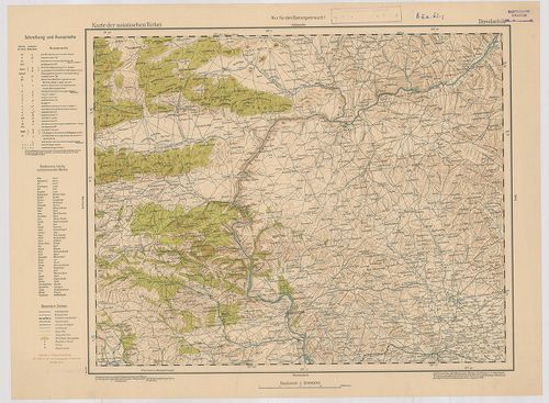
| Title | Karte der asiatischen Türkei. |
124. Carte de Constantinople avec ses Faubourgs le port, le Bosph... [B III a 63]
Institute and Museum of Military History •
B III a
•
B III Balkán-félsziget
•
B I–XV. Európa
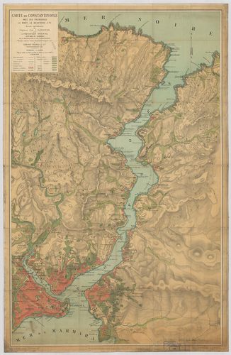
| Title | Carte de Constantinople avec ses Faubourgs le port, le Bosphore etc. |
| Main title | Boszporusz és Istanbul térképe 1887-ben. |
125. Plan de Constantinople et du Bosphore. [B III a 63/1]
Institute and Museum of Military History •
B III a
•
B III Balkán-félsziget
•
B I–XV. Európa
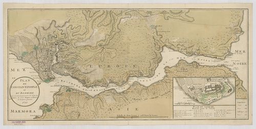
| Title | Plan de Constantinople et du Bosphore. |
| Main title | Mt.: Plan du Serrail. (A Palota térképe.) |
| Subject | Istanbul és a Boszporusz térképe 1788-ban. |
126. General-Karte der Europaeischen Türkey und des Königreich Gr... [B III a 64]
Institute and Museum of Military History •
B III a
•
B III Balkán-félsziget
•
B I–XV. Európa
| Title | General-Karte der Europaeischen Türkey und des Königreich Griechenland. |
| Main title | Mt.: Plan von Constantinople. (Konstantinápoly és környéke.) |
| Subject | Europai Törökország és a Görög Királyság általános térképe 1869-ben. |
127. Europaeische Türkei und Griechenland. – Borítócím: Übersicht... [B III a 64/1]
Institute and Museum of Military History •
B III a
•
B III Balkán-félsziget
•
B I–XV. Európa
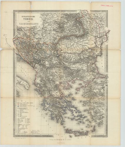
| Title | Europaeische Türkei und Griechenland. – Borítócím: Übersichtskarte der Europäischen Türkei und des Königreich Griechenland. |
| Main title | Európai Törökország és Görögország térképe 1876-ban. |
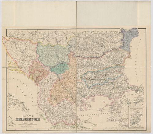
128. General-Karte der Europäischen Türkei. – Borítócím: General-... [B III a 65]
Institute and Museum of Military History •
B III a
•
B III Balkán-félsziget
•
B I–XV. Európa
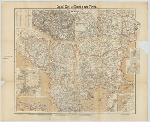
| Title | General-Karte der Europäischen Türkei. – Borítócím: General-Karte der Europäischen Türkei und Montenegro’s. |
| Main title | 9 mt.: 1. Montenegro. 2. Umgebung von Schumla. (Kolarovgrad, Bulg. és környéke.) 3. Umgebung von Silistria. (Szilisztra, Bulg. és környéke.) 4. [Konstantinopel.] |
| Subject | 5. [Kréta.] |
129. Special-Karte der Europäischen Türkei in 20 Blättern. [B III a 66]
Institute and Museum of Military History •
B III a
•
B III Balkán-félsziget
•
B I–XV. Európa
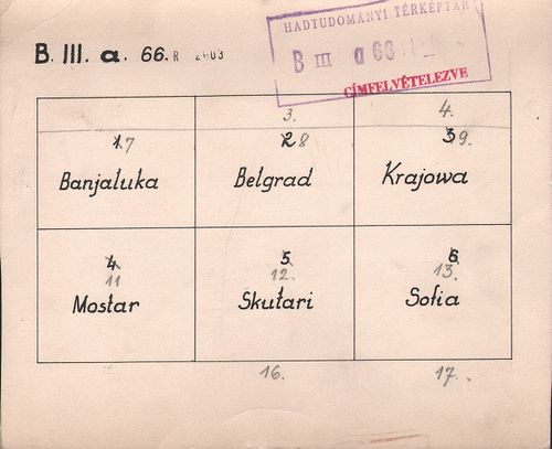
| Title | Special-Karte der Europäischen Türkei in 20 Blättern. |
| Main title | Az Európai Törökország részletes térképe 20 szelvényen. |
130. Europ[aische] Türkey: Rumelien, Bulgarien und Wallachei. [B III a 67]
Institute and Museum of Military History •
B III a
•
B III Balkán-félsziget
•
B I–XV. Európa
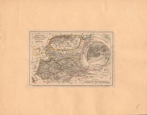
| Title | Europ[aische] Türkey: Rumelien, Bulgarien und Wallachei. |
| Main title | Mt.: Constantinopel. (Istanbul.)Európai Törökország, Rumélia, Bulgária és a Havasalföld térképe. |
131. Karte der Europäischen Türkei. [B III a 68]
Institute and Museum of Military History •
B III a
•
B III Balkán-félsziget
•
B I–XV. Európa
| Title | Karte der Europäischen Türkei. |
| Main title | Mt.: Constantinopel und der Bosporus. (Istanbul és a Boszporusz.)Európai Törökország térképe. |
132. Handkarte der Europäischen Türkei, Bulgarien und Ost-Rumelie... [B III a 70]
Institute and Museum of Military History •
B III a
•
B III Balkán-félsziget
•
B I–XV. Európa
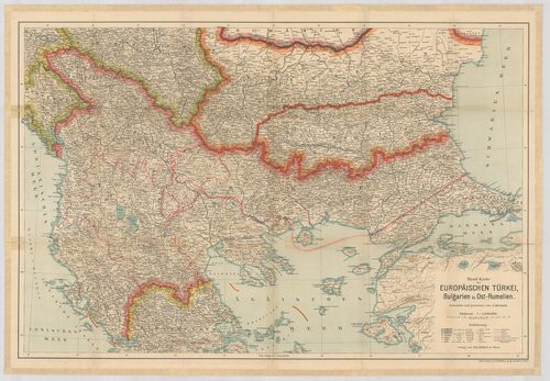
| Title | Handkarte der Europäischen Türkei, Bulgarien und Ost-Rumelien. |
| Main title | Európai Törökország, Bulgária és K-Rumélia térképe. |
133. Die Landschaft Romanien. Nr. 16. (Kirkekklesische und Gallip... [B III a 70/1]
Institute and Museum of Military History •
B III a
•
B III Balkán-félsziget
•
B I–XV. Európa
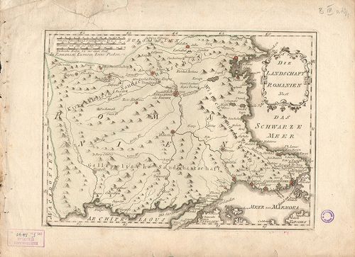
| Title | Die Landschaft Romanien. Nr. 16. (Kirkekklesische und Gallipolosche Sandschakschaft.) |
| Main title | Adrianopel (Edirne) környékének térképe. |
134. [A Balkán-félsziget.] [B III a 72/2]
Institute and Museum of Military History •
B III a
•
B III Balkán-félsziget
•
B I–XV. Európa
| Title | [A Balkán-félsziget.] |
135. [Európai Törökország térképe.] [B III a 72/3]
Institute and Museum of Military History •
B III a
•
B III Balkán-félsziget
•
B I–XV. Európa
| Title | [Európai Törökország térképe.] |
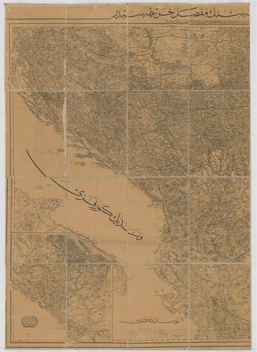
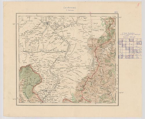
136. [A Török Birodalom és a Balkán félsziget.] [B III a 72/5]
Institute and Museum of Military History •
B III a
•
B III Balkán-félsziget
•
B I–XV. Európa
| Title | [A Török Birodalom és a Balkán félsziget.] |
| Main title | 1. Leskovac. 2. Samakov. 3. Shkodär. 4. Debar. 5. Bitola. 6. Edessza. 7. Kozané. 8. Thesszaloniké. 9. Kerkyra. 10. Arta. 11. Trikala és környéke. |
137. Carte de la partie d’Albanie occupée par la Bacha de Scutari... [B III a 73]
Institute and Museum of Military History •
B III a
•
B III Balkán-félsziget
•
B I–XV. Európa
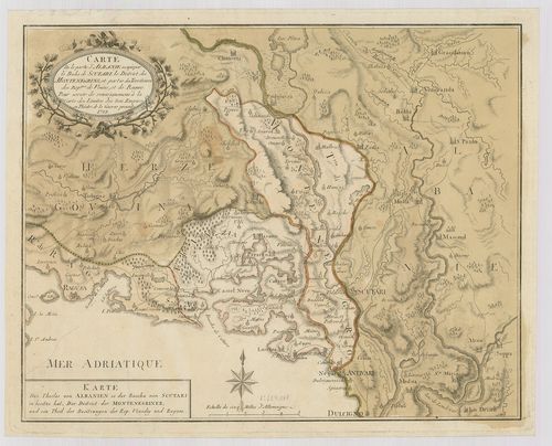
| Title | Carte de la partie d’Albanie occupée par la Bacha de Scutari, le District des Montenegrins, et partie des Territories des Rep. ques de Venise et de Raguse. – Karte des Theiles von Albanien so. der Bacha von Scutari in besitze hat der District der Montenegriner… |
| Main title | Albánia, Montenegró, Dalmácia, Dubrovnik egy részének térképe 1788-ban. |
138. Carte Générale de la Turquie d’Europe, et de la Hongrie. [B III a 73/1]
Institute and Museum of Military History •
B III a
•
B III Balkán-félsziget
•
B I–XV. Európa
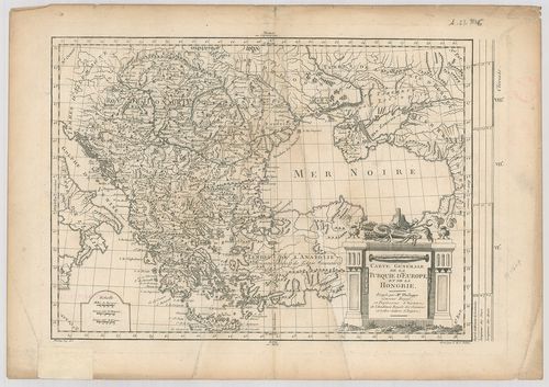
| Title | Carte Générale de la Turquie d’Europe, et de la Hongrie. |
| Main title | Az európai Török Birodalom és Magyarország térképe 1780 körül. |
139. Carte de l’Épire et de la Thessalie. [B III a 74/2]
Institute and Museum of Military History •
B III a
•
B III Balkán-félsziget
•
B I–XV. Európa
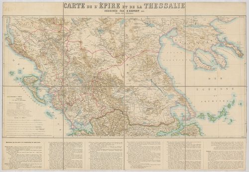
| Title | Carte de l’Épire et de la Thessalie. |
| Main title | Görögország: Thesszália térképe 1871-ben. |
140. [Görögország É-i részének általános térképe.] [B III a 75]
Institute and Museum of Military History •
B III a
•
B III Balkán-félsziget
•
B I–XV. Európa
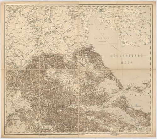
| Title | [Görögország É-i részének általános térképe.] |
| Main title | É-Thesszália és a határos területek térképe 1897-ben. |