661. Deutschland, Königr. der Niederlande, Kgr. Belgien und die S... [B IV c 191/1]
Institute and Museum of Military History •
B IV c
•
B IV Német birodalom
•
B I–XV. Európa
| Title | Deutschland, Königr. der Niederlande, Kgr. Belgien und die Schweiz, nebst Theilen der Angränzenden Länder. |
| Main title | 2 mt.: 1. Die Hauptverbindungstrassen durch Europa zu Lande u. zu Wasser. (Európa szárazföldi és víziközlekedési térképe.) 2. Regirungs-Bezirk Gumbinnen (Guszev) in Ost-Preussen. (Kelet-Poroszország kormányzósági kerülete.) |
662. Allemagne Du Nord Grands Itinéraires pour Automobiles. – Nor... [B IV c 191/2]
Institute and Museum of Military History •
B IV c
•
B IV Német birodalom
•
B I–XV. Európa
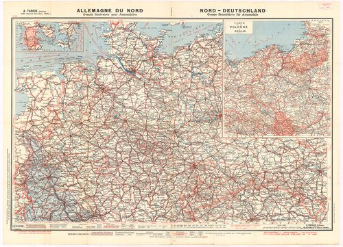
| Title | Allemagne Du Nord Grands Itinéraires pour Automobiles. – Nord-Deutschland Grosse Reiseführer für Automobile. Nr. 36. |
| Main title | Mt.: Carte de la Pologne á Berlin. (Úthálózati térkép Berlinből Lengyelország felé.) |
| Subject | Észak-Németország út-vasúthálózati térképe. |
663. Historische Karte von Elsass und Lothringen zur Uebersicht d... [B IV c 203]
Institute and Museum of Military History •
B IV c
•
B IV Német birodalom
•
B I–XV. Európa
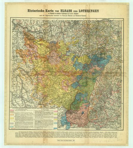
| Title | Historische Karte von Elsass und Lothringen zur Uebersicht der territorialen Veränderungen im 17. und 18. Jahrhundert. |
| Main title | Elszász-Lotharingia történelmi térképe. |
664. Post und Reise-Karte von Deutschland und den Nachbar Staaten... [B IV c 205]
Institute and Museum of Military History •
B IV c
•
B IV Német birodalom
•
B I–XV. Európa
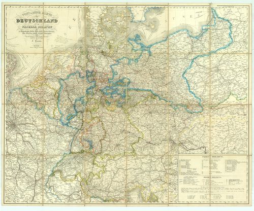
| Title | Post und Reise-Karte von Deutschland und den Nachbar Staaten bis Kopenhagen, Dover, Paris, Lyon, Turin, Ferrara, Ofen, Debrecin, Lublin, Grodno, Tauroggen. |
| Main title | Németország posta és úthálózati térképe. |
665. General-Karte von Westlichen Russland nebst Preussen, Posen ... [B IV c 206]
Institute and Museum of Military History •
B IV c
•
B IV Német birodalom
•
B I–XV. Európa
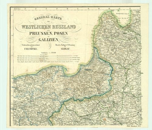
| Title | General-Karte von Westlichen Russland nebst Preussen, Posen und Galizien. |
| Main title | Mt.: (Warszawa és környéke.) |
| Subject | Nyugat-Oroszország–Poroszország–Poznan és Galicia általános térképe úthálózattal. |
666. Post-, Reise- und Eisenbahn-Karte von Deutschland, der Schwe... [B IV c 207]
Institute and Museum of Military History •
B IV c
•
B IV Német birodalom
•
B I–XV. Európa
| Title | Post-, Reise- und Eisenbahn-Karte von Deutschland, der Schweitz, den Niederlanden und Belgien… |
667. Pharus-Reisekarte von Deutschland. [B IV c 208]
Institute and Museum of Military History •
B IV c
•
B IV Német birodalom
•
B I–XV. Európa
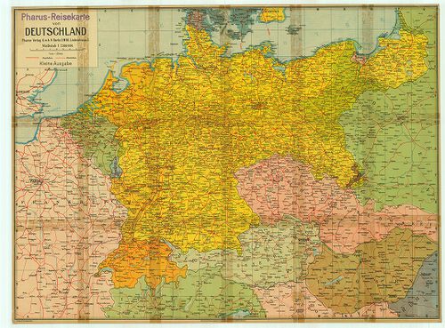
| Title | Pharus-Reisekarte von Deutschland. |
| Main title | Németország úttérképe. |
668. Eduard Gaebler’s Verkehrskarte des Deutschen Reichs. Zur Übe... [B IV c 209]
Institute and Museum of Military History •
B IV c
•
B IV Német birodalom
•
B I–XV. Európa
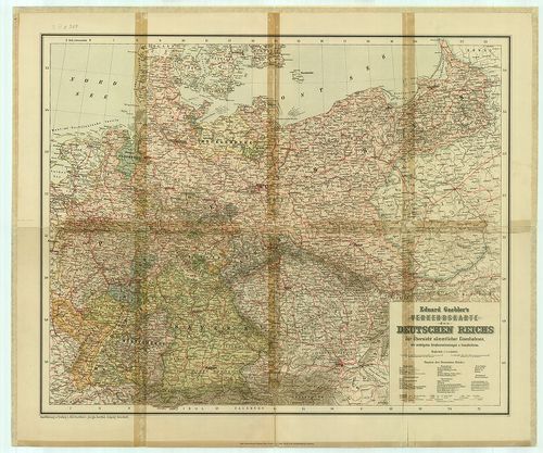
| Title | Eduard Gaebler’s Verkehrskarte des Deutschen Reichs. Zur Übersichts sämmtlicher Eisenbahnen… |
| Main title | A Német Birodalom közlekedési térképe 1934-ben. |
669. Deutschland (West- und Mittelteil.) Grosse Autokarte mit Kur... [B IV c 210]
Institute and Museum of Military History •
B IV c
•
B IV Német birodalom
•
B I–XV. Európa
| Title | Deutschland (West- und Mittelteil.) Grosse Autokarte mit Kurzführer. RV. No. 80. |
670. Allgemeine Ubersicht des nordwestlichen Kriegsschauplatzes. [B IV c 211]
Institute and Museum of Military History •
B IV c
•
B IV Német birodalom
•
B I–XV. Európa
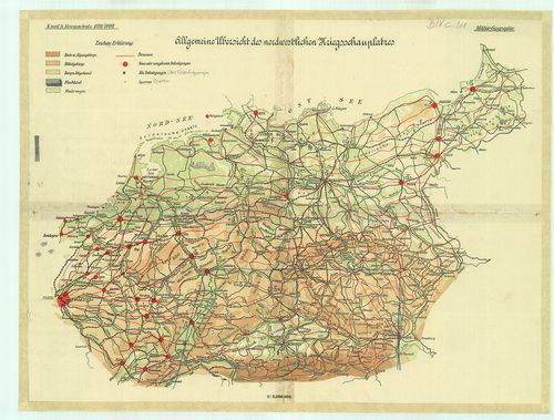
| Title | Allgemeine Ubersicht des nordwestlichen Kriegsschauplatzes. |
| Main title | Az európai ÉNY-i hadszíntér áttekintőtérképe 1899/1890-ben. |
671. Németország [B IV c 212]
Institute and Museum of Military History •
B IV c
•
B IV Német birodalom
•
B I–XV. Európa
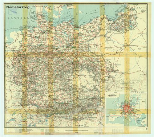
| Title | Németország |
| Main title | Mt.: A német repülőjáratok hálózata. |
| Subject | Németország út-vasúthálózati térképe. |
672. Ravenstein-Liebenow’s Special-Rad- und Automobilkarte von Mi... [B IV c 213]
Institute and Museum of Military History •
B IV c
•
B IV Német birodalom
•
B I–XV. Európa
| Title | Ravenstein-Liebenow’s Special-Rad- und Automobilkarte von Mittel-Europa. Berlin, 60. |
673. Deutsche Lufthansa. [B IV c 214]
Institute and Museum of Military History •
B IV c
•
B IV Német birodalom
•
B I–XV. Európa
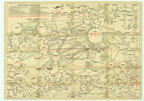
| Title | Deutsche Lufthansa. |
| Main title | Németország légijáratainak térképe 1939-ben. |
674. Eisenbahn-Uebersichtskarte von Deutschland und den angrenzen... [B IV c 215]
Institute and Museum of Military History •
B IV c
•
B IV Német birodalom
•
B I–XV. Európa
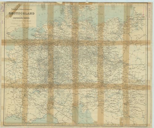
| Title | Eisenbahn-Uebersichtskarte von Deutschland und den angrenzenden Ländern. |
| Main title | Németország vasúthálózati térképe 1905–1906-ban. |
| Subject | Hauptverkehrslinien von Europa. (Európa fő-vasútvonalainak térképe 1905–1906-ban.) |
675. [Németország út-vasút, repülőjárat térképe.] [B IV c 216]
Institute and Museum of Military History •
B IV c
•
B IV Német birodalom
•
B I–XV. Európa
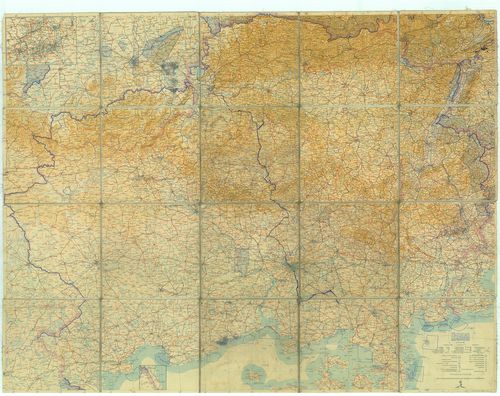
| Title | [Németország út-vasút, repülőjárat térképe.] |
| Main title | Mt.: [Düsseldorf-Dortmund közötti terület közlekedési térképe.] |
676. Eisenbahnkarte zu Stroms Kursbuch fürs Reich. [B IV c 217]
Institute and Museum of Military History •
B IV c
•
B IV Német birodalom
•
B I–XV. Európa
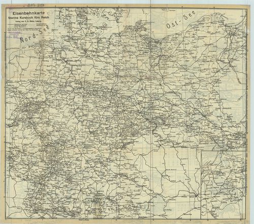
| Title | Eisenbahnkarte zu Stroms Kursbuch fürs Reich. |
| Main title | 30 mt. vasútforgalmi térképek: 1. Elberfeld-Barmen, 2. Bremen, 3. Breslau (Wrocław) 4. Danzig. (Gdansk.) 5. Dresden, 6. Frankfurt, 7. Hamburg, 8. Hannover, 9. Cöln, (Köln.) 10. Königsberg, (Kalinyingrad.) 11. Leipzig, 12. Magdeburg, 13. Metz, 14. München, 15. Nürnberg, 16. Stettin, 17. Strassburg, 18. Stuttgart, 19. Wiesbaden, 20. Brüssel, 21. Berlin, 22. Elektrische Hoch und Untergrundbahn zu Berlin. (A berlini földalatti és magasvasút térképe.) 23. Kopenhagen (Křbenhavn) 24. Prag, 25. Paris, 26. Wien, 27. Budapest városok térképe a vasúti pályaudvarokkal. 28. Spezialkarte von Sachsen und Nordböhmen. (Szászorság és É-Csehország vasúthálózati térképe.) 29. Spezialkarte der Eisenbahnen zwischen Düsseldorf, Essen, Elberfeld und Dortmund. (Düsseldorf–Essen–Elberfeld és Dortmund közötti vasúthálózat térképe.) 30. Seeweg nach England. (Tengeri közlekedési térkép Rotterdam–London között.Németország vasúthálózati térképe 1902–1903-ban. |
677. Justus Perthes Autostrassen-Karte von Deutschland. [B IV c 218]
Institute and Museum of Military History •
B IV c
•
B IV Német birodalom
•
B I–XV. Európa
| Title | Justus Perthes Autostrassen-Karte von Deutschland. |
678. Reichs Auto Karte. Blatt: Berlin, – Halle. [B IV c 219]
Institute and Museum of Military History •
B IV c
•
B IV Német birodalom
•
B I–XV. Európa
| Title | Reichs Auto Karte. Blatt: Berlin, – Halle. |
679. Shell Autokarten. Gebietskarte 1–2–3–4. [B IV c 220]
Institute and Museum of Military History •
B IV c
•
B IV Német birodalom
•
B I–XV. Európa
| Title | Shell Autokarten. Gebietskarte 1–2–3–4. |
680. Reichs Auto-Karte. Blatt: Konstanz–Erfurt–Frankfurt a. M.–Br... [B IV c 221]
Institute and Museum of Military History •
B IV c
•
B IV Német birodalom
•
B I–XV. Európa
| Title | Reichs Auto-Karte. Blatt: Konstanz–Erfurt–Frankfurt a. M.–Breslau–Halle–Berlin–Magdeburg–Osnabrück–Schwerin. |