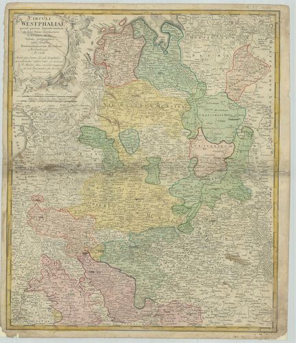
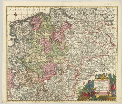
241. Nova et exacta Mappa Geographica exhibens Circulum Westphali... [B IV a 401]
Institute and Museum of Military History •
B IV a
•
B IV Német birodalom
•
B I–XV. Európa
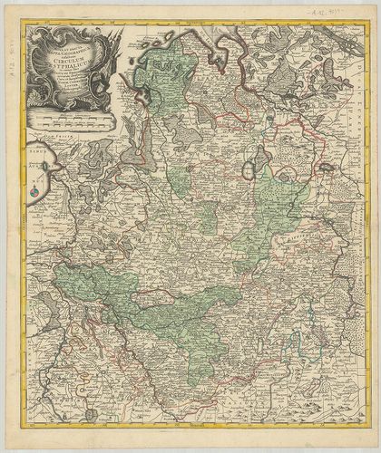
| Title | Nova et exacta Mappa Geographica exhibens Circulum Westphalicum… |
| Main title | Vesztfália porosz tartomány földrajz térképe. |
242. Carte du Cercle de Westphalie… [B IV a 402]
Institute and Museum of Military History •
B IV a
•
B IV Német birodalom
•
B I–XV. Európa
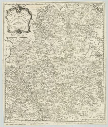
| Title | Carte du Cercle de Westphalie… |
| Main title | Vesztfália porosz tartomány térképe 1759-ben. |
243. Special Karte von den Westphälschen Provinzen… [B IV a 402/5]
Institute and Museum of Military History •
B IV a
•
B IV Német birodalom
•
B I–XV. Európa
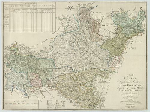
| Title | Special Karte von den Westphälschen Provinzen… |
| Main title | Vesztfália porosz tartomány részletes térképe 1790-ben. |
244. Charte von dem Königreiche Westphalen nach seinen dermaligen... [B IV a 402/6]
Institute and Museum of Military History •
B IV a
•
B IV Német birodalom
•
B I–XV. Európa
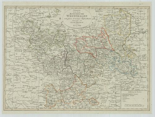
| Title | Charte von dem Königreiche Westphalen nach seinen dermaligen Bestandtheilen. |
| Main title | Vesztfália térképe 1809-ben. |
245. Circuli Westphaliae quoad partem septentrionalem in suos Sta... [B IV a 402/7]
Institute and Museum of Military History •
B IV a
•
B IV Német birodalom
•
B I–XV. Európa
| Title | Circuli Westphaliae quoad partem septentrionalem in suos Status ecclesiasticos et seculares divisi Tabula geographica. |
| Main title | Vesztfália térképe 1760-ban. |
246. Topographischen Karte von Westphalen… [B IV a 402/11]
Institute and Museum of Military History •
B IV a
•
B IV Német birodalom
•
B I–XV. Európa
| Title | Topographischen Karte von Westphalen… |
| Main title | Vesztfália topográfiai térképe 1812-ben. |
247. Der Westphaelische Kreis zum Gebrauche der Oesterreichischen... [B IV a 402/12]
Institute and Museum of Military History •
B IV a
•
B IV Német birodalom
•
B I–XV. Európa
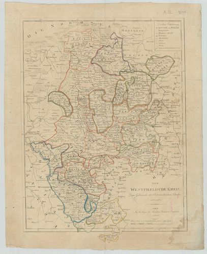
| Title | Der Westphaelische Kreis zum Gebrauche der Oesterreichischen Schulen. |
| Main title | Vesztfália térképe kerületi beosztással az osztrák iskolák részére. |
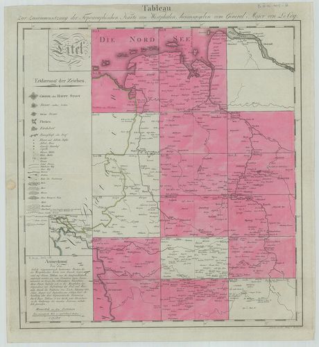
248. Topographisch-militairischer Atlas von dem Grossherzogthume ... [B IV a 402/14]
Institute and Museum of Military History •
B IV a
•
B IV Német birodalom
•
B I–XV. Európa
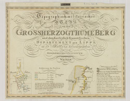
| Title | Topographisch-militairischer Atlas von dem Grossherzogthume Berg und dem Kaiserlich Französischen Departement der Lippe. |
| Main title | Berg Nagyhercegség és Lippe tartomány katonai-topográfiai térképe 1813-ban. |
249. Die Königl.[ichen], Preussischen-Provinz Westphalen und Rhei... [B IV a 402/20]
Institute and Museum of Military History •
B IV a
•
B IV Német birodalom
•
B I–XV. Európa
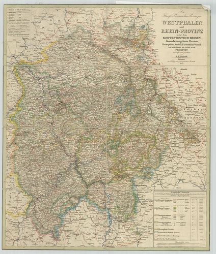
| Title | Die Königl.[ichen], Preussischen-Provinz Westphalen und Rhein-Provinz nebst dem Kurfürstenthum Hessen, Grossherzogthum Hessen, Herzogthum Nassau, Fürstenthum Waldeck und dem Gebiete der Freien Stadt Frankfurt. |
| Main title | Vesztfália porosz tartomány, a Rajna-tartományok és a szabad Frankfurt térképe 1844-ben. |
250. [Vesztfália porosz tartomány és a Rajna-tartományok topográf... [B IV a 402/21]
Institute and Museum of Military History •
B IV a
•
B IV Német birodalom
•
B I–XV. Európa
| Title | [Vesztfália porosz tartomány és a Rajna-tartományok topográfiai térképe.] |
251. Topographische Karte des Regierungs-Bezirks Arnsberg nebst d... [B IV a 402/23]
Institute and Museum of Military History •
B IV a
•
B IV Német birodalom
•
B I–XV. Európa
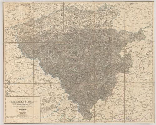
| Title | Topographische Karte des Regierungs-Bezirks Arnsberg nebst dem angrenzenden Landestheilen. |
| Main title | Arnsberg környékének topográfiai térképe 1860-ban. |
252. Karte der Rhein Gegenden von Käyserswerth bis Arnheim. [B IV a 402/29]
Institute and Museum of Military History •
B IV a
•
B IV Német birodalom
•
B I–XV. Európa
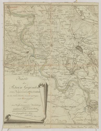
| Title | Karte der Rhein Gegenden von Käyserswerth bis Arnheim. |
| Main title | Mt.: [Pannerdeni csatorna.]A Rajna vidék térképe Käyserswerth-től Arnheim-ig. |
253. Ganz neue Vorstellung des Rhein-Stroms von Basel bis Coblenz... [B IV a 402/30]
Institute and Museum of Military History •
B IV a
•
B IV Német birodalom
•
B I–XV. Európa
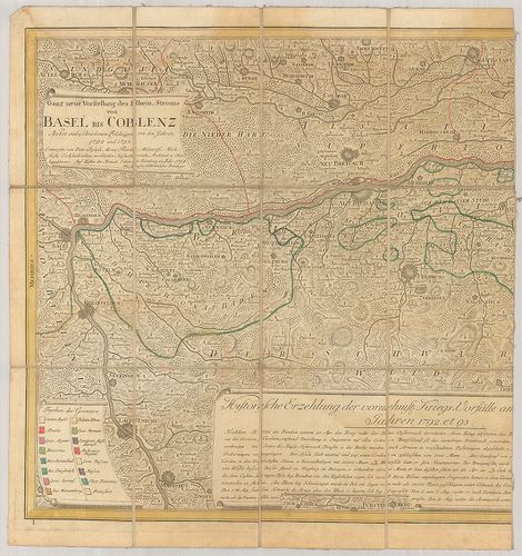
| Title | Ganz neue Vorstellung des Rhein-Stroms von Basel bis Coblenz. Terv.: – 1792–1793. |
| Main title | A Rajna vidék térképe Baseltől-Koblenz-ig 1793-ban. |
254. Circulus Westphalicus in suas Provincias et Ditiones. [B IV a 403]
Institute and Museum of Military History •
B IV a
•
B IV Német birodalom
•
B I–XV. Európa
| Title | Circulus Westphalicus in suas Provincias et Ditiones. |
| Main title | Vesztfália tartomány térképe. |
255. Circulus Bavariae in suas quasque Ditiones tam cum finitimis... [B IV a 404]
Institute and Museum of Military History •
B IV a
•
B IV Német birodalom
•
B I–XV. Európa
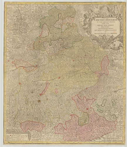
| Title | Circulus Bavariae in suas quasque Ditiones tam cum finitimis, quam Insertis Regionibus accuratissime divisus… |
| Main title | Bajorország általános térképe. |
256. Circulus Bavaricus… [B IV a 405]
Institute and Museum of Military History •
B IV a
•
B IV Német birodalom
•
B I–XV. Európa
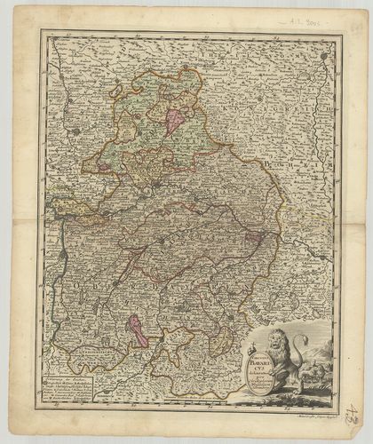
| Title | Circulus Bavaricus… |
| Main title | Bajorország térképe. |
257. Charte des Bayrischen Kreises. [B IV a 406]
Institute and Museum of Military History •
B IV a
•
B IV Német birodalom
•
B I–XV. Európa
| Title | Charte des Bayrischen Kreises. |
| Main title | Bajorország térképe 1802-ben. |
258. Chur-Bayern. [B IV a 407]
Institute and Museum of Military History •
B IV a
•
B IV Német birodalom
•
B I–XV. Európa
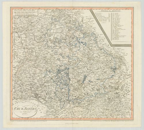
| Title | Chur-Bayern. |
| Main title | A Bajor választófejedelemség térképe 1802-ben. |
259. Königreich Baiern. [B IV a 408]
Institute and Museum of Military History •
B IV a
•
B IV Német birodalom
•
B I–XV. Európa
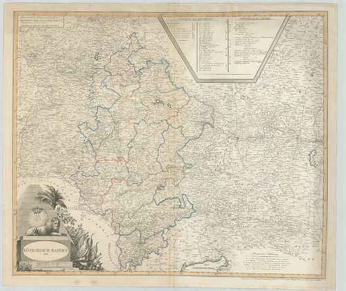
| Title | Königreich Baiern. |
| Main title | A Bajor Királyság térképe 1806-ban. |
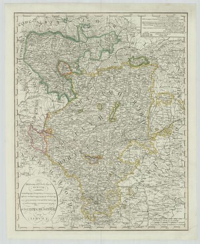
260. Der Bayrische, Schwaebische und Fraenkische Kreis. [B IV a 409]
Institute and Museum of Military History •
B IV a
•
B IV Német birodalom
•
B I–XV. Európa
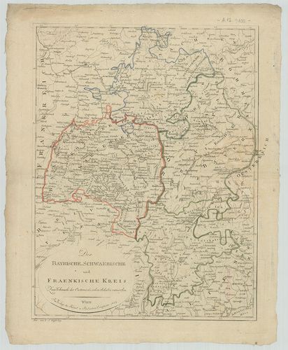
| Title | Der Bayrische, Schwaebische und Fraenkische Kreis. |
| Main title | Bajorország, Svábföld és Frankföld térképe 1807-ben. |