301. Geometrische Karte über das ober Amt Zweybrücken nebst dem d... [B IV a 489]
Institute and Museum of Military History •
B IV a
•
B IV Német birodalom
•
B I–XV. Európa
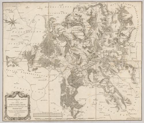
| Title | Geometrische Karte über das ober Amt Zweybrücken nebst dem dazu gehörigen Amt Homburg. |
| Main title | Zweibrücken és Homburg környékének felmérési térképe 1774-ben. |
302. Die bayerische Pfalz. [B IV a 493]
Institute and Museum of Military History •
B IV a
•
B IV Német birodalom
•
B I–XV. Európa
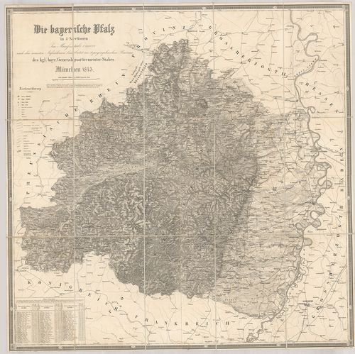
| Title | Die bayerische Pfalz. |
| Main title | A bajor Pfalz tartomány térképe 1845-ben. |
303. Die Bayerische Pfalz. [B IV a 494]
Institute and Museum of Military History •
B IV a
•
B IV Német birodalom
•
B I–XV. Európa
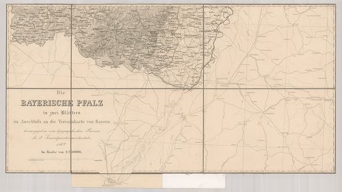
| Title | Die Bayerische Pfalz. |
| Main title | A bajor Pfalz tartomány térképe 1862-ben. |
304. Tractus Nordligensis Germ. Ries dicti accurata Descritpio ad... [B IV a 497]
Institute and Museum of Military History •
B IV a
•
B IV Német birodalom
•
B I–XV. Európa
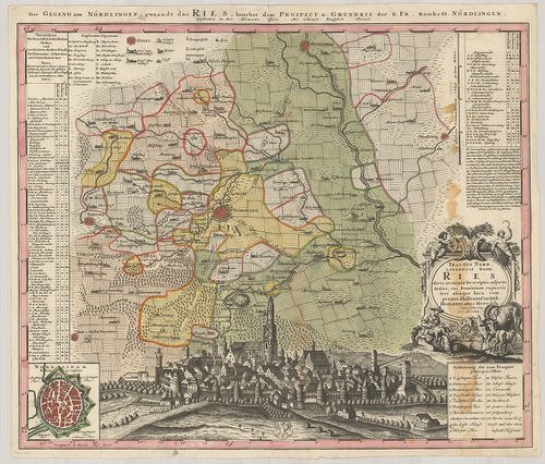
| Title | Tractus Nordligensis Germ. Ries dicti accurata Descritpio adjecto Indice, cui Dominium cujus vis loci aliaque Iura competant illustrata Curatib. |
| Main title | Mt.: Nordlingae Ichonographia. (Nördlingen város térképe.) A térkép alján Nördlingen város látképe.Nördlingen környékének térképe 1738-ban. |
305. Topographische Karte der Gegend zwischen der Donau, Abens, u... [B IV a 521/1]
Institute and Museum of Military History •
B IV a
•
B IV Német birodalom
•
B I–XV. Európa
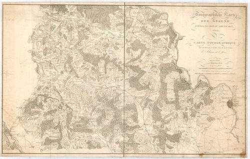
| Title | Topographische Karte der Gegend zwischen der Donau, Abens, und Iser. – Carte Topographique du Pays Entre le Danube, l’Abens, et l’Iser. |
| Main title | A Duna–Abens–Isar közötti terület topográfiai térképe 1811-ben. |
306. Geographische Abbildvng des gantzen Umfangs der Marggrafscha... [B IV a 522]
Institute and Museum of Military History •
B IV a
•
B IV Német birodalom
•
B I–XV. Európa
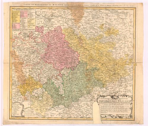
| Title | Geographische Abbildvng des gantzen Umfangs der Marggrafschaft Meissen… |
| Main title | A Meissen-i őrgrófság általános térképe 1762-ban. |
307. Circuli Supe Saxoniae… [B IV a 523]
Institute and Museum of Military History •
B IV a
•
B IV Német birodalom
•
B I–XV. Európa
| Title | Circuli Supe Saxoniae… |
| Main title | Szászország térképe 1757-ben. |
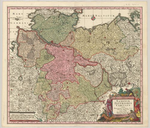
308. Saxoniae Inferioris Circulus, exhibens Ducatus Brunswic, Lün... [B IV a 524]
Institute and Museum of Military History •
B IV a
•
B IV Német birodalom
•
B I–XV. Európa
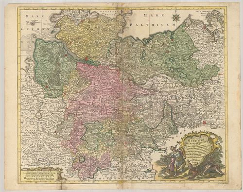
| Title | Saxoniae Inferioris Circulus, exhibens Ducatus Brunswic, Lüneburg, Magdeburg, Bremens, Mechlinoburg et Holsat… |
| Main title | Alsó-Szászország tartományainak: Braunschweig, Lüneburg, Magdeburg, Bréma, Mecklenburg és Holstein hercegség térképe 1761-ben. |
309. Saxonia Superiore. [B IV a 525]
Institute and Museum of Military History •
B IV a
•
B IV Német birodalom
•
B I–XV. Európa
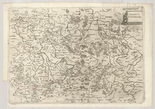
| Title | Saxonia Superiore. |
| Main title | Felső-Szászország térképe. |
310. Der Ober Saechsische Kreis zum Gebrauche der Oesterreichisch... [B IV a 526]
Institute and Museum of Military History •
B IV a
•
B IV Német birodalom
•
B I–XV. Európa
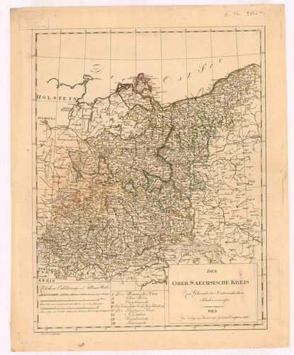
| Title | Der Ober Saechsische Kreis zum Gebrauche der Oesterreichischen Schulen entworfen. |
| Main title | Felső-Szászország térképe 1806-ban. |
311. Saxoniae Superioris, Praesertim Elektoralis Circulus, cum ad... [B IV a 527]
Institute and Museum of Military History •
B IV a
•
B IV Német birodalom
•
B I–XV. Európa
| Title | Saxoniae Superioris, Praesertim Elektoralis Circulus, cum adjacentibus, Ducatibus et Provinciis… |
| Main title | Felső-Szászország: tartományok, hercegségek térképe 1758-ban. |
312. Comitatus Schoenburgensis… [B IV a 528]
Institute and Museum of Military History •
B IV a
•
B IV Német birodalom
•
B I–XV. Európa
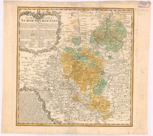
| Title | Comitatus Schoenburgensis… |
| Main title | Schönburg grófság térképe 1760-ban. |
313. Saxoniae Inferioris Circulus juxta Principatus et Status suo... [B IV a 529]
Institute and Museum of Military History •
B IV a
•
B IV Német birodalom
•
B I–XV. Európa
| Title | Saxoniae Inferioris Circulus juxta Principatus et Status suos Accurate delineatus cura et stilo… |
314. Mappa Geographica Circuli Metalliferi Electoratus Saxoniae c... [B IV a 574]
Institute and Museum of Military History •
B IV a
•
B IV Német birodalom
•
B I–XV. Európa
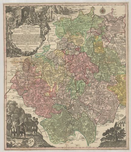
| Title | Mappa Geographica Circuli Metalliferi Electoratus Saxoniae cum imnibus quae in eo comprehenduntur Praefecturis et Dynastiis… |
| Main title | A Szász választófejedelemség bányavidékének földrajzi térképe. |
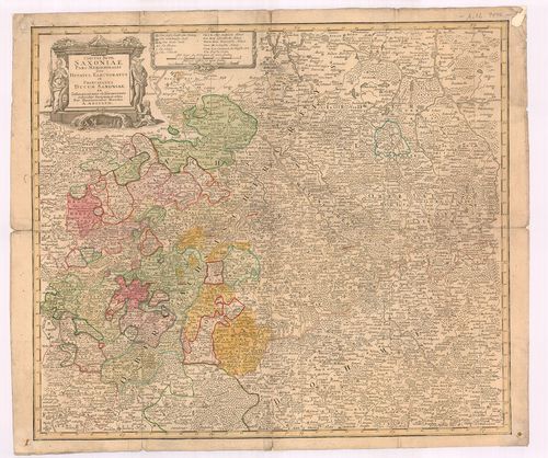
315. Landgraviatus Thuringiae juxta recentiss. designation: in su... [B IV a 576]
Institute and Museum of Military History •
B IV a
•
B IV Német birodalom
•
B I–XV. Európa
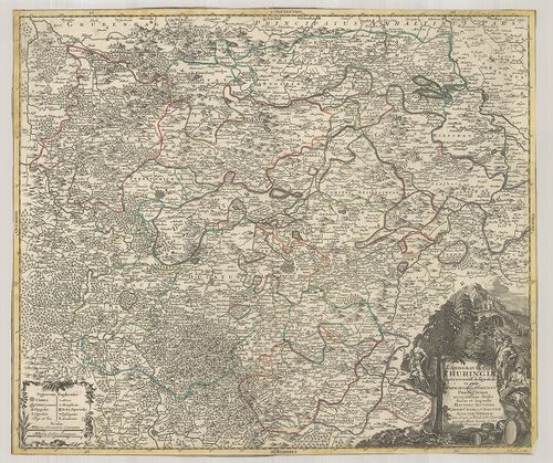
| Title | Landgraviatus Thuringiae juxta recentiss. designation: in suos Principatus Status, et Praefecturas accuratissime divisus… |
| Main title | A Thüringia-i őrgrófság térképe. |
316. Neue und accurate Landkarte des Mittätig-Ober-Sachsischen K.... [B IV a 578]
Institute and Museum of Military History •
B IV a
•
B IV Német birodalom
•
B I–XV. Európa
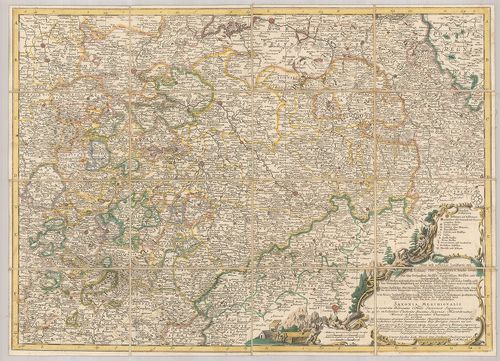
| Title | Neue und accurate Landkarte des Mittätig-Ober-Sachsischen K. Reichs Crenss. Begreiffend das Chur Herzogthum Sachsen, Marggrafthum Meissen, und die Landgrafschafft Thüringen. |
| Main title | Felső-Szászország - a Szász hercegség, Meissen és Thüringiai őrgrófság térképe. |
317. Karte von Königreiche Sachsen… [B IV a 580]
Institute and Museum of Military History •
B IV a
•
B IV Német birodalom
•
B I–XV. Európa

| Title | Karte von Königreiche Sachsen… |
| Main title | A Szász Királyság térképe 1833-ban. |
318. Das Königreich Sachsen und seine Umlande. [B IV a 581]
Institute and Museum of Military History •
B IV a
•
B IV Német birodalom
•
B I–XV. Európa
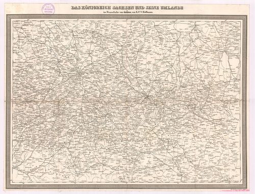
| Title | Das Königreich Sachsen und seine Umlande. |
| Main title | A Szász Királyság és környékének térképe úthálózattal. |
319. Marchionatus Misniae primaria Elector. Saxoniae Provincia, i... [B IV a 581/2]
Institute and Museum of Military History •
B IV a
•
B IV Német birodalom
•
B I–XV. Európa
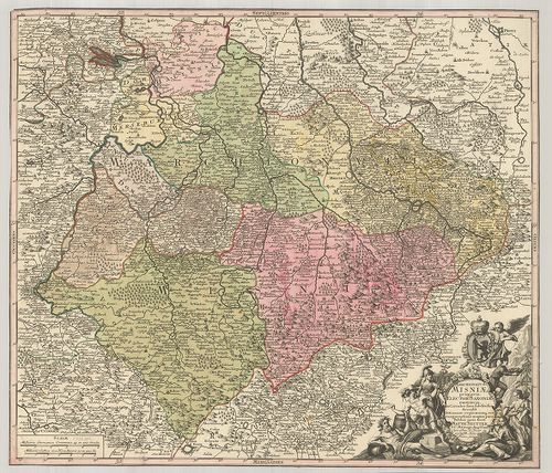
| Title | Marchionatus Misniae primaria Elector. Saxoniae Provincia, in Circulus suos subdivisus Accedit… |
| Main title | A Szász választófejedelemség Meissen őrgrófságának térképe. |
320. Das Koenigreich Sachsen. [B IV a 582]
Institute and Museum of Military History •
B IV a
•
B IV Német birodalom
•
B I–XV. Európa
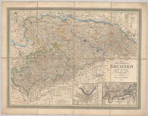
| Title | Das Koenigreich Sachsen. |
| Main title | 2 mt.: 1. Grundriss von Dresden. (Drezda és környéke.) 2. Der besuchteste Theil Sächsischen Schweiz. (Részlet a Szász-Svájcról.)A Szász Királyság térképe 1844-ben. |