341. Ducatus Würtenbergici cum Locis limitaneis utpote maxima par... [B IV a 632/3]
Institute and Museum of Military History •
B IV a
•
B IV Német birodalom
•
B I–XV. Európa
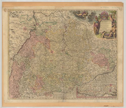
| Title | Ducatus Würtenbergici cum Locis limitaneis utpote maxima parte Circuli Suevici praefertim utraqu marchion: Bandesi et Sylva Vulgo Nigra… |
| Main title | Mt.: Sylvae Herciniae siue Martiae pars superior, olin dicta Eremus Helvetiorum… (Hercinia erdős vidék térképe.)A Württemberg hercegség térképe 1710-ben. |
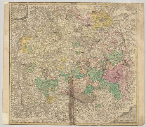
342. Geographica Provinciarvm Sveviae Descriptio Schwaben, in XXV... [B IV a 633]
Institute and Museum of Military History •
B IV a
•
B IV Német birodalom
•
B I–XV. Európa
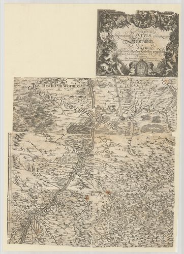
| Title | Geographica Provinciarvm Sveviae Descriptio Schwaben, in XXVIII übereintreffenden Tabellen vorgestellet. |
| Main title | A Svábföld földrajzi térképe 1629 körül. |
343. Übersichtskarte von Württemberg und Hohenzollern. Ötszínnel ... [B IV a 634]
Institute and Museum of Military History •
B IV a
•
B IV Német birodalom
•
B I–XV. Európa
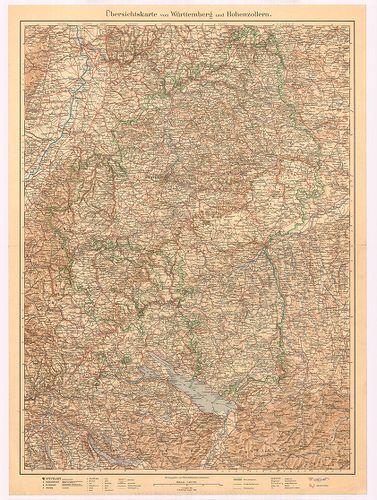
| Title | Übersichtskarte von Württemberg und Hohenzollern. Ötszínnel nyomott II. kiad. (I. kiad. 1885.) |
| Main title | Württemberg és Hohenzollern tartományok áttekintő térképe 1928-ban. |
344. Übersichtskarte von Hohenzollern. [B IV a 634/1]
Institute and Museum of Military History •
B IV a
•
B IV Német birodalom
•
B I–XV. Európa
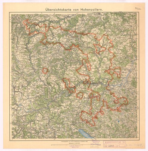
| Title | Übersichtskarte von Hohenzollern. |
| Main title | Hohenzollern tartomány áttekintő térképe 1932-ben. |
345. Markungs-Karte von Württemberg und der Hohenzollernschen Lan... [B IV a 634/2]
Institute and Museum of Military History •
B IV a
•
B IV Német birodalom
•
B I–XV. Európa
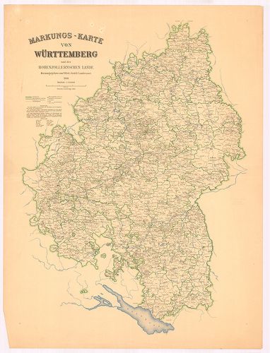
| Title | Markungs-Karte von Württemberg und der Hohenzollernschen Lande. |
| Main title | Württemberg és Hohenzollern terület térképe 1930-ban. |
346. Per Inclyti Circuli Suevici… [B IV a 635]
Institute and Museum of Military History •
B IV a
•
B IV Német birodalom
•
B I–XV. Európa
| Title | Per Inclyti Circuli Suevici… |
| Main title | Svábföld térképe. |
347. Circulus Svevicus, Cum Incorporatis et Adjacentibus Regionib... [B IV a 636]
Institute and Museum of Military History •
B IV a
•
B IV Német birodalom
•
B I–XV. Európa
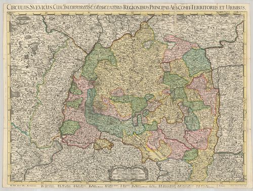
| Title | Circulus Svevicus, Cum Incorporatis et Adjacentibus Regionibus, Principat: Abb. Comit. Territoriis et urbius. |
| Main title | A Svábföld térképe 1704-ben. |
348. Circuli Sveviae. – Le Cercle de Svabe. [B IV a 637]
Institute and Museum of Military History •
B IV a
•
B IV Német birodalom
•
B I–XV. Európa
| Title | Circuli Sveviae. – Le Cercle de Svabe. |
| Main title | A Svábföldi hercegségek térképe 1743-ban. |
349. Croquis de Carte Militaire de la Souabe. [B IV a 638]
Institute and Museum of Military History •
B IV a
•
B IV Német birodalom
•
B I–XV. Európa
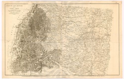
| Title | Croquis de Carte Militaire de la Souabe. |
| Main title | A Svábföld térképe. |
350. Charte von Schwaben und den angränzenden Ländern… [B IV a 640]
Institute and Museum of Military History •
B IV a
•
B IV Német birodalom
•
B I–XV. Európa
| Title | Charte von Schwaben und den angränzenden Ländern… |
| Main title | A Svábföld térképe 1803-ban. |
351. Charte von Schwaben mit allen Städten Marktfleken und Pfarrd... [B IV a 641]
Institute and Museum of Military History •
B IV a
•
B IV Német birodalom
•
B I–XV. Európa
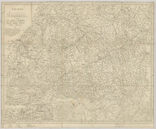
| Title | Charte von Schwaben mit allen Städten Marktfleken und Pfarrdörfern, Chausseen, Flüssen, Bächen und der mahligen Gränzen. |
| Main title | A Svábföld térképe 1803-ban. |
352. Il circolo di Svevia et il landgraviato D’Alsazia. [B IV a 652]
Institute and Museum of Military History •
B IV a
•
B IV Német birodalom
•
B I–XV. Európa
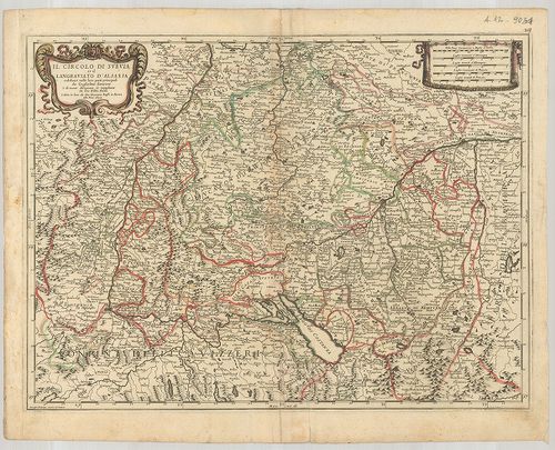
| Title | Il circolo di Svevia et il landgraviato D’Alsazia. |
| Main title | A Svábföld és Elszász térképe 1678-ban. |
353. Neueste Karte von dem Koenigreich Wuertemberg und dem Grossh... [B IV a 653]
Institute and Museum of Military History •
B IV a
•
B IV Német birodalom
•
B I–XV. Európa
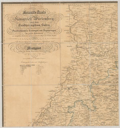
| Title | Neueste Karte von dem Koenigreich Wuertemberg und dem Grossherzogthum Baden mit den inclavirten Fürstenthümern Hechingen und Sigmaringen… |
| Main title | A Württemberg-i Királyság, Badeni nagyhercegség, Hechingen és Sigmaringen hercegségek térképe úthálózattal. |
354. Karte des Königreichs Württemberg und der Hohenzollern’schen... [B IV a 654]
Institute and Museum of Military History •
B IV a
•
B IV Német birodalom
•
B I–XV. Európa
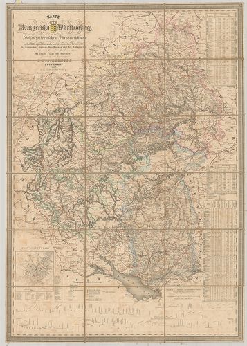
| Title | Karte des Königreichs Württemberg und der Hohenzollern’schen Fürstenthümer… |
| Main title | Mt.: Plan von Stuttgart. (Stuttgart várostérk.) A térkép déli szélén metszetek a hegyekről.A Württemberg Királyság és Hohenzollern nagyhercegség térképe 1843-ban. |
355. Das Königreich Würtemberg das Grossherzogthum Baden und die ... [B IV a 654/1]
Institute and Museum of Military History •
B IV a
•
B IV Német birodalom
•
B I–XV. Európa
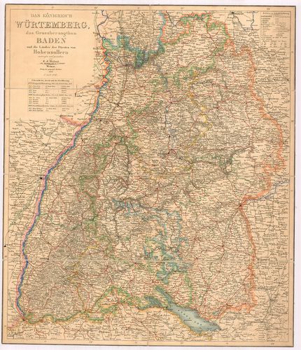
| Title | Das Königreich Würtemberg das Grossherzogthum Baden und die Länder der Fürsten von Hohenzollern. |
| Main title | Württemberg királyság, Baden nagyhercegség, Hohenzollern hercegség térképe 1847-ben. |
356. [A Württemberg-i Királyság általános térképe.] [B IV a 655]
Institute and Museum of Military History •
B IV a
•
B IV Német birodalom
•
B I–XV. Európa
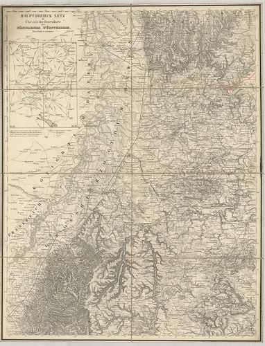
| Title | [A Württemberg-i Királyság általános térképe.] |
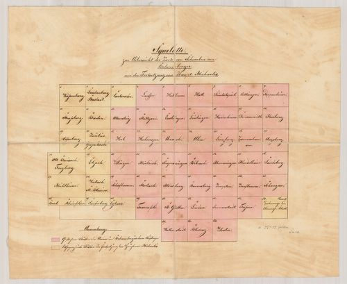
| Main title | Mt.: Hauptdreieck netz als übersicht der Generalkarte des Königreichs Württemberg. (Háromszögelési hálózat) |
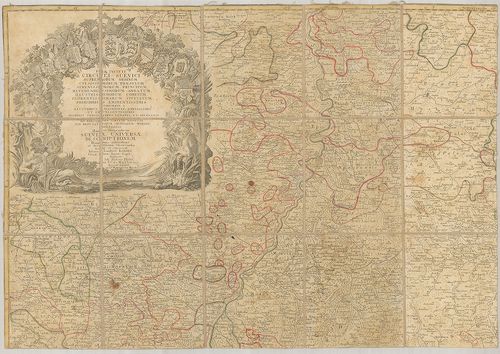
357. Suevia Universa IX. Tabulis Delineata, in quibus Omnium, non... [B IV a 658]
Institute and Museum of Military History •
B IV a
•
B IV Német birodalom
•
B I–XV. Európa
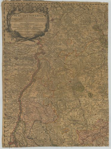
| Title | Suevia Universa IX. Tabulis Delineata, in quibus Omnium, non solum ad Circulum pertinentium Episcopatuum, Ducatuum, Marchionatuum, Principatuum… |
| Main title | A Svábföld térképe püspökségek, hercegségek, grófságok kerületi megjelölésével. |
358. Topographische Charte von Schwaben. [B IV a 661]
Institute and Museum of Military History •
B IV a
•
B IV Német birodalom
•
B I–XV. Európa
| Title | Topographische Charte von Schwaben. |
| Main title | A Svábföld topográfiai térképe. |
359. Charte vom Königreiche Württemberg. [B IV a 663]
Institute and Museum of Military History •
B IV a
•
B IV Német birodalom
•
B I–XV. Európa
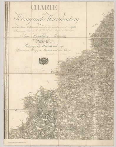
| Title | Charte vom Königreiche Württemberg. |
| Main title | A Württemberg-i Királyság térképe. |
360. Topographisch-militairischer Atlas von dem Koenigreiche Würt... [B IV a 663/1]
Institute and Museum of Military History •
B IV a
•
B IV Német birodalom
•
B I–XV. Európa
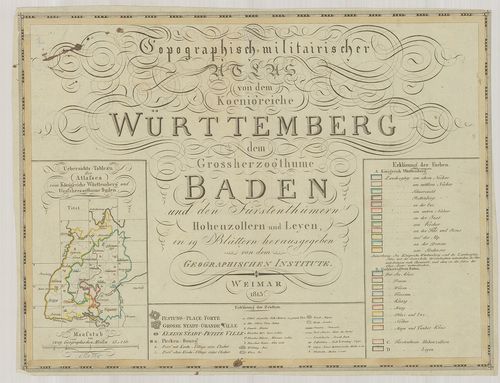
| Title | Topographisch-militairischer Atlas von dem Koenigreiche Württemberg dem Grossherzogthume Baden und den Fürstenthümern Hohenzollern und Leyen. |
| Main title | A Württemberg-i Királyság, Badeni nagyhercegség, Hohenzollern- és Leyen hercegségek térképe 1813-ben. |