401. Karte des Herzogthums Mecklenburg mit seinen verschiedenen P... [B IV a 811]
Institute and Museum of Military History •
B IV a
•
B IV Német birodalom
•
B I–XV. Európa
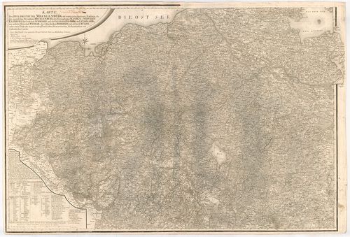
| Title | Karte des Herzogthums Mecklenburg mit seinen verschiedenen Provinzen… |
| Main title | A Mecklenburg-i hercegség térképe a hozzátartozó tartományokkal 1794-ben. |
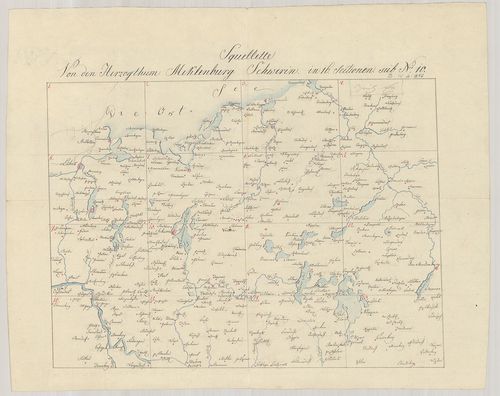
402. Special Karte von den Grossherzogthümern Mecklenburg-Schweri... [B IV a 812]
Institute and Museum of Military History •
B IV a
•
B IV Német birodalom
•
B I–XV. Európa
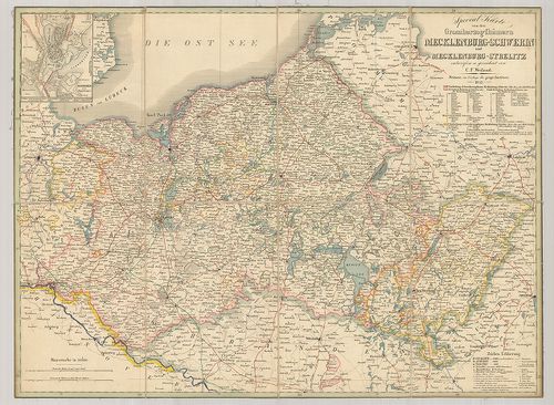
| Title | Special Karte von den Grossherzogthümern Mecklenburg-Schwerin und Mecklenburg-Strelitz. |
| Main title | Mt.: Schwerin nebst Umgebungen. (Schwerin és környéke.) |
| Subject | Mecklenburg-Schwerin és Mecklenburg-Strelitz nagyhercegségek részletes térképe 1843-ban. |
403. Die Grossherzogthümer Meklenburg-Schwerin und Meklenburg-Str... [B IV a 813]
Institute and Museum of Military History •
B IV a
•
B IV Német birodalom
•
B I–XV. Európa
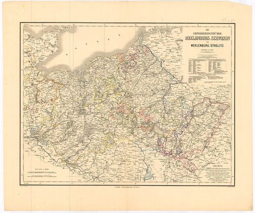
| Title | Die Grossherzogthümer Meklenburg-Schwerin und Meklenburg-Strelitz. |
| Main title | Mecklenburg-Schwerin és Mecklenburg-Strelitz nagyhercegségek térképe. |
404. Die Grossherzogthümer Mecklenburg Schwerin- und Strelitz. [B IV a 814]
Institute and Museum of Military History •
B IV a
•
B IV Német birodalom
•
B I–XV. Európa
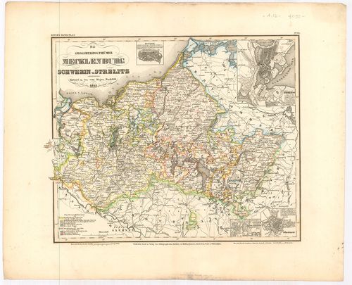
| Title | Die Grossherzogthümer Mecklenburg Schwerin- und Strelitz. |
| Main title | 4 mt.: 1. Rostock, 2. Schwerin, 3. Alt und Neu Sterlitz, 4. Güstrow – várostérképek. |
| Subject | Mecklenburg-Schwerin és Strelitz nagyhercegségek térképe 1848-ban. |
405. Carte Chorographique et militaire du Duche de Meklenburg-Str... [B IV a 815]
Institute and Museum of Military History •
B IV a
•
B IV Német birodalom
•
B I–XV. Európa
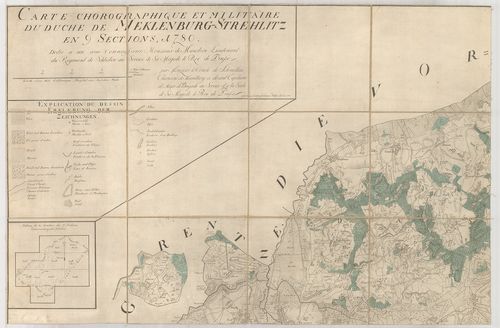
| Title | Carte Chorographique et militaire du Duche de Meklenburg-Strelitz. |
| Main title | Mecklenburg-Strelitz hercegség földrajzi és katonai térképe 1780-ban. |
406. Topographisch Oeconomisch und Militaerische Charte des Herzo... [B IV a 816]
Institute and Museum of Military History •
B IV a
•
B IV Német birodalom
•
B I–XV. Európa
| Title | Topographisch Oeconomisch und Militaerische Charte des Herzogthums Mecklenburg Schwerin und des Fürstenthums Ratzeburg… |
| Main title | Mecklenburg-Schwerin hercegség, Ratzeburg fejedelemség topográfiai-katonai térképe 1788-ban. |
407. Karte von dem Herzogthum Oldenburg. [B IV a 816/7]
Institute and Museum of Military History •
B IV a
•
B IV Német birodalom
•
B I–XV. Európa
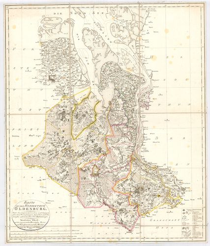
| Title | Karte von dem Herzogthum Oldenburg. |
| Main title | Oldenburg hercegség térképe 1803-ban. |
408. Grossherzogthum Oldenburg und Gebiet der Freien Stadt Bremen... [B IV a 816/8]
Institute and Museum of Military History •
B IV a
•
B IV Német birodalom
•
B I–XV. Európa
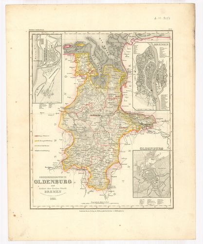
| Title | Grossherzogthum Oldenburg und Gebiet der Freien Stadt Bremen. |
| Main title | 3 mt. 1. Bremenhafen. (Brémakikötő térképe.) 2. Bremen. (Bréma város térképe.) 3. Oldenburg. (Oldenburg város térképe.) |
| Subject | Oldenburg nagyhercegség és a szabad Bréma város térképe 1851-ben. |
409. Die Grossherzoglich und Herzoglich Sächsischen Länder nebst ... [B IV a 817/1]
Institute and Museum of Military History •
B IV a
•
B IV Német birodalom
•
B I–XV. Európa
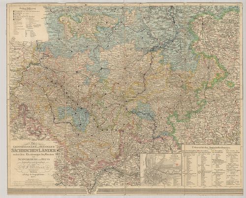
| Title | Die Grossherzoglich und Herzoglich Sächsischen Länder nebst den Besitzungen der Fürsten von Schwarzburg und Reuss. |
| Main title | Mt.: Grundriss von Weimar… (Weimar és környéke.) |
| Subject | A Szász tartományok nagyhercegségei és hercegségeinek térképe 1847-ben. (Schwarzburg- és Reuss fejedelemség.) |
410. Topographische Karte der Aemter Altenburg und Ronneburg. – C... [B IV a 818]
Institute and Museum of Military History •
B IV a
•
B IV Német birodalom
•
B I–XV. Európa
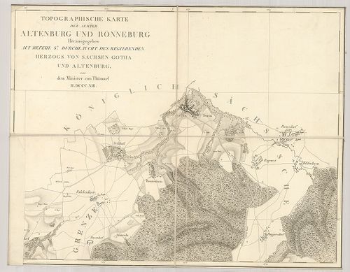
| Title | Topographische Karte der Aemter Altenburg und Ronneburg. – Carte Topographique des Bailaiges D’Altenbourg et de Ronnebourg. |
| Main title | Altenburg és Ronneburg (Szászvidék) topográfiai térképe 1813-ban. |
411. General-Karte der Aemter Altenburg und Ronneburg. – Carte Gé... [B IV a 818/1]
Institute and Museum of Military History •
B IV a
•
B IV Német birodalom
•
B I–XV. Európa
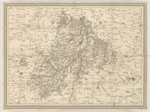
| Title | General-Karte der Aemter Altenburg und Ronneburg. – Carte Générale des Bailliages d’Altenbourg et de Ronnebourg. |
| Main title | Altenburg és Ronneburg (Szászvidék) általános térképe 1843-ban. |
412. Tabula Geographica in qua Serenissimi Principis Friderici Du... [B IV a 819]
Institute and Museum of Military History •
B IV a
•
B IV Német birodalom
•
B I–XV. Európa
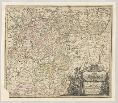
| Title | Tabula Geographica in qua Serenissimi Principis Friderici Duc. Sax. Juliae, Cliviae et Montium, nec non Angeriae et Westphaliae Principatvs Gotha, Cobvrg et Altenburg cum omnibus eorundem Praefecturis tam in Thuringia quam Misnia et Franconia. |
| Main title | Gotha, Coburg és Altenburg hercegségek általános térképe. |
413. Charte von dem Fürstemthume Weimar. [B IV a 826]
Institute and Museum of Military History •
B IV a
•
B IV Német birodalom
•
B I–XV. Európa
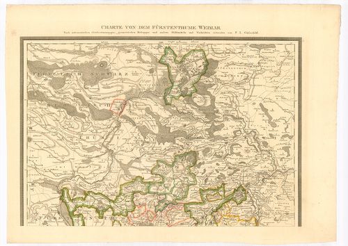
| Title | Charte von dem Fürstemthume Weimar. |
| Main title | A Weimar hercegség térképe. |
414. Topographische Karte des Gebiets der freien, Hannestadt Lübe... [B IV a 844]
Institute and Museum of Military History •
B IV a
•
B IV Német birodalom
•
B I–XV. Európa
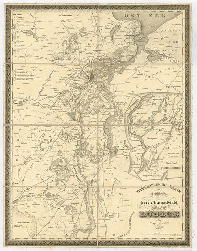
| Title | Topographische Karte des Gebiets der freien, Hannestadt Lübeck. |
| Main title | Mt.: Das Amt Bergedorf. (Bergedorf és környéke.)Lübeck (Hansa város) és környékének topográfiai térképe 1843-ban. |
415. Karte von Elsass-Lothringen. [B IV a 854]
Institute and Museum of Military History •
B IV a
•
B IV Német birodalom
•
B I–XV. Európa
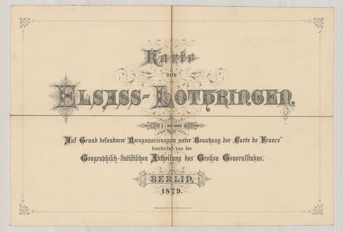
| Title | Karte von Elsass-Lothringen. |
| Main title | Elszász-Lotharingia térképe 1879-ben. |
416. Tractus Eichsfeldiae in suas Praefecturas divisae nec non Te... [B IV a 855]
Institute and Museum of Military History •
B IV a
•
B IV Német birodalom
•
B I–XV. Európa
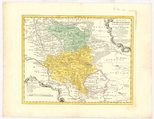
| Title | Tractus Eichsfeldiae in suas Praefecturas divisae nec non Territorii Mvhlhvsani Chorographia cum confiniis Hassiae et Principatus Calenbergici… |
| Main title | Eichsfeld vidékének térképe 1759-ben. |
417. Alsatia Superior et Inferior III. Tabulis Delineata cum Fini... [B IV a 880]
Institute and Museum of Military History •
B IV a
•
B IV Német birodalom
•
B I–XV. Európa
| Title | Alsatia Superior et Inferior III. Tabulis Delineata cum Finitimis Episcopatibus, Ducatibus, Principatibus et Marchionatibus, Abbatiis Comitatibus, Urbibus… |
| Main title | Elszász térképe. |
418. Carte Topographique du Département du Haut-Rhin. [B IV a 887]
Institute and Museum of Military History •
B IV a
•
B IV Német birodalom
•
B I–XV. Európa
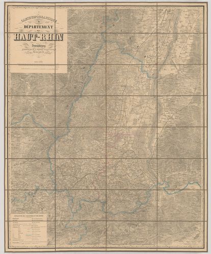
| Title | Carte Topographique du Département du Haut-Rhin. |
| Main title | A Felső-Rajna vidék topográfiai térképe. |
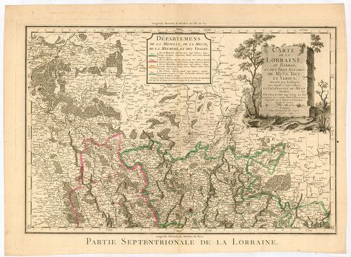
419. La Lorraine qui comprend Les Duchés de Lorraine et de Bar et... [B IV a 888]
Institute and Museum of Military History •
B IV a
•
B IV Német birodalom
•
B I–XV. Európa
| Title | La Lorraine qui comprend Les Duchés de Lorraine et de Bar et les Balliages des Eveschés et des Villes de Metz, Toul, et Verdun. – La Lorraine, sous le nom de laquelle sont compris les Duchés de Lorraine et de Bar, et les Balliages du Temporel… |
| Main title | Lotharingia német tartomány, Metz, Toul és Verdun püspökségek térképe 1690-ben. |
420. Carte de la Lorraine, du Barrois et des Trois Evěchés de Met... [B IV a 892]
Institute and Museum of Military History •
B IV a
•
B IV Német birodalom
•
B I–XV. Európa
| Title | Carte de la Lorraine, du Barrois et des Trois Evěchés de Metz, Toul, et Verdun… |
| Main title | Lotharingia német tartomány, Metz, Toul és Verdun püspökségek térképe 1790-ben. |
421. Deutsche Demokratische Republik. [B IV a 893]
Institute and Museum of Military History •
B IV a
•
B IV Német birodalom
•
B I–XV. Európa
| Title | Deutsche Demokratische Republik. |
| Main title | Mt.: [Berlin–Európa városainak légi közlekedési térképe.] |
| Subject | A Német Demokratikus Köztársaság térképe úthálózattal. |
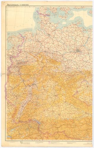
422. [Németország.] Übersichtskarte. Ostblatt [B IV a 897]
Institute and Museum of Military History •
B IV a
•
B IV Német birodalom
•
B I–XV. Európa
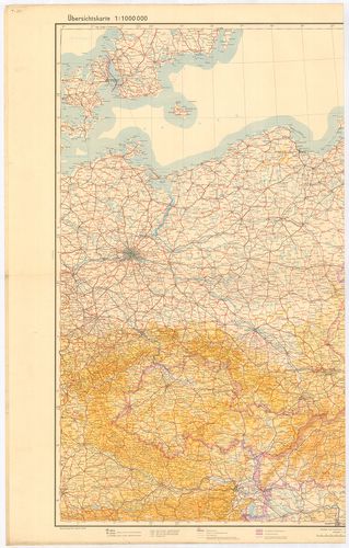
| Title | [Németország.] Übersichtskarte. Ostblatt |
| Main title | Németország (Magdeburg–Polozk–Regensburg–Tschernowitz kivágat.) áttekintő térképe 1944-ben. |
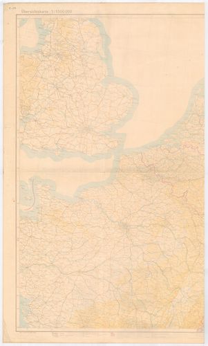
423. [Németország.] Übersichtskarte. Mittelblatt. [B IV a 897/1]
Institute and Museum of Military History •
B IV a
•
B IV Német birodalom
•
B I–XV. Európa
| Title | [Németország.] Übersichtskarte. Mittelblatt. |
| Main title | Németország (Nancy–Lemberg–Klagenfurt–Odense kivágat) áttekintő térképe 1944-ben. |
424. Deutschland. [B IV a 907]
Institute and Museum of Military History •
B IV a
•
B IV Német birodalom
•
B I–XV. Európa
| Title | Deutschland. |
| Main title | Németország közigazgatási térképe. |
425. Übersichtskarte von dem Deutsches Reich Westblatt. [B IV a 908]
Institute and Museum of Military History •
B IV a
•
B IV Német birodalom
•
B I–XV. Európa
| Title | Übersichtskarte von dem Deutsches Reich Westblatt. |
| Main title | Nyugat-Németország áttekintő térképe 1945-ben. (Liverpool–Berlin–La Rochelle–Villach kivágat.) |
426. Deutsche Heereskarte nur für den Dienstgebrauch. Operationsk... [B IV a 908/1]
Institute and Museum of Military History •
B IV a
•
B IV Német birodalom
•
B I–XV. Európa
| Title | Deutsche Heereskarte nur für den Dienstgebrauch. Operationskarte Ost Blatt I. 4. kiad. |
| Main title | Németország: a Keleti-tenger vidékének katonai térképe 1945-ben. |
427. JRO Karte. Der Deutsche Westen. [B IV a 908/2]
Institute and Museum of Military History •
B IV a
•
B IV Német birodalom
•
B I–XV. Európa
| Title | JRO Karte. Der Deutsche Westen. |
| Main title | Nyugat-Németország térképe úthálózattal. |
428. Karte Nemacske. [B IV a 910]
Institute and Museum of Military History •
B IV a
•
B IV Német birodalom
•
B I–XV. Európa
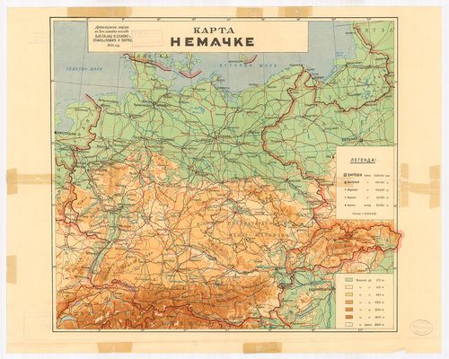
| Title | Karte Nemacske. |
| Main title | Németország térképe 1939 végén. |
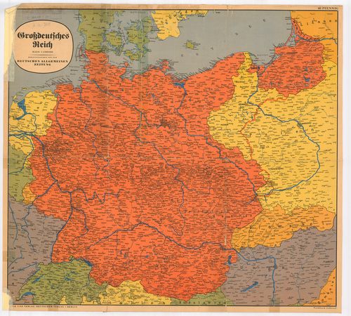
429. Des Grossdeutsche Reich mit dem Protektorat Böhmen und Mähre... [B IV a 911]
Institute and Museum of Military History •
B IV a
•
B IV Német birodalom
•
B I–XV. Európa
| Title | Des Grossdeutsche Reich mit dem Protektorat Böhmen und Mähren. |
| Main title | A Német Birodalom út-vasúttérképe 1939-ben. |
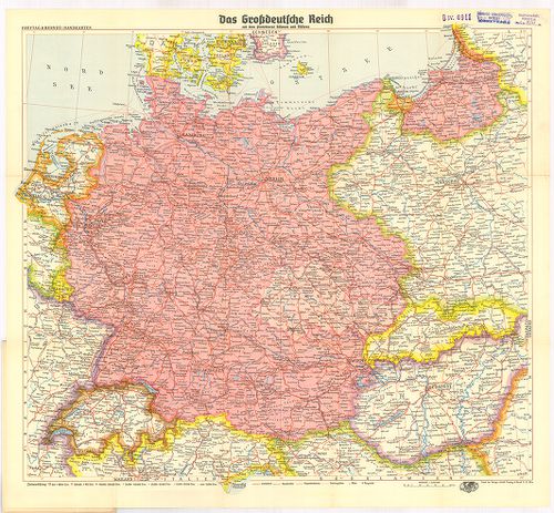
430. Grossdeutsches Reich. [B IV a 914]
Institute and Museum of Military History •
B IV a
•
B IV Német birodalom
•
B I–XV. Európa
| Title | Grossdeutsches Reich. |
| Main title | A Német Birodalom térképe 1939 végén. |
431. Deutschland. Flemmings Generalkarten. [B IV a 915]
Institute and Museum of Military History •
B IV a
•
B IV Német birodalom
•
B I–XV. Európa
| Title | Deutschland. Flemmings Generalkarten. |
| Main title | 15 mt. a hátold.: 1. Schiffbare Flüsse und Kanäle Mittel-Europas. (Közép-Európa hajózható folyói és csatornái.) 2. Rheinisch-Westfälisches Industrigebiet. (Rajna-Wesztfália iparterülete.) 3. Deutschland-Niederschläge und Temperaturen. (Németország hőmérséklete és csapadék térképe.) 4. Der deutsche Rundfunkverkehr und die Entfernungen von Berlin. (Rádióközvetítő távolság Berlinből.) 5. Deutsche Stämme und Hauptmundarten. (Német nyelvjárás térképe.) 6. Deutschland-Bodenerhebungen. (Németország talajszint emelkedései.) 7. Deutschland-Erdgeschichte. (Geologie.) Németország geológia térképe.) 8. Deutschland-Bodennutzung. (Németország földhasználata.) 9. Deutschland-Waldungen. (Németország erdőségei.) 10. Deutschland Landwirtschaft: Weizen. (Németország mezőgazdasága: Búza.) 11. Gerste (Árpa.) 12. Roggen. (Rozs.) 13. Kartoffeln. (Burgonya.) 14. Deutschland-Bodenschätze. (Németország természeti kincsei.) 15. Deutschland-Industrie. (Németország ipara.) |
| Subject | Németország politikai és közlekedési térképe . |
432. Ravenstein-Karte von Deutschland mit politischer Gliederung. [B IV a 916]
Institute and Museum of Military History •
B IV a
•
B IV Német birodalom
•
B I–XV. Európa
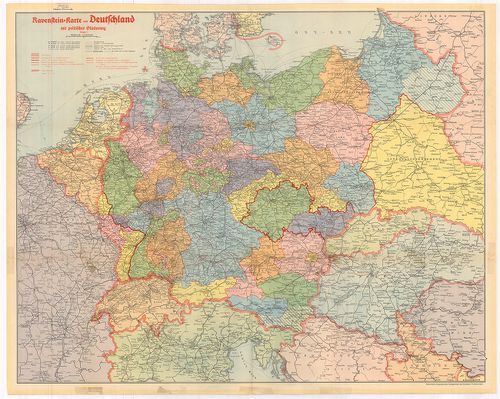
| Title | Ravenstein-Karte von Deutschland mit politischer Gliederung. |
| Main title | Németország politikai és közlekedési térképe kerületi beosztással 1942. novemberében. |
433. Das Deutsche Reich seit dem 13. März 1938. [B IV a 918]
Institute and Museum of Military History •
B IV a
•
B IV Német birodalom
•
B I–XV. Európa
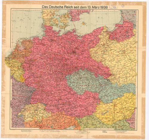
| Title | Das Deutsche Reich seit dem 13. März 1938. |
| Main title | A Német Birodalom térképe 1938. március 13-án. |
434. Das Grossdeutsche Reich und seine Nachbargebiete. [B IV a 919]
Institute and Museum of Military History •
B IV a
•
B IV Német birodalom
•
B I–XV. Európa
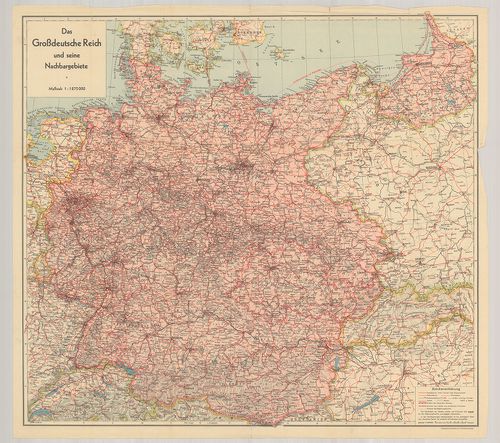
| Title | Das Grossdeutsche Reich und seine Nachbargebiete. |
| Main title | A Német Birodalom térképe 1939 végén. |
435. Sudetenland in 2 Blättern. [B IV a 920]
Institute and Museum of Military History •
B IV a
•
B IV Német birodalom
•
B I–XV. Európa
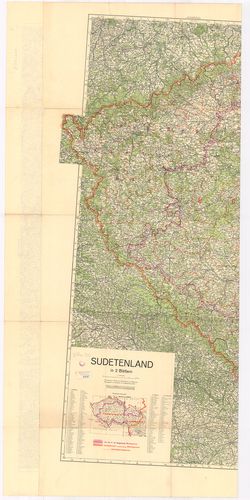
| Title | Sudetenland in 2 Blättern. |
| Main title | Mt.: Politische Grenzen. (Politikai határ.) |
| Subject | Szudétaföld térképe (NY-i rész) 1938. november 20-án. Altenburg–Vöcklaburg–Baden–Freiburg kivágat. |
436. [Kelet-Poroszország, a Visztulától K-re.] [B IV a 921]
Institute and Museum of Military History •
B IV a
•
B IV Német birodalom
•
B I–XV. Európa
| Title | [Kelet-Poroszország, a Visztulától K-re.] |
437. Vogels Karte des Deutschen Reichs und der Alpenländer. Nr. 1... [B IV a 923]
Institute and Museum of Military History •
B IV a
•
B IV Német birodalom
•
B I–XV. Európa
| Title | Vogels Karte des Deutschen Reichs und der Alpenländer. Nr. 14. Blatt Berlin. |
| Main title | A Német Birodalom: Berlin környékének térképe. |
438. Vogels Karte des Deutschen Reichs und der Alpenländer Nr. 15... [B IV a 924]
Institute and Museum of Military History •
B IV a
•
B IV Német birodalom
•
B I–XV. Európa
| Title | Vogels Karte des Deutschen Reichs und der Alpenländer Nr. 15. Blatt Frankfurt a. O. M. |
| Main title | A Német Birodalom: Frankfurt am Odera és környékének térképe. |
439. Vogels Karte des Deutschen Reichs und der Alpenländer Nr. 19... [B IV a 925]
Institute and Museum of Military History •
B IV a
•
B IV Német birodalom
•
B I–XV. Európa
| Title | Vogels Karte des Deutschen Reichs und der Alpenländer Nr. 19. Blatt Dresden. |
| Main title | A Német Birodalom: Drezda környékének térképe. |
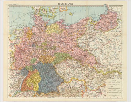
440. Deutsches Reich. [B IV a 926]
Institute and Museum of Military History •
B IV a
•
B IV Német birodalom
•
B I–XV. Európa
| Title | Deutsches Reich. |
| Main title | Dél-Németország térképe 1895-ben. |
441. General Map. Bavaria. [B IV a 927]
Institute and Museum of Military History •
B IV a
•
B IV Német birodalom
•
B I–XV. Európa
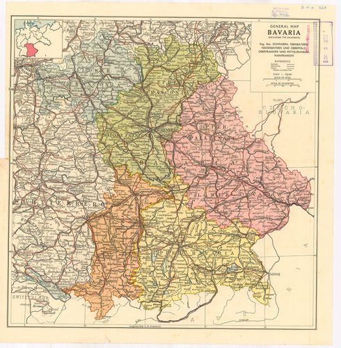
| Title | General Map. Bavaria. |
| Main title | Bajorország általános térképe 1920 után. |
442. Niemiecka Republika Demokratyczna. – Niemiecka Republika Fed... [B IV a 928]
Institute and Museum of Military History •
B IV a
•
B IV Német birodalom
•
B I–XV. Európa
| Title | Niemiecka Republika Demokratyczna. – Niemiecka Republika Federalna. Mapa przegładowa Europy. |
| Main title | Mt.: Berlin. |
| Subject | A Német Demokratikus Köztársaság és a Német Szövetségi Köztársaság hegyvízrajzi térképe 1963-ban. |
443. Niemcy. Mapa przeglądowa Europy. [B IV a 928/1]
Institute and Museum of Military History •
B IV a
•
B IV Német birodalom
•
B I–XV. Európa
| Title | Niemcy. Mapa przeglądowa Europy. |
| Main title | Mt.: Berlin |
| Subject | 3 térk. 1. Mapa Bogactw Mineralnych. (Ásványi lelőhelyek.) 2. Mapa przemysłu. (Az ipar.) 3. Mapa Rolnictwa. (Mezőgazdaság.)Németország hegyvízrajzi térképe 1959-ben. |
444. Germanszkaja Demokraticseszkaja Reszpublika. [B IV a 929]
Institute and Museum of Military History •
B IV a
•
B IV Német birodalom
•
B I–XV. Európa
| Title | Germanszkaja Demokraticseszkaja Reszpublika. |
| Main title | Moszkva, 1964. GUGK. |
| Subject | 3 Mt.: 1. Promüslennoszt’ (Ipar) 2. Szel’szkoe hozjajsztvo. (Mezőgazdaság) 3. Berlin. |
445. Németország. [B IV a 930]
Institute and Museum of Military History •
B IV a
•
B IV Német birodalom
•
B I–XV. Európa
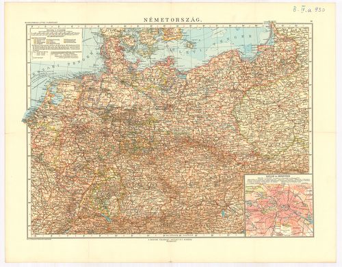
| Title | Németország. |
| Main title | Mt.: Berlin és környéke. |
446. Germany and its approaches… – Occupation Zones Germany and A... [B IV a 931]
Institute and Museum of Military History •
B IV a
•
B IV Német birodalom
•
B I–XV. Európa
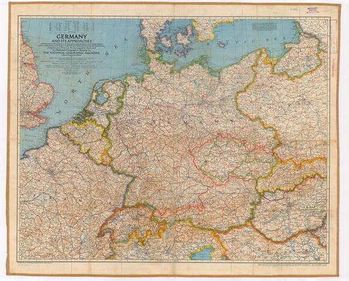
| Title | Germany and its approaches… – Occupation Zones Germany and Austria. |
| Main title | Németország: megszállási zónák 1945-ből. |
447. Nord und Mittelbayern. [B IV a 958]
Institute and Museum of Military History •
B IV a
•
B IV Német birodalom
•
B I–XV. Európa
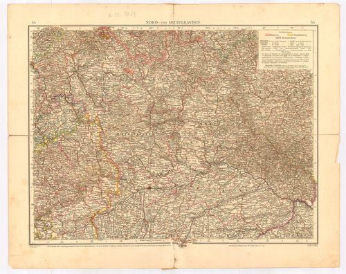
| Title | Nord und Mittelbayern. |
| Main title | Észak- és Közép-Bajorország térképe. |
448. Nordwest-Deutschland. [B IV a 959]
Institute and Museum of Military History •
B IV a
•
B IV Német birodalom
•
B I–XV. Európa
| Title | Nordwest-Deutschland. |
| Main title | 5 mt.: 1. Umgebung von Hamburg. (Hamburg és környéke.) 2. Helgoland. (Helgoland porosz sziget térképe.) 3. Bremer-Haven–Lehe város térkép. 4. Cux Haven várostérkép. 5. Der Kieler Hafen (Kiel kikötő.) |
| Subject | Németország ÉNY-i részének térképe. |
449. Nordwest-Deutschland. (Nordwestlicher Teil.) [B IV a 960]
Institute and Museum of Military History •
B IV a
•
B IV Német birodalom
•
B I–XV. Európa
| Title | Nordwest-Deutschland. (Nordwestlicher Teil.) |
| Main title | Németország ÉNY-i részének térképe. |
450. Südost-Deutschland. [B IV a 961]
Institute and Museum of Military History •
B IV a
•
B IV Német birodalom
•
B I–XV. Európa
| Title | Südost-Deutschland. |
| Main title | Németország DK-i részének térképe (Bajorország). |
451. Mittel-Deutschland. [B IV a 964]
Institute and Museum of Military History •
B IV a
•
B IV Német birodalom
•
B I–XV. Európa
| Title | Mittel-Deutschland. |
| Main title | Közép-Németország térképe. |
452. Nord-Deutschland. (Südostlicher Teil) [B IV a 965]
Institute and Museum of Military History •
B IV a
•
B IV Német birodalom
•
B I–XV. Európa
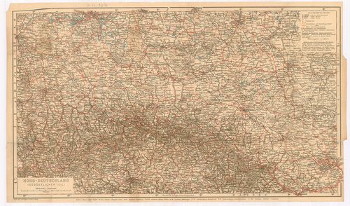
| Title | Nord-Deutschland. (Südostlicher Teil) |
| Main title | Észak-Németország térképe. |
453. Karte der Fränkischen Schweiz. [B IV a 966]
Institute and Museum of Military History •
B IV a
•
B IV Német birodalom
•
B I–XV. Európa
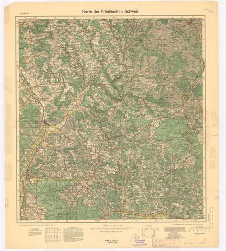
| Title | Karte der Fränkischen Schweiz. |
| Main title | Frank-Svájc térképe 1933-ban. |
454. Topographische Übersichtskarte von Südwestdeutschland in 6 B... [B IV a 967]
Institute and Museum of Military History •
B IV a
•
B IV Német birodalom
•
B I–XV. Európa
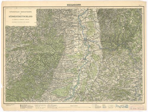
| Title | Topographische Übersichtskarte von Südwestdeutschland in 6 Blättern. Blatt I. Heilbronn. Blatt II. Hall. Blatt III. Stuttgart. |
| Main title | Németország DNY-i részének topográfiai térképe 1925–1928-ban. |
455. Füssen, Germany. [B IV a 968]
Institute and Museum of Military History •
B IV a
•
B IV Német birodalom
•
B I–XV. Európa
| Title | Füssen, Germany. |
| Main title | Németország: Füssen és környékének (Bajor Alpok) térképe 1943-ban. |
456. Standortkarte von Deggendorf. [B IV a 969]
Institute and Museum of Military History •
B IV a
•
B IV Német birodalom
•
B I–XV. Európa
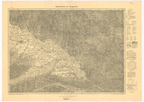
| Title | Standortkarte von Deggendorf. |
| Main title | Deggendorf és környékének topográfiai térképe 1934-ben. |
457. Karte der Pfalz. [B IV a 970]
Institute and Museum of Military History •
B IV a
•
B IV Német birodalom
•
B I–XV. Európa
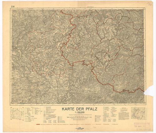
| Title | Karte der Pfalz. |
| Main title | Pfalz kerület térképe 1935-ben az akkori határ kijelölésével. |
458. Deutschland. [B IV a 974]
Institute and Museum of Military History •
B IV a
•
B IV Német birodalom
•
B I–XV. Európa
| Title | Deutschland. |
| Main title | Németország térképe 1953-ban. |
459. Deutsche Demokratische Republik. [B IV a 975]
Institute and Museum of Military History •
B IV a
•
B IV Német birodalom
•
B I–XV. Európa
| Title | Deutsche Demokratische Republik. |
| Main title | Mt.: [N. D. K. tartományok térképe.] |
| Subject | A Német Demokratikus Köztársaság térképe 1953-ban. |
460. Deutsche Demokratische Republik und Westdeutschland. [B IV a 977/1]
Institute and Museum of Military History •
B IV a
•
B IV Német birodalom
•
B I–XV. Európa
| Title | Deutsche Demokratische Republik und Westdeutschland. |
| Main title | A Német Demokratikus Köztársaság és Nyugat-Németország általános térképe úthálózattal 1965-ben. |
461. Federativnaja Reszpublika Germanii. [B IV a 980]
Institute and Museum of Military History •
B IV a
•
B IV Német birodalom
•
B I–XV. Európa
| Title | Federativnaja Reszpublika Germanii. |
| Main title | 3 mt. 1. Promislennoszty. (Iparvidék.) 2. Rejnszko Vesztfalszkij rajon. (Rajna-Vesztfáliai kerület.) 3. Szeljkoje hozjajsztvo. (Mezőgazdaság.) |
| Subject | A Német Szövetségi Köztársaság térképe úthálózattal. |
462. Die beiden deutschen Staaten. [B IV a 981]
Institute and Museum of Military History •
B IV a
•
B IV Német birodalom
•
B I–XV. Európa
| Title | Die beiden deutschen Staaten. |
| Main title | A két német állam (NSZK, NDK) térképe úthálózattal 1965-ben. |
463. Solling-Karte. [B IV a 990]
Institute and Museum of Military History •
B IV a
•
B IV Német birodalom
•
B I–XV. Európa
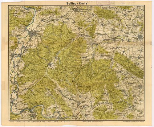
| Title | Solling-Karte. |
| Main title | A Solling-hegység (Németo.) topográfiai térképe. |
464. Kreis Angermünden. [B IV a 999]
Institute and Museum of Military History •
B IV a
•
B IV Német birodalom
•
B I–XV. Európa
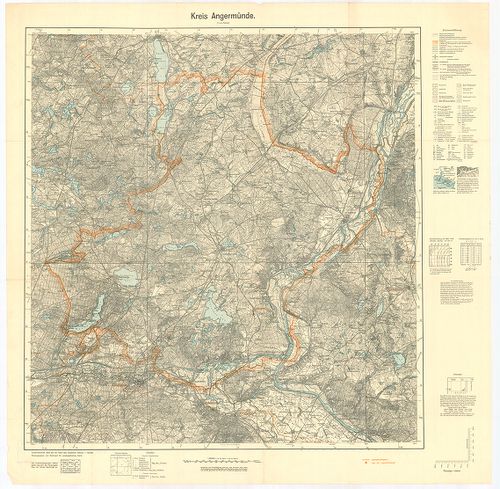
| Title | Kreis Angermünden. |
| Main title | Angermünden-kerület (Németo.) topográfiai térképe 1939-ben. |
465. Oberamtskarte Blaubeuren. [B IV a 1000]
Institute and Museum of Military History •
B IV a
•
B IV Német birodalom
•
B I–XV. Európa
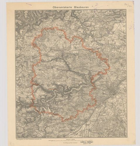
| Title | Oberamtskarte Blaubeuren. |
| Main title | Blaubeuren-kerület (Németo.) topográfiai térképe 1934-ben. |
466. Oberamtskarte Ehingen. [B IV a 1001]
Institute and Museum of Military History •
B IV a
•
B IV Német birodalom
•
B I–XV. Európa
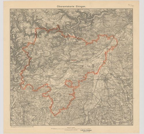
| Title | Oberamtskarte Ehingen. |
| Main title | Ehingen-kerület (Németo.) topográfiai térképe 1934-ben. |
467. Oberamtskarte Geislingen. [B IV a 1002]
Institute and Museum of Military History •
B IV a
•
B IV Német birodalom
•
B I–XV. Európa
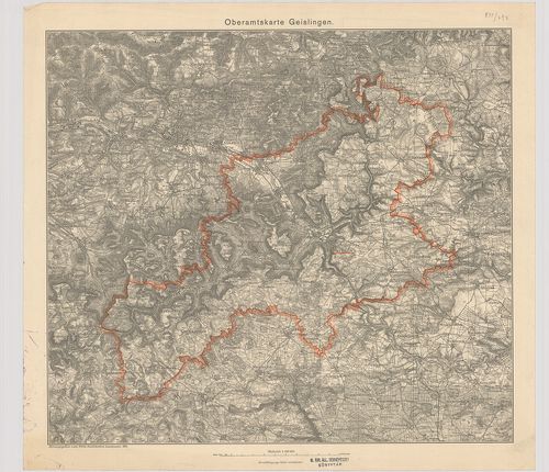
| Title | Oberamtskarte Geislingen. |
| Main title | Geislingen-kerület ((Németo.) topográfiai térképe 1934-ben. |
468. Oberamtskarte Heidenheim. [B IV a 1003]
Institute and Museum of Military History •
B IV a
•
B IV Német birodalom
•
B I–XV. Európa
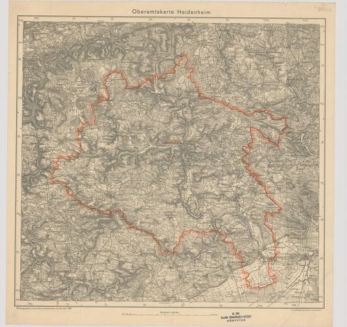
| Title | Oberamtskarte Heidenheim. |
| Main title | Heidenheim-kerület (Németo.) topográfiai térképe 1935-ben. |
469. Oberamtskarte Heilbronn. [B IV a 1004]
Institute and Museum of Military History •
B IV a
•
B IV Német birodalom
•
B I–XV. Európa
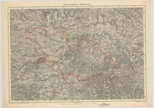
| Title | Oberamtskarte Heilbronn. |
| Main title | Heilbronn-kerület (Németo.) topográfiai térképe 1935-ben. |
470. Oberamtskarte Laupheim. [B IV a 1005]
Institute and Museum of Military History •
B IV a
•
B IV Német birodalom
•
B I–XV. Európa
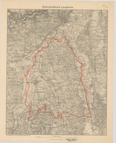
| Title | Oberamtskarte Laupheim. |
| Main title | Laupheim-kerület topográfiai térképe 1933-ban. |
471. Oberamt Leonberg. Archasologische Fundkarte. [B IV a 1006]
Institute and Museum of Military History •
B IV a
•
B IV Német birodalom
•
B I–XV. Európa
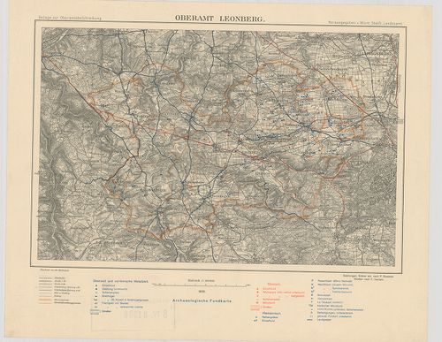
| Title | Oberamt Leonberg. Archasologische Fundkarte. |
| Main title | Leonberg-kerület (Németo.) régészetilelet térképe 1930-ban. |
472. Oberamtskarte Münsingen. [B IV a 1007]
Institute and Museum of Military History •
B IV a
•
B IV Német birodalom
•
B I–XV. Európa
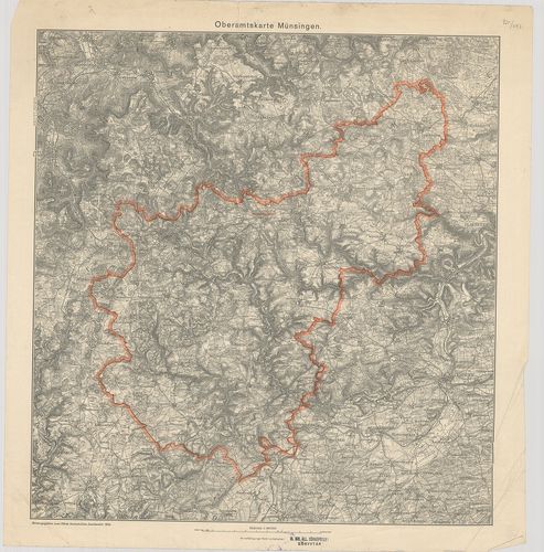
| Title | Oberamtskarte Münsingen. |
| Main title | Münsingen-kerület (Németo.) topográfiai térképe 1934-ben. |
473. Oberamtskarte Ulm. [B IV a 1008]
Institute and Museum of Military History •
B IV a
•
B IV Német birodalom
•
B I–XV. Európa
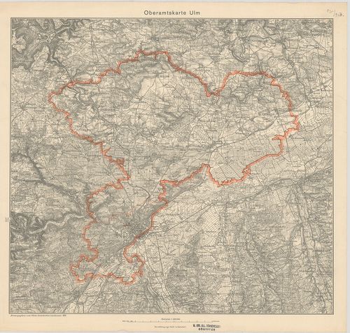
| Title | Oberamtskarte Ulm. |
| Main title | Ulm-kerület (Németo.) topográfiai térképe 1934-ben. |
474. Oberamtskarte Urach. [B IV a 1009]
Institute and Museum of Military History •
B IV a
•
B IV Német birodalom
•
B I–XV. Európa
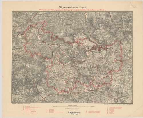
| Title | Oberamtskarte Urach. |
| Main title | Oberamts und Markungsgrenzen Eintragungen vorgeschtlicher Bodenfunde und Strassen. |
| Subject | Urach-kerület (Németo.) térképe a régészeti lelőhelyek és utak berajzolásával 1932-ben. |
475. Heilbronn – Hall – Mergentheim. Blatt I. [B IV a 1011]
Institute and Museum of Military History •
B IV a
•
B IV Német birodalom
•
B I–XV. Európa
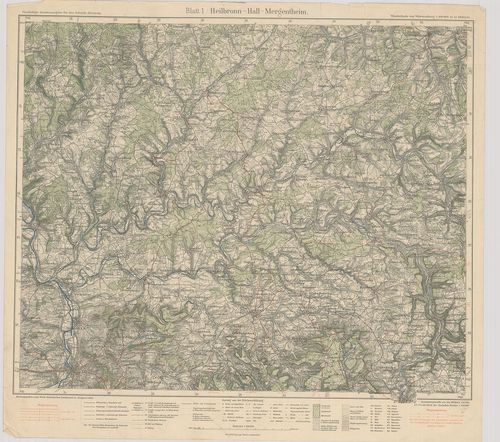
| Title | Heilbronn – Hall – Mergentheim. Blatt I. |
| Main title | Heilbronn–Hall–Mergentheim közötti terület (Németo.) térképe 1928-ban. |
476. Langenburg–Crailsheim–Rothenburg. Blatt 2. [B IV a 1012]
Institute and Museum of Military History •
B IV a
•
B IV Német birodalom
•
B I–XV. Európa
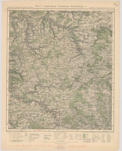
| Title | Langenburg–Crailsheim–Rothenburg. Blatt 2. |
| Main title | Langenburg–Crailsheim–Rothenburg közötti terület (Németo.) topográfiai térképe 1932-ben. |
477. Heilbronn–Stuttgart–Maulbronn. Blatt 3. [B IV a 1013]
Institute and Museum of Military History •
B IV a
•
B IV Német birodalom
•
B I–XV. Európa
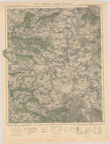
| Title | Heilbronn–Stuttgart–Maulbronn. Blatt 3. |
| Main title | Heiilbronn–Stuttgart–Maulbronn közötti terület (Németo.) topográfiai térképe 1931-ben. |
478. Hall–Löwenstein–Gmünd. Blatt 4. [B IV a 1014]
Institute and Museum of Military History •
B IV a
•
B IV Német birodalom
•
B I–XV. Európa
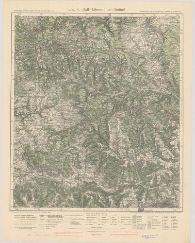
| Title | Hall–Löwenstein–Gmünd. Blatt 4. |
| Main title | Hall–Löwenstein–Gmünd közötti terület (Németo.) topográfiai térképe 1930-ban. |
479. Crailsheim–Gmünd–Nördlingen. Blatt 5. [B IV a 1015]
Institute and Museum of Military History •
B IV a
•
B IV Német birodalom
•
B I–XV. Európa
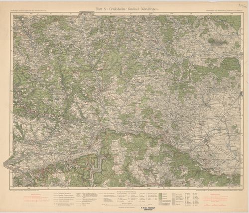
| Title | Crailsheim–Gmünd–Nördlingen. Blatt 5. |
| Main title | Crailsheim–Gmünd–Nördlingen közötti terület (Németo.) topográfiai térképe 1933-ban. |
480. Stuttgart–Herrenberg–Reutlingen. Blatt 7. [B IV a 1017]
Institute and Museum of Military History •
B IV a
•
B IV Német birodalom
•
B I–XV. Európa
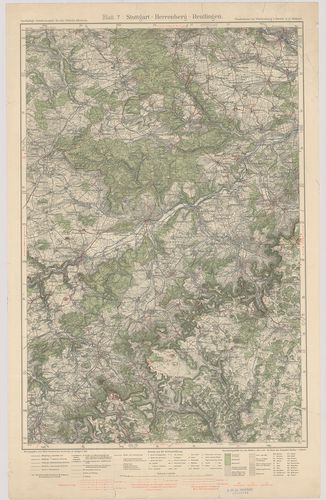
| Title | Stuttgart–Herrenberg–Reutlingen. Blatt 7. |
| Main title | Stuttgart–Herrenberg–Reutlingen közötti terület (Németo.) topográfiai térképe 1930-ban. |
481. Göppingen–Urach–Blaubeuren. Blatt 8. [B IV a 1018]
Institute and Museum of Military History •
B IV a
•
B IV Német birodalom
•
B I–XV. Európa
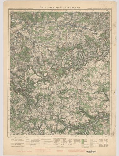
| Title | Göppingen–Urach–Blaubeuren. Blatt 8. |
| Main title | Göppingen–Urach–Blaubeuren közötti terület (Németo.) topográfiai térképe 1934-ben. |
482. Neresheim–Geislingen–Ulm. Blatt 9. [B IV a 1019]
Institute and Museum of Military History •
B IV a
•
B IV Német birodalom
•
B I–XV. Európa
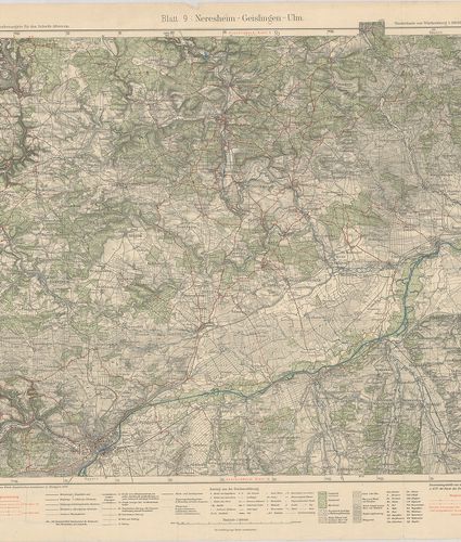
| Title | Neresheim–Geislingen–Ulm. Blatt 9. |
| Main title | Neresheim–Geislingen–Ulm közötti terület (Németo.) topográfiai térképe 1929-ben. |
483. Sulz–Schramberg–Tuttlingen. Blatt 10. [B IV a 1020]
Institute and Museum of Military History •
B IV a
•
B IV Német birodalom
•
B I–XV. Európa
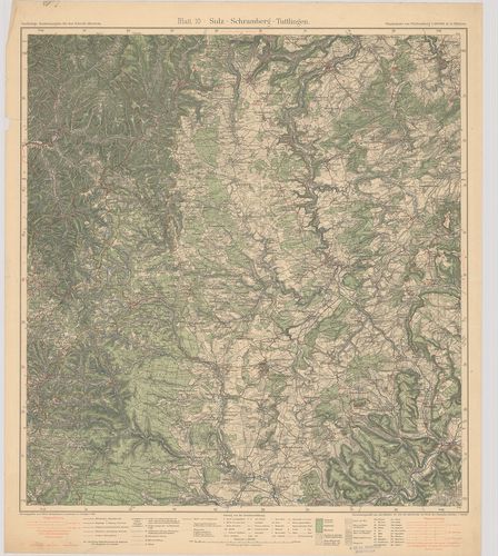
| Title | Sulz–Schramberg–Tuttlingen. Blatt 10. |
| Main title | Sulz–Schramberg–Tuttlingen közötti terület (Németo.) topográfiai térképe 1931-ben. |
484. Hechingen–Tuttlingen–Sigmaringen. Blatt 11. [B IV a 1021]
Institute and Museum of Military History •
B IV a
•
B IV Német birodalom
•
B I–XV. Európa
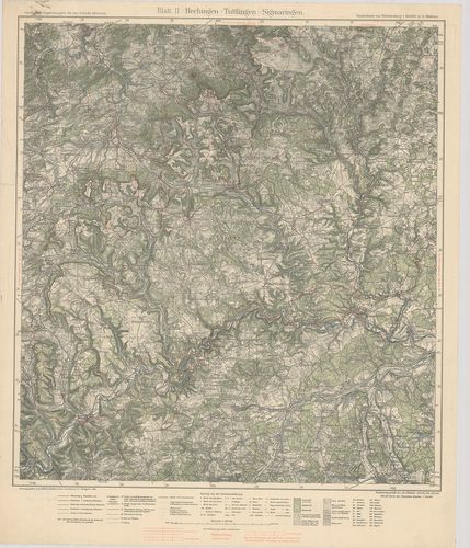
| Title | Hechingen–Tuttlingen–Sigmaringen. Blatt 11. |
| Main title | Hechingen–Tuttlingen–Sigmaringen közötti terület (Németo.) topográfiai térképe 1929-ben. |
485. Ehingen–Riedlingen–Biberach. Blatt 12. [B IV a 1022]
Institute and Museum of Military History •
B IV a
•
B IV Német birodalom
•
B I–XV. Európa
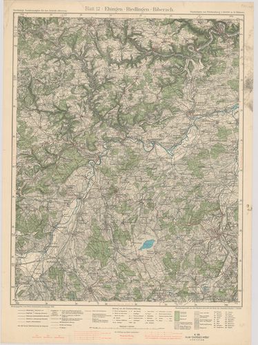
| Title | Ehingen–Riedlingen–Biberach. Blatt 12. |
| Main title | Ehingen–Riedlingen–Biberach közötti terület (Németo.) topográfiai térképe 1934-ben. |
486. Ulm–Laupheim–Memmingen. Blatt 13. [B IV a 1023]
Institute and Museum of Military History •
B IV a
•
B IV Német birodalom
•
B I–XV. Európa
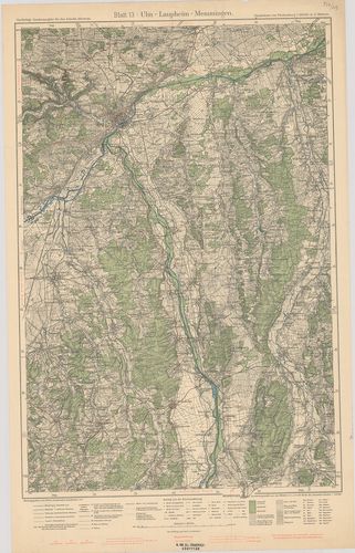
| Title | Ulm–Laupheim–Memmingen. Blatt 13. |
| Main title | Ulm–Laupheim–Memmingen közötti terület (Németo.) topográfiai térképe 1933-ban. |
487. Waldsee–Friedrichshafen–Bregenz. Blatt 14. [B IV a 1024]
Institute and Museum of Military History •
B IV a
•
B IV Német birodalom
•
B I–XV. Európa
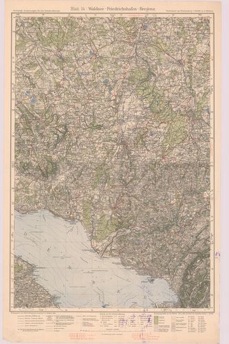
| Title | Waldsee–Friedrichshafen–Bregenz. Blatt 14. |
| Main title | Waldsee–Friedrichshafen–Bregenz közötti terület (Németo.) topográfiai térképe 1928-ban. |
488. Memmingen–Wangen–Kempten. Blatt 15. [B IV a 1025]
Institute and Museum of Military History •
B IV a
•
B IV Német birodalom
•
B I–XV. Európa
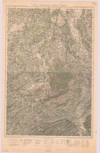
| Title | Memmingen–Wangen–Kempten. Blatt 15. |
| Main title | Memmingen–Wangen–Kempten közötti terület (Németo.) topográfiai térképe 1932-ben. |
489. Unterland I. Heilbronn–Heidelberg. Unterland II. Ellwagen–Ha... [B IV a 1026]
Institute and Museum of Military History •
B IV a
•
B IV Német birodalom
•
B I–XV. Európa
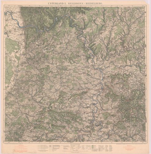
| Title | Unterland I. Heilbronn–Heidelberg. Unterland II. Ellwagen–Hall–Rothenburg o. d. t. |
| Main title | Heilbronn–Heidelberg és Ellwagen–Hall–Rothenburg o.d.t. közötti terület (Németo.) topográfiai térképe 1927-ben. |
490. Gemeinde und Kreiskarte von Baden–Württemberg. Stand 1.7.197... [B IV a 1027]
Institute and Museum of Military History •
B IV a
•
B IV Német birodalom
•
B I–XV. Európa
| Title | Gemeinde und Kreiskarte von Baden–Württemberg. Stand 1.7.1971. Kreise, Regierungsbezirke und Regionen nach dem Kreisreformgesetz und dem Regionalverbandsgesetz. |
| Main title | Baden–Württemberg (Németo.) község és körzet (kerület) térképe. |
491. Geographische Landesaufnahme Naturräumliche Gliederung, Deut... [B IV a 1028]
Institute and Museum of Military History •
B IV a
•
B IV Német birodalom
•
B I–XV. Európa
| Title | Geographische Landesaufnahme Naturräumliche Gliederung, Deutschlands. – Bremerhaven, 39. |
492. Geographische Landesaufnahme Naturräumliche Gliederung, Deut... [B IV a 1028/1]
Institute and Museum of Military History •
B IV a
•
B IV Német birodalom
•
B I–XV. Európa
| Title | Geographische Landesaufnahme Naturräumliche Gliederung, Deutschlands. – Braunschweig, 87. |
493. Geographische Landesaufnahme Naturräumliche Gliederung, Deut... [B IV a 1028/2]
Institute and Museum of Military History •
B IV a
•
B IV Német birodalom
•
B I–XV. Európa
| Title | Geographische Landesaufnahme Naturräumliche Gliederung, Deutschlands. – Husum. 22. |
494. Karte des Deutschen Reiches. [B IV a 1041]
Institute and Museum of Military History •
B IV a
•
B IV Német birodalom
•
B I–XV. Európa
| Title | Karte des Deutschen Reiches. |
495. [Németország.] [B IV a 1045]
Institute and Museum of Military History •
B IV a
•
B IV Német birodalom
•
B I–XV. Európa
| Title | [Németország.] |
496. Topographischer Atlas von Bayern. [B IV a 1046]
Institute and Museum of Military History •
B IV a
•
B IV Német birodalom
•
B I–XV. Európa
| Title | Topographischer Atlas von Bayern. |
497. Deutsche Karte. [B IV a 1046/1]
Institute and Museum of Military History •
B IV a
•
B IV Német birodalom
•
B I–XV. Európa
| Title | Deutsche Karte. |
498. Vergrösserung der Karte des Deutschen Reichs M. 1:100 000. i... [B IV a 1046/2]
Institute and Museum of Military History •
B IV a
•
B IV Német birodalom
•
B I–XV. Európa
| Title | Vergrösserung der Karte des Deutschen Reichs M. 1:100 000. in M. 1:50 000. |
499. Topogr.[aphische] Übersichtskarte des Deutschen Reiches. Bam... [B IV a 1050]
Institute and Museum of Military History •
B IV a
•
B IV Német birodalom
•
B I–XV. Európa
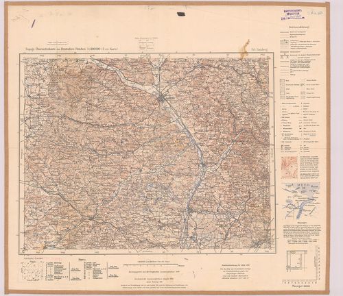
| Title | Topogr.[aphische] Übersichtskarte des Deutschen Reiches. Bamberg 153. |
| Main title | Németország: Bamberg környékének topográfiai áttekintő térképe 1940-ben. |
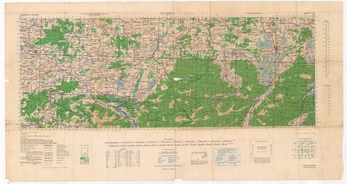
500. Germany. Salzburg Sheet N. 48. – Köln Sheet K. 51. [B IV a 1051]
Institute and Museum of Military History •
B IV a
•
B IV Német birodalom
•
B I–XV. Európa
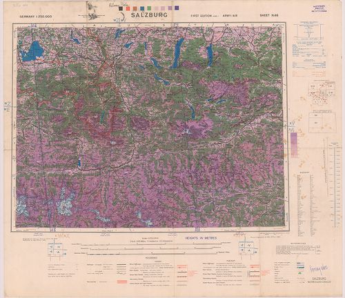
| Title | Germany. Salzburg Sheet N. 48. – Köln Sheet K. 51. |
| Main title | Németország: Salzburg (48.) és Köln (51) 1:250 000 ma. lapok. |