501. Germany. Salzburg. Sheet X–7, Wels. Sheet X–8. [B IV a 1052]
Institute and Museum of Military History •
B IV a
•
B IV Német birodalom
•
B I–XV. Európa
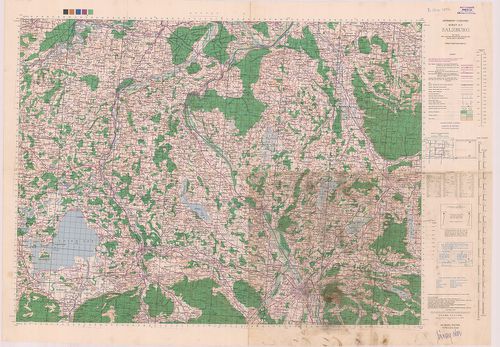
| Title | Germany. Salzburg. Sheet X–7, Wels. Sheet X–8. |
| Main title | Németország: Salzburg és Wels 1:100 000 ma. lapok. |
502. Germany. Nürnberg Sheet M 50, Pilsen Sheet N 50, Prag Sheet ... [B IV a 1053]
Institute and Museum of Military History •
B IV a
•
B IV Német birodalom
•
B I–XV. Európa
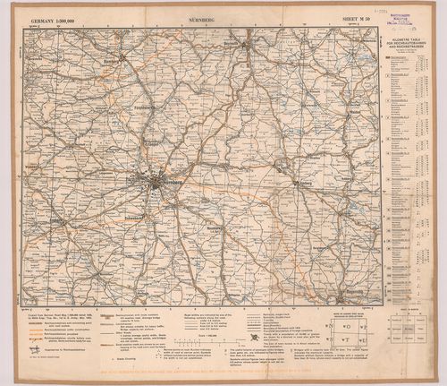
| Title | Germany. Nürnberg Sheet M 50, Pilsen Sheet N 50, Prag Sheet 0 50. |
| Main title | Németország: Nürnberg, Pilsen és Prága 1:300 000 ma. lapok. |
503. Übersichtskarte-Deutsches Reich. Westhälfte-Osthälfte. [B IV a 1054]
Institute and Museum of Military History •
B IV a
•
B IV Német birodalom
•
B I–XV. Európa
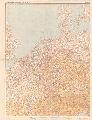
| Title | Übersichtskarte-Deutsches Reich. Westhälfte-Osthälfte. |
| Main title | A Német Birodalom térképe 1944-ben. |
504. Topographische Karte von Bayern. [B IV a 1055]
Institute and Museum of Military History •
B IV a
•
B IV Német birodalom
•
B I–XV. Európa
| Title | Topographische Karte von Bayern. |
505. Mansfeldiae Comitatus Descriptio. [B IV a 1056]
Institute and Museum of Military History •
B IV a
•
B IV Német birodalom
•
B I–XV. Európa
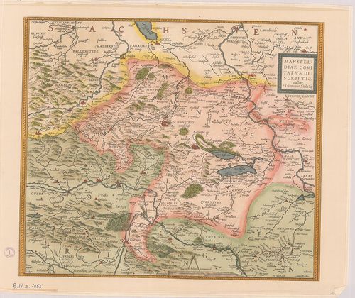
| Title | Mansfeldiae Comitatus Descriptio. |
| Main title | Mansfelt tartomány (Németo.) térképe a XVI. sz.-ból. |
506. Die Erste Landesaufnahme der Kurfürstentums Sachsen 1586–163... [B IV a 1057]
Institute and Museum of Military History •
B IV a
•
B IV Német birodalom
•
B I–XV. Európa
| Title | Die Erste Landesaufnahme der Kurfürstentums Sachsen 1586–1633. Tafel IX., X. |
| Main title | A Szász választófejedelemségek első felmérésének részlete. IX. X. tábla. 1586–1633-ból. |
507. Berlin. [B IV a 1058]
Institute and Museum of Military History •
B IV a
•
B IV Német birodalom
•
B I–XV. Európa
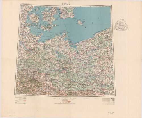
| Title | Berlin. |
508. Neu Hand- und Wandkarte des Deutschlen Reich und der nachbar... [B IV a 1059]
Institute and Museum of Military History •
B IV a
•
B IV Német birodalom
•
B I–XV. Európa
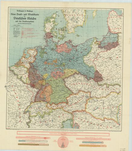
| Title | Neu Hand- und Wandkarte des Deutschlen Reich und der nachbargebirte … |
| Main title | A Német Birodalom és környezete a békeszerződések után 1919 júniusában. A határok tervezete. |
509. [Németország.] 1:50 000 ma. UTM sorozat 8 szelvénye. [B IV a 1060]
Institute and Museum of Military History •
B IV a
•
B IV Német birodalom
•
B I–XV. Európa
| Title | [Németország.] 1:50 000 ma. UTM sorozat 8 szelvénye. |
510. [Németország.] 1:100 000 ma. UTM sorozat 12 szelvénye. [B IV a 1061]
Institute and Museum of Military History •
B IV a
•
B IV Német birodalom
•
B I–XV. Európa
| Title | [Németország.] 1:100 000 ma. UTM sorozat 12 szelvénye. |
511. Das Deutsche Reich nach dem Pressburger Frieden. [B IV a 1062]
Institute and Museum of Military History •
B IV a
•
B IV Német birodalom
•
B I–XV. Európa
| Title | Das Deutsche Reich nach dem Pressburger Frieden. |
| Main title | A Német Birodalom térképe a Pozsonyi béke után (1805). |
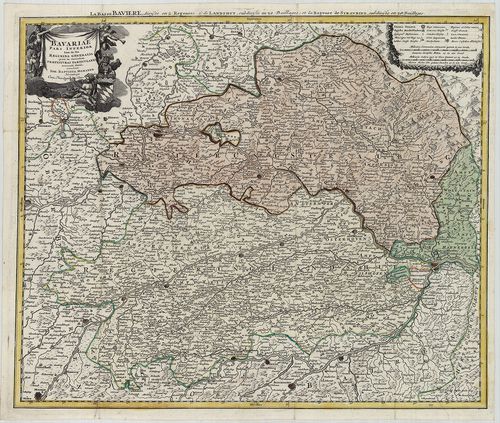
512. Bavariae… [B IV a 1063]
Institute and Museum of Military History •
B IV a
•
B IV Német birodalom
•
B I–XV. Európa
| Title | Bavariae… |
| Main title | Bajorország térképe. |
513. Topographische Karte (Bajoro., Baden-Württemberg) [B IV a 1064]
Institute and Museum of Military History •
B IV a
•
B IV Német birodalom
•
B I–XV. Európa
| Title | Topographische Karte (Bajoro., Baden-Württemberg) |
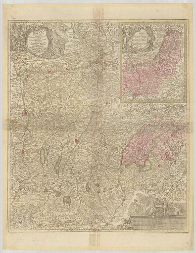
514. Bavariae Pars Inferior tam in sua Regimina Generalia quam in... [B IV a 1066]
Institute and Museum of Military History •
B IV a
•
B IV Német birodalom
•
B I–XV. Európa
| Title | Bavariae Pars Inferior tam in sua Regimina Generalia quam in eorundem Praefecturas Particulares… |
| Main title | Bajorország térképe (Straubing és Landhut, német kormányzóságok) a 18. században. |
515. Central Europe. U 1 szelvény. [B IV a 1067]
Institute and Museum of Military History •
B IV a
•
B IV Német birodalom
•
B I–XV. Európa
| Title | Central Europe. U 1 szelvény. |
| Main title | Közép-Európa, angol háborús térkép 1 szelvénye. |