441. General Map. Bavaria. [B IV a 927]
Institute and Museum of Military History •
B IV a
•
B IV Német birodalom
•
B I–XV. Európa
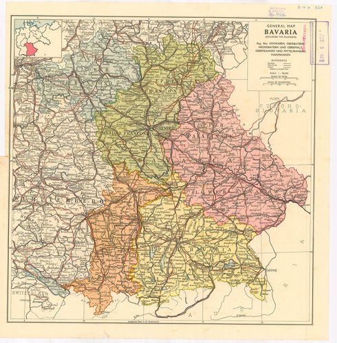
| Title | General Map. Bavaria. |
| Main title | Bajorország általános térképe 1920 után. |
442. Niemiecka Republika Demokratyczna. – Niemiecka Republika Fed... [B IV a 928]
Institute and Museum of Military History •
B IV a
•
B IV Német birodalom
•
B I–XV. Európa
| Title | Niemiecka Republika Demokratyczna. – Niemiecka Republika Federalna. Mapa przegładowa Europy. |
| Main title | Mt.: Berlin. |
| Subject | A Német Demokratikus Köztársaság és a Német Szövetségi Köztársaság hegyvízrajzi térképe 1963-ban. |
443. Niemcy. Mapa przeglądowa Europy. [B IV a 928/1]
Institute and Museum of Military History •
B IV a
•
B IV Német birodalom
•
B I–XV. Európa
| Title | Niemcy. Mapa przeglądowa Europy. |
| Main title | Mt.: Berlin |
| Subject | 3 térk. 1. Mapa Bogactw Mineralnych. (Ásványi lelőhelyek.) 2. Mapa przemysłu. (Az ipar.) 3. Mapa Rolnictwa. (Mezőgazdaság.)Németország hegyvízrajzi térképe 1959-ben. |
444. Germanszkaja Demokraticseszkaja Reszpublika. [B IV a 929]
Institute and Museum of Military History •
B IV a
•
B IV Német birodalom
•
B I–XV. Európa
| Title | Germanszkaja Demokraticseszkaja Reszpublika. |
| Main title | Moszkva, 1964. GUGK. |
| Subject | 3 Mt.: 1. Promüslennoszt’ (Ipar) 2. Szel’szkoe hozjajsztvo. (Mezőgazdaság) 3. Berlin. |
445. Németország. [B IV a 930]
Institute and Museum of Military History •
B IV a
•
B IV Német birodalom
•
B I–XV. Európa
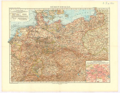
| Title | Németország. |
| Main title | Mt.: Berlin és környéke. |
446. Germany and its approaches… – Occupation Zones Germany and A... [B IV a 931]
Institute and Museum of Military History •
B IV a
•
B IV Német birodalom
•
B I–XV. Európa
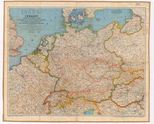
| Title | Germany and its approaches… – Occupation Zones Germany and Austria. |
| Main title | Németország: megszállási zónák 1945-ből. |
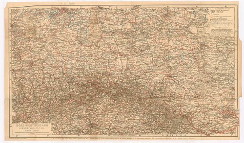
447. Nord und Mittelbayern. [B IV a 958]
Institute and Museum of Military History •
B IV a
•
B IV Német birodalom
•
B I–XV. Európa
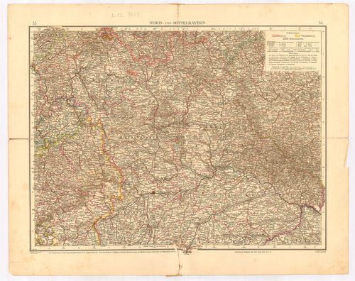
| Title | Nord und Mittelbayern. |
| Main title | Észak- és Közép-Bajorország térképe. |
448. Nordwest-Deutschland. [B IV a 959]
Institute and Museum of Military History •
B IV a
•
B IV Német birodalom
•
B I–XV. Európa
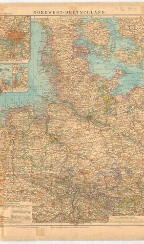
| Title | Nordwest-Deutschland. |
| Main title | 5 mt.: 1. Umgebung von Hamburg. (Hamburg és környéke.) 2. Helgoland. (Helgoland porosz sziget térképe.) 3. Bremer-Haven–Lehe város térkép. 4. Cux Haven várostérkép. 5. Der Kieler Hafen (Kiel kikötő.) |
| Subject | Németország ÉNY-i részének térképe. |
449. Nordwest-Deutschland. (Nordwestlicher Teil.) [B IV a 960]
Institute and Museum of Military History •
B IV a
•
B IV Német birodalom
•
B I–XV. Európa
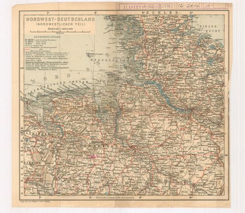
| Title | Nordwest-Deutschland. (Nordwestlicher Teil.) |
| Main title | Németország ÉNY-i részének térképe. |
450. Südost-Deutschland. [B IV a 961]
Institute and Museum of Military History •
B IV a
•
B IV Német birodalom
•
B I–XV. Európa
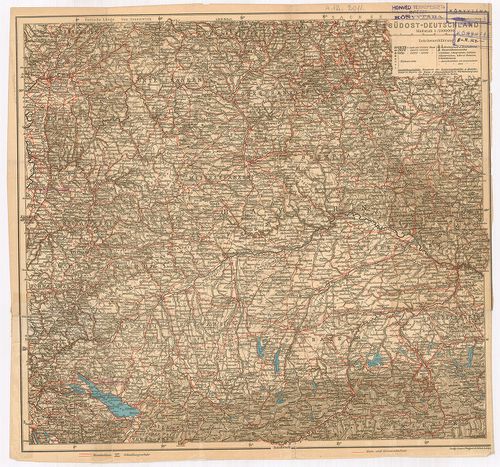
| Title | Südost-Deutschland. |
| Main title | Németország DK-i részének térképe (Bajorország). |
451. Mittel-Deutschland. [B IV a 964]
Institute and Museum of Military History •
B IV a
•
B IV Német birodalom
•
B I–XV. Európa
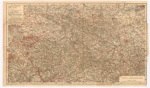
| Title | Mittel-Deutschland. |
| Main title | Közép-Németország térképe. |
452. Nord-Deutschland. (Südostlicher Teil) [B IV a 965]
Institute and Museum of Military History •
B IV a
•
B IV Német birodalom
•
B I–XV. Európa
| Title | Nord-Deutschland. (Südostlicher Teil) |
| Main title | Észak-Németország térképe. |
453. Karte der Fränkischen Schweiz. [B IV a 966]
Institute and Museum of Military History •
B IV a
•
B IV Német birodalom
•
B I–XV. Európa
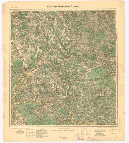
| Title | Karte der Fränkischen Schweiz. |
| Main title | Frank-Svájc térképe 1933-ban. |
454. Topographische Übersichtskarte von Südwestdeutschland in 6 B... [B IV a 967]
Institute and Museum of Military History •
B IV a
•
B IV Német birodalom
•
B I–XV. Európa
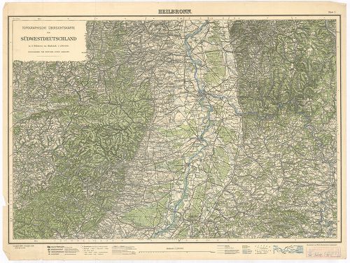
| Title | Topographische Übersichtskarte von Südwestdeutschland in 6 Blättern. Blatt I. Heilbronn. Blatt II. Hall. Blatt III. Stuttgart. |
| Main title | Németország DNY-i részének topográfiai térképe 1925–1928-ban. |
455. Füssen, Germany. [B IV a 968]
Institute and Museum of Military History •
B IV a
•
B IV Német birodalom
•
B I–XV. Európa
| Title | Füssen, Germany. |
| Main title | Németország: Füssen és környékének (Bajor Alpok) térképe 1943-ban. |
456. Standortkarte von Deggendorf. [B IV a 969]
Institute and Museum of Military History •
B IV a
•
B IV Német birodalom
•
B I–XV. Európa
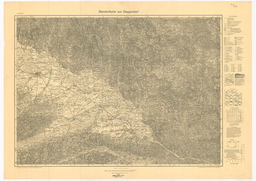
| Title | Standortkarte von Deggendorf. |
| Main title | Deggendorf és környékének topográfiai térképe 1934-ben. |
457. Karte der Pfalz. [B IV a 970]
Institute and Museum of Military History •
B IV a
•
B IV Német birodalom
•
B I–XV. Európa
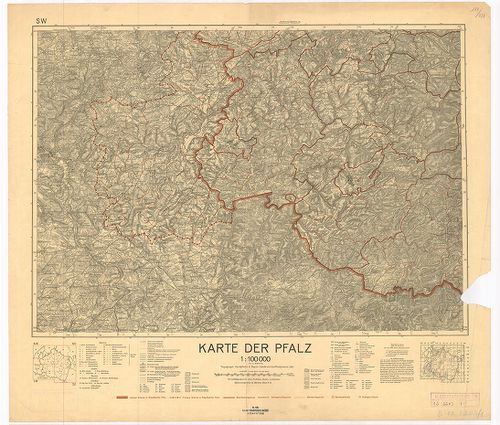
| Title | Karte der Pfalz. |
| Main title | Pfalz kerület térképe 1935-ben az akkori határ kijelölésével. |
458. Deutschland. [B IV a 974]
Institute and Museum of Military History •
B IV a
•
B IV Német birodalom
•
B I–XV. Európa
| Title | Deutschland. |
| Main title | Németország térképe 1953-ban. |
459. Deutsche Demokratische Republik. [B IV a 975]
Institute and Museum of Military History •
B IV a
•
B IV Német birodalom
•
B I–XV. Európa
| Title | Deutsche Demokratische Republik. |
| Main title | Mt.: [N. D. K. tartományok térképe.] |
| Subject | A Német Demokratikus Köztársaság térképe 1953-ban. |
460. Deutsche Demokratische Republik und Westdeutschland. [B IV a 977/1]
Institute and Museum of Military History •
B IV a
•
B IV Német birodalom
•
B I–XV. Európa
| Title | Deutsche Demokratische Republik und Westdeutschland. |
| Main title | A Német Demokratikus Köztársaság és Nyugat-Németország általános térképe úthálózattal 1965-ben. |