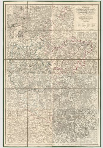
301. Geometrische Karte über das ober Amt Zweybrücken nebst dem d... [B IV a 489]
Institute and Museum of Military History •
B IV a
•
B IV Német birodalom
•
B I–XV. Európa
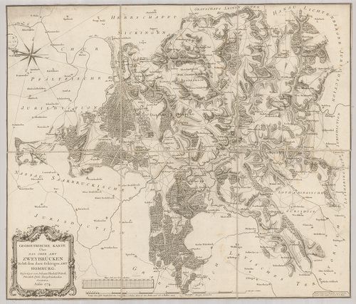
| Title | Geometrische Karte über das ober Amt Zweybrücken nebst dem dazu gehörigen Amt Homburg. |
| Main title | Zweibrücken és Homburg környékének felmérési térképe 1774-ben. |
302. Die bayerische Pfalz. [B IV a 493]
Institute and Museum of Military History •
B IV a
•
B IV Német birodalom
•
B I–XV. Európa
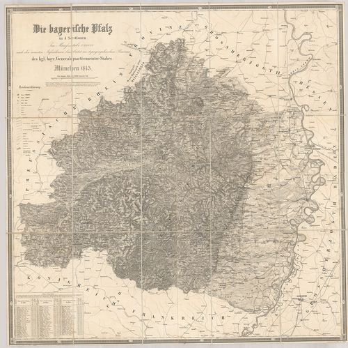
| Title | Die bayerische Pfalz. |
| Main title | A bajor Pfalz tartomány térképe 1845-ben. |
303. Die Bayerische Pfalz. [B IV a 494]
Institute and Museum of Military History •
B IV a
•
B IV Német birodalom
•
B I–XV. Európa
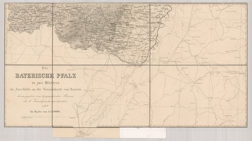
| Title | Die Bayerische Pfalz. |
| Main title | A bajor Pfalz tartomány térképe 1862-ben. |
304. Tractus Nordligensis Germ. Ries dicti accurata Descritpio ad... [B IV a 497]
Institute and Museum of Military History •
B IV a
•
B IV Német birodalom
•
B I–XV. Európa
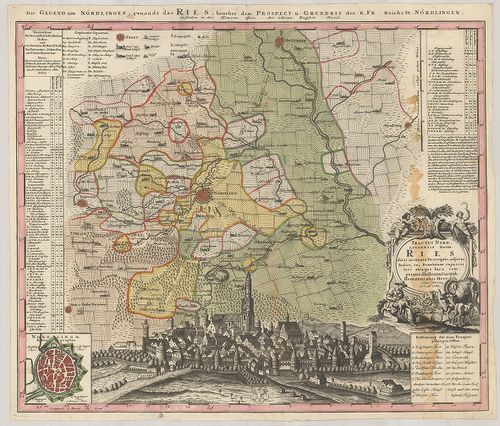
| Title | Tractus Nordligensis Germ. Ries dicti accurata Descritpio adjecto Indice, cui Dominium cujus vis loci aliaque Iura competant illustrata Curatib. |
| Main title | Mt.: Nordlingae Ichonographia. (Nördlingen város térképe.) A térkép alján Nördlingen város látképe.Nördlingen környékének térképe 1738-ban. |
305. Topographische Karte der Gegend zwischen der Donau, Abens, u... [B IV a 521/1]
Institute and Museum of Military History •
B IV a
•
B IV Német birodalom
•
B I–XV. Európa
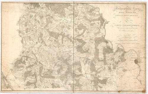
| Title | Topographische Karte der Gegend zwischen der Donau, Abens, und Iser. – Carte Topographique du Pays Entre le Danube, l’Abens, et l’Iser. |
| Main title | A Duna–Abens–Isar közötti terület topográfiai térképe 1811-ben. |
306. Geographische Abbildvng des gantzen Umfangs der Marggrafscha... [B IV a 522]
Institute and Museum of Military History •
B IV a
•
B IV Német birodalom
•
B I–XV. Európa
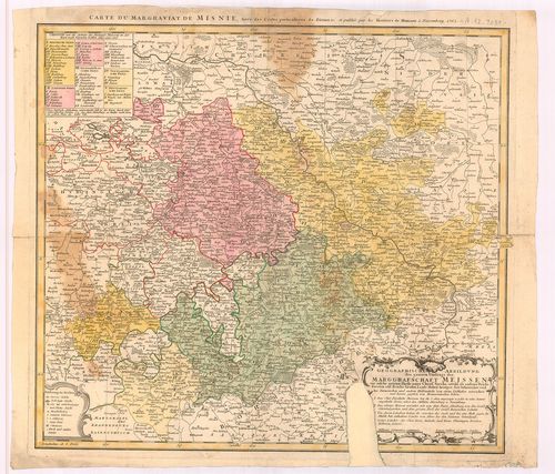
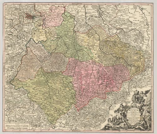
| Title | Geographische Abbildvng des gantzen Umfangs der Marggrafschaft Meissen… |
| Main title | A Meissen-i őrgrófság általános térképe 1762-ban. |
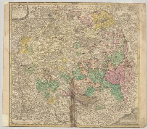
307. Circuli Supe Saxoniae… [B IV a 523]
Institute and Museum of Military History •
B IV a
•
B IV Német birodalom
•
B I–XV. Európa
| Title | Circuli Supe Saxoniae… |
| Main title | Szászország térképe 1757-ben. |
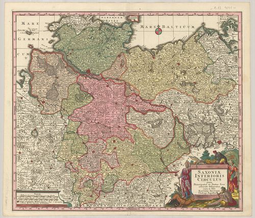
308. Saxoniae Inferioris Circulus, exhibens Ducatus Brunswic, Lün... [B IV a 524]
Institute and Museum of Military History •
B IV a
•
B IV Német birodalom
•
B I–XV. Európa
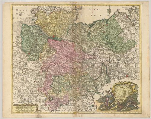
| Title | Saxoniae Inferioris Circulus, exhibens Ducatus Brunswic, Lüneburg, Magdeburg, Bremens, Mechlinoburg et Holsat… |
| Main title | Alsó-Szászország tartományainak: Braunschweig, Lüneburg, Magdeburg, Bréma, Mecklenburg és Holstein hercegség térképe 1761-ben. |
309. Saxonia Superiore. [B IV a 525]
Institute and Museum of Military History •
B IV a
•
B IV Német birodalom
•
B I–XV. Európa
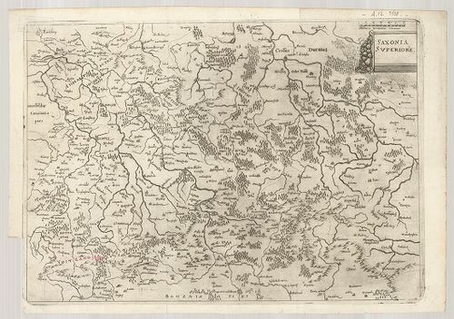
| Title | Saxonia Superiore. |
| Main title | Felső-Szászország térképe. |
310. Der Ober Saechsische Kreis zum Gebrauche der Oesterreichisch... [B IV a 526]
Institute and Museum of Military History •
B IV a
•
B IV Német birodalom
•
B I–XV. Európa
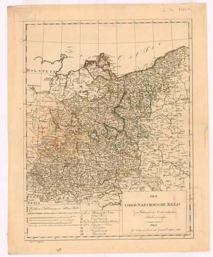
| Title | Der Ober Saechsische Kreis zum Gebrauche der Oesterreichischen Schulen entworfen. |
| Main title | Felső-Szászország térképe 1806-ban. |
311. Saxoniae Superioris, Praesertim Elektoralis Circulus, cum ad... [B IV a 527]
Institute and Museum of Military History •
B IV a
•
B IV Német birodalom
•
B I–XV. Európa
| Title | Saxoniae Superioris, Praesertim Elektoralis Circulus, cum adjacentibus, Ducatibus et Provinciis… |
| Main title | Felső-Szászország: tartományok, hercegségek térképe 1758-ban. |
312. Comitatus Schoenburgensis… [B IV a 528]
Institute and Museum of Military History •
B IV a
•
B IV Német birodalom
•
B I–XV. Európa
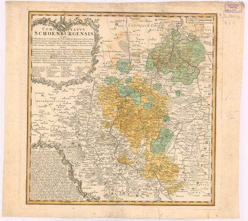
| Title | Comitatus Schoenburgensis… |
| Main title | Schönburg grófság térképe 1760-ban. |
313. Saxoniae Inferioris Circulus juxta Principatus et Status suo... [B IV a 529]
Institute and Museum of Military History •
B IV a
•
B IV Német birodalom
•
B I–XV. Európa
| Title | Saxoniae Inferioris Circulus juxta Principatus et Status suos Accurate delineatus cura et stilo… |
314. Mappa Geographica Circuli Metalliferi Electoratus Saxoniae c... [B IV a 574]
Institute and Museum of Military History •
B IV a
•
B IV Német birodalom
•
B I–XV. Európa
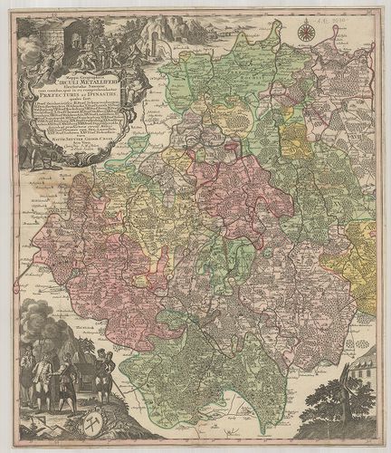
| Title | Mappa Geographica Circuli Metalliferi Electoratus Saxoniae cum imnibus quae in eo comprehenduntur Praefecturis et Dynastiis… |
| Main title | A Szász választófejedelemség bányavidékének földrajzi térképe. |
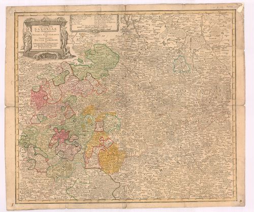
315. Landgraviatus Thuringiae juxta recentiss. designation: in su... [B IV a 576]
Institute and Museum of Military History •
B IV a
•
B IV Német birodalom
•
B I–XV. Európa
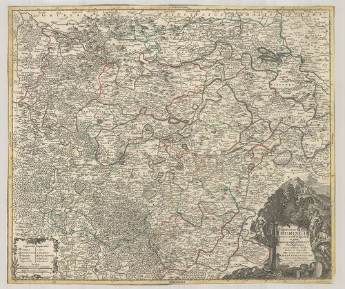
| Title | Landgraviatus Thuringiae juxta recentiss. designation: in suos Principatus Status, et Praefecturas accuratissime divisus… |
| Main title | A Thüringia-i őrgrófság térképe. |
316. Neue und accurate Landkarte des Mittätig-Ober-Sachsischen K.... [B IV a 578]
Institute and Museum of Military History •
B IV a
•
B IV Német birodalom
•
B I–XV. Európa
| Title | Neue und accurate Landkarte des Mittätig-Ober-Sachsischen K. Reichs Crenss. Begreiffend das Chur Herzogthum Sachsen, Marggrafthum Meissen, und die Landgrafschafft Thüringen. |
| Main title | Felső-Szászország - a Szász hercegség, Meissen és Thüringiai őrgrófság térképe. |
317. Karte von Königreiche Sachsen… [B IV a 580]
Institute and Museum of Military History •
B IV a
•
B IV Német birodalom
•
B I–XV. Európa

| Title | Karte von Königreiche Sachsen… |
| Main title | A Szász Királyság térképe 1833-ban. |
318. Das Königreich Sachsen und seine Umlande. [B IV a 581]
Institute and Museum of Military History •
B IV a
•
B IV Német birodalom
•
B I–XV. Európa
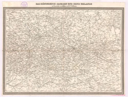
| Title | Das Königreich Sachsen und seine Umlande. |
| Main title | A Szász Királyság és környékének térképe úthálózattal. |
319. Marchionatus Misniae primaria Elector. Saxoniae Provincia, i... [B IV a 581/2]
Institute and Museum of Military History •
B IV a
•
B IV Német birodalom
•
B I–XV. Európa
| Title | Marchionatus Misniae primaria Elector. Saxoniae Provincia, in Circulus suos subdivisus Accedit… |
| Main title | A Szász választófejedelemség Meissen őrgrófságának térképe. |
320. Das Koenigreich Sachsen. [B IV a 582]
Institute and Museum of Military History •
B IV a
•
B IV Német birodalom
•
B I–XV. Európa
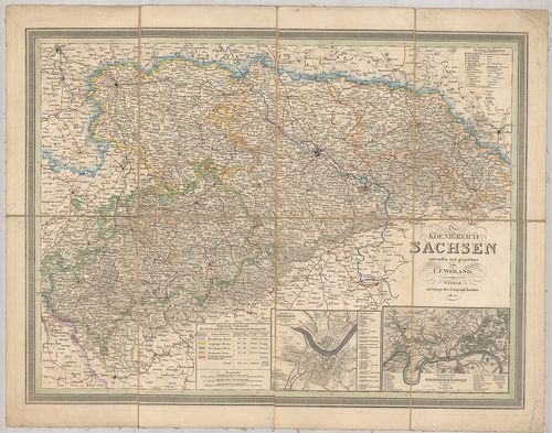
| Title | Das Koenigreich Sachsen. |
| Main title | 2 mt.: 1. Grundriss von Dresden. (Drezda és környéke.) 2. Der besuchteste Theil Sächsischen Schweiz. (Részlet a Szász-Svájcról.)A Szász Királyság térképe 1844-ben. |
321. Gantz neue und vollstaendige Geographische General-Charte vo... [B IV a 589/2]
Institute and Museum of Military History •
B IV a
•
B IV Német birodalom
•
B I–XV. Európa
| Title | Gantz neue und vollstaendige Geographische General-Charte vom Gantzen Churfürstenthum Sachsen mit allen einverleibten dazu gehörigen Marggraffthümern, Fürstenthümern, Grafschafften… |
| Main title | Szászország általános földrajzi térképe úthálózattal, postaállomások jelölésével 1763-ban. |
322. Grossherzoglich-Herzoglich Sächsische Länder nebst den Fürst... [B IV a 590]
Institute and Museum of Military History •
B IV a
•
B IV Német birodalom
•
B I–XV. Európa
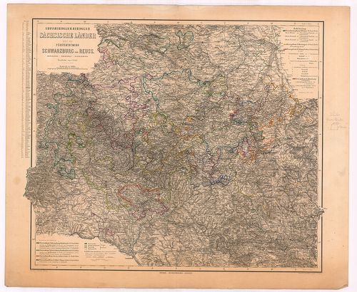
| Title | Grossherzoglich-Herzoglich Sächsische Länder nebst den Fürstenthümern Schwarzburg und Reuss. |
| Main title | A Szász nagyhercegség, Schwarzburg és Reuss hercegségek térképe. |
323. Charte vom Nieder-Saechsischen Kreise [B IV a 591]
Institute and Museum of Military History •
B IV a
•
B IV Német birodalom
•
B I–XV. Európa
| Title | Charte vom Nieder-Saechsischen Kreise |
| Main title | Alsó-Szászország térképe 1806-ban. |
324. Topographisch-militairischer Atlas von dem Königreiche Sachs... [B IV a 592]
Institute and Museum of Military History •
B IV a
•
B IV Német birodalom
•
B I–XV. Európa
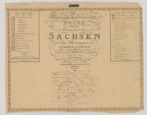
| Title | Topographisch-militairischer Atlas von dem Königreiche Sachsen… |
| Main title | Szászország katonai-topográfiai atlasza 1812-ben kerületi beosztással. |
325. Topographischer Atlas des Koenigreiches Sachsen. [B IV a 594]
Institute and Museum of Military History •
B IV a
•
B IV Német birodalom
•
B I–XV. Európa
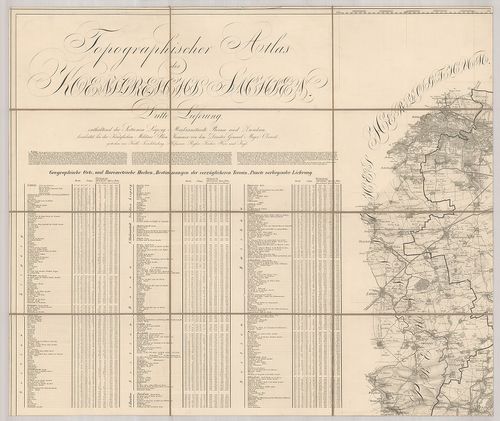
| Title | Topographischer Atlas des Koenigreiches Sachsen. |
| Main title | Szászország topográfiai atlasza 1835-ben. |
326. Topographischer Atlas des Königreiches Sachsen. [B IV a 594/1]
Institute and Museum of Military History •
B IV a
•
B IV Német birodalom
•
B I–XV. Európa
| Title | Topographischer Atlas des Königreiches Sachsen. |
| Main title | Szászország topográfiai atlasza 1835-ben. |
327. Charte des Koenigreichs Sachsen und der angrenzenden Laender... [B IV a 595]
Institute and Museum of Military History •
B IV a
•
B IV Német birodalom
•
B I–XV. Európa
| Title | Charte des Koenigreichs Sachsen und der angrenzenden Laenderabteilungen. |
| Main title | Szászország térképe. |
328. Topographisch-Orographische Spezial-Karte des Königreiches S... [B IV a 596]
Institute and Museum of Military History •
B IV a
•
B IV Német birodalom
•
B I–XV. Európa
| Title | Topographisch-Orographische Spezial-Karte des Königreiches Sachsen. |
| Main title | Mt.: Üebersichtskarte der vorzüglichsten Höhen- und Thalpunkte des Königreiches Sachsen. (Szászország hegyeinek és völgyeinek áttekintő térképe.) |
| Subject | Szászország topográfiai-hegyrajzi részletes térképe. |
329. Topographische Karte vom Koenigreich Sachsen. [B IV a 597]
Institute and Museum of Military History •
B IV a
•
B IV Német birodalom
•
B I–XV. Európa
| Title | Topographische Karte vom Koenigreich Sachsen. |
| Main title | Szászország topográfiai térképe 1863-ban. |
330. Ortskarte vom Koenigreich Sachsen. [B IV a 597/1]
Institute and Museum of Military History •
B IV a
•
B IV Német birodalom
•
B I–XV. Európa
| Title | Ortskarte vom Koenigreich Sachsen. |
| Main title | Szászország településeinek térképe 1863-ban. |
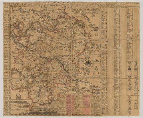
331. Totius Marchionatus Lusatiae tam superioris quam inferioris ... [B IV a 599]
Institute and Museum of Military History •
B IV a
•
B IV Német birodalom
•
B I–XV. Európa
| Title | Totius Marchionatus Lusatiae tam superioris quam inferioris Tabula specialis in suos Comitatus et Dominatus… |
| Main title | Lausitz őrgrófság térképe. |
332. Geograph. Delineation des zu denen Kuhr Saechsischen Landen ... [B IV a 601]
Institute and Museum of Military History •
B IV a
•
B IV Német birodalom
•
B I–XV. Európa
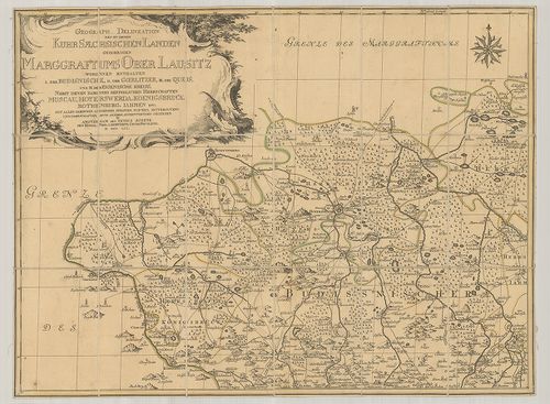
| Title | Geograph. Delineation des zu denen Kuhr Saechsischen Landen gehoerigen Marggrafthums Ober Lausitz… |
| Main title | Felső-Lausitz földrajzi térképe 1759-ben. |
333. Accurate Geographische Delineation der Dioeces und des Ammte... [B IV a 603]
Institute and Museum of Military History •
B IV a
•
B IV Német birodalom
•
B I–XV. Európa
| Title | Accurate Geographische Delineation der Dioeces und des Ammtes Dresden… |
| Main title | 1. Alt-Dresden. 2. Neu-Dreden. (Régi és Új-Drezda) látképe.Drezda és környékének földrajzi térképe. |
334. Situations Charte der Gegend zwischen Dresden und Freyberg b... [B IV a 613]
Institute and Museum of Military History •
B IV a
•
B IV Német birodalom
•
B I–XV. Európa
| Title | Situations Charte der Gegend zwischen Dresden und Freyberg bis zur Boehmischen Graentze. |
| Main title | Drezda és Freiberg közötti terület általános térképe a cseh határig. |
335. [Meissen környékének kéziratos térképe "a la vue Aufnahme".] [B IV a 624]
Institute and Museum of Military History •
B IV a
•
B IV Német birodalom
•
B I–XV. Európa
| Title | [Meissen környékének kéziratos térképe "a la vue Aufnahme".] |
336. Basse Partie de l’Evesché de Munster, et le Comté de Benthem... [B IV a 625]
Institute and Museum of Military History •
B IV a
•
B IV Német birodalom
•
B I–XV. Európa
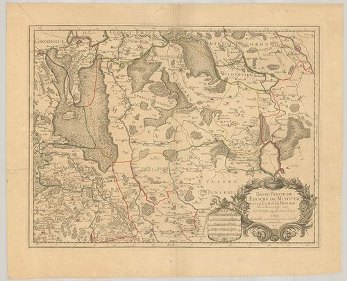
| Title | Basse Partie de l’Evesché de Munster, et le Comté de Benthem. |
| Main title | A Münster-i püspökség és a Bentheim grófság általános térképe. |
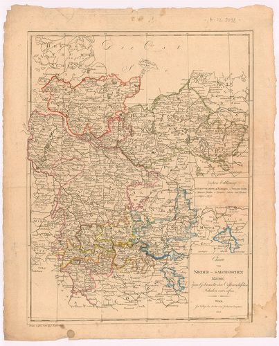
337. Haute Partie de l’Evesché de Munster subdivisé en ses princi... [B IV a 626]
Institute and Museum of Military History •
B IV a
•
B IV Német birodalom
•
B I–XV. Európa
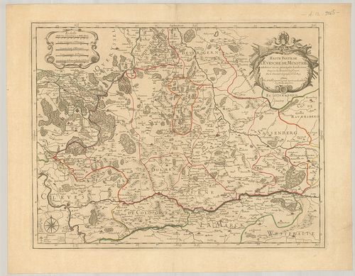
| Title | Haute Partie de l’Evesché de Munster subdivisé en ses principales Iuridictions. |
| Main title | A Münster-i püspökség északi részének térképe. |
338. Principatvs Silesiae Mvnsterbergensis exactissima Tabula Geo... [B IV a 627]
Institute and Museum of Military History •
B IV a
•
B IV Német birodalom
•
B I–XV. Európa
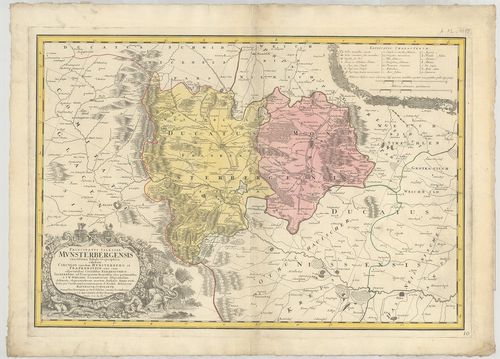
| Title | Principatvs Silesiae Mvnsterbergensis exactissima Tabula Geographica exhibens Circvlos ejus dem Mvnsterberg et Frankenstein… |
| Main title | Ziebice és Zabkowice Šlaskie porosz kerületek térképe 1736-ban. |
339. Topographische Karte der Gegend von Hohnstein und Schandau, ... [B IV a 630/1]
Institute and Museum of Military History •
B IV a
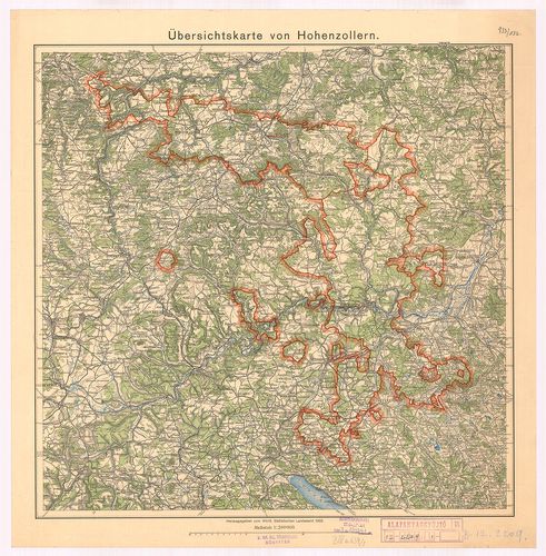
•
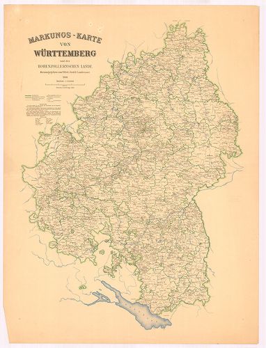
B IV Német birodalom
•
B I–XV. Európa
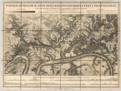
| Title | Topographische Karte der Gegend von Hohnstein und Schandau, oder des besuchtesten Theiles der sogenannten saechsischen Schweiz. 1823–1826. |
| Main title | A Szász-Svájc vidéke, Hohnstein és Schandau közötti terület. |
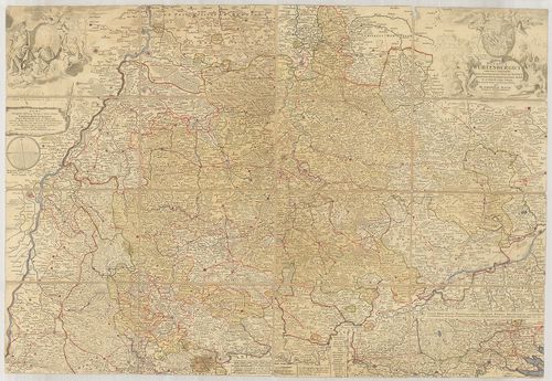
340. Ducatus Wurtenbergici cum Locis limitaneis, utpote maxima pa... [B IV a 632/2]
Institute and Museum of Military History •
B IV a
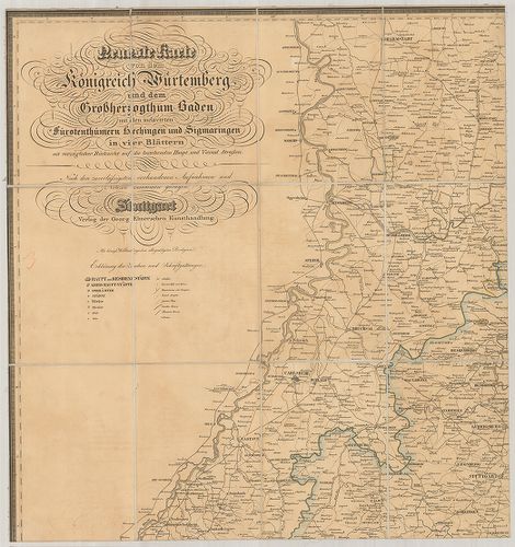
•
B IV Német birodalom
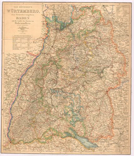
•
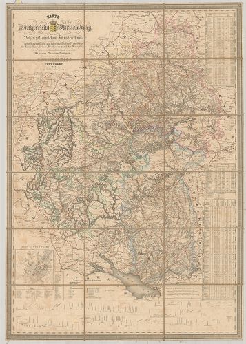
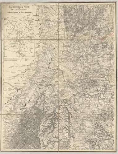
B I–XV. Európa
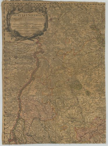
| Title | Ducatus Wurtenbergici cum Locis limitaneis, utpote maxima parte Circuli Suevici praefertim Utroqu Marchionatu Badn si et Sylva vulgo Nigra… |
| Main title | Mt.: Sylvae Herciniae sive martiae pars superior, olim dicta Eremus Helvatiorum… (Hercinia erdős vidék térképe.)A Württemberg hercegség térképe 1710-ben. |
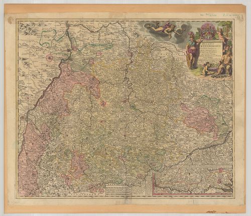
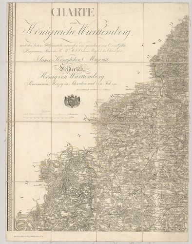
341. Ducatus Würtenbergici cum Locis limitaneis utpote maxima par... [B IV a 632/3]
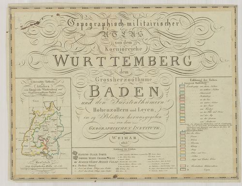
Institute and Museum of Military History •
B IV a
•
B IV Német birodalom
•
B I–XV. Európa
| Title | Ducatus Würtenbergici cum Locis limitaneis utpote maxima parte Circuli Suevici praefertim utraqu marchion: Bandesi et Sylva Vulgo Nigra… |
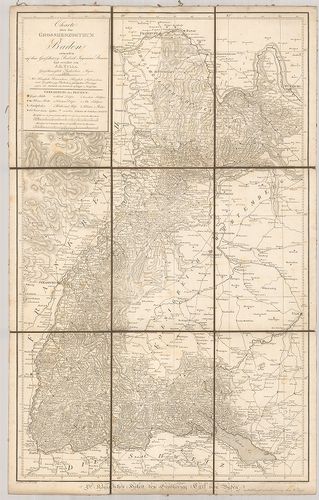
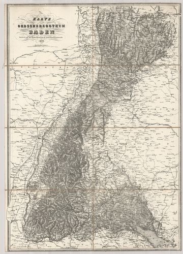
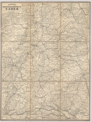
| Main title | Mt.: Sylvae Herciniae siue Martiae pars superior, olin dicta Eremus Helvetiorum… (Hercinia erdős vidék térképe.)A Württemberg hercegség térképe 1710-ben. |
342. Geographica Provinciarvm Sveviae Descriptio Schwaben, in XXV... [B IV a 633]
Institute and Museum of Military History •
B IV a
•
B IV Német birodalom
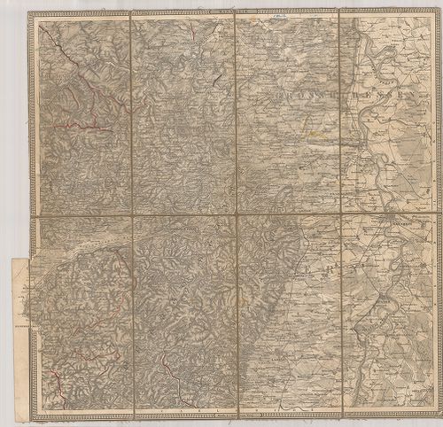
•
B I–XV. Európa
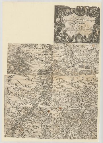
| Title | Geographica Provinciarvm Sveviae Descriptio Schwaben, in XXVIII übereintreffenden Tabellen vorgestellet. |
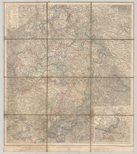
| Main title | A Svábföld földrajzi térképe 1629 körül. |
343. Übersichtskarte von Württemberg und Hohenzollern. Ötszínnel ... [B IV a 634]
Institute and Museum of Military History •
B IV a
•
B IV Német birodalom
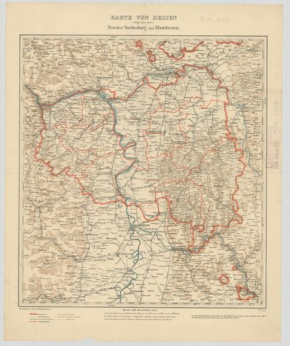
•
B I–XV. Európa
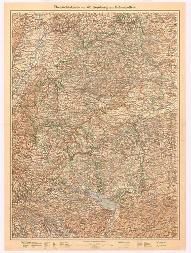
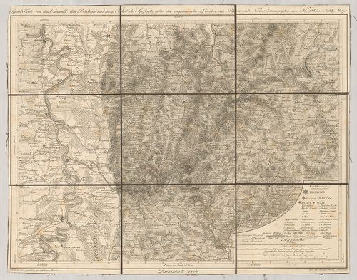
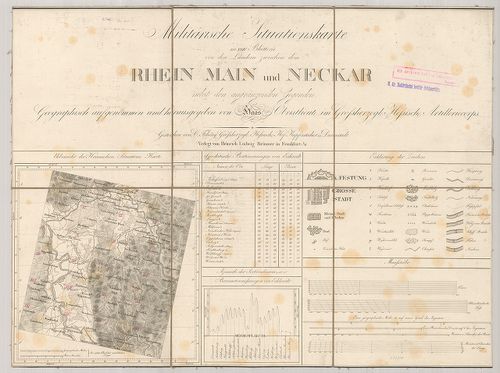
| Title | Übersichtskarte von Württemberg und Hohenzollern. Ötszínnel nyomott II. kiad. (I. kiad. 1885.) |
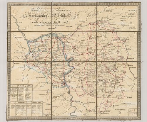
| Main title | Württemberg és Hohenzollern tartományok áttekintő térképe 1928-ban. |
344. Übersichtskarte von Hohenzollern. [B IV a 634/1]
Institute and Museum of Military History •
B IV a
•
B IV Német birodalom
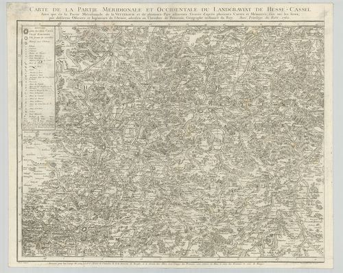
•
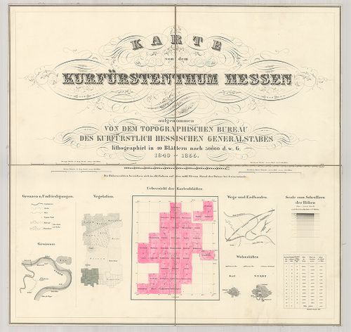
B I–XV. Európa
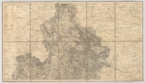
| Title | Übersichtskarte von Hohenzollern. |
| Main title | Hohenzollern tartomány áttekintő térképe 1932-ben. |
345. Markungs-Karte von Württemberg und der Hohenzollernschen Lan... [B IV a 634/2]
Institute and Museum of Military History •
B IV a
•
B IV Német birodalom
•
B I–XV. Európa
| Title | Markungs-Karte von Württemberg und der Hohenzollernschen Lande. |
| Main title | Württemberg és Hohenzollern terület térképe 1930-ban. |
346. Per Inclyti Circuli Suevici… [B IV a 635]
Institute and Museum of Military History •
B IV a
•
B IV Német birodalom
•
B I–XV. Európa
| Title | Per Inclyti Circuli Suevici… |
| Main title | Svábföld térképe. |
347. Circulus Svevicus, Cum Incorporatis et Adjacentibus Regionib... [B IV a 636]
Institute and Museum of Military History •
B IV a
•
B IV Német birodalom
•
B I–XV. Európa
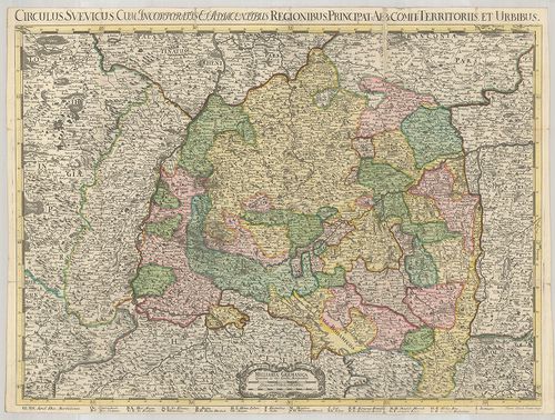
| Title | Circulus Svevicus, Cum Incorporatis et Adjacentibus Regionibus, Principat: Abb. Comit. Territoriis et urbius. |
| Main title | A Svábföld térképe 1704-ben. |
348. Circuli Sveviae. – Le Cercle de Svabe. [B IV a 637]
Institute and Museum of Military History •
B IV a
•
B IV Német birodalom
•
B I–XV. Európa
| Title | Circuli Sveviae. – Le Cercle de Svabe. |
| Main title | A Svábföldi hercegségek térképe 1743-ban. |
349. Croquis de Carte Militaire de la Souabe. [B IV a 638]
Institute and Museum of Military History •
B IV a
•
B IV Német birodalom
•
B I–XV. Európa
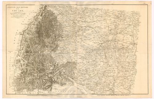
| Title | Croquis de Carte Militaire de la Souabe. |
| Main title | A Svábföld térképe. |
350. Charte von Schwaben und den angränzenden Ländern… [B IV a 640]
Institute and Museum of Military History •
B IV a
•
B IV Német birodalom
•
B I–XV. Európa
| Title | Charte von Schwaben und den angränzenden Ländern… |
| Main title | A Svábföld térképe 1803-ban. |
351. Charte von Schwaben mit allen Städten Marktfleken und Pfarrd... [B IV a 641]
Institute and Museum of Military History •
B IV a
•
B IV Német birodalom
•
B I–XV. Európa
| Title | Charte von Schwaben mit allen Städten Marktfleken und Pfarrdörfern, Chausseen, Flüssen, Bächen und der mahligen Gränzen. |
| Main title | A Svábföld térképe 1803-ban. |
352. Il circolo di Svevia et il landgraviato D’Alsazia. [B IV a 652]
Institute and Museum of Military History •
B IV a
•
B IV Német birodalom
•
B I–XV. Európa
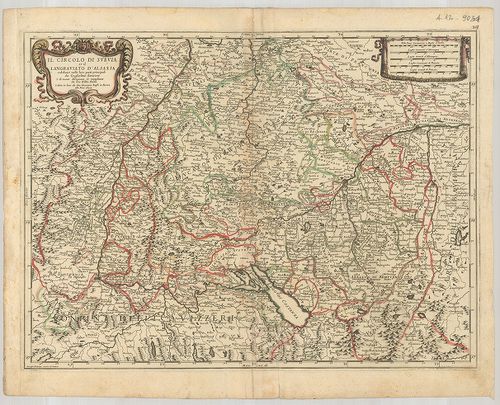
| Title | Il circolo di Svevia et il landgraviato D’Alsazia. |
| Main title | A Svábföld és Elszász térképe 1678-ban. |
353. Neueste Karte von dem Koenigreich Wuertemberg und dem Grossh... [B IV a 653]
Institute and Museum of Military History •
B IV a
•
B IV Német birodalom
•
B I–XV. Európa
| Title | Neueste Karte von dem Koenigreich Wuertemberg und dem Grossherzogthum Baden mit den inclavirten Fürstenthümern Hechingen und Sigmaringen… |
| Main title | A Württemberg-i Királyság, Badeni nagyhercegség, Hechingen és Sigmaringen hercegségek térképe úthálózattal. |
354. Karte des Königreichs Württemberg und der Hohenzollern’schen... [B IV a 654]
Institute and Museum of Military History •
B IV a
•
B IV Német birodalom
•
B I–XV. Európa
| Title | Karte des Königreichs Württemberg und der Hohenzollern’schen Fürstenthümer… |
| Main title | Mt.: Plan von Stuttgart. (Stuttgart várostérk.) A térkép déli szélén metszetek a hegyekről.A Württemberg Királyság és Hohenzollern nagyhercegség térképe 1843-ban. |
355. Das Königreich Würtemberg das Grossherzogthum Baden und die ... [B IV a 654/1]
Institute and Museum of Military History •
B IV a
•
B IV Német birodalom
•
B I–XV. Európa
| Title | Das Königreich Würtemberg das Grossherzogthum Baden und die Länder der Fürsten von Hohenzollern. |
| Main title | Württemberg királyság, Baden nagyhercegség, Hohenzollern hercegség térképe 1847-ben. |
356. [A Württemberg-i Királyság általános térképe.] [B IV a 655]
Institute and Museum of Military History •
B IV a
•
B IV Német birodalom
•
B I–XV. Európa
| Title | [A Württemberg-i Királyság általános térképe.] |
| Main title | Mt.: Hauptdreieck netz als übersicht der Generalkarte des Königreichs Württemberg. (Háromszögelési hálózat) |
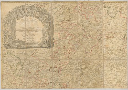
357. Suevia Universa IX. Tabulis Delineata, in quibus Omnium, non... [B IV a 658]
Institute and Museum of Military History •
B IV a
•
B IV Német birodalom
•
B I–XV. Európa
| Title | Suevia Universa IX. Tabulis Delineata, in quibus Omnium, non solum ad Circulum pertinentium Episcopatuum, Ducatuum, Marchionatuum, Principatuum… |
| Main title | A Svábföld térképe püspökségek, hercegségek, grófságok kerületi megjelölésével. |
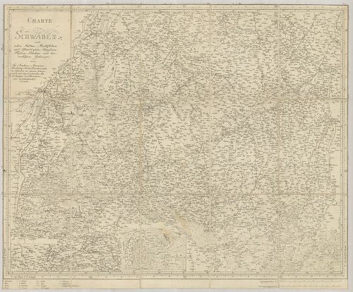
358. Topographische Charte von Schwaben. [B IV a 661]
Institute and Museum of Military History •
B IV a
•
B IV Német birodalom
•
B I–XV. Európa
| Title | Topographische Charte von Schwaben. |
| Main title | A Svábföld topográfiai térképe. |
359. Charte vom Königreiche Württemberg. [B IV a 663]
Institute and Museum of Military History •
B IV a
•
B IV Német birodalom
•
B I–XV. Európa
| Title | Charte vom Königreiche Württemberg. |
| Main title | A Württemberg-i Királyság térképe. |
360. Topographisch-militairischer Atlas von dem Koenigreiche Würt... [B IV a 663/1]
Institute and Museum of Military History •
B IV a
•
B IV Német birodalom
•
B I–XV. Európa
| Title | Topographisch-militairischer Atlas von dem Koenigreiche Württemberg dem Grossherzogthume Baden und den Fürstenthümern Hohenzollern und Leyen. |
| Main title | A Württemberg-i Királyság, Badeni nagyhercegség, Hohenzollern- és Leyen hercegségek térképe 1813-ben. |
361. Topographischer Atlas des Koenigreichs Württemberg. [B IV a 664]
Institute and Museum of Military History •
B IV a
•
B IV Német birodalom
•
B I–XV. Európa
| Title | Topographischer Atlas des Koenigreichs Württemberg. |
| Main title | A Württemberg-i Királyság topográfiai térképe 1851-ben. |
362. Topographischer Atlas des Koenigreichs Württemberg. [B IV a 664/1]
Institute and Museum of Military History •
B IV a
•
B IV Német birodalom
•
B I–XV. Európa
| Title | Topographischer Atlas des Koenigreichs Württemberg. |
363. Provincia Landvogtiae Superioris et Inferioris Sueviae ipsam... [B IV a 665/2]
Institute and Museum of Military History •
B IV a
•
B IV Német birodalom
•
B I–XV. Európa
| Title | Provincia Landvogtiae Superioris et Inferioris Sueviae ipsam Landvogtiam Comitatus Dynastias et Dominatus Austriacos eidem Subordinatos Complectens una cum… |
| Main title | A Svábföld térképe 1782-ben. |
364. Serenissimis Principibvs ac Dominis ab Hohenloh, Dynastis in... [B IV a 667]
Institute and Museum of Military History •
B IV a
•
B IV Német birodalom
•
B I–XV. Európa
| Title | Serenissimis Principibvs ac Dominis ab Hohenloh, Dynastis in Langenburg, nec non Celsissimis Comitatibvs ac Dominis ab Hohenloh et Gleichen, Dynastis in Langenb. et Cranchfeld etc. Dominis meis Clementissimis, Comitatus Hohenloici… |
| Main title | 2 mt.: 1. Die in der Landgrafschaft Thüringen liegende und dem Hochgraefl. Haus Hohenloh–Neuenstein gehörige obere Grafschaft Gleichen. (Gleichen grófság térképe.) 2. Die in Nieder Elsass liegende Hochfürtlich. Hohenloh-Bartensteinische und Hochgraefl. Leiningische gemeinschaftliche Aempter Ober- und Nieder Brunn. (Alsó-Felső Brunn térképe.) |
| Subject | Hohenlohe grófság térképe 1748-ban. |
365. Verwaltungseinteilung von Baden. [B IV a 676]
Institute and Museum of Military History •
B IV a
•
B IV Német birodalom
•
B I–XV. Európa
| Title | Verwaltungseinteilung von Baden. |
| Main title | Baden közigazgatási térképe. |
366. Nova et accurata Territorii Vlmensis cum Dominio Wainensi … [B IV a 682]
Institute and Museum of Military History •
B IV a
•
B IV Német birodalom
•
B I–XV. Európa
| Title | Nova et accurata Territorii Vlmensis cum Dominio Wainensi … |
| Main title | Mt.: Grund und Abriss der Ulmischen Herrschafft zu Wain. (Wain város és környéke.)Ulm és környékének térképe. |
367. Gross Herzogthum Baden. [B IV a 684]
Institute and Museum of Military History •
B IV a
•
B IV Német birodalom
•
B I–XV. Európa

| Title | Gross Herzogthum Baden. |
| Main title | A Baden-i Nagyhercegség térképe 1846-ban. |
368. Charte über das Grossherzogthum Baden. [B IV a 685]
Institute and Museum of Military History •
B IV a
•
B IV Német birodalom
•
B I–XV. Európa
| Title | Charte über das Grossherzogthum Baden. |
| Main title | A Baden-i Nagyhercegség térképe 1814-ben. |
369. Karte von dem Grossherzogthum Baden. [B IV a 687]
Institute and Museum of Military History •
B IV a
•
B IV Német birodalom
•
B I–XV. Európa
| Title | Karte von dem Grossherzogthum Baden. |
| Main title | A Baden-i Nagyhercegség térképe 1843-ban. |
370. Uebersichts-Karte von dem Grossherzogthum Baden nebst Theile... [B IV a 688]
Institute and Museum of Military History •
B IV a
•
B IV Német birodalom
•
B I–XV. Európa
| Title | Uebersichts-Karte von dem Grossherzogthum Baden nebst Theilen der angrenzenden Laender. |
| Main title | A Baden-i Nagyhercegség áttekintő térképe 1861-ben. |
371. Karte von dem Grossherzogthum Baden. [B IV a 689/1]
Institute and Museum of Military History •
B IV a
•
B IV Német birodalom
•
B I–XV. Európa
| Title | Karte von dem Grossherzogthum Baden. |
| Main title | A Baden-i Nagyhercegség térképe. |
372. Topographische Karte über das Grossherzogthum Baden. [B IV a 690]
Institute and Museum of Military History •
B IV a
•
B IV Német birodalom
•
B I–XV. Európa
| Title | Topographische Karte über das Grossherzogthum Baden. |
| Main title | A Baden Nagyhercegség, Rastatt és környékének topográfiai térképe 1841-ben. |
373. Topographischer Atlas ueber das Grossherzogthum Baden. [B IV a 691]
Institute and Museum of Military History •
B IV a
•
B IV Német birodalom
•
B I–XV. Európa
| Title | Topographischer Atlas ueber das Grossherzogthum Baden. |
| Main title | A Baden-i Nagyhercegség topográfiai térképe. |
374. Topographischer Atlas ueber das Grossherzogthum Baden. [B IV a 691/1]
Institute and Museum of Military History •
B IV a
•
B IV Német birodalom
•
B I–XV. Európa
| Title | Topographischer Atlas ueber das Grossherzogthum Baden. |
| Main title | A Baden-i Nagyhercegség topográfiai térképe. |
375. Archiepiscopatus et Electoratus Moguntini una cum adjecentib... [B IV a 741]
Institute and Museum of Military History •
B IV a
•
B IV Német birodalom
•
B I–XV. Európa
| Title | Archiepiscopatus et Electoratus Moguntini una cum adjecentibus repraesentatio… |
| Main title | A Mainz-i választófejedelemség és püspökség térképe. |
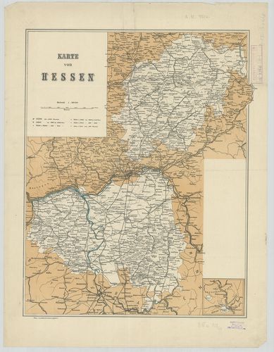
376. Neueste Karte vom Kurfürstenthum Hessen. [B IV a 744]
Institute and Museum of Military History •
B IV a
•
B IV Német birodalom
•
B I–XV. Európa
| Title | Neueste Karte vom Kurfürstenthum Hessen. |
| Main title | 2 mt.: 1. Der Kreis Schaumburg. (Schaumburg kerület térképe.) 2. Umgegend von Cassel. (Kassel és környéke.) |
| Subject | A Hessen-i Őrgrófság térképe 1844-ben. |
377. Karte von dem Grossherzogthume Hessen und dem Angränzenden L... [B IV a 745]
Institute and Museum of Military History •
B IV a
•
B IV Német birodalom
•
B I–XV. Európa
| Title | Karte von dem Grossherzogthume Hessen und dem Angränzenden Ländern. |
| Main title | A Hessen-i Nagyhercegség térképe 1858 körül. |
378. Karte von dem Grossherzogthum Hessen und dem Herzogthum Nass... [B IV a 747]
Institute and Museum of Military History •
B IV a
•
B IV Német birodalom
•
B I–XV. Európa
| Title | Karte von dem Grossherzogthum Hessen und dem Herzogthum Nassau. |
| Main title | Mt.: Uebersicht der Karte von Hessen und Nassau nebst den Vorzüglichsten Gebirgszügen. (Hessen és Nassau hegyrajz térképe.) |
| Subject | A Hessen-i Nagyhercegség és Nassau Hercegség térképe 1878-ban. |
379. Karte von dem Grossherzogthume Hessen. [B IV a 756]
Institute and Museum of Military History •
B IV a
•
B IV Német birodalom
•
B I–XV. Európa
| Title | Karte von dem Grossherzogthume Hessen. |
| Main title | A Hessen-i Nagyhercegség térképe. |
380. Karte von dem Grossherzogthume Hessen. [B IV a 756/1]
Institute and Museum of Military History •
B IV a
•
B IV Német birodalom
•
B I–XV. Európa
| Title | Karte von dem Grossherzogthume Hessen. |
| Main title | A Hessen-i Nagyhercegség térképe. |
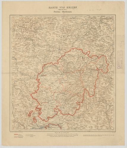
381. Verwaltungskarte des Volksstaates Hessen. Provinz Oberhessen... [B IV a 758/a]
Institute and Museum of Military History •
B IV a
•
B IV Német birodalom
•
B I–XV. Európa
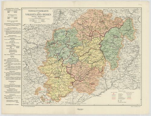
| Title | Verwaltungskarte des Volksstaates Hessen. Provinz Oberhessen. |
| Main title | Felső-Hessen közigazgatási térképe. |
382. Verwaltungskarte des Volksstaates Hessen. Provinz Starkenbur... [B IV a 758/b]
Institute and Museum of Military History •
B IV a
•
B IV Német birodalom
•
B I–XV. Európa
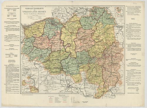
| Title | Verwaltungskarte des Volksstaates Hessen. Provinz Starkenburg u. Rheinhessen. |
| Main title | 2 mt.: 1. Von Neckargerach bis Wimpfen. (Neckar vidéke Neckargerachtól Wimpfenig.) 2. Steinbach. (Steinbach és környéke.)Starkenburg és Rheinhessen közigazgatási térképe. |
383. Special Karte von dem Odenwald, dem Bauland und einem Theil ... [B IV a 758/3]
Institute and Museum of Military History •
B IV a
•
B IV Német birodalom
•
B I–XV. Európa
| Title | Special Karte von dem Odenwald, dem Bauland und einem Theil des Spessart’s, nebst des angränzenden Ländern am Rhein und Neckar. |
| Main title | A Rajna és a Neckar közötti terület részletes térképe (Odenwald, Bauland és Spessart vidéke) 1808-ban. |
384. Militärische Situationskarte in XXIV Blättern von dem Länder... [B IV a 758/4]
Institute and Museum of Military History •
B IV a
•
B IV Német birodalom
•
B I–XV. Európa
| Title | Militärische Situationskarte in XXIV Blättern von dem Ländern zwischen dem Rhein, Main und Neckar nebst den angränzenden Gegenden. |
| Main title | A Rajna, Main és Neckar közötti tartományok katonai térképe. |
385. Wandcharte von den Provinzen Starkenburg und Rheinhessen. [B IV a 758/5]
Institute and Museum of Military History •
B IV a
•
B IV Német birodalom
•
B I–XV. Európa
| Title | Wandcharte von den Provinzen Starkenburg und Rheinhessen. |
| Main title | Starkenburg és Rheinhessen (Hessen) tartományok térképe. |
386. Karte von Hessen. (Hügel’sche Karte.) Provinz Starkenburg un... [B IV a 758/6]
Institute and Museum of Military History •
B IV a
•
B IV Német birodalom
•
B I–XV. Európa
| Title | Karte von Hessen. (Hügel’sche Karte.) Provinz Starkenburg und Rheinhessen. |
| Main title | Starkenburg és Rheinhessen (Hessen) tartományok térképe. |
387. Karte von Hessen. (Hügel’sche Karte.) Provinz Oberhessen. [B IV a 758/7]
Institute and Museum of Military History •
B IV a
•
B IV Német birodalom
•
B I–XV. Európa
| Title | Karte von Hessen. (Hügel’sche Karte.) Provinz Oberhessen. |
| Main title | Felső-Hessen térképe. |
388. Karte der Provinz Rheinhessen. [B IV a 758/9]
Institute and Museum of Military History •
B IV a
•
B IV Német birodalom
•
B I–XV. Európa
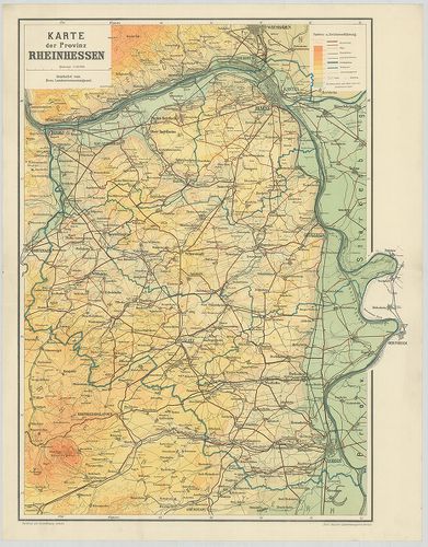
| Title | Karte der Provinz Rheinhessen. |
| Main title | Rheinhessen (Hessen) tartomány térképe. |
389. Carte de la Partie Septentrionale du Landgraviat de Hesse Ca... [B IV a 758/10]
Institute and Museum of Military History •
B IV a
•
B IV Német birodalom
•
B I–XV. Európa
| Title | Carte de la Partie Septentrionale du Landgraviat de Hesse Cassel, de l’Evesché de Paderborn, du Comte de Valdeck, du Duché de Brunswich Luneburg, et le Pays d’Eichsfeld, etc. |
| Main title | Hessen, Kassel, Paderborgn, Waldeck, Braunschweig, Lüneburg és Eichsfeld tartományok térképe. |
390. Karte von Hessen. [B IV a 758/11]
Institute and Museum of Military History •
B IV a
•
B IV Német birodalom
•
B I–XV. Európa
| Title | Karte von Hessen. |
| Main title | Hessen térképe. |
391. Carte tres déteillée de la Partie Méridionale du Landgraviat... [B IV a 759]
Institute and Museum of Military History •
B IV a
•
B IV Német birodalom
•
B I–XV. Európa
| Title | Carte tres déteillée de la Partie Méridionale du Landgraviat de Hesse-Cassel. |
| Main title | A Hessen-Kassel-i választófejedelemség térképe 1761-ben. |
392. Karte von dem Kurfürstenthum Hessen. [B IV a 760]
Institute and Museum of Military History •
B IV a
•
B IV Német birodalom
•
B I–XV. Európa
| Title | Karte von dem Kurfürstenthum Hessen. |
| Main title | A Hessen-i választófejedelemség térképe 1855-ben. |
393. [A Hessen-i választófejedelemség általános térképe.] [B IV a 762]
Institute and Museum of Military History •
B IV a
•
B IV Német birodalom
•
B I–XV. Európa
| Title | [A Hessen-i választófejedelemség általános térképe.] |
| Main title | Mt.: Grafschaft Schaumburg. (Schaumburg grófság térképe.) |
394. [A Hessen-i választófejedelemség általános térképe.] [B IV a 763]
Institute and Museum of Military History •
B IV a
•
B IV Német birodalom
•
B I–XV. Európa
| Title | [A Hessen-i választófejedelemség általános térképe.] |
| Main title | Mt.: Grafschaft Schaumburg. (Schaumburg grófság térképe.) |
395. Inferioris Comitatus Cattimeli-Bocensis. [B IV a 766]
Institute and Museum of Military History •
B IV a
•
B IV Német birodalom
•
B I–XV. Európa
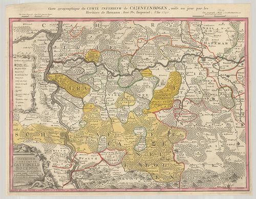
| Title | Inferioris Comitatus Cattimeli-Bocensis. |
| Main title | A Katzenelnbogen-i grófság térképe 1745-ben. |
396. Topographisch-militairischer Atlas von den Grossherzogthümer... [B IV a 770]
Institute and Museum of Military History •
B IV a
•
B IV Német birodalom
•
B I–XV. Európa
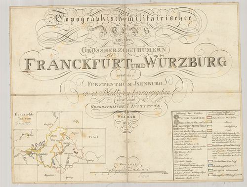
| Title | Topographisch-militairischer Atlas von den Grossherzogthümern Franckfurt und Würzburg nebst dem Fürstenthum Isenburg. |
| Main title | Frankfurt, Würzburg nagyhercegségek Neu-Isenburg hercegség katonai-topográfiai térképe 1813-ban. |
397. Das Herzogthum Nassau. [B IV a 772]
Institute and Museum of Military History •
B IV a
•
B IV Német birodalom
•
B I–XV. Európa
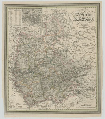
| Title | Das Herzogthum Nassau. |
| Main title | Mt.: Plan von Wiesbaden. (Wiesbaden város térképe.) |
| Subject | Nassau hercegség térképe 1830-ben. |
398. Abbildung der Keys: Freyen Reichs-Walh und Handelstatt Franc... [B IV a 789]
Institute and Museum of Military History •
B IV a
•
B IV Német birodalom
•
B I–XV. Európa
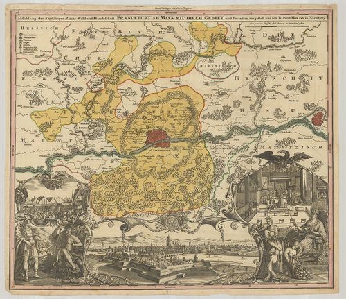
| Title | Abbildung der Keys: Freyen Reichs-Walh und Handelstatt Franckfurt am Mayn mit Ihrem Gebietet und Gräntzen. |
| Main title | Frankfurt am Main és környékének általános térképe. |
399. Charta Dvcatvs Megapolensis… – Carte Generale de Dvche de Me... [B IV a 809]
Institute and Museum of Military History •
B IV a
•
B IV Német birodalom
•
B I–XV. Európa
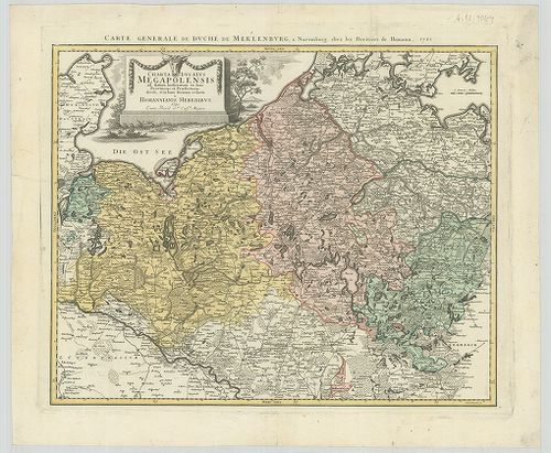
| Title | Charta Dvcatvs Megapolensis… – Carte Generale de Dvche de Meklenbvrg. |
| Main title | A Mecklenburg-i hercegség térképe 1781-ben. |
400. Meklenburg Ducatus. [B IV a 810]
Institute and Museum of Military History •
B IV a
•
B IV Német birodalom
•
B I–XV. Európa
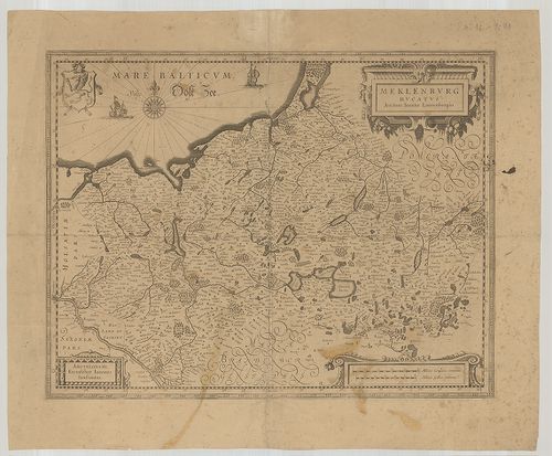
| Title | Meklenburg Ducatus. |
| Main title | A Mecklenburg-i hercegség térképe. |