2101. Orographische Übersicht des Südostens der österreichisch-ung... [B IX b 35]
Institute and Museum of Military History •
B IX b
•
B IX Ausztria–Magyarország
•
B I–XV. Európa
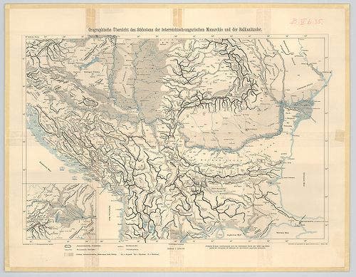
| Title | Orographische Übersicht des Südostens der österreichisch-ungarischen Monarchie und der Balkanländer. |
| Main title | Az Osztrák–Magyar Monarchia délkeleti részének és a Balkán-félsziget egy részének orográfiai térképe 1905-ben. |
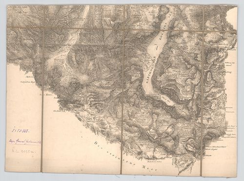
2102. Der Südwesten der österreichisch-ungarischen Monarchie mit d... [B IX b 35/1]
Institute and Museum of Military History •
B IX b
•
B IX Ausztria–Magyarország
•
B I–XV. Európa
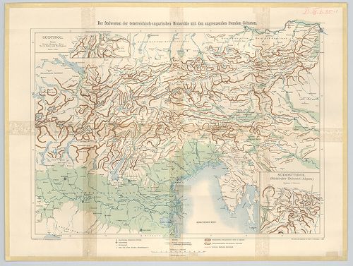
| Title | Der Südwesten der österreichisch-ungarischen Monarchie mit den angrenzenden Fremden Gebieten. |
| Main title | 2 Mt. 1. Südosttirol. (Délkelet-Tirol) |
| Subject | 2. Südtirol. (Dél-Tirol) |
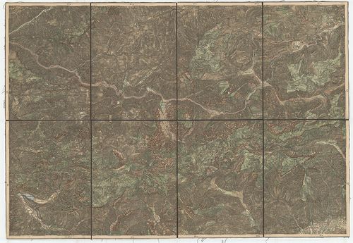
2103. [Az Osztrák–Magyar Monarchia déli része és a Balkán-félszige... [B IX b 35/2]
Institute and Museum of Military History •
B IX b
•
B IX Ausztria–Magyarország
•
B I–XV. Európa
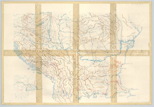
| Title | [Az Osztrák–Magyar Monarchia déli része és a Balkán-félsziget északi részének hegyvonulatai.] |
2104. [Az Osztrák–Magyar Monarchia délkeleti része és a szomszédos... [B IX b 35/3]
Institute and Museum of Military History •
B IX b
•
B IX Ausztria–Magyarország
•
B I–XV. Európa
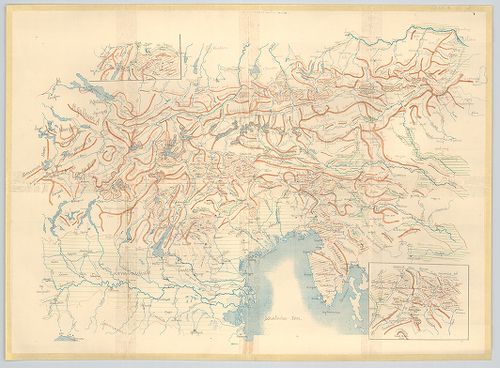
| Title | [Az Osztrák–Magyar Monarchia délkeleti része és a szomszédos területek hegyvonulatai.] |
| Main title | 2 mt. 1. [Délkelet-Tirol.] 2. [Dél-Tirol] |
2105. Ausztrija. [B IX b 39]
Institute and Museum of Military History •
B IX b
•
B IX Ausztria–Magyarország
•
B I–XV. Európa
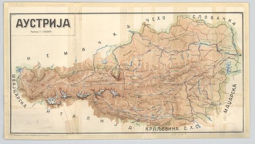
| Title | Ausztrija. |
| Main title | Ausztria hegyrajzi térképe. |
2106. Hypsometrische Karte von Gebiete des Schneeberges und der Ra... [B IX b 41]
Institute and Museum of Military History •
B IX b
•
B IX Ausztria–Magyarország
•
B I–XV. Európa
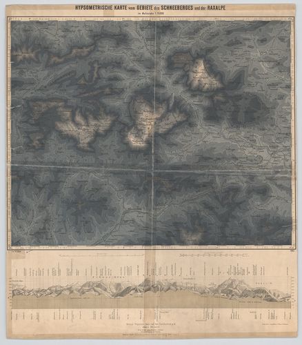
| Title | Hypsometrische Karte von Gebiete des Schneeberges und der Raxalpe. |
| Main title | A Schneeberg és a Raxalpe hegység hipszometrikus térképe 1883-ban. |
2107. Oro Hydro Graphische General Charte von Boehmen Maehren und ... [B IX b 42/1]
Institute and Museum of Military History •
B IX b
•
B IX Ausztria–Magyarország
•
B I–XV. Európa
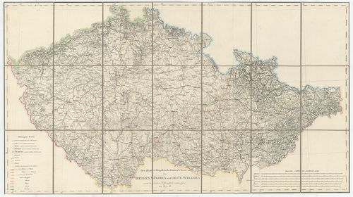
| Title | Oro Hydro Graphische General Charte von Boehmen Maehren und Oestr. Schlesien |
| Main title | Cseh-Morvaország és osztrák Szilézia általános hegyvízrajzi térképe. |
2108. [A König-See környéke (Németország)]. [B IX b 53]
Institute and Museum of Military History •
B IX b
•
B IX Ausztria–Magyarország
•
B I–XV. Európa
| Title | [A König-See környéke (Németország)]. |
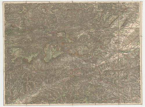
2109. Niederösterreich und Nordsteiermark. Raum Villach-Marburg-Br... [B IX b 55]
Institute and Museum of Military History •
B IX b
•
B IX Ausztria–Magyarország
•
B I–XV. Európa
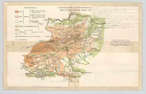
| Title | Niederösterreich und Nordsteiermark. Raum Villach-Marburg-Bruck a. M. |
| Main title | Alsó-Ausztria és Észak-Stájerország vázlatos helyrajzi térképe. |
2110. Karte des Ortlergebietes. [B IX b 56]
Institute and Museum of Military History •
B IX b
•
B IX Ausztria–Magyarország
•
B I–XV. Európa
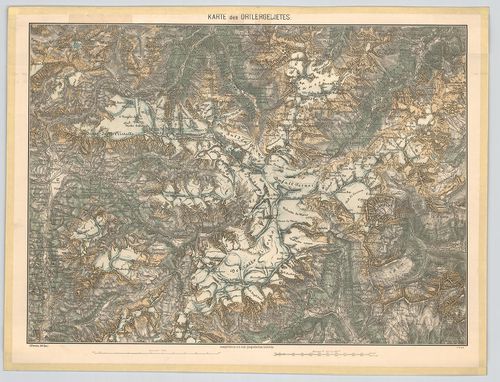
| Title | Karte des Ortlergebietes. |
| Main title | Az Ortler- hegység (Ortles, Ol.) részletes térképe 1876-ban. |
2111. Spezial-Karte der Ortler-Gruppe. [B IX b 56/1]
Institute and Museum of Military History •
B IX b
•
B IX Ausztria–Magyarország
•
B I–XV. Európa
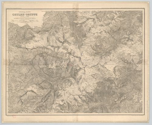
| Title | Spezial-Karte der Ortler-Gruppe. |
| Main title | Ortler-hegycsoport (Ortles, Ol.) térképe 1913-ban. |
2112. Karte der Dolomit-Gruppen. [B IX b 57]
Institute and Museum of Military History •
B IX b
•
B IX Ausztria–Magyarország
•
B I–XV. Európa
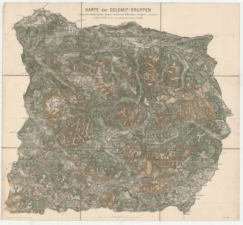
| Title | Karte der Dolomit-Gruppen. |
| Main title | A Dolomit- hegycsoport 1876-ban. |
2113. Turisten-Wanderkarte der Dolomiten. [B IX b 58]
Institute and Museum of Military History •
B IX b
•
B IX Ausztria–Magyarország
•
B I–XV. Európa
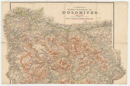
| Title | Turisten-Wanderkarte der Dolomiten. |
| Main title | A Dolomitok turistaúttérképe 1896 körül. |
2114. Österreichische Alpenländer. [B IX b 59]
Institute and Museum of Military History •
B IX b
•
B IX Ausztria–Magyarország
•
B I–XV. Európa
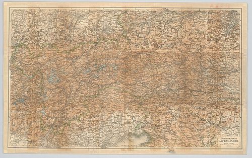
| Title | Österreichische Alpenländer. |
| Main title | Az osztrák Alpok térképe. |
2115. Special-Karte des Karwendel Gebirges. [B IX b 60]
Institute and Museum of Military History •
B IX b
•
B IX Ausztria–Magyarország
•
B I–XV. Európa
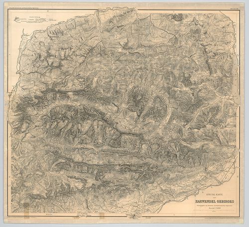
| Title | Special-Karte des Karwendel Gebirges. |
| Main title | A Karwendel-hegység térképe 1888-ban. |
2116. Karte der Schneeberg-Raxalpe-Hochschwab und Ötscher-Gruppe. [B IX b 61]
Institute and Museum of Military History •
B IX b
•
B IX Ausztria–Magyarország
•
B I–XV. Európa
| Title | Karte der Schneeberg-Raxalpe-Hochschwab und Ötscher-Gruppe. |
| Main title | A Schneeberg, Raxalpe, Hochschwab és az Ötscher hegységek részletes térképe 1882-ben. |
2117. Topographische detailkarte der Hochschwab-Gruppe. [B IX b 62]
Institute and Museum of Military History •
B IX b
•
B IX Ausztria–Magyarország
•
B I–XV. Európa
| Title | Topographische detailkarte der Hochschwab-Gruppe. |
| Main title | A Hochschwab-hegycsoport egy részének topográfiai térképe. |
2118. Karte der Lechtaler-Alpen. [B IX b 63]
Institute and Museum of Military History •
B IX b
•
B IX Ausztria–Magyarország
•
B I–XV. Európa
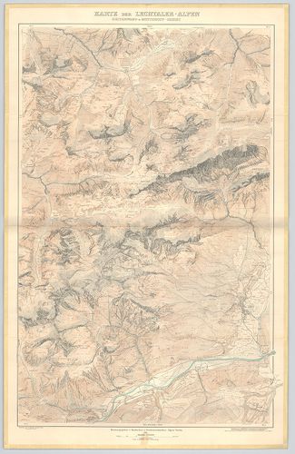
| Title | Karte der Lechtaler-Alpen. |
| Main title | I. Karte der Lechtaler-Alpen. |
| Subject | II. Karte der Lechtaler-Alpen. Heiterwand und Muttekopf-Gebiet. |
2119. Special Karte der Gross-Golckner-Gruppe. [B IX b 63/1]
Institute and Museum of Military History •
B IX b
•
B IX Ausztria–Magyarország
•
B I–XV. Európa
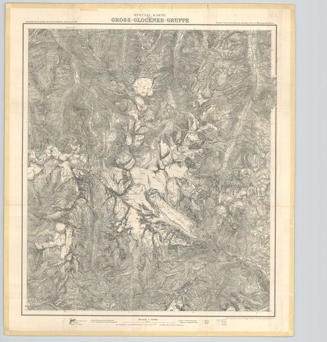
| Title | Special Karte der Gross-Golckner-Gruppe. |
| Main title | A Gross-Glockner- hegycsoport és környékének hegyrajzi térképe 1890-ben. |
2120. Ostalpen. [B IX b 64]
Institute and Museum of Military History •
B IX b
•
B IX Ausztria–Magyarország
•
B I–XV. Európa
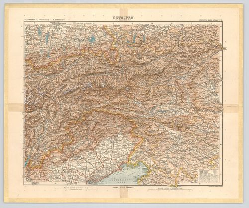
| Title | Ostalpen. |
| Main title | A Keleti-Alpok térképe 1901-ben. |