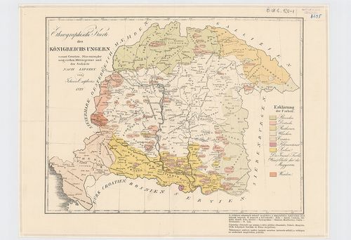
2521. Ethnographische Karte des Königreichs Ungarn. [B IX c 118/1]
Institute and Museum of Military History •
B IX c
•
B IX Ausztria–Magyarország
•
B I–XV. Európa
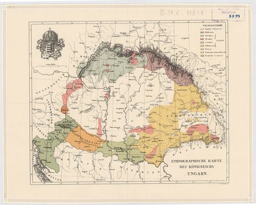
| Title | Ethnographische Karte des Königreichs Ungarn. |
| Main title | Magyarország néprajzi térképe 1846 körül. |
2522. Magyarország nemzetiségi térképe. 1773. [B IX c 118/2]
Institute and Museum of Military History •
B IX c
•
B IX Ausztria–Magyarország
•
B I–XV. Európa
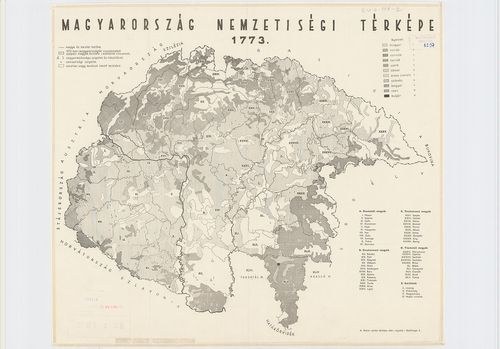
| Title | Magyarország nemzetiségi térképe. 1773. |
2523. Sprachen Karte der Österreichischen Monarchie. [B IX c 119]
Institute and Museum of Military History •
B IX c
•
B IX Ausztria–Magyarország
•
B I–XV. Európa
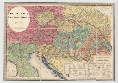
| Title | Sprachen Karte der Österreichischen Monarchie. |
| Main title | Az Osztrák Monarchia néprajzi térképe 1848 körül. |
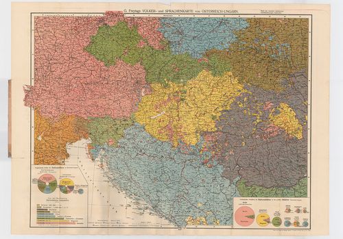
2524. Völker- und Sprachenkarte von Österreich–Ungarn. G. Freytags... [B IX c 120]
Institute and Museum of Military History •
B IX c
•
B IX Ausztria–Magyarország
•
B I–XV. Európa
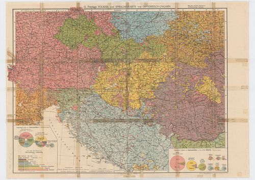
| Title | Völker- und Sprachenkarte von Österreich–Ungarn. G. Freytags. |
| Main title | Az Osztrák–Magyar Monarchia nemzetiségi térképe az 1910-es népszámlálás alapján. |
2525. Ethnographische Karte des Königreichs Ungarn sammt Croatien,... [B IX c 120/1]
Institute and Museum of Military History •
B IX c
•
B IX Ausztria–Magyarország
•
B I–XV. Európa
| Title | Ethnographische Karte des Königreichs Ungarn sammt Croatien, Slavonien, der Ungarischen Militärgrenze und der Seeküste. |
| Main title | A Magyar Királyság, Horvátország, Szlavónia, a Határőrvidék és a Magyar Tengerpart néprajzi térképe 1829-ben. |
2526. Ethnographische Karte vom Österreich.[ische] Kaiserstaat. [B IX c 121]
Institute and Museum of Military History •
B IX c
•
B IX Ausztria–Magyarország
•
B I–XV. Európa
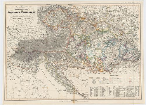
| Title | Ethnographische Karte vom Österreich.[ische] Kaiserstaat. |
| Main title | Az Osztrák Monarchia néprajzi térképe 1849-ből. |
2527. Ethnographische Karte der Oesterreischischen Monarchie. [B IX c 123]
Institute and Museum of Military History •
B IX c
•
B IX Ausztria–Magyarország
•
B I–XV. Európa
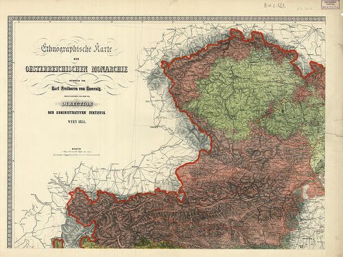
| Title | Ethnographische Karte der Oesterreischischen Monarchie. |
| Main title | Az Osztrák Monarchia néprajzi térképe 1855-ben. |
2528. Ethnographische Karte der Oesterreichischen Monarchie. [B IX c 124]
Institute and Museum of Military History •
B IX c
•
B IX Ausztria–Magyarország
•
B I–XV. Európa

| Title | Ethnographische Karte der Oesterreichischen Monarchie. |
| Main title | Az Osztrák Monarchia néprajzi térképe 1856-ban. |
2529. Völker- und Sprachenkarte von Österreich–Ungarn. G. Freytags... [B IX c 125]
Institute and Museum of Military History •
B IX c
•
B IX Ausztria–Magyarország
•
B I–XV. Európa
| Title | Völker- und Sprachenkarte von Österreich–Ungarn. G. Freytags. |
2530. Völker- und Sprachenkarte von Österreich–Ungarn. [B IX c 125/2]
Institute and Museum of Military History •
B IX c
•
B IX Ausztria–Magyarország
•
B I–XV. Európa
| Title | Völker- und Sprachenkarte von Österreich–Ungarn. |
| Main title | Az Osztrák–Magyar Monarchia néprajzi és nyelvi térképe. |
2531. Völker- und Sprachenkarte von Österreich–Ungarn. [B IX c 125/4]
Institute and Museum of Military History •
B IX c
•
B IX Ausztria–Magyarország
•
B I–XV. Európa
| Title | Völker- und Sprachenkarte von Österreich–Ungarn. |
| Main title | A hátlapon: 5 mt.: 1. Evropy |
| Subject | 2. Rakousko-alpských zemi |
2532. [Magyarország községhatáros nemzetiségi térképe az 1910-es n... [B IX c 128]
Institute and Museum of Military History •
B IX c
•
B IX Ausztria–Magyarország
•
B I–XV. Európa
| Title | [Magyarország községhatáros nemzetiségi térképe az 1910-es népszámlálás alapján.] |
2533. Magyarország népessége anyanyelv szerint 1910-ben, járásonki... [B IX c 129]
Institute and Museum of Military History •
B IX c
•
B IX Ausztria–Magyarország
•
B I–XV. Európa
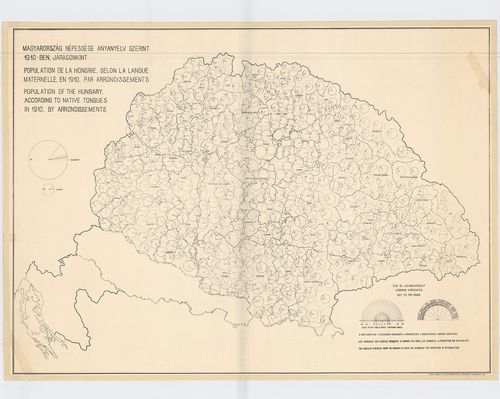
| Title | Magyarország népessége anyanyelv szerint 1910-ben, járásonkint. – Population de la Hongrie. Selon la Langue Maternelle en 1910. par Arrondissements. – Population of the Hungary According to Native Tongues in 1910. by Arrondissements. |
2534. Natur und Kunst Producten Karte..[Az Osztrák Monarchia 8 tar... [B IX c 130/1]
Institute and Museum of Military History •
B IX c
•
B IX Ausztria–Magyarország
•
B I–XV. Európa
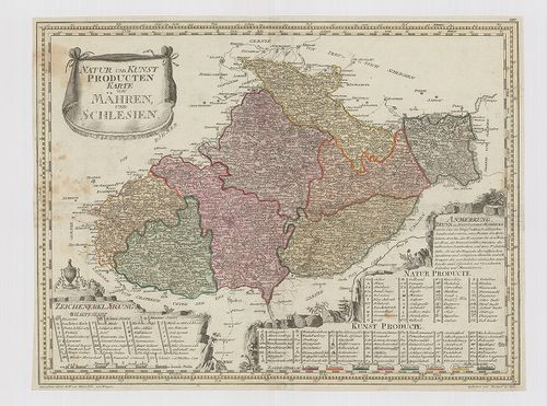
| Title | Natur und Kunst Producten Karte..[Az Osztrák Monarchia 8 tartományának bányászati és ipari térképe.] |
| Main title | 1. Natur und Kunst Producten Karte von Mähren und Schlesien. (Morvaország és Szilézia bányászati és ipari térképe) |
| Subject | 2. Natur und Kunst Producten Karte von Vorder Oestreich. (Elő-Ausztria (D-Németország) bányászati és ipari térképe.) |
2535. Novissima Regni Hungariae Potamographica et Telluris Prodoct... [B IX c 130/2]
Institute and Museum of Military History •
B IX c
•
B IX Ausztria–Magyarország
•
B I–XV. Európa
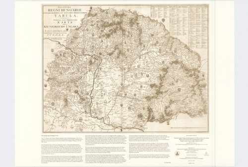
| Title | Novissima Regni Hungariae Potamographica et Telluris Prodoctorum Tabula. – Wasser und Producten Karte des Koenigreichs Ungarn. – Magyarország természeti tulajdonságainak Tüköre. |
| Main title | Magyarország természet-földrajzi térképe 1791 körül. |
2536. Eisenbahnfahrt von Wien bis Wiener-Neustadt. [B IX c 131]
Institute and Museum of Military History •
B IX c
•
B IX Ausztria–Magyarország
•
B I–XV. Európa
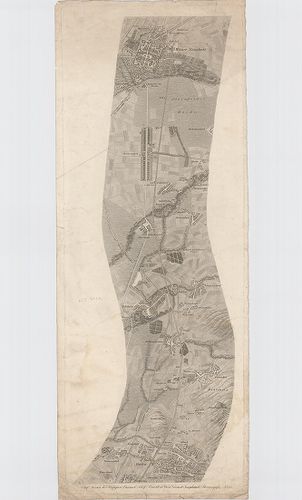
| Title | Eisenbahnfahrt von Wien bis Wiener-Neustadt. |
| Main title | Bécs és Bécsújhely közötti vasút térképe 1837 körül. |
2537. Die Forste der in Verwaltung des k. k. Ackerbau-Ministeriums... [B IX c 132]
Institute and Museum of Military History •
B IX c
•
B IX Ausztria–Magyarország
•
B I–XV. Európa
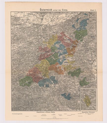
| Title | Die Forste der in Verwaltung des k. k. Ackerbau-Ministeriums Stehenden Staats- und Fondsgüter. |
| Main title | Az Osztrák–Magyar Monarchia egyes részeinek Földművelésügyi Minisztériuma állami és alapítványi erdőinek térképe 1885-ben. |
2538. Oesterreichs Laender unter den Roemern. [B IX c 134]
Institute and Museum of Military History •
B IX c
•
B IX Ausztria–Magyarország
•
B I–XV. Európa
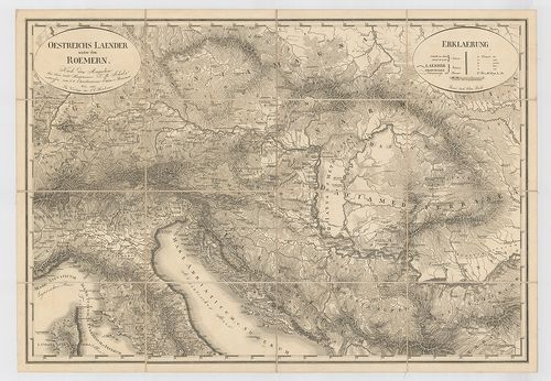
| Title | Oesterreichs Laender unter den Roemern. |
| Main title | Ausztria és a hozzá tartozó országok a rómaiak alatt. |
2539. Topographische Handelskarte des österreichischen Kaiserstaat... [B IX c 137]
Institute and Museum of Military History •
B IX c
•
B IX Ausztria–Magyarország
•
B I–XV. Európa
| Title | Topographische Handelskarte des österreichischen Kaiserstaates. |
| Main title | Az Osztrák Császárság kereskedelmi és közlekedési térképe 1833-ban. |
2540. Topographische Handels General Post und Strassenkarte des ös... [B IX c 138]
Institute and Museum of Military History •
B IX c
•
B IX Ausztria–Magyarország
•
B I–XV. Európa
| Title | Topographische Handels General Post und Strassenkarte des österreichischen Kaiserstaates. |
| Main title | Az Osztrák Császárság általános posta- és úttérképe 1841-ben. |