2641. Magyarország és Ausztria, valamint Bosnia és Herczegovina Oc... [B IX c 616/3]
Institute and Museum of Military History •
B IX c
•
B IX Ausztria–Magyarország
•
B I–XV. Európa
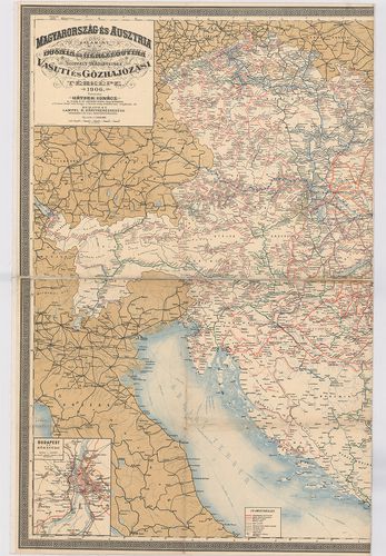
| Title | Magyarország és Ausztria, valamint Bosnia és Herczegovina Occupalt Területeinek vasúti és Gőzhajózási térképe |
| Main title | 3 mt.: 1. Budapest és környéke. 2. Wien és környéke. 3. A Balkán-félsziget vasúti térképe. (A térkép Bulgária vasúti hálózatát ábrázolja.) |
2642. [Magyarország.] Automobilista Toura-térkép Budapest–Bécs, Bé... [B IX c 616/4]
Institute and Museum of Military History •
B IX c
•
B IX Ausztria–Magyarország
•
B I–XV. Európa
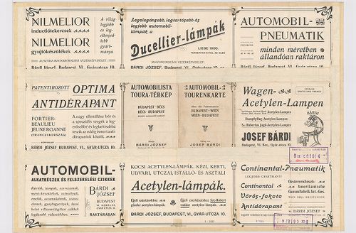
| Title | [Magyarország.] Automobilista Toura-térkép Budapest–Bécs, Bécs–Budapest közötti automobil-utakról. – Automobil-Tourenkarte über die Fahrstrassen Budapest–Wien, Wien–Budapest. |
2643. Haupt- und Neben Strassenzüge im Bereiche der Militair Divis... [B IX c 618]
Institute and Museum of Military History •
B IX c
•
B IX Ausztria–Magyarország
•
B I–XV. Európa
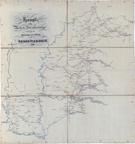
| Title | Haupt- und Neben Strassenzüge im Bereiche der Militair Division von Grosswardein. |
| Main title | A Nagyváradi katonai hadosztály körlete, fő és mellék útvonalainak térképe 1841-ben. |
2644. Strassen-Karte des Koenigreiches Ungarn. [B IX c 619]
Institute and Museum of Military History •
B IX c
•
B IX Ausztria–Magyarország
•
B I–XV. Európa
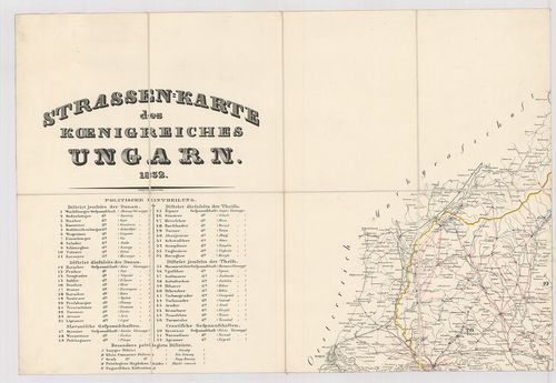
| Title | Strassen-Karte des Koenigreiches Ungarn. |
| Main title | Magyarország úttérképe 1832-ben. |
2645. Orts- und Strassenkarte des Königreiches Ungarn (mit inbegri... [B IX c 620]
Institute and Museum of Military History •
B IX c
•
B IX Ausztria–Magyarország
•
B I–XV. Európa
| Title | Orts- und Strassenkarte des Königreiches Ungarn (mit inbegriff des ehemaligen Siebenbürgen) nebst Kroatien und Slavonien. |
| Main title | Magyarország, Erdély, Horvát-Szlavónia település és úttérképe 1882-ben. |
2646. Orts- und Strassenkarte des Königreiches Ungarn (mit inbegri... [B IX c 620/1]
Institute and Museum of Military History •
B IX c
•
B IX Ausztria–Magyarország
•
B I–XV. Európa
| Title | Orts- und Strassenkarte des Königreiches Ungarn (mit inbegriff des ehemaligen Siebenbürgen) nebst Kroatien und Slavonien. |
| Main title | Magyarország, Erdély, Horvát-Szlavónia település és úttérképe 1887-ben. |
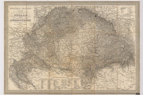
2647. Orts und Strassen-Karte der Königreiche Ungarn, Croatien und... [B IX c 620/2]
Institute and Museum of Military History •
B IX c
•
B IX Ausztria–Magyarország
•
B I–XV. Európa
| Title | Orts und Strassen-Karte der Königreiche Ungarn, Croatien und Slavonien des Grossfürstenthums Siebenbürgen und der k. k. Militair Graenze. |
2648. Neu und accurat verfasste General Post Landkarte des sehr Gr... [B IX c 623]
Institute and Museum of Military History •
B IX c
•
B IX Ausztria–Magyarország
•
B I–XV. Európa
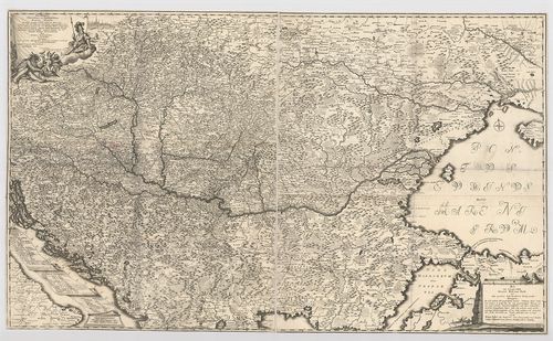
| Title | Neu und accurat verfasste General Post Landkarte des sehr Grossen Welt berühmten König Reichs Hungarn. |
| Main title | Magyarország és a környező részek posta térképe 1740 körül. |
2649. Mappa Postalis INCLITT Regni Hungariae Partitumque Eidem Adn... [B IX c 624]
Institute and Museum of Military History •
B IX c
•
B IX Ausztria–Magyarország
•
B I–XV. Európa
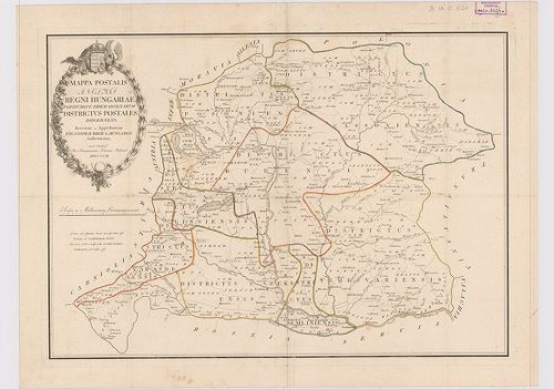
| Title | Mappa Postalis INCLITT Regni Hungariae Partitumque Eidem Adnexarum Districtus Postales Discernens. |
| Main title | Magyarország postatérképe 1802-ben. |
2650. Új Posta Mappája Magyar és Erdély Országoknak a’ posták legú... [B IX c 625]
Institute and Museum of Military History •
B IX c
•
B IX Ausztria–Magyarország
•
B I–XV. Európa
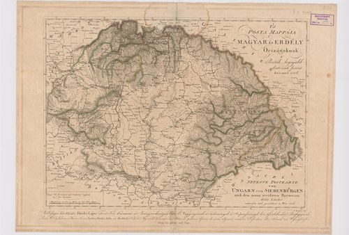
| Title | Új Posta Mappája Magyar és Erdély Országoknak a’ posták legújabb elintézések szerént. – Neueste Postkarte von Ungarn und Siebenbürgen nach dem genau revidierten Postwesen dieser Länder. |
2651. Karte des ungarischen Communikations-Netzes. [B IX c 626]
Institute and Museum of Military History •
B IX c
•
B IX Ausztria–Magyarország
•
B I–XV. Európa
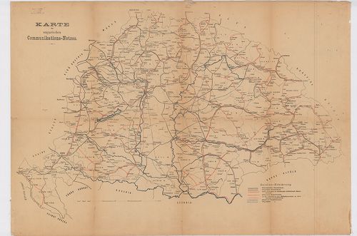
| Title | Karte des ungarischen Communikations-Netzes. |
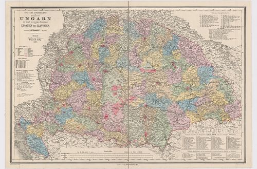
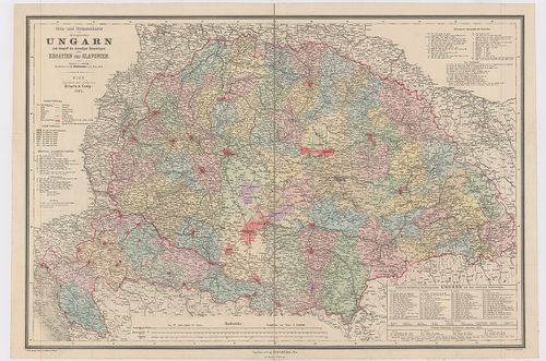
| Main title | Magyarország közlekedési hálózatának (vasút- és út) térképe 1900 körül. |
2652. General-Post- und Strassen-Karte des Königreichs Ungarn und ... [B IX c 628]
Institute and Museum of Military History •
B IX c
•
B IX Ausztria–Magyarország
•
B I–XV. Európa
| Title | General-Post- und Strassen-Karte des Königreichs Ungarn und des Grossfürstenthums Siebenbürgen. |
| Main title | A Magyar Királyság és Erdély út- és postatérképe 1848-ban. |
2653. General-Post- und Strassen-Karte des Königreichs Ungarn und ... [B IX c 628/2]
Institute and Museum of Military History •
B IX c
•
B IX Ausztria–Magyarország
•
B I–XV. Európa
| Title | General-Post- und Strassen-Karte des Königreichs Ungarn und des Grossfürstenthums Siebenbürgen. |
2654. [Magyarország - úttérkép Pozsony – Arvavarallya (Oravský Pod... [B IX c 629]
Institute and Museum of Military History •
B IX c
•
B IX Ausztria–Magyarország
•
B I–XV. Európa
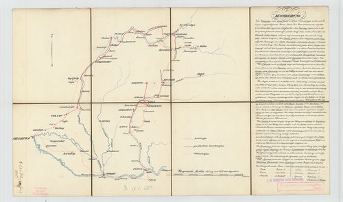
| Title | [Magyarország - úttérkép Pozsony – Arvavarallya (Oravský Podzamok) Esztergom között.] |
2655. Post und General Karte von Hungarn. [B IX c 629/3]
Institute and Museum of Military History •
B IX c
•
B IX Ausztria–Magyarország
•
B I–XV. Európa
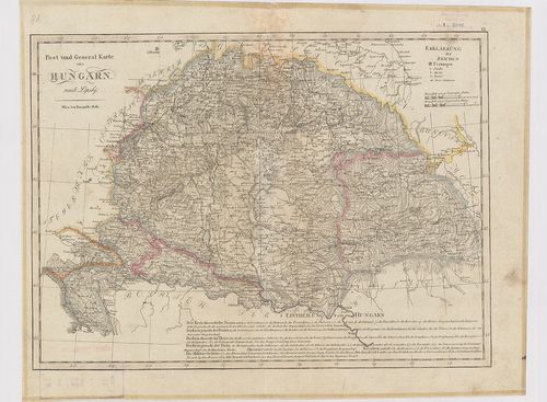
| Title | Post und General Karte von Hungarn. |
| Main title | Magyarország posta- és általános térképe 1820 körül. |
2656. Magyar Ország, Erdély, Horvát és Tót országok, s’ a Határőrv... [B IX c 630]
Institute and Museum of Military History •
B IX c
•
B IX Ausztria–Magyarország
•
B I–XV. Európa
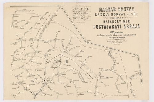
| Title | Magyar Ország, Erdély, Horvát és Tót országok, s’ a Határőrvidék Postajárati ábrája. |
2657. [Magyarország.] A Magyar Korona Országainak Posta és Távirda... [B IX c 631]
Institute and Museum of Military History •
B IX c
•
B IX Ausztria–Magyarország
•
B I–XV. Európa
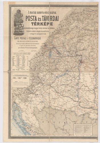
| Title | [Magyarország.] A Magyar Korona Országainak Posta és Távirdai Térképe. – Carte Postale et Telegraphique des Pays de la Couronne de Hongrie. |
| Main title | 2 mt.: 1. a postaszállító tengeri hajójáratok. 2. A fő- és székváros területén működő Posta-Távirda hivatalok. |
2658. [Magyarország.] A Magyar Korona Országai távirdahálózatának ... [B IX c 631/1]
Institute and Museum of Military History •
B IX c
•
B IX Ausztria–Magyarország
•
B I–XV. Európa
| Title | [Magyarország.] A Magyar Korona Országai távirdahálózatának részletes térképe. – Carte Sepciale du Réseau Télégraphique des pays de la Couronne de Hongrie. |
| Main title | Mt. A székes-főváros területén működő távirda-hivatalok és azok fekvése. Ker. beosztás. |
2659. [Magyarország.] A Magyar Korona Országai, Távbeszélő hálózat... [B IX c 631/2]
Institute and Museum of Military History •
B IX c
•
B IX Ausztria–Magyarország
•
B I–XV. Európa
| Title | [Magyarország.] A Magyar Korona Országai, Távbeszélő hálózatainak részletes térképe. – Carte Specialie du Réseau Téléphonique des Pays de la Couronne de Hongrie. |
| Main title | 9. tl. 1. Budapesti igazgatóság. |
| Subject | 2. Kassai (Kosice) igazatóság |
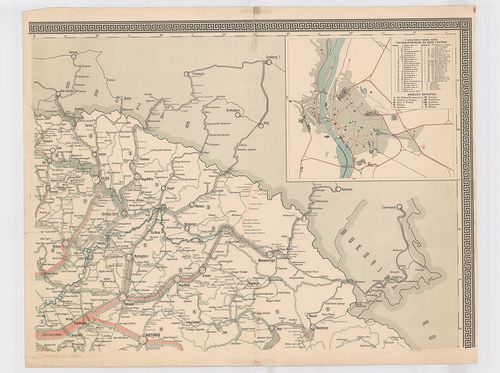
2660. [Magyarország.] A Magyar Korona Országainak posta- és távird... [B IX c 631/3]
Institute and Museum of Military History •
B IX c
•
B IX Ausztria–Magyarország
•
B I–XV. Európa
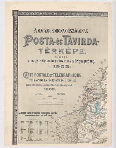
| Title | [Magyarország.] A Magyar Korona Országainak posta- és távirda-térképe. – Carte Postale et Telegraphique des pays de la Couronne de Hongrie. |
| Main title | 2 mt. 1. [Budapest és környéke.] 2. Az Adriai-tenger hajójáratai.] |