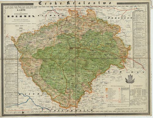
81. Králowstwi České: Uprawil a Pomocí Českého Museum. [B IX a 74]
Institute and Museum of Military History •
B IX a
•
B IX Ausztria–Magyarország
•
B I–XV. Európa
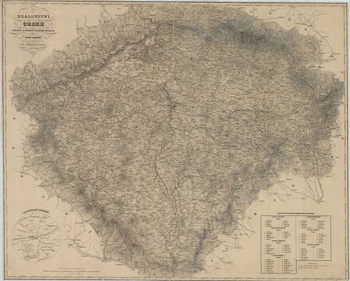
| Title | Králowstwi České: Uprawil a Pomocí Českého Museum. |
| Main title | Csehország térképe 1850-ben. |
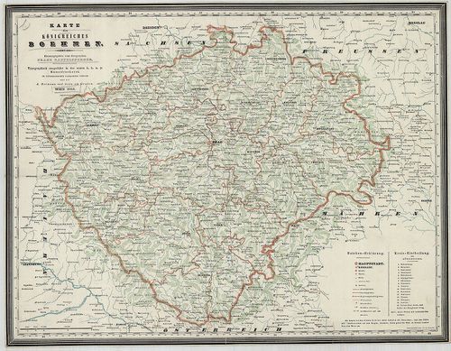
82. Handkarte des Königreiches Böhmen. [B IX a 75]
Institute and Museum of Military History •
B IX a
•
B IX Ausztria–Magyarország
•
B I–XV. Európa
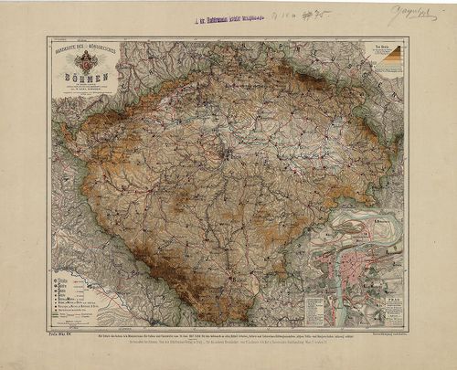
| Title | Handkarte des Königreiches Böhmen. |
| Main title | Mt. Prag. (Prága várostérkép.) |
| Subject | A Cseh Királyság térképe 1880 körül. |
83. Königreich Böhmen. Markgrafschaft Mähren. Herzogthum Schlesi... [B IX a 76]
Institute and Museum of Military History •
B IX a
•
B IX Ausztria–Magyarország
•
B I–XV. Európa
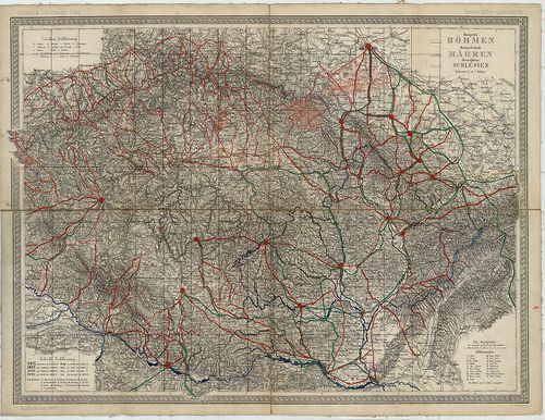
| Title | Königreich Böhmen. Markgrafschaft Mähren. Herzogthum Schlesien. |
| Main title | „Scheda und Steinhauser Atlas. Böhmen, Mähren u. Schlesien.” lapja. |
| Subject | Cseh–, Morvaország és Szilézia térképe 1877-ben. |
84. Mappa Geographica Regnum Bohemiae cum adiunctis Ducatu[s] Si... [B IX a 77]
Institute and Museum of Military History •
B IX a
•
B IX Ausztria–Magyarország
•
B I–XV. Európa
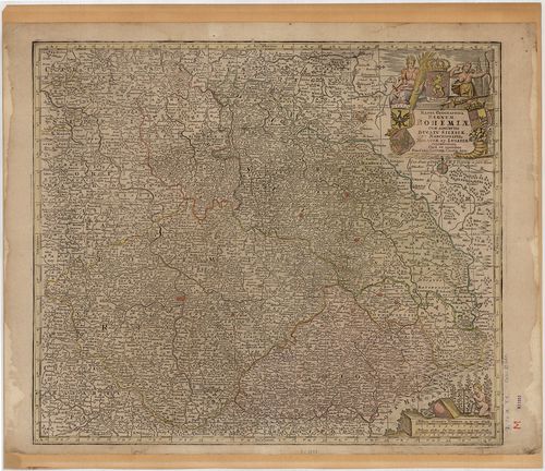
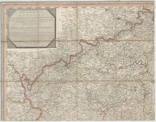
| Title | Mappa Geographica Regnum Bohemiae cum adiunctis Ducatu[s] Silesiae, et Marchionatib. Moraviae, et Lusatiae… |
| Main title | Csehország, Szilézia, Morvaország és Lausitz őrgrófság térképe a 18. században. |
85. Nova et accurata Descriptio Geographica Totius Regni Bohemia... [B IX a 78]
Institute and Museum of Military History •
B IX a
•
B IX Ausztria–Magyarország
•
B I–XV. Európa
| Title | Nova et accurata Descriptio Geographica Totius Regni Bohemiae, Eidemque incorporati Comitatus Glacensis… |
| Main title | Csehország térképe a 18. században. |
86. Mappa Geographica totius Regni Bohemiae in XII. Circulus div... [B IX a 79]
Institute and Museum of Military History •
B IX a
•
B IX Ausztria–Magyarország
•
B I–XV. Európa
| Title | Mappa Geographica totius Regni Bohemiae in XII. Circulus divisae, annexis Comitatu Glacensi et Districtu Egerano… |
| Main title | Csehország térképe 1758-ban a XII. ker. megnevezésével és jelölésével. |
87. Mappa Chorographica novissima et completissima Totius Regni ... [B IX a 80]
Institute and Museum of Military History •
B IX a
•
B IX Ausztria–Magyarország
•
B I–XV. Európa
| Title | Mappa Chorographica novissima et completissima Totius Regni Bohemiae in duodecim Circulos Divisae cum Comitatu Glacensi et Districtu Egrano… |
| Main title | Csehország térképe 1726-ban. |
88. Nouvea Theatre de Guerre ou Atlas Topographique et Militaire... [B IX a 81]
Institute and Museum of Military History •
B IX a
•
B IX Ausztria–Magyarország
•
B I–XV. Európa
| Title | Nouvea Theatre de Guerre ou Atlas Topographique et Militaire qui comprend Le Royaume de Boheme, le Comté Glatz, le Marquisat de Moravie, le Duche de Silesie, le Marquisat de Lusace, la Saxe Electorate, et di Haut Palatinat de Baviere. |
| Main title | 3 térk. mell. 1. Marquisat de Brandebourg. (Brandenburg őrgrófság térk.) 2. Plan de la Bataille de Chotzemitz. Metsz. Durand. (Chotzemitz ütközet térk.) 3. Plan de la Ville Berlin… 1753. |
| Subject | Csehország, Szilézia, Lausitz, Szászország térképe 1758-ban. |
89. Totius Regni Bohemiae Mappa Chorographico-mineralogico-hydra... [B IX a 83]
Institute and Museum of Military History •
B IX a
•
B IX Ausztria–Magyarország
•
B I–XV. Európa
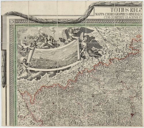
| Title | Totius Regni Bohemiae Mappa Chorographico-mineralogico-hydraulico-commercialis cum Comitatu Glacensi et Districtu Egrano. |
| Main title | Csehország térképe 1808-ban. |
90. Das Koenigreich Boehmen… [B IX a 84]
Institute and Museum of Military History •
B IX a
•
B IX Ausztria–Magyarország
•
B I–XV. Európa
| Title | Das Koenigreich Boehmen… |
| Main title | Csehország térképe 1809-ben. |
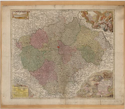
91. Kreis-Atlas des Königreichs Böhmen. [B IX a 85]
Institute and Museum of Military History •
B IX a
•
B IX Ausztria–Magyarország
•
B I–XV. Európa
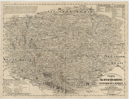
| Title | Kreis-Atlas des Königreichs Böhmen. |
| Main title | Csehország 16 kerületének térképe 1826–1834-ben. |
92. Das Königreich Boehmen. [B IX a 85/a]
Institute and Museum of Military History •
B IX a
•
B IX Ausztria–Magyarország
•
B I–XV. Európa
| Title | Das Königreich Boehmen. |
| Main title | Csehország térképe 1842-ben. |
93. Karte des Königreiches Boehmen. [B IX a 85/b]
Institute and Museum of Military History •
B IX a
•
B IX Ausztria–Magyarország
•
B I–XV. Európa
| Title | Karte des Königreiches Boehmen. |
| Main title | Csehország térképe 1845-ben. |
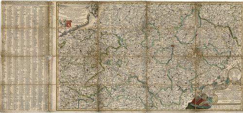
94. Kreis, -Gericht, -Völker, -Telegrafen, -Eisenbahn und Post-K... [B IX a 85/c]
Institute and Museum of Military History •
B IX a
•
B IX Ausztria–Magyarország
•
B I–XV. Európa
| Title | Kreis, -Gericht, -Völker, -Telegrafen, -Eisenbahn und Post-Karte des Königreiches Boehmen. |
| Main title | Csehország közigazgatási, törvénykezési, népességi, távirda, posta, vasúthálózati térképe 1850-ben. |
95. Karte des Königreiches Boehmen. [B IX a 85/d]
Institute and Museum of Military History •
B IX a
•
B IX Ausztria–Magyarország
•
B I–XV. Európa
| Title | Karte des Königreiches Boehmen. |
| Main title | Csehország térképe 1841-ben. |
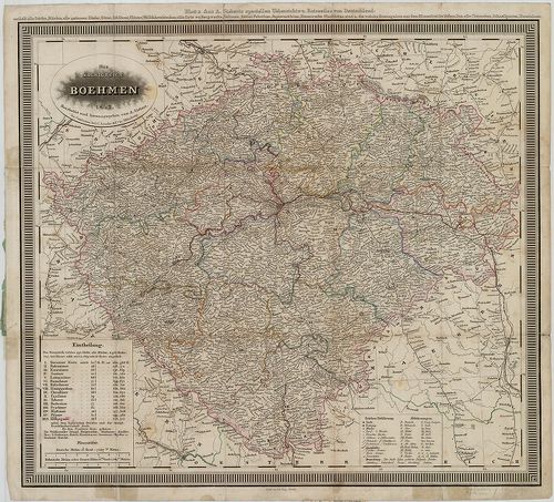
96. Koenigreich Boehmen. [B IX a 86]
Institute and Museum of Military History •
B IX a
•
B IX Ausztria–Magyarország
•
B I–XV. Európa
| Title | Koenigreich Boehmen. |
| Main title | Csehország térképe 1844-ben. |
97. General-Karte des Königreiches Böhmen. [B IX a 87]
Institute and Museum of Military History •
B IX a
•
B IX Ausztria–Magyarország
•
B I–XV. Európa
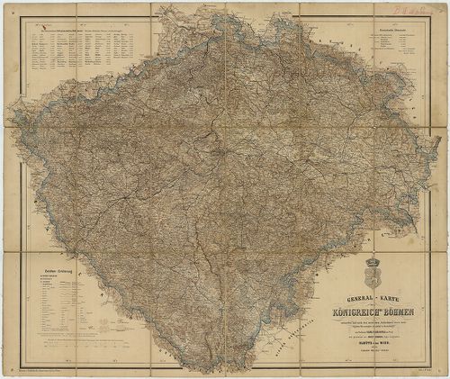
| Title | General-Karte des Königreiches Böhmen. |
| Main title | Csehország térképe 1862-ben vasúthálózattal. |
98. General Karte des Königreichs Böhmen. [B IX a 88]
Institute and Museum of Military History •
B IX a
•
B IX Ausztria–Magyarország
•
B I–XV. Európa
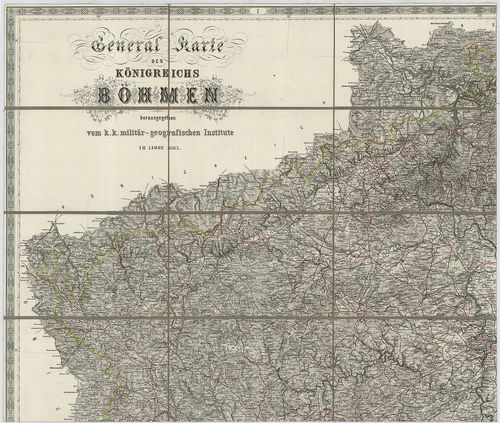
| Title | General Karte des Königreichs Böhmen. |
| Main title | Csehország általános térképe 1865-ben, a II. katonai felmérés alapján. |
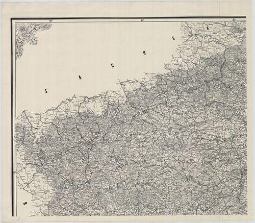
99. General Karte des Königreichs Böhmen. [B IX a 88/1]
Institute and Museum of Military History •
B IX a
•
B IX Ausztria–Magyarország
•
B I–XV. Európa
| Title | General Karte des Königreichs Böhmen. |
| Main title | Csehország általános térképe 1869-ben, a II. katonai felmérés alapján. |
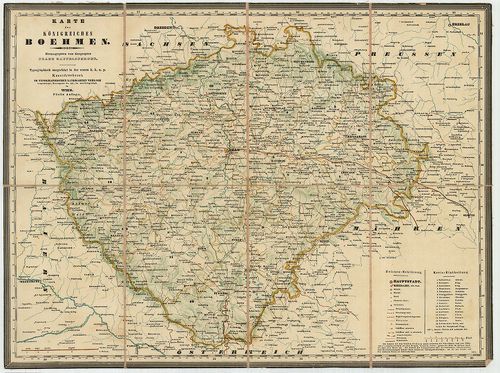
100. General-Karte Königreiches Böhmen. [B IX a 89]
Institute and Museum of Military History •
B IX a
•
B IX Ausztria–Magyarország
•
B I–XV. Európa
| Title | General-Karte Königreiches Böhmen. |
| Main title | Csehország térképe 1895-ben. |