101. General-Karte des Fürst zu Fürstenbergschen Fideikommissbesi... [B IX a 90]
Institute and Museum of Military History •
B IX a
•
B IX Ausztria–Magyarország
•
B I–XV. Európa
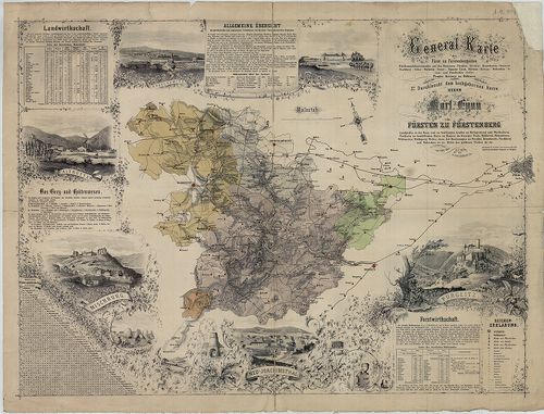
| Title | General-Karte des Fürst zu Fürstenbergschen Fideikommissbesitzstandes auf den Domainen Pürgltz, (Křivoklat), Kruschowitz, (Krušovice,) Nischburg, (Nižbor,) Wschettat, (Všetaty), Panošuv Ujezd, Skřiwan, (Skřivany,) Woleschna, (Volešna), und Pawelschin, (Pavlčin), Prager Kreises in Böhmen. |
| Main title | Fürstenberg fejedelemség (Csehország, Prágától NY-ra.) térképe a 19. században. |
102. Karte jener Theile des Erzherzogthums Oesterreich, Königreic... [B IX a 91]
Institute and Museum of Military History •
B IX a
•
B IX Ausztria–Magyarország
•
B I–XV. Európa

| Title | Karte jener Theile des Erzherzogthums Oesterreich, Königreiches Ungarn und Markgraftthums Mähren, welche von der zur K. K. Familie Herrschaft Holitsch gehörigen Hutweide Provist… |
| Main title | Holitsch őrgrófi család birtoka, Ausztria, Magyarország és a Morva őrgrófság területén 1839-ben. (Pozsonytól É-ra.) |
103. Carte Generale du Royaume de Boheme du Dusché de Silesie et ... [B IX a 92]
Institute and Museum of Military History •
B IX a
•
B IX Ausztria–Magyarország
•
B I–XV. Európa
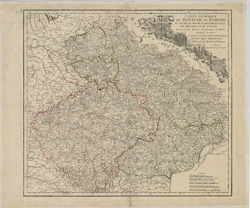
| Title | Carte Generale du Royaume de Boheme du Dusché de Silesie et des Marquisats de Moravie et de Lusace. |
| Main title | Csehország, Sziléziai hercegség, Morva – és Lausitz őrgrófságok általános térképe a 18. század közepén. |
104. Special-Karte des Koenigreiches Boehmen. [B IX a 95]
Institute and Museum of Military History •
B IX a
•
B IX Ausztria–Magyarország
•
B I–XV. Európa
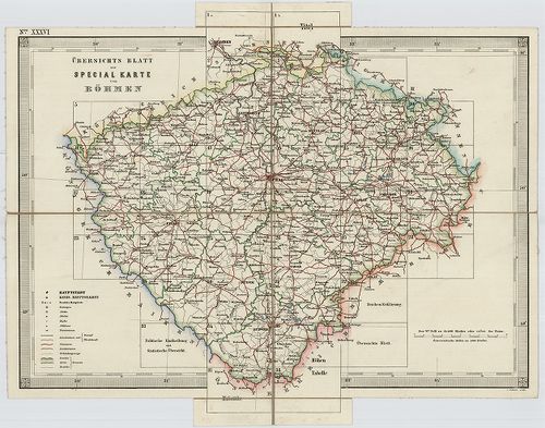
| Title | Special-Karte des Koenigreiches Boehmen. |
| Main title | Csehország részletes topográfiai térképe 1847-1860 között, a II. katonai felmérés alapján. |
105. Special-Karte des Koenigreiches Boehmen. [B IX a 95/1]
Institute and Museum of Military History •
B IX a
•
B IX Ausztria–Magyarország
•
B I–XV. Európa
| Title | Special-Karte des Koenigreiches Boehmen. |
| Main title | Csehország részletes topográfiai térképe 1847-1860 között, a II. katonai felmérés alapján. |
106. Special-Karte des Koenigreiches Boehmen. [B IX a 96]
Institute and Museum of Military History •
B IX a
•
B IX Ausztria–Magyarország
•
B I–XV. Európa
| Title | Special-Karte des Koenigreiches Boehmen. |
| Main title | Csehország részletes topográfiai térképe 1847-1860 között, a II. katonai felmérés alapján. |
107. Boehmen. Neu Geographie. [B IX a 100]
Institute and Museum of Military History •
B IX a
•
B IX Ausztria–Magyarország
•
B I–XV. Európa
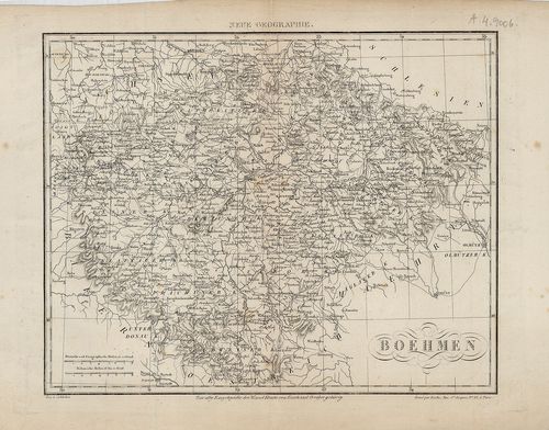
| Title | Boehmen. Neu Geographie. |
| Main title | Csehország térképe a 19. században. |
108. Charte von Böhmen, Mähren und Oestr. Schlesien. [B IX a 101]
Institute and Museum of Military History •
B IX a
•
B IX Ausztria–Magyarország
•
B I–XV. Európa
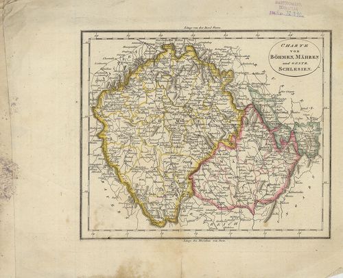
| Title | Charte von Böhmen, Mähren und Oestr. Schlesien. |
| Main title | Csehország, Morvaország és Osztrák-Szilézia általános térképe 1780 körül. |
109. Csehország É-i részének felmérési szelvényei az I. katonai f... [B IX a 103]
Institute and Museum of Military History •
B IX a
•
B IX Ausztria–Magyarország
•
B I–XV. Európa
| Title | Csehország É-i részének felmérési szelvényei az I. katonai felmérésből, "a la vue" felmérés.. |
110. Nordwestlicher Theil von Boehmen, enthaltend: den Pilsner, E... [B IX a 108]
Institute and Museum of Military History •
B IX a
•
B IX Ausztria–Magyarország
•
B I–XV. Európa
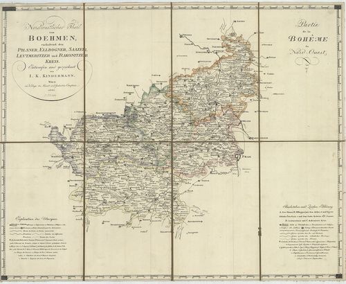
| Title | Nordwestlicher Theil von Boehmen, enthaltend: den Pilsner, Ellbogner, Saazer, Leutmeritzer und Rakonitzer Kreis. – Partie de la Boheme du Nord-Quest. |
| Main title | Csehország ÉK-i részének általános térképe 1802-ben. (Pilzen, Plzen) (Elbogen, Loket), (Saaz, Zatec), (Leutmeritz, Litoměrice) és (Rakonitz, Rakovnik) kerületek. |
111. Südlicher Theil von Boehmen, enthaltend den Klattauer, Berau... [B IX a 109]
Institute and Museum of Military History •
B IX a
•
B IX Ausztria–Magyarország
•
B I–XV. Európa
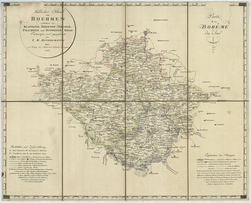
| Title | Südlicher Theil von Boehmen, enthaltend den Klattauer, Berauner, Taborer, Prachiner und Budweiser Kreis. – Partie de la Bohéme du Sud. |
| Main title | Csehország D-i részének általános térképe 1802-ben, (Klatovy – Beraun – Tábor – Strakonice és Česke Budějovice kerületek.) |
112. Nordöstlicher Theil von Boehmen, enthaltend den Bunzlauer, B... [B IX a 110]
Institute and Museum of Military History •
B IX a
•
B IX Ausztria–Magyarország
•
B I–XV. Európa
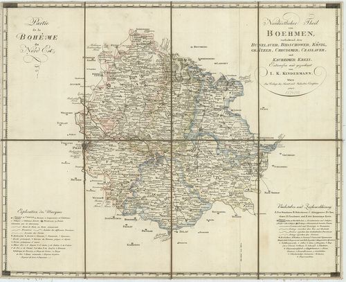
| Title | Nordöstlicher Theil von Boehmen, enthaltend den Bunzlauer, Bidschower, Königgrätzer, Chrudimer, Czaslauer und Kaurzimer Kreis. – Partie de la Boheme du Nord Est. |
| Main title | Csehország ÉK-i részének általános térképe 1803-ban. (Mladá Boleslav – Novi Bydžov – Hradec Králove – Chrudim – Caslav, és Kolin ker.) |
113. Cseh- és Morvaország, Szilézia. [B IX a 111]
Institute and Museum of Military History •
B IX a
•
B IX Ausztria–Magyarország
•
B I–XV. Európa
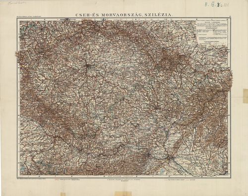
| Title | Cseh- és Morvaország, Szilézia. |
114. Cseh- és Morva Országok 's az Aistriai Házhoz tartozó Sziléz... [B IX a 112]
Institute and Museum of Military History •
B IX a
•
B IX Ausztria–Magyarország
•
B I–XV. Európa
| Title | Cseh- és Morva Országok 's az Aistriai Házhoz tartozó Szilézia földképe. |
115. Das Nördliche Böhmen. [B IX a 113]
Institute and Museum of Military History •
B IX a
•
B IX Ausztria–Magyarország
•
B I–XV. Európa
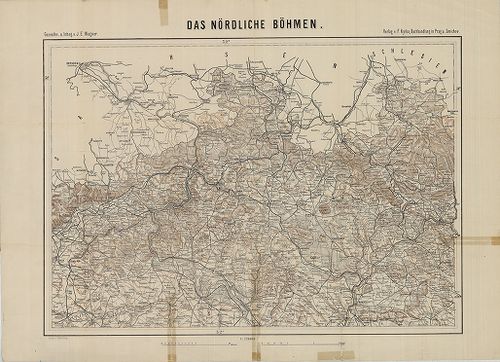
| Title | Das Nördliche Böhmen. |
| Main title | Csehország É-i részének térképe 1880-ban. |
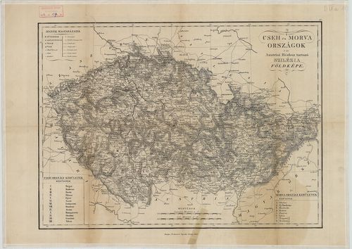
116. Tseh és Morva Országok ’s az Austriai Házhoz tartozó Silesia... [B IX a 114]
Institute and Museum of Military History •
B IX a
•
B IX Ausztria–Magyarország
•
B I–XV. Európa
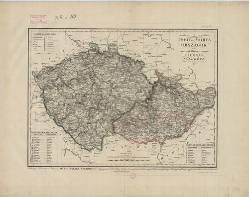
| Title | Tseh és Morva Országok ’s az Austriai Házhoz tartozó Silesia (Szilézia) földképe. |
| Main title | Cseh és Morvaország térképe 1835-ben, a kerületek jelölésével és határszín. |
117. Il Regno di Ungheria. [B IX a 115]
Institute and Museum of Military History •
B IX a
•
B IX Ausztria–Magyarország
•
B I–XV. Európa
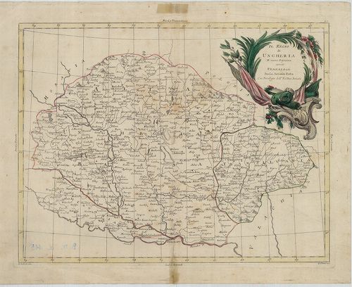
| Title | Il Regno di Ungheria. |
| Main title | A Magyar Királyság térképe 1781-ben. |
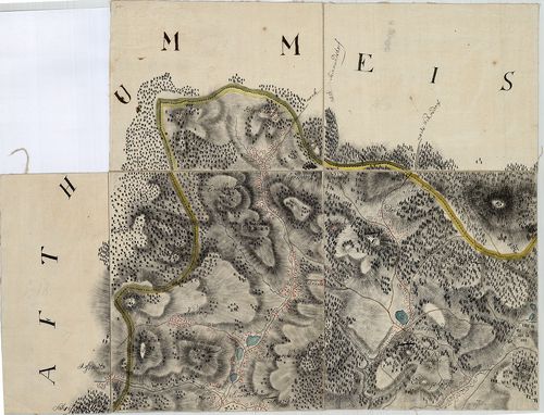
118. Topographische Carte Einer Gegend in Boehmen An der Isser in... [B IX a 117]
Institute and Museum of Military History •
B IX a
•
B IX Ausztria–Magyarország
•
B I–XV. Európa
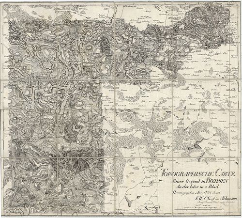
| Title | Topographische Carte Einer Gegend in Boehmen An der Isser in 2 Blad. |
| Main title | A Jizera (Iser) folyó vidékének topográfiai térképe 1794-ben (Csehország). |
119. Regno di Boemia, Ducato di Silesia e Marchesati di Moravia e... [B IX a 118]
Institute and Museum of Military History •
B IX a
•
B IX Ausztria–Magyarország
•
B I–XV. Európa
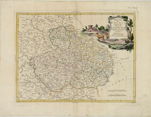
| Title | Regno di Boemia, Ducato di Silesia e Marchesati di Moravia e Lusazia. |
| Main title | Csehország, a Szilézia hercegség, Morva és Lausitz őrgrófság térképe 1779-ben. |
120. Parte Orientale del Regno di Boemia. [B IX a 118/1]
Institute and Museum of Military History •
B IX a
•
B IX Ausztria–Magyarország
•
B I–XV. Európa
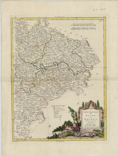
| Title | Parte Orientale del Regno di Boemia. |
| Main title | Csehország K-i részének térképe 1779-ben. |