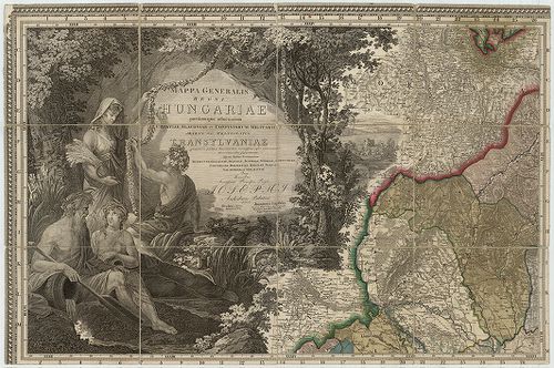
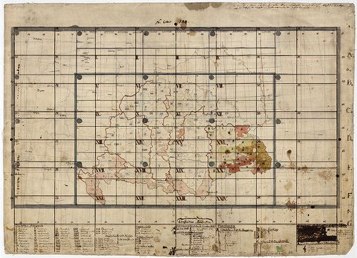
401. Mappa Generalis Topographico-Ecclesiastico-Ethnographico-Sta... [B IX a 506/4]
Institute and Museum of Military History •
B IX a
•
B IX Ausztria–Magyarország
•
B I–XV. Európa
| Title | Mappa Generalis Topographico-Ecclesiastico-Ethnographico-Statistica Regni Hungariae partiumque, adnexarum Croatiae Slavoniae et Confinitorum Militarium Magni item Principatus Transylvaniae. |
| Main title | A Magyar Királyság, Horvát-Szlavónia , a katőnai Határőrvidékek és Erdély általános topográfiai, egyházmegyei, néprajzi, statisztikai térképe 1825-ben. |
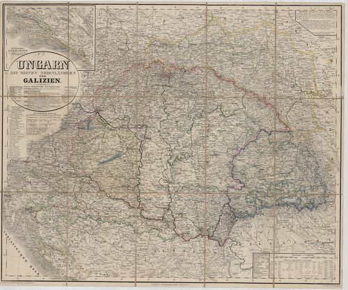
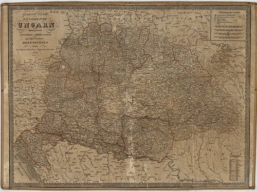
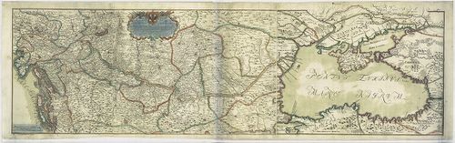
402. Ungarn mit seinen Nebenländern und Galizien. [B IX a 508]
Institute and Museum of Military History •
B IX a
•
B IX Ausztria–Magyarország
•
B I–XV. Európa
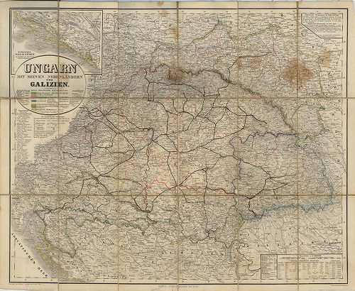
| Title | Ungarn mit seinen Nebenländern und Galizien. |
| Main title | Magyarország és környéke és Galícia térképe 1858-ban. |
403. Ungarn und seine Nebenländer. [B IX a 509]
Institute and Museum of Military History •
B IX a
•
B IX Ausztria–Magyarország
•
B I–XV. Európa
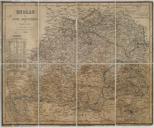
| Title | Ungarn und seine Nebenländer. |
| Main title | Mt. Ofen-Pest. (Pest-Buda várostérk.) |
| Subject | Magyarország és környékének térképe 1860 körül. |
404. A Magyar Korona Országainak Iskolai falitérképe. [B IX a 510/2]
Institute and Museum of Military History •
B IX a
•
B IX Ausztria–Magyarország
•
B I–XV. Európa
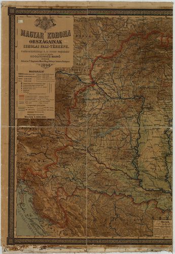
| Title | A Magyar Korona Országainak Iskolai falitérképe. |
| Main title | Mt. Budapest és környéke. |
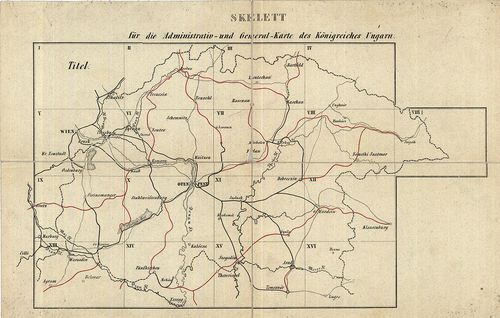
405. [Magyarország közigazgatási térképe megyei és kerületi beosz... [B IX a 511]
Institute and Museum of Military History •
B IX a
•
B IX Ausztria–Magyarország
•
B I–XV. Európa
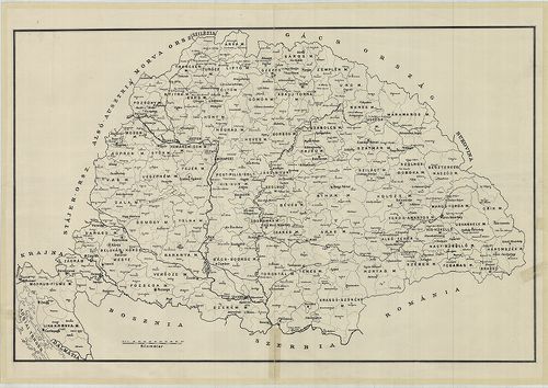
| Title | [Magyarország közigazgatási térképe megyei és kerületi beosztással.] |
406. Tabula Hungaria et Regionum quae praeterea ab ea dependent… [B IX a 512]
Institute and Museum of Military History •
B IX a
•
B IX Ausztria–Magyarország
•
B I–XV. Európa
| Title | Tabula Hungaria et Regionum quae praeterea ab ea dependent… |
| Main title | Magyarország és a társországok térképe 1760 körül. |
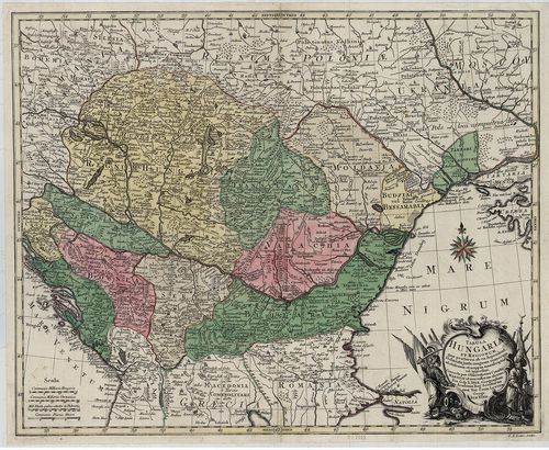
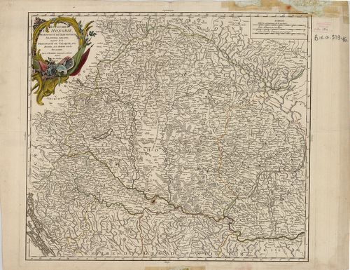
407. Mappa Geographica novissima Regni Hungariae divisi in suos C... [B IX a 513]
Institute and Museum of Military History •
B IX a
•
B IX Ausztria–Magyarország
•
B I–XV. Európa
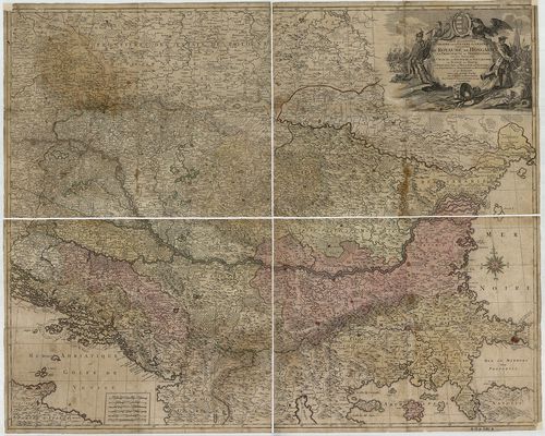
| Title | Mappa Geographica novissima Regni Hungariae divisi in suos Comitatus cum Districtibus Iazygum et Cumanorum Banatus Temesiensis ejusque Districtuum nec non Regnorum Croatiae, Sclavoniae, Dalmatiae, Magni Principatus Transilvaniae partis Bosniae Serviai Bulgariae et Walachiae… |
| Main title | A Magyar Királyság, Horvát-Szlavónia, Dalmácia, Erdély, valamint Bosznia, Szerbia, Bulgária és Havasalföld egy részének térképe 1769-ben. |
408. Magyarországnak Földképe melly az eddig készült Mappákból le... [B IX a 513/c]
Institute and Museum of Military History •
B IX a
•
B IX Ausztria–Magyarország
•
B I–XV. Európa
| Title | Magyarországnak Földképe melly az eddig készült Mappákból lehetően meg jobbítva a ’köz haszonra ki bocsátatott Pesten. |
409. Allgemeine Charte vom Königreiche Ungarn mit Einschluss der ... [B IX a 513/d]
Institute and Museum of Military History •
B IX a
•
B IX Ausztria–Magyarország
•
B I–XV. Európa
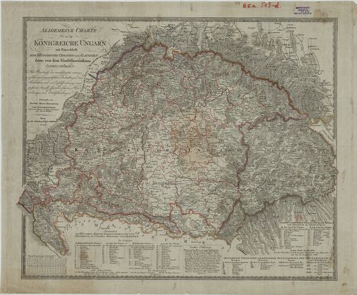
| Title | Allgemeine Charte vom Königreiche Ungarn mit Einschluss der Königreiche Croatien und Slavonien dann von dem Grossfürstenthum Siebenbürgen… |
| Main title | A Magyar Királyság, Horvát-Szlavónia és Erdély általános térképe 1836-ban, megyei beosztással. |
410. General-Karte von Königreich Hungarn in VIII gezeichneten Bl... [B IX a 514/1]
Institute and Museum of Military History •
B IX a
•
B IX Ausztria–Magyarország
•
B I–XV. Európa
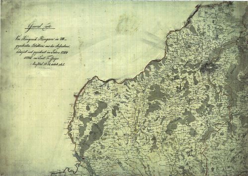
| Title | General-Karte von Königreich Hungarn in VIII gezeichneten Blättern aus der Aufnahme reduciert und gezeichnet im Jahre 1784 und 1785. |
| Main title | Magyarország általános térképe 8 lapon 1784–85-ben az I. katonai felmérés alapján. |
411. Vorstellung des Königreichs Ungarn nach den Poststationen fü... [B IX a 515/2]
Institute and Museum of Military History •
B IX a
•
B IX Ausztria–Magyarország
•
B I–XV. Európa
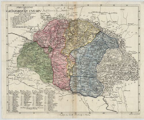
| Title | Vorstellung des Königreichs Ungarn nach den Poststationen für Reisende. |
| Main title | A Magyar Királyság térképe 1800 körül, a postai állomások és útvonal jelölésével. |
412. A New Map of Hungary, particulary of its Rivers and Natural ... [B IX a 515/3]
Institute and Museum of Military History •
B IX a
•
B IX Ausztria–Magyarország
•
B I–XV. Európa
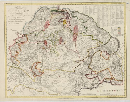
| Title | A New Map of Hungary, particulary of its Rivers and Natural productions. |
| Main title | Magyarország etnikai, geológiai és postahálózati térképe 1797-ben. |
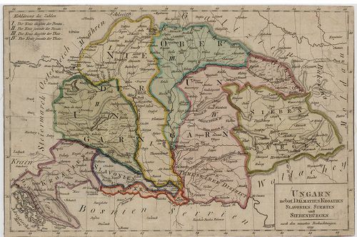
413. Mappa Generalis Regni Hungariae parti umque adnexarum Croati... [B IX a 518]
Institute and Museum of Military History •
B IX a
•
B IX Ausztria–Magyarország
•
B I–XV. Európa
| Title | Mappa Generalis Regni Hungariae parti umque adnexarum Croatiae, Slavoniae et Confiniorum Militarium Magni item Principatus Transylvaniae. |
| Main title | Repertorium locorum Objectorumque in XII. tabulis Mappae Regnorum Hungariae Slavoniae, Croatiae, et Confiniorum Militarium Magni item Principatus Transylvaniae… |
| Subject | A Magyar Királyság, Horvát–Szlavonia és Erdély általános térképe 1806-ban. |
414. Ungarn nebst Dalmatien, Kroatien, Slavonien, Syrmien und Sie... [B IX a 518/a]
Institute and Museum of Military History •
B IX a
•
B IX Ausztria–Magyarország
•
B I–XV. Európa
| Title | Ungarn nebst Dalmatien, Kroatien, Slavonien, Syrmien und Siebenbürgen. |
| Main title | Magyarország, Dalmácia, Horvát-Szlavónia, a Szerémség és Erdély térképe 1809-ben. |
415. [A Mappa Generalis kéziratos alapja. [B IX a 518/b]
Institute and Museum of Military History •
B IX a
•
B IX Ausztria–Magyarország
•
B I–XV. Európa
| Title | [A Mappa Generalis kéziratos alapja. |
| Main title | Magyar Ország, Horvát, Tót, Dalmát, Erdély országok, a’ tenger mellék, katonai Határőrvidék, Földképe… – Karte des Königreichs Ungarn der Königreiche Croatien, Slavonien, Dalmatien, des Grossfürstenth. Siebenbürgen, des Künstenlandes und der Militair Grenze… |
416. Magyarország, Horvát, Tót, Dalmát és Erdély Országok, a’ ten... [B IX a 519/1]
Institute and Museum of Military History •
B IX a
•
B IX Ausztria–Magyarország
•
B I–XV. Európa
| Title | Magyarország, Horvát, Tót, Dalmát és Erdély Országok, a’ tenger mellék’ és a’ végőri vidékek’ közönséges posták’ és utak’ földabrosza… – Vollstaendige General Posten- und Strassen-Karte des Königreichs Ungarn… |
417. Karte des Königreichs Ungarn, seiner Nebenländer, und Sieben... [B IX a 519/a]
Institute and Museum of Military History •
B IX a
•
B IX Ausztria–Magyarország
•
B I–XV. Európa
| Title | Karte des Königreichs Ungarn, seiner Nebenländer, und Siebenbürgen’s. |
| Main title | A Magyar Királyság, a szomszédos országok és Erdély térképe 1838-ban. |
418. Magyarország, Horvát, Tót Dalmát, Erdély Országok, a’ Tenger... [B IX a 519/2]
Institute and Museum of Military History •
B IX a
•
B IX Ausztria–Magyarország
•
B I–XV. Európa
| Title | Magyarország, Horvát, Tót Dalmát, Erdély Országok, a’ Tenger mellék, katonai határőrvidék, s’ az Austriai Birodalom szomszéd részeinek Földképe… II. egészen megváltoztatott… kiadás. – Karte des Königreichs Ungarn der Königreiche Croatien, Slavonien, Dalmatien, des Grossfürstenth. Siebenbürgen des Küstenlandes… II.-te … Ausgabe. |
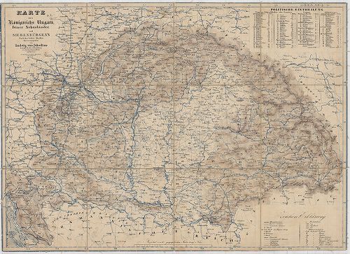
419. Comitatskarten von Ungarn. [B IX a 520]
Institute and Museum of Military History •
B IX a
•
B IX Ausztria–Magyarország
•
B I–XV. Európa
| Title | Comitatskarten von Ungarn. |
| Main title | A Magyar Királyság vármegyéinek térképe 1857-1859 között, járási beosztással, posta és úthálózattal. (A II. katonai felmérés alapján). Vármegyék: 1.Abaúj-Torna. 2.Arad. 3.Árva-Thúrócz (Árva-Turóc). 4.Baranya. 5.Bars és Honth (Bars és Hont). 6.Békés-Csanád. 7.Borsod. 8.a Éjszaki-Bihar (Észak-Bihar). 8.b. Süd-Biharer (Dél-Bihar). 9. Vas. 10. Gömör. 11.Esztergom. 12.Heves. 13.Komerner (Komárom). 14.Liptau (Liptó). 15.Marmaros (Máramaros). 16.Nógrád. 17.F.Nyitra (Felső-Nyitra). 18.Alsó-Nyítra. 19. Soprony és Győr (Sopron és Győr). 20.Pest-Pilis. 21.Pest-Solt, Csongrád, Szolnok. 22.Pozsony. 23.Sáros. 24.Sohler (Zólyom). 25.Somogy. 26.Székes-Fejér (Fejér). 27.Szathmár (Szatmár). 28.Szabolcs. 29.Tolna. 30.Trencsény (Trencsén). 31.Beregh-Ugocsa (Bereg-Ugocsa). 32.Ungh (Ung). 33.Veszprém. 34. Wieselburg (Moson). 35.Zala. 36.Zemplén. 37. Zipser (Szepes). |
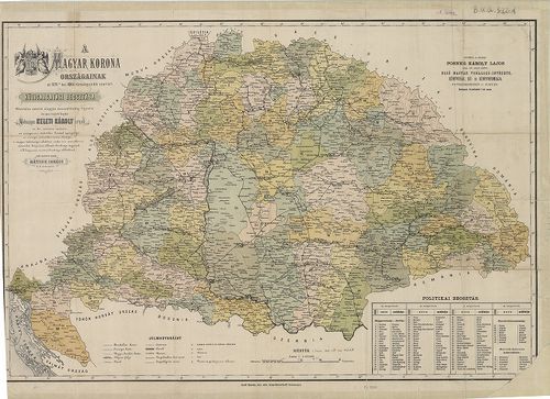
420. Administrativ- und General-Karte des Königreiches Ungarn. [B IX a 521]
Institute and Museum of Military History •
B IX a
•
B IX Ausztria–Magyarország
•
B I–XV. Európa
| Title | Administrativ- und General-Karte des Königreiches Ungarn. |
| Main title | A Magyar Királyság közigazgatási térképe 1858-ban, a II. katonai felmérés alapján. |
421. Administrativ- und General-Karte des Königreiches Ungarn. [B IX a 521/1]
Institute and Museum of Military History •
B IX a
•
B IX Ausztria–Magyarország
•
B I–XV. Európa
| Title | Administrativ- und General-Karte des Königreiches Ungarn. |
| Main title | A Magyar Királyság közigazgatási térképe 1861-ben, a II. katonai felmérés alapján. |
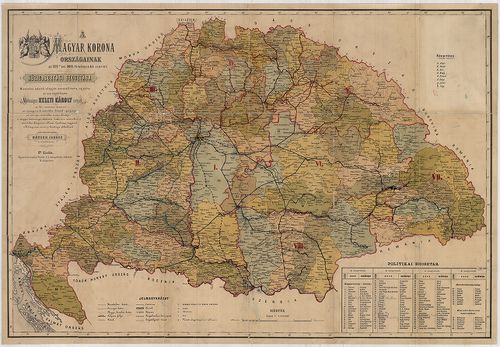
422. Administrativ- und General-Karte des Königreiches Ungarn. [B IX a 521/2]
Institute and Museum of Military History •
B IX a
•
B IX Ausztria–Magyarország
•
B I–XV. Európa
| Title | Administrativ- und General-Karte des Königreiches Ungarn. |
| Main title | A Magyar Királyság közigazgatási térképe 1869-ben, a II. katonai felmérés alapján. |
423. Administrativ- und General-Karte des Königreichs Ungarn. [B IX a 521/3]
Institute and Museum of Military History •
B IX a
•
B IX Ausztria–Magyarország
•
B I–XV. Európa
| Title | Administrativ- und General-Karte des Königreichs Ungarn. |
| Main title | A Magyar Királyság közigazgatási térképe 1870-ben, a II. katonai felmérés alapján. |
424. Administrativ- und General-Karte des Königreichs Ungarn. [B IX a 521/4]
Institute and Museum of Military History •
B IX a
•
B IX Ausztria–Magyarország
•
B I–XV. Európa
| Title | Administrativ- und General-Karte des Königreichs Ungarn. |
| Main title | A Magyar Királyság közigazgatási térképe 1872-ben, a II. katonai felmérés alapján. |
425. Administrativ- und General-Karte des Königreichs Ungarn. [B IX a 521/5]
Institute and Museum of Military History •
B IX a
•
B IX Ausztria–Magyarország
•
B I–XV. Európa
| Title | Administrativ- und General-Karte des Königreichs Ungarn. |
| Main title | A Magyar Királyság közigazgatási térképe 1874-ben, a II. katonai felmérés alapján. |
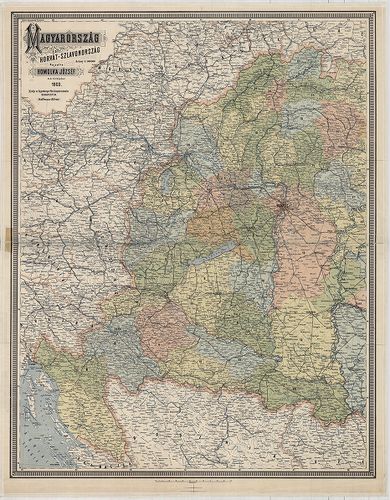
426. A Magyar Korona Országainak Magyarország, Horvát és Szlavono... [B IX a 522]
Institute and Museum of Military History •
B IX a
•
B IX Ausztria–Magyarország
•
B I–XV. Európa
| Title | A Magyar Korona Országainak Magyarország, Horvát és Szlavonország közigazgatási falitérképe. |
| Main title | 3 mt. 1. Törvénykezési beosztás. |
| Subject | 2. A népesség sűrűsége. |
427. A Magyar Korona Országainak az 1876-ik évi XXXIII. törvényci... [B IX a 522/1]
Institute and Museum of Military History •
B IX a
•
B IX Ausztria–Magyarország
•
B I–XV. Európa
| Title | A Magyar Korona Országainak az 1876-ik évi XXXIII. törvénycikk szerinti közigazgatási beosztása. |
428. A Magyar Korona Országainak az 1876-ik évi XXXIII. törvényci... [B IX a 522/2]
Institute and Museum of Military History •
B IX a
•
B IX Ausztria–Magyarország
•
B I–XV. Európa
| Title | A Magyar Korona Országainak az 1876-ik évi XXXIII. törvénycikk szerinti közigazgatási beosztása. |
429. Osztrák–Magyar Monarchia térképe. [B IX a 522/3]
Institute and Museum of Military History •
B IX a
•
B IX Ausztria–Magyarország
•
B I–XV. Európa
| Title | Osztrák–Magyar Monarchia térképe. |
430. A Magyar Szt[ent] Korona Országainak térképe. [B IX a 522/4]
Institute and Museum of Military History •
B IX a
•
B IX Ausztria–Magyarország
•
B I–XV. Európa
| Title | A Magyar Szt[ent] Korona Országainak térképe. |
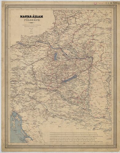
431. A Magyar Állam közigazgatási térképe. [B IX a 524/1]
Institute and Museum of Military History •
B IX a
•
B IX Ausztria–Magyarország
•
B I–XV. Európa
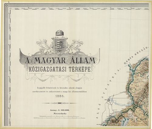
| Title | A Magyar Állam közigazgatási térképe. |
432. A Magyar Állam Közigazgatási térképe. [B IX a 524/2]
Institute and Museum of Military History •
B IX a
•
B IX Ausztria–Magyarország
•
B I–XV. Európa
| Title | A Magyar Állam Közigazgatási térképe. |
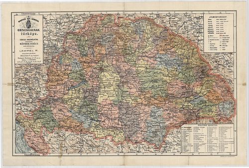
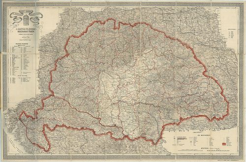
433. A Magyar Állam közigazgatási térképe. [B IX a 525]
Institute and Museum of Military History •
B IX a
•
B IX Ausztria–Magyarország
•
B I–XV. Európa
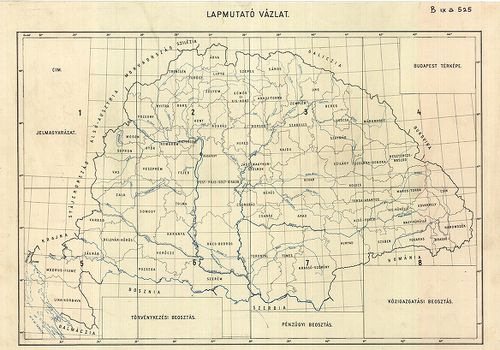
| Title | A Magyar Állam közigazgatási térképe. |
| Main title | Mt. Budapest. |
434. Magyarország közigazgatási térképe. [B IX a 525/1]
Institute and Museum of Military History •
B IX a
•
B IX Ausztria–Magyarország
•
B I–XV. Európa
| Title | Magyarország közigazgatási térképe. |
435. A Magyar Sz.[ent] Korona országainak térképe. [B IX a 525/3]
Institute and Museum of Military History •
B IX a
•
B IX Ausztria–Magyarország
•
B I–XV. Európa
| Title | A Magyar Sz.[ent] Korona országainak térképe. |
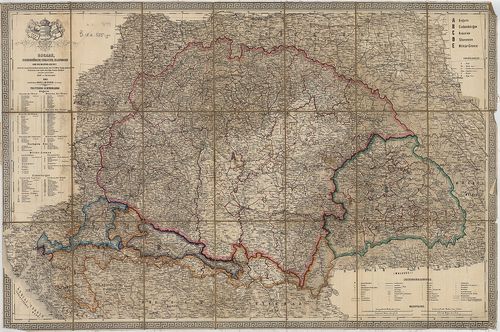
436. Ungarn mit seiner Nebenländern und Galizien. [B IX a 525/4]
Institute and Museum of Military History •
B IX a
•
B IX Ausztria–Magyarország
•
B I–XV. Európa
| Title | Ungarn mit seiner Nebenländern und Galizien. |
| Main title | Mt. Südliches Dalmatien. (Dalmácia D-i része.) |
| Subject | Magyarország, a társországok és Galícia térképe 1855-ben. |
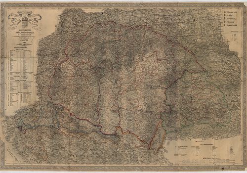
437. Ungarn mit seinen Nebenländern und Galizien. [B IX a 525/4]
Institute and Museum of Military History •
B IX a
•
B IX Ausztria–Magyarország
•
B I–XV. Európa
| Title | Ungarn mit seinen Nebenländern und Galizien. |
| Main title | Mt. Südlichen Dalmatien. (Dalmácia D-i része.) |
| Subject | Magyarország, a társországok és Galícia térképe 1862-ben. |
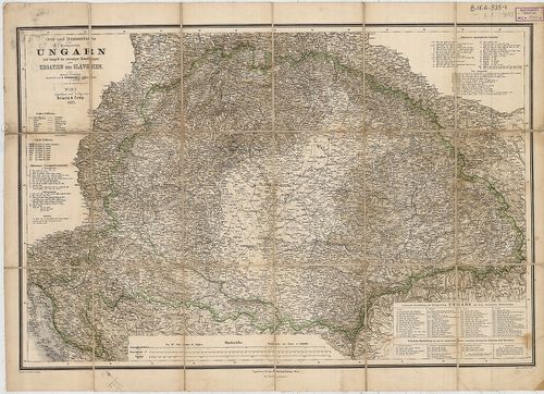
438. Ungarn, Siebenbürgen, Croatien, Slavonien und die Militär-Gr... [B IX a 525/5]
Institute and Museum of Military History •
B IX a
•
B IX Ausztria–Magyarország
•
B I–XV. Európa
| Title | Ungarn, Siebenbürgen, Croatien, Slavonien und die Militär-Grenze… |
| Main title | Magyarország, Erdély , Horvát-Szlavónia és a szomszédos államok térképe 1863-ban. |
439. A Magyar Szent Korona országai: Magyarország, Erdély, Horvát... [B IX a 525/6]
Institute and Museum of Military History •
B IX a
•
B IX Ausztria–Magyarország
•
B I–XV. Európa
| Title | A Magyar Szent Korona országai: Magyarország, Erdély, Horvát-Tótország és a katonai végvidék. |
440. Orts und Strassen-Karte der Königreiche Ungarn, Croatien und... [B IX a 525/7]
Institute and Museum of Military History •
B IX a
•
B IX Ausztria–Magyarország
•
B I–XV. Európa
| Title | Orts und Strassen-Karte der Königreiche Ungarn, Croatien und Slavonien, des Grossfürstenthums Siebenbürgen, und der k. k. Militair Graenze. |
| Main title | A Magyar Királyság, Horvát-Szlavónia, Erdély és a katonai határőrvidék térképe 1865-ben, úthálózattal. |
441. Orts und Strassenkarte des Königreiches Ungarn (Mit Inbegrif... [B IX a 525/7]
Institute and Museum of Military History •
B IX a
•
B IX Ausztria–Magyarország
•
B I–XV. Európa
| Title | Orts und Strassenkarte des Königreiches Ungarn (Mit Inbegriff des Ehehmaligen Siebenbürgen) nebst Kroatien und Slavonien. |
| Main title | A Magyar Királyság, Horvát-Szlavónia, Erdély és a katonai határőrvidék térképe 1882-ben, úthálózattal. |
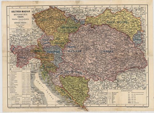
442. General Karte von Königreiche Ungarn und Königreich Kroatien... [B IX a 525/8]
Institute and Museum of Military History •
B IX a
•
B IX Ausztria–Magyarország
•
B I–XV. Európa
| Title | General Karte von Königreiche Ungarn und Königreich Kroatien Sclavonien samt Grossfürstenthum Sibenbürgen. |
| Main title | A Magyar Királyság, Horvát-Szlavónia, Erdély térképe 1833-ban. |
443. Magyar Állam földképe. [B IX a 525/9]
Institute and Museum of Military History •
B IX a
•
B IX Ausztria–Magyarország
•
B I–XV. Európa
| Title | Magyar Állam földképe. |
444. A Magyar Állam Közigazgatási Térképe. [B IX a 525]
Institute and Museum of Military History •
B IX a
•
B IX Ausztria–Magyarország
•
B I–XV. Európa
| Title | A Magyar Állam Közigazgatási Térképe. |
| Main title | Mt. Budapest, |
445. Magyar Birodalom iskolai faltérképe. Schulwandkarte des Unga... [B IX a 525/10]
Institute and Museum of Military History •
B IX a
•
B IX Ausztria–Magyarország
•
B I–XV. Európa
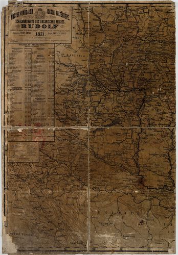
| Title | Magyar Birodalom iskolai faltérképe. Schulwandkarte des Ungarischen Reiches. |
| Main title | Mt. Dalmácia déli része. |
446. Magyarország és Horvát-Szlavonország. [B IX a 525/11]
Institute and Museum of Military History •
B IX a
•
B IX Ausztria–Magyarország
•
B I–XV. Európa
| Title | Magyarország és Horvát-Szlavonország. |
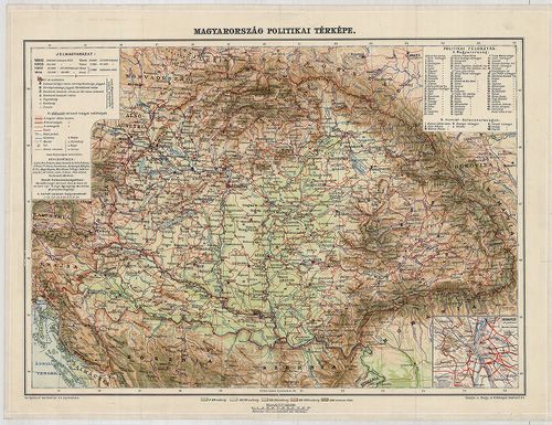
447. Magyarország politikai térképe. [B IX a 525/12]
Institute and Museum of Military History •
B IX a
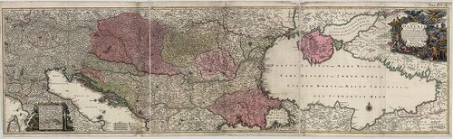
•
B IX Ausztria–Magyarország
•
B I–XV. Európa
| Title | Magyarország politikai térképe. |
| Main title | Mt. Budapest pályaudvarai. |
448. Sorozat: [B IX a 527]
Institute and Museum of Military History •
B IX a
•
B IX Ausztria–Magyarország
•
B I–XV. Európa
| Title | Sorozat: |
| Main title | Fekete-fehér,eredeti méretű (63x42 cm) fénykép reprodukciók az Osztrák Birodalom I. katonai felméréséből, eredeti változat. 1782-1785. |
449. Kleine Charte des Königreiches Hungarn. [B IX a 528/1a]
Institute and Museum of Military History •
B IX a
•
B IX Ausztria–Magyarország
•
B I–XV. Európa
| Title | Kleine Charte des Königreiches Hungarn. |
| Main title | A Magyar Királyság részletes térképe 1785-ben, az I. katonai felmérés alapján. |
450. „Alapvonal mérései.” Carte von der bey Peterwardein zwischen... [B IX a 529]
Institute and Museum of Military History •
B IX a
•
B IX Ausztria–Magyarország
•
B I–XV. Európa
| Title | „Alapvonal mérései.” Carte von der bey Peterwardein zwischen der Donau, und Theiss befindlichen. Rőmer Schanz, Samt einigen nahe gelegenen Ortschafften, so bey gelegenheit der Anno 1769 in dieser gegend vorgenommen Messung eines Grads der Erde auf der Meridian Linie Trigonometrisch ist aufgenommen worden. |
| Main title | Magyarország: Pétervárad, Petrovaradin, – Csurog, Čurug, – Szeged–Kistelek környékének geodéziai felmérése 1769-ben. (Ott találhatók a római kori sáncok.) |
451. Aufnahmskarte des Königreiches Ungarn. [B IX a 530]
Institute and Museum of Military History •
B IX a
•
B IX Ausztria–Magyarország
•
B I–XV. Európa
| Title | Aufnahmskarte des Königreiches Ungarn. |
| Main title | A II. katonai felmérés szelvényei egyszínű másolatban. |
452. Spezialkarte des Königreiches Ungarn. [B IX a 531]
Institute and Museum of Military History •
B IX a
•
B IX Ausztria–Magyarország
•
B I–XV. Európa
| Title | Spezialkarte des Königreiches Ungarn. |
| Main title | Magyarország részletes térképe a II. katonai felmérés alapján. |
453. Specialkarte des Königreiches Ungarn. [B IX a 531/1]
Institute and Museum of Military History •
B IX a
•
B IX Ausztria–Magyarország
•
B I–XV. Európa
| Title | Specialkarte des Königreiches Ungarn. |
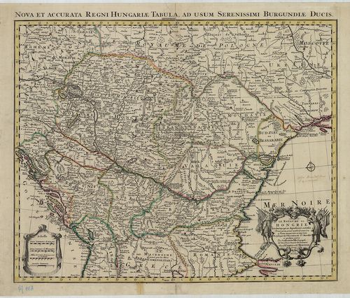
| Main title | Magyarország részletes térképe a II. katonai felmérés alapján.. |
454. Specialkarte des Königreiches Ungarn. [B IX a 531/2]
Institute and Museum of Military History •
B IX a
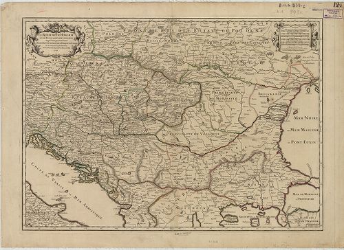
•
B IX Ausztria–Magyarország
•
B I–XV. Európa
| Title | Specialkarte des Königreiches Ungarn. |
| Main title | Magyarország részletes térképe a II. katonai felmérés alapján.. |
455. Specialkarte des Königreiches Ungarn. 3 album. [B IX a 531/4]
Institute and Museum of Military History •
B IX a
•
B IX Ausztria–Magyarország
•
B I–XV. Európa
| Title | Specialkarte des Königreiches Ungarn. 3 album. |
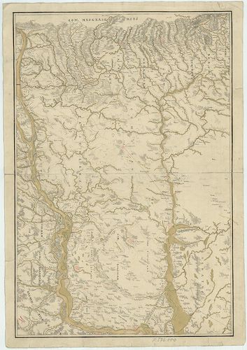
| Main title | Magyarország részletes térképe a II. katonai felmérés alapján.. |
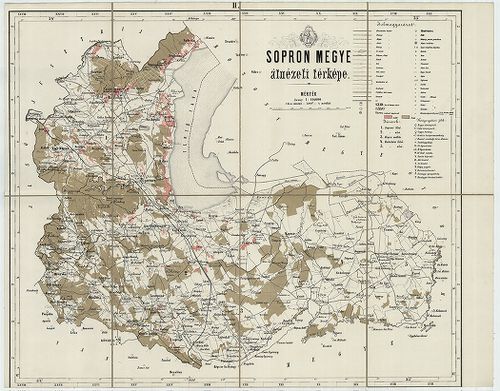
456. [Magyarország megyéinek (20 vármegye) átnézeti (részletes) t... [B IX a 532]
Institute and Museum of Military History •
B IX a
•
B IX Ausztria–Magyarország
•
B I–XV. Európa
| Title | [Magyarország megyéinek (20 vármegye) átnézeti (részletes) térképe: Sopron, Győr, Veszprém, Vas, Zala, Somogy, Tolna, Baranya, Nógrád, Zólyom, Liptó, Gömör és Kishont, Torna, Abauj, Zemplén, Ung, Beregh (Bereg), Máramaros, Ugocsa, Moson.] |
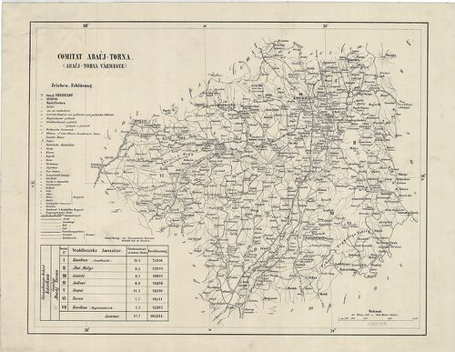
457. Comitats-Karte von Ungarn. [Magyarország megyéi.] [B IX a 533]
Institute and Museum of Military History •
B IX a
•
B IX Ausztria–Magyarország
•
B I–XV. Európa
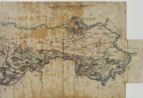
| Title | Comitats-Karte von Ungarn. [Magyarország megyéi.] |
| Main title | 1. Bars-vm. 2. Borsod-vm. 3. Esztergom-vm. 4. Hont-vm. 5. Turocz-vm. 6. Neograd-vm. 7. Zólyom-vm. 8. Liptó-vm. 9. A. Abaújvár-vm. B. Torna-vm. 10. Árva-vm. 11. Záránd-vm. 12. A. Közép Szolnok-vm. B. Kraszna-vm. C. Kővár vidéke. |
458. Das Pacshalik von Ofen im Jahre 1650 nach Hadschi Chalfa. [B IX a 535]
Institute and Museum of Military History •
B IX a
•
B IX Ausztria–Magyarország
•
B I–XV. Európa
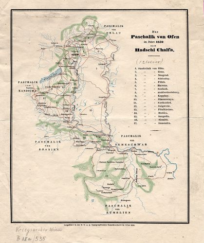
| Title | Das Pacshalik von Ofen im Jahre 1650 nach Hadschi Chalfa. |
| Main title | Magyarország: A budai Ejalet pontos határa, szandzsákok határai és neveik felsorolása 1650-ben. |
459. Tabula Geographica Ungariae Veteris ex Historia Anonym Belae... [B IX a 536]
Institute and Museum of Military History •
B IX a
•
B IX Ausztria–Magyarország
•
B I–XV. Európa
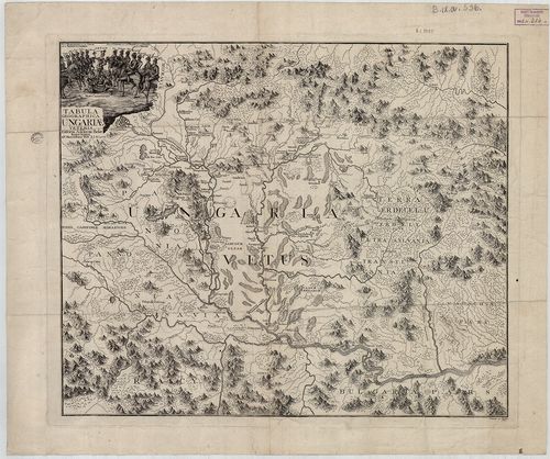
| Title | Tabula Geographica Ungariae Veteris ex Historia Anonym Belae Regis Notarii, 1772. |
| Main title | Magyarország térképe a honfoglalás idején Anonymus leírása alapján. |
460. Mappa Hungariae Inferioris Districtus Cisdanubiani… [B IX a 537]
Institute and Museum of Military History •
B IX a
•
B IX Ausztria–Magyarország
•
B I–XV. Európa
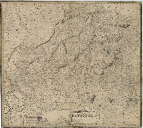
| Title | Mappa Hungariae Inferioris Districtus Cisdanubiani… |
| Main title | É-Magyarország Ny-i részének térképe 1739-ben (pestisjárvány térkép). (Littau, Litovel – Késmárk, Kežmarok – Kapuvár – Jászberény kivágat.) |
461. Mappa Generalis Omnium Inferioris Hungariae Liberarum Regiar... [B IX a 538]
Institute and Museum of Military History •
B IX a
•
B IX Ausztria–Magyarország
•
B I–XV. Európa
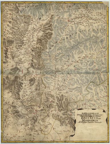
| Title | Mappa Generalis Omnium Inferioris Hungariae Liberarum Regiarum Montanar civitatum et dominiorum ad Inclytam Cameram Montanisti. |
| Main title | Felső-Magyarország általános térképe. |
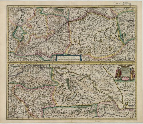
462. [Magyarország térképe.] [B IX a 539]
Institute and Museum of Military History •
B IX a
•
B IX Ausztria–Magyarország
•
B I–XV. Európa
| Title | [Magyarország térképe.] |
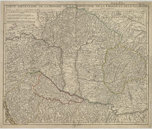
463. Carte Particuliere de la Hongrie de la Transilvanie de la Cr... [B IX a 539/1]
Institute and Museum of Military History •
B IX a
•
B IX Ausztria–Magyarország
•
B I–XV. Európa
| Title | Carte Particuliere de la Hongrie de la Transilvanie de la Croatie et de la Sclavonie. |
| Main title | Magyarország, Erdély, Horvát-Szlavónia térképe 1717-ben, tartományi határszínezés. |
464. Carte Particuliere de la Hongrie de la Transilvanie de la Cr... [B IX a 539/2]
Institute and Museum of Military History •
B IX a
•
B IX Ausztria–Magyarország
•
B I–XV. Európa
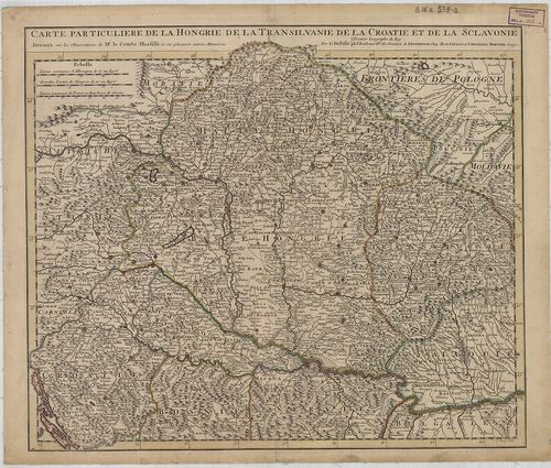
| Title | Carte Particuliere de la Hongrie de la Transilvanie de la Croatie et de la Sclavonie. |
| Main title | Magyarország, Erdély, Horvát-Szlavónia térképe Delisle térképe alapján. |
465. Nieuwe Kaart van t Koninkryk Hongaryen en Zevčnbergen na de ... [B IX a 539/3]
Institute and Museum of Military History •
B IX a
•
B IX Ausztria–Magyarország
•
B I–XV. Európa
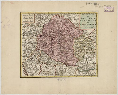
| Title | Nieuwe Kaart van t Koninkryk Hongaryen en Zevčnbergen na de laatske ondekkingen. |
| Main title | Magyarország és Erdély térképe 1760 körül. |
466. Le Royaume de Hongrie et des Pays qui en dependoient autreso... [B IX a 539/4]
Institute and Museum of Military History •
B IX a
•
B IX Ausztria–Magyarország
•
B I–XV. Európa
| Title | Le Royaume de Hongrie et des Pays qui en dependoient autresois… |
| Main title | Magyarország és a szomszédos területek térképe 1730 körül, tartományi határszínezés. |
467. Novissima et Accuratissima Toti Regni Hungariae, Dalmatiae, ... [B IX a 539/5]
Institute and Museum of Military History •
B IX a
•
B IX Ausztria–Magyarország
•
B I–XV. Európa
| Title | Novissima et Accuratissima Toti Regni Hungariae, Dalmatiae, Croatiae, Sclavoniae Bosniae, Serviae, Transilvaniae cum adiacentib. Regnis et Privincis Tabula. |
| Main title | A Magyar Királyság, Dalmácia, Horvát-Szlavónia, Bosznia, Szerbia, Erdély és a szomszédos tartományok térképe a 17. század végén, határvonal szín. |
468. Le Royaume de Hongrie et les Estats qui en ont esté Sujets e... [B IX a 539/6]
Institute and Museum of Military History •
B IX a
•
B IX Ausztria–Magyarország
•
B I–XV. Európa
| Title | Le Royaume de Hongrie et les Estats qui en ont esté Sujets et qui font presentement la Partie Septentrionale de la Turquie en Europa. |
| Main title | A Magyar Királyság, és a Török Birodalom É-i részének térképe 1717-ben, határvonal színezés. |
469. Königreich Hungarn, samt den vereinigten Ländern. [B IX a 539/7]
Institute and Museum of Military History •
B IX a
•
B IX Ausztria–Magyarország
•
B I–XV. Európa
| Title | Königreich Hungarn, samt den vereinigten Ländern. |
| Main title | A Magyar Királyság és a szomszédos országok térképe a XIX. század elején. |
470. Carte Geographique du Theatre de la Guerre en general repres... [B IX a 539/8]
Institute and Museum of Military History •
B IX a
•
B IX Ausztria–Magyarország
•
B I–XV. Európa
| Title | Carte Geographique du Theatre de la Guerre en general representant le Royaume de Hongarie, la Principaute de Transylvanie, et les Royaumes de Croacie, de Dalmacie, de Esclavonie, de Bosnie, de Servie, les Principautés de Moldavie, de Valachie, les Provinces de Bessarabie, de Bulgarie et de Romanie, avec une grande Partie de L’Etat de Polgne. |
| Main title | A Magyar Királyság, Erdély, Horvát-Szlavónia, Dalmácia, Bosznia, Szerbia, Moldova, Bulgária, Románia és Lengyelország egy részének földrajzi térképe a 18. második felében. |
471. Tabula Hungaria et Regionum, quae praterae ab ea dependent, ... [B IX a 539/9]
Institute and Museum of Military History •
B IX a
•
B IX Ausztria–Magyarország
•
B I–XV. Európa
| Title | Tabula Hungaria et Regionum, quae praterae ab ea dependent, Delineata juxta magnum numerum annotationum… |
| Main title | Magyarország, a társországok és a Balkán-félsziget É-i államainak térképe 1720 körül. |
472. Totius Regni Hungariae Maxim ae que Partis Danubii Fluminis ... [B IX a 539/10]
Institute and Museum of Military History •
B IX a
•
B IX Ausztria–Magyarország
•
B I–XV. Európa
| Title | Totius Regni Hungariae Maxim ae que Partis Danubii Fluminis una cum adjacentibus et finitimis Regionibus. |
| Main title | A Magyar Királyság és a Duna országainak általános térképe a 17. században, de Jonghe nyomán. |
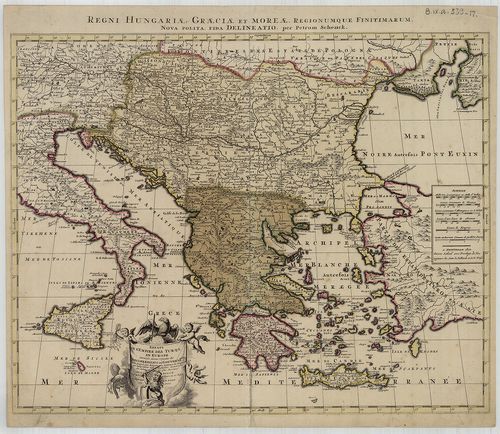
473. Regni Hungariae, Graeciae et Moreae ac Regionum, quae ei quo... [B IX a 539/11]
Institute and Museum of Military History •
B IX a
•
B IX Ausztria–Magyarország
•
B I–XV. Európa
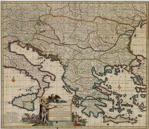
| Title | Regni Hungariae, Graeciae et Moreae ac Regionum, quae ei quondam fuére Christiani, ut-Transilvaniae, Valachiae, Moldaviae, Bessarábiae, Bosniae, Sclavoniae, Serviae, Bulgariae, Croatiae, Romaniae, Dalmatiae, Morlachiae, Ragusanae Republicae. |
| Main title | A Magyar Királyság és a Balkán-félsziget térképe a 17. század végén, tartományi határszín. |
474. Tabula Synoptica Totius Fluminis Danubii a fontibus usque ad... [B IX a 539/12]
Institute and Museum of Military History •
B IX a
•
B IX Ausztria–Magyarország
•
B I–XV. Európa
| Title | Tabula Synoptica Totius Fluminis Danubii a fontibus usque ad Ostia in qua omnes regiones, quas perfluit et amnes, quos recipit, Imprimis Integrum Hungariae Regnum, Principat. Transilvaniae… |
| Main title | A Duna menti országok térképe 1745 körül, a Fekete-erdőtől a Kaukázusig. |
475. Tibi Exellentissime Domine Comes sa’ culi nostri artis belli... [B IX a 539/13]
Institute and Museum of Military History •
B IX a
•
B IX Ausztria–Magyarország
•
B I–XV. Európa
| Title | Tibi Exellentissime Domine Comes sa’ culi nostri artis bellicae Mari terraque admirando prodigio jure omni neodata ha’c Mappa inscribitur. Exhib et illa pra’cique Regioner, ad quar modo omnium aculi connentuntur, tribus scilicet aximis Europa’ Imperii… |
| Main title | Az Adriától a Fekete-tengerig terjedő országok: Karintia, Krajna, Horvátország, Bosznia, Magyarország, Erdély, Moldva, Havasalföld, Bulgária térképe 1737-ben. |
476. Exactissima Totius Danubii Fluvii Tabula et minores in eum i... [B IX a 539/14]
Institute and Museum of Military History •
B IX a
•
B IX Ausztria–Magyarország
•
B I–XV. Európa
| Title | Exactissima Totius Danubii Fluvii Tabula et minores in eum influentes Fluvii, cum Omnibus adjacentibus Regionibus. |
| Main title | A Duna menti országok térképe 2 részletben a 17. század végén. (Württembergtől – a Fekete-tengerig.) |
477. Maximi Totius Europae Fluminis Danubii cursus per Germaniam ... [B IX a 539/15]
Institute and Museum of Military History •
B IX a
•
B IX Ausztria–Magyarország
•
B I–XV. Európa
| Title | Maximi Totius Europae Fluminis Danubii cursus per Germaniam Hungariamque. |
| Main title | A Duna menti országok általános térképe 2 részletben (Württembergtől–Belgrádig) |
478. Royaume de Hongrie, Principauté de Transilvanie, Sclavonie, ... [B IX a 539/16]
Institute and Museum of Military History •
B IX a
•
B IX Ausztria–Magyarország
•
B I–XV. Európa
| Title | Royaume de Hongrie, Principauté de Transilvanie, Sclavonie, Croatie, et partie de la Principauté de Valaquie, de la Bosnie, de la Servie et de la Bulgarie. |
| Main title | A Magyar Királyság, Erdély, Horvát-Szlavónia és a Balkán É-i részének térképe 1751-ben. |
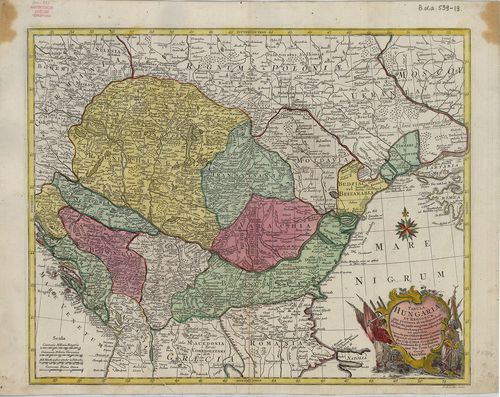
479. Regni Hungariae, Graeciae et Moreae, Regionumque Finitimarum... [B IX a 539/17]
Institute and Museum of Military History •
B IX a
•
B IX Ausztria–Magyarország
•
B I–XV. Európa
| Title | Regni Hungariae, Graeciae et Moreae, Regionumque Finitimarum. |
| Main title | A Magyar Királyság és a Balkán-félsziget államainak térképe a 18. sz. elején. |
480. Hungaria cum adiacentibus Provinciis nova et accuratiori for... [B IX a 539/18]
Institute and Museum of Military History •
B IX a
•
B IX Ausztria–Magyarország
•
B I–XV. Európa

| Title | Hungaria cum adiacentibus Provinciis nova et accuratiori forma exhibetur… |
| Main title | Magyarország és a szomszédos államok térképe 1716 körül. |
481. Tabula Hungaria et Regionum, quae praeterea ab ea dependent,... [B IX a 539/19]
Institute and Museum of Military History •
B IX a
•
B IX Ausztria–Magyarország
•
B I–XV. Európa
| Title | Tabula Hungaria et Regionum, quae praeterea ab ea dependent, Delineata juxta magnum numerum annotationum et mappas manuscriptas vel impressas… |
| Main title | Magyarország és a környező államok térképe a 18. században. |
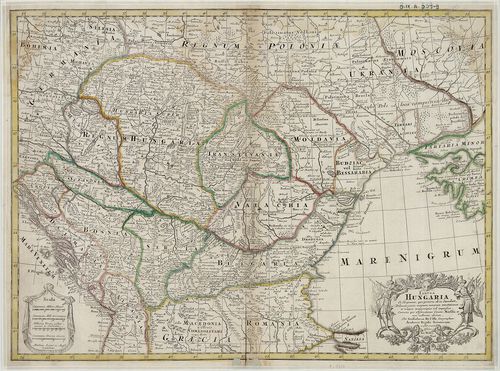
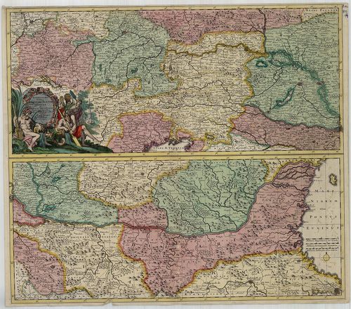
482. Länder der Ungarischen Krone. [B IX a 543]
Institute and Museum of Military History •
B IX a
•
B IX Ausztria–Magyarország
•
B I–XV. Európa
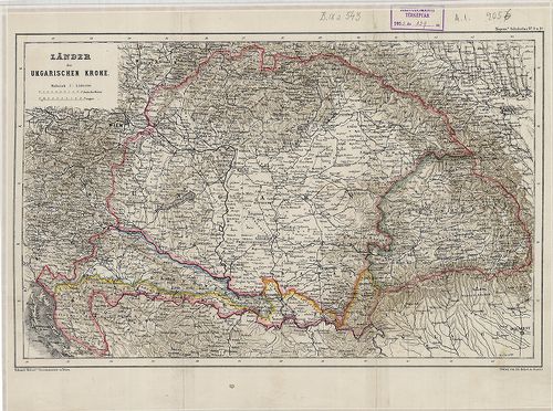
| Title | Länder der Ungarischen Krone. |
| Main title | A Magyar Korona országai: Magyarország, Erdély, Horvát-Szlavónia térképe 1860 körül. |
483. [A Duna–Tisza köze és Felső-Magyarország térképe 1790-ben.] [B IX a 547]
Institute and Museum of Military History •
B IX a
•
B IX Ausztria–Magyarország
•
B I–XV. Európa
| Title | [A Duna–Tisza köze és Felső-Magyarország térképe 1790-ben.] |
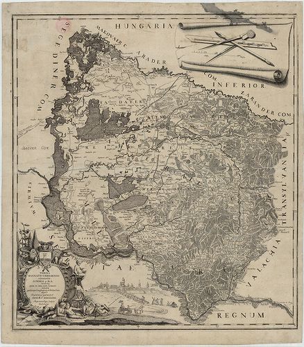
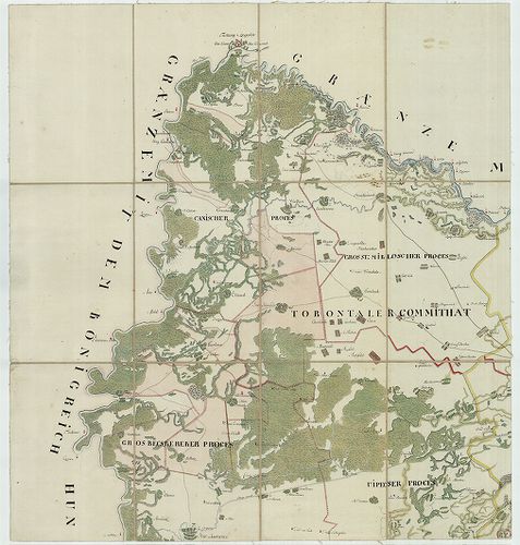
484. Tabula Banatus Temesiensis a geometris… [B IX a 567]
Institute and Museum of Military History •
B IX a
•
B IX Ausztria–Magyarország
•
B I–XV. Európa
| Title | Tabula Banatus Temesiensis a geometris… |
| Main title | A Temesi Bánság térképe 1776-ban. |
485. Tabula Banatus Temesiensis 1776. [B IX a 567/1]
Institute and Museum of Military History •
B IX a
•
B IX Ausztria–Magyarország
•
B I–XV. Európa
| Title | Tabula Banatus Temesiensis 1776. |
| Main title | A Temesi Bánság térképe 1776-ban. |
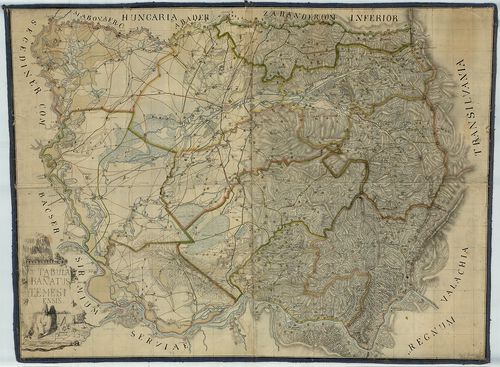
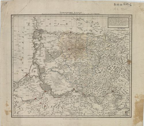
486. Geographische Charte von Temeswarer Banat welche die Flüsse,... [B IX a 572]
Institute and Museum of Military History •
B IX a
•
B IX Ausztria–Magyarország
•
B I–XV. Európa
| Title | Geographische Charte von Temeswarer Banat welche die Flüsse, Ortschaften und Weege nach dem Bestand im Jahre 1805. |
| Main title | A Temesi Bánság földrajzi térképe 1805-ben, úthálózattal, megyebeosztással. |
487. General-Karte de Vojvodschaft Serbien und des Temescher Bana... [B IX a 574]
Institute and Museum of Military History •
B IX a
•
B IX Ausztria–Magyarország
•
B I–XV. Európa
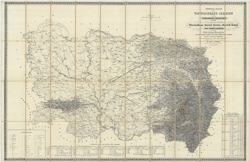
| Title | General-Karte de Vojvodschaft Serbien und des Temescher Banates dann der vier Gränzregimenter Peterwardeiner, Deutsch-Banater, Illirisch-Banater ind Roman-Banater… |
| Main title | A Temesi-Bánság, a Szerb Vajdaság és a Katonai Határőrvidék, (Péterváradi, Német-Bánsági, Illir-Bánsági és a Oláh-Bánsági ezred) általános térképe 1853-ban, a II. katonai felmérés alapján. |
488. Karte der Wojwodschaft Serbien und des Temescher Banates neb... [B IX a 574/1]
Institute and Museum of Military History •
B IX a
•
B IX Ausztria–Magyarország
•
B I–XV. Európa
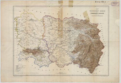
| Title | Karte der Wojwodschaft Serbien und des Temescher Banates nebst dem Serbisch-Banatischen Militärgränzlande. |
| Main title | A Szerb Vajdaság és a Temesi Bánság térképe 1850 körül. |
489. Nova Mappa Geographica Princip: Transilvaniae, Districtus Te... [B IX a 576]
Institute and Museum of Military History •
B IX a
•
B IX Ausztria–Magyarország
•
B I–XV. Európa
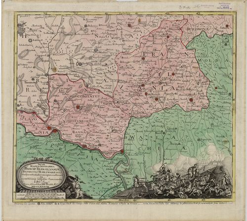
| Title | Nova Mappa Geographica Princip: Transilvaniae, Districtus Temeswariensis, et adjacentium aliarum regionum et locoru… |
| Main title | Erdély és a Temesi Bánság térképe 1788-ban. |
490. [Plan des Temeswarer Bannatths… [B IX a 578]
Institute and Museum of Military History •
B IX a
•
B IX Ausztria–Magyarország
•
B I–XV. Európa
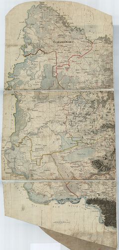
| Title | [Plan des Temeswarer Bannatths… |
| Main title | A Temesi Bánság részletes térképe 1773 körül, az I. katonai felmérés alapján. |
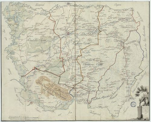
491. Banater und Arad Moden: K. K. Administr. Güter und Praedien ... [B IX a 579]
Institute and Museum of Military History •
B IX a
•
B IX Ausztria–Magyarország
•
B I–XV. Európa
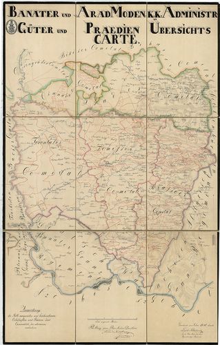
| Title | Banater und Arad Moden: K. K. Administr. Güter und Praedien Übersichts Carte. |
| Main title | Temesi Bánság valamint Arad és Csanád megye térképe 1841-ben. |
492. Karta Bacske, Szrema, i Banata sza predlozsenima ob blagoveš... [B IX a 579/1]
Institute and Museum of Military History •
B IX a
•
B IX Ausztria–Magyarország
•
B I–XV. Európa
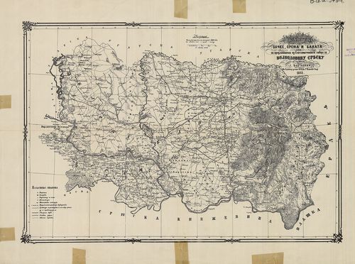
| Title | Karta Bacske, Szrema, i Banata sza predlozsenima ob blagoveštenskoga šabora za Vojvodovinu Szrbszku. |
| Main title | Bácska, Szerémség, Bánság és a Szerb Vajdaság térképe 1861-ben. |
493. Temeschwarer Bannat. Trigonometrisch und astronomisch berich... [B IX a 579/2]
Institute and Museum of Military History •
B IX a
•
B IX Ausztria–Magyarország
•
B I–XV. Európa
| Title | Temeschwarer Bannat. Trigonometrisch und astronomisch berichtigt. |
| Main title | Temesi Bánság térképe 1788-ban, kerületi beosztással, trigonometriai és asztronómiai adatokkal. |
494. Versuch einer politischen und natürlichen Geschichte des Tem... [B IX a 579/3]
Institute and Museum of Military History •
B IX a
•
B IX Ausztria–Magyarország
•
B I–XV. Európa
| Title | Versuch einer politischen und natürlichen Geschichte des Temeswarer Banats… Wien. 1780. Johann Paul Krauss. 26 cm. A temesi Bánság német nyelvű szöv. leírása. 135 p. 1 térk. mell. Tabula Banatus Temesiensis a geometris… |
| Main title | A Temesi Bánság térképe 1776-ban, + 1 kötet szöveges leírása 1780-ból. |
495. Charte von Bannat. [B IX a 581]
Institute and Museum of Military History •
B IX a
•
B IX Ausztria–Magyarország
•
B I–XV. Európa
| Title | Charte von Bannat. |
| Main title | A Temesi Bánság általános térképe 1786 körül az I. katonai felmérés alapján. |
496. Mappa Chorographica novissima et completissima totius Regno ... [B IX a 582]
Institute and Museum of Military History •
B IX a
•
B IX Ausztria–Magyarország
•
B I–XV. Európa
| Title | Mappa Chorographica novissima et completissima totius Regno Hungariae incorporati Bannatus Temesiensis una cum trium Comitatuum Processibus, proutet cum adiunctis Germanico Illiricis, atque Valachio Illiricis Militaribus Distribus. |
| Main title | Temesi Bánság térképe 1789 körül. |
497. Charte des Oguliner Grenz Regiments. [B IX a 588/1]
Institute and Museum of Military History •
B IX a
•
B IX Ausztria–Magyarország
•
B I–XV. Európa
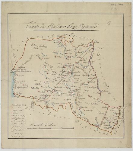
| Title | Charte des Oguliner Grenz Regiments. |
| Main title | Az Ogulini Határőrezred területének térképe a 19. század elején. |
498. Plan des Sluiner Grenz-Regiments. [B IX a 588/2]
Institute and Museum of Military History •
B IX a
•
B IX Ausztria–Magyarország
•
B I–XV. Európa
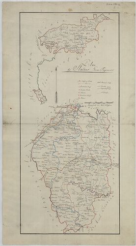
| Title | Plan des Sluiner Grenz-Regiments. |
| Main title | A Szluini Határőrezred területének térképe a 19. század elején. |
499. A két Bánális Regementek. [B IX a 588/3]
Institute and Museum of Military History •
B IX a
•
B IX Ausztria–Magyarország
•
B I–XV. Európa
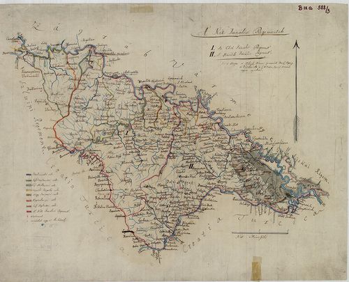
| Title | A két Bánális Regementek. |
| Main title | Az I. és II. Báni Határőrezred területének térképe a 19. század elején. |
500. Pétervári Regement Mappája (A Péterváradi Határőrezred térké... [B IX a 588/4]
Institute and Museum of Military History •
B IX a
•
B IX Ausztria–Magyarország
•
B I–XV. Európa
| Title | Pétervári Regement Mappája (A Péterváradi Határőrezred térképe). |