221. Handkarte von Salzburg. [B IX a 273]
Institute and Museum of Military History •
B IX a
•
B IX Ausztria–Magyarország
•
B I–XV. Európa
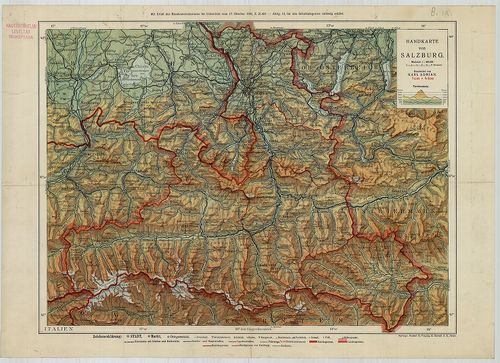
| Title | Handkarte von Salzburg. |
| Main title | Salzburg iskolai térképe 1919 körül. |
222. Topographische Reise- und Gebirgs-Karte der Umgebung von Sal... [B IX a 274]
Institute and Museum of Military History •
B IX a
•
B IX Ausztria–Magyarország
•
B I–XV. Európa
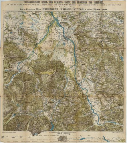
| Title | Topographische Reise- und Gebirgs-Karte der Umgebung von Salzburg… |
| Main title | Salzburg környékének topográfiai térképe az 1880-as évek végén. |
223. Charte von Steyermark. – Carte de la Styrie. [B IX a 277]
Institute and Museum of Military History •
B IX a
•
B IX Ausztria–Magyarország
•
B I–XV. Európa
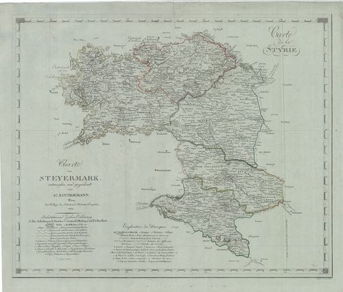
| Title | Charte von Steyermark. – Carte de la Styrie. |
| Main title | Stájerország térképe 1802-ben. |
224. Das Herzogthum Steyermark. [B IX a 278]
Institute and Museum of Military History •
B IX a
•
B IX Ausztria–Magyarország
•
B I–XV. Európa
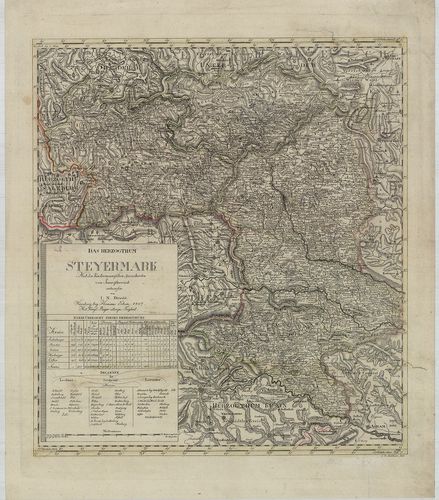
| Title | Das Herzogthum Steyermark. |
| Main title | A Stájer hercegség térképe, a kerületek jelölésével. |
225. Das Kronland Steyermark. [B IX a 279]
Institute and Museum of Military History •
B IX a
•
B IX Ausztria–Magyarország
•
B I–XV. Európa
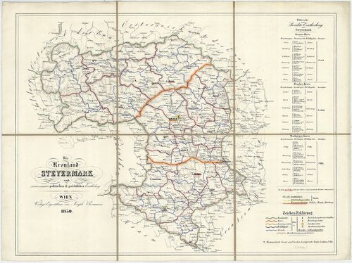
| Title | Das Kronland Steyermark. |
| Main title | Stájerország térképe 1850-ben. |
226. Handkarte des Herzogthumes Steiermark. [B IX a 280]
Institute and Museum of Military History •
B IX a
•
B IX Ausztria–Magyarország
•
B I–XV. Európa
| Title | Handkarte des Herzogthumes Steiermark. |
| Main title | Mt. Graz und Umgebung. (Gráz és körny.) |
| Subject | A Stájer hercegség iskolai térképe 1892-ben. |
227. Die K.[aiserliche] Österreichischen Kronländer Steiermark, K... [B IX a 280/1]
Institute and Museum of Military History •
B IX a
•
B IX Ausztria–Magyarország
•
B I–XV. Európa
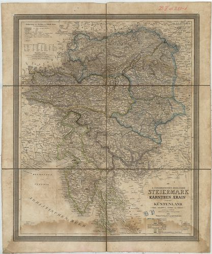
| Title | Die K.[aiserliche] Österreichischen Kronländer Steiermark, Kärnthen, Krain und das Küstenland (Görz, Gradisca, Istrien und Triest.) |
| Main title | Stájerország, Karintia, Krajna és a Tengermellék (Görz, (Gorozia), Gradisca, Isztria és Trieszt, térképe 1850-ben, tartományi határszínezéssel. |
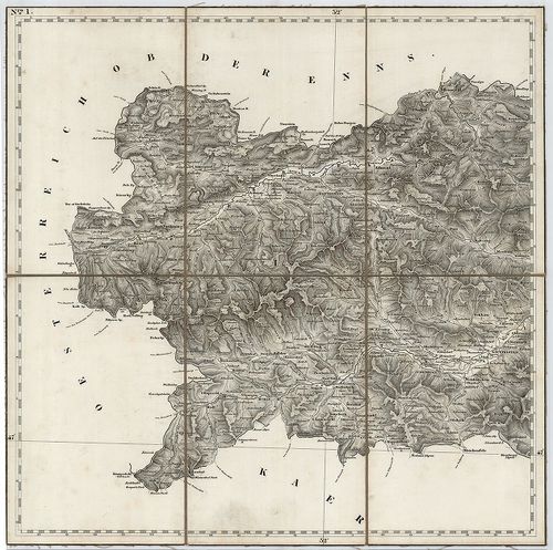
228. Umgebungen von Steyr, Enns, und Kremsmünster. Blatt 12. [B IX a 280/6]
Institute and Museum of Military History •
B IX a
•
B IX Ausztria–Magyarország
•
B I–XV. Európa
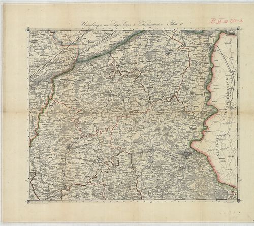
| Title | Umgebungen von Steyr, Enns, und Kremsmünster. Blatt 12. |
| Main title | Felső-Ausztria (Enns–Steyer–Kremsmünster közötti terület) topográfiai térképe. |
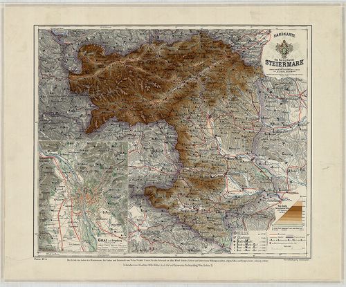
229. Schulhandkarte des Herzogtums Steiermark. [B IX a 281]
Institute and Museum of Military History •
B IX a
•
B IX Ausztria–Magyarország
•
B I–XV. Európa
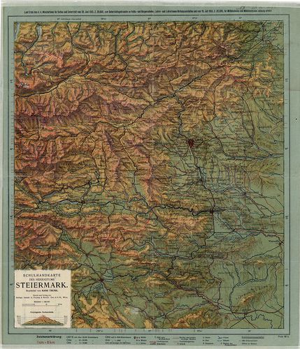
| Title | Schulhandkarte des Herzogtums Steiermark. |
| Main title | A Stájer Hercegség iskolai térképe 1913-ban. |
230. Ducatus Stiriae Novissima Tabula ex amptiore mappa… [B IX a 282]
Institute and Museum of Military History •
B IX a
•
B IX Ausztria–Magyarország
•
B I–XV. Európa
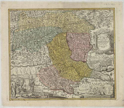
| Title | Ducatus Stiriae Novissima Tabula ex amptiore mappa… |
| Main title | Mt. Grätz die Haubt Statt des gantzen Herzogthums. (Graz főváros.) |
| Subject | A Stájer Hercegség térképe 1716-ban. |
231. General-Karte des Herzogthums Steyermark. [B IX a 284]
Institute and Museum of Military History •
B IX a
•
B IX Ausztria–Magyarország
•
B I–XV. Európa
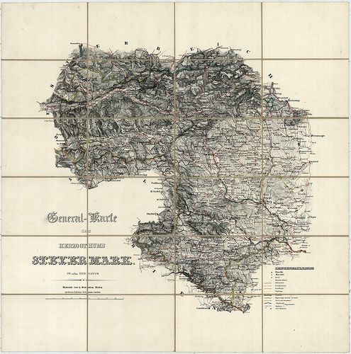
| Title | General-Karte des Herzogthums Steyermark. |
| Main title | A Stájer Hercegség általános térképe 1830 körül. |
232. General-Karte des Herzogthums Steyermark. [B IX a 285]
Institute and Museum of Military History •
B IX a
•
B IX Ausztria–Magyarország
•
B I–XV. Európa
| Title | General-Karte des Herzogthums Steyermark. |
| Main title | A Stájer Hercegség általános térképe 1842-ben, a II. katonai felmérés alapján. |
233. General-Karte des Herzogthums Steyermark. [B IX a 285]
Institute and Museum of Military History •
B IX a
•
B IX Ausztria–Magyarország
•
B I–XV. Európa
| Title | General-Karte des Herzogthums Steyermark. |
| Main title | A Stájer Hercegség általános térképe 1856-ban, a II. katonai felmérés alapján. |
234. GeneralPost und Strassen Karte des Herzogthums Steiermark. [B IX a 287]
Institute and Museum of Military History •
B IX a
•
B IX Ausztria–Magyarország
•
B I–XV. Európa
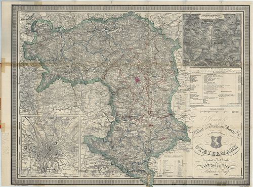
| Title | GeneralPost und Strassen Karte des Herzogthums Steiermark. |
| Main title | 2 mt. 1. Plan von Graz. (Graz várostérk.) 2. Umgebung von Maria Zell. (Máriazell és körny.) |
| Subject | A Stájer Hercegség általános, posta és úthálózati térképe 1898-ban. |
235. General-Karte des Herzogthums Steyermark. [B IX a 288]
Institute and Museum of Military History •
B IX a
•
B IX Ausztria–Magyarország
•
B I–XV. Európa
| Title | General-Karte des Herzogthums Steyermark. |
| Main title | A Stájer Hercegség általános térképe 1856-ban, a II. katonai felmérés alapján. |
236. General-Karte des Herzogthums Steyermark. [B IX a 288]
Institute and Museum of Military History •
B IX a
•
B IX Ausztria–Magyarország
•
B I–XV. Európa
| Title | General-Karte des Herzogthums Steyermark. |
| Main title | A Stájer Hercegség általános térképe 1872-ben, a II. katonai felmérés alapján. |
237. Karte von Steiermark und Krain. [B IX a 289]
Institute and Museum of Military History •
B IX a
•
B IX Ausztria–Magyarország
•
B I–XV. Európa
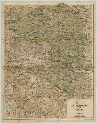
| Title | Karte von Steiermark und Krain. |
| Main title | Stájerország és Krajna térképe 1900 körül. |
238. Nova et accurata Carinthiae Ducatus Tabula geographica in Su... [B IX a 302]
Institute and Museum of Military History •
B IX a
•
B IX Ausztria–Magyarország
•
B I–XV. Európa
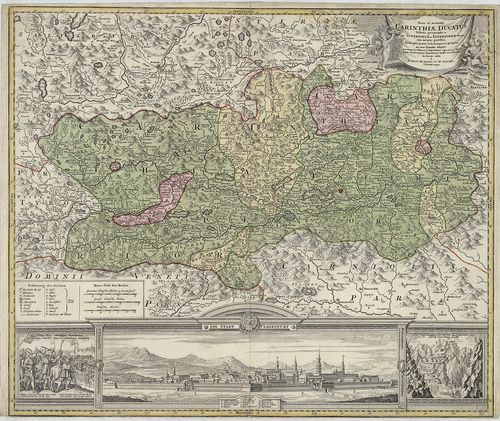
| Title | Nova et accurata Carinthiae Ducatus Tabula geographica in Superiorem et Inferiorem divisa cum infertis partibus… |
| Main title | A Stájer Hercegség térképe a 18. században. |
239. Carinthia Ducatus distincta in Superiorem et Inferior. Cum i... [B IX a 303]
Institute and Museum of Military History •
B IX a
•
B IX Ausztria–Magyarország
•
B I–XV. Európa
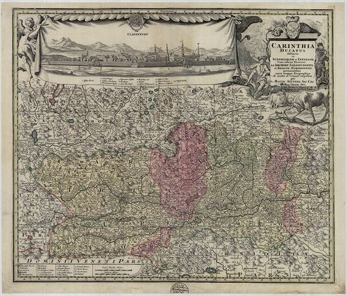
| Title | Carinthia Ducatus distincta in Superiorem et Inferior. Cum insertis Dominiis ad Archiep. Salisburgens. et Episcop. Bambergensis… |
| Main title | A Karintiai Hercegség, a Salzburgi Érsekség és a Bambergi Püspökség térképe 1730 körül. |
240. Carinthia Ducatus distincta in Superiorem et Inferior, cum i... [B IX a 303]
Institute and Museum of Military History •
B IX a
•
B IX Ausztria–Magyarország
•
B I–XV. Európa
| Title | Carinthia Ducatus distincta in Superiorem et Inferior, cum insertis Dominiis ad. Archiep. Salisburgens. et Episcop. Bambergensis… |
| Main title | A Karintiai Hercegség, a Salzburgi Érsekség és a Bambergi Püspökség térképe. |