761. Carte des ersten Banal Regiments. [B IX a 1130]
Institute and Museum of Military History •
B IX a
•
B IX Ausztria–Magyarország
•
B I–XV. Európa
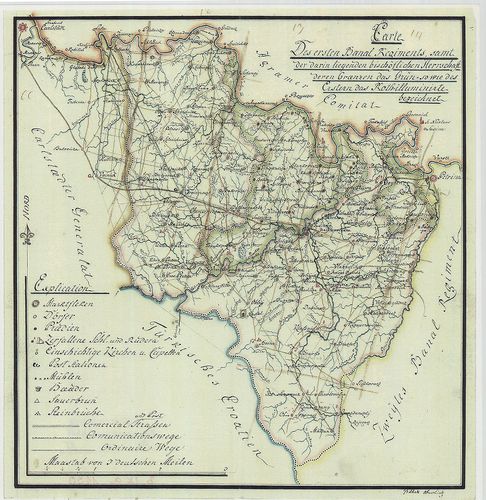
| Title | Carte des ersten Banal Regiments. |
| Main title | Az Első Bánáti Regiment (Báni határőrezred) területének térképe a XIX. sz. elején. |
762. Eigentlicher Entwurff des zwischen Ungarn und Schlesien gele... [B IX a 1131]
Institute and Museum of Military History •
B IX a
•
B IX Ausztria–Magyarország
•
B I–XV. Európa
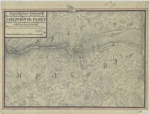
| Title | Eigentlicher Entwurff des zwischen Ungarn und Schlesien gelegene Iablonkover Passes... |
| Main title | A Jablunkai-hágó térképe a magyar-sziléziai határon. |
763. Original-Aufnahmskarte des Temesvárer Banats...unter der Dir... [B IX a 1132]
Institute and Museum of Military History •
B IX a
•
B IX Ausztria–Magyarország
•
B I–XV. Európa
| Title | Original-Aufnahmskarte des Temesvárer Banats...unter der Direction des Obersten Elmpt des G. Q. St.. |
| Main title | A Temesi Bánság felmérési szelvényei az I. katonai felmérés idején. |
764. Royaume de Hongrie; Avec la Partie la plus Septentrionale de... [B IX a 1133]
Institute and Museum of Military History •
B IX a
•
B IX Ausztria–Magyarország
•
B I–XV. Európa
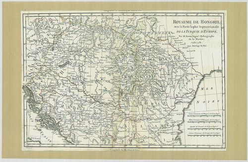
| Title | Royaume de Hongrie; Avec la Partie la plus Septentrionale de la Turquie D'Europe. |
| Main title | A Magyar Királyság; a Török Birodalom északi része Európában. |
765. La Hongrie. [B IX a 1135]
Institute and Museum of Military History •
B IX a
•
B IX Ausztria–Magyarország
•
B I–XV. Európa
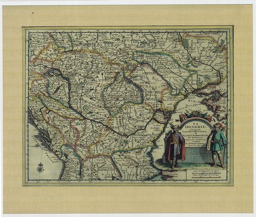
| Title | La Hongrie. |
| Main title | Magyarország 1713-ból. |
766. Totius Regni Hungariae Maximaeque Partis Danubii Fluminis un... [B IX a 1137]
Institute and Museum of Military History •
B IX a
•
B IX Ausztria–Magyarország
•
B I–XV. Európa
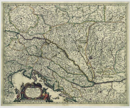
| Title | Totius Regni Hungariae Maximaeque Partis Danubii Fluminis una cum adjacentibus et finitimis Regionibus. |
| Main title | A Magyar Királyság térképe a környező Duna menti részekkel. |
767. Totius Regni Hungariae Maximae que Partis Danubii Fluminis ... [B IX a 1138]
Institute and Museum of Military History •
B IX a
•
B IX Ausztria–Magyarország
•
B I–XV. Európa
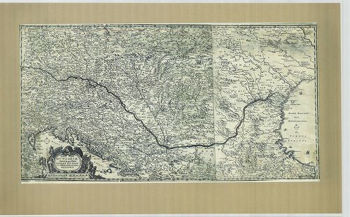
| Title | Totius Regni Hungariae Maximae que Partis Danubii Fluminis una cum adjacentibus et finitimis Regionibus. |
| Main title | A Magyar Királyság térképe a környező Duna menti részekkel. |
768. Hungaria, (Hongheren), Transylvania. [B IX a 1139]
Institute and Museum of Military History •
B IX a
•
B IX Ausztria–Magyarország
•
B I–XV. Európa
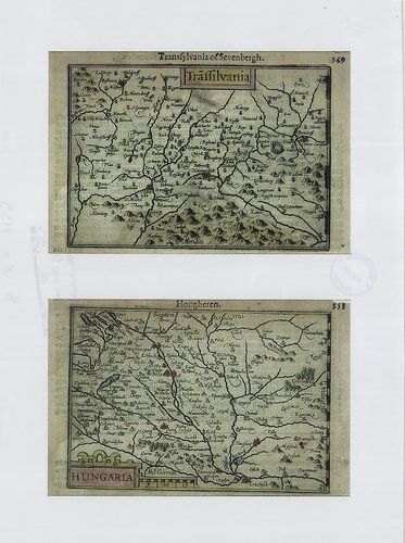
| Title | Hungaria, (Hongheren), Transylvania. |
| Main title | A Magyar Királyság és Erdély térképe. |
769. [Ungariae et omnium partium eius universalis descriptio.] [B IX a 1140]
Institute and Museum of Military History •
B IX a
•
B IX Ausztria–Magyarország
•
B I–XV. Európa
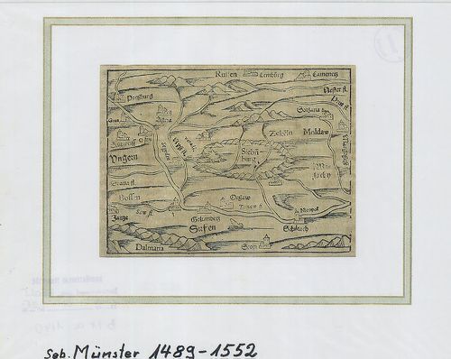
| Title | [Ungariae et omnium partium eius universalis descriptio.] |
| Main title | Magyarország és környéke. |
770. Österreich-Ungarn. Übersicht. [B IX a 1141]
Institute and Museum of Military History •
B IX a
•
B IX Ausztria–Magyarország
•
B I–XV. Európa
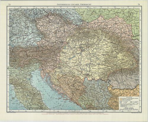
| Title | Österreich-Ungarn. Übersicht. |
| Main title | Az Osztrák-Magyar Monarchia áttekintő térképe. |
771. Ungarn, Galizien, Bukowina, Croatien, Slavonien, Wojwodina, ... [B IX a 1142]
Institute and Museum of Military History •
B IX a
•
B IX Ausztria–Magyarország
•
B I–XV. Európa
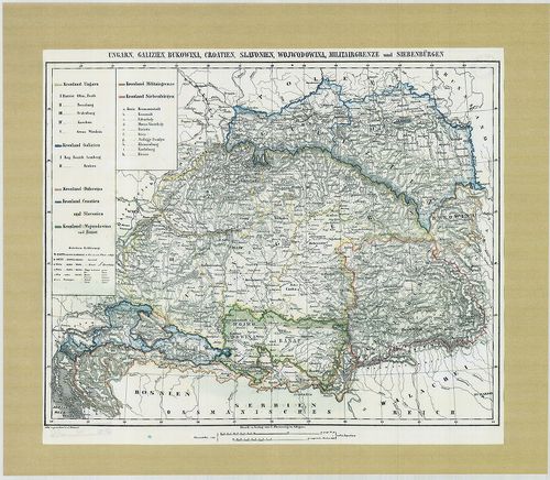
| Title | Ungarn, Galizien, Bukowina, Croatien, Slavonien, Wojwodina, Militairgrenze und Siebenbürgen. |
| Main title | Magyarország, Galícia, Bukovina, Horvátország, a Vajdaság, a Határőrvidékek és Erdély térképe 1840-ből. |
772. Hungaria Utraque... [B IX a 1143]
Institute and Museum of Military History •
B IX a
•
B IX Ausztria–Magyarország
•
B I–XV. Európa
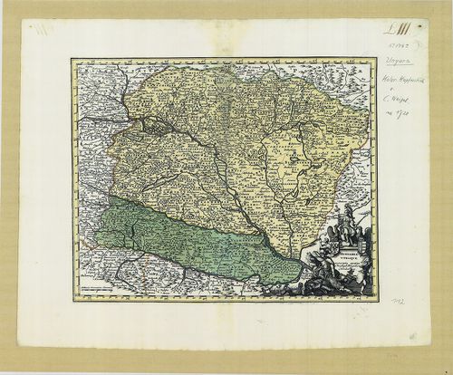
| Title | Hungaria Utraque... |
| Main title | Magyarország térképe. |
773. Novissima et Accuratissima totius Hungariae tabula... [B IX a 1144]
Institute and Museum of Military History •
B IX a
•
B IX Ausztria–Magyarország
•
B I–XV. Európa
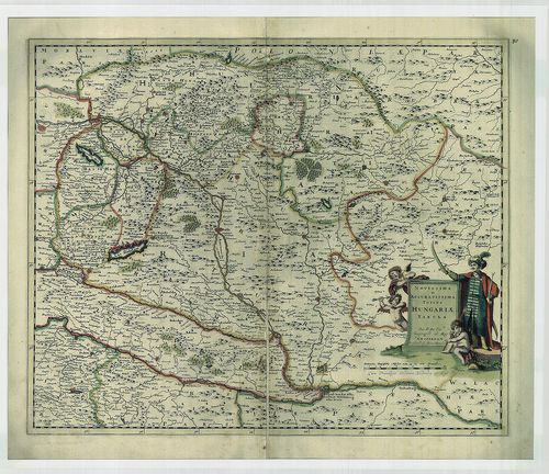
| Title | Novissima et Accuratissima totius Hungariae tabula... |
| Main title | Magyarország térképe. |
774. Transylvania. [B IX a 1145]
Institute and Museum of Military History •
B IX a
•
B IX Ausztria–Magyarország
•
B I–XV. Európa
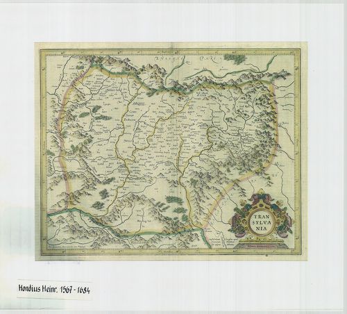
| Title | Transylvania. |
| Main title | Erdély térképe. |
775. Karte von Innerösterreich, oder das Herzogthum Steyermark, K... [B IX a 1146]
Institute and Museum of Military History •
B IX a
•
B IX Ausztria–Magyarország
•
B I–XV. Európa
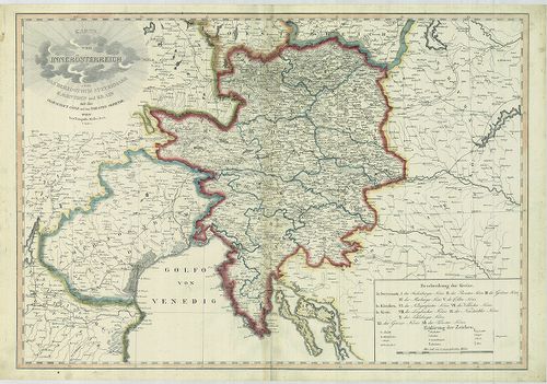
| Title | Karte von Innerösterreich, oder das Herzogthum Steyermark, Kaernthen und Krain mit der Grafschaft Görz und dem Triester Gebiethe. |
| Main title | Belső-Ausztria (A Stájer Hercegség, Karintia, Krajna, a Görz-i Hercegség és a Trieszti terület) térképe. |
776. Karte der Österreichischen Monarchie. [B IX a 1147]
Institute and Museum of Military History •
B IX a
•
B IX Ausztria–Magyarország
•
B I–XV. Európa
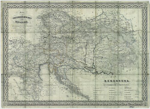
| Title | Karte der Österreichischen Monarchie. |
| Main title | Az Osztrák Monarchia térképe 1861-ből. |
777. Österreich-Ungarn. [B IX a 1148]
Institute and Museum of Military History •
B IX a
•
B IX Ausztria–Magyarország
•
B I–XV. Európa
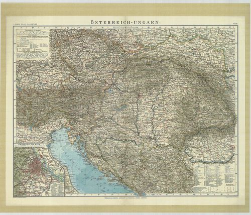
| Title | Österreich-Ungarn. |
| Main title | Az Osztrák-Magyar Monarchia térképe 1912-ből. |
778. Mappa Chorographica per quam Communicatio Sclavoniae... [B IX a 1149]
Institute and Museum of Military History •
B IX a
•
B IX Ausztria–Magyarország
•
B I–XV. Európa
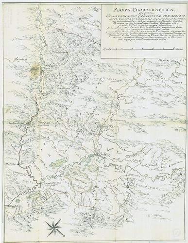
| Title | Mappa Chorographica per quam Communicatio Sclavoniae... |
| Main title | Földrajzi térkép, amelynek segítségével Szlavónia közlekedését ábrázolják. |
779. Mappa Lineae Limitaneae Particularis, Sirmiensis. [B IX a 1150]
Institute and Museum of Military History •
B IX a
•
B IX Ausztria–Magyarország
•
B I–XV. Európa
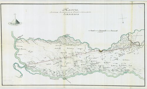
| Title | Mappa Lineae Limitaneae Particularis, Sirmiensis. |
| Main title | A szerémségi határszakasz résztérképe. |
780. Mappa Geographica, Lineae Limitaneae partem Szluinensem comp... [B IX a 1151]
Institute and Museum of Military History •
B IX a
•
B IX Ausztria–Magyarország
•
B I–XV. Európa
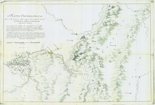
| Title | Mappa Geographica, Lineae Limitaneae partem Szluinensem compendiose exhibens... |
| Main title | Geográfiai térkép, amely a szluini határrészt ábrázolja. |