901. Temesvarer Bannat abgetheilet in Seine District und Process. [B IX a 1281]
Institute and Museum of Military History •
B IX a
•
B IX Ausztria–Magyarország
•
B I–XV. Európa
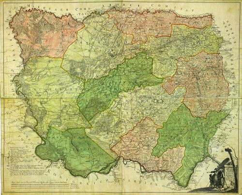
| Title | Temesvarer Bannat abgetheilet in Seine District und Process. |
| Main title | A Temesi Bánság térképe kerületi beosztással. |
902. Das Temesvarer Bannat wie solches in ihre 11 Districte einge... [B IX a 1282]
Institute and Museum of Military History •
B IX a
•
B IX Ausztria–Magyarország
•
B I–XV. Európa
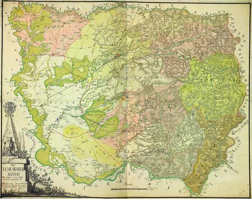
| Title | Das Temesvarer Bannat wie solches in ihre 11 Districte eingetheilet ist. |
| Main title | A Temesi Bánság térképe a 11 kerületi beosztással. |
903. Das Temeswarer Bannat in 3 Komitater, oder 13 Districte geth... [B IX a 1283]
Institute and Museum of Military History •
B IX a
•
B IX Ausztria–Magyarország
•
B I–XV. Európa
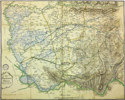
| Title | Das Temeswarer Bannat in 3 Komitater, oder 13 Districte getheilet. |
| Main title | A Temesi Bánság térképe kerületi beosztással. |
904. Plan der 43 Ortschaften des Deutsch-Bannatischen Grenz-Regim... [B IX a 1284]
Institute and Museum of Military History •
B IX a
•
B IX Ausztria–Magyarország
•
B I–XV. Európa
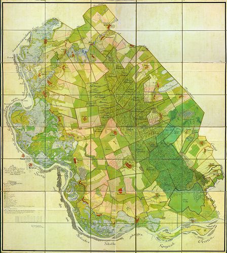
| Title | Plan der 43 Ortschaften des Deutsch-Bannatischen Grenz-Regiments, nebst dem darin befindlichen Gr. Rit. Kloster Voilovicza. |
| Main title | A Német-Bánsági Határőrvidék 43 településének térképe. |
905. Plan des Deutsch-Bannatischen Gränz-Infanterie-Regiments. [B IX a 1285]
Institute and Museum of Military History •
B IX a
•
B IX Ausztria–Magyarország
•
B I–XV. Európa
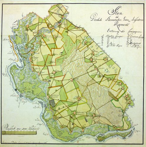
| Title | Plan des Deutsch-Bannatischen Gränz-Infanterie-Regiments. |
| Main title | A Német-Bánsági Határőrvidék térképe. |
906. Carta geografica ejusdem Transilvaniae partis et quidem Czik... [B IX a 1286]
Institute and Museum of Military History •
B IX a
•
B IX Ausztria–Magyarország
•
B I–XV. Európa
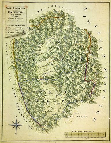
| Title | Carta geografica ejusdem Transilvaniae partis et quidem Czik inferioris et superioris, cum confinibus adjacentibus. |
| Main title | Az erdélyi Csík területe és környéke. |
907. Plan des Passes Ojtoss. [B IX a 1287]
Institute and Museum of Military History •
B IX a
•
B IX Ausztria–Magyarország
•
B I–XV. Európa
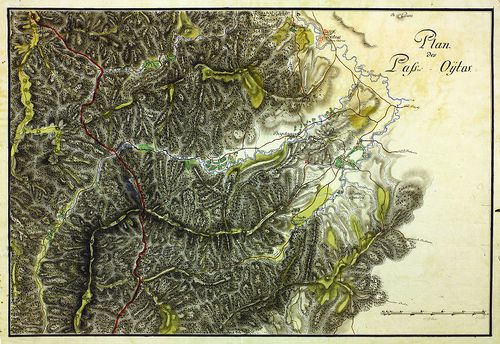
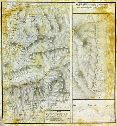
| Title | Plan des Passes Ojtoss. |
| Main title | Az Ojtozi-szoros térképe. |
908. Situations-Plan des Törtzburger Passes in Siebenbürgen nebst... [B IX a 1288]
Institute and Museum of Military History •
B IX a
•
B IX Ausztria–Magyarország
•
B I–XV. Európa
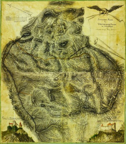
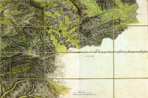
| Title | Situations-Plan des Törtzburger Passes in Siebenbürgen nebst 2 Prospect des dasigen Bergschlosses. |
| Main title | Az erdélyi Törcsvári-hágó térképe, alul jobb és bal oldalt a vár oldalnézeti képével. |
909. Situations-Plan des Ter(t)zburger Passes. [B IX a 1289]
Institute and Museum of Military History •
B IX a
•
B IX Ausztria–Magyarország
•
B I–XV. Európa
| Title | Situations-Plan des Ter(t)zburger Passes. |
| Main title | A Törcsvári-hágó térképe. |
910. Situations-Plan des Ter(t)zburger Passes... [B IX a 1290]
Institute and Museum of Military History •
B IX a
•
B IX Ausztria–Magyarország
•
B I–XV. Európa

| Title | Situations-Plan des Ter(t)zburger Passes... |
| Main title | A Törcsvári-hágó térképe. |
911. Situations-Plan des Rothen Thurm Passes im Grossiürsteuthum ... [B IX a 1291]
Institute and Museum of Military History •
B IX a
•
B IX Ausztria–Magyarország
•
B I–XV. Európa
| Title | Situations-Plan des Rothen Thurm Passes im Grossiürsteuthum Siebenbürgen. |
| Main title | Az erdélyi Vöröstorony-hágó térképe. |
912. Situations-Plan des Rothen Thurm Passes, von der Strasse und... [B IX a 1292]
Institute and Museum of Military History •
B IX a
•
B IX Ausztria–Magyarország
•
B I–XV. Európa
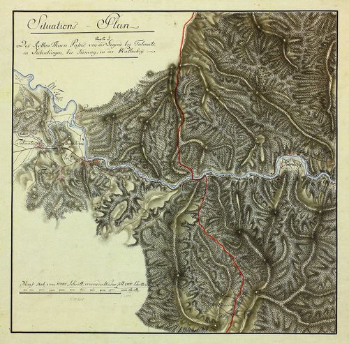
| Title | Situations-Plan des Rothen Thurm Passes, von der Strasse und Gegend bei Talmats (Nagy-Talmács) in Siebenbürgen, bis Kineny' (Cáneni) in der Walachey. |
| Main title | Az erdélyi Vöröstorony-hágó térképe az erdélyi Nagy-Talmács és a havasalföldi Cáneni között. |
913. Plan des Vulcaner Passes, oder Weg von Hatzeg (Hátszeg) über... [B IX a 1293]
Institute and Museum of Military History •
B IX a
•
B IX Ausztria–Magyarország
•
B I–XV. Európa
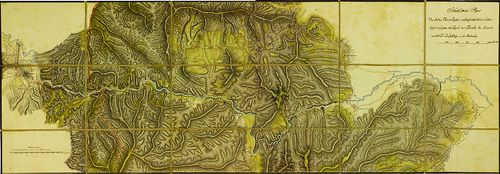
| Title | Plan des Vulcaner Passes, oder Weg von Hatzeg (Hátszeg) über das Gebürg nach Tergusyl (Tergu Jiu) aus Siebenbürgen in die Wallachey. |
| Main title | Az erdélyi Vulkán-szoros térképe Hátszeg és Tergu Jiu között. |
914. Mappa Chorographica otendens....Tractum Territoriorum…Pacis,... [B IX a 1294]
Institute and Museum of Military History •
B IX a
•
B IX Ausztria–Magyarország
•
B I–XV. Európa
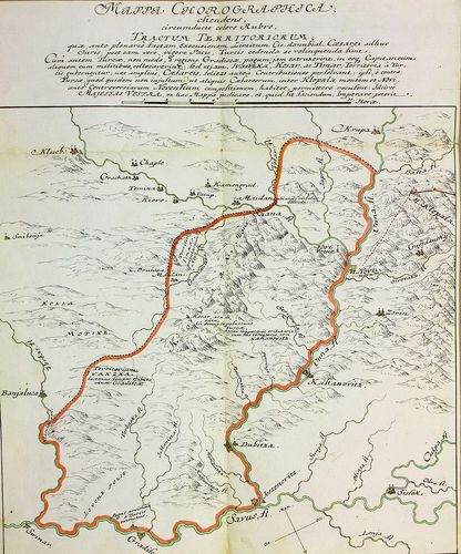
| Title | Mappa Chorographica otendens....Tractum Territoriorum…Pacis, Turcis... |
| Main title | Földrajzi térkép, amely piros színnel keretezve azokat a területeket mutatja, amelyet a békeszerződés értelmében a törököknek kell átadni (Banja Luka, Gradisca, Novi közti terület). |
915. Carte der Banal Granitz. [B IX a 1295]
Institute and Museum of Military History •
B IX a
•
B IX Ausztria–Magyarország
•
B I–XV. Európa
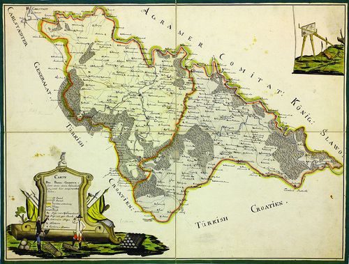
| Title | Carte der Banal Granitz. |
| Main title | A Báni Határőrvidék térképe. |
916. Carte der Banal Granitz. [B IX a 1296]
Institute and Museum of Military History •
B IX a
•
B IX Ausztria–Magyarország
•
B I–XV. Európa
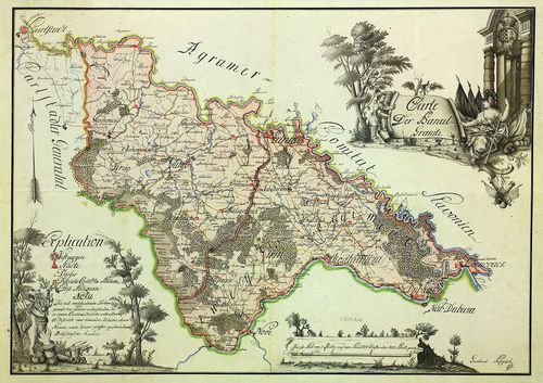
| Title | Carte der Banal Granitz. |
| Main title | A Báni Határőrvidék térképe. |
917. Charte von der Militair-Banal Gräntz. [B IX a 1297]
Institute and Museum of Military History •
B IX a
•
B IX Ausztria–Magyarország
•
B I–XV. Európa
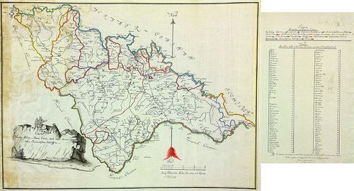
| Title | Charte von der Militair-Banal Gräntz. |
| Main title | A Báni Határőrvidék térképe. |
918. Plan von dem Carlstädter Generalate und einem Theile des Pro... [B IX a 1298]
Institute and Museum of Military History •
B IX a
•
B IX Ausztria–Magyarország
•
B I–XV. Európa
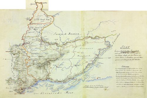
| Title | Plan von dem Carlstädter Generalate und einem Theile des Provinciale bis zum Culpa-Flusse als der Gränze zwischen Crain u. Croatien. |
| Main title | A Károlyvárosi Határőrvidék ée környékének térképe a Kulpa folyóig, mint Krajna és Horvátország határáig. |
919. Generalatus Warasdinensis. [B IX a 1299]
Institute and Museum of Military History •
B IX a
•
B IX Ausztria–Magyarország
•
B I–XV. Európa
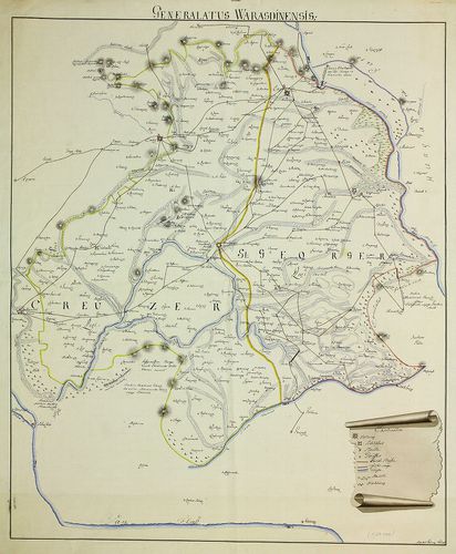
| Title | Generalatus Warasdinensis. |
| Main title | A Varasdi Határőrvidék térképe. |
920. Warasdiner Generalat. [B IX a 1300]
Institute and Museum of Military History •
B IX a
•
B IX Ausztria–Magyarország
•
B I–XV. Európa

| Title | Warasdiner Generalat. |
| Main title | A Varasdi Határőrvidék térképe. |