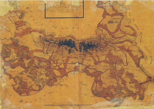
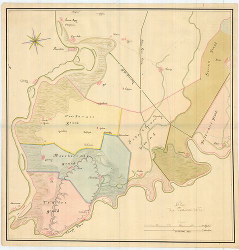
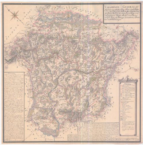
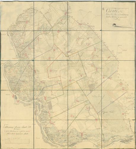
851. Warasdiner Miliairgrenze... [B IX a 1230]
Institute and Museum of Military History •
B IX a
•
B IX Ausztria–Magyarország
•
B I–XV. Európa
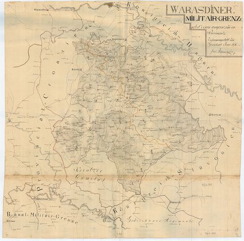
| Title | Warasdiner Miliairgrenze... |
| Main title | A Varasdi Határőrvidék térképe. |
852. Carte der Carlstadter Banal und Warasdiner Granz Regimenter ... [B IX a 1231]
Institute and Museum of Military History •
B IX a
•
B IX Ausztria–Magyarország
•
B I–XV. Európa
| Title | Carte der Carlstadter Banal und Warasdiner Granz Regimenter als auch des angranzenden Illyrien und Provinzial Croatien. |
| Main title | A Báni és Varasdi Határőrvidék térképe a határos illír és horvát területekkel. |
853. Plan des löblichen Warasdiner-Sanct Geoger Regiments Bezirk. [B IX a 1232]
Institute and Museum of Military History •
B IX a
•
B IX Ausztria–Magyarország
•
B I–XV. Európa
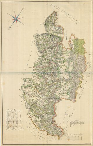
| Title | Plan des löblichen Warasdiner-Sanct Geoger Regiments Bezirk. |
| Main title | A Szent György ezred területének térképe. |
854. [A Szlavón Királyság és a Szlavón Határőrvidék térképe] [B IX a 1233]
Institute and Museum of Military History •
B IX a
•
B IX Ausztria–Magyarország
•
B I–XV. Európa
| Title | [A Szlavón Királyság és a Szlavón Határőrvidék térképe] |
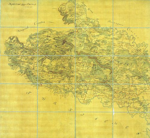
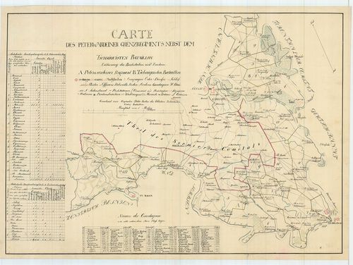
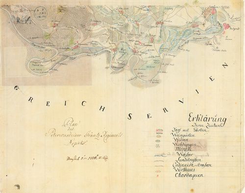
855. Plan des in Syrmien liegenden Peterwardeiner granz Infanteri... [B IX a 1234]
Institute and Museum of Military History •
B IX a
•
B IX Ausztria–Magyarország
•
B I–XV. Európa
| Title | Plan des in Syrmien liegenden Peterwardeiner granz Infanterie Regiments ... |
| Main title | A Péterváradi Határőrezred területén fekvő Szerémség térképe. |
856. Carta des Peterwardeiner Grenz Regiments nebst dem Tschaiqui... [B IX a 1235]
Institute and Museum of Military History •
B IX a
•
B IX Ausztria–Magyarország
•
B I–XV. Európa
| Title | Carta des Peterwardeiner Grenz Regiments nebst dem Tschaiquisten Bataillon. |
| Main title | A Péterváradi Határőrezred és a Csajkás ezred területe. |
857. Mappa der ad Militaire anno 1767 in Syrmien übernommene Herr... [B IX a 1236]
Institute and Museum of Military History •
B IX a
•
B IX Ausztria–Magyarország
•
B I–XV. Európa
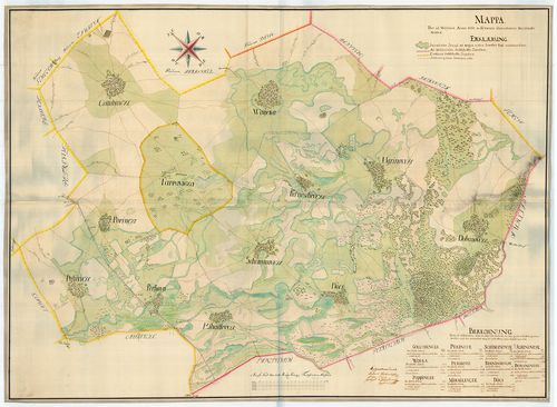
| Title | Mappa der ad Militaire anno 1767 in Syrmien übernommene Herrschaft Woika (Vojka). |
| Main title | A Vojka-i uradalmi birtok térképe a Szerémségben. |
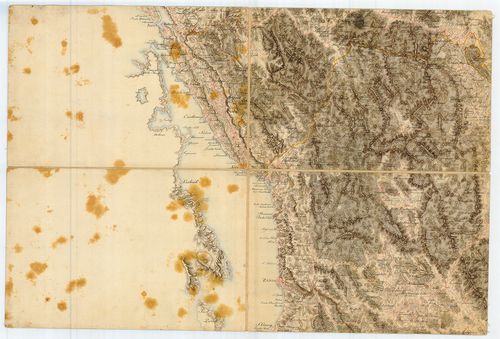
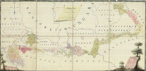
858. Carte Originale et particuliere de la Bosnie... [B IX a 1237]
Institute and Museum of Military History •
B IX a
•
B IX Ausztria–Magyarország
•
B I–XV. Európa
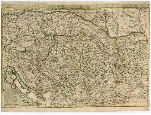
| Title | Carte Originale et particuliere de la Bosnie... |
| Main title | Bosznia, Szlavónia, Horvátország és a határőrvidékek térképe, a Magyar Királyság és Szerbia egy részével. |
859. Plan des Peterwardeiner Granz-Regiments Bezirks. [B IX a 1238]
Institute and Museum of Military History •
B IX a
•
B IX Ausztria–Magyarország
•
B I–XV. Európa
| Title | Plan des Peterwardeiner Granz-Regiments Bezirks. |
| Main title | A Péterváradi Határőrvidék térképe. (Szlavón Határőrvidék része) |
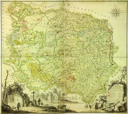
860. Plan und Situation des Gradiscaner Regiments... [B IX a 1239]
Institute and Museum of Military History •
B IX a
•
B IX Ausztria–Magyarország
•
B I–XV. Európa
| Title | Plan und Situation des Gradiscaner Regiments... |
| Main title | A Gradisca-i Katonai Hatáűrőrezred térképe. (Szlavón Határőrvidék része) |
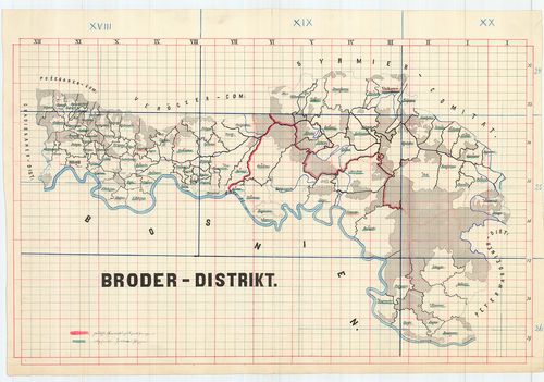
861. Broeder Grenz-Regiment. [B IX a 1240]
Institute and Museum of Military History •
B IX a
•
B IX Ausztria–Magyarország
•
B I–XV. Európa
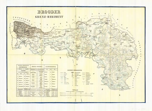
| Title | Broeder Grenz-Regiment. |
| Main title | A Brodi Katonai Határőrezred térképe. (Szlavón Határőrvidék része) |
862. Karte des Gradiscaner Grenz Regiment. [B IX a 1241]
Institute and Museum of Military History •
B IX a
•
B IX Ausztria–Magyarország
•
B I–XV. Európa

| Title | Karte des Gradiscaner Grenz Regiment. |
| Main title | A Gradisca-i Katonai Hatáűrőrezred térképe. (Szlavón Határőrvidék része) |
863. Peterwardeiner Regiment. [B IX a 1242]
Institute and Museum of Military History •
B IX a
•
B IX Ausztria–Magyarország
•
B I–XV. Európa
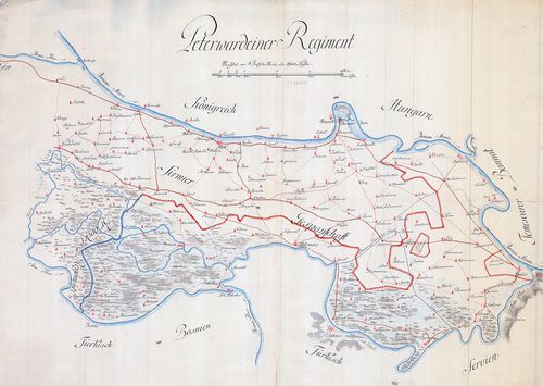
| Title | Peterwardeiner Regiment. |
| Main title | A Péterváradi Katonai Hatáűrőrezred térképe. (Szlavón Határőrvidék része) |
864. A Szlavón Határőrvidék - Gradiscaner Dist., Broder District,... [B IX a 1243]
Institute and Museum of Military History •
B IX a
•
B IX Ausztria–Magyarország
•
B I–XV. Európa
| Title | A Szlavón Határőrvidék - Gradiscaner Dist., Broder District, Peterwardeiner-Distrikt. |
| Main title | A Szlavón Határőrvidék - a Gradiscai, Brodi, Péterváradi körzet térképei. |
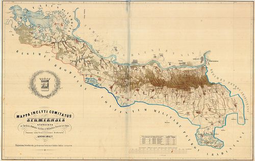
865. Mappa inclyti Comitatus Syrmiensis... [B IX a 1244]
Institute and Museum of Military History •
B IX a
•
B IX Ausztria–Magyarország
•
B I–XV. Európa
| Title | Mappa inclyti Comitatus Syrmiensis... |
| Main title | A Szerémség térképe. |
866. Carta des Peterwardeiner Militar-Districts zwischen Ratscha ... [B IX a 1245]
Institute and Museum of Military History •
B IX a
•
B IX Ausztria–Magyarország
•
B I–XV. Európa
| Title | Carta des Peterwardeiner Militar-Districts zwischen Ratscha und Zemlin. |
| Main title | A Péterváradi Katonai Körzet térképe Racsa és Zemlin között. |
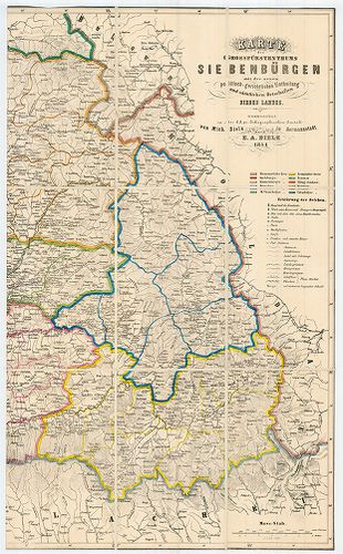
867. Karte des Grossfürtenthums Siebenbürgen... [B IX a 1247]
Institute and Museum of Military History •
B IX a
•
B IX Ausztria–Magyarország
•
B I–XV. Európa
| Title | Karte des Grossfürtenthums Siebenbürgen... |
| Main title | Az Erdélyi Nagyfejedelemség térképe. |
868. [A Temesi Bánság térképe.] [B IX a 1248]
Institute and Museum of Military History •
B IX a
•
B IX Ausztria–Magyarország
•
B I–XV. Európa

| Title | [A Temesi Bánság térképe.] |
869. Plan von dem Tschaikisten Terrain. [B IX a 1249]
Institute and Museum of Military History •
B IX a
•
B IX Ausztria–Magyarország
•
B I–XV. Európa
| Title | Plan von dem Tschaikisten Terrain. |
| Main title | A Csajkások térképe. |
870. Esquelette sammtlicher kk. Militair Graenzen reduciert aus v... [B IX a 1250]
Institute and Museum of Military History •
B IX a
•
B IX Ausztria–Magyarország
•
B I–XV. Európa
| Title | Esquelette sammtlicher kk. Militair Graenzen reduciert aus verschiedenen Kriegs Karten. |
| Main title | A Katonai Határőrvidékek (Horvát, Szlavón, Erdélyi Határőrvidékek) áttekintő térképe a különböző katonai felmérések alapján. |
871. Karte vom Koenigreich Slavonien... [B IX a 1251]
Institute and Museum of Military History •
B IX a
•
B IX Ausztria–Magyarország
•
B I–XV. Európa
| Title | Karte vom Koenigreich Slavonien... |
| Main title | A Szlavón Királyság és a környező területek (Szlavón Határőrvidék) térképe az I. katonai felmérés alapján. |
872. Reducirte Bannal-Grenz Charte. [B IX a 1252]
Institute and Museum of Military History •
B IX a
•
B IX Ausztria–Magyarország
•
B I–XV. Európa
| Title | Reducirte Bannal-Grenz Charte. |
| Main title | A Báni Határőrvidék térképe az I. katonai felmérés alapján. |
873. Charte von Temeswarer Bannat. [B IX a 1253]
Institute and Museum of Military History •
B IX a
•
B IX Ausztria–Magyarország
•
B I–XV. Európa
| Title | Charte von Temeswarer Bannat. |
| Main title | A Temesi Bánság térképe az I. katonai felmérés alapján. |
874. Plan des Rothen Thurner Passes. [B IX a 1254]
Institute and Museum of Military History •
B IX a
•
B IX Ausztria–Magyarország
•
B I–XV. Európa
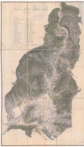
| Title | Plan des Rothen Thurner Passes. |
| Main title | A Vöröstorony-hágó térképe. |
875. Originale der Generalkarte von Siebenbürgen. [B IX a 1255]
Institute and Museum of Military History •
B IX a
•
B IX Ausztria–Magyarország
•
B I–XV. Európa
| Title | Originale der Generalkarte von Siebenbürgen. |
| Main title | Erdély általános térképének (1:288 000) eredetije. |
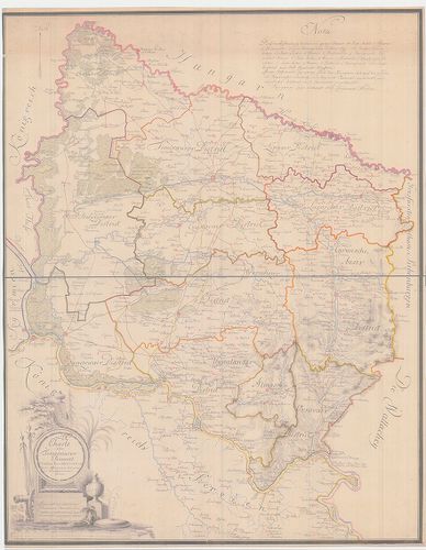
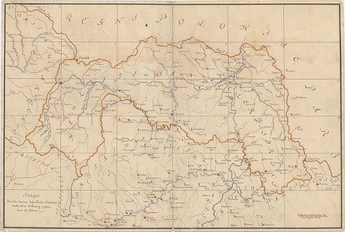
876. Varasdiner Generalat... [B IX a 1256]
Institute and Museum of Military History •
B IX a
•
B IX Ausztria–Magyarország
•
B I–XV. Európa
| Title | Varasdiner Generalat... |
| Main title | A Varasdi Határőrvidék térképe az I. katonai felmérés alapján. |
877. A habsburgi monarkia triásztérképe. [B IX a 1257]
Institute and Museum of Military History •
B IX a
•
B IX Ausztria–Magyarország
•
B I–XV. Európa
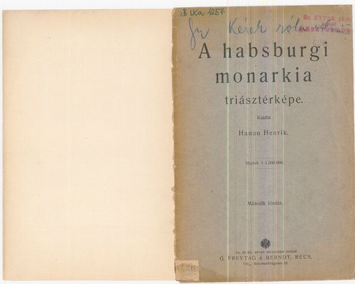
| Title | A habsburgi monarkia triásztérképe. |
| Main title | Német kiadást lásd a B IX a 30/11 jelzet alatt. |
878. Hungariae totius vit ex compluribus aliorum geographicis Cha... [B IX a 1258]
Institute and Museum of Military History •
B IX a
•
B IX Ausztria–Magyarország
•
B I–XV. Európa
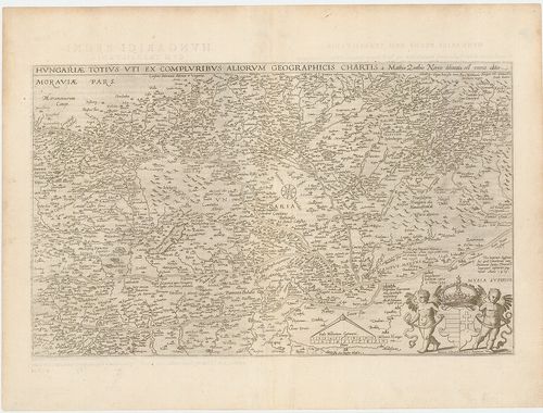
| Title | Hungariae totius vit ex compluribus aliorum geographicis Chartis. |
| Main title | Magyarország térképe. |
879. Partie meridionale du Rme de Hongrie. [B IX a 1259]
Institute and Museum of Military History •
B IX a
•
B IX Ausztria–Magyarország
•
B I–XV. Európa

| Title | Partie meridionale du Rme de Hongrie. |
| Main title | A Magyar Királyság déli részének térképe. |
880. Wien. XV. 13. Az 1:75 000 ma. szelvény 1:100 000 ma.- ra k... [B IX a 1260]
Institute and Museum of Military History •
B IX a
•
B IX Ausztria–Magyarország
•
B I–XV. Európa
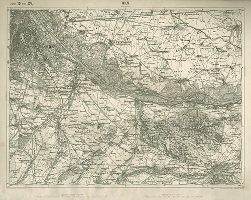
| Title | Wien. XV. 13. Az 1:75 000 ma. szelvény 1:100 000 ma.- ra kicsinyítése. |
881. Tulln. XIV. 12. Az 1:75 000 ma. szelvény 1:100 000 ma.- ra... [B IX a 1261]
Institute and Museum of Military History •
B IX a
•
B IX Ausztria–Magyarország
•
B I–XV. Európa
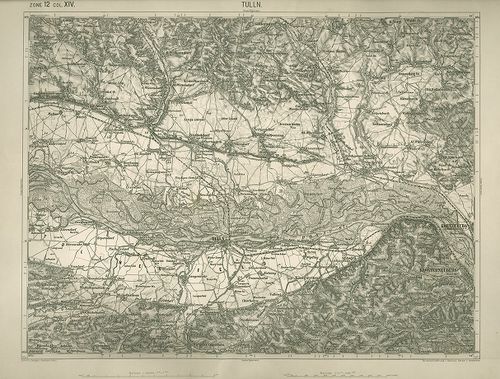
| Title | Tulln. XIV. 12. Az 1:75 000 ma. szelvény 1:100 000 ma.- ra kicsinyítése. |
882. Stuhl Mühlenbach in dem Grosfürstenthum Siebenbürgen. Geomet... [B IX a 1262]
Institute and Museum of Military History •
B IX a
•
B IX Ausztria–Magyarország
•
B I–XV. Európa
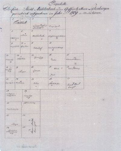
| Title | Stuhl Mühlenbach in dem Grosfürstenthum Siebenbürgen. Geometrisch aufgenohmen im Jahr 1769 in 33 Sectionen. |
| Main title | A szászsebesi Mühlenbach szék gazdasági felmérése (I. kat. felm. előzménye.) |
883. Plan des löbl. Kaiserl. Königl. Ansiedlenden Banater Deutsch... [B IX a 1263]
Institute and Museum of Military History •
B IX a
•
B IX Ausztria–Magyarország
•
B I–XV. Európa
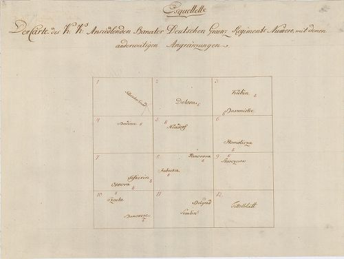
| Title | Plan des löbl. Kaiserl. Königl. Ansiedlenden Banater Deutschen Graenz Regiments.... |
| Main title | A Német Bánsági 12. határezred térképe. |
884. [Karánsebes, Slatina és Teregova felmérési térképei.] [B IX a 1264]
Institute and Museum of Military History •
B IX a
•
B IX Ausztria–Magyarország
•
B I–XV. Európa
| Title | [Karánsebes, Slatina és Teregova felmérési térképei.] |
885. Kriegs Carte in 93 Brouillons Sectionen von Ober Ungarn... [B IX a 1265]
Institute and Museum of Military History •
B IX a
•
B IX Ausztria–Magyarország
•
B I–XV. Európa
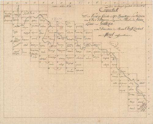
| Title | Kriegs Carte in 93 Brouillons Sectionen von Ober Ungarn... |
| Main title | Felső-Magyarország felmérési térképei. (I. kat. felm. előzménye.) |
886. Banater Generalat. [B IX a 1266]
Institute and Museum of Military History •
B IX a
•
B IX Ausztria–Magyarország
•
B I–XV. Európa
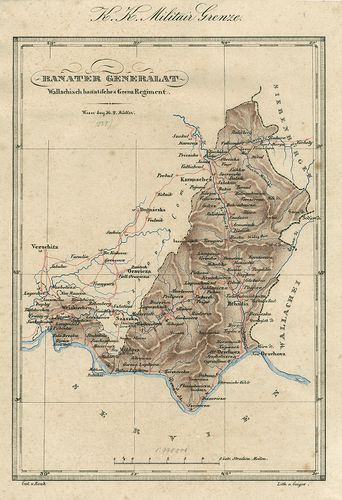
| Title | Banater Generalat. |
| Main title | Az Oláh Bánsági határezred térképe. |
887. Situations Plan des Wallach Illirisch Granz Infanterie Reg. ... [B IX a 1267]
Institute and Museum of Military History •
B IX a
•
B IX Ausztria–Magyarország
•
B I–XV. Európa
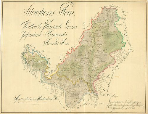
| Title | Situations Plan des Wallach Illirisch Granz Infanterie Reg. Bezirks No. 13. |
| Main title | A Oláh-Illír 13. határezred térképe. |
888. Carte des Wallach-Illirischen Grenz Regiments Bezirks No. 13... [B IX a 1268]
Institute and Museum of Military History •
B IX a
•
B IX Ausztria–Magyarország
•
B I–XV. Európa
| Title | Carte des Wallach-Illirischen Grenz Regiments Bezirks No. 13. |
889. Carte des Löbl. Wallach-Illyrischen Granz Regiment No. 13. [B IX a 1269]
Institute and Museum of Military History •
B IX a
•
B IX Ausztria–Magyarország
•
B I–XV. Európa
| Title | Carte des Löbl. Wallach-Illyrischen Granz Regiment No. 13. |
| Main title | A Oláh-Illír 13. határezred térképe. |
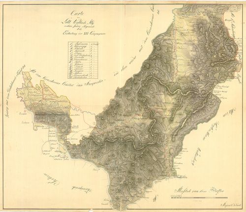
890. Übersichts Carte des Illyrisch Banater Grenz Bataillons. [B IX a 1270]
Institute and Museum of Military History •
B IX a
•
B IX Ausztria–Magyarország
•
B I–XV. Európa
| Title | Übersichts Carte des Illyrisch Banater Grenz Bataillons. |
| Main title | Az Illír-Bánsági 14. határezred áttekintő térképe. |
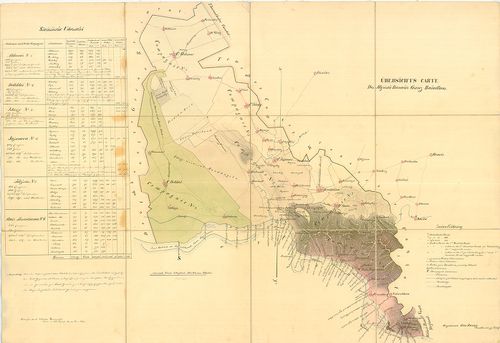
891. Mappa über den Bethskereker District... [B IX a 1271]
Institute and Museum of Military History •
B IX a
•
B IX Ausztria–Magyarország
•
B I–XV. Európa
| Title | Mappa über den Bethskereker District... |
892. Illirischbanater Grenz-Regiment No. 14. [B IX a 1272]
Institute and Museum of Military History •
B IX a
•
B IX Ausztria–Magyarország
•
B I–XV. Európa

| Title | Illirischbanater Grenz-Regiment No. 14. |
| Main title | Az Illír-Bánsági 14. határezred térképe. |
893. Carte des K. k. Deutsbanatischen Granz Regimenst No. 12. [B IX a 1273]
Institute and Museum of Military History •
B IX a
•
B IX Ausztria–Magyarország
•
B I–XV. Európa
| Title | Carte des K. k. Deutsbanatischen Granz Regimenst No. 12. |
| Main title | A Német-Bánsági 12. határezred térképe. |
894. Karte der Banater Militaergraenze. [B IX a 1274]
Institute and Museum of Military History •
B IX a
•
B IX Ausztria–Magyarország
•
B I–XV. Európa

| Title | Karte der Banater Militaergraenze. |
| Main title | Az Bánsági Katonai Határőrvidék térképe. |
895. Plan der Gegent zwischen Caransebes und Fenisch im Temesware... [B IX a 1275]
Institute and Museum of Military History •
B IX a
•
B IX Ausztria–Magyarország
•
B I–XV. Európa
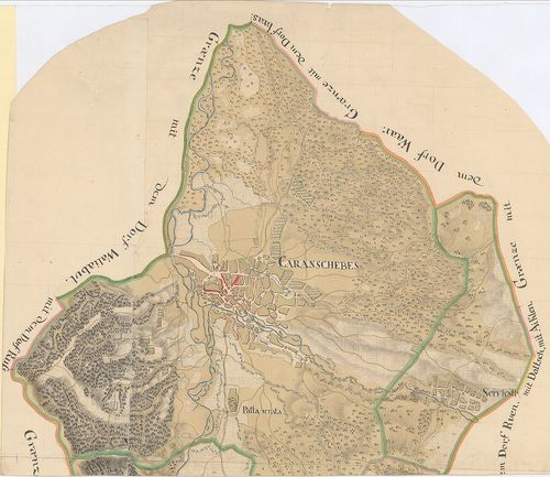
| Title | Plan der Gegent zwischen Caransebes und Fenisch im Temeswarer-Banat. |
| Main title | A Temesvári Bánságban található Karánsebes és Fényes környékének térképe. |
896. Carte des Deutsbanatischen Granz-Regimenst No. 12. [B IX a 1276]
Institute and Museum of Military History •
B IX a
•
B IX Ausztria–Magyarország
•
B I–XV. Európa
| Title | Carte des Deutsbanatischen Granz-Regimenst No. 12. |
| Main title | A Német-Bánsági 12. határezred térképe. |
897. Situations Plan der gegend im Ried, wo das neue Ort in alt B... [B IX a 1277]
Institute and Museum of Military History •
B IX a
•
B IX Ausztria–Magyarország
•
B I–XV. Európa

| Title | Situations Plan der gegend im Ried, wo das neue Ort in alt Bortsa... |
| Main title | Borcsa környékének térképe. |
898. [Az Oláh-Illír határezred térképe.] [B IX a 1278]
Institute and Museum of Military History •
B IX a
•
B IX Ausztria–Magyarország
•
B I–XV. Európa
| Title | [Az Oláh-Illír határezred térképe.] |
899. [A sandec-i körzet-Árva, Liptó,, Szepes, Sáros vármegyék erg... [B IX a 1279]
Institute and Museum of Military History •
B IX a
•
B IX Ausztria–Magyarország
•
B I–XV. Európa
| Title | [A sandec-i körzet-Árva, Liptó,, Szepes, Sáros vármegyék ergyes részei-felmérési szelvényeinek áttekintője (28 szelvény). Az I. katonai felmérés előzménye, részfelmérés.] |
900. Plan von dem Temesvarer Bannat wie solches im 11 Districten ... [B IX a 1280]
Institute and Museum of Military History •
B IX a
•
B IX Ausztria–Magyarország
•
B I–XV. Európa
| Title | Plan von dem Temesvarer Bannat wie solches im 11 Districten eingetheilt. |
| Main title | A Temesi Bánság térképe a 11 kerületi beosztással. |