901. Temesvarer Bannat abgetheilet in Seine District und Process. [B IX a 1281]
Institute and Museum of Military History •
B IX a
•
B IX Ausztria–Magyarország
•
B I–XV. Európa
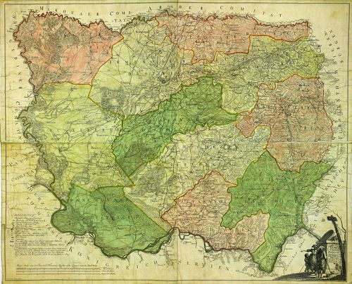
| Title | Temesvarer Bannat abgetheilet in Seine District und Process. |
| Main title | A Temesi Bánság térképe kerületi beosztással. |
902. Das Temesvarer Bannat wie solches in ihre 11 Districte einge... [B IX a 1282]
Institute and Museum of Military History •
B IX a
•
B IX Ausztria–Magyarország
•
B I–XV. Európa
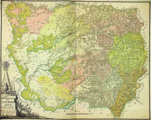
| Title | Das Temesvarer Bannat wie solches in ihre 11 Districte eingetheilet ist. |
| Main title | A Temesi Bánság térképe a 11 kerületi beosztással. |
903. Das Temeswarer Bannat in 3 Komitater, oder 13 Districte geth... [B IX a 1283]
Institute and Museum of Military History •
B IX a
•
B IX Ausztria–Magyarország
•
B I–XV. Európa
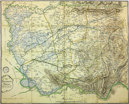
| Title | Das Temeswarer Bannat in 3 Komitater, oder 13 Districte getheilet. |
| Main title | A Temesi Bánság térképe kerületi beosztással. |
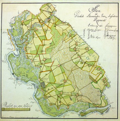
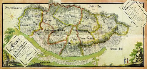
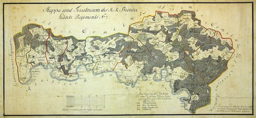
904. Plan der 43 Ortschaften des Deutsch-Bannatischen Grenz-Regim... [B IX a 1284]
Institute and Museum of Military History •
B IX a
•
B IX Ausztria–Magyarország
•
B I–XV. Európa
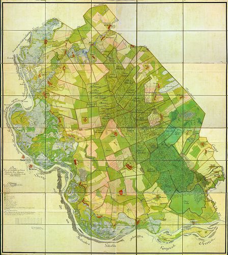
| Title | Plan der 43 Ortschaften des Deutsch-Bannatischen Grenz-Regiments, nebst dem darin befindlichen Gr. Rit. Kloster Voilovicza. |
| Main title | A Német-Bánsági Határőrvidék 43 településének térképe. |
905. Plan des Deutsch-Bannatischen Gränz-Infanterie-Regiments. [B IX a 1285]
Institute and Museum of Military History •
B IX a
•
B IX Ausztria–Magyarország
•
B I–XV. Európa
| Title | Plan des Deutsch-Bannatischen Gränz-Infanterie-Regiments. |
| Main title | A Német-Bánsági Határőrvidék térképe. |
906. Carta geografica ejusdem Transilvaniae partis et quidem Czik... [B IX a 1286]
Institute and Museum of Military History •
B IX a
•
B IX Ausztria–Magyarország
•
B I–XV. Európa
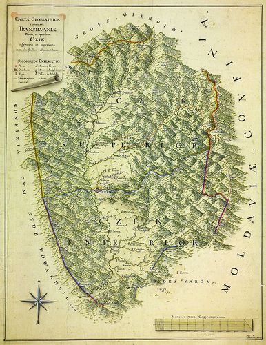
| Title | Carta geografica ejusdem Transilvaniae partis et quidem Czik inferioris et superioris, cum confinibus adjacentibus. |
| Main title | Az erdélyi Csík területe és környéke. |
907. Plan des Passes Ojtoss. [B IX a 1287]
Institute and Museum of Military History •
B IX a
•
B IX Ausztria–Magyarország
•
B I–XV. Európa
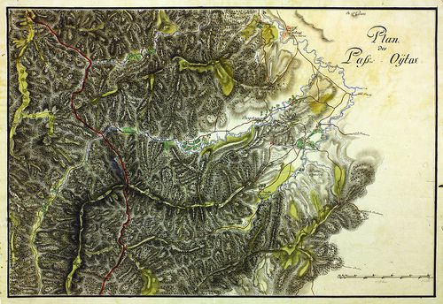
| Title | Plan des Passes Ojtoss. |
| Main title | Az Ojtozi-szoros térképe. |
908. Situations-Plan des Törtzburger Passes in Siebenbürgen nebst... [B IX a 1288]
Institute and Museum of Military History •
B IX a
•
B IX Ausztria–Magyarország
•
B I–XV. Európa
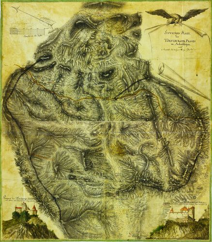
| Title | Situations-Plan des Törtzburger Passes in Siebenbürgen nebst 2 Prospect des dasigen Bergschlosses. |
| Main title | Az erdélyi Törcsvári-hágó térképe, alul jobb és bal oldalt a vár oldalnézeti képével. |
909. Situations-Plan des Ter(t)zburger Passes. [B IX a 1289]
Institute and Museum of Military History •
B IX a
•
B IX Ausztria–Magyarország
•
B I–XV. Európa
| Title | Situations-Plan des Ter(t)zburger Passes. |
| Main title | A Törcsvári-hágó térképe. |
910. Situations-Plan des Ter(t)zburger Passes... [B IX a 1290]
Institute and Museum of Military History •
B IX a
•
B IX Ausztria–Magyarország
•
B I–XV. Európa

| Title | Situations-Plan des Ter(t)zburger Passes... |
| Main title | A Törcsvári-hágó térképe. |
911. Situations-Plan des Rothen Thurm Passes im Grossiürsteuthum ... [B IX a 1291]
Institute and Museum of Military History •
B IX a
•
B IX Ausztria–Magyarország
•
B I–XV. Európa
| Title | Situations-Plan des Rothen Thurm Passes im Grossiürsteuthum Siebenbürgen. |
| Main title | Az erdélyi Vöröstorony-hágó térképe. |
912. Situations-Plan des Rothen Thurm Passes, von der Strasse und... [B IX a 1292]
Institute and Museum of Military History •
B IX a
•
B IX Ausztria–Magyarország
•
B I–XV. Európa
| Title | Situations-Plan des Rothen Thurm Passes, von der Strasse und Gegend bei Talmats (Nagy-Talmács) in Siebenbürgen, bis Kineny' (Cáneni) in der Walachey. |
| Main title | Az erdélyi Vöröstorony-hágó térképe az erdélyi Nagy-Talmács és a havasalföldi Cáneni között. |
913. Plan des Vulcaner Passes, oder Weg von Hatzeg (Hátszeg) über... [B IX a 1293]
Institute and Museum of Military History •
B IX a
•
B IX Ausztria–Magyarország
•
B I–XV. Európa
| Title | Plan des Vulcaner Passes, oder Weg von Hatzeg (Hátszeg) über das Gebürg nach Tergusyl (Tergu Jiu) aus Siebenbürgen in die Wallachey. |
| Main title | Az erdélyi Vulkán-szoros térképe Hátszeg és Tergu Jiu között. |
914. Mappa Chorographica otendens....Tractum Territoriorum…Pacis,... [B IX a 1294]
Institute and Museum of Military History •
B IX a
•
B IX Ausztria–Magyarország
•
B I–XV. Európa
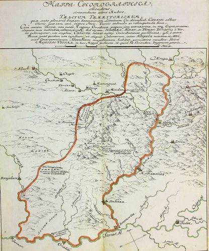
| Title | Mappa Chorographica otendens....Tractum Territoriorum…Pacis, Turcis... |
| Main title | Földrajzi térkép, amely piros színnel keretezve azokat a területeket mutatja, amelyet a békeszerződés értelmében a törököknek kell átadni (Banja Luka, Gradisca, Novi közti terület). |
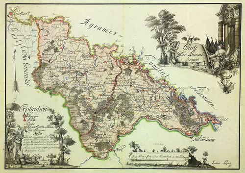
915. Carte der Banal Granitz. [B IX a 1295]
Institute and Museum of Military History •
B IX a
•
B IX Ausztria–Magyarország
•
B I–XV. Európa
| Title | Carte der Banal Granitz. |
| Main title | A Báni Határőrvidék térképe. |
916. Carte der Banal Granitz. [B IX a 1296]
Institute and Museum of Military History •
B IX a
•
B IX Ausztria–Magyarország
•
B I–XV. Európa
| Title | Carte der Banal Granitz. |
| Main title | A Báni Határőrvidék térképe. |
917. Charte von der Militair-Banal Gräntz. [B IX a 1297]
Institute and Museum of Military History •
B IX a
•
B IX Ausztria–Magyarország
•
B I–XV. Európa
| Title | Charte von der Militair-Banal Gräntz. |
| Main title | A Báni Határőrvidék térképe. |
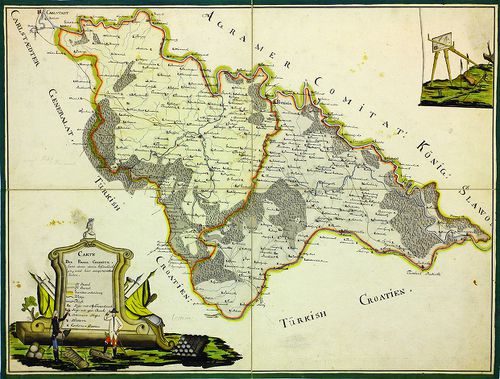
918. Plan von dem Carlstädter Generalate und einem Theile des Pro... [B IX a 1298]
Institute and Museum of Military History •
B IX a
•
B IX Ausztria–Magyarország
•
B I–XV. Európa
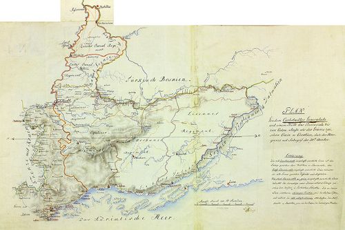
| Title | Plan von dem Carlstädter Generalate und einem Theile des Provinciale bis zum Culpa-Flusse als der Gränze zwischen Crain u. Croatien. |
| Main title | A Károlyvárosi Határőrvidék ée környékének térképe a Kulpa folyóig, mint Krajna és Horvátország határáig. |
919. Generalatus Warasdinensis. [B IX a 1299]
Institute and Museum of Military History •
B IX a
•
B IX Ausztria–Magyarország
•
B I–XV. Európa
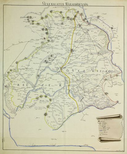
| Title | Generalatus Warasdinensis. |
| Main title | A Varasdi Határőrvidék térképe. |
920. Warasdiner Generalat. [B IX a 1300]
Institute and Museum of Military History •
B IX a
•
B IX Ausztria–Magyarország
•
B I–XV. Európa

| Title | Warasdiner Generalat. |
| Main title | A Varasdi Határőrvidék térképe. |
921. [A Varasdi Határőrvidék térképe.] [B IX a 1301]
Institute and Museum of Military History •
B IX a
•
B IX Ausztria–Magyarország
•
B I–XV. Európa
| Title | [A Varasdi Határőrvidék térképe.] |
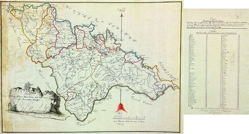
922. Mappa …Carlstaeter Generalats. [B IX a 1302]
Institute and Museum of Military History •
B IX a
•
B IX Ausztria–Magyarország
•
B I–XV. Európa
| Title | Mappa …Carlstaeter Generalats. |
| Main title | A Károlyvárosi Határőrvidék térképe. |
923. Plan von den löbl Szluiner und Oguliner Grenz Regiment. [B IX a 1303]
Institute and Museum of Military History •
B IX a
•
B IX Ausztria–Magyarország
•
B I–XV. Európa
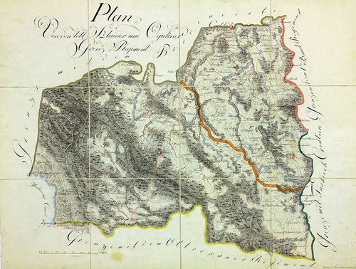
| Title | Plan von den löbl Szluiner und Oguliner Grenz Regiment. |
| Main title | A Szluin-i és Ogulin-i Határőrezredek térképe. |
924. Übersichts-Carte des Liccaner Grenz Regiments. [B IX a 1304]
Institute and Museum of Military History •
B IX a
•
B IX Ausztria–Magyarország
•
B I–XV. Európa
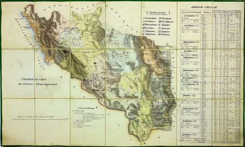
| Title | Übersichts-Carte des Liccaner Grenz Regiments. |
| Main title | A Likka-i Határőrezred áttekintő térképe. |
925. Karte von Liccaner Grenz-Regiments. [B IX a 1305]
Institute and Museum of Military History •
B IX a
•
B IX Ausztria–Magyarország
•
B I–XV. Európa
| Title | Karte von Liccaner Grenz-Regiments. |
| Main title | A Likka-i Határőrezred térképe. |
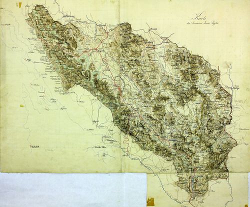
926. Charte des Ottochaner Regiments. [B IX a 1306]
Institute and Museum of Military History •
B IX a
•
B IX Ausztria–Magyarország
•
B I–XV. Európa
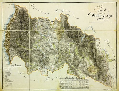
| Title | Charte des Ottochaner Regiments. |
| Main title | Az Otocsáni Határőrezred térképe. |
927. Carte des Carlstaedter Oguliner Grenz-Regiment… [B IX a 1307]
Institute and Museum of Military History •
B IX a
•
B IX Ausztria–Magyarország
•
B I–XV. Európa
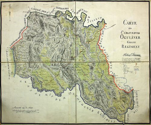
| Title | Carte des Carlstaedter Oguliner Grenz-Regiment… |
| Main title | Az Otocsáni Határőrezred térképe. |
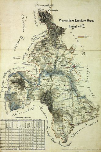
928. Charte des Varasdiner Kreuzer Grenz Infanterie Regiments No.... [B IX a 1308]
Institute and Museum of Military History •
B IX a
•
B IX Ausztria–Magyarország
•
B I–XV. Európa
| Title | Charte des Varasdiner Kreuzer Grenz Infanterie Regiments No. 5. |
| Main title | A Varasdi 5. határőr gyalogezred térképe. |
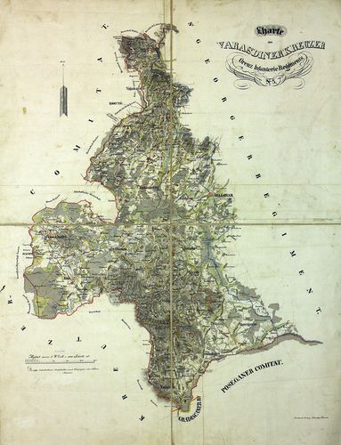
929. Warasdiner-Kreutzer Grenz Regiments No. [B IX a 1309]
Institute and Museum of Military History •
B IX a
•
B IX Ausztria–Magyarország
•
B I–XV. Európa
| Title | Warasdiner-Kreutzer Grenz Regiments No. |
| Main title | A Varasdi 5. határőr gyalogezred térképe. |
930. Karte des Warasdiner Creutzer Grenz Inft. Regmt. No 5. [B IX a 1310]
Institute and Museum of Military History •
B IX a
•
B IX Ausztria–Magyarország
•
B I–XV. Európa
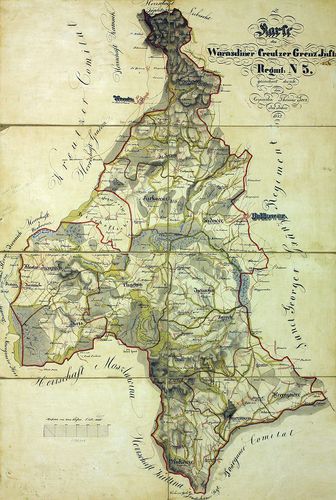
| Title | Karte des Warasdiner Creutzer Grenz Inft. Regmt. No 5. |
| Main title | A Varasdi 5. határőr gyalogezred térképe. |
931. Carte des Warasdiner St. Georger Regiments. [B IX a 1311]
Institute and Museum of Military History •
B IX a
•
B IX Ausztria–Magyarország
•
B I–XV. Európa
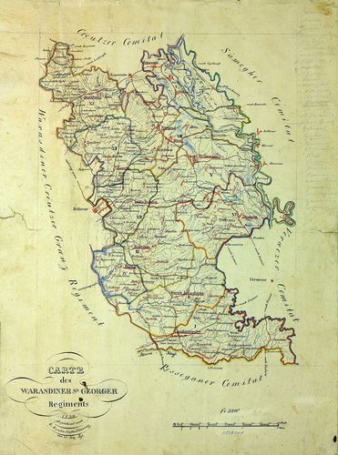
| Title | Carte des Warasdiner St. Georger Regiments. |
| Main title | A Varasdi Szent György ezred térképe. |
932. Karte des Warasdiner St. Georger Regiments. [B IX a 1312]
Institute and Museum of Military History •
B IX a
•
B IX Ausztria–Magyarország
•
B I–XV. Európa
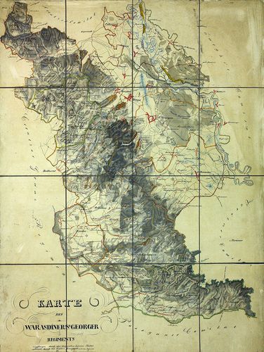
| Title | Karte des Warasdiner St. Georger Regiments. |
| Main title | A Varasdi Szent György ezred térképe. |
933. Karte des k.k. Warasdiner Sanct Georger VI. Grenz Regiments. [B IX a 1313]
Institute and Museum of Military History •
B IX a
•
B IX Ausztria–Magyarország
•
B I–XV. Európa
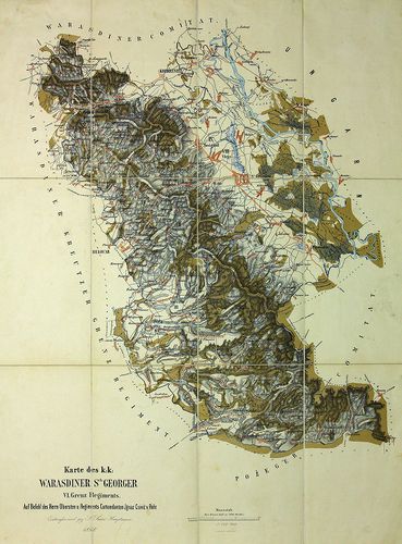
| Title | Karte des k.k. Warasdiner Sanct Georger VI. Grenz Regiments. |
| Main title | A Varasdi VI. Szent György határezred térképe. |
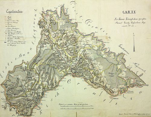
934. Carte deren zwei Banal-Regimenter. [B IX a 1314]
Institute and Museum of Military History •
B IX a
•
B IX Ausztria–Magyarország
•
B I–XV. Európa
| Title | Carte deren zwei Banal-Regimenter. |
| Main title | A két Báni Határőrvidék térképe. |
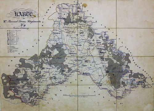
935. Carte Carte des Kaiser Königlichen zweyten Banal Grentz Infa... [B IX a 1315]
Institute and Museum of Military History •
B IX a
•
B IX Ausztria–Magyarország
•
B I–XV. Európa
| Title | Carte Carte des Kaiser Königlichen zweyten Banal Grentz Infanterie Regiments No. 11. |
| Main title | A két Bánsági Határőrvidék 11. gyalog határezred térképe. |
936. Karte des 2. Banal-Grenz-Regiments no. 11. [B IX a 1316]
Institute and Museum of Military History •
B IX a
•
B IX Ausztria–Magyarország
•
B I–XV. Európa
| Title | Karte des 2. Banal-Grenz-Regiments no. 11. |
| Main title | A két Bánsági Határőrvidék 11. gyalog határezred térképe. |
937. Militair Charte eines Theil des Agramer Comitat… [B IX a 1317]
Institute and Museum of Military History •
B IX a
•
B IX Ausztria–Magyarország
•
B I–XV. Európa
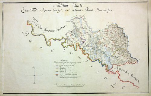
| Title | Militair Charte eines Theil des Agramer Comitat… |
| Main title | Zágráb megye egy részének katonai térképe. |
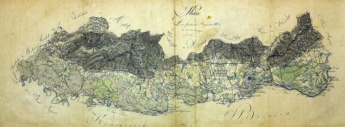
938. Sluin. [B IX a 1318]
Institute and Museum of Military History •
B IX a
•
B IX Ausztria–Magyarország
•
B I–XV. Európa
| Title | Sluin. |
| Main title | Sluin környékének térképe, jobb alsó sarokban a vár és a város látképével. |
939. Karte von dem Millitair District des Königreich Sclavonien u... [B IX a 1319]
Institute and Museum of Military History •
B IX a
•
B IX Ausztria–Magyarország
•
B I–XV. Európa
| Title | Karte von dem Millitair District des Königreich Sclavonien und Herzogthum Syrmien. |
| Main title | A Szlavón Határőrvidék és a Szerémség térképe. |
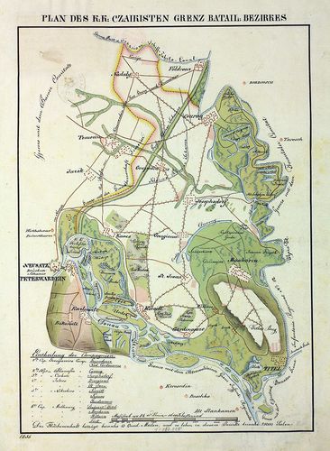
940. Carte des Peterwardeiner Grenz Regiments und Tsaikisten Bat... [B IX a 1320]
Institute and Museum of Military History •
B IX a
•
B IX Ausztria–Magyarország
•
B I–XV. Európa
| Title | Carte des Peterwardeiner Grenz Regiments und Tsaikisten Battaillon. |
| Main title | A Péterváradi Határőrezred és a Csajkás ezred térképe. |
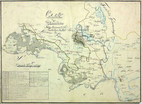
941. Charte von der Lage des löbl. Broder Infanterie Grenz-Regime... [B IX a 1321]
Institute and Museum of Military History •
B IX a
•
B IX Ausztria–Magyarország
•
B I–XV. Európa
| Title | Charte von der Lage des löbl. Broder Infanterie Grenz-Regiments. |
| Main title | A Bródi határőr gyalogezred térképe. |
942. Plan von der Laage des Kais. Königlichen Brooder Grenz Infan... [B IX a 1322]
Institute and Museum of Military History •
B IX a
•
B IX Ausztria–Magyarország
•
B I–XV. Európa
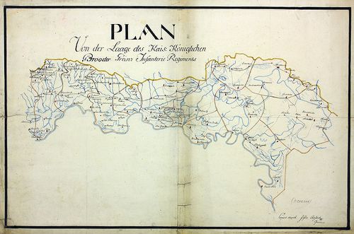
| Title | Plan von der Laage des Kais. Königlichen Brooder Grenz Infanterie Regiments. |
| Main title | A Bródi határőr gyalogezred térképe. |
943. Mappa und Territorium des k. k. Broder Gräntz Regiments No. ... [B IX a 1323]
Institute and Museum of Military History •
B IX a
•
B IX Ausztria–Magyarország
•
B I–XV. Európa
| Title | Mappa und Territorium des k. k. Broder Gräntz Regiments No. 7. |
| Main title | A Bródi 7. határőrezred térképe. |
944. Charte des löb. Gradiscaner Regiments. [B IX a 1324]
Institute and Museum of Military History •
B IX a
•
B IX Ausztria–Magyarország
•
B I–XV. Európa
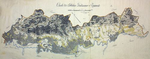
| Title | Charte des löb. Gradiscaner Regiments. |
| Main title | A Gradiscai ezred térképe. |
945. Plan des Gradiscaner Regiments No. 8. [B IX a 1325]
Institute and Museum of Military History •
B IX a
•
B IX Ausztria–Magyarország
•
B I–XV. Európa
| Title | Plan des Gradiscaner Regiments No. 8. |
| Main title | A 8. Gradiscai ezred térképe. |
946. Plan der Lage von K.K. Peterwardeiner Gränz Regiment. [B IX a 1326]
Institute and Museum of Military History •
B IX a
•
B IX Ausztria–Magyarország
•
B I–XV. Európa
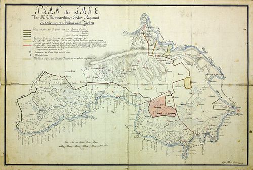
| Title | Plan der Lage von K.K. Peterwardeiner Gränz Regiment. |
| Main title | A Péterváradi határezred térképe. |
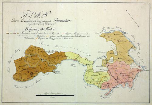
947. Plan der in Syrmien liegenden Peterwardeiner Grenz-Infanteri... [B IX a 1327]
Institute and Museum of Military History •
B IX a
•
B IX Ausztria–Magyarország
•
B I–XV. Európa
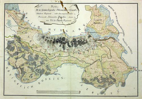
| Title | Plan der in Syrmien liegenden Peterwardeiner Grenz-Infanterie Regiments. |
| Main title | A szerémségi Péterváradi határ-gyalogezred térképe. |
948. Plan des in Syrmien liegenden Peterwardeiner Grenz-Infanteri... [B IX a 1328]
Institute and Museum of Military History •
B IX a
•
B IX Ausztria–Magyarország
•
B I–XV. Európa
| Title | Plan des in Syrmien liegenden Peterwardeiner Grenz-Infanterie-Regiments. |
| Main title | A szerémségi Péterváradi határ-gyalogezred térképe. |
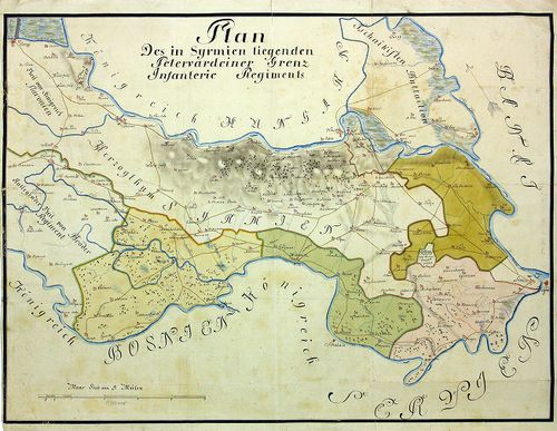
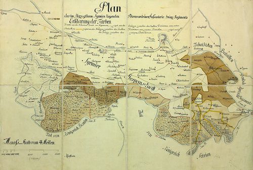
949. Plan des in Herzogthum Syrmien liegenden Peterwardeiner -Inf... [B IX a 1329]
Institute and Museum of Military History •
B IX a
•
B IX Ausztria–Magyarország
•
B I–XV. Európa
| Title | Plan des in Herzogthum Syrmien liegenden Peterwardeiner -Infanterie- Grenz -Regiments. |
| Main title | A szerémségi Péterváradi határ-gyalogezred térképe. |
950. Plan des in Herzogthum Syrmien liegenden Peterwardeiner -Inf... [B IX a 1330]
Institute and Museum of Military History •
B IX a
•
B IX Ausztria–Magyarország
•
B I–XV. Európa
| Title | Plan des in Herzogthum Syrmien liegenden Peterwardeiner -Infanterie- Grenz -Regiments. |
| Main title | A szerémségi Péterváradi határ-gyalogezred térképe. |
951. Plan des Slavonischen Peterwardeiner Gränz Regiments. [B IX a 1331]
Institute and Museum of Military History •
B IX a
•
B IX Ausztria–Magyarország
•
B I–XV. Európa
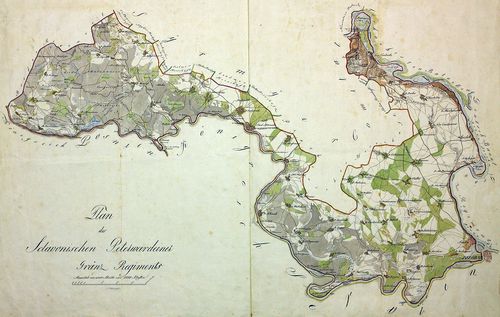
| Title | Plan des Slavonischen Peterwardeiner Gränz Regiments. |
| Main title | A szlavóniai Péterváradi határezred térképe. |
952. Carte des Kais. König. Peterwardeiner Grenz-Regiments. [B IX a 1332]
Institute and Museum of Military History •
B IX a
•
B IX Ausztria–Magyarország
•
B I–XV. Európa
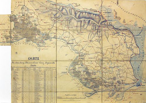
| Title | Carte des Kais. König. Peterwardeiner Grenz-Regiments. |
| Main title | A császári-királyi Péterváradi határezred térképe. |
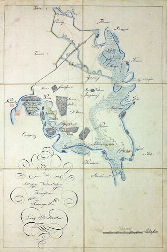
953. Plan aller Gründe des k. k. Tschaikisten Bataillons-Cantons-... [B IX a 1333]
Institute and Museum of Military History •
B IX a
•
B IX Ausztria–Magyarország
•
B I–XV. Európa
| Title | Plan aller Gründe des k. k. Tschaikisten Bataillons-Cantons-Bezirk. |
| Main title | A császári-királyi Csajkások térképe. |
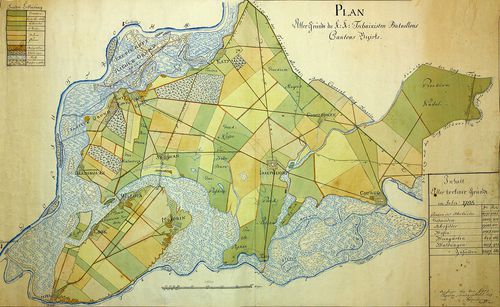
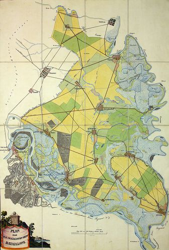
954. Plan des Tschaikisten Bataillons. [B IX a 1334]
Institute and Museum of Military History •
B IX a
•
B IX Ausztria–Magyarország
•
B I–XV. Európa
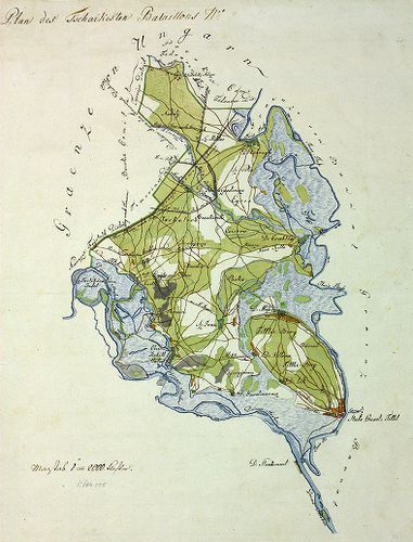
| Title | Plan des Tschaikisten Bataillons. |
| Main title | A Csajkás ezred térképe. |
955. Plan des löblichen kaiserlichen königlichen Tschaikisten Gre... [B IX a 1335]
Institute and Museum of Military History •
B IX a
•
B IX Ausztria–Magyarország
•
B I–XV. Európa
| Title | Plan des löblichen kaiserlichen königlichen Tschaikisten Grenz-Bataillons. |
| Main title | A Csajkás határezred térképe. |
956. Plan des k. k. Czaikisten Grenz-Bataillons. [B IX a 1336]
Institute and Museum of Military History •
B IX a
•
B IX Ausztria–Magyarország
•
B I–XV. Európa
| Title | Plan des k. k. Czaikisten Grenz-Bataillons. |
| Main title | A Csajkás határezred térképe. |
957. Plan vom Syrmier Comitat. [B IX a 1337]
Institute and Museum of Military History •
B IX a
•
B IX Ausztria–Magyarország
•
B I–XV. Európa
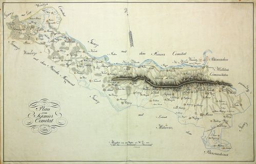
| Title | Plan vom Syrmier Comitat. |
| Main title | A Szerémség térképe. |
958. Plan des k. k. Czaikisten Grenz-Bataill. Bezirks. [B IX a 1338]
Institute and Museum of Military History •
B IX a
•
B IX Ausztria–Magyarország
•
B I–XV. Európa
| Title | Plan des k. k. Czaikisten Grenz-Bataill. Bezirks. |
| Main title | A Csajkás határezred térképe. |
959. Magyaror Szent Korona Országai. Erdély részének kézi térképe... [B IX a 1339]
Institute and Museum of Military History •
B IX a
•
B IX Ausztria–Magyarország
•
B I–XV. Európa
| Title | Magyaror Szent Korona Országai. Erdély részének kézi térképe. |
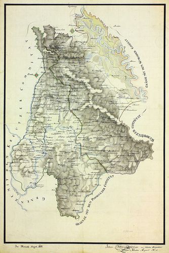
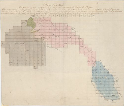
960. Aufnahme von der Marmorosch in Ober Ungarn. [B IX a 1340]
Institute and Museum of Military History •
B IX a
•
B IX Ausztria–Magyarország
•
B I–XV. Európa
| Title | Aufnahme von der Marmorosch in Ober Ungarn. |
| Main title | Máramaros I. katonai felmérése (részfelmérés). |
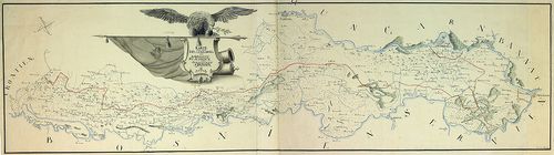
961. Eine newe Land Karte von Wien biss nach Constantinopel und a... [B IX a 1341]
Institute and Museum of Military History •
B IX a
•
B IX Ausztria–Magyarország
•
B I–XV. Európa
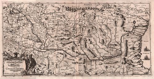
| Title | Eine newe Land Karte von Wien biss nach Constantinopel und angräntzenden Ländern. |
| Main title | Magyarország és a környező területek (Bécs-Konstantinápoly között) térképe. |
962. Die königliche niederhung. 7 freye Bergstädt, Kremnitz, Sche... [B IX a 1342]
Institute and Museum of Military History •
B IX a
•
B IX Ausztria–Magyarország
•
B I–XV. Európa
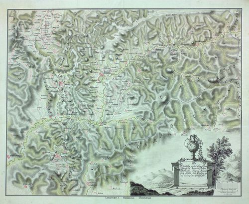
| Title | Die königliche niederhung. 7 freye Bergstädt, Kremnitz, Schemnitz, Neusol Pugans (Bakabánya). Königsberg, Dulln und Libeten (Libetbánya) mit den umliegenden Ortschaften. |
| Main title | A hét szabad királyi bányaváros térképe. |