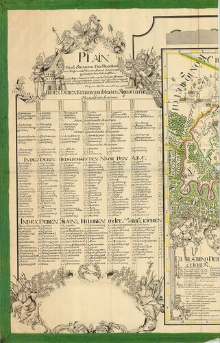
801. Mappa Geographica Facta in Ufum Commerciorum „Buda et Baja”. [B IX a 1175]
Institute and Museum of Military History •
B IX a
•
B IX Ausztria–Magyarország
•
B I–XV. Európa
| Title | Mappa Geographica Facta in Ufum Commerciorum „Buda et Baja”. |
| Main title | „Kereskedelmi útvonalak térképe” |
802. A Tabula Hubgariae és változatai. [B IX a 1176]
Institute and Museum of Military History •
B IX a
•
B IX Ausztria–Magyarország
•
B I–XV. Európa
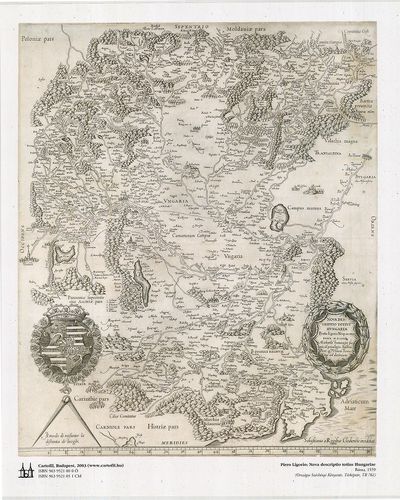
| Title | A Tabula Hubgariae és változatai. |
| Main title | A Lázár és Zsámboky térképek (XVI. sz.) faximile kiadása. |
803. Illyricum. [B IX a 1178]
Institute and Museum of Military History •
B IX a
•
B IX Ausztria–Magyarország
•
B I–XV. Európa
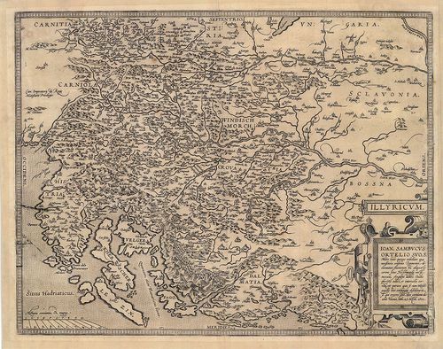
| Title | Illyricum. |
| Main title | Illíria térképe. |
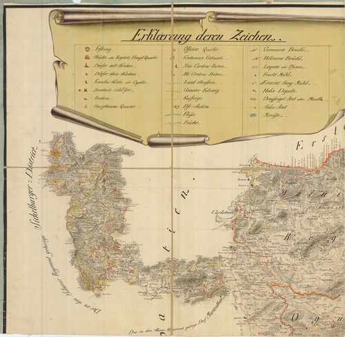
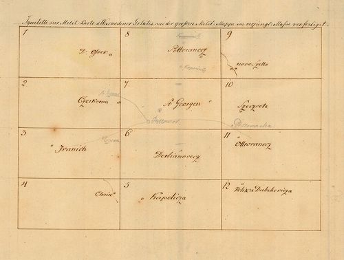
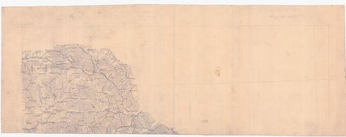
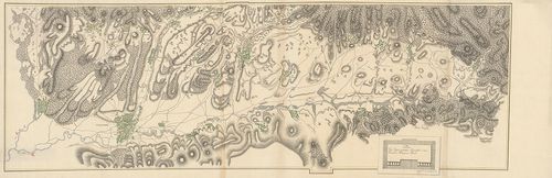
804. Squellette der Aufnahms Carte des Carstadter Generalats in 6... [B IX a 1181]
Institute and Museum of Military History •
B IX a
•
B IX Ausztria–Magyarország
•
B I–XV. Európa
| Title | Squellette der Aufnahms Carte des Carstadter Generalats in 64 Sectionen. |
| Main title | A Károlyvárosi Határőrvidék felmérési szelvényeinek áttekintője az I. katonai felmérés idején. |
805. A Szent Korona országai (1886). [B IX a 1182]
Institute and Museum of Military History •
B IX a
•
B IX Ausztria–Magyarország
•
B I–XV. Európa
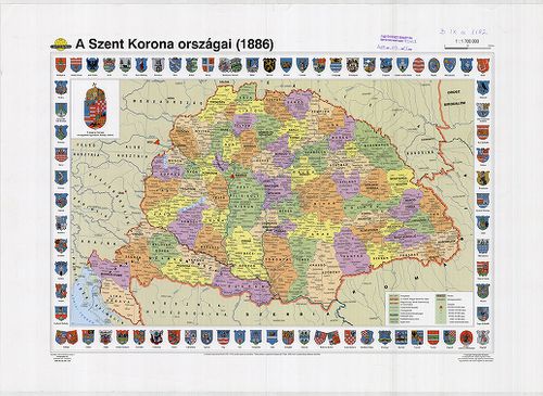
| Title | A Szent Korona országai (1886). |
806. The mape of Hungari....1626. [B IX a 1183]
Institute and Museum of Military History •
B IX a
•
B IX Ausztria–Magyarország
•
B I–XV. Európa
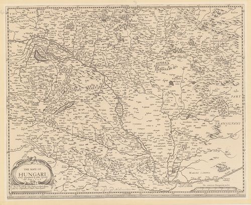
| Title | The mape of Hungari....1626. |
| Main title | Magyarország térképe, 1626. |
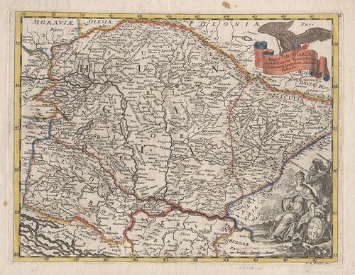
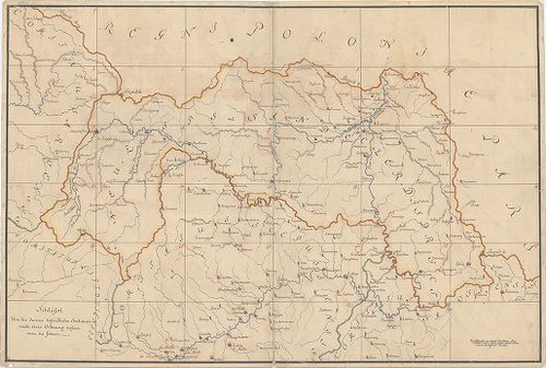
807. Regni Hungariae, et Regionum, quae ei quondem fuere unitae. ... [B IX a 1187]
Institute and Museum of Military History •
B IX a
•
B IX Ausztria–Magyarország
•
B I–XV. Európa
| Title | Regni Hungariae, et Regionum, quae ei quondem fuere unitae. ut Transilvaniae, Valachiae, Moldaviae, Serviae, Romaniae, Bulgariae, Bessarabiae, Croatiae, Bosniae, Dalmatiae, Sclavoniae, Morlachiae, Ragusanae, Republicae… |
| Main title | A Magyar Királyság és a Balkán-félsziget térképe 1688-ban. |
808. La Transilvania Diuisa su L’Esemplare delle Carte … [B IX a 1188]
Institute and Museum of Military History •
B IX a
•
B IX Ausztria–Magyarország
•
B I–XV. Európa
| Title | La Transilvania Diuisa su L’Esemplare delle Carte … |
| Main title | Erdély térképe 1686-ban, a nemzetiségi területek megnevezésével. |
809. Ungariae loca praecipua recens emendata atque edita… [B IX a 1189]
Institute and Museum of Military History •
B IX a
•
B IX Ausztria–Magyarország
•
B I–XV. Európa
| Title | Ungariae loca praecipua recens emendata atque edita… |
| Main title | Magyarország térképe 1579-ben. |
810. Carte de la Hongrie a l’Autriche… [B IX a 1190]
Institute and Museum of Military History •
B IX a
•
B IX Ausztria–Magyarország
•
B I–XV. Európa
| Title | Carte de la Hongrie a l’Autriche… |
811. L’Ungaria nuouamente descritta, et accresciuta di Varie Noti... [B IX a 1191]
Institute and Museum of Military History •
B IX a
•
B IX Ausztria–Magyarország
•
B I–XV. Európa
| Title | L’Ungaria nuouamente descritta, et accresciuta di Varie Notizie… |
| Main title | Magyarország térképe 1686-ban. |
812. The mape of Hungari....1626. [B IX a 1192]
Institute and Museum of Military History •
B IX a
•
B IX Ausztria–Magyarország
•
B I–XV. Európa
| Title | The mape of Hungari....1626. |
813. Tabula Hungarie ad quatour latera per Lazarum quondam Thomae... [B IX a 1193]
Institute and Museum of Military History •
B IX a
•
B IX Ausztria–Magyarország
•
B I–XV. Európa
| Title | Tabula Hungarie ad quatour latera per Lazarum quondam Thomae Strigonien Cardin. Secretariu viru, exptuz congesta, á Georgio Tanstetter Collimitio reuisa auctiorqz reddita atque iamprimu á Io. Cuspiniano edita Serenissimo Hungarie et Bohemiae Regi Ferdinando principi et infanti. Hispaniarum Archiduci Austriae ec. Sacra, auspitio maiestatis suae ob reip Christiane vsum, opera Petri Apiani de Leyssnigk Mathematici Ingolstadiani inuulgata Anno Dni 1528. Véste: Collimitius Tanstetter György. |
| Main title | Lázár Magyarország térképének (1528) fakszimile kiadása 2002-ben. |
814. Regni Hungariae et Regionum, quae ei quondam fuere unitae, u... [B IX a 1194]
Institute and Museum of Military History •
B IX a
•
B IX Ausztria–Magyarország
•
B I–XV. Európa
| Title | Regni Hungariae et Regionum, quae ei quondam fuere unitae, ut Transilvaniae, Valachiae, Moldaviae, Serviae, Romaniae, Bulgariae, Bessarábiae, Croatiae, Bosniae, Dalmatiae, Sclavoniae, Morlachiae, Ragusanae Republicae Maximaequ Partis Danubii Fluminis. |
| Main title | A Magyar Királyság és a környező államok (Duna menti országok) térképe 1688-ban. |
815. Regnum Hungaria in Omnes suos Comitatus Accurate... [B IX a 1195]
Institute and Museum of Military History •
B IX a
•
B IX Ausztria–Magyarország
•
B I–XV. Európa
| Title | Regnum Hungaria in Omnes suos Comitatus Accurate... |
| Main title | A Magyar Királyság térképe a XVII. sz. végén, megyebeosztással. |
816. Danubius, Fluvius Europae maximus. A Fontibus ad Ostia. [B IX a 1196]
Institute and Museum of Military History •
B IX a
•
B IX Ausztria–Magyarország
•
B I–XV. Európa
| Title | Danubius, Fluvius Europae maximus. A Fontibus ad Ostia. |
| Main title | A Duna, Európa nagy folyójának térképe. Az eredettől a torkolatig. |
817. A Magyar Szent Korona országainak települései és közigazgatá... [B IX a 1198]
Institute and Museum of Military History •
B IX a
•
B IX Ausztria–Magyarország
•
B I–XV. Európa
| Title | A Magyar Szent Korona országainak települései és közigazgatása. Hátoldalán: Magyarország az Osztrák-Magyar Monarchiában. |
818. Das Khynigreich Hungern... [B IX a 1199]
Institute and Museum of Military History •
B IX a
•
B IX Ausztria–Magyarország
•
B I–XV. Európa
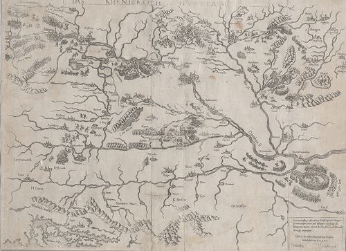
| Title | Das Khynigreich Hungern... |
| Main title | A Magyar Királyság. Az 1566-os török hadjárat főbb várostromainak bemutatása. |
819. Regni Hungariae cum adiuncta Transylvania... [B IX a 1200]
Institute and Museum of Military History •
B IX a
•
B IX Ausztria–Magyarország
•
B I–XV. Európa
| Title | Regni Hungariae cum adiuncta Transylvania... |
| Main title | A Magyar Királyság és Erdély térképe. |
820. Carte von Ungarn und Siebenbürgen. [B IX a 1201]
Institute and Museum of Military History •
B IX a
•
B IX Ausztria–Magyarország
•
B I–XV. Európa
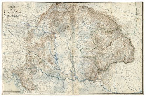
| Title | Carte von Ungarn und Siebenbürgen. |
| Main title | A Magyar Királyság és Erdély térképe. |
821. Carte von Ungarn und Siebenbürgen. [B IX a 1202]
Institute and Museum of Military History •
B IX a
•
B IX Ausztria–Magyarország
•
B I–XV. Európa
| Title | Carte von Ungarn und Siebenbürgen. |
| Main title | A Magyar Királyság és Erdély térképe. |
822. Charte von den Königreichen Ungarn, Kroatien, und Slavonien ... [B IX a 1203]
Institute and Museum of Military History •
B IX a
•
B IX Ausztria–Magyarország
•
B I–XV. Európa
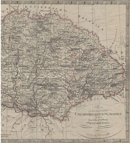
| Title | Charte von den Königreichen Ungarn, Kroatien, und Slavonien mit dem Grossfürstenthume Siebenbürgen. |
| Main title | A Magyar Királyság, Horvátország, Szlavónia és Erdély térképe. (nyugati rész h.) |
823. Magyar Ország közönséges földképe. [B IX a 1204]
Institute and Museum of Military History •
B IX a
•
B IX Ausztria–Magyarország
•
B I–XV. Európa

| Title | Magyar Ország közönséges földképe. |
824. Tabula generalis Regni Hungariae, Croatiae et Slavoniae nec ... [B IX a 1205]
Institute and Museum of Military History •
B IX a
•
B IX Ausztria–Magyarország
•
B I–XV. Európa
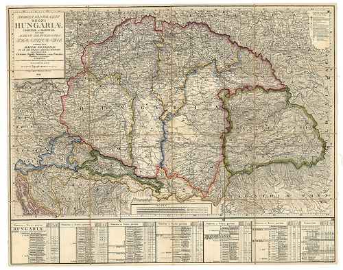
| Title | Tabula generalis Regni Hungariae, Croatiae et Slavoniae nec non Magni Principatus Transylvaniae… |
| Main title | A Magyar Királyság, Horvát-Szlavónia és Erdély általános térképe 1848-ban. Tartományi színezés. |
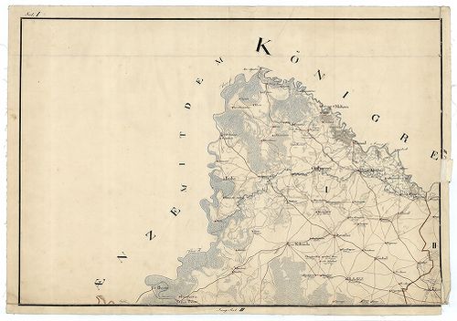
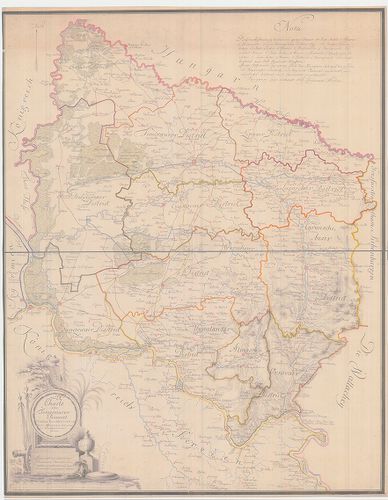
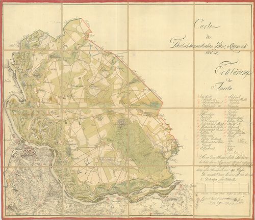
825. [Trencsén-, Túróc-, Árva-, Liptó-, Szepes- és Sáros megyék t... [B IX a 1206]
Institute and Museum of Military History •
B IX a
•
B IX Ausztria–Magyarország
•
B I–XV. Európa
| Title | [Trencsén-, Túróc-, Árva-, Liptó-, Szepes- és Sáros megyék területét ábrázoló általános térkép 1831-ből, készült Aulich százados irányításával, az I. katonai felmérés alapján.] |
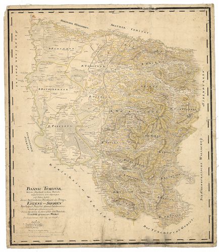
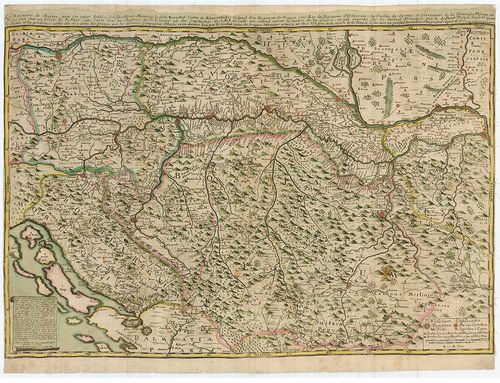
826. Karte vom Banat und der Wallachey... [B IX a 1207]
Institute and Museum of Military History •
B IX a
•
B IX Ausztria–Magyarország
•
B I–XV. Európa
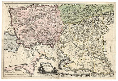
| Title | Karte vom Banat und der Wallachey... |
| Main title | A Temesi Bánság és Havasalföld térképe. |
827. Der Temesvarer Bannat. [B IX a 1208]
Institute and Museum of Military History •
B IX a
•
B IX Ausztria–Magyarország
•
B I–XV. Európa
| Title | Der Temesvarer Bannat. |
| Main title | A Temesi Bánság "Mercy" féle térképének a kicsinyitésével készült térkép. (Lásd: B IX a 1166) |
828. [A Temesi Bánság topográfiai térképe.] [B IX a 1209]
Institute and Museum of Military History •
B IX a
•
B IX Ausztria–Magyarország
•
B I–XV. Európa
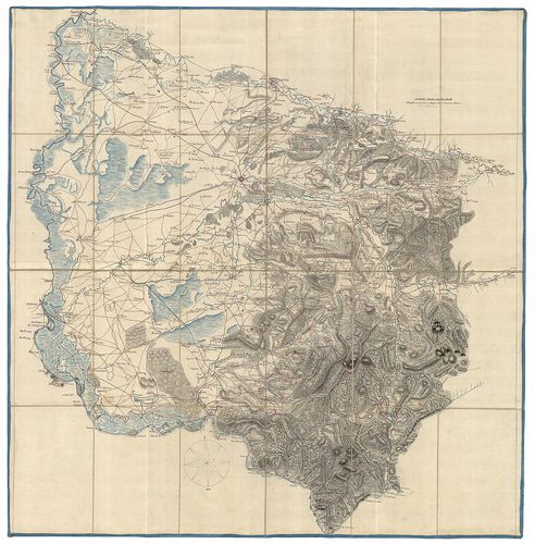
| Title | [A Temesi Bánság topográfiai térképe.] |
829. Carte von dem Temesvarer Banat und dem König. Servien, nebst... [B IX a 1210]
Institute and Museum of Military History •
B IX a
•
B IX Ausztria–Magyarország
•
B I–XV. Európa
| Title | Carte von dem Temesvarer Banat und dem König. Servien, nebst einen Theil von Ungarn, Slavonien und Bosnien. |
| Main title | A Temesi Bánság és a Szerb Királyság, valamint a Magyar Királyság, Szlavónia és Bosznia egy részének totográfiai térképe. |
830. Generalkarte vom Temesvárer Banat, mit Inbegriff des Tschaik... [B IX a 1211]
Institute and Museum of Military History •
B IX a
•
B IX Ausztria–Magyarország
•
B I–XV. Európa
| Title | Generalkarte vom Temesvárer Banat, mit Inbegriff des Tschaikisten Bezirks. |
| Main title | A Temesi Bánság (a Csajkások területével együtt) topográfiai térképe az I. kat. felm. alapján. |
831. Karte des Wallach-Illirischen und des deutchen Ansiedlungs-R... [B IX a 1212]
Institute and Museum of Military History •
B IX a
•
B IX Ausztria–Magyarország
•
B I–XV. Európa
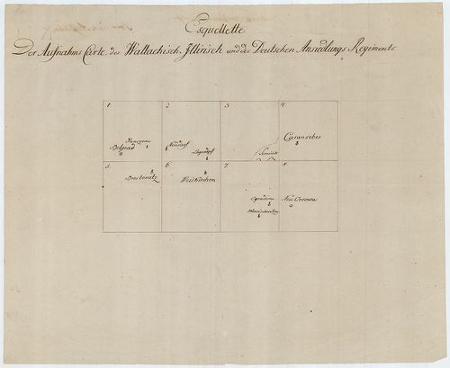
| Title | Karte des Wallach-Illirischen und des deutchen Ansiedlungs-Regiments. |
| Main title | Az Oláh-Illír és a és a Német Bánsági Határezredek topográfiai térképe az I. kat. felm. alapján. |
832. Uibersichts Karte der Banatischen Militair Granze. [B IX a 1213]
Institute and Museum of Military History •
B IX a
•
B IX Ausztria–Magyarország
•
B I–XV. Európa
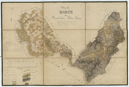
| Title | Uibersichts Karte der Banatischen Militair Granze. |
| Main title | A Bánsági Határőrvidék topográfiai térképe az I. kat. felm. alapján. |
833. Plan des Roszdyil Berges bei F. Hrabonicza an der Strasse vo... [B IX a 1214]
Institute and Museum of Military History •
B IX a
•
B IX Ausztria–Magyarország
•
B I–XV. Európa
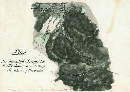
| Title | Plan des Roszdyil Berges bei F. Hrabonicza an der Strasse von Munkác nach Vereczke. |
| Main title | A Roszdyil-hegység F. Hraboniczánál, a Munkács-Verecke közötti út mentén. |
834. Plan des Roszdyil Berges bei F. Hrabonicza an der Strasse vo... [B IX a 1214]
Institute and Museum of Military History •
B IX a
•
B IX Ausztria–Magyarország
•
B I–XV. Európa
| Title | Plan des Roszdyil Berges bei F. Hrabonicza an der Strasse von Munkác nach Vereczke. |
| Main title | A Roszdyil-hegység F. Hraboniczánál, a Munkács-Verecke közötti út mentén. |
835. Plan des Passes bei Sola (Sóslak) im Comitat Unghvar an der ... [B IX a 1215]
Institute and Museum of Military History •
B IX a
•
B IX Ausztria–Magyarország
•
B I–XV. Európa
| Title | Plan des Passes bei Sola (Sóslak) im Comitat Unghvar an der Strasse nach Uszok. |
836. Plan des Passes bei Sola (Sóslak) im Comitat Unghvar an der ... [B IX a 1215]
Institute and Museum of Military History •
B IX a
•
B IX Ausztria–Magyarország
•
B I–XV. Európa
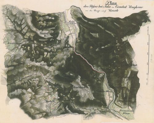
| Title | Plan des Passes bei Sola (Sóslak) im Comitat Unghvar an der Strasse nach Uszok. |
| Main title | A Sóslaki-szoros Ung megyében, az Uzsoki-hágó felé vezető úton. |
837. A la vue Aufnahme der Gegend von Sümegh. [B IX a 1216]
Institute and Museum of Military History •
B IX a
•
B IX Ausztria–Magyarország
•
B I–XV. Európa
| Title | A la vue Aufnahme der Gegend von Sümegh. |
838. Plan des Passes...im Vitsa (Vecsa). Thale am Wege von Munkác... [B IX a 1217]
Institute and Museum of Military History •
B IX a
•
B IX Ausztria–Magyarország
•
B I–XV. Európa

| Title | Plan des Passes...im Vitsa (Vecsa). Thale am Wege von Munkács über Szolyva und Volocz nach Verecke. |
| Main title | A Munkács-Verecke közötti völgy térképe. |
839. Situation der Wederanischen Hölle. [B IX a 1218]
Institute and Museum of Military History •
B IX a
•
B IX Ausztria–Magyarország
•
B I–XV. Európa
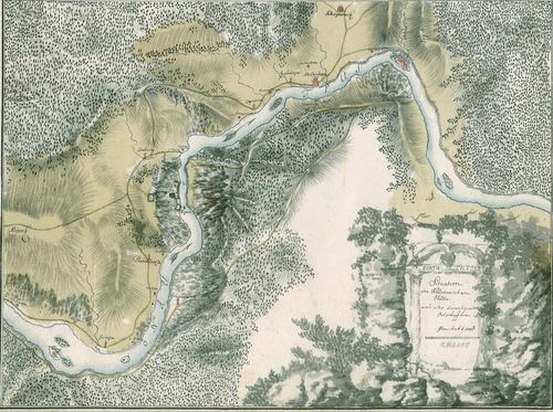
| Title | Situation der Wederanischen Hölle. |
| Main title | A Veteráni-barlang kkörnyéke. |
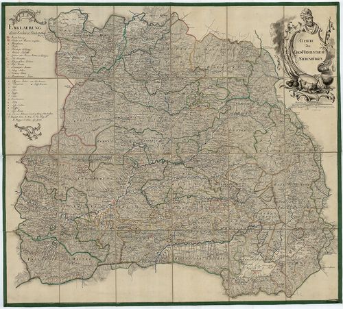
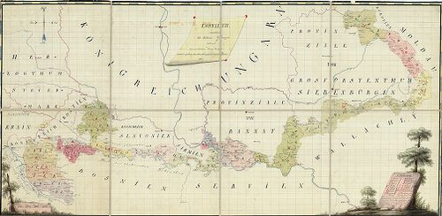
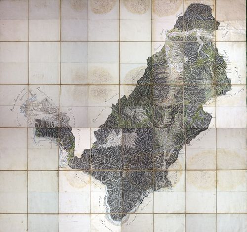
840. Magni Principatus Transylvaniae... [B IX a 1219]
Institute and Museum of Military History •
B IX a
•
B IX Ausztria–Magyarország
•
B I–XV. Európa
| Title | Magni Principatus Transylvaniae... |
| Main title | Az Erdélyi Nagyfejedelemség térképe az I. kat. felm. nyomán, a Jeney-féle térkép alapján - B IX a 715/1 - harmadára kicsinyítve. |
841. Nova Magni Principatus Transilvaniae... [B IX a 1220]
Institute and Museum of Military History •
B IX a
•
B IX Ausztria–Magyarország
•
B I–XV. Európa
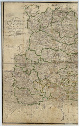
| Title | Nova Magni Principatus Transilvaniae... |
| Main title | Az Erdélyi Nagyfejedelemség "új" térképe, Bukovina és Moldva területével, Jeney-féle térkép alapján - B IX a 715/1 - negyedére kicsinyítve. |
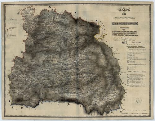
842. Generalkarte von Siebenbürgen… [B IX a 1221]
Institute and Museum of Military History •
B IX a
•
B IX Ausztria–Magyarország
•
B I–XV. Európa
| Title | Generalkarte von Siebenbürgen… |
| Main title | Erdély általános térképe 1789-ben. |
843. Charte des Grossfürstenthum Siebenbürgen. [B IX a 1222]
Institute and Museum of Military History •
B IX a
•
B IX Ausztria–Magyarország
•
B I–XV. Európa
| Title | Charte des Grossfürstenthum Siebenbürgen. |
| Main title | Az Erdélyi Nagyfejedelemség térképe |
844. Karte des Grossfürstenthums Siebenbürgen. [B IX a 1223]
Institute and Museum of Military History •
B IX a
•
B IX Ausztria–Magyarország
•
B I–XV. Európa
| Title | Karte des Grossfürstenthums Siebenbürgen. |
| Main title | Az Erdélyi Nagyfejedelemség térképe |
845. Special-Karte von Burzen Lande, oder dem Kronstadter Distric... [B IX a 1224]
Institute and Museum of Military History •
B IX a
•
B IX Ausztria–Magyarország
•
B I–XV. Európa
| Title | Special-Karte von Burzen Lande, oder dem Kronstadter District, in Siebenbürgen... |
| Main title | Az erdélyi Brassói Körzet topográfiai térképe az I. kat. felm. alapján (hatodára kics. ) |
846. Situatons Plan von Pass Gymess. [B IX a 1225]
Institute and Museum of Military History •
B IX a
•
B IX Ausztria–Magyarország
•
B I–XV. Európa
| Title | Situatons Plan von Pass Gymess. |
| Main title | A Gyimesi-szoros térképe. |
847. Geographische Mappe des Grossfürstenthums Siebenbürgen. [B IX a 1226]
Institute and Museum of Military History •
B IX a
•
B IX Ausztria–Magyarország
•
B I–XV. Európa

| Title | Geographische Mappe des Grossfürstenthums Siebenbürgen. |
| Main title | Az Erdélyi Nagyfejedelemség földrajzi térképe |
848. Ideal Plan. Von der zwischen Agram, Carlstadt, Zeng, Ottocha... [B IX a 1227]
Institute and Museum of Military History •
B IX a
•
B IX Ausztria–Magyarország
•
B I–XV. Európa
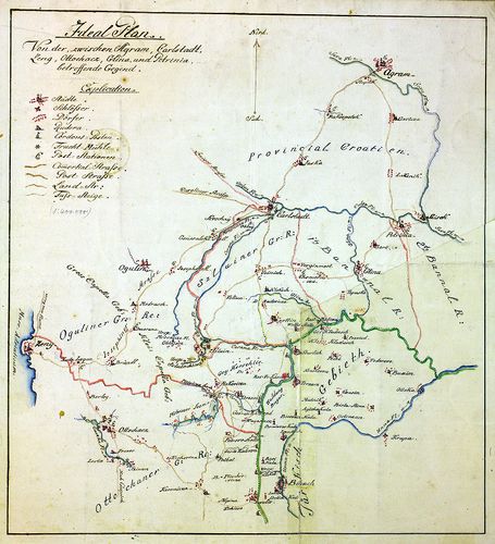
| Title | Ideal Plan. Von der zwischen Agram, Carlstadt, Zeng, Ottochacz, Glina und Petrinja betreffende Gegend. |
| Main title | A Zágráb, Károlyváros, Zeng, Glina és Petrinja által határolt. terület térképe. |
849. Charte des Carlstadter Generalats... [B IX a 1228]
Institute and Museum of Military History •
B IX a
•
B IX Ausztria–Magyarország
•
B I–XV. Európa
| Title | Charte des Carlstadter Generalats... |
| Main title | A Károlyvárosi Határőrvidék térképe az I. katonai felmérés 1791-es kiegészítése után. |
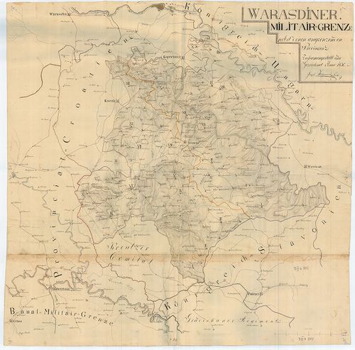
850. Militair Carte des Varasdiner Generalats... [B IX a 1229]
Institute and Museum of Military History •
B IX a
•
B IX Ausztria–Magyarország
•
B I–XV. Európa
| Title | Militair Carte des Varasdiner Generalats... |
| Main title | A Varasdi Határőrvidék térképe. |
851. Warasdiner Miliairgrenze... [B IX a 1230]
Institute and Museum of Military History •
B IX a
•
B IX Ausztria–Magyarország
•
B I–XV. Európa
| Title | Warasdiner Miliairgrenze... |
| Main title | A Varasdi Határőrvidék térképe. |
852. Carte der Carlstadter Banal und Warasdiner Granz Regimenter ... [B IX a 1231]
Institute and Museum of Military History •
B IX a
•
B IX Ausztria–Magyarország
•
B I–XV. Európa
| Title | Carte der Carlstadter Banal und Warasdiner Granz Regimenter als auch des angranzenden Illyrien und Provinzial Croatien. |
| Main title | A Báni és Varasdi Határőrvidék térképe a határos illír és horvát területekkel. |
853. Plan des löblichen Warasdiner-Sanct Geoger Regiments Bezirk. [B IX a 1232]
Institute and Museum of Military History •
B IX a
•
B IX Ausztria–Magyarország
•
B I–XV. Európa
| Title | Plan des löblichen Warasdiner-Sanct Geoger Regiments Bezirk. |
| Main title | A Szent György ezred területének térképe. |
854. [A Szlavón Királyság és a Szlavón Határőrvidék térképe] [B IX a 1233]
Institute and Museum of Military History •
B IX a
•
B IX Ausztria–Magyarország
•
B I–XV. Európa
| Title | [A Szlavón Királyság és a Szlavón Határőrvidék térképe] |
855. Plan des in Syrmien liegenden Peterwardeiner granz Infanteri... [B IX a 1234]
Institute and Museum of Military History •
B IX a
•
B IX Ausztria–Magyarország
•
B I–XV. Európa
| Title | Plan des in Syrmien liegenden Peterwardeiner granz Infanterie Regiments ... |
| Main title | A Péterváradi Határőrezred területén fekvő Szerémség térképe. |
856. Carta des Peterwardeiner Grenz Regiments nebst dem Tschaiqui... [B IX a 1235]
Institute and Museum of Military History •
B IX a
•
B IX Ausztria–Magyarország
•
B I–XV. Európa
| Title | Carta des Peterwardeiner Grenz Regiments nebst dem Tschaiquisten Bataillon. |
| Main title | A Péterváradi Határőrezred és a Csajkás ezred területe. |
857. Mappa der ad Militaire anno 1767 in Syrmien übernommene Herr... [B IX a 1236]
Institute and Museum of Military History •
B IX a
•
B IX Ausztria–Magyarország
•
B I–XV. Európa
| Title | Mappa der ad Militaire anno 1767 in Syrmien übernommene Herrschaft Woika (Vojka). |
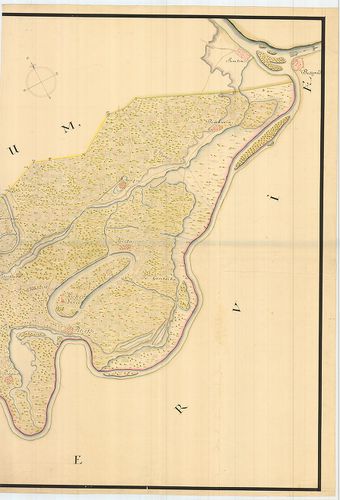
| Main title | A Vojka-i uradalmi birtok térképe a Szerémségben. |
858. Carte Originale et particuliere de la Bosnie... [B IX a 1237]
Institute and Museum of Military History •
B IX a
•
B IX Ausztria–Magyarország
•
B I–XV. Európa
| Title | Carte Originale et particuliere de la Bosnie... |
| Main title | Bosznia, Szlavónia, Horvátország és a határőrvidékek térképe, a Magyar Királyság és Szerbia egy részével. |
859. Plan des Peterwardeiner Granz-Regiments Bezirks. [B IX a 1238]
Institute and Museum of Military History •
B IX a
•
B IX Ausztria–Magyarország
•
B I–XV. Európa
| Title | Plan des Peterwardeiner Granz-Regiments Bezirks. |
| Main title | A Péterváradi Határőrvidék térképe. (Szlavón Határőrvidék része) |
860. Plan und Situation des Gradiscaner Regiments... [B IX a 1239]
Institute and Museum of Military History •
B IX a
•
B IX Ausztria–Magyarország
•
B I–XV. Európa
| Title | Plan und Situation des Gradiscaner Regiments... |
| Main title | A Gradisca-i Katonai Hatáűrőrezred térképe. (Szlavón Határőrvidék része) |
861. Broeder Grenz-Regiment. [B IX a 1240]
Institute and Museum of Military History •
B IX a
•
B IX Ausztria–Magyarország
•
B I–XV. Európa
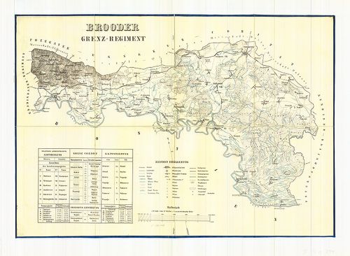
| Title | Broeder Grenz-Regiment. |
| Main title | A Brodi Katonai Határőrezred térképe. (Szlavón Határőrvidék része) |
862. Karte des Gradiscaner Grenz Regiment. [B IX a 1241]
Institute and Museum of Military History •
B IX a
•
B IX Ausztria–Magyarország
•
B I–XV. Európa

| Title | Karte des Gradiscaner Grenz Regiment. |
| Main title | A Gradisca-i Katonai Hatáűrőrezred térképe. (Szlavón Határőrvidék része) |
863. Peterwardeiner Regiment. [B IX a 1242]
Institute and Museum of Military History •
B IX a
•
B IX Ausztria–Magyarország
•
B I–XV. Európa
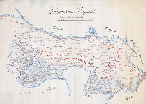
| Title | Peterwardeiner Regiment. |
| Main title | A Péterváradi Katonai Hatáűrőrezred térképe. (Szlavón Határőrvidék része) |
864. A Szlavón Határőrvidék - Gradiscaner Dist., Broder District,... [B IX a 1243]
Institute and Museum of Military History •
B IX a
•
B IX Ausztria–Magyarország
•
B I–XV. Európa
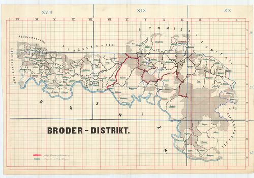
| Title | A Szlavón Határőrvidék - Gradiscaner Dist., Broder District, Peterwardeiner-Distrikt. |
| Main title | A Szlavón Határőrvidék - a Gradiscai, Brodi, Péterváradi körzet térképei. |
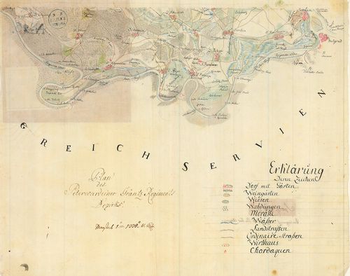
865. Mappa inclyti Comitatus Syrmiensis... [B IX a 1244]
Institute and Museum of Military History •
B IX a
•
B IX Ausztria–Magyarország
•
B I–XV. Európa
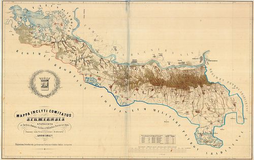
| Title | Mappa inclyti Comitatus Syrmiensis... |
| Main title | A Szerémség térképe. |
866. Carta des Peterwardeiner Militar-Districts zwischen Ratscha ... [B IX a 1245]
Institute and Museum of Military History •
B IX a
•
B IX Ausztria–Magyarország
•
B I–XV. Európa
| Title | Carta des Peterwardeiner Militar-Districts zwischen Ratscha und Zemlin. |
| Main title | A Péterváradi Katonai Körzet térképe Racsa és Zemlin között. |
867. Karte des Grossfürtenthums Siebenbürgen... [B IX a 1247]
Institute and Museum of Military History •
B IX a
•
B IX Ausztria–Magyarország
•
B I–XV. Európa
| Title | Karte des Grossfürtenthums Siebenbürgen... |
| Main title | Az Erdélyi Nagyfejedelemség térképe. |
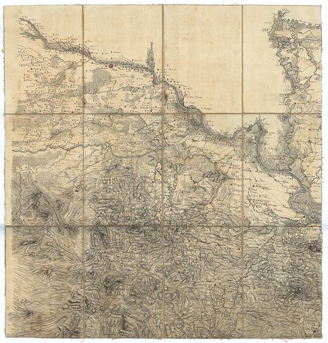
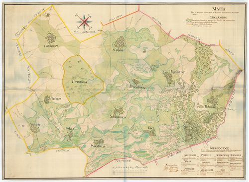
868. [A Temesi Bánság térképe.] [B IX a 1248]
Institute and Museum of Military History •
B IX a
•
B IX Ausztria–Magyarország
•
B I–XV. Európa

| Title | [A Temesi Bánság térképe.] |
869. Plan von dem Tschaikisten Terrain. [B IX a 1249]
Institute and Museum of Military History •
B IX a
•
B IX Ausztria–Magyarország
•
B I–XV. Európa
| Title | Plan von dem Tschaikisten Terrain. |
| Main title | A Csajkások térképe. |
870. Esquelette sammtlicher kk. Militair Graenzen reduciert aus v... [B IX a 1250]
Institute and Museum of Military History •
B IX a
•
B IX Ausztria–Magyarország
•
B I–XV. Európa
| Title | Esquelette sammtlicher kk. Militair Graenzen reduciert aus verschiedenen Kriegs Karten. |
| Main title | A Katonai Határőrvidékek (Horvát, Szlavón, Erdélyi Határőrvidékek) áttekintő térképe a különböző katonai felmérések alapján. |
871. Karte vom Koenigreich Slavonien... [B IX a 1251]
Institute and Museum of Military History •
B IX a
•
B IX Ausztria–Magyarország
•
B I–XV. Európa
| Title | Karte vom Koenigreich Slavonien... |
| Main title | A Szlavón Királyság és a környező területek (Szlavón Határőrvidék) térképe az I. katonai felmérés alapján. |
872. Reducirte Bannal-Grenz Charte. [B IX a 1252]
Institute and Museum of Military History •
B IX a
•
B IX Ausztria–Magyarország
•
B I–XV. Európa
| Title | Reducirte Bannal-Grenz Charte. |
| Main title | A Báni Határőrvidék térképe az I. katonai felmérés alapján. |
873. Charte von Temeswarer Bannat. [B IX a 1253]
Institute and Museum of Military History •
B IX a
•
B IX Ausztria–Magyarország
•
B I–XV. Európa
| Title | Charte von Temeswarer Bannat. |
| Main title | A Temesi Bánság térképe az I. katonai felmérés alapján. |
874. Plan des Rothen Thurner Passes. [B IX a 1254]
Institute and Museum of Military History •
B IX a
•
B IX Ausztria–Magyarország
•
B I–XV. Európa
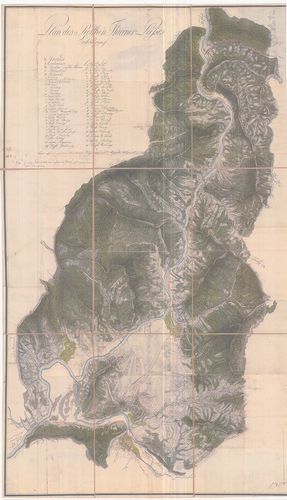
| Title | Plan des Rothen Thurner Passes. |
| Main title | A Vöröstorony-hágó térképe. |
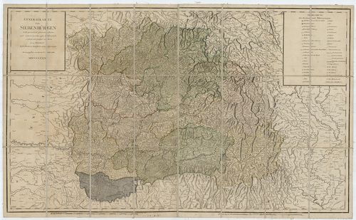
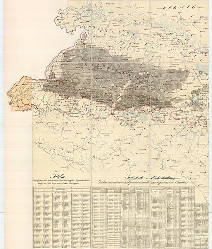
875. Originale der Generalkarte von Siebenbürgen. [B IX a 1255]
Institute and Museum of Military History •
B IX a
•
B IX Ausztria–Magyarország
•
B I–XV. Európa
| Title | Originale der Generalkarte von Siebenbürgen. |
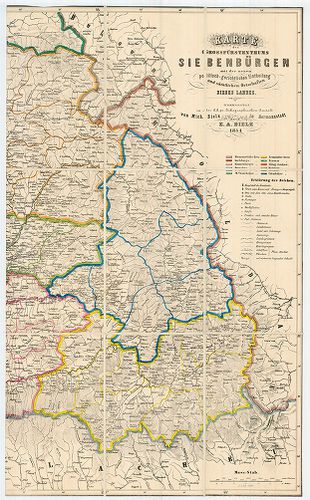
| Main title | Erdély általános térképének (1:288 000) eredetije. |
876. Varasdiner Generalat... [B IX a 1256]
Institute and Museum of Military History •
B IX a
•
B IX Ausztria–Magyarország
•
B I–XV. Európa
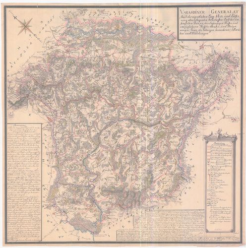
| Title | Varasdiner Generalat... |
| Main title | A Varasdi Határőrvidék térképe az I. katonai felmérés alapján. |
877. A habsburgi monarkia triásztérképe. [B IX a 1257]
Institute and Museum of Military History •
B IX a
•
B IX Ausztria–Magyarország
•
B I–XV. Európa
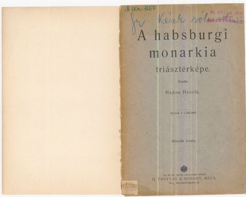
| Title | A habsburgi monarkia triásztérképe. |
| Main title | Német kiadást lásd a B IX a 30/11 jelzet alatt. |
878. Hungariae totius vit ex compluribus aliorum geographicis Cha... [B IX a 1258]
Institute and Museum of Military History •
B IX a
•
B IX Ausztria–Magyarország
•
B I–XV. Európa
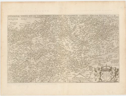
| Title | Hungariae totius vit ex compluribus aliorum geographicis Chartis. |
| Main title | Magyarország térképe. |
879. Partie meridionale du Rme de Hongrie. [B IX a 1259]
Institute and Museum of Military History •
B IX a
•
B IX Ausztria–Magyarország
•
B I–XV. Európa

| Title | Partie meridionale du Rme de Hongrie. |
| Main title | A Magyar Királyság déli részének térképe. |
880. Wien. XV. 13. Az 1:75 000 ma. szelvény 1:100 000 ma.- ra k... [B IX a 1260]
Institute and Museum of Military History •
B IX a
•
B IX Ausztria–Magyarország
•
B I–XV. Európa
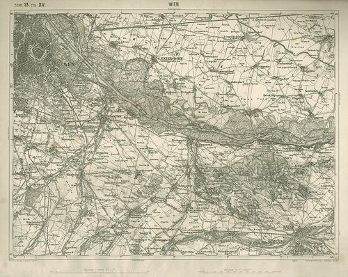
| Title | Wien. XV. 13. Az 1:75 000 ma. szelvény 1:100 000 ma.- ra kicsinyítése. |
881. Tulln. XIV. 12. Az 1:75 000 ma. szelvény 1:100 000 ma.- ra... [B IX a 1261]
Institute and Museum of Military History •
B IX a
•
B IX Ausztria–Magyarország
•
B I–XV. Európa
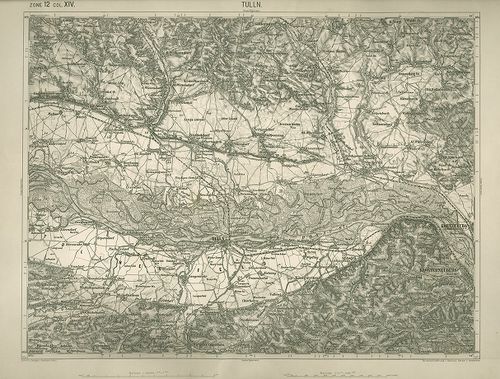
| Title | Tulln. XIV. 12. Az 1:75 000 ma. szelvény 1:100 000 ma.- ra kicsinyítése. |
882. Stuhl Mühlenbach in dem Grosfürstenthum Siebenbürgen. Geomet... [B IX a 1262]
Institute and Museum of Military History •
B IX a
•
B IX Ausztria–Magyarország
•
B I–XV. Európa
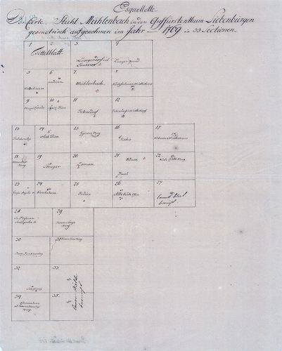
| Title | Stuhl Mühlenbach in dem Grosfürstenthum Siebenbürgen. Geometrisch aufgenohmen im Jahr 1769 in 33 Sectionen. |
| Main title | A szászsebesi Mühlenbach szék gazdasági felmérése (I. kat. felm. előzménye.) |
883. Plan des löbl. Kaiserl. Königl. Ansiedlenden Banater Deutsch... [B IX a 1263]
Institute and Museum of Military History •
B IX a
•
B IX Ausztria–Magyarország
•
B I–XV. Európa
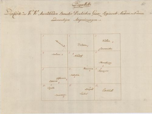
| Title | Plan des löbl. Kaiserl. Königl. Ansiedlenden Banater Deutschen Graenz Regiments.... |
| Main title | A Német Bánsági 12. határezred térképe. |
884. [Karánsebes, Slatina és Teregova felmérési térképei.] [B IX a 1264]
Institute and Museum of Military History •
B IX a
•
B IX Ausztria–Magyarország
•
B I–XV. Európa
| Title | [Karánsebes, Slatina és Teregova felmérési térképei.] |
885. Kriegs Carte in 93 Brouillons Sectionen von Ober Ungarn... [B IX a 1265]
Institute and Museum of Military History •
B IX a
•
B IX Ausztria–Magyarország
•
B I–XV. Európa
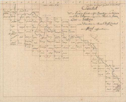
| Title | Kriegs Carte in 93 Brouillons Sectionen von Ober Ungarn... |
| Main title | Felső-Magyarország felmérési térképei. (I. kat. felm. előzménye.) |
886. Banater Generalat. [B IX a 1266]
Institute and Museum of Military History •
B IX a
•
B IX Ausztria–Magyarország
•
B I–XV. Európa
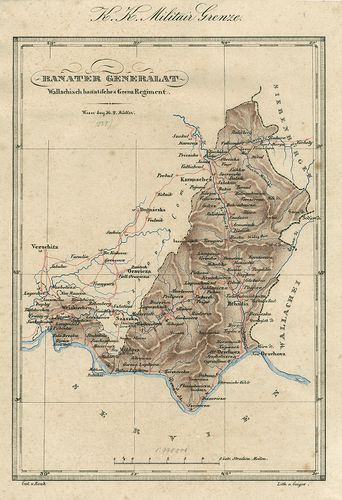
| Title | Banater Generalat. |
| Main title | Az Oláh Bánsági határezred térképe. |
887. Situations Plan des Wallach Illirisch Granz Infanterie Reg. ... [B IX a 1267]
Institute and Museum of Military History •
B IX a
•
B IX Ausztria–Magyarország
•
B I–XV. Európa
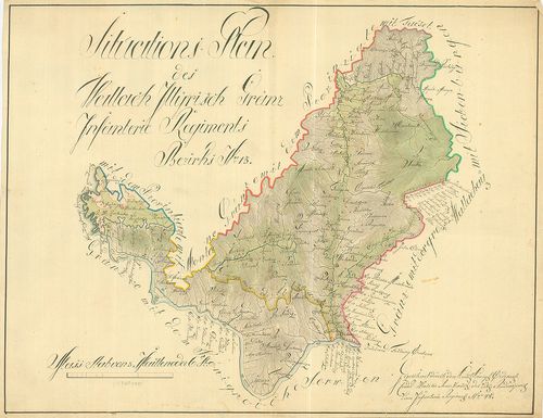
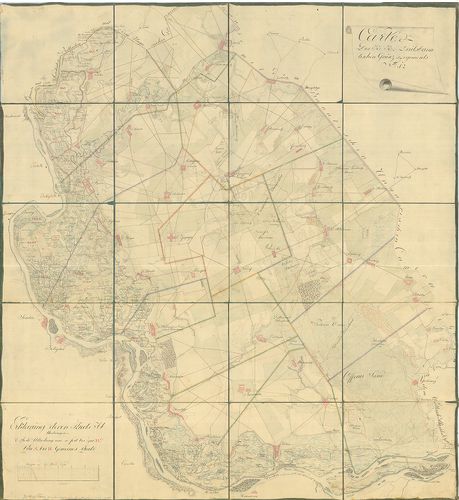
| Title | Situations Plan des Wallach Illirisch Granz Infanterie Reg. Bezirks No. 13. |
| Main title | A Oláh-Illír 13. határezred térképe. |
888. Carte des Wallach-Illirischen Grenz Regiments Bezirks No. 13... [B IX a 1268]
Institute and Museum of Military History •
B IX a
•
B IX Ausztria–Magyarország
•
B I–XV. Európa
| Title | Carte des Wallach-Illirischen Grenz Regiments Bezirks No. 13. |
889. Carte des Löbl. Wallach-Illyrischen Granz Regiment No. 13. [B IX a 1269]
Institute and Museum of Military History •
B IX a
•
B IX Ausztria–Magyarország
•
B I–XV. Európa
| Title | Carte des Löbl. Wallach-Illyrischen Granz Regiment No. 13. |
| Main title | A Oláh-Illír 13. határezred térképe. |
890. Übersichts Carte des Illyrisch Banater Grenz Bataillons. [B IX a 1270]
Institute and Museum of Military History •
B IX a
•
B IX Ausztria–Magyarország
•
B I–XV. Európa
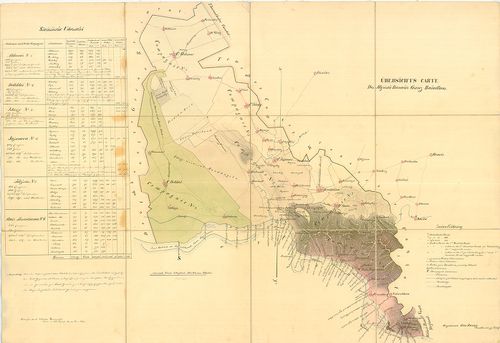
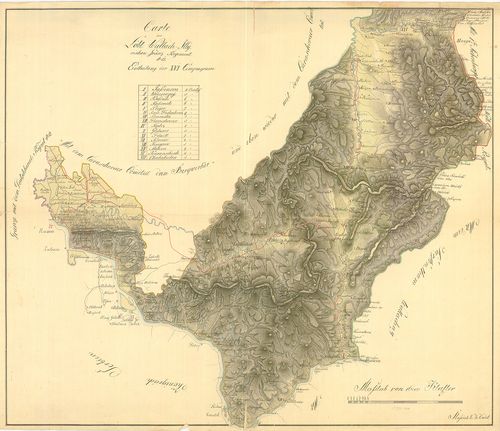
| Title | Übersichts Carte des Illyrisch Banater Grenz Bataillons. |
| Main title | Az Illír-Bánsági 14. határezred áttekintő térképe. |
891. Mappa über den Bethskereker District... [B IX a 1271]
Institute and Museum of Military History •
B IX a
•
B IX Ausztria–Magyarország
•
B I–XV. Európa
| Title | Mappa über den Bethskereker District... |
892. Illirischbanater Grenz-Regiment No. 14. [B IX a 1272]
Institute and Museum of Military History •
B IX a
•
B IX Ausztria–Magyarország
•
B I–XV. Európa

| Title | Illirischbanater Grenz-Regiment No. 14. |
| Main title | Az Illír-Bánsági 14. határezred térképe. |
893. Carte des K. k. Deutsbanatischen Granz Regimenst No. 12. [B IX a 1273]
Institute and Museum of Military History •
B IX a
•
B IX Ausztria–Magyarország
•
B I–XV. Európa
| Title | Carte des K. k. Deutsbanatischen Granz Regimenst No. 12. |
| Main title | A Német-Bánsági 12. határezred térképe. |
894. Karte der Banater Militaergraenze. [B IX a 1274]
Institute and Museum of Military History •
B IX a
•
B IX Ausztria–Magyarország
•
B I–XV. Európa

| Title | Karte der Banater Militaergraenze. |
| Main title | Az Bánsági Katonai Határőrvidék térképe. |
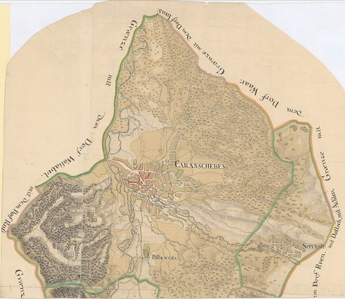
895. Plan der Gegent zwischen Caransebes und Fenisch im Temesware... [B IX a 1275]
Institute and Museum of Military History •
B IX a
•
B IX Ausztria–Magyarország
•
B I–XV. Európa
| Title | Plan der Gegent zwischen Caransebes und Fenisch im Temeswarer-Banat. |
| Main title | A Temesvári Bánságban található Karánsebes és Fényes környékének térképe. |
896. Carte des Deutsbanatischen Granz-Regimenst No. 12. [B IX a 1276]
Institute and Museum of Military History •
B IX a
•
B IX Ausztria–Magyarország
•
B I–XV. Európa
| Title | Carte des Deutsbanatischen Granz-Regimenst No. 12. |
| Main title | A Német-Bánsági 12. határezred térképe. |
897. Situations Plan der gegend im Ried, wo das neue Ort in alt B... [B IX a 1277]
Institute and Museum of Military History •
B IX a
•
B IX Ausztria–Magyarország
•
B I–XV. Európa

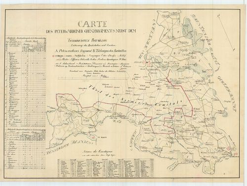
| Title | Situations Plan der gegend im Ried, wo das neue Ort in alt Bortsa... |
| Main title | Borcsa környékének térképe. |
898. [Az Oláh-Illír határezred térképe.] [B IX a 1278]
Institute and Museum of Military History •
B IX a
•
B IX Ausztria–Magyarország
•
B I–XV. Európa
| Title | [Az Oláh-Illír határezred térképe.] |
899. [A sandec-i körzet-Árva, Liptó,, Szepes, Sáros vármegyék erg... [B IX a 1279]
Institute and Museum of Military History •
B IX a
•
B IX Ausztria–Magyarország
•
B I–XV. Európa
| Title | [A sandec-i körzet-Árva, Liptó,, Szepes, Sáros vármegyék ergyes részei-felmérési szelvényeinek áttekintője (28 szelvény). Az I. katonai felmérés előzménye, részfelmérés.] |
900. Plan von dem Temesvarer Bannat wie solches im 11 Districten ... [B IX a 1280]
Institute and Museum of Military History •
B IX a
•
B IX Ausztria–Magyarország
•
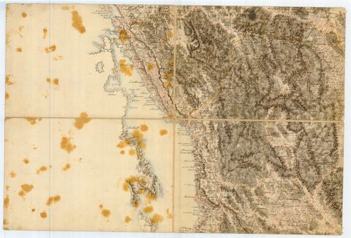
B I–XV. Európa
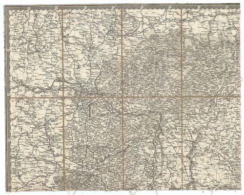
| Title | Plan von dem Temesvarer Bannat wie solches im 11 Districten eingetheilt. |
| Main title | A Temesi Bánság térképe a 11 kerületi beosztással. |