1. Geognostische Karte des Beckens von Wien… [B IX b 5]
Institute and Museum of Military History •
B IX b
•
B IX Ausztria–Magyarország
•
B I–XV. Európa
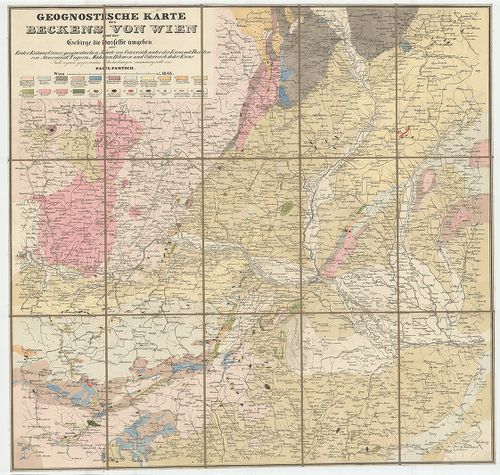
| Title | Geognostische Karte des Beckens von Wien… |
| Main title | Bécs környékének geológiai térképe 1843-ban. |
2. Geognostische Karte des Oesterreichischen Kaiserstaates mit ... [B IX b 10]
Institute and Museum of Military History •
B IX b
•
B IX Ausztria–Magyarország
•
B I–XV. Európa
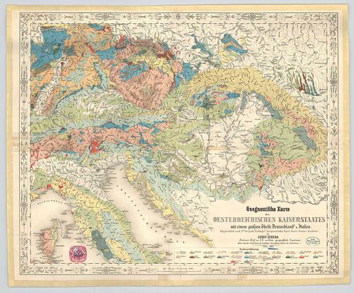
| Title | Geognostische Karte des Oesterreichischen Kaiserstaates mit einem grossen Theile Deutschland u.[nd] Italien. |
| Main title | Az Osztrák Császárság, Németország és Itália nagy részének geológiai térképe 1847-ben. |
3. Geognostische Karte Tirols. [B IX b 11]
Institute and Museum of Military History •
B IX b
•
B IX Ausztria–Magyarország
•
B I–XV. Európa
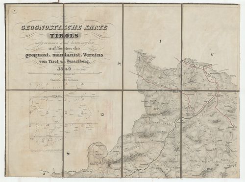
| Title | Geognostische Karte Tirols. |
| Main title | Tirol geológiai térképe 1849-ben. |
4. Geognostische Karte der Nord-Karpathen in Schlesien … [B IX b 14]
Institute and Museum of Military History •
B IX b
•
B IX Ausztria–Magyarország
•
B I–XV. Európa
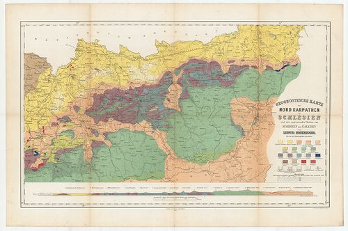
| Title | Geognostische Karte der Nord-Karpathen in Schlesien … |
| Main title | Az É-i Kárpátok külső övezetének geológiai térképe 1860-ban. |
5. Magyar Országnak és a hozzá kaptsoltatott Horváth és Tóth or... [B IX b 16]
Institute and Museum of Military History •
B IX b
•
B IX Ausztria–Magyarország
•
B I–XV. Európa
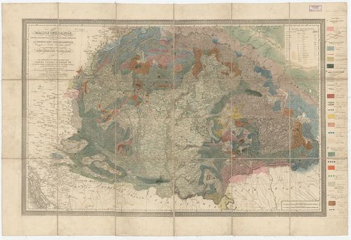
| Title | Magyar Országnak és a hozzá kaptsoltatott Horváth és Tóth országnak, ’s határőrző katonai vidékeknek nem különben az Erdélyi Fejedelemségnek Vármegyékre és Szabad Kerületekre osztatott ’s a’ legjobb mappák szerént készitetett közönséges táblája… |
| Main title | Karacs térképére Beudant rárajzolta Magyarország geológiai térképét 1818-ban. |
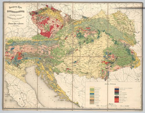
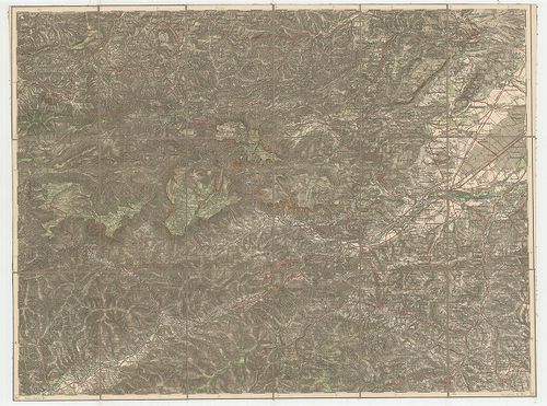
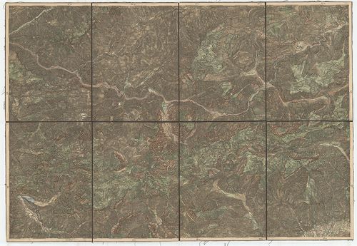
6. Geologische Karte von Österreich–Ungarn… [B IX b 21]
Institute and Museum of Military History •
B IX b
•
B IX Ausztria–Magyarország
•
B I–XV. Európa
| Title | Geologische Karte von Österreich–Ungarn… |
| Main title | Ausztria–Magyarország geológiai térképe. |
7. Geologische Karte von Österreich–Ungarn mit Bosnien-Hercegow... [B IX b 21/1]
Institute and Museum of Military History •
B IX b
•
B IX Ausztria–Magyarország
•
B I–XV. Európa
| Title | Geologische Karte von Österreich–Ungarn mit Bosnien-Hercegowina und Montenegro. |
| Main title | Ausztria–Magyarország, Bosznia, Hercegovina és Montenegro geológiai térképe 1884-ben. |
8. A selmeczi bányavidék ércztelér vonulatai. – Filons métallif... [B IX b 22/1]
Institute and Museum of Military History •
B IX b
•
B IX Ausztria–Magyarország
•
B I–XV. Európa
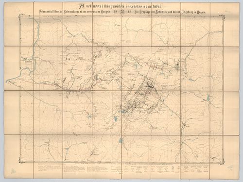
| Title | A selmeczi bányavidék ércztelér vonulatai. – Filons métalliféres de Selmeczbánya et ses environs en Hongrie. – Die Erzgänge von Schemnitz und dessen Umgebung in Ungarn. |
9. [Magyarország] A magyar szt. korona országai területén létez... [B IX b 22/3]
Institute and Museum of Military History •
B IX b
•
B IX Ausztria–Magyarország
•
B I–XV. Európa
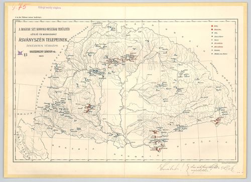
| Title | [Magyarország] A magyar szt. korona országai területén létező és megvizsgált ásványszén telepeinek átnézetes térképe. |
10. [Magyarország] A magyar birodalom vasérc- és kőszéntelepeine... [B IX b 22/4]
Institute and Museum of Military History •
B IX b
•
B IX Ausztria–Magyarország
•
B I–XV. Európa
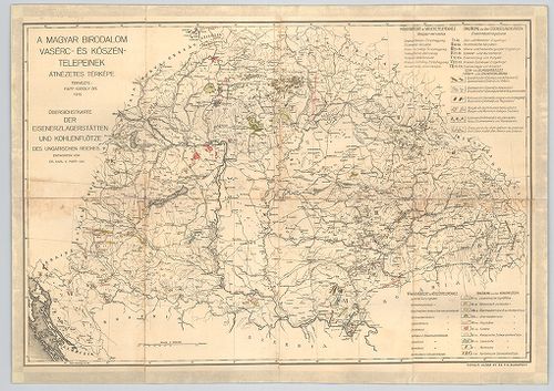
| Title | [Magyarország] A magyar birodalom vasérc- és kőszéntelepeinek átnézetes térképe. – Übersichstkarte der Eisenerzlagerstätten und Kohlenflötze des Ungarischen Reiches. |
11. Du fer. Production et valeur. [B IX b 22/5]
Institute and Museum of Military History •
B IX b
•
B IX Ausztria–Magyarország
•
B I–XV. Európa
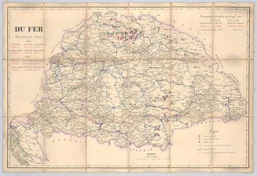
| Title | Du fer. Production et valeur. |
| Main title | Magyarország vasérc-lelőhelyei és értékük frankban kifejezve 1856-ban és 1876-ban. |
12. A körmöczi bányavidék földtani viszonyai bányageológiai szem... [B IX b 22/6]
Institute and Museum of Military History •
B IX b
•
B IX Ausztria–Magyarország
•
B I–XV. Európa
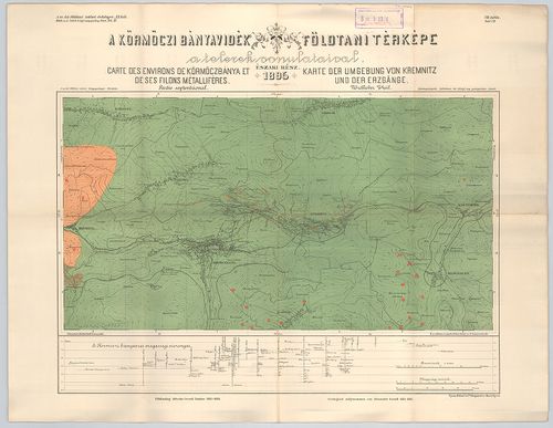
| Title | A körmöczi bányavidék földtani viszonyai bányageológiai szempontból. – Die Geologischen verhältnisse des Kremnitzer Bergbaugebietes von Montangeologischen standpunkte. XI. köt. 4. füz. Atlasz. |
| Main title | 2 térk. mell. 1. VII. tábl. A körmöczi bányavidék földtani térképe a telerek vonulataival. É-i rész 1895. – Carte des environs de Körmöczbánya et de ses filons métalliféres. Partie septentrional. Karte des Umgebung von Kremnitz und der Erzgänge. Nördlicher Theil. |
| Subject | 2. VIII. tábla. A körmöczi bányavidék földtani térképe a Nándor altáró kitüntetésével. Déli rész 1895. – Carte des environs de Körmöczbánya avec la galérie d’ecoulement nommée galérie Nándor. Partie meridionale 1895. – Karte der Umgebung von Kremnitz mit dem Ferdinand erbstollen. Südlicher Theil 1895. |
13. [Magyarország] A Magyar Korona Országai területén található ... [B IX b 22/7]
Institute and Museum of Military History •
B IX b
•
B IX Ausztria–Magyarország
•
B I–XV. Európa
| Title | [Magyarország] A Magyar Korona Országai területén található mű és építőipari szempontból fontosabb kőzetek előfordulási helyeinek átnézetes térképe. – Übersichts-Karte der auf dem Gebiete der Länder der Ungarischen Krone verkommenden wichtigeren Decorations und Bau-Gesteine. |
14. Des meteaux. [B IX b 22/8]
Institute and Museum of Military History •
B IX b
•
B IX Ausztria–Magyarország
•
B I–XV. Európa
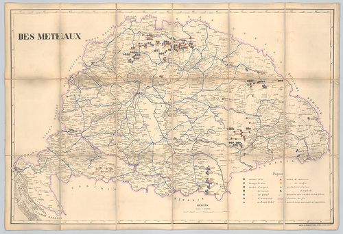
| Title | Des meteaux. |
| Main title | Magyarország fémlelőhelyei 1876 körül. |
15. Du sel. Production et valeur. [B IX b 22/9]
Institute and Museum of Military History •
B IX b
•
B IX Ausztria–Magyarország
•
B I–XV. Európa
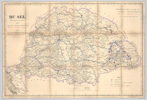
| Title | Du sel. Production et valeur. |
| Main title | Magyarország sólelőhelyei és értékük frankban kifejezve 1856-ban és 1876-ban. |
16. Pécs városa környékének földtani térképe. – Geologische Kart... [B IX b 23]
Institute and Museum of Military History •
B IX b
•
B IX Ausztria–Magyarország
•
B I–XV. Európa
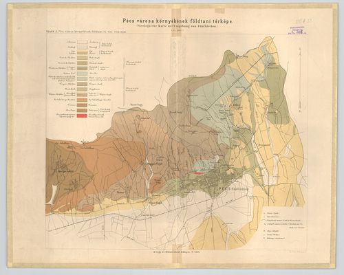
| Title | Pécs városa környékének földtani térképe. – Geologische Karte der Umgebung von Fünfkirchen. |
17. Budapest és Szent-Endre vidéke. [B IX b 23/1]
Institute and Museum of Military History •
B IX b
•
B IX Ausztria–Magyarország
•
B I–XV. Európa
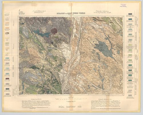
| Title | Budapest és Szent-Endre vidéke. |
| Main title | Budapest és Szentendre környékének geológiai térképe 1898-ban. |
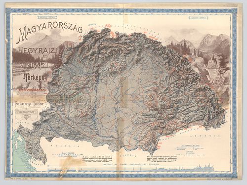
18. Magyarország hegy és vízrajzi térképe. [B IX b 23/4]
Institute and Museum of Military History •
B IX b
•
B IX Ausztria–Magyarország
•
B I–XV. Európa

| Title | Magyarország hegy és vízrajzi térképe. |
| Main title | Mt. A Magas Tátra. |
19. Magyarország hegy- és vízrajzi térképe az esővonalakkal. – O... [B IX b 23/6]
Institute and Museum of Military History •
B IX b
•
B IX Ausztria–Magyarország
•
B I–XV. Európa
| Title | Magyarország hegy- és vízrajzi térképe az esővonalakkal. – Orographical and hydrographical map of Hungary showing the distribution of rains. |
| Main title | 1900–1910 évek átlaga alapján készült csapadéktérkép, a piros izovonalakat 1912 körül nyomták rá. |
20. Magyarország geológiai térképe. [B IX b 23/7]
Institute and Museum of Military History •
B IX b
•
B IX Ausztria–Magyarország
•
B I–XV. Európa
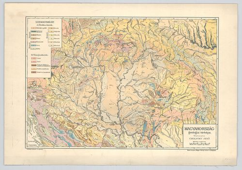
| Title | Magyarország geológiai térképe. |
21. Buda-Pest vidéke. – Umgebungen von Ofen und Pest. [B IX b 24]
Institute and Museum of Military History •
B IX b
•
B IX Ausztria–Magyarország
•
B I–XV. Európa
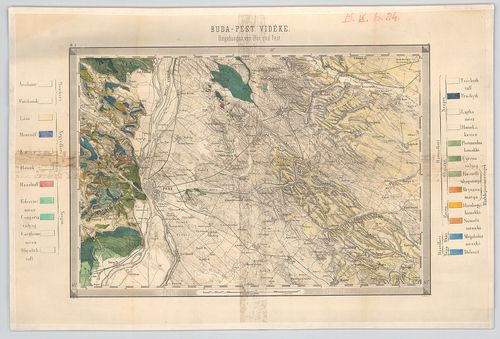
| Title | Buda-Pest vidéke. – Umgebungen von Ofen und Pest. |
22. Hypsometrische Karte der Steiermark. [B IX b 25]
Institute and Museum of Military History •
B IX b
•
B IX Ausztria–Magyarország
•
B I–XV. Európa
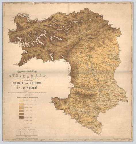
| Title | Hypsometrische Karte der Steiermark. |
| Main title | Stájerország hipszometrikus áttekintő térképe. |
23. Hypsometrische Übersichts Karte des Königreiches Böhmen. [B IX b 27]
Institute and Museum of Military History •
B IX b
•
B IX Ausztria–Magyarország
•
B I–XV. Európa
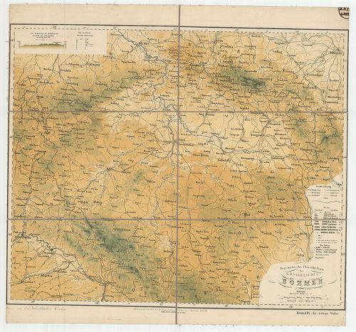
| Title | Hypsometrische Übersichts Karte des Königreiches Böhmen. |
| Main title | A Cseh Királyság hipszometrikus áttekintő térképe. |
24. Hypsometrische Übersichts Karte der Markgrafschaft Maehren u... [B IX b 28]
Institute and Museum of Military History •
B IX b
•
B IX Ausztria–Magyarország
•
B I–XV. Európa
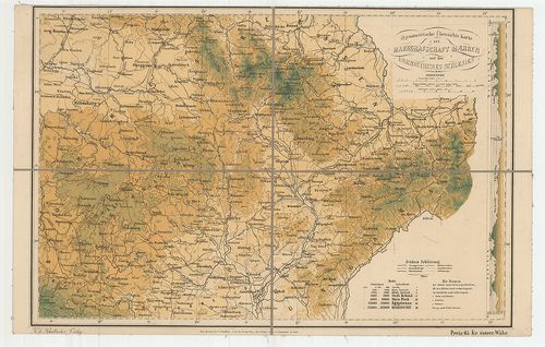
| Title | Hypsometrische Übersichts Karte der Markgrafschaft Maehren und des Herzogthumes Schlesien. |
| Main title | A Morva Őrgrófság és a Sziléziai Hercegség hipszometrikus áttekintő térképe 1880 körül. |
25. Hypsometrische Übersichts-Karte des Erzherzogthumes Oesterre... [B IX b 29]
Institute and Museum of Military History •
B IX b
•
B IX Ausztria–Magyarország
•
B I–XV. Európa
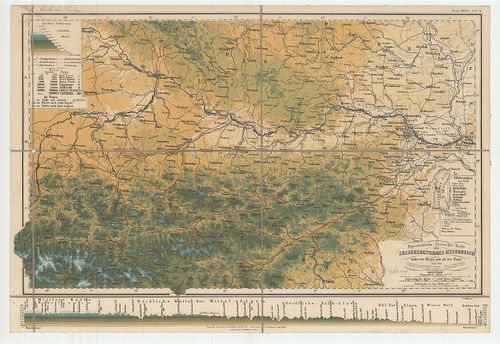
| Title | Hypsometrische Übersichts-Karte des Erzherzogthumes Oesterreich… Herzogthumes Salzburg. |
| Main title | Az Osztrák Főhercegség és Salzburg hipszometrikus áttekintő térképe. |
26. Hypsometrische Übersichts-Karte des Herzogthumes Steiermark… [B IX b 30]
Institute and Museum of Military History •
B IX b
•
B IX Ausztria–Magyarország
•
B I–XV. Európa
| Title | Hypsometrische Übersichts-Karte des Herzogthumes Steiermark… |
| Main title | Stájerország hipszometrikus áttekintő térképe. |
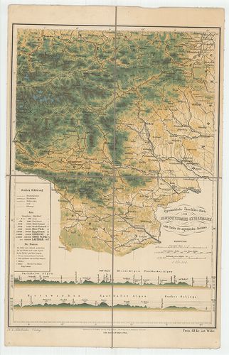
27. Hypsometrische Übersichts Karte der Gefürsteten Grafschaft T... [B IX b 31]
Institute and Museum of Military History •
B IX b
•
B IX Ausztria–Magyarország
•
B I–XV. Európa
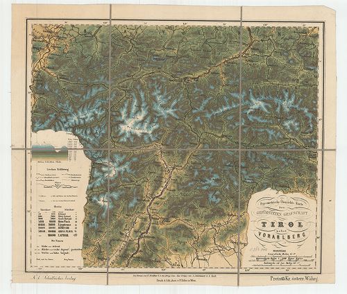
| Title | Hypsometrische Übersichts Karte der Gefürsteten Grafschaft Tirol nebst Vorarlberg. |
| Main title | Tirol és Vorarlberg hipszometrikus áttekintő térképe. |
28. Hypsometrische Übersichts Karte von den Herzogthümern Kärnte... [B IX b 32]
Institute and Museum of Military History •
B IX b
•
B IX Ausztria–Magyarország
•
B I–XV. Európa
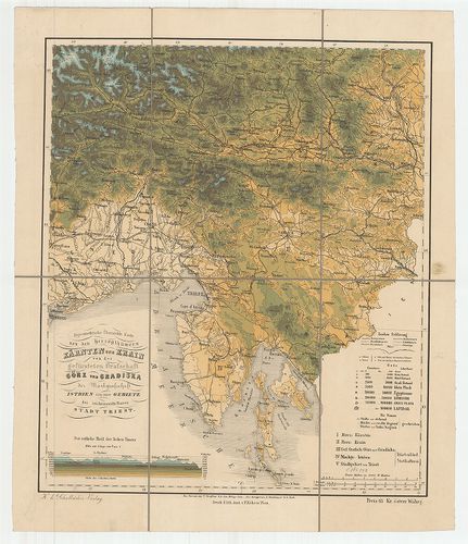
| Title | Hypsometrische Übersichts Karte von den Herzogthümern Kärnten und Krain von der… Görz und Gradiska… Istrien… Triest. |
| Main title | Karintia és Krajnai hercegség, Görz, (Gorizia) és Gradiska, Istria és Trieszt hipszometrikus áttekintő térképe. |
29. Hypsometrische Übersichts Karte des Königreiches Galizien mi... [B IX b 33]
Institute and Museum of Military History •
B IX b
•
B IX Ausztria–Magyarország
•
B I–XV. Európa
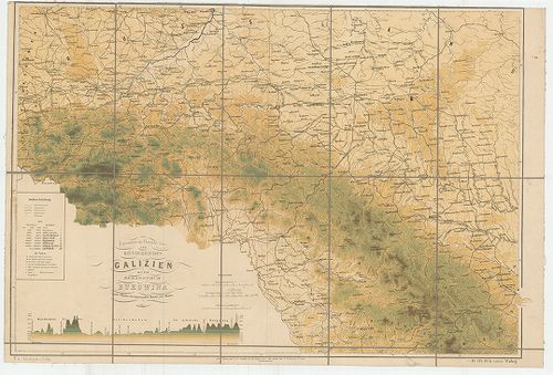
| Title | Hypsometrische Übersichts Karte des Königreiches Galizien mit dem Herzogthum Bukowina… |
| Main title | A Galícia Királyság és a Bukovina Hercegség hipszometrikus áttekintő térképe. |
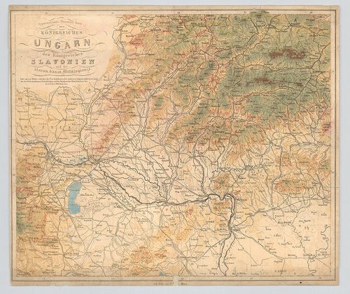
30. Hypsometrische Übersichts Karte des Königreiches Ungarn des ... [B IX b 34]
Institute and Museum of Military History •
B IX b
•
B IX Ausztria–Magyarország
•
B I–XV. Európa
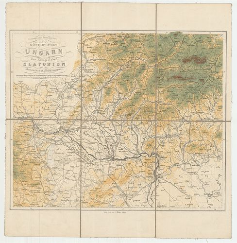
| Title | Hypsometrische Übersichts Karte des Königreiches Ungarn des Königreiches Slavonien und der slavon. banat. Militärgrenze. |
| Main title | A Magyar és Szlavon Királyság hipszometrikus áttekintő térképe. |
31. Hypsometrische Übersichts Karte des Königreiches Ungarn des ... [B IX b 34/1]
Institute and Museum of Military History •
B IX b
•
B IX Ausztria–Magyarország
•
B I–XV. Európa
| Title | Hypsometrische Übersichts Karte des Königreiches Ungarn des Königreiches Slavonien und der slavon. banat. Militärgrenze. |
| Main title | A Magyar és Szlavon Királyság hipszometrikus áttekintő térképe. |
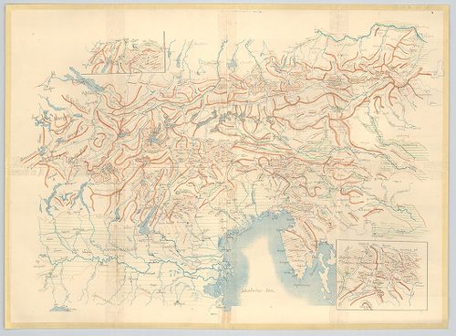
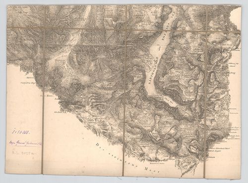
32. Orographische Übersicht des Südostens der österreichisch-ung... [B IX b 35]
Institute and Museum of Military History •
B IX b
•
B IX Ausztria–Magyarország
•
B I–XV. Európa
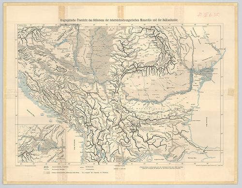
| Title | Orographische Übersicht des Südostens der österreichisch-ungarischen Monarchie und der Balkanländer. |
| Main title | Az Osztrák–Magyar Monarchia délkeleti részének és a Balkán-félsziget egy részének orográfiai térképe 1905-ben. |
33. Der Südwesten der österreichisch-ungarischen Monarchie mit d... [B IX b 35/1]
Institute and Museum of Military History •
B IX b
•
B IX Ausztria–Magyarország
•
B I–XV. Európa
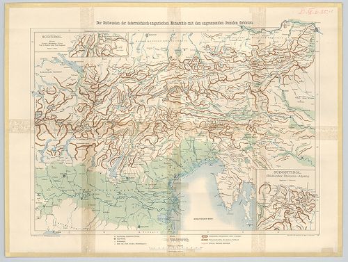
| Title | Der Südwesten der österreichisch-ungarischen Monarchie mit den angrenzenden Fremden Gebieten. |
| Main title | 2 Mt. 1. Südosttirol. (Délkelet-Tirol) |
| Subject | 2. Südtirol. (Dél-Tirol) |
34. [Az Osztrák–Magyar Monarchia déli része és a Balkán-félszige... [B IX b 35/2]
Institute and Museum of Military History •
B IX b
•
B IX Ausztria–Magyarország
•
B I–XV. Európa
| Title | [Az Osztrák–Magyar Monarchia déli része és a Balkán-félsziget északi részének hegyvonulatai.] |
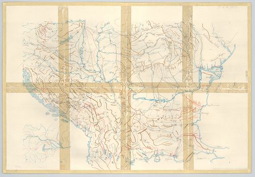
35. [Az Osztrák–Magyar Monarchia délkeleti része és a szomszédos... [B IX b 35/3]
Institute and Museum of Military History •
B IX b
•
B IX Ausztria–Magyarország
•
B I–XV. Európa
| Title | [Az Osztrák–Magyar Monarchia délkeleti része és a szomszédos területek hegyvonulatai.] |
| Main title | 2 mt. 1. [Délkelet-Tirol.] 2. [Dél-Tirol] |
36. Ausztrija. [B IX b 39]
Institute and Museum of Military History •
B IX b
•
B IX Ausztria–Magyarország
•
B I–XV. Európa
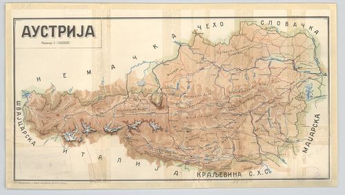
| Title | Ausztrija. |
| Main title | Ausztria hegyrajzi térképe. |
37. Hypsometrische Karte von Gebiete des Schneeberges und der Ra... [B IX b 41]
Institute and Museum of Military History •
B IX b
•
B IX Ausztria–Magyarország
•
B I–XV. Európa
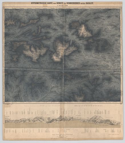
| Title | Hypsometrische Karte von Gebiete des Schneeberges und der Raxalpe. |
| Main title | A Schneeberg és a Raxalpe hegység hipszometrikus térképe 1883-ban. |
38. Oro Hydro Graphische General Charte von Boehmen Maehren und ... [B IX b 42/1]
Institute and Museum of Military History •
B IX b
•
B IX Ausztria–Magyarország
•
B I–XV. Európa
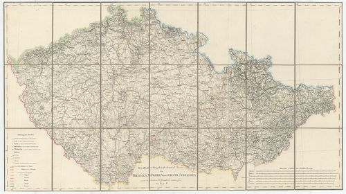
| Title | Oro Hydro Graphische General Charte von Boehmen Maehren und Oestr. Schlesien |
| Main title | Cseh-Morvaország és osztrák Szilézia általános hegyvízrajzi térképe. |
39. [A König-See környéke (Németország)]. [B IX b 53]
Institute and Museum of Military History •
B IX b
•
B IX Ausztria–Magyarország
•
B I–XV. Európa
| Title | [A König-See környéke (Németország)]. |
40. Niederösterreich und Nordsteiermark. Raum Villach-Marburg-Br... [B IX b 55]
Institute and Museum of Military History •
B IX b
•
B IX Ausztria–Magyarország
•
B I–XV. Európa
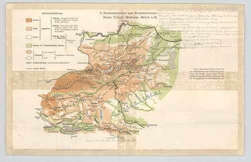
| Title | Niederösterreich und Nordsteiermark. Raum Villach-Marburg-Bruck a. M. |
| Main title | Alsó-Ausztria és Észak-Stájerország vázlatos helyrajzi térképe. |
41. Karte des Ortlergebietes. [B IX b 56]
Institute and Museum of Military History •
B IX b
•
B IX Ausztria–Magyarország
•
B I–XV. Európa
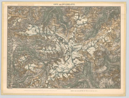
| Title | Karte des Ortlergebietes. |
| Main title | Az Ortler- hegység (Ortles, Ol.) részletes térképe 1876-ban. |
42. Spezial-Karte der Ortler-Gruppe. [B IX b 56/1]
Institute and Museum of Military History •
B IX b
•
B IX Ausztria–Magyarország
•
B I–XV. Európa
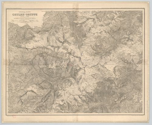
| Title | Spezial-Karte der Ortler-Gruppe. |
| Main title | Ortler-hegycsoport (Ortles, Ol.) térképe 1913-ban. |
43. Karte der Dolomit-Gruppen. [B IX b 57]
Institute and Museum of Military History •
B IX b
•
B IX Ausztria–Magyarország
•
B I–XV. Európa
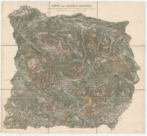
| Title | Karte der Dolomit-Gruppen. |
| Main title | A Dolomit- hegycsoport 1876-ban. |
44. Turisten-Wanderkarte der Dolomiten. [B IX b 58]
Institute and Museum of Military History •
B IX b
•
B IX Ausztria–Magyarország
•
B I–XV. Európa
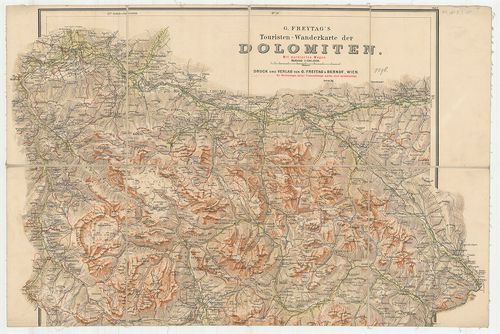
| Title | Turisten-Wanderkarte der Dolomiten. |
| Main title | A Dolomitok turistaúttérképe 1896 körül. |
45. Österreichische Alpenländer. [B IX b 59]
Institute and Museum of Military History •
B IX b
•
B IX Ausztria–Magyarország
•
B I–XV. Európa
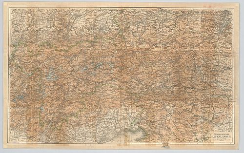
| Title | Österreichische Alpenländer. |
| Main title | Az osztrák Alpok térképe. |
46. Special-Karte des Karwendel Gebirges. [B IX b 60]
Institute and Museum of Military History •
B IX b
•
B IX Ausztria–Magyarország
•
B I–XV. Európa
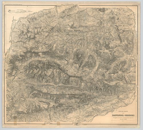
| Title | Special-Karte des Karwendel Gebirges. |
| Main title | A Karwendel-hegység térképe 1888-ban. |
47. Karte der Schneeberg-Raxalpe-Hochschwab und Ötscher-Gruppe. [B IX b 61]
Institute and Museum of Military History •
B IX b
•
B IX Ausztria–Magyarország
•
B I–XV. Európa
| Title | Karte der Schneeberg-Raxalpe-Hochschwab und Ötscher-Gruppe. |
| Main title | A Schneeberg, Raxalpe, Hochschwab és az Ötscher hegységek részletes térképe 1882-ben. |
48. Topographische detailkarte der Hochschwab-Gruppe. [B IX b 62]
Institute and Museum of Military History •
B IX b
•
B IX Ausztria–Magyarország
•
B I–XV. Európa
| Title | Topographische detailkarte der Hochschwab-Gruppe. |
| Main title | A Hochschwab-hegycsoport egy részének topográfiai térképe. |
49. Karte der Lechtaler-Alpen. [B IX b 63]
Institute and Museum of Military History •
B IX b
•
B IX Ausztria–Magyarország
•
B I–XV. Európa
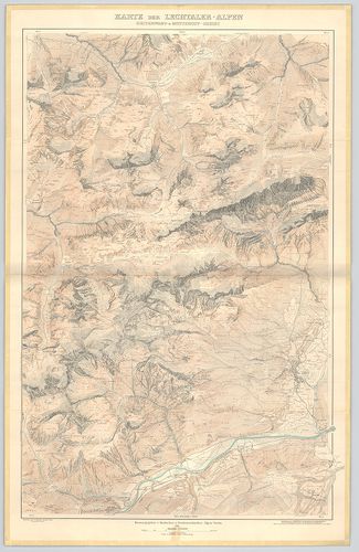
| Title | Karte der Lechtaler-Alpen. |
| Main title | I. Karte der Lechtaler-Alpen. |
| Subject | II. Karte der Lechtaler-Alpen. Heiterwand und Muttekopf-Gebiet. |
50. Special Karte der Gross-Golckner-Gruppe. [B IX b 63/1]
Institute and Museum of Military History •
B IX b
•
B IX Ausztria–Magyarország
•
B I–XV. Európa
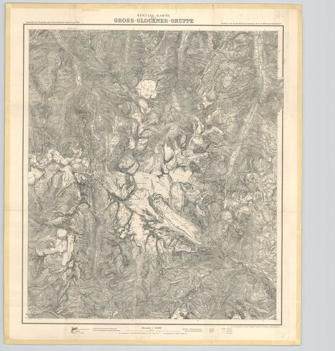
| Title | Special Karte der Gross-Golckner-Gruppe. |
| Main title | A Gross-Glockner- hegycsoport és környékének hegyrajzi térképe 1890-ben. |