641. Magyarország (X–XI. sz.) [B IX c 1413]
Institute and Museum of Military History •
B IX c
•
B IX Ausztria–Magyarország
•
B I–XV. Európa
| Title | Magyarország (X–XI. sz.) |
| Main title | 1 mt: Egyházmegyék 1038-ban |
642. Magyarország a Hunyadiak és Jagellók korában (1437×1526.) [B IX c 1414]
Institute and Museum of Military History •
B IX c
•
B IX Ausztria–Magyarország
•
B I–XV. Európa
| Title | Magyarország a Hunyadiak és Jagellók korában (1437×1526.) |
| Main title | 4 Mt.: 1. Várnai csata |
| Subject | 2. A nándorfehérvári csata |
643. A függetlenségi harcok (Magyarország a XVII. században) [B IX c 1415]
Institute and Museum of Military History •
B IX c
•
B IX Ausztria–Magyarország
•
B I–XV. Európa
| Title | A függetlenségi harcok (Magyarország a XVII. században) |
644. Az Osztrák–Magyar Monarchia (1867–1918.) [B IX c 1416]
Institute and Museum of Military History •
B IX c
•
B IX Ausztria–Magyarország
•
B I–XV. Európa
| Title | Az Osztrák–Magyar Monarchia (1867–1918.) |
| Main title | 2 mt. 1. O.–M nemzetiségei 1910. |
| Subject | 2. A vasúthálózat fejlődése Mo. |
645. A Pilis és Dobogókő környéke [B IX c 1418]
Institute and Museum of Military History •
B IX c
•
B IX Ausztria–Magyarország
•
B I–XV. Európa
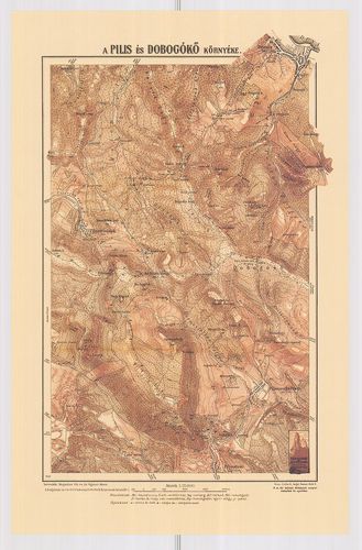
| Title | A Pilis és Dobogókő környéke |
646. A gazdaságok területének megoszlása nagyságkategóriák szerin... [B IX c 1419]
Institute and Museum of Military History •
B IX c
•
B IX Ausztria–Magyarország
•
B I–XV. Európa
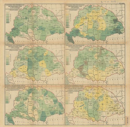
| Title | A gazdaságok területének megoszlása nagyságkategóriák szerint. 6 térkép, statisztikai adatokkal. |
647. Magyarország gazdaságföldrajzi térképe. [B IX c 1420]
Institute and Museum of Military History •
B IX c
•
B IX Ausztria–Magyarország
•
B I–XV. Európa
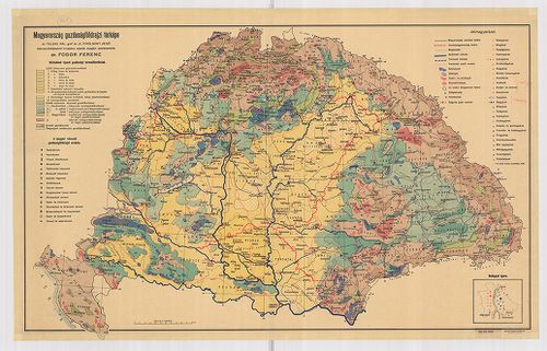
| Title | Magyarország gazdaságföldrajzi térképe. |
648. Limitum post Pacem Carlovitcensem A MDCXCVIII. Mappa Geograp... [B IX c 1421]
Institute and Museum of Military History •
B IX c
•
B IX Ausztria–Magyarország
•
B I–XV. Európa
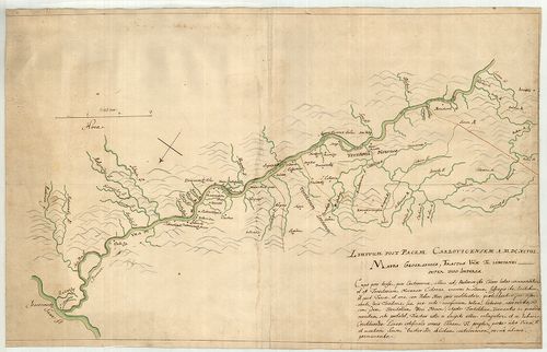
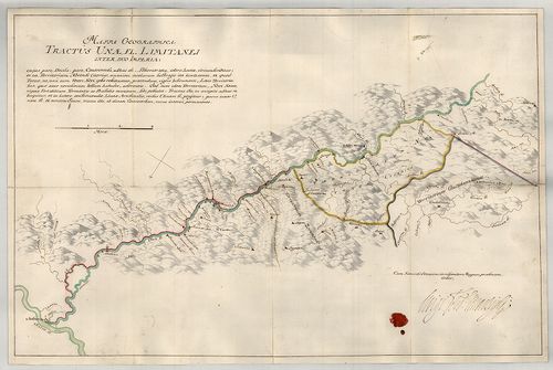
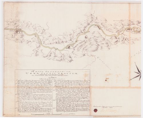
| Title | Limitum post Pacem Carlovitcensem A MDCXCVIII. Mappa Geographica, Tractus Unnae fl. Limitanei inter duo Imperia. |
| Main title | Az 1698. (sic!) évi Karlócai békeszerződés utáni határok földrajzi térképe, amely az Una folyónak a két birodalom közötti határszakaszát ábrázolja. Határtérkép. |
649. Mappa Geographica Unnae Fluvii Tractum, a Kastanovitz, usque... [B IX c 1422]
Institute and Museum of Military History •
B IX c
•
B IX Ausztria–Magyarország
•
B I–XV. Európa
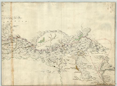
| Title | Mappa Geographica Unnae Fluvii Tractum, a Kastanovitz, usque ad Monasterii rudera, item, Controversum adhuc Territorium Novense, exhibens. |
| Main title | Geográfiai térkép, amely az Una folyót Kastanovitztól a kolostor romjaiig, valamint a még vitatott novi-i területet ábrázolja. Határtérkép. |
650. Mappa Geographica; Lineam, inter utrumque Imperium, Limitane... [B IX c 1423]
Institute and Museum of Military History •
B IX c
•
B IX Ausztria–Magyarország
•
B I–XV. Európa
| Title | Mappa Geographica; Lineam, inter utrumque Imperium, Limitaneam, a Confluxu Savi et Unae ffl., ad montem usque Popinam, ad Mare usque Adriaticum; Compendiose exhibens |
| Main title | Földrajzi térkép, amely a két birodalom határvonalát a Száva és az Una folyók torkolatától a Popina hegyig, és innen a velencei fennhatóságú területekig, egészen az Adriai tengerig, vázlatosan bemutatja. Határtérkép. |
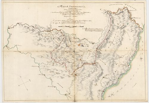
651. Mappa Geographica Tractus Unae fl. Limitanei inter Duo imper... [B IX c 1424]
Institute and Museum of Military History •
B IX c
•
B IX Ausztria–Magyarország
•
B I–XV. Európa
| Title | Mappa Geographica Tractus Unae fl. Limitanei inter Duo imperia... |
| Main title | Földrajzi térkép, amely az Una folyónak a két birodalom közötti szakaszát ábrázolja. Határtérkép. |
652. Mappa Geographica Tractus Limitanei a Sluin, usque ad, Tripl... [B IX c 1425]
Institute and Museum of Military History •
B IX c
•
B IX Ausztria–Magyarország
•
B I–XV. Európa
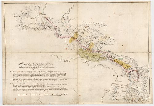
| Title | Mappa Geographica Tractus Limitanei a Sluin, usque ad, Triplicis Confinii, Punctum... |
| Main title | Szluintól a hármas határ pontjáig terjedő határszakasz geográfiai térképe... Határtérkép. |
653. Mappa Geographica, qua Praecautio contra Pestem instituenda ... [B IX c 1426]
Institute and Museum of Military History •
B IX c
•
B IX Ausztria–Magyarország
•
B I–XV. Európa
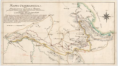
| Title | Mappa Geographica, qua Praecautio contra Pestem instituenda [...] ostenditur... |
| Main title | Földrajzi térkép, amelyen a pestis terjedésének megelőzésére hozandó intézkedéseket mutatjuk meg. Határtérkép. |
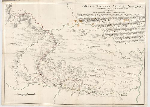
654. Mappa Geograph. Croatiae Inferior. Inter Unam, Colapim, et S... [B IX c 1427]
Institute and Museum of Military History •
B IX c
•
B IX Ausztria–Magyarország
•
B I–XV. Európa
| Title | Mappa Geograph. Croatiae Inferior. Inter Unam, Colapim, et Savum, sitt., qua ostenditur, quid demolitio Novi, importare possit... |
655. Mappa Geographica Lineae, ad Coranam, fl. Limitaneae, usque ... [B IX c 1428]
Institute and Museum of Military History •
B IX c
•
B IX Ausztria–Magyarország
•
B I–XV. Európa
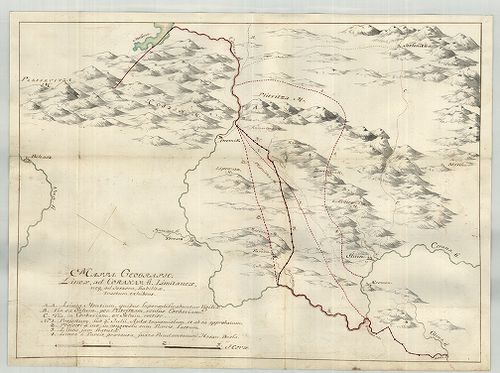
| Title | Mappa Geographica Lineae, ad Coranam, fl. Limitaneae, usque ad Jeszera [sic], stabilitae, tractum exhibens... |
| Main title | Földrajzi térkép, amely a Corana folyó mentén Jeszeraig futó végleges határszakaszt ábrázolja. Határtérkép. |
656. Mappa Limitanea Regni Croatiae... [B IX c 1429]
Institute and Museum of Military History •
B IX c
•
B IX Ausztria–Magyarország
•
B I–XV. Európa
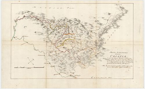
| Title | Mappa Limitanea Regni Croatiae... |
| Main title | Horvátország határtérképe... |
657. Mappa Generalis Regni Croatiae Totius. [B IX c 1430]
Institute and Museum of Military History •
B IX c
•
B IX Ausztria–Magyarország
•
B I–XV. Európa
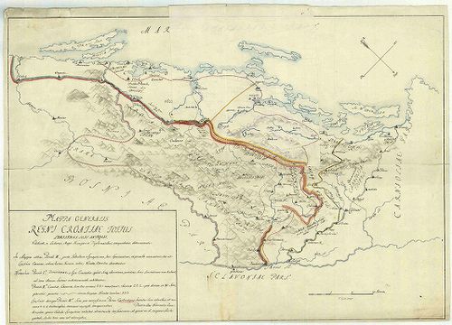
| Title | Mappa Generalis Regni Croatiae Totius. |
| Main title | Horvátország térképe..Határtérkép. |
658. Mappa, qua ostenduntur difficultates communicationis Sclavon... [B IX c 1431]
Institute and Museum of Military History •
B IX c
•
B IX Ausztria–Magyarország
•
B I–XV. Európa
| Title | Mappa, qua ostenduntur difficultates communicationis Sclavoniae et Croatiae evacuatis Jeszenovitz et Dubitza |
| Main title | Azon térkép, amelyen bemutatjuk, milyen közlekedési nehézségekkel kell szembenézni Jeszenovitz és Dubitza kiürítése után.Határtérkép. |
659. Mappa Geographica Unnae Fluvii Tractum, a Kastanovitz...Terr... [B IX c 1433]
Institute and Museum of Military History •
B IX c
•
B IX Ausztria–Magyarország
•
B I–XV. Európa
| Title | Mappa Geographica Unnae Fluvii Tractum, a Kastanovitz...Territorium Novense... |
| Main title | Az Una folyó térképe Kastanovitz-től Novi-ig. Határtérkép. |
660. Mappa Geographica Lineae inter utrumque Imperium, Limitaneae... [B IX c 1434]
Institute and Museum of Military History •
B IX c
•
B IX Ausztria–Magyarország
•
B I–XV. Európa
| Title | Mappa Geographica Lineae inter utrumque Imperium, Limitaneae [...] a Confinio Triplici, usque ad Szluin [...] exhibens |
| Main title | Földrajzi térkép, amely a két birodalom között húzódó [...] határokat a hármas határtól Szluinig... mutatja. Határtérkép. |