201. Triangulation du département de la Somme. (I.re Ordre.) [B V c 70/1]
Institute and Museum of Military History •
B V c
•
B V Franciaország
•
B I–XV. Európa
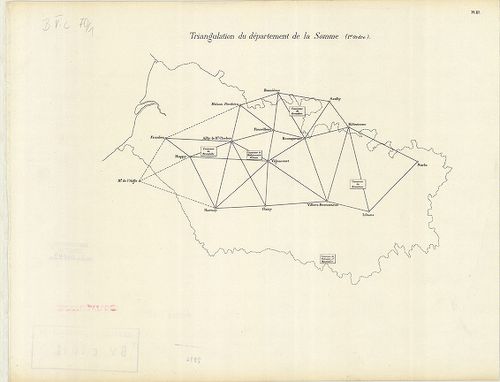
| Title | Triangulation du département de la Somme. (I.re Ordre.) |
| Main title | Franciaország: A Somme megye trigonometriai felmérési hálózata, a 19. században. |
202. Nivellement Général de la France. [B V c 70/2]
Institute and Museum of Military History •
B V c
•
B V Franciaország
•
B I–XV. Európa
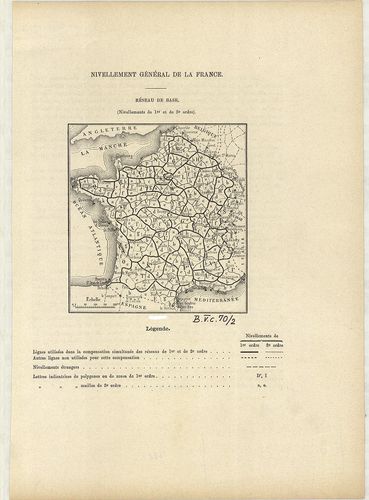
| Title | Nivellement Général de la France. |
| Main title | Franciaország általános szintezés-hálózati térképe 1880 körül megyei beosztással. |
203. Nivellement Général de la France. [B V c 70/3]
Institute and Museum of Military History •
B V c
•
B V Franciaország
•
B I–XV. Európa
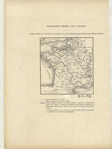
| Title | Nivellement Général de la France. |
| Main title | Franciaország szintezés-hálózat térképe 1880 körül. |
204. Prof. W. Liebenows Karte für das Gebiet zwischen Metz u. Rei... [B V c 81]
Institute and Museum of Military History •
B V c
•
B V Franciaország
•
B I–XV. Európa
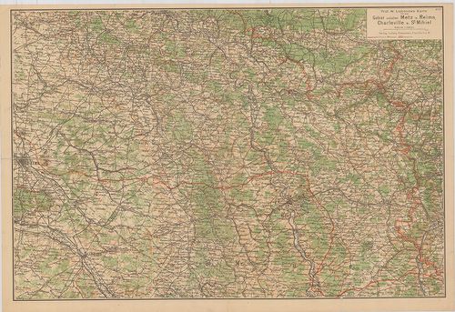
| Title | Prof. W. Liebenows Karte für das Gebiet zwischen Metz u. Reims, Charleville u. St. Mihiel. No. 47. |
| Main title | Franciaország: Metz–Reims–Charleville és St. Mihiel közötti terület úthálózati térképe az 1918-as frontvonal jelöléssel. |
205. Übersichtskarte des deutsch-Französischen Kriegsschauplatzes... [B V c 82]
Institute and Museum of Military History •
B V c
•
B V Franciaország
•
B I–XV. Európa
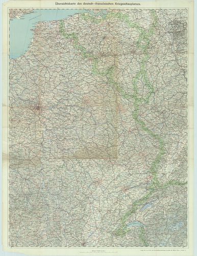
| Title | Übersichtskarte des deutsch-Französischen Kriegsschauplatzes. Lechners Kriegskarte VII. |
| Main title | A német–francia hadszíntér térképe az I. világháborúban. |
206. Paris, westlicher Teil. [B V c 83]
Institute and Museum of Military History •
B V c
•
B V Franciaország
•
B I–XV. Európa
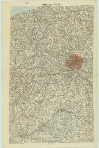
| Title | Paris, westlicher Teil. |
| Main title | Franciaország: Páris környékének topográfiai térképe 1918-ban. |
207. Metz–Belfort. [B V c 85]
Institute and Museum of Military History •
B V c
•
B V Franciaország
•
B I–XV. Európa
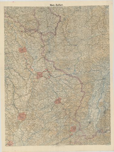
| Title | Metz–Belfort. |
| Main title | Franciaország: Metz–Belfört környékének topográfiai térképe 1918-ban. |
208. A Mosel és Marne közötti terület általános térképe. [B V c 87]
Institute and Museum of Military History •
B V c
•
B V Franciaország
•
B I–XV. Európa
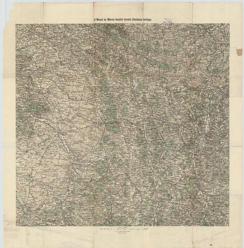
| Title | A Mosel és Marne közötti terület általános térképe. |
209. Der deutsch-französische Kriegsschauplatz. – Specialkarte de... [B V c 89]
Institute and Museum of Military History •
B V c
•
B V Franciaország
•
B I–XV. Európa
| Title | Der deutsch-französische Kriegsschauplatz. – Specialkarte des Kriegsschauplatzes. Der deutsch-Französische Krieg. No. 1. |
210. Spezialkarte der Nördlichen Westfront. – Spezialkarte der Sü... [B V c 90]
Institute and Museum of Military History •
B V c
•
B V Franciaország
•
B I–XV. Európa
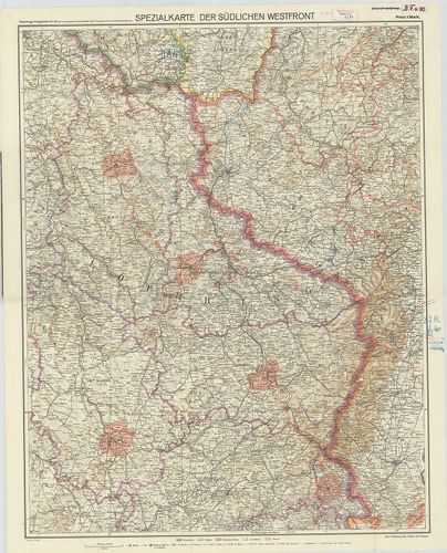
| Title | Spezialkarte der Nördlichen Westfront. – Spezialkarte der Südlichen Westfront. Flemmings Kriegskarte No. 23. |
| Main title | A német–francia hadszíntér térképe az I. világháborúban. |
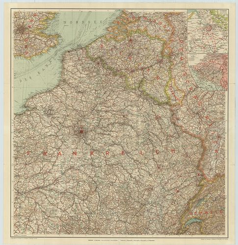
211. Deutsch-französische Grenzgebiet. Mit den französischen Befe... [B V c 91]
Institute and Museum of Military History •
B V c
•
B V Franciaország
•
B I–XV. Európa
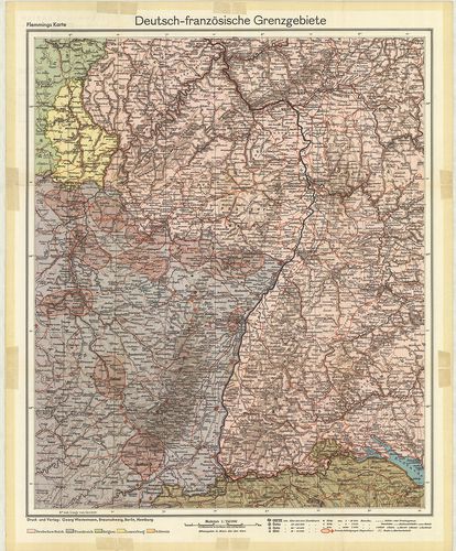
| Title | Deutsch-französische Grenzgebiet. Mit den französischen Befestigungen „Maginot-Linie.” Flemmings Karten, Sonderausgabe. |
| Main title | A német–francia határ a francia erődítések és a Maginot-vonal térképe. |
212. A Nyugati Hadszíntér. [B V c 94]
Institute and Museum of Military History •
B V c
•
B V Franciaország
•
B I–XV. Európa
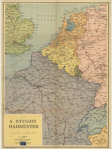
| Title | A Nyugati Hadszíntér. |
213. Karte des Kriegsschauplatzes in Frankreich. [B V c 95]
Institute and Museum of Military History •
B V c
•
B V Franciaország
•
B I–XV. Európa
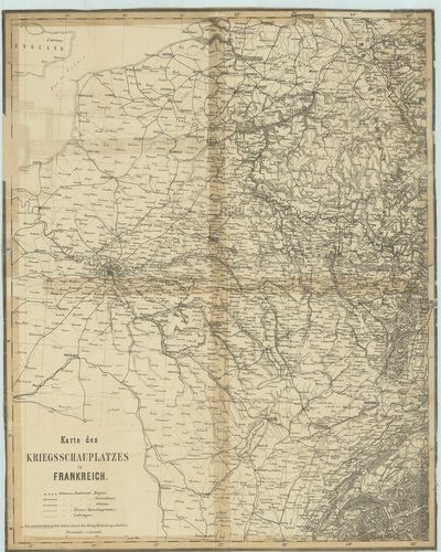
| Title | Karte des Kriegsschauplatzes in Frankreich. |
| Main title | A francia hadszíntér térképe az első világháborúban. |
214. Karte zu den Operationen auf dem südöstlichen Kriegsschaupla... [B V c 96]
Institute and Museum of Military History •
B V c
•
B V Franciaország
•
B I–XV. Európa
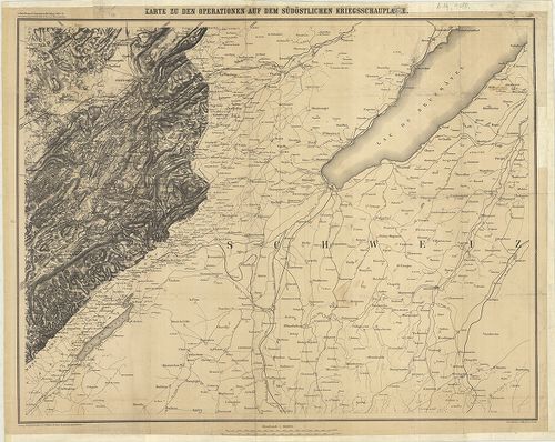
| Title | Karte zu den Operationen auf dem südöstlichen Kriegsschauplatzes. |
| Main title | A német–francia háború térképe 1870–71-ben, a délkeleti hadszíntér. |
215. Karten des französisch-belgischen Kriegsschauplatzes. Nordös... [B V c 97]
Institute and Museum of Military History •
B V c
•
B V Franciaország
•
B I–XV. Európa
| Title | Karten des französisch-belgischen Kriegsschauplatzes. Nordöstliches Frankreich und Belgien. |
| Main title | 2 mt.: 1. Antwerpen und Umgebung (Antverpen és környéke). 2. Sprachen-Karte von Belgien. (Belgium nyelv-térképe.) |
| Subject | 2 old. térk.: 1. Flandern und Artois. (Flandria és Artois térképe.) |
216. Carte des opérations su le front Français. Bale- (Basel) Méz... [B V c 99]
Institute and Museum of Military History •
B V c
•
B V Franciaország
•
B I–XV. Európa
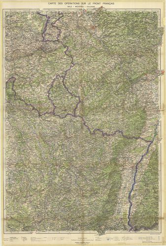
| Title | Carte des opérations su le front Français. Bale- (Basel) Méziéres-Cologne. (Köln.) |
| Main title | Franciaország ÉK-i részének hadműveleti térképe a II. világháborúban. |
217. Frontiére Franco-Allemande. [B V c 100]
Institute and Museum of Military History •
B V c
•
B V Franciaország
•
B I–XV. Európa
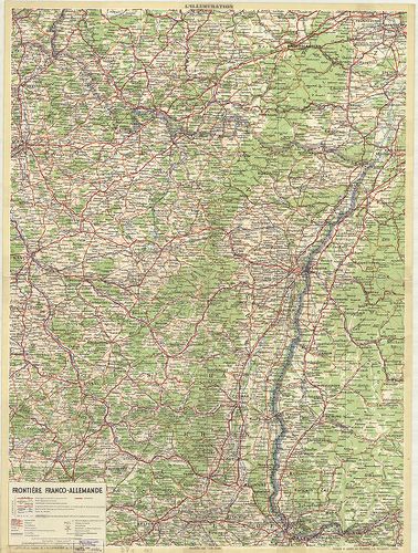
| Title | Frontiére Franco-Allemande. |
| Main title | A francia–német határtérkép 1939-ben. |
218. Carte aéronautique de la France. [B V c 101]
Institute and Museum of Military History •
B V c
•
B V Franciaország
•
B I–XV. Európa
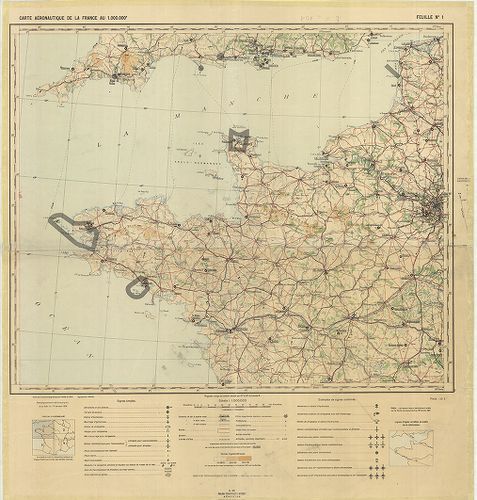
| Title | Carte aéronautique de la France. |
| Main title | Franciaország általános térképe. |
219. Reliefkarte des Argonnen Waldes und der Gegend von Verdun. N... [B V c 102]
Institute and Museum of Military History •
B V c
•
B V Franciaország
•
B I–XV. Európa
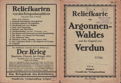
| Title | Reliefkarte des Argonnen Waldes und der Gegend von Verdun. Nr. 11. |
| Main title | Verdun és környékének madártávlati térképe 1914-ben. |
220. Übersicht Befestigungen und des Eisenbahnnetzes von Ost-Fran... [B V c 103]
Institute and Museum of Military History •
B V c
•
B V Franciaország
•
B I–XV. Európa
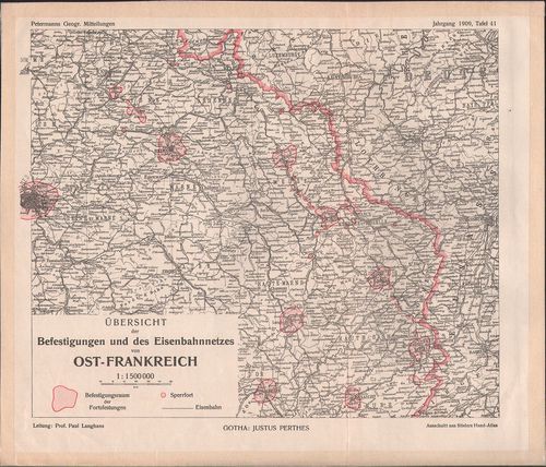
| Title | Übersicht Befestigungen und des Eisenbahnnetzes von Ost-Frankreich. |
| Main title | Kelet-Franciaország erődítéseinek és vasúthálózatának térképe 1909-ben. |