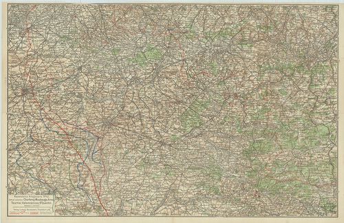
101. Région Parisienne. Routiére touristique administrative. [B V c 146]
Institute and Museum of Military History •
B V c
•
B V Franciaország
•
B I–XV. Európa
| Title | Région Parisienne. Routiére touristique administrative. |
102. Languedoc Roussillon. Routiére touristique administrative. [B V c 146/1]
Institute and Museum of Military History •
B V c
•
B V Franciaország
•
B I–XV. Európa
| Title | Languedoc Roussillon. Routiére touristique administrative. |
103. France. Bretagne. [B V c 161]
Institute and Museum of Military History •
B V c
•
B V Franciaország
•
B I–XV. Európa
| Title | France. Bretagne. |
104. Pyrénées. France. [B V c 162]
Institute and Museum of Military History •
B V c
•
B V Franciaország
•
B I–XV. Európa
| Title | Pyrénées. France. |
105. France, Provence Côte d’Azur. [B V c 164]
Institute and Museum of Military History •
B V c
•
B V Franciaország
•
B I–XV. Európa
| Title | France, Provence Côte d’Azur. |
106. France. Corse. [B V c 165]
Institute and Museum of Military History •
B V c
•
B V Franciaország
•
B I–XV. Európa
| Title | France. Corse. |
107. Ravensteins Kriegskarte no. 42. – Gebiet zwischen Charleroy,... [B V c 166]
Institute and Museum of Military History •
B V c
•
B V Franciaország
•
B I–XV. Európa
| Title | Ravensteins Kriegskarte no. 42. – Gebiet zwischen Charleroy, Maubeuge, Arras, Tournai, Valenciennes, St. Quentin |
| Main title | Charleroy, Maubeuge, Arras, Tournai, Valenciennes, St. Quentin városok és környékük az I- világháború alatt. |
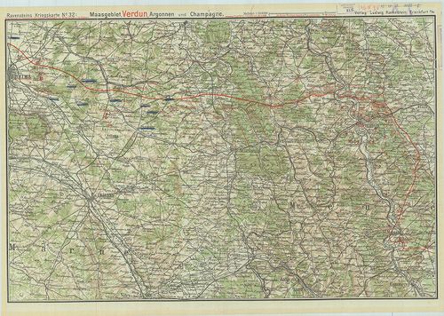
108. Ravensteins Kriegskarte No. 32 – Maasgebiet, Verdun, Argonne... [B V c 167]
Institute and Museum of Military History •
B V c
•
B V Franciaország
•
B I–XV. Európa
| Title | Ravensteins Kriegskarte No. 32 – Maasgebiet, Verdun, Argonnen und Champagne. |
| Main title | Verdun, Argonnen és Champagne városok környéke az I- világháború alatt. |
109. Namenverzeichnis zu den Karten des Französisch-belgischen Kr... [B V c 168]
Institute and Museum of Military History •
B V c
•
B V Franciaország
•
B I–XV. Európa
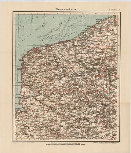
| Title | Namenverzeichnis zu den Karten des Französisch-belgischen Kriegshauplatzes. |
| Main title | 8 térkép (5 lapon). l. Flandern und Artois (Flandria és Artois). |
| Subject | 2. Champagne und Französisch-Lothringen (Champagne és Francia-Lotharingia). |
110. Deutsch–Französischer Krieg 1914. Belfort und die Vogesen au... [B V c 173]
Institute and Museum of Military History •
B V c
•
B V Franciaország
•
B I–XV. Európa
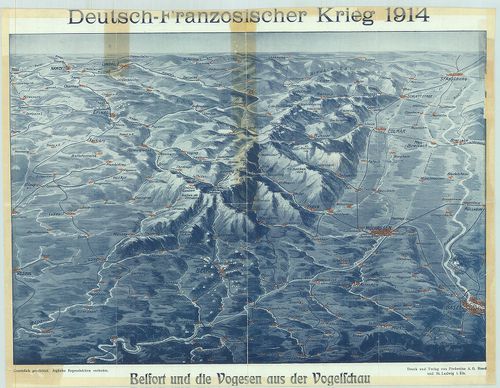
| Title | Deutsch–Französischer Krieg 1914. Belfort und die Vogesen aus der Vogelscheu |
| Main title | Német–francia háború 1914. Belfort és a Vogézek madártávlatból. Német, francia, svájci határvidék, plasztikus rálátásban. |
111. A Nyugati Hadszíntér. A Maginot és a Siegfried vonal tájékoz... [B V c 174]
Institute and Museum of Military History •
B V c
•
B V Franciaország
•
B I–XV. Európa
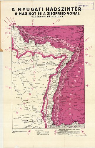
| Title | A Nyugati Hadszíntér. A Maginot és a Siegfried vonal tájékoztató vázlata. |
112. G. Freytags Kriegskarte von Nordost-Frankreich und Belgien. [B V c 175]
Institute and Museum of Military History •
B V c
•
B V Franciaország
•
B I–XV. Európa
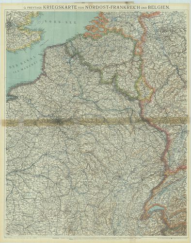
| Title | G. Freytags Kriegskarte von Nordost-Frankreich und Belgien. |
| Main title | Franciaország ÉK-i része és Belgium hadszíntér térképe az 1918. márc. 21–27. offenzíva megindulásakor. |
113. G. Freytags Kriegskarte von Nordost-Frankreich und Belgien. [B V c 176]
Institute and Museum of Military History •
B V c
•
B V Franciaország
•
B I–XV. Európa
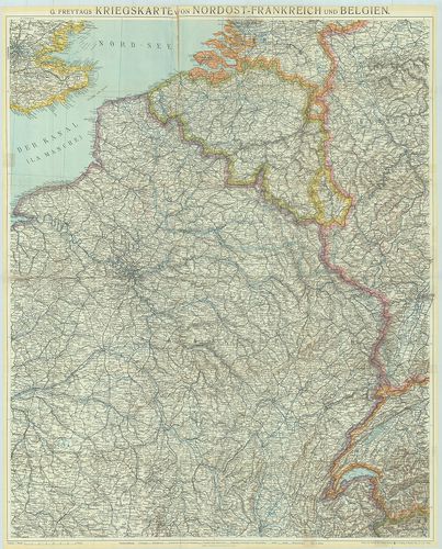
| Title | G. Freytags Kriegskarte von Nordost-Frankreich und Belgien. |
| Main title | Franciaország ÉK-i része és Belgium hadszíntér térképe az 1916. febr.-ban. |
114. Franciaország – autótérkép. [B V c 177]
Institute and Museum of Military History •
B V c
•
B V Franciaország
•
B I–XV. Európa
| Title | Franciaország – autótérkép. |
115. Carte Michelin de la France. [B V c 178]
Institute and Museum of Military History •
B V c
•
B V Franciaország
•
B I–XV. Európa
| Title | Carte Michelin de la France. |
116. Carte Michelin de la France, Normandie. [B V c 179]
Institute and Museum of Military History •
B V c
•
B V Franciaország
•
B I–XV. Európa
| Title | Carte Michelin de la France, Normandie. |
117. Carte Michelin de la France Nord, Flandre, Artois, Picardie. [B V c 180]
Institute and Museum of Military History •
B V c
•
B V Franciaország
•
B I–XV. Európa
| Title | Carte Michelin de la France Nord, Flandre, Artois, Picardie. |
118. France, Carte routiére et touristique. [B V c 181]
Institute and Museum of Military History •
B V c
•
B V Franciaország
•
B I–XV. Európa
| Title | France, Carte routiére et touristique. |
119. France routiére départementale. [B V c 182]
Institute and Museum of Military History •
B V c
•
B V Franciaország
•
B I–XV. Európa
| Title | France routiére départementale. |
| Main title | 2 mt.: Relief de la France. Sorties de Paris. (Franviaország domborzata. Párizs környéke. |
120. Provence. [B V c 183]
Institute and Museum of Military History •
B V c
•
B V Franciaország
•
B I–XV. Európa
| Title | Provence. |
| Main title | Franciaország áttek. térképe. |
121. Corse-du Sud, Haute Corse. [B V c 184]
Institute and Museum of Military History •
B V c
•
B V Franciaország
•
B I–XV. Európa
| Title | Corse-du Sud, Haute Corse. |
122. France. [B V c 185]
Institute and Museum of Military History •
B V c
•
B V Franciaország
•
B I–XV. Európa
| Title | France. |
| Main title | Franciaország autótérképe |
123. France Direct route map. [B V c 186]
Institute and Museum of Military History •
B V c
•
B V Franciaország
•
B I–XV. Európa
| Title | France Direct route map. |
124. Carte Nautique & touristique de la vallée de l´Ardéche [B V c 187]
Institute and Museum of Military History •
B V c
•
B V Franciaország
•
B I–XV. Európa
| Title | Carte Nautique & touristique de la vallée de l´Ardéche |
125. Territorial Eintheilungs u. Dislokations Karte. (+1 mellékté... [B V c 188]
Institute and Museum of Military History •
B V c
•
B V Franciaország
•
B I–XV. Európa
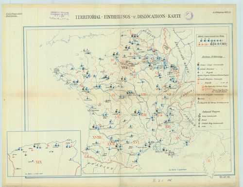
| Title | Territorial Eintheilungs u. Dislokations Karte. (+1 melléktérkép Algéria). |
| Main title | A francia hadsereg diszlokációs térképe. |