1. Eisenbahnkarte von Frankreich und Belgien. [B V c 10]
Institute and Museum of Military History •
B V c
•
B V Franciaország
•
B I–XV. Európa
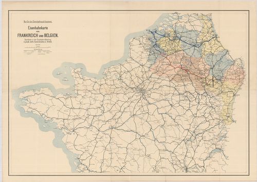
| Title | Eisenbahnkarte von Frankreich und Belgien. |
| Main title | Franciaország északi része és Belgium vasúthálózati térképe 1916-ban. |
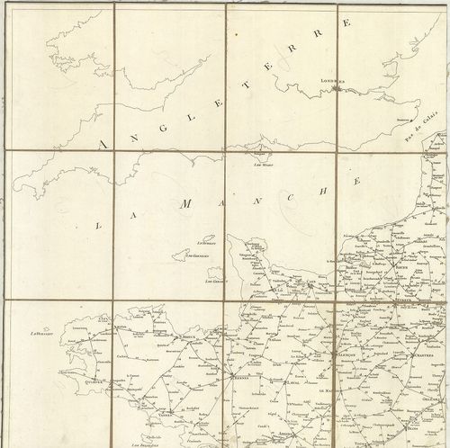
2. Carte Générale des Chemins de Fer et des Voies Navigables de... [B V c 13/1]
Institute and Museum of Military History •
B V c
•
B V Franciaország
•
B I–XV. Európa
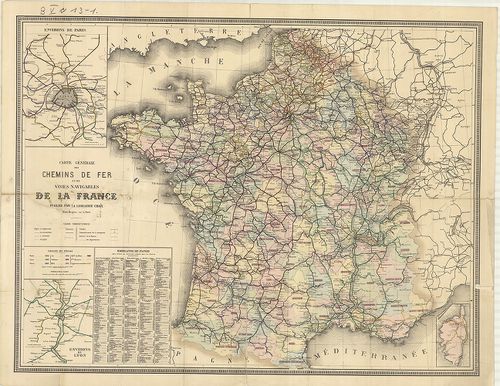
| Title | Carte Générale des Chemins de Fer et des Voies Navigables de la France… – Guide Chaix Carte des Chemins de Fer de La France. |
| Main title | 2 mt.: 1. Environs de Paris. (Páris környéke.) 2. Environs de Lyon. (Lyon környéke.) |
| Subject | Franciaország vasúti és hajózási térképe 1879-ben. |
3. Carte des Routes d’Étapes de l’Émpire Frances… [B V c 30]
Institute and Museum of Military History •
B V c
•
B V Franciaország
•
B I–XV. Európa
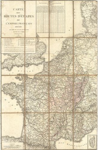
| Title | Carte des Routes d’Étapes de l’Émpire Frances… |
| Main title | A Francia Császárság katonai utánpótlási úthálózati térképe 1811-ben. (London–Varsó–Pergignan–Sarajevo kivágat.) |
4. Carte des Routes d’Étapes de la France. [B V c 30/1]
Institute and Museum of Military History •
B V c
•
B V Franciaország
•
B I–XV. Európa
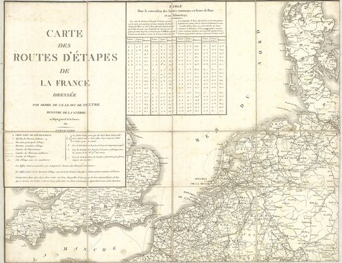
| Title | Carte des Routes d’Étapes de la France. |
| Main title | Franciaország katonai utánpótlási, úthálózati térképe 1814-ben. |
5. Carte Itinéraire de l’Empire Français… [B V c 33]
Institute and Museum of Military History •
B V c
•
B V Franciaország
•
B I–XV. Európa
| Title | Carte Itinéraire de l’Empire Français… |
| Main title | A Francia Császárság közlekedési térképe 1814-ben, a 130 megye megjelölésével. |
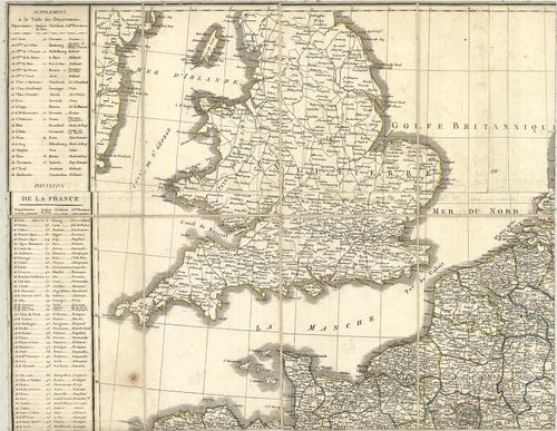
6. Itinéraire de la France du Atlas Général… [B V c 33/1]
Institute and Museum of Military History •
B V c
•
B V Franciaország
•
B I–XV. Európa
| Title | Itinéraire de la France du Atlas Général… |
| Main title | Franciaország úttérképe a 19. században. |
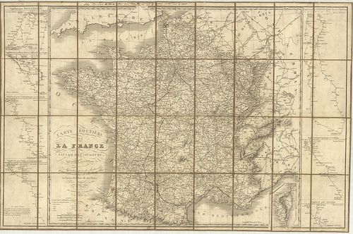
7. Carte Routiere de la France… [B V c 34]
Institute and Museum of Military History •
B V c
•
B V Franciaország
•
B I–XV. Európa
| Title | Carte Routiere de la France… |
| Main title | Franciaország úthálózati térképe 1821-ben. |
8. Carte Routiére de la France… [B V c 35]
Institute and Museum of Military History •
B V c
•
B V Franciaország
•
B I–XV. Európa
| Title | Carte Routiére de la France… |
| Main title | 7 mt.: 1. Supplément pour Madrid et Lisbonne. (Lisboa-Lisszabon-Madrid útvonal térképe.) 2. Supplément pour Turin–Florence–Milan–Romeet–Naples. (Torino–Firenze–Milanó–Róma–Napoli útvonal téképe.) 3. Supplément pour Constantinople par Laybach. (Istanbul–Ljubljana útvonal térképe.) 4. Supplément pour Vienne et Constantinople (Bécs–Istanbul útvonal térképe.) 5. Supplément pour Dresde–Berlin–Warsovie–Moscou et St. Petersbourg.) (Dresden–Berlin–Warszawa–Moszkva–Leningrad útvonali térképe. 6. Supplément pour Copenhague et Stockholm. (Křbenhavn – Stockholm útvonal térképe.) 7. Supplément pour Amsterdam. (Amsterdam útvonal térképe.) |
| Subject | Franciaország úttérképe 1828-ban. |
9. Carte des voies de communication de la France de la Belgique... [B V c 41]
Institute and Museum of Military History •
B V c
•
B V Franciaország
•
B I–XV. Európa
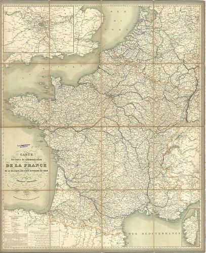
| Title | Carte des voies de communication de la France de la Belgique, de Etats Riverains du Rhin… |
| Main title | Mt.: [Párizs és környéke.] |
| Subject | Franciaország és Belgium közlekedési térképe 1845-ben. |
10. Carte des Étapes de France… [B V c 42]
Institute and Museum of Military History •
B V c
•
B V Franciaország
•
B I–XV. Európa
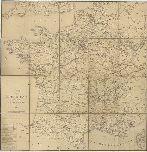
| Title | Carte des Étapes de France… |
| Main title | Franciaország katonai utánpótlási, úthálózati térképe 1861-ben. |
11. Vorstellung des Weges den Hannibal genommen durch Gallien un... [B V c 43]
Institute and Museum of Military History •
B V c
•
B V Franciaország
•
B I–XV. Európa
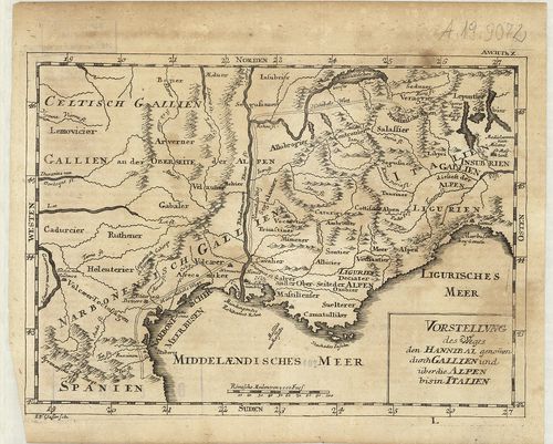
| Title | Vorstellung des Weges den Hannibal genommen durch Gallien und über die Alpen bis in Italien. |
| Main title | Franciaország déli részének történelmi térképe a 18. században, Hannibál hadiútjának megjelölésével. |
12. Tableau des Services de la Poste aux Lettres. [B V c 49]
Institute and Museum of Military History •
B V c
•
B V Franciaország
•
B I–XV. Európa
| Title | Tableau des Services de la Poste aux Lettres. |
| Main title | Mt.: [Páris postahálózati térképe.] |
| Subject | Franciaország postahálózati térképe a posta hivatalok megjelölésével a 18. században. |
13. Les Frontieres de France et des Pais Bas… [B V c 49/1]
Institute and Museum of Military History •
B V c
•
B V Franciaország
•
B I–XV. Európa
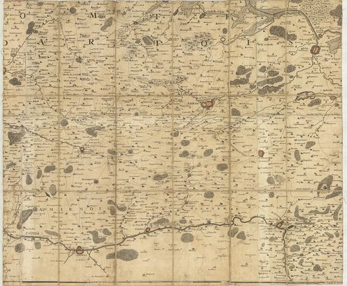
| Title | Les Frontieres de France et des Pais Bas… |
| Main title | Franciaország és a Német-Alföld határtérképe a 18. században. (A Flandriai grófság, D’Artois de Hainaut és Namur tartományok és a Brabanti hercegség területe.) |
14. Graenz-Karte der zusammenstossenden Französchen, Östreichisc... [B V c 50/2]
Institute and Museum of Military History •
B V c
•
B V Franciaország
•
B I–XV. Európa
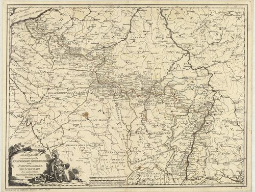
| Title | Graenz-Karte der zusammenstossenden Französchen, Östreichischen und Reichs Laender. Ein Schauplatz des gegenwärtigen französisch-östreichischen Krieges. |
| Main title | Franciaország, Ausztria és a Német Birodalom határtérképe a francia–osztrák háború hadszínterével 1792-ben. |
15. Carte de la Frontiére Nord-est de la France… [B V c 50/8]
Institute and Museum of Military History •
B V c
•
B V Franciaország
•
B I–XV. Európa
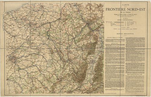
| Title | Carte de la Frontiére Nord-est de la France… |
| Main title | Franciaország ÉNY-i részének térképe 1862 körül. |
16. Carte Militaire de la France… [B V c 52-1]
Institute and Museum of Military History •
B V c
•
B V Franciaország
•
B I–XV. Európa
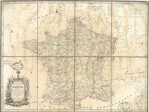
| Title | Carte Militaire de la France… |
| Main title | Franciaország katonai vonatkozású térképe, úthálózattal 1835-ben. |
17. Carte de la France… [B V c 55]
Institute and Museum of Military History •
B V c
•
B V Franciaország
•
B I–XV. Európa
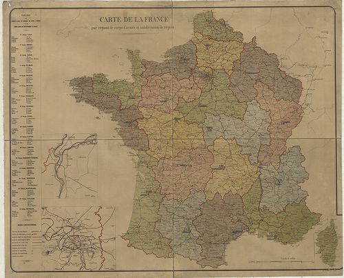
| Title | Carte de la France… |
| Main title | 2 mt.: 1. [Lyon és környéke.] 2. [Párizs és környéke.] |
| Subject | Franciaország vasúti térképe 1870 körül a 18 tartomány jelölésével. |
18. Carte du Diocese de Mende. [B V c 61/5]
Institute and Museum of Military History •
B V c
•
B V Franciaország
•
B I–XV. Európa
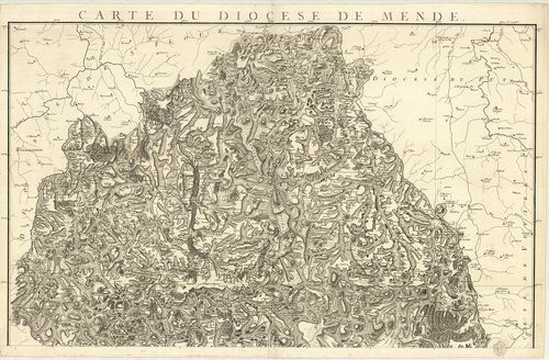
| Title | Carte du Diocese de Mende. |
| Main title | Franciaország: Mende egyházi kerület térképe 1814 körül. |
19. Carte du Diocese de Mirepoix. [B V c 61/6]
Institute and Museum of Military History •
B V c
•
B V Franciaország
•
B I–XV. Európa
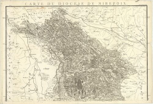
| Title | Carte du Diocese de Mirepoix. |
| Main title | Franciaország: Mirepoix egyházi kerület térképe 1814 körül. |
20. Carte du Diocese de Montauban. [B V c 61/7]
Institute and Museum of Military History •
B V c
•
B V Franciaország
•
B I–XV. Európa
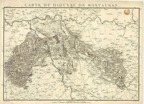
| Title | Carte du Diocese de Montauban. |
| Main title | Franciaország: Montauban egyházi kerület térképe 1814 körül. |
21. Carte du Diocese de Montpellier. [B V c 61/8]
Institute and Museum of Military History •
B V c
•
B V Franciaország
•
B I–XV. Európa
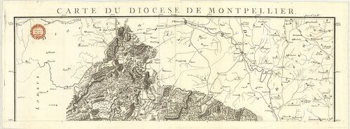
| Title | Carte du Diocese de Montpellier. |
| Main title | Franciaország: Montpellier egyházi kerület térképe 1814 körül. |
22. Carte du Diocese D’Agde. [B V c 61/9]
Institute and Museum of Military History •
B V c
•
B V Franciaország
•
B I–XV. Európa
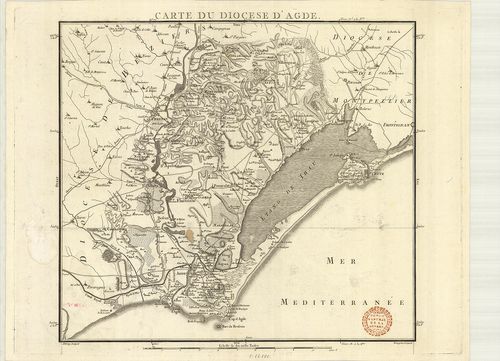
| Title | Carte du Diocese D’Agde. |
| Main title | Franciaország: Agde egyházi kerület térképe 1814 körül. |
23. Carte du Diocese de Nismes. [B V c 61/11]
Institute and Museum of Military History •
B V c
•
B V Franciaország
•
B I–XV. Európa
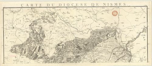
| Title | Carte du Diocese de Nismes. |
| Main title | Franciaország: Nimes egyházi kerület térképe 1814 körül. |
24. Carte du Diocese du Puy. [B V c 61/14]
Institute and Museum of Military History •
B V c
•
B V Franciaország
•
B I–XV. Európa
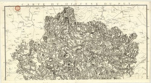
| Title | Carte du Diocese du Puy. |
| Main title | Franciaország: Le Puy egyházi kerület térképe 1814 körül. |
25. Carte du Diocese de Rieux. [B V c 61/15]
Institute and Museum of Military History •
B V c
•
B V Franciaország
•
B I–XV. Európa
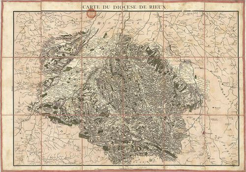
| Title | Carte du Diocese de Rieux. |
| Main title | Franciaország: Rieumes egyházi kerüelt térképe 1814 körül. |
26. Carte du Réseau des Chemins de Fer du Midi. [B V c 62]
Institute and Museum of Military History •
B V c
•
B V Franciaország
•
B I–XV. Európa
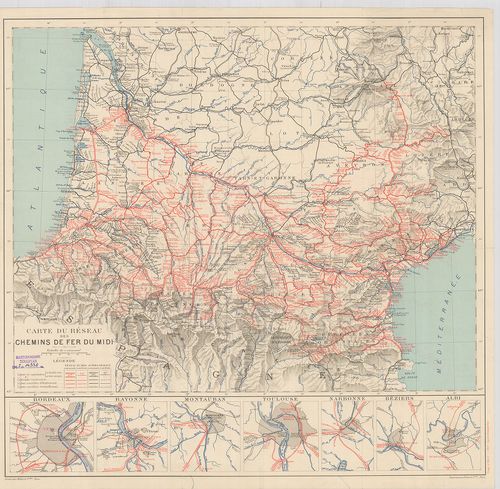
| Title | Carte du Réseau des Chemins de Fer du Midi. |
| Main title | 7 mt.: 1. Bordeaux, 2. Bayonne, 3. Montauban, 4. Toulouse, 5. Narbonne, 6. Béziers, 7. Albi városok közlekedési térképe. |
| Subject | Franciaország DNY-i részének vasúthálózati térképe 1911-ben. |
27. Supplement zur Strassen-Karte der Westlichen Alpen. 1832. [B V c 62/1]
Institute and Museum of Military History •
B V c
•
B V Franciaország
•
B I–XV. Európa
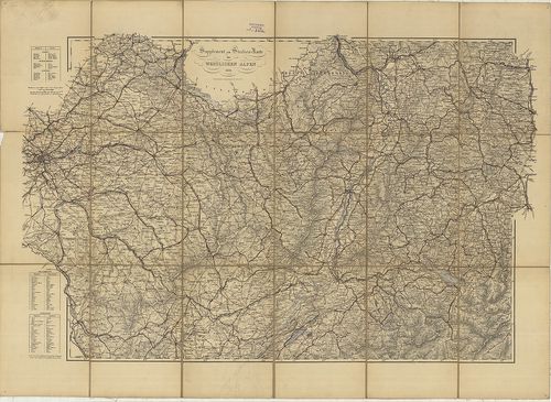
| Title | Supplement zur Strassen-Karte der Westlichen Alpen. 1832. |
| Main title | A Nyugati-Alpok úthálózati térképe 1832-ből, a vasúthálózat 1870-ig helyesbítve. |
28. Supplement zur Strassen-Karte der Westlichen Alpen. [B V c 62/2]
Institute and Museum of Military History •
B V c
•
B V Franciaország
•
B I–XV. Európa
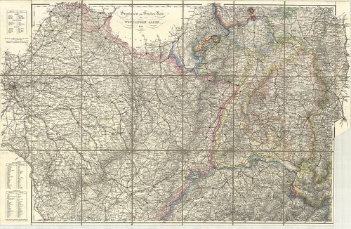
| Title | Supplement zur Strassen-Karte der Westlichen Alpen. |
| Main title | A Nyugati-Alpok úthálózati térképe 1832-ben. |
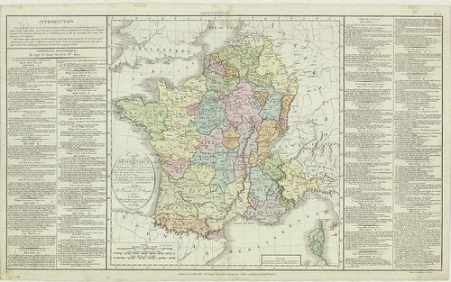
29. Tableau Statistique et Géographique de l’Espéce Chevaline en... [B V c 63]
Institute and Museum of Military History •
B V c
•
B V Franciaország
•
B I–XV. Európa
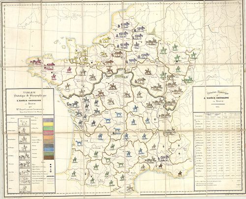
| Title | Tableau Statistique et Géographique de l’Espéce Chevaline en France. |
| Main title | Franciaország földrajzi és statisztikai térképe a lóállományról 1834-ben. |
30. Plan de L’innondation de la Ville de Condé du coste’ de L’es... [B V c 65]
Institute and Museum of Military History •
B V c
•
B V Franciaország
•
B I–XV. Európa
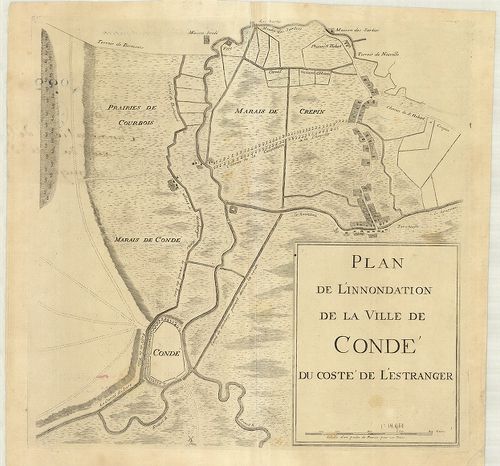
| Title | Plan de L’innondation de la Ville de Condé du coste’ de L’estranges. |
| Main title | Franciaország: Condé sur Escaut környékének vízborította területei és csatornái a 18. században. |
31. Carte de la Gaule, divisée en 17 Grandes Provinces Romaines… [B V c 67]
Institute and Museum of Military History •
B V c
•
B V Franciaország
•
B I–XV. Európa
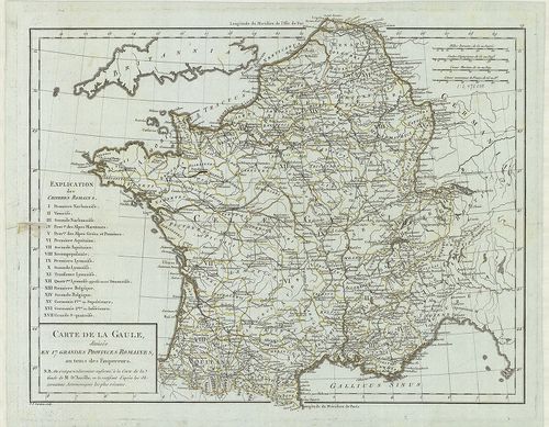
| Title | Carte de la Gaule, divisée en 17 Grandes Provinces Romaines… |
| Main title | Franciaország: Gallia történelmi térképe a 17 római tartomány jelölésével. |
32. Carte Syntétique des accroissements successifs de la puissan... [B V c 68]
Institute and Museum of Military History •
B V c
•
B V Franciaország
•
B I–XV. Európa
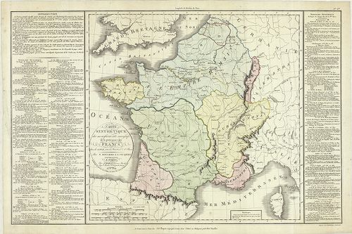
| Title | Carte Syntétique des accroissements successifs de la puissance des Francs. |
| Main title | Franciaország összefoglaló történelmi térképe 420–986. között. |
33. Carte Syintétique… la monarchie Francaise… le Consulat de Bo... [B V c 69]
Institute and Museum of Military History •
B V c
•
B V Franciaország
•
B I–XV. Európa
| Title | Carte Syintétique… la monarchie Francaise… le Consulat de Bonaparte. |
| Main title | Franciaország összefoglaló történelmi térképe 987-től 1800-ig, Bonaparte konzulságáig. |
34. Paralléle de Paris. [B V c 70]
Institute and Museum of Military History •
B V c
•
B V Franciaország
•
B I–XV. Európa
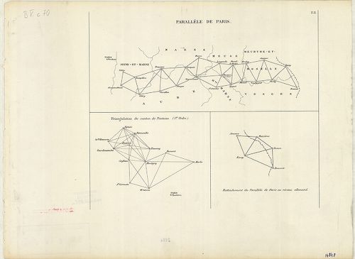
| Title | Paralléle de Paris. |
35. Triangulation du département de la Somme. (I.re Ordre.) [B V c 70/1]
Institute and Museum of Military History •
B V c
•
B V Franciaország
•
B I–XV. Európa
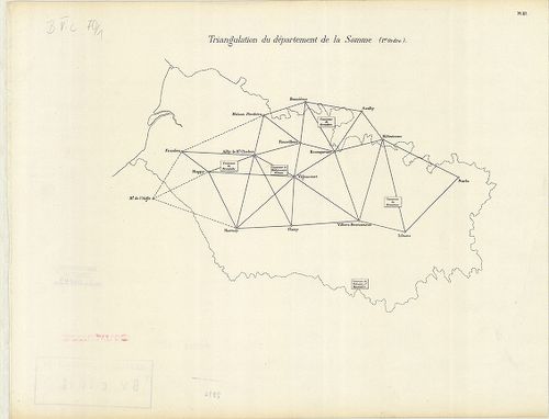
| Title | Triangulation du département de la Somme. (I.re Ordre.) |
| Main title | Franciaország: A Somme megye trigonometriai felmérési hálózata, a 19. században. |
36. Nivellement Général de la France. [B V c 70/2]
Institute and Museum of Military History •
B V c
•
B V Franciaország
•
B I–XV. Európa
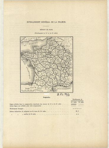
| Title | Nivellement Général de la France. |
| Main title | Franciaország általános szintezés-hálózati térképe 1880 körül megyei beosztással. |
37. Nivellement Général de la France. [B V c 70/3]
Institute and Museum of Military History •
B V c
•
B V Franciaország
•
B I–XV. Európa
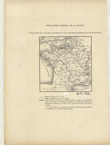
| Title | Nivellement Général de la France. |
| Main title | Franciaország szintezés-hálózat térképe 1880 körül. |
38. Prof. W. Liebenows Karte für das Gebiet zwischen Metz u. Rei... [B V c 81]
Institute and Museum of Military History •
B V c
•
B V Franciaország
•
B I–XV. Európa
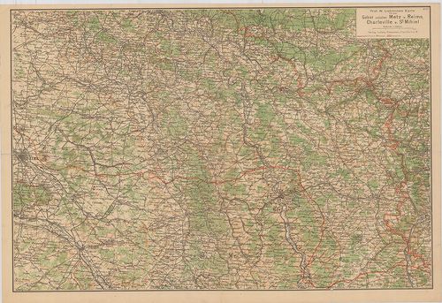
| Title | Prof. W. Liebenows Karte für das Gebiet zwischen Metz u. Reims, Charleville u. St. Mihiel. No. 47. |
| Main title | Franciaország: Metz–Reims–Charleville és St. Mihiel közötti terület úthálózati térképe az 1918-as frontvonal jelöléssel. |
39. Übersichtskarte des deutsch-Französischen Kriegsschauplatzes... [B V c 82]
Institute and Museum of Military History •
B V c
•
B V Franciaország
•
B I–XV. Európa
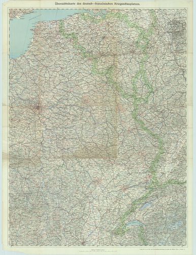
| Title | Übersichtskarte des deutsch-Französischen Kriegsschauplatzes. Lechners Kriegskarte VII. |
| Main title | A német–francia hadszíntér térképe az I. világháborúban. |
40. Paris, westlicher Teil. [B V c 83]
Institute and Museum of Military History •
B V c
•
B V Franciaország
•
B I–XV. Európa
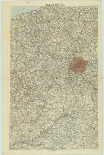
| Title | Paris, westlicher Teil. |
| Main title | Franciaország: Páris környékének topográfiai térképe 1918-ban. |
41. Metz–Belfort. [B V c 85]
Institute and Museum of Military History •
B V c
•
B V Franciaország
•
B I–XV. Európa
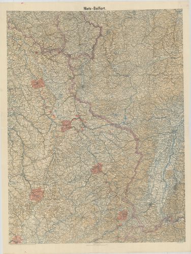
| Title | Metz–Belfort. |
| Main title | Franciaország: Metz–Belfört környékének topográfiai térképe 1918-ban. |
42. A Mosel és Marne közötti terület általános térképe. [B V c 87]
Institute and Museum of Military History •
B V c
•
B V Franciaország
•
B I–XV. Európa
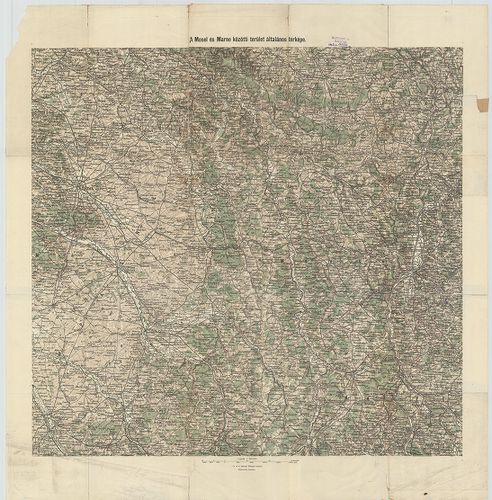
| Title | A Mosel és Marne közötti terület általános térképe. |
43. Der deutsch-französische Kriegsschauplatz. – Specialkarte de... [B V c 89]
Institute and Museum of Military History •
B V c
•
B V Franciaország
•
B I–XV. Európa
| Title | Der deutsch-französische Kriegsschauplatz. – Specialkarte des Kriegsschauplatzes. Der deutsch-Französische Krieg. No. 1. |
44. Spezialkarte der Nördlichen Westfront. – Spezialkarte der Sü... [B V c 90]
Institute and Museum of Military History •
B V c
•
B V Franciaország
•
B I–XV. Európa
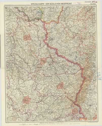
| Title | Spezialkarte der Nördlichen Westfront. – Spezialkarte der Südlichen Westfront. Flemmings Kriegskarte No. 23. |
| Main title | A német–francia hadszíntér térképe az I. világháborúban. |
45. Deutsch-französische Grenzgebiet. Mit den französischen Befe... [B V c 91]
Institute and Museum of Military History •
B V c
•
B V Franciaország
•
B I–XV. Európa
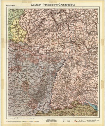
| Title | Deutsch-französische Grenzgebiet. Mit den französischen Befestigungen „Maginot-Linie.” Flemmings Karten, Sonderausgabe. |
| Main title | A német–francia határ a francia erődítések és a Maginot-vonal térképe. |
46. A Nyugati Hadszíntér. [B V c 94]
Institute and Museum of Military History •
B V c
•
B V Franciaország
•
B I–XV. Európa
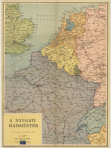
| Title | A Nyugati Hadszíntér. |
47. Karte des Kriegsschauplatzes in Frankreich. [B V c 95]
Institute and Museum of Military History •
B V c
•
B V Franciaország
•
B I–XV. Európa
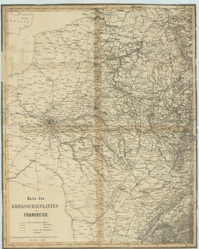
| Title | Karte des Kriegsschauplatzes in Frankreich. |
| Main title | A francia hadszíntér térképe az első világháborúban. |
48. Karte zu den Operationen auf dem südöstlichen Kriegsschaupla... [B V c 96]
Institute and Museum of Military History •
B V c
•
B V Franciaország
•
B I–XV. Európa
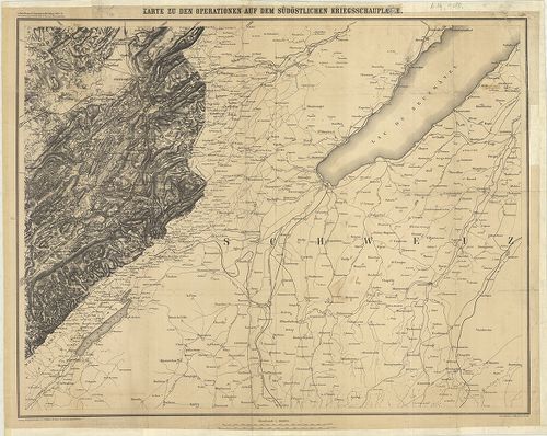
| Title | Karte zu den Operationen auf dem südöstlichen Kriegsschauplatzes. |
| Main title | A német–francia háború térképe 1870–71-ben, a délkeleti hadszíntér. |
49. Karten des französisch-belgischen Kriegsschauplatzes. Nordös... [B V c 97]
Institute and Museum of Military History •
B V c
•
B V Franciaország
•
B I–XV. Európa
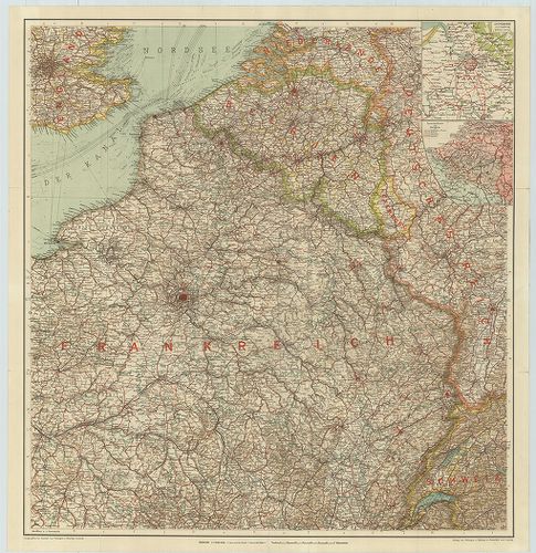
| Title | Karten des französisch-belgischen Kriegsschauplatzes. Nordöstliches Frankreich und Belgien. |
| Main title | 2 mt.: 1. Antwerpen und Umgebung (Antverpen és környéke). 2. Sprachen-Karte von Belgien. (Belgium nyelv-térképe.) |
| Subject | 2 old. térk.: 1. Flandern und Artois. (Flandria és Artois térképe.) |
50. Carte des opérations su le front Français. Bale- (Basel) Méz... [B V c 99]
Institute and Museum of Military History •
B V c
•
B V Franciaország
•
B I–XV. Európa
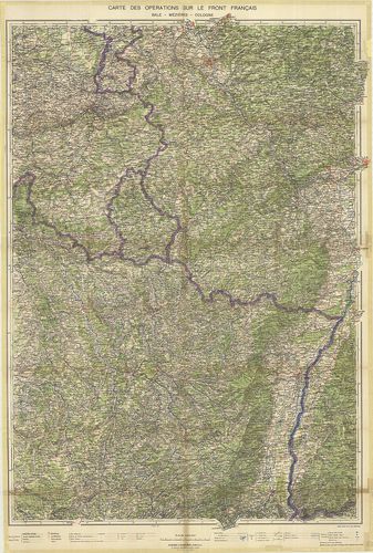
| Title | Carte des opérations su le front Français. Bale- (Basel) Méziéres-Cologne. (Köln.) |
| Main title | Franciaország ÉK-i részének hadműveleti térképe a II. világháborúban. |