81. Indusztrialnoe razvitie SzSzSzR. za godü predvoennüh pjatile... [B XI c 53]
Institute and Museum of Military History •
B XI c
•
B XI Oroszország
•
B I–XV. Európa
| Title | Indusztrialnoe razvitie SzSzSzR. za godü predvoennüh pjatiletok. (1928–1940 gg.) |
| Main title | Mt.: [A Bajkálon túli terület.] |
| Subject | A Szovjetunió ipari fejlődése az első ötéves terv után 1928–1940. között. |
82. Indusztrial’noe razvitie SzSzSzR za godü predvoennüh pjatile... [B XI c 53/1]
Institute and Museum of Military History •
B XI c
•
B XI Oroszország
•
B I–XV. Európa
| Title | Indusztrial’noe razvitie SzSzSzR za godü predvoennüh pjatiletok. (1928–1940 gg.) 2 térkép 1 lapon: 1.: Promüslennoszt’ Szojuza SzSzR v 1940 g. 2.: Promüslennoszt’ Roszszii v 1913 g. |
| Main title | Mt.: [Bajkálon túli terület.] |
83. Drevneruszszkoe goszudarsztvo v IX-nacsale XII v. [B XI c 54]
Institute and Museum of Military History •
B XI c
•
B XI Oroszország
•
B I–XV. Európa
| Title | Drevneruszszkoe goszudarsztvo v IX-nacsale XII v. |
84. Etapnaja karta Evropejszkoj Roszszii. [B XI c 55]
Institute and Museum of Military History •
B XI c
•
B XI Oroszország
•
B I–XV. Európa

| Title | Etapnaja karta Evropejszkoj Roszszii. |
| Main title | Az Európai Oroszország katonai állomásainak térképe 1867-ben. |
85. West-Russland. [B XI c 56]
Institute and Museum of Military History •
B XI c
•
B XI Oroszország
•
B I–XV. Európa
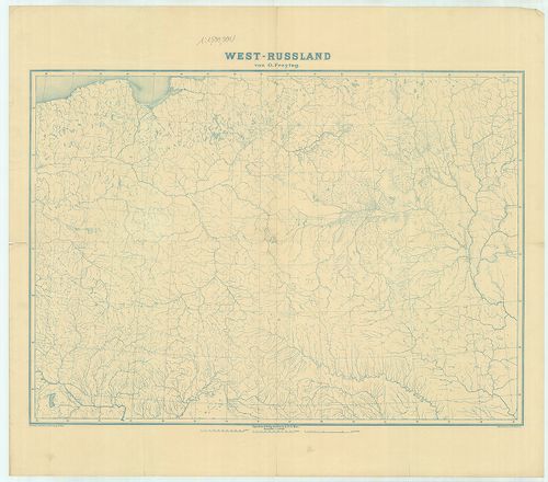
| Title | West-Russland. |
| Main title | Nyugat-Oroszország vízrajzi munkatérképe. |
86. General-Karte vom Westlichen Russland nebst Preussen, Posen ... [B XI c 56/1]
Institute and Museum of Military History •
B XI c
•
B XI Oroszország
•
B I–XV. Európa

| Title | General-Karte vom Westlichen Russland nebst Preussen, Posen und Galizien. |
| Main title | Mt.: Warschau (Varsó). |
| Subject | Nyugat-Oroszország, Poroszország, Lengyelország és Galícia általános térképe 1868-ban. |
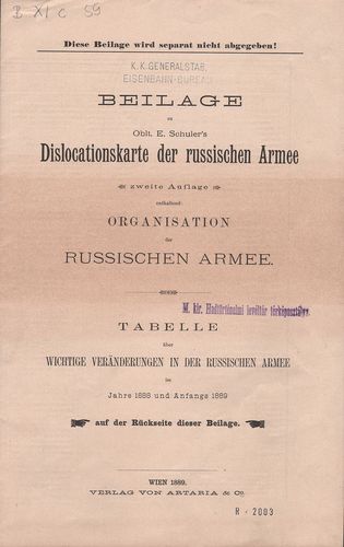
87. Dislocations-Karte der Russischen-Armee. [B XI c 57]
Institute and Museum of Military History •
B XI c
•
B XI Oroszország
•
B I–XV. Európa

| Title | Dislocations-Karte der Russischen-Armee. |
| Main title | Oroszországi hadseregek diszlokációs térképe az összegyűjtött adatok alapján 1880-ban. |
88. Drevneruszszkoe goszudarsztvo-Kkievszkaja rusz’ v IX-nacsale... [B XI c 58]
Institute and Museum of Military History •
B XI c
•
B XI Oroszország
•
B I–XV. Európa
| Title | Drevneruszszkoe goszudarsztvo-Kkievszkaja rusz’ v IX-nacsale XII v. |
89. Dislocations Karte der Russischen Heeres (im europäischen Re... [B XI c 59]
Institute and Museum of Military History •
B XI c
•
B XI Oroszország
•
B I–XV. Európa
| Title | Dislocations Karte der Russischen Heeres (im europäischen Reichstheile) nebst Tebellarischer Übersicht der Armeeverhältnisse im Frieden, in der Mobilisirung und im Kriege. |
| Main title | Mt.: Der Militär-Bezirk Warschau (Varsó katonai területe.) |
| Subject | Az Európai Oroszország hadseregének diszlokációs térképe. |
90. Die Standquartiere des Russischen Heeres im Europaeischen Re... [B XI c 60]
Institute and Museum of Military History •
B XI c
•
B XI Oroszország
•
B I–XV. Európa

| Title | Die Standquartiere des Russischen Heeres im Europaeischen Reichstheile. |
| Main title | Mt.: Kaukasus nebst Astrachan. (Kaukázus és Astrahany) |
| Subject | Az Európai Oroszország hadseregének állomáshelyei 1890-ben a vasútvonalak mellett. |
91. Friedens Dislokations-Karte der Russischen Truppen. [B XI c 61]
Institute and Museum of Military History •
B XI c
•
B XI Oroszország
•
B I–XV. Európa

| Title | Friedens Dislokations-Karte der Russischen Truppen. |
| Main title | Mt.: Kaukasus.Az oroszországi csapatoknak békebeli diszlokációs térképe 1893-ban. |
92. Béke-elhelyezés az európai Oroszországban 1912 végén. 1.-2.-... [B XI c 61/3]
Institute and Museum of Military History •
B XI c
•
B XI Oroszország
•
B I–XV. Európa

| Title | Béke-elhelyezés az európai Oroszországban 1912 végén. 1.-2.-3. mell. |
| Main title | 1. mell.: Nyugati terület. 2. mell.: Központi terület. 3 mell.: Kaukasus, (Kaukázus). |
93. Friedensdislokation im europäischen Russland. (westliche Geb... [B XI c 61/4]
Institute and Museum of Military History •
B XI c
•
B XI Oroszország
•
B I–XV. Európa

| Title | Friedensdislokation im europäischen Russland. (westliche Gebiete). Mitte – 1914. 1 mell. |
| Main title | Az Európai Oroszország békebeli haderőinek elhelyezése 1914-ben. |
94. Toplivnaja promüstlennoszt SzSzSzR. Ekonomicseszkaja ucsebna... [B XI c 62]
Institute and Museum of Military History •
B XI c
•
B XI Oroszország
•
B I–XV. Európa
| Title | Toplivnaja promüstlennoszt SzSzSzR. Ekonomicseszkaja ucsebnaja karta. |
95. Zsivotnovodsztvo SzSzSzR. Ucsebnaja karta. [B XI c 63]
Institute and Museum of Military History •
B XI c
•
B XI Oroszország
•
B I–XV. Európa
| Title | Zsivotnovodsztvo SzSzSzR. Ucsebnaja karta. |
96. General Karte vom Europaeischen Russland. [B XI c 64]
Institute and Museum of Military History •
B XI c
•
B XI Oroszország
•
B I–XV. Európa

| Title | General Karte vom Europaeischen Russland. |
| Main title | Mt.: Grundriss von St. Petersburg. (Szentpétervár–Leningrád) |
| Subject | Európai Oroszország néprajzi és települései térképe 1854-ben, a vasútvonalak kézzel berajzolva. |
97. Tehnicseszkie kulturu SzSzSzR. Ucsebnaja karta. [B XI c 65]
Institute and Museum of Military History •
B XI c
•
B XI Oroszország
•
B I–XV. Európa
| Title | Tehnicseszkie kulturu SzSzSzR. Ucsebnaja karta. |
98. Pocsvennaja karta SzSzSzR. Ucsebnaja Karta. [B XI c 66]
Institute and Museum of Military History •
B XI c
•
B XI Oroszország
•
B I–XV. Európa
| Title | Pocsvennaja karta SzSzSzR. Ucsebnaja Karta. |
99. Gospodarcza mapa Polski. [B XI c 67]
Institute and Museum of Military History •
B XI c
•
B XI Oroszország
•
B I–XV. Európa
| Title | Gospodarcza mapa Polski. |
| Main title | Lengyelország gazdasági térképe. |
100. Livland nach der Eintheilung Heinrich des Letten und zu den ... [B XI c 68]
Institute and Museum of Military History •
B XI c
•
B XI Oroszország
•
B I–XV. Európa

| Title | Livland nach der Eintheilung Heinrich des Letten und zu den Zeiten der Bischöfse u. Ordenmeister bis 1562. |
| Main title | Livonia egy részének térképe 1562-ben. |