41. Parte d’Italia che comprende lo stato Superiore di Parma, Mo... [B VII a 39/1]
Institute and Museum of Military History •
B VII a
•
B VII Olaszország
•
B I–XV. Európa
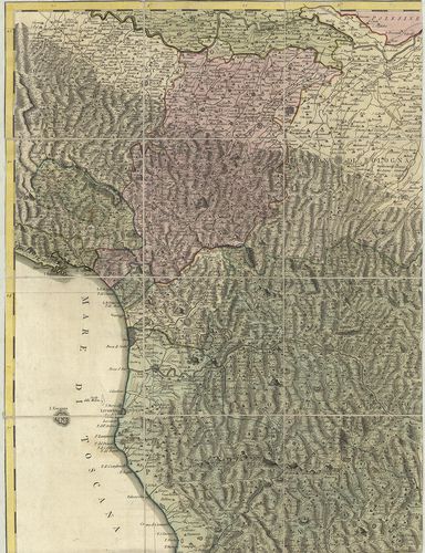
| Title | Parte d’Italia che comprende lo stato Superiore di Parma, Modena, Toscana, Bolognese e Ferrarese. – Parte D’Italia Foglio Terzo e Quarto che comprende La Campagna di Roma, Patrimonio di S. Pietro La Sabina e la Marca colle confinanti di Toscana e Regno di Napoli. |
| Main title | Mt.: L’Isola di Sardegna e Corsica. (Szardínia és Korzika.) Közép-Olaszország térképe 1790 körül. |
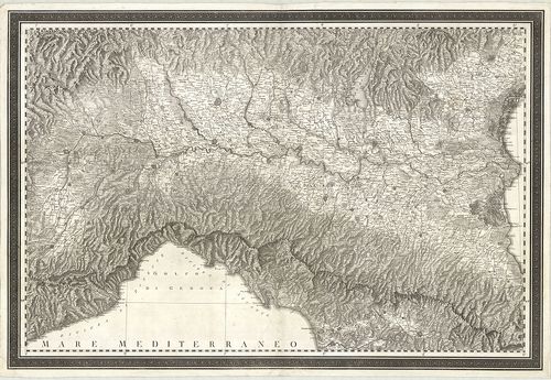
42. Topographische Carte des Königreichs Italien. Mit angränzend... [B VII a 39/3]
Institute and Museum of Military History •
B VII a
•
B VII Olaszország
•
B I–XV. Európa
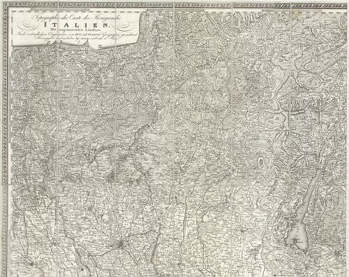
| Title | Topographische Carte des Königreichs Italien. Mit angränzenden Ländern… – Carta Topografica del Regno d’Italia’ |
| Main title | Észak-Olaszország általános térképe a 19. század elején. |
43. Carta del Territorio della Republika Cisalpina e di parte de... [B VII a 40]
Institute and Museum of Military History •
B VII a
•
B VII Olaszország
•
B I–XV. Európa
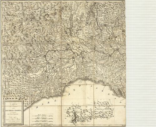
| Title | Carta del Territorio della Republika Cisalpina e di parte delli Stati Limitrofi. |
| Main title | Mt.: [Comoi-tó és az Adda folyó környéke.] |
| Subject | Észak-Olaszország: az Alpoktól D-re eső terület általános térképe 1797-ben. |
44. Carta Geografica del Territorio Trevigiano. [B VII a 41]
Institute and Museum of Military History •
B VII a
•
B VII Olaszország
•
B I–XV. Európa
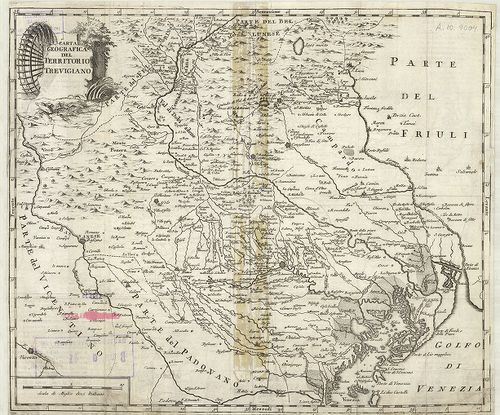
| Title | Carta Geografica del Territorio Trevigiano. |
| Main title | Treviso tartomány földrajzi térképe a 18. században. |
45. Carta del Teatro della Guerra in Italia divisa secondo i nuo... [B VII a 42]
Institute and Museum of Military History •
B VII a
•
B VII Olaszország
•
B I–XV. Európa
| Title | Carta del Teatro della Guerra in Italia divisa secondo i nuovi Confini. Metsz.: J. Müller. |
| Main title | Közép- és Észak-Olaszország térképe 1799-ben. |
46. Nuova Carta dell’ Italia settentrionale, e delle Alpi, che l... [B VII a 43]
Institute and Museum of Military History •
B VII a
•
B VII Olaszország
•
B I–XV. Európa
| Title | Nuova Carta dell’ Italia settentrionale, e delle Alpi, che la circoscrivono, formata d’ordine’ 1799. |
| Main title | Észak-Olaszország térképe 1799-ben. |
47. Carta administrativa del Regno d’Italia co suoi stabilimento... [B VII a 45]
Institute and Museum of Military History •
B VII a
•
B VII Olaszország
•
B I–XV. Európa
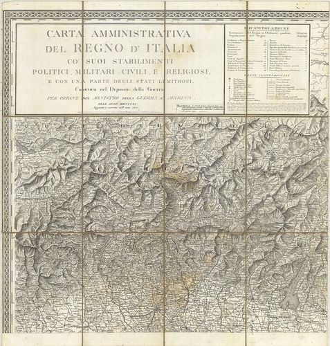
| Title | Carta administrativa del Regno d’Italia co suoi stabilimento politici, militari, civili, e religiosi… 1811. |
| Main title | Az Olasz Királyság közigazgatási térképe 1813-ban. |
48. Politische Einteilung von Oberitalien. [B VII a 45/3]
Institute and Museum of Military History •
B VII a
•
B VII Olaszország
•
B I–XV. Európa
| Title | Politische Einteilung von Oberitalien. |
| Main title | Észak-Olaszország politikai térképe 1910 körül. |
49. Carta D’Italia. [B VII a 45/51]
Institute and Museum of Military History •
B VII a
•
B VII Olaszország
•
B I–XV. Európa
| Title | Carta D’Italia. |
| Main title | Olaszország (főleg az északi rész) 1:25 000 ma. topográfiai térképe. |
50. Italia. Carta topografica delle provincie Meridionale. – Car... [B VII a 45/52]
Institute and Museum of Military History •
B VII a
•
B VII Olaszország
•
B I–XV. Európa
| Title | Italia. Carta topografica delle provincie Meridionale. – Carte della Sicilia. |
| Main title | Olaszország középső és déli részének 1:50 000 ma. topográfiai térképe. |
51. Carte d’Italia. [B VII a 45/53]
Institute and Museum of Military History •
B VII a
•
B VII Olaszország
•
B I–XV. Európa
| Title | Carte d’Italia. |
| Main title | Olaszország egyes részeinek 1:50 000 ma. topográfiai térképe. |
52. Carta Geografica e postale del Regno Lombardo – Veneto… No. ... [B VII a 47]
Institute and Museum of Military History •
B VII a
•
B VII Olaszország
•
B I–XV. Európa
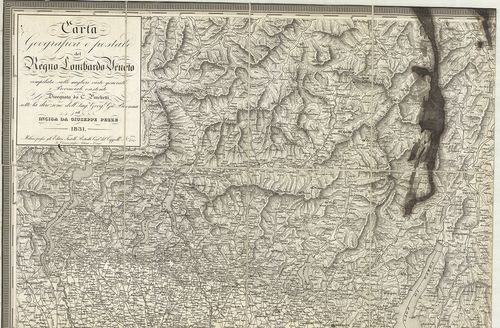
| Title | Carta Geografica e postale del Regno Lombardo – Veneto… No. 4027. |
| Main title | 17 mt.: 1. Como. 2. Pavia. 3. Lodi. 4. Bergamo. 5. Milano. 6. Sondrio. 7. Cremona. 8. Brescia. 9. Mantova. 10. Verona. 11. Vincenza. 12. Rovigo. 13. Padova. 15. Venezia. 15. Belluno. 16. Treviso. 17. Udine. |
| Subject | A Lombard-Velencei Királyság földrajzi térképe postahálózattal 1831-ben. |
53. Generalkarte des Lombardisch-Venetianischen Königreiches… – ... [B VII a 47/1]
Institute and Museum of Military History •
B VII a
•
B VII Olaszország
•
B I–XV. Európa
| Title | Generalkarte des Lombardisch-Venetianischen Königreiches… – Carte Generale del Regno Lombardo – Veneto… 1838. |
| Main title | A Lombard-Velencei Királyság általános térképe 1856-ban. |
54. Generalkarte des Lombardisch-Venetianischen Königreiches… – ... [B VII a 47/2]
Institute and Museum of Military History •
B VII a
•
B VII Olaszország
•
B I–XV. Európa
| Title | Generalkarte des Lombardisch-Venetianischen Königreiches… – Carta Generale del Regno Lombardo – Veneto… |
| Main title | A Lombard-Velencei Királyság általános térképe 1838-ban. |
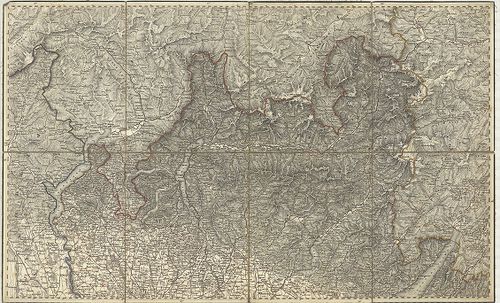
55. Carta topografica del Regno Lombardo-Veneto… Topographische ... [B VII a 48/2]
Institute and Museum of Military History •
B VII a
•
B VII Olaszország
•
B I–XV. Európa

| Title | Carta topografica del Regno Lombardo-Veneto… Topographische Karte des Lombardisch-Venetianischen Koenigreichs… |
| Main title | A Lombard-Velencei Királyság topográfiai térképe 1833-ban. |
56. Carta topografica del Regno Lombardo-Veneto… Topographische ... [B VII a 48/2]
Institute and Museum of Military History •
B VII a
•
B VII Olaszország
•
B I–XV. Európa
| Title | Carta topografica del Regno Lombardo-Veneto… Topographische Karte des Lombardisch-Venetianischen Koenigreichs… |
| Main title | A Lombard-Velencei Királyság topográfiai térképe 1856-ban. |
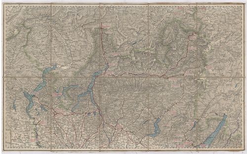
57. Topographische Karte des Lombardisch-Venezianischen Königrei... [B VII a 48/3]
Institute and Museum of Military History •
B VII a
•
B VII Olaszország
•
B I–XV. Európa
| Title | Topographische Karte des Lombardisch-Venezianischen Königreichs. Mit angränzenden Ländern. – Carta Topografica del Regno Lombardo – Veneto… |
| Main title | A Lombard- és Velencei Királyság topográfiai térképe a 19. század elején. |
58. [Felső-Olaszország: Milanó környékének általános térképe 183... [B VII a 49]
Institute and Museum of Military History •
B VII a
•
B VII Olaszország
•
B I–XV. Európa
| Title | [Felső-Olaszország: Milanó környékének általános térképe 1833–1851-ben.] |
59. G. Freytags Karte des Österreichisch-Italienischen Grenzgebi... [B VII a 50]
Institute and Museum of Military History •
B VII a
•
B VII Olaszország
•
B I–XV. Európa
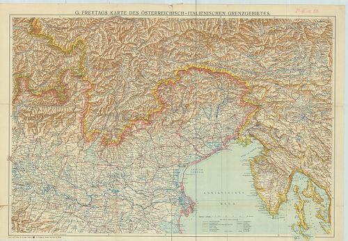
| Title | G. Freytags Karte des Österreichisch-Italienischen Grenzgebietes. |
| Main title | Az osztrák–olasz határvidék általános térképe 1910 körül. |
60. Cursus Fluminis Padi vel Po per Longobardiam… [B VII a 51]
Institute and Museum of Military History •
B VII a
•
B VII Olaszország
•
B I–XV. Európa
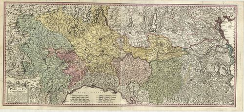
| Title | Cursus Fluminis Padi vel Po per Longobardiam… |
| Main title | Lombardia: a Pó völgyének általános térképe 1735-ben. |