161. Statvs Ecclesiastici nec non Magni Dvcatvs Toscanae nova Tab... [B VII a 373]
Institute and Museum of Military History •
B VII a
•
B VII Olaszország
•
B I–XV. Európa
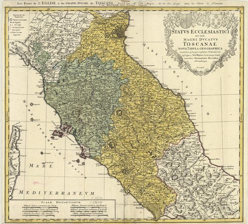
| Title | Statvs Ecclesiastici nec non Magni Dvcatvs Toscanae nova Tabvla Geographica. – Les Etats de l’Eglise et du Grand Dvche de Toscane… |
| Main title | Az Egyházi Állam és Toscana-i Nagyhercegség térképe 1748-ban. |
162. Nuova Carta Geografica dello Stato Ecclesiastico… [B VII a 377/1]
Institute and Museum of Military History •
B VII a
•
B VII Olaszország
•
B I–XV. Európa
| Title | Nuova Carta Geografica dello Stato Ecclesiastico… |
| Main title | Az Egyházi Állam földrajzi térképe 1750 körül. |
163. Lo Stato Ecclesiastico diviso nelle sue Provincie con le Reg... [B VII a 378]
Institute and Museum of Military History •
B VII a
•
B VII Olaszország
•
B I–XV. Európa
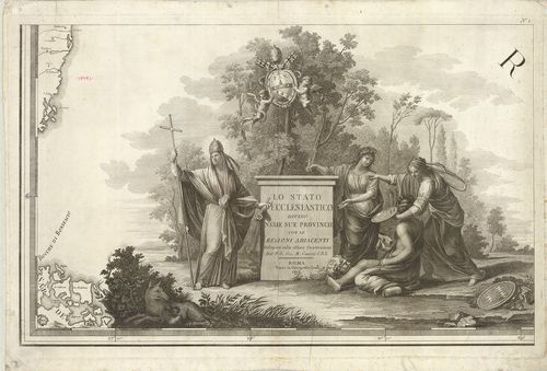
| Title | Lo Stato Ecclesiastico diviso nelle sue Provincie con le Regioni adiacenti… |
| Main title | Az Egyházi Állam térképe 1805-ben. |
164. Nuova Carta degli Stati Pontifici Meridionali. [B VII a 382]
Institute and Museum of Military History •
B VII a
•
B VII Olaszország
•
B I–XV. Európa
| Title | Nuova Carta degli Stati Pontifici Meridionali. |
| Main title | 2 mt.: 1. [Róma és környéke hegyrajza.] 2. Tavola Peutingeriana.] |
| Subject | A Pápai Állam térképe 1820-ban. |
165. Carta topografica dello Stato Pontificio e del Gran-Ducato d... [B VII a 385]
Institute and Museum of Military History •
B VII a
•
B VII Olaszország
•
B I–XV. Európa
| Title | Carta topografica dello Stato Pontificio e del Gran-Ducato di Toscana construtta sopra misure astronomico trigonometriche ed incisa sopra pietra… Topographische Karte des Kirchenstaates und des Grossherzogthunes Toscana… |
| Main title | Az Egyházi Állam és a Toscana-i Nagyhercegség topográfiai térképe 1851-ben. |
166. Legatione del Dvcato d’Vrbino con la Diocesi, e Governo di C... [B VII a 386]
Institute and Museum of Military History •
B VII a
•
B VII Olaszország
•
B I–XV. Európa
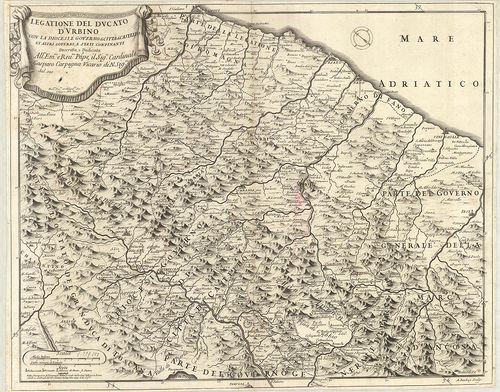
| Title | Legatione del Dvcato d’Vrbino con la Diocesi, e Governo di Citta di Castello et Attri Governi e Stati Confinanti. |
| Main title | Urbino hercegség és a környező egyházmegyék térképe 1697-ben. |
167. La Marca Anconitana, e Fermana… [B VII a 388]
Institute and Museum of Military History •
B VII a
•
B VII Olaszország
•
B I–XV. Európa
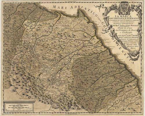
| Title | La Marca Anconitana, e Fermana… |
| Main title | Le Marche tartomány: Ancona és Fermo megyék térképe a határos részekkel 1711-ben. |
168. Il Lazio con le sue piu Cospicue Strade Antiche e Moderne e ... [B VII a 391]
Institute and Museum of Military History •
B VII a
•
B VII Olaszország
•
B I–XV. Európa
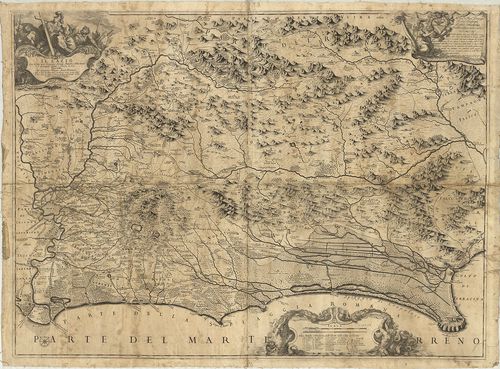
| Title | Il Lazio con le sue piu Cospicue Strade Antiche e Moderne e principali Casali, e Tenute di esso… |
| Main title | Lazio tartomány térképe 1693-ban hálózattal. |
169. Carta del Patrimonio de S.[an] Pietro. [B VII a 394/2]
Institute and Museum of Military History •
B VII a
•
B VII Olaszország
•
B I–XV. Európa
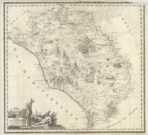
| Title | Carta del Patrimonio de S.[an] Pietro. |
| Main title | Az Egyházi Állam térképe 1802-ben. |
170. Tavola generale della Provincia dell’ Umbria… [B VII a 397]
Institute and Museum of Military History •
B VII a
•
B VII Olaszország
•
B I–XV. Európa
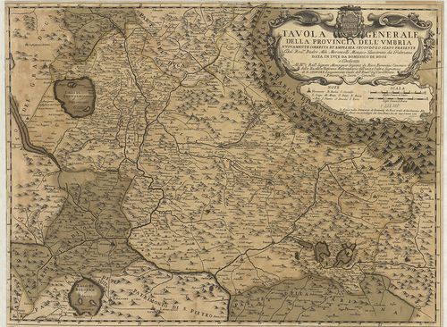
| Title | Tavola generale della Provincia dell’ Umbria… |
| Main title | Umbria tartomány általános térképe 1712-ben. |
171. Carta del Territorio d’Orvieto e Territorio di Pervgia [B VII a 397/2]
Institute and Museum of Military History •
B VII a
•
B VII Olaszország
•
B I–XV. Európa
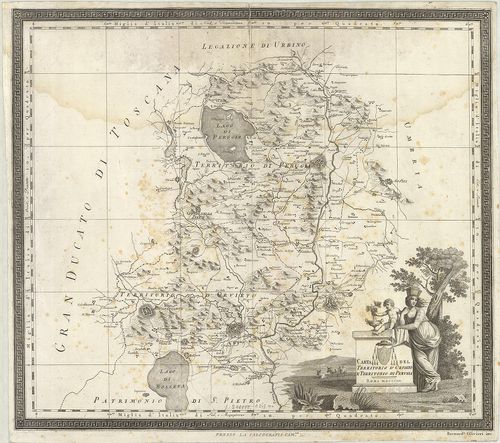
| Title | Carta del Territorio d’Orvieto e Territorio di Pervgia |
| Main title | Orvieto járás és Perugia tartomány környékének térképe 1803-ban. |
172. Carta della provincia della Lunigiana. B. A. W. H. XLV. Th. ... [B VII a 398]
Institute and Museum of Military History •
B VII a
•
B VII Olaszország
•
B I–XV. Európa
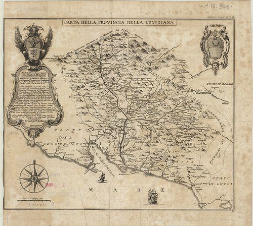
| Title | Carta della provincia della Lunigiana. B. A. W. H. XLV. Th. N. Z. XXVII. Th. |
| Main title | Lunigiana tartomány térképe 1759-ben. |
173. Carta del Regno di Napoli. [B VII a 403/2]
Institute and Museum of Military History •
B VII a
•
B VII Olaszország
•
B I–XV. Európa
| Title | Carta del Regno di Napoli. |
| Main title | Nápoly Királyság térképe 1807-ben. |
174. Carta topografica del Monte Vesuvio. [B VII a 404/5]
Institute and Museum of Military History •
B VII a
•
B VII Olaszország
•
B I–XV. Európa
| Title | Carta topografica del Monte Vesuvio. |
| Main title | Vezúv és környékének topográfiai térképe 1875–76-ban. |
175. General-Karte von dem Koenigreiche Neapel, … [B VII a 406]
Institute and Museum of Military History •
B VII a
•
B VII Olaszország
•
B I–XV. Európa
| Title | General-Karte von dem Koenigreiche Neapel, … |
| Main title | A Nápolyi Királyság általános térképe 1806 körül. |
176. General-Karte von dem Koenigreiche Neapel, in 4 Blättern… mi... [B VII a 406]
Institute and Museum of Military History •
B VII a
•
B VII Olaszország
•
B I–XV. Európa
| Title | General-Karte von dem Koenigreiche Neapel, in 4 Blättern… mit Vermehrung der Strassen und Anzeige der Posten… |
| Main title | A Nápolyi Királyság általános térképe 1820-ban. |
177. Atlante del Regno di Napoli. [B VII a 407]
Institute and Museum of Military History •
B VII a
•
B VII Olaszország
•
B I–XV. Európa
| Title | Atlante del Regno di Napoli. |
| Main title | A Nápolyi Királyság általános térképe 1821 körül. |
178. Carta delle Province Napolitane in Fogli 25 Fotoincisa col p... [B VII a 407/1]
Institute and Museum of Military History •
B VII a
•
B VII Olaszország
•
B I–XV. Európa
| Title | Carta delle Province Napolitane in Fogli 25 Fotoincisa col procedimento del generale Avet. |
| Main title | Nápoly tartomány térképe 1874-ben. |
179. [A Nápolyi Királyság térképe.] [B VII a 408]
Institute and Museum of Military History •
B VII a
•
B VII Olaszország
•
B I–XV. Európa
| Title | [A Nápolyi Királyság térképe.] |
180. Isola d’Ischia, Procida, Vivara. Nr. 4. [B VII a 409]
Institute and Museum of Military History •
B VII a
•
B VII Olaszország
•
B I–XV. Európa
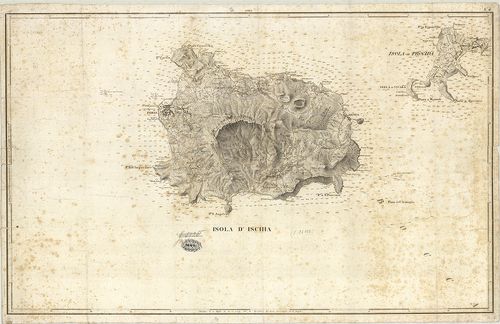
| Title | Isola d’Ischia, Procida, Vivara. Nr. 4. |
| Main title | Ischia, Procida és Vivara szigetek térképe 1820 körül. |