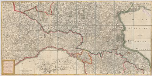
301. Strassen Karte des Lombardisch-Venezianischen Koenigreiches.... [B VII c 43]
Institute and Museum of Military History •
B VII c
•
B VII Olaszország
•
B I–XV. Európa
| Title | Strassen Karte des Lombardisch-Venezianischen Koenigreiches. – Gouvernement Venedig. |
| Main title | A Velencei Kormányzóság úttérképe. |
302. Carta Itineraria del Regno Lombardo-Veneto indicante tutte l... [B VII c 46]
Institute and Museum of Military History •
B VII c
•
B VII Olaszország
•
B I–XV. Európa
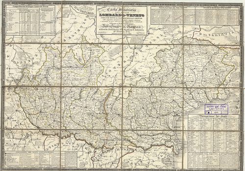
| Title | Carta Itineraria del Regno Lombardo-Veneto indicante tutte le stazioni postali e militari… |
| Main title | A Lombard-Velencei Királyság úttérképe 1832-ben a postai és katonai állomások feltüntetésével. |
303. Carta Postale e Stradale dell’ Italia. [B VII c 47]
Institute and Museum of Military History •
B VII c
•
B VII Olaszország
•
B I–XV. Európa
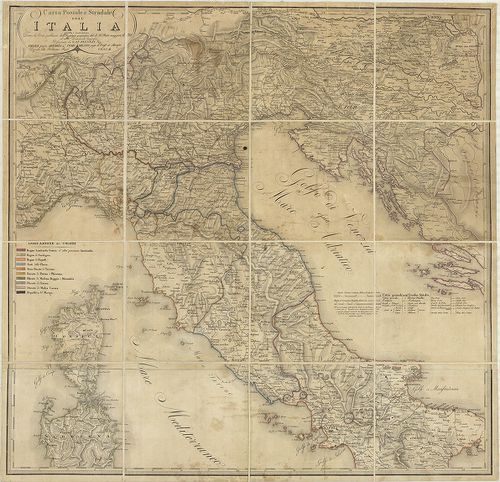
| Title | Carta Postale e Stradale dell’ Italia. |
| Main title | Olaszország északi és középső részének posta és úttérképe. |
304. Carta stradale e postale dell’Italia. 1852. [B VII c 48]
Institute and Museum of Military History •
B VII c
•
B VII Olaszország
•
B I–XV. Európa
| Title | Carta stradale e postale dell’Italia. 1852. |
| Main title | Mt.: Itinerario postale dell’Italia coll’ indicazione delle vie percorse dai vapori (Olaszország posta útjai és hajóútvonalai a távolság feltüntetésével)- |
| Subject | Olaszország út és postatérképe tartományhatárokkal 1859-ben. |
305. Carta stradale e postale dell’ Italia. [B VII c 49]
Institute and Museum of Military History •
B VII c
•
B VII Olaszország
•
B I–XV. Európa
| Title | Carta stradale e postale dell’ Italia. |
| Main title | Mt.: Itinerario postale dell’Italia coll’ indicazione delle vie percorse dai vapori (Olaszország postaútjai és hajóútvonalai a távolság feltüntetésével). |
| Subject | Olaszország út- és postatérképe tartományhatárokkal 1849-ben. |
306. Carta postale ed itineraria dell’ Italia. [B VII c 51]
Institute and Museum of Military History •
B VII c
•
B VII Olaszország
•
B I–XV. Európa
| Title | Carta postale ed itineraria dell’ Italia. |
| Main title | Olaszország északi részének posta és úttérképe 1838-ban. |
307. Routenskelett. Beilage 1. [B VII c 52]
Institute and Museum of Military History •
B VII c
•
B VII Olaszország
•
B I–XV. Európa
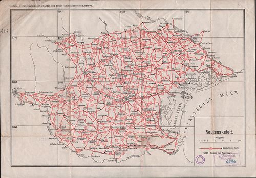
| Title | Routenskelett. Beilage 1. |
| Main title | Az osztrák–olasz határvidék úttérképének áttekintő hálózata 1910 körül. |
308. Carta postale ed itineraria d’Italia. [B VII c 54]
Institute and Museum of Military History •
B VII c
•
B VII Olaszország
•
B I–XV. Európa
| Title | Carta postale ed itineraria d’Italia. |
| Main title | Mt.: Movimento generale de paccheboti a vapore (Személy és áruszállítás a Földközi tengeren). |
| Subject | Olaszország út- és postatérképe. |
309. Carta stradale dell’Italia. [B VII c 55]
Institute and Museum of Military History •
B VII c
•
B VII Olaszország
•
B I–XV. Európa
| Title | Carta stradale dell’Italia. |
| Main title | Olaszország úttérképe 1856-ban. |
310. Strassen-Karte des Lombardisch-Venezianischen Koenigreiches.... [B VII c 57]
Institute and Museum of Military History •
B VII c
•
B VII Olaszország
•
B I–XV. Európa
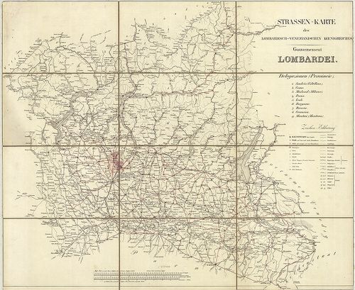
| Title | Strassen-Karte des Lombardisch-Venezianischen Koenigreiches. – Gouvernement Lombardei. |
| Main title | A Lombard Kormányzóság úttérképe. |
311. Atlante stradale d’Italia del Touring Club Italiano. VII. [B VII c 58]
Institute and Museum of Military History •
B VII c
•
B VII Olaszország
•
B I–XV. Európa

| Title | Atlante stradale d’Italia del Touring Club Italiano. VII. |
| Main title | Korzika és Szárdinia úttérképe. |
312. Schematische Telegraphen- und Telephonkarte Norditaliens… [B VII c 61/2]
Institute and Museum of Military History •
B VII c
•
B VII Olaszország
•
B I–XV. Európa
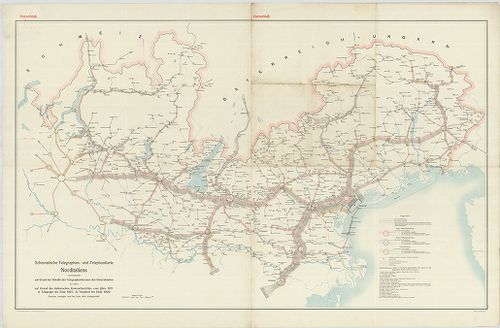
| Title | Schematische Telegraphen- und Telephonkarte Norditaliens… |
| Main title | Észak-Olaszország távíró és telefonhálózata 1911 körül. |
313. Etat de la maison d’Autriche en Italie D’aprés le Traité de ... [B VII c 74]
Institute and Museum of Military History •
B VII c
•
B VII Olaszország
•
B I–XV. Európa
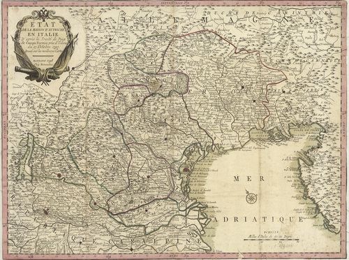
| Title | Etat de la maison d’Autriche en Italie D’aprés le Traité de Paix de Campo Formio prés d’Udine du 17. Octobre 1797. |
| Main title | Olaszország: Ausztria tartománya a Campoformioi békeszerződés után 1797-ben. |
314. Nuova Carta dei Stati della Casa d’Austria in Italia dopo il... [B VII c 75]
Institute and Museum of Military History •
B VII c
•
B VII Olaszország
•
B I–XV. Európa
| Title | Nuova Carta dei Stati della Casa d’Austria in Italia dopo il trattato di pace di Luneville. |
| Main title | Olaszország: Ausztria tartományai a Lunevillei békeszerződés (1801) megkötése után. |
315. Italia divisa né suoi presenti Confini. [B VII c 76]
Institute and Museum of Military History •
B VII c
•
B VII Olaszország
•
B I–XV. Európa
| Title | Italia divisa né suoi presenti Confini. |
| Main title | Olaszország térképe 1806-ban úthálózattal. |
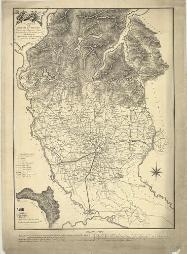
316. Tipo di esecuzone del confine Milanese col Cremasco da Carav... [B VII c 81]
Institute and Museum of Military History •
B VII c
•
B VII Olaszország
•
B I–XV. Európa
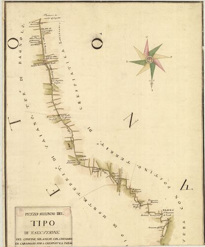
| Title | Tipo di esecuzone del confine Milanese col Cremasco da Caravaggio sino a crespiatica inclusi voluto dal trattaro di Mantova. |
| Main title | Milanó és Crema tartomány határtérképe az 1756-ban Mantovában kötött szerződés alapján. |
317. Drevnjaja Italija. [B VII c 83]
Institute and Museum of Military History •
B VII c
•
B VII Olaszország
•
B I–XV. Európa
| Title | Drevnjaja Italija. |
| Main title | Az Ókori-Olaszország történelmi térképe az i. e. V. században. |
318. Drevnjaja Italija. [B VII c 83/1]
Institute and Museum of Military History •
B VII c
•
B VII Olaszország
•
B I–XV. Európa
| Title | Drevnjaja Italija. |
| Main title | Mt.: Osznovanie Rima (Róma alapítása). |
| Subject | Az Ó-kori Olaszország térképe. |
319. [A Mincio folyó Valeggio és Monzambano közötti szakaszának t... [B VII c 126/1]
Institute and Museum of Military History •
B VII c
•
B VII Olaszország
•
B I–XV. Európa
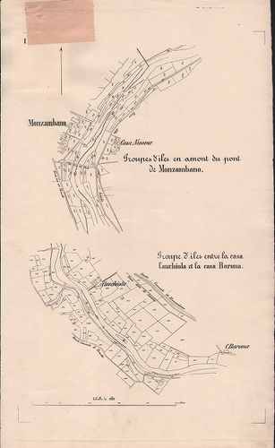
| Title | [A Mincio folyó Valeggio és Monzambano közötti szakaszának térképe.] |
320. Gea-Karte von Oberitalien und den Nachbargebieten. [B VII c 129]
Institute and Museum of Military History •
B VII c
•
B VII Olaszország
•
B I–XV. Európa

| Title | Gea-Karte von Oberitalien und den Nachbargebieten. |
| Main title | Felső-Olaszország a szomszédos országokkal 1910 körül úthálózattal. |
321. Olasz–francia határvidék. [B VII c 140]
Institute and Museum of Military History •
B VII c
•
B VII Olaszország
•
B I–XV. Európa

| Title | Olasz–francia határvidék. |
322. Italienisch-österreichisches Grenzgebiet. Flemmings Kriegska... [B VII c 141]
Institute and Museum of Military History •
B VII c
•
B VII Olaszország
•
B I–XV. Európa

| Title | Italienisch-österreichisches Grenzgebiet. Flemmings Kriegskarte No. 21. |
| Main title | Az olasz–osztrák határvidék. |
323. Nuova Carta del teatro della guerra in Italia. [B VII c 176]
Institute and Museum of Military History •
B VII c
•
B VII Olaszország
•
B I–XV. Európa
| Title | Nuova Carta del teatro della guerra in Italia. |
| Main title | Észak-Olaszországi hadszíntér térképe 1813-ban. |
324. Carta degli Stati di S. M. il Re di Sardegna e parte de paes... [B VII c 177]
Institute and Museum of Military History •
B VII c
•
B VII Olaszország
•
B I–XV. Európa
| Title | Carta degli Stati di S. M. il Re di Sardegna e parte de paesi ad essi confinanti Rettificata nella Regia Topografia… |
| Main title | Mt.: Isola del Regno di Sardegna (Szardinia). |
| Subject | A Szadiniai Királyság Piemonte részének térképe a határos területekkel 1800-ban. |
325. Carta degli Stati di S. M. il Re di Sardegna e parte de paes... [B VII c 177/1]
Institute and Museum of Military History •
B VII c
•
B VII Olaszország
•
B I–XV. Európa
| Title | Carta degli Stati di S. M. il Re di Sardegna e parte de paesi ad essi confinanti Rettificata nella Regia Topografia… |
| Main title | Mt.: Isola del Regno di Sardegna. (Szardinia) nevezetesebb csatahelyek felsorolásával. |
| Subject | A Szardiniai Királyság Piemonte részének térképe a határos területekkel 1790-es években. |
326. Carta militare dell’Italia. [B VII c 178]
Institute and Museum of Military History •
B VII c
•
B VII Olaszország
•
B I–XV. Európa
| Title | Carta militare dell’Italia. |
| Main title | Olaszország katonai térképe 1800 körül úthálózattal. |
327. Carta delle Stazioni militari i Italia. [B VII c 179]
Institute and Museum of Military History •
B VII c
•
B VII Olaszország
•
B I–XV. Európa
| Title | Carta delle Stazioni militari i Italia. |
| Main title | Olaszország katonai állomáshelyeinek térképe 1804-ben. |
328. Carta delle stazioni militari in Italia ed in Dalmazia. 1805... [B VII c 180]
Institute and Museum of Military History •
B VII c
•
B VII Olaszország
•
B I–XV. Európa
| Title | Carta delle stazioni militari in Italia ed in Dalmazia. 1805. |
| Main title | Olaszország és Dalmácia katonai állomáshelyei 1806-ban. |
329. Carta militare del regno d’Eturia e del principato di Lucca. [B VII c 181]
Institute and Museum of Military History •
B VII c
•
B VII Olaszország
•
B I–XV. Európa
| Title | Carta militare del regno d’Eturia e del principato di Lucca. |
| Main title | A Toscanai Királyság és a Lucca Hercegség katonai térképe 1806-ban úthálózattal. |
330. Carta delle stazioni militari navigazione, e poste del regno... [B VII c 182]
Institute and Museum of Military History •
B VII c
•
B VII Olaszország
•
B I–XV. Európa
| Title | Carta delle stazioni militari navigazione, e poste del regno d’Italia. |
| Main title | 2 mt.: 1. Dalmazia. 2. [Olaszország Középső- és D-i része.] |
| Subject | Az Olasz Királyság katonai kikötői és postaállomásai 1810-ben. |
331. Carta degl’ itinerari militari da Bologna a tutto il Regno d... [B VII c 183]
Institute and Museum of Military History •
B VII c
•
B VII Olaszország
•
B I–XV. Európa
| Title | Carta degl’ itinerari militari da Bologna a tutto il Regno di Napoli. |
| Main title | Olaszország katonai útvonalai Bolognától a Nápolyi Királyságig 1809-ben. |
332. Militair Routen in Italien. [B VII c 184]
Institute and Museum of Military History •
B VII c
•
B VII Olaszország
•
B I–XV. Európa
| Title | Militair Routen in Italien. |
| Main title | Olaszország katonai úttérképe 1800 körül. |
333. Carta delle poste e stazioni militari per le provincie d’Ita... [B VII c 185]
Institute and Museum of Military History •
B VII c
•
B VII Olaszország
•
B I–XV. Európa
| Title | Carta delle poste e stazioni militari per le provincie d’Italia tanto Austriache che Estere con parte dei paesi limitrofi. – Post und Marschkarte für di Oestreichischen und die fremden Italianischen provinzen nebst Theilen der angränzenden Länder. |
| Main title | Olaszország és a határos területek posta és katonai állomáshelyeinek térképe 1820-ban. |
334. Ober und Mittel Italien. [B VII c 186/1]
Institute and Museum of Military History •
B VII c
•
B VII Olaszország
•
B I–XV. Európa
| Title | Ober und Mittel Italien. |
| Main title | Mt.: Umgebung von Rom (Róma környéke). |
| Subject | Olaszország felső és középső része 1851-ben. |
335. Ober und mittel Italien. [B VII c 186/2]
Institute and Museum of Military History •
B VII c
•
B VII Olaszország
•
B I–XV. Európa
| Title | Ober und mittel Italien. |
| Main title | Mt.: Umgebung von Rom (Róma környéke). |
| Subject | Olaszország felső és középső része 1853-ban. |
336. Carta delle provincie meridionali d’ Italia indicante le tap... [B VII c 188]
Institute and Museum of Military History •
B VII c
•
B VII Olaszország
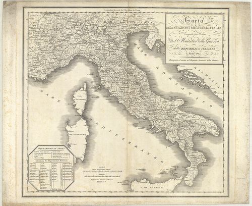
•
B I–XV. Európa
| Title | Carta delle provincie meridionali d’ Italia indicante le tappe militari ed i rilievi postali. |
| Main title | Olaszország déli tartományainak katonai és postatérképe 1861-ben. |
337. Circoscrizione militare territoriale del Regno d’Italia. [B VII c 191]
Institute and Museum of Military History •
B VII c
•
B VII Olaszország
•
B I–XV. Európa

| Title | Circoscrizione militare territoriale del Regno d’Italia. |
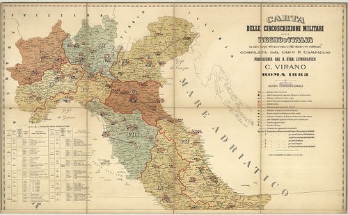
| Main title | Az Olasz Királyság katonai körzeti beosztása 1877 márciusában. |
338. Carta dimostrativa delle circoscrizioni militari del regno D... [B VII c 192]
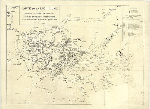
Institute and Museum of Military History •
B VII c
•
B VII Olaszország
•
B I–XV. Európa

| Title | Carta dimostrativa delle circoscrizioni militari del regno D’Italia. |
| Main title | Az Olasz Királyság katonai körzeti beosztása 1879-ben. |
339. Carta delle circoscrizioni militari del Regno d’Italia… [B VII c 193]
Institute and Museum of Military History •
B VII c
•
B VII Olaszország
•
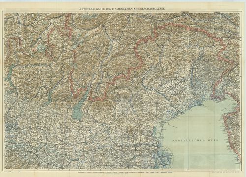
B I–XV. Európa
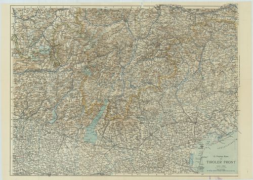
| Title | Carta delle circoscrizioni militari del Regno d’Italia… |
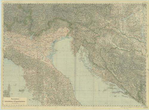
| Main title | Az Olasz Királyság katonai körzeteinek térképe 1883-ban. |
340. Carta della circoscrizione militare territoriale del Regno 1... [B VII c 194]
Institute and Museum of Military History •
B VII c
•
B VII Olaszország
•
B I–XV. Európa
| Title | Carta della circoscrizione militare territoriale del Regno 1883. |
| Main title | Az Olasz Krályság katonai körzeti beosztása 1883 júliusában. |
341. Carte de la Lombardie et de la Province de Novare (Piémont) ... [B VII c 195]
Institute and Museum of Military History •
B VII c
•
B VII Olaszország
•
B I–XV. Európa
| Title | Carte de la Lombardie et de la Province de Novare (Piémont) avec les principales installations et canalisations électriques primaires. |
| Main title | Lombardia és Novara (Piemonte) tartomány elektromos vezetékhálózata 1930 körül. |
342. Dislocations-Karte der Italienischen Armee… im Frieden und i... [B VII c 196]
Institute and Museum of Military History •
B VII c
•
B VII Olaszország
•
B I–XV. Európa
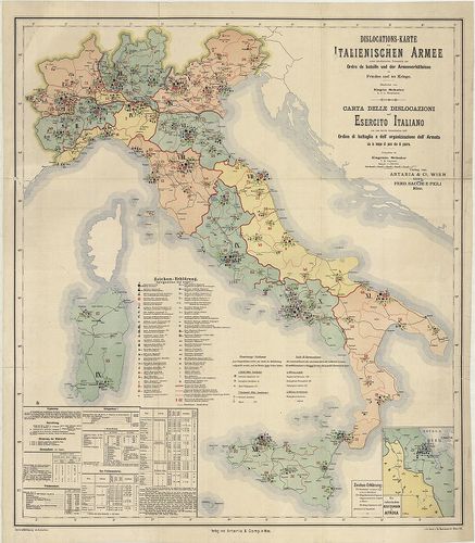
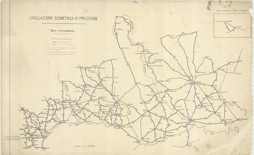
| Title | Dislocations-Karte der Italienischen Armee… im Frieden und im Kriege. – Karta delle dislocazioni dell’ Esercito Italiano … sia in tempo di pace che di guerra. |
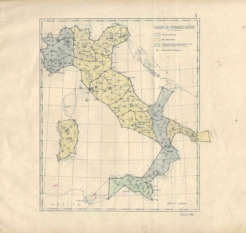
| Main title | Mt.: Die Italienischen Besitzungen in Afrika (Massaua: olasz telepek Afrikában). |
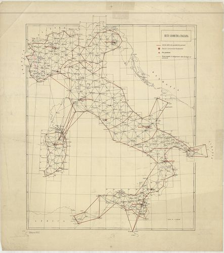
| Subject | Az olasz hadsereg diszlokációs térképe háborúban és békében 1891-ben. |
343. Italien. Friedens-Dislocation der Italienischen Armee 1893. [B VII c 196/1]
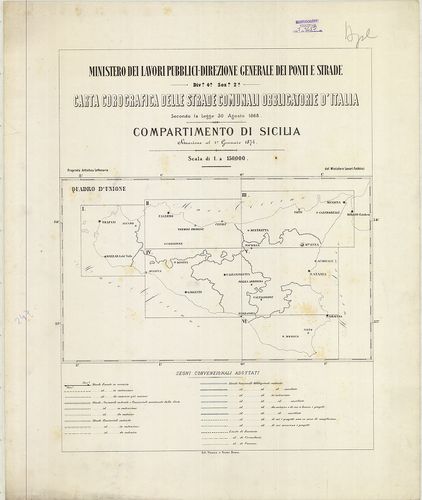
Institute and Museum of Military History •
B VII c
•
B VII Olaszország
•
B I–XV. Európa
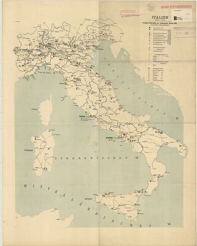
| Title | Italien. Friedens-Dislocation der Italienischen Armee 1893. |
| Main title | Olaszország: az olasz hadsereg békeidőbeli diszlokációs térképe 1893-ban. |
344. Dislokation der italienischen Gebirgstruppen im Sommer 1909. [B VII c 196/4]
Institute and Museum of Military History •
B VII c
•
B VII Olaszország
•
B I–XV. Európa
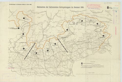
| Title | Dislokation der italienischen Gebirgstruppen im Sommer 1909. |
| Main title | Észak-Olaszország: a hegyi alakulatok diszlokációs térképe 1909 nyarán. |
345. Friedensdislokation der italienischen Armee. Frühjahr 1912. [B VII c 196/5]
Institute and Museum of Military History •
B VII c
•
B VII Olaszország
•
B I–XV. Európa
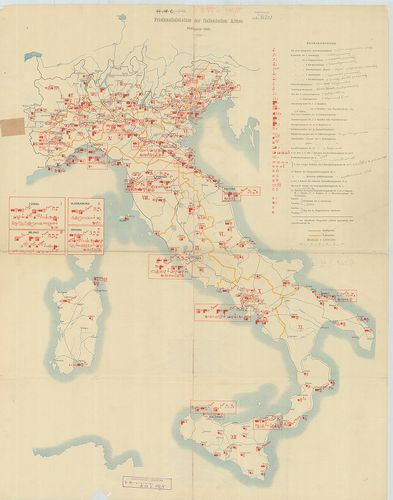
| Title | Friedensdislokation der italienischen Armee. Frühjahr 1912. |
| Main title | Olaszország: az olasz hadsereg békebeli elhelyezésének térképe 1912. tavaszán. |
346. Diocesi Padovana con tutta la sua estensione ne vicini terri... [B VII c 197]
Institute and Museum of Military History •
B VII c
•
B VII Olaszország
•
B I–XV. Európa

| Title | Diocesi Padovana con tutta la sua estensione ne vicini territori. |
| Main title | A Padovai egyházmegye és a szomszédos területek egy részének térképe 1720-ban. |
347. Carta della diocesi di Milano. Divisa in Regioni e Pievi. [B VII c 197/1]
Institute and Museum of Military History •
B VII c
•
B VII Olaszország
•
B I–XV. Európa
| Title | Carta della diocesi di Milano. Divisa in Regioni e Pievi. |
| Main title | A Milánói egyházmegye térképe 1800 körül. |
348. Rivista Mensile del Touring Club Italiano. Carta della guerr... [B VII c 198]
Institute and Museum of Military History •
B VII c
•
B VII Olaszország
•
B I–XV. Európa
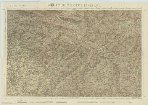
| Title | Rivista Mensile del Touring Club Italiano. Carta della guerra. Febbraio 1917. |
| Main title | F. 15. Udine-Tolmino. F. 16. Lubiana. F. 19. Gorozia-Trieste. F. 20. Adelsberg (Postojna). |
| Subject | Olaszország úthálózati térképe 1917-ben. |
349. Carte générale d’Italie pour servir á l’intelligence des opé... [B VII c 199]
Institute and Museum of Military History •
B VII c
•
B VII Olaszország
•
B I–XV. Európa
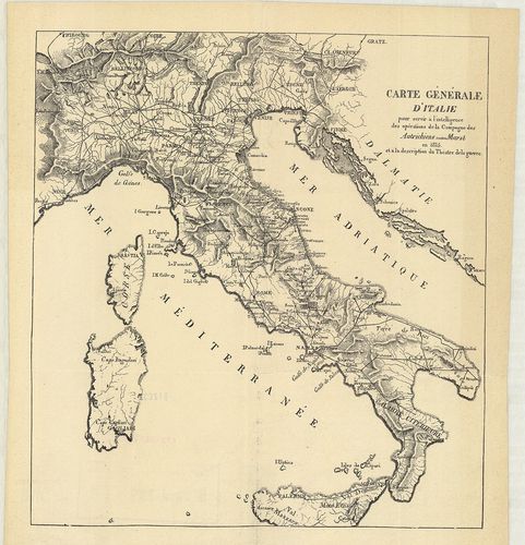
| Title | Carte générale d’Italie pour servir á l’intelligence des opérations de la Campagne des Autrichiens contre Murat en 1815 et á la description du Théatre de la guerre. |
| Main title | Olaszországi általános térképe úthálózattal, és az 1815. évi osztrák csapatok és Murat nápolyi király között lezajlott csata színhelye. |
350. Tirol u[nd] Oberitalien. Ravensteins Kriegskarte. Nr. 45. [B VII c 200]
Institute and Museum of Military History •
B VII c
•
B VII Olaszország
•
B I–XV. Európa
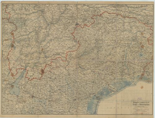
| Title | Tirol u[nd] Oberitalien. Ravensteins Kriegskarte. Nr. 45. |
| Main title | Tirol és Felső-Olaszország általános térképe 1910 körül, úthálózattal. |
351. Italienisch-Oesterreichischer Kriegsschauplatz. Flemmings Kr... [B VII c 200/1]
Institute and Museum of Military History •
B VII c
•
B VII Olaszország
•
B I–XV. Európa
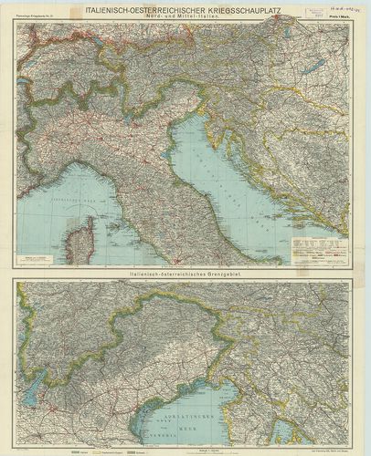
| Title | Italienisch-Oesterreichischer Kriegsschauplatz. Flemmings Kriegskarte Nr. 21. 2 térk. egy lapon: 1. Nord- und Mittel-Italien. |
| Main title | (Észak- és Közép-Olaszország.) 2. Italienisch-österreichisches Grenzgebiet. |
| Subject | Olasz–osztrák határvidék.) |
352. Operationskarte von Oberitalien zum Feldzuge 1866. [B VII c 201]
Institute and Museum of Military History •
B VII c
•
B VII Olaszország
•
B I–XV. Európa
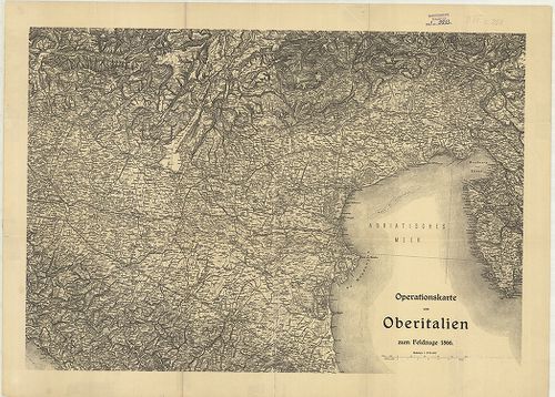
| Title | Operationskarte von Oberitalien zum Feldzuge 1866. |
| Main title | Felső-Olaszország hadműveleti térképe az 1866. évi hadjárathoz. |
353. Hadműveleti térkép Felső-Olaszországról az 1866. évi hadjára... [B VII c 201/1]
Institute and Museum of Military History •
B VII c
•
B VII Olaszország
•
B I–XV. Európa
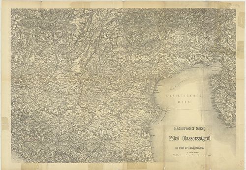
| Title | Hadműveleti térkép Felső-Olaszországról az 1866. évi hadjárathoz. |
354. G. Freytags Karte der Isonzofront. – Tiroler, Kärntner und I... [B VII c 202]
Institute and Museum of Military History •
B VII c
•
B VII Olaszország
•
B I–XV. Európa
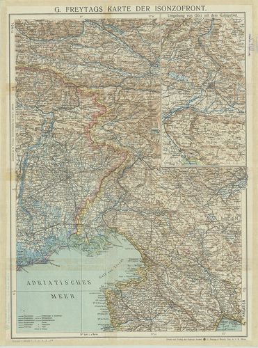
| Title | G. Freytags Karte der Isonzofront. – Tiroler, Kärntner und Isonzo-Front. |
| Main title | Mt.: Umgebung von Görz mit dem Karstgebiet (Gorizia környéke a Karszt vidékkel). |
| Subject | Karintiai és az Isonzo front térképe 1916 körül. |
355. G. Freytags Karte des Italienischen Kriegsschauplatzes. [B VII c 202/1]
Institute and Museum of Military History •
B VII c
•
B VII Olaszország
•
B I–XV. Európa
| Title | G. Freytags Karte des Italienischen Kriegsschauplatzes. |
| Main title | Az olasz hadszíntér térképe. |
356. G. Freytags Karte der Tiroler Front. [B VII c 202/2]
Institute and Museum of Military History •
B VII c
•
B VII Olaszország
•
B I–XV. Európa
| Title | G. Freytags Karte der Tiroler Front. |
| Main title | Olaszország: a tiroli hadszíntér térképe 1916 körül. |
357. Neue Generalkarte des südwestlichen Kriegsschauplatzes. West... [B VII c 203]
Institute and Museum of Military History •
B VII c
•
B VII Olaszország
•
B I–XV. Európa
| Title | Neue Generalkarte des südwestlichen Kriegsschauplatzes. Westliches Blatt. (Tiroler-Front). Lechners Kriegskarten XVIII. |
| Main title | A délnyugati hadszíntér - tiroli hadszíntér - térképe 1916–17-ben. |
358. Neu Generalkarte des südwestlichen Kriegsschauplatzes. Östli... [B VII c 203/1]
Institute and Museum of Military History •
B VII c
•
B VII Olaszország
•
B I–XV. Európa
| Title | Neu Generalkarte des südwestlichen Kriegsschauplatzes. Östliches Blatt. (Isonzo-Front.) Lechners Kriegskarten XIX. |
| Main title | A Délnyugati hadszíntér - Isonzo-front térképe 1916–17-ben. |
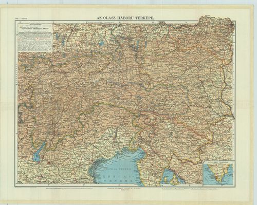
359. Az olasz háború térképe. [B VII c 203/2]
Institute and Museum of Military History •
B VII c
•
B VII Olaszország
•
B I–XV. Európa
| Title | Az olasz háború térképe. |
360. Special-Karte des Kriegsschauplatzes in Sardinien. – Special... [B VII c 204]
Institute and Museum of Military History •
B VII c
•
B VII Olaszország
•
B I–XV. Európa
| Title | Special-Karte des Kriegsschauplatzes in Sardinien. – Special Map of the seat of war in Sardinia. |
| Main title | 2 mt.: 1. Plänen der Umgebungen Alessandria. (Alessandria környéke.) 2. Plänen der Umgebungen Casale. (Casale Monferrato környéke.)A Szardiniai Királyság (Piemonte) hadszíntér térképe 1850 körül. |
361. Italienischer Kriegsschauplatz. [B VII c 205]
Institute and Museum of Military History •
B VII c
•
B VII Olaszország
•
B I–XV. Európa
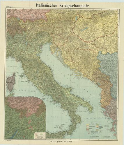
| Title | Italienischer Kriegsschauplatz. |
| Main title | Mt.: Sprachenkarte von Südtirol (Dél-Tirol nyelvjárásai). |
| Subject | Az olasz hadszíntér térképe 1917 körül. |
362. Olaszország háborús térképe. Rózsavölgyi térképek. 9. [B VII c 206]
Institute and Museum of Military History •
B VII c
•
B VII Olaszország
•
B I–XV. Európa
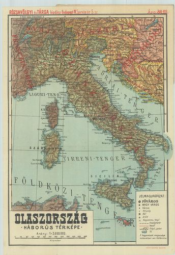
| Title | Olaszország háborús térképe. Rózsavölgyi térképek. 9. |
363. Lechner’s Übersichtskarte des südwestlichen Kriegsschauplatz... [B VII c 207]
Institute and Museum of Military History •
B VII c
•
B VII Olaszország
•
B I–XV. Európa
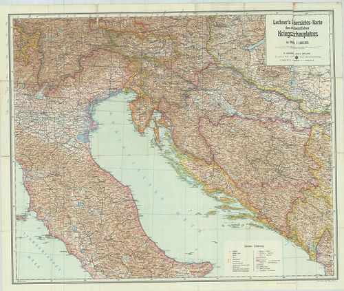
| Title | Lechner’s Übersichtskarte des südwestlichen Kriegsschauplatzes. – Lechners Kriegskarte XI. |
| Main title | A délnyugati hadszíntér áttekintő térképe 1915-ben. |
364. G. Freytag Karte der Kärntner und Isonzo-Front. – Karte der ... [B VII c 208]
Institute and Museum of Military History •
B VII c
•
B VII Olaszország
•
B I–XV. Európa
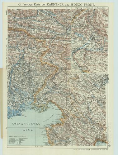
| Title | G. Freytag Karte der Kärntner und Isonzo-Front. – Karte der Isonzo-Front. |
| Main title | Mt.: Umgebung von Görz mit dem Karstgebiet. (Gorizia és a Karszt-vidék térképe.)Az Isonzo-front és Karintia térképe úthálózattal 1917 körül. |
365. Übersichtskarte des südwestlichen Kriegsschauplatzes. – Über... [B VII c 209]
Institute and Museum of Military History •
B VII c
•
B VII Olaszország
•
B I–XV. Európa
| Title | Übersichtskarte des südwestlichen Kriegsschauplatzes. – Übersichtskarte der österreich–italienischen Grenzgebiete. Lechners Kriegskarten X. |
| Main title | A délnyugati hadszíntér – osztrák–olasz határvidék - térképe 1915-ben. |
366. G. Freytags Karte des Österreichisch–Italienischen Grenzgebi... [B VII c 209/1]
Institute and Museum of Military History •
B VII c
•
B VII Olaszország
•
B I–XV. Európa
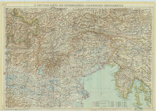
| Title | G. Freytags Karte des Österreichisch–Italienischen Grenzgebietes. |
| Main title | Az osztrák–olasz határvidék térképe 1917 körül. |
367. Carta itineraria delle stazioni militari del regno di Napoli... [B VII c 210]
Institute and Museum of Military History •
B VII c
•
B VII Olaszország
•
B I–XV. Európa
| Title | Carta itineraria delle stazioni militari del regno di Napoli. Metsz.: G. Azzerboni |
| Main title | A Nápolyi Királyság katonai és úttérképe 1810-ben. |
368. Plan des Schlachtfeldes von Custoza am 24. Juni. 1866. [B VII c 222]
Institute and Museum of Military History •
B VII c
•
B VII Olaszország
•
B I–XV. Európa
| Title | Plan des Schlachtfeldes von Custoza am 24. Juni. 1866. |
| Main title | A Custozai csatatér térképe 1866. június 24-én. |
369. Gegend Diess- und jenseits des Mincio Flusses. Zwischen Pesc... [B VII c 222/1]
Institute and Museum of Military History •
B VII c
•
B VII Olaszország
•
B I–XV. Európa
| Title | Gegend Diess- und jenseits des Mincio Flusses. Zwischen Peschiera, Castiglione, Guidizzolo, Valeggio und Castelnovo. |
| Main title | A Mincio folyó környéke Peschiera d. G., Castiglione, Guidizzolo, Valeggio és Castelnuovo között 1850 körül. |
370. [A Mincio folyó környéke Valeggio, Volta és Castellaro közöt... [B VII c 222/2]
Institute and Museum of Military History •
B VII c
•
B VII Olaszország
•
B I–XV. Európa
| Title | [A Mincio folyó környéke Valeggio, Volta és Castellaro között.] |
371. Carta itineraria del regno d’Italia. [B VII c 223]
Institute and Museum of Military History •
B VII c
•
B VII Olaszország
•
B I–XV. Európa
| Title | Carta itineraria del regno d’Italia. |
| Main title | Az Olasz Királyság úttérképe 1868-ban. |
372. Az Olasz Királyság úttérképe 1896–99-ben. [B VII c 225]
Institute and Museum of Military History •
B VII c
•
B VII Olaszország
•
B I–XV. Európa
| Title | Az Olasz Királyság úttérképe 1896–99-ben. |
373. Ravensteins Kriegskarte. 1. No. 16. – Süd-Tirol („Trentin”) ... [B VII c 226]
Institute and Museum of Military History •
B VII c
•
B VII Olaszország
•
B I–XV. Európa
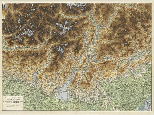
| Title | Ravensteins Kriegskarte. 1. No. 16. – Süd-Tirol („Trentin”) Dolomiten, Lombardische Berge, Gardasee-Gebiet und Angrenzendes Ober-Italien. 2. No. 17. Oestl. Dolomiten, Karnische- u. Julische Alpen, Gönz, Küstenland, Friaul und oberitalienische Venezianische Ebene. |
| Main title | Dél-Tirol, Dolomitok, Garda-tó, Felső-Olaszországi határvidék, K.-Dolomitok, Karni-Juliai Alpok, Görz, Tengermellék Frianli és Felső-Olaszország-i Velencei-síkság térképe 1880 körül. |
374. La Sicilia. – Sicilia preistorica. [B VII c 233]
Institute and Museum of Military History •
B VII c
•
B VII Olaszország
•
B I–XV. Európa
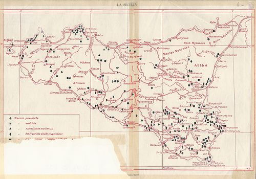
| Title | La Sicilia. – Sicilia preistorica. |
| Main title | Szicília őskori térképe. |
375. Carta ferroviaria d’Italia e linee di navigazione. [B VII c 234]
Institute and Museum of Military History •
B VII c
•
B VII Olaszország
•
B I–XV. Európa
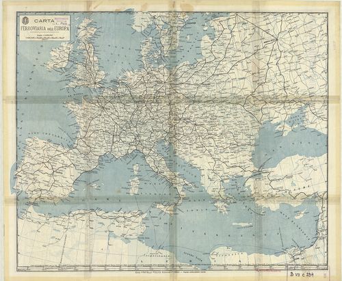
| Title | Carta ferroviaria d’Italia e linee di navigazione. |
| Main title | 1. Firenze. 2. Trieste e dintorni. [Trieszt környéke.] 3. Genova. 4. Napoli (Nápoly) 5. Roma e dintorni. [Róma környéke.] 6. Milano. 7. Milano-laghi e linee affluenti (Milanó környéki tavak és mellékfolyók.] 8. Torino. |
| Subject | Carta ferroviaria dell’ Europa. [Európa vasútvonalainak térképe.] |
376. Carta stradale d’Italia. Foglio 2. [B VII c 235]
Institute and Museum of Military History •
B VII c
•
B VII Olaszország
•
B I–XV. Európa
| Title | Carta stradale d’Italia. Foglio 2. |
| Main title | Olaszország középső részének úttérképe 1950 körül. |
377. Reale Automobile Club d’Italia. – Carta schematica delle con... [B VII c 236]
Institute and Museum of Military History •
B VII c
•
B VII Olaszország
•
B I–XV. Európa
| Title | Reale Automobile Club d’Italia. – Carta schematica delle condizioni stradizioni stradali estate – autunno 1937. – XV. – État des routes eté – automne 1937. – XV. – Condition of roads summer-herbst 1937–XV. – Strassenzustand sommer-autumn 1937–XV. |
| Main title | Olaszország útviszonyai és úthálózata 1937 nyarán és őszén. |
378. Carta automobilistica d’Italia. A. C. I. [B VII c 237]
Institute and Museum of Military History •
B VII c
•
B VII Olaszország
•
B I–XV. Európa
| Title | Carta automobilistica d’Italia. A. C. I. |
| Main title | Olaszország autótérképe 1940 körül. |
379. BZ Karte 74. Triest, Pola, Abbazia, Fiume, Adelsberg. [B VII c 238]
Institute and Museum of Military History •
B VII c
•
B VII Olaszország
•
B I–XV. Európa
| Title | BZ Karte 74. Triest, Pola, Abbazia, Fiume, Adelsberg. |
| Main title | 7 mt.: 1. Abbazia. 2. Capodistria. 3. Fiume. 4. Mitterburg. 5. Pola. 6. Portorose. 7. Triest. |
| Subject | Az Isztriai-félsziget:, Trieste, Pula, Opatija, Rijeka, Postojna úttérképe 1926 körül. |
380. [Olaszország repülőtérkép.] [B VII c 239]
Institute and Museum of Military History •
B VII c
•
B VII Olaszország
•
B I–XV. Európa
| Title | [Olaszország repülőtérkép.] |
| Main title | Mt.: [A svájci–olasz határvidék.] |
381. Northern Italy – Southern Italy. [B VII c 239/1]
Institute and Museum of Military History •
B VII c
•
B VII Olaszország
•
B I–XV. Európa
| Title | Northern Italy – Southern Italy. |
| Main title | Olaszország térképe úthálózattal az 1940-es években. |
382. Livellazione geometrica di precisione. [B VII c 240]
Institute and Museum of Military History •
B VII c
•
B VII Olaszország
•
B I–XV. Európa
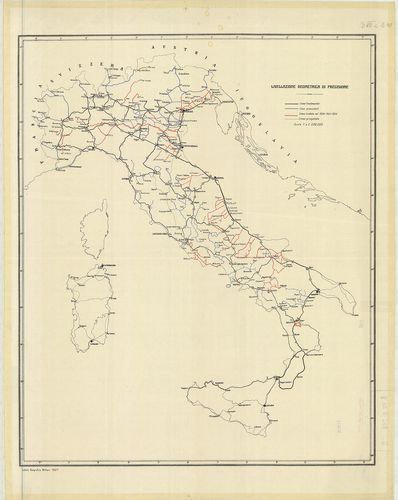
| Title | Livellazione geometrica di precisione. |
| Main title | Olaszország: felsőrendű szintezési vonalak 1924–26-ban. |
383. Livellazione geometrica di precisione. [B VII c 242]
Institute and Museum of Military History •
B VII c
•
B VII Olaszország
•
B I–XV. Európa
| Title | Livellazione geometrica di precisione. |
| Main title | Mt.: Linea Palazzolo–Chiari–Coccaglio. (Szintezési vonal.) |
| Subject | Felső-Olaszország: Torino és Miláno környékének felsőrendű szintezési vonalai 1930 körül. |
384. [Olaszország pontos geodéziai meghatározása 1900 szeptemberb... [B VII c 243]
Institute and Museum of Military History •
B VII c
•
B VII Olaszország
•
B I–XV. Európa
| Title | [Olaszország pontos geodéziai meghatározása 1900 szeptemberben.] |
| Main title | I. Lavori di triangulazione. (Háromszögelési hálózat.) II. Livellazione geometrica di precisione. (Felsőrendű szintezési vonalak.) III. Lavori astronomico-geodetici. (Csillagászati alappontok.) |
385. Rete geodetica Italiana. [B VII c 244]
Institute and Museum of Military History •
B VII c
•
B VII Olaszország
•
B I–XV. Európa
| Title | Rete geodetica Italiana. |
| Main title | Olaszország geodéziai meghatározása 1922-ben. |
386. Carta corografica delle strade comunali obbligatorie d’Itali... [B VII c 245]
Institute and Museum of Military History •
B VII c
•
B VII Olaszország
•
B I–XV. Európa

| Title | Carta corografica delle strade comunali obbligatorie d’Italia. Secondo la legge 30 Agosto 1868. Compartimento di Sardegna. Situazione al 1°. Gennaio 1874. |
| Main title | Az 1868-i törvény alapján megállapított közutak térképe.Szardinia úthálózatának térképe 1874-ben. |
387. Carta Corografica delle strade comunali obbligatorie d’Itali... [B VII c 247]
Institute and Museum of Military History •
B VII c
•
B VII Olaszország
•
B I–XV. Európa
| Title | Carta Corografica delle strade comunali obbligatorie d’Italia. Secondo la Legge 30 Agosto 1868. Compartimento di Sicilia. Situazione al 1° Gennaio 1874. |
| Main title | Az 1868-i törvény alapján megállapított közutak térképe.Szicília úthálózatának térképe 1874-ben. |
388. Carta corografica delle strade comunali obbligatorie d’Itali... [B VII c 248]
Institute and Museum of Military History •
B VII c
•
B VII Olaszország
•
B I–XV. Európa

| Title | Carta corografica delle strade comunali obbligatorie d’Italia. Secondo la Legge 30 Agosto 1868. Compartimento delle Puglie. Situazione al 31 Dicember 1876. |
| Main title | Az 1868-i törvény alapján megállapított közutak térképe.Puglia tartomány úthálózatának térképe 1876-ban. |
389. Carta corografica delle strade comunali obbligatorie d’Itali... [B VII c 249]
Institute and Museum of Military History •
B VII c
•
B VII Olaszország
•
B I–XV. Európa
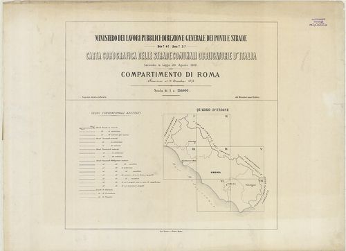
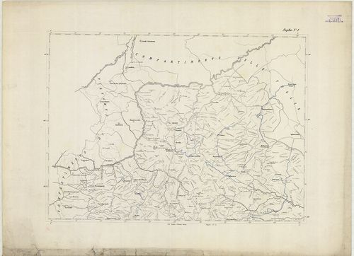
| Title | Carta corografica delle strade comunali obbligatorie d’Italia. Secondo la Legge 30 Agosto 1868. Compartimento di Roma. Situazione al 31 Dicembre 1876. |
| Main title | Az 1868-i törvény alapján megállapított közutak térképe.Róma körzetének úthálózati térképe 1876-ban. |
390. Carta corografica dalle strade comunali obbligatorie d’Itali... [B VII c 250]
Institute and Museum of Military History •
B VII c
•
B VII Olaszország
•
B I–XV. Európa

| Title | Carta corografica dalle strade comunali obbligatorie d’Italia. Secondo la Legge 30 Agosto 1868. Compartimento de Calabria. Situazione al 31 Dicembre 1875. |
| Main title | Az 1868-i törvény alapján megállapított közutak térképe.Calabria tartomány úthálózatának térképe 1875-ben. |
391. Compartimento della Basilicata. [B VII c 251]
Institute and Museum of Military History •
B VII c
•
B VII Olaszország
•
B I–XV. Európa
| Title | Compartimento della Basilicata. |
| Main title | Basilicata tartomány úthálózatának térképe 1875 körül. |
392. Italija. Ekonomicseszkaja ucsebnaja Karta. [B VII c 252]
Institute and Museum of Military History •
B VII c
•
B VII Olaszország
•
B I–XV. Európa
| Title | Italija. Ekonomicseszkaja ucsebnaja Karta. |
| Main title | Olaszország gazdasági térképe középiskolások számára. |
393. Meran und die Dolomiten. – Dr. Brünner’s Dolomiten Auto- und... [B VII c 260]
Institute and Museum of Military History •
B VII c
•
B VII Olaszország
•
B I–XV. Európa
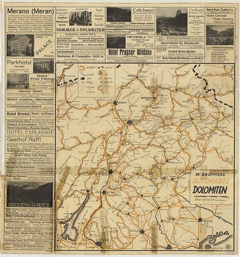
| Title | Meran und die Dolomiten. – Dr. Brünner’s Dolomiten Auto- und Wander-Karte. |
| Main title | 1. Autokarte Dolomiten. |
| Subject | Merano és a Dolomitok autó- és turistatérképe 1930 körül. |
394. G. Freytag’s Touristen – Wanderkarte der Dolomiten. II. Östl... [B VII c 261]
Institute and Museum of Military History •
B VII c
•
B VII Olaszország
•
B I–XV. Európa
| Title | G. Freytag’s Touristen – Wanderkarte der Dolomiten. II. Östliches Blatt. |
| Main title | A Dolomitok turistatérképe. |
395. Welschnofen mit Rosengarten und Latemar. [B VII c 262]
Institute and Museum of Military History •
B VII c
•
B VII Olaszország
•
B I–XV. Európa

| Title | Welschnofen mit Rosengarten und Latemar. |
| Main title | Nova Levante – Catinaccio – Latemar környéki hegyi-utak térképe 1900 körül. |
396. Carta del Cadore, Agordino e Zoldano. [B VII c 264]
Institute and Museum of Military History •
B VII c
•
B VII Olaszország
•
B I–XV. Európa

| Title | Carta del Cadore, Agordino e Zoldano. |
| Main title | Cadore–Agordo–Zoldo–Alto vidék térképe 1910-ben vasút és úthálózattal. |
397. Val Gardena, Marmolada, Catinaccio, Gruppo di Sella. [B VII c 265]
Institute and Museum of Military History •
B VII c
•
B VII Olaszország
•
B I–XV. Európa

| Title | Val Gardena, Marmolada, Catinaccio, Gruppo di Sella. |
| Main title | A Gardena-völgy, Marmolada, Catinaccio és Sella szirtcsoportok turista térképe 1900 körül. |
398. Il Cervino e il Monte Rosa. [B VII c 266]
Institute and Museum of Military History •
B VII c
•
B VII Olaszország
•
B I–XV. Európa

| Title | Il Cervino e il Monte Rosa. |
| Main title | A Cervino és a Monte Rosa szirtek környékének turistatérképe 1900 körül. |
399. Riviera dei Fiori Italia. [B VII c 267]
Institute and Museum of Military History •
B VII c
•
B VII Olaszország
•
B I–XV. Európa
| Title | Riviera dei Fiori Italia. |
| Main title | Az olasz Riviéra turistatérképe 1960 körül. |
400. Carta Turistica delle Dolomiti. – Carte touristique de la ré... [B VII c 268]
Institute and Museum of Military History •
B VII c
•
B VII Olaszország
•
B I–XV. Európa
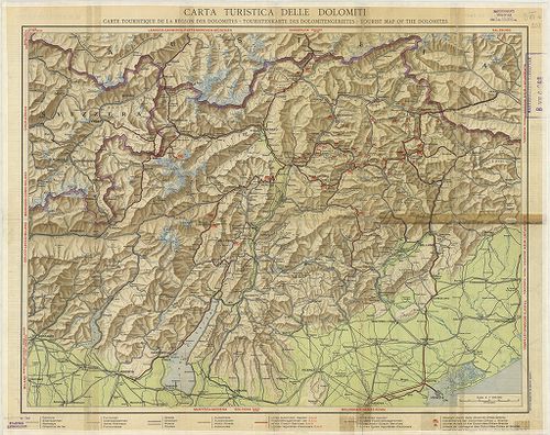
| Title | Carta Turistica delle Dolomiti. – Carte touristique de la région des Dolomites. – Touristenkarte des Dolomitengebietes. – Tourist map of the Dolomites. |
| Main title | A Dolomitok turistatérképe 1930 körül. |