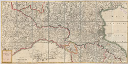
301. Strassen Karte des Lombardisch-Venezianischen Koenigreiches.... [B VII c 43]
Institute and Museum of Military History •
B VII c
•
B VII Olaszország
•
B I–XV. Európa
| Title | Strassen Karte des Lombardisch-Venezianischen Koenigreiches. – Gouvernement Venedig. |
| Main title | A Velencei Kormányzóság úttérképe. |
302. Carta Itineraria del Regno Lombardo-Veneto indicante tutte l... [B VII c 46]
Institute and Museum of Military History •
B VII c
•
B VII Olaszország
•
B I–XV. Európa
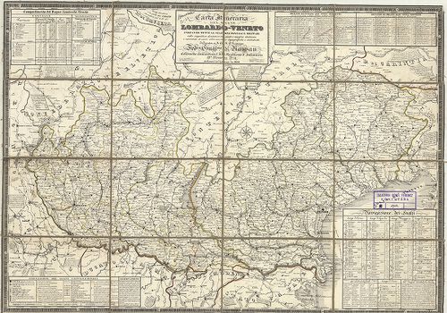
| Title | Carta Itineraria del Regno Lombardo-Veneto indicante tutte le stazioni postali e militari… |
| Main title | A Lombard-Velencei Királyság úttérképe 1832-ben a postai és katonai állomások feltüntetésével. |
303. Carta Postale e Stradale dell’ Italia. [B VII c 47]
Institute and Museum of Military History •
B VII c
•
B VII Olaszország
•
B I–XV. Európa
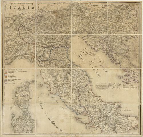
| Title | Carta Postale e Stradale dell’ Italia. |
| Main title | Olaszország északi és középső részének posta és úttérképe. |
304. Carta stradale e postale dell’Italia. 1852. [B VII c 48]
Institute and Museum of Military History •
B VII c
•
B VII Olaszország
•
B I–XV. Európa
| Title | Carta stradale e postale dell’Italia. 1852. |
| Main title | Mt.: Itinerario postale dell’Italia coll’ indicazione delle vie percorse dai vapori (Olaszország posta útjai és hajóútvonalai a távolság feltüntetésével)- |
| Subject | Olaszország út és postatérképe tartományhatárokkal 1859-ben. |
305. Carta stradale e postale dell’ Italia. [B VII c 49]
Institute and Museum of Military History •
B VII c
•
B VII Olaszország
•
B I–XV. Európa
| Title | Carta stradale e postale dell’ Italia. |
| Main title | Mt.: Itinerario postale dell’Italia coll’ indicazione delle vie percorse dai vapori (Olaszország postaútjai és hajóútvonalai a távolság feltüntetésével). |
| Subject | Olaszország út- és postatérképe tartományhatárokkal 1849-ben. |
306. Carta postale ed itineraria dell’ Italia. [B VII c 51]
Institute and Museum of Military History •
B VII c
•
B VII Olaszország
•
B I–XV. Európa
| Title | Carta postale ed itineraria dell’ Italia. |
| Main title | Olaszország északi részének posta és úttérképe 1838-ban. |
307. Routenskelett. Beilage 1. [B VII c 52]
Institute and Museum of Military History •
B VII c
•
B VII Olaszország
•
B I–XV. Európa
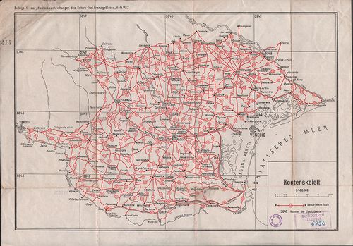
| Title | Routenskelett. Beilage 1. |
| Main title | Az osztrák–olasz határvidék úttérképének áttekintő hálózata 1910 körül. |
308. Carta postale ed itineraria d’Italia. [B VII c 54]
Institute and Museum of Military History •
B VII c
•
B VII Olaszország
•
B I–XV. Európa
| Title | Carta postale ed itineraria d’Italia. |
| Main title | Mt.: Movimento generale de paccheboti a vapore (Személy és áruszállítás a Földközi tengeren). |
| Subject | Olaszország út- és postatérképe. |
309. Carta stradale dell’Italia. [B VII c 55]
Institute and Museum of Military History •
B VII c
•
B VII Olaszország
•
B I–XV. Európa
| Title | Carta stradale dell’Italia. |
| Main title | Olaszország úttérképe 1856-ban. |
310. Strassen-Karte des Lombardisch-Venezianischen Koenigreiches.... [B VII c 57]
Institute and Museum of Military History •
B VII c
•
B VII Olaszország
•
B I–XV. Európa
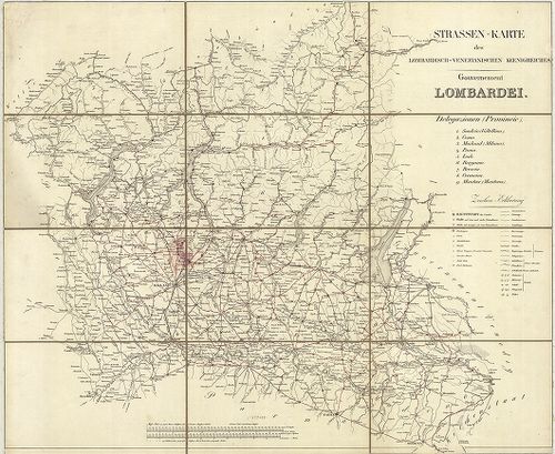
| Title | Strassen-Karte des Lombardisch-Venezianischen Koenigreiches. – Gouvernement Lombardei. |
| Main title | A Lombard Kormányzóság úttérképe. |
311. Atlante stradale d’Italia del Touring Club Italiano. VII. [B VII c 58]
Institute and Museum of Military History •
B VII c
•
B VII Olaszország
•
B I–XV. Európa

| Title | Atlante stradale d’Italia del Touring Club Italiano. VII. |
| Main title | Korzika és Szárdinia úttérképe. |
312. Schematische Telegraphen- und Telephonkarte Norditaliens… [B VII c 61/2]
Institute and Museum of Military History •
B VII c
•
B VII Olaszország
•
B I–XV. Európa
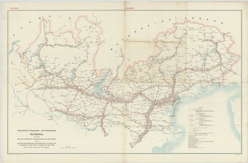
| Title | Schematische Telegraphen- und Telephonkarte Norditaliens… |
| Main title | Észak-Olaszország távíró és telefonhálózata 1911 körül. |
313. Etat de la maison d’Autriche en Italie D’aprés le Traité de ... [B VII c 74]
Institute and Museum of Military History •
B VII c
•
B VII Olaszország
•
B I–XV. Európa
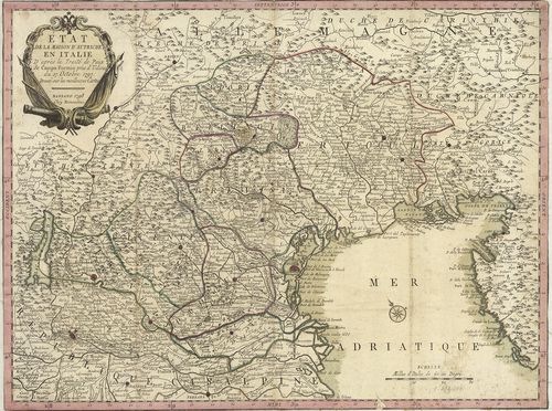
| Title | Etat de la maison d’Autriche en Italie D’aprés le Traité de Paix de Campo Formio prés d’Udine du 17. Octobre 1797. |
| Main title | Olaszország: Ausztria tartománya a Campoformioi békeszerződés után 1797-ben. |
314. Nuova Carta dei Stati della Casa d’Austria in Italia dopo il... [B VII c 75]
Institute and Museum of Military History •
B VII c
•
B VII Olaszország
•
B I–XV. Európa
| Title | Nuova Carta dei Stati della Casa d’Austria in Italia dopo il trattato di pace di Luneville. |
| Main title | Olaszország: Ausztria tartományai a Lunevillei békeszerződés (1801) megkötése után. |
315. Italia divisa né suoi presenti Confini. [B VII c 76]
Institute and Museum of Military History •
B VII c
•
B VII Olaszország
•
B I–XV. Európa
| Title | Italia divisa né suoi presenti Confini. |
| Main title | Olaszország térképe 1806-ban úthálózattal. |
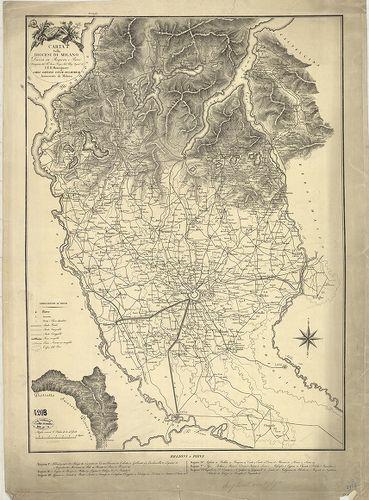
316. Tipo di esecuzone del confine Milanese col Cremasco da Carav... [B VII c 81]
Institute and Museum of Military History •
B VII c
•
B VII Olaszország
•
B I–XV. Európa
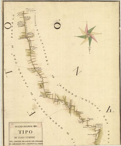
| Title | Tipo di esecuzone del confine Milanese col Cremasco da Caravaggio sino a crespiatica inclusi voluto dal trattaro di Mantova. |
| Main title | Milanó és Crema tartomány határtérképe az 1756-ban Mantovában kötött szerződés alapján. |
317. Drevnjaja Italija. [B VII c 83]
Institute and Museum of Military History •
B VII c
•
B VII Olaszország
•
B I–XV. Európa
| Title | Drevnjaja Italija. |
| Main title | Az Ókori-Olaszország történelmi térképe az i. e. V. században. |
318. Drevnjaja Italija. [B VII c 83/1]
Institute and Museum of Military History •
B VII c
•
B VII Olaszország
•
B I–XV. Európa
| Title | Drevnjaja Italija. |
| Main title | Mt.: Osznovanie Rima (Róma alapítása). |
| Subject | Az Ó-kori Olaszország térképe. |
319. [A Mincio folyó Valeggio és Monzambano közötti szakaszának t... [B VII c 126/1]
Institute and Museum of Military History •
B VII c
•
B VII Olaszország
•
B I–XV. Európa
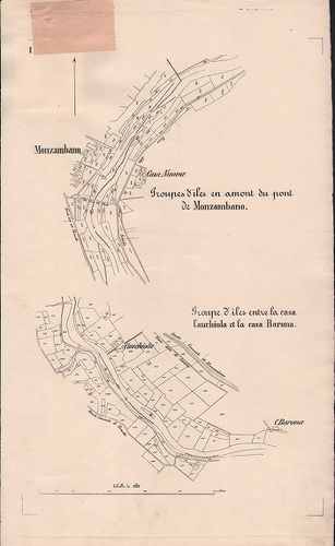
| Title | [A Mincio folyó Valeggio és Monzambano közötti szakaszának térképe.] |
320. Gea-Karte von Oberitalien und den Nachbargebieten. [B VII c 129]
Institute and Museum of Military History •
B VII c
•
B VII Olaszország
•
B I–XV. Európa

| Title | Gea-Karte von Oberitalien und den Nachbargebieten. |
| Main title | Felső-Olaszország a szomszédos országokkal 1910 körül úthálózattal. |
321. Olasz–francia határvidék. [B VII c 140]
Institute and Museum of Military History •
B VII c
•
B VII Olaszország
•
B I–XV. Európa

| Title | Olasz–francia határvidék. |
322. Italienisch-österreichisches Grenzgebiet. Flemmings Kriegska... [B VII c 141]
Institute and Museum of Military History •
B VII c
•
B VII Olaszország
•
B I–XV. Európa

| Title | Italienisch-österreichisches Grenzgebiet. Flemmings Kriegskarte No. 21. |
| Main title | Az olasz–osztrák határvidék. |
323. Nuova Carta del teatro della guerra in Italia. [B VII c 176]
Institute and Museum of Military History •
B VII c
•
B VII Olaszország
•
B I–XV. Európa
| Title | Nuova Carta del teatro della guerra in Italia. |
| Main title | Észak-Olaszországi hadszíntér térképe 1813-ban. |
324. Carta degli Stati di S. M. il Re di Sardegna e parte de paes... [B VII c 177]
Institute and Museum of Military History •
B VII c
•
B VII Olaszország
•
B I–XV. Európa
| Title | Carta degli Stati di S. M. il Re di Sardegna e parte de paesi ad essi confinanti Rettificata nella Regia Topografia… |
| Main title | Mt.: Isola del Regno di Sardegna (Szardinia). |
| Subject | A Szadiniai Királyság Piemonte részének térképe a határos területekkel 1800-ban. |
325. Carta degli Stati di S. M. il Re di Sardegna e parte de paes... [B VII c 177/1]
Institute and Museum of Military History •
B VII c
•
B VII Olaszország
•
B I–XV. Európa
| Title | Carta degli Stati di S. M. il Re di Sardegna e parte de paesi ad essi confinanti Rettificata nella Regia Topografia… |
| Main title | Mt.: Isola del Regno di Sardegna. (Szardinia) nevezetesebb csatahelyek felsorolásával. |
| Subject | A Szardiniai Királyság Piemonte részének térképe a határos területekkel 1790-es években. |
326. Carta militare dell’Italia. [B VII c 178]
Institute and Museum of Military History •
B VII c
•
B VII Olaszország
•
B I–XV. Európa
| Title | Carta militare dell’Italia. |
| Main title | Olaszország katonai térképe 1800 körül úthálózattal. |
327. Carta delle Stazioni militari i Italia. [B VII c 179]
Institute and Museum of Military History •
B VII c
•
B VII Olaszország
•
B I–XV. Európa
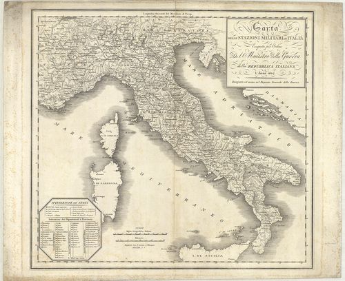
| Title | Carta delle Stazioni militari i Italia. |
| Main title | Olaszország katonai állomáshelyeinek térképe 1804-ben. |
328. Carta delle stazioni militari in Italia ed in Dalmazia. 1805... [B VII c 180]
Institute and Museum of Military History •
B VII c
•
B VII Olaszország
•
B I–XV. Európa
| Title | Carta delle stazioni militari in Italia ed in Dalmazia. 1805. |
| Main title | Olaszország és Dalmácia katonai állomáshelyei 1806-ban. |
329. Carta militare del regno d’Eturia e del principato di Lucca. [B VII c 181]
Institute and Museum of Military History •
B VII c
•
B VII Olaszország
•
B I–XV. Európa
| Title | Carta militare del regno d’Eturia e del principato di Lucca. |
| Main title | A Toscanai Királyság és a Lucca Hercegség katonai térképe 1806-ban úthálózattal. |
330. Carta delle stazioni militari navigazione, e poste del regno... [B VII c 182]
Institute and Museum of Military History •
B VII c
•
B VII Olaszország
•
B I–XV. Európa
| Title | Carta delle stazioni militari navigazione, e poste del regno d’Italia. |
| Main title | 2 mt.: 1. Dalmazia. 2. [Olaszország Középső- és D-i része.] |
| Subject | Az Olasz Királyság katonai kikötői és postaállomásai 1810-ben. |
331. Carta degl’ itinerari militari da Bologna a tutto il Regno d... [B VII c 183]
Institute and Museum of Military History •
B VII c
•
B VII Olaszország
•
B I–XV. Európa
| Title | Carta degl’ itinerari militari da Bologna a tutto il Regno di Napoli. |
| Main title | Olaszország katonai útvonalai Bolognától a Nápolyi Királyságig 1809-ben. |
332. Militair Routen in Italien. [B VII c 184]
Institute and Museum of Military History •
B VII c
•
B VII Olaszország
•
B I–XV. Európa
| Title | Militair Routen in Italien. |
| Main title | Olaszország katonai úttérképe 1800 körül. |
333. Carta delle poste e stazioni militari per le provincie d’Ita... [B VII c 185]
Institute and Museum of Military History •
B VII c
•
B VII Olaszország
•
B I–XV. Európa
| Title | Carta delle poste e stazioni militari per le provincie d’Italia tanto Austriache che Estere con parte dei paesi limitrofi. – Post und Marschkarte für di Oestreichischen und die fremden Italianischen provinzen nebst Theilen der angränzenden Länder. |
| Main title | Olaszország és a határos területek posta és katonai állomáshelyeinek térképe 1820-ban. |
334. Ober und Mittel Italien. [B VII c 186/1]
Institute and Museum of Military History •
B VII c
•
B VII Olaszország
•
B I–XV. Európa
| Title | Ober und Mittel Italien. |
| Main title | Mt.: Umgebung von Rom (Róma környéke). |
| Subject | Olaszország felső és középső része 1851-ben. |
335. Ober und mittel Italien. [B VII c 186/2]
Institute and Museum of Military History •
B VII c
•
B VII Olaszország
•
B I–XV. Európa
| Title | Ober und mittel Italien. |
| Main title | Mt.: Umgebung von Rom (Róma környéke). |
| Subject | Olaszország felső és középső része 1853-ban. |
336. Carta delle provincie meridionali d’ Italia indicante le tap... [B VII c 188]
Institute and Museum of Military History •
B VII c
•
B VII Olaszország
•
B I–XV. Európa
| Title | Carta delle provincie meridionali d’ Italia indicante le tappe militari ed i rilievi postali. |
| Main title | Olaszország déli tartományainak katonai és postatérképe 1861-ben. |
337. Circoscrizione militare territoriale del Regno d’Italia. [B VII c 191]
Institute and Museum of Military History •
B VII c
•
B VII Olaszország
•
B I–XV. Európa

| Title | Circoscrizione militare territoriale del Regno d’Italia. |
| Main title | Az Olasz Királyság katonai körzeti beosztása 1877 márciusában. |
338. Carta dimostrativa delle circoscrizioni militari del regno D... [B VII c 192]
Institute and Museum of Military History •
B VII c
•
B VII Olaszország
•
B I–XV. Európa

| Title | Carta dimostrativa delle circoscrizioni militari del regno D’Italia. |
| Main title | Az Olasz Királyság katonai körzeti beosztása 1879-ben. |
339. Carta delle circoscrizioni militari del Regno d’Italia… [B VII c 193]
Institute and Museum of Military History •
B VII c
•
B VII Olaszország
•
B I–XV. Európa
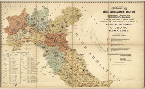
| Title | Carta delle circoscrizioni militari del Regno d’Italia… |
| Main title | Az Olasz Királyság katonai körzeteinek térképe 1883-ban. |
340. Carta della circoscrizione militare territoriale del Regno 1... [B VII c 194]
Institute and Museum of Military History •
B VII c
•
B VII Olaszország
•
B I–XV. Európa
| Title | Carta della circoscrizione militare territoriale del Regno 1883. |
| Main title | Az Olasz Krályság katonai körzeti beosztása 1883 júliusában. |
341. Carte de la Lombardie et de la Province de Novare (Piémont) ... [B VII c 195]
Institute and Museum of Military History •
B VII c
•
B VII Olaszország
•
B I–XV. Európa
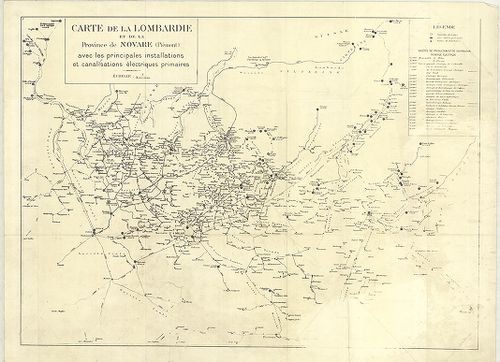
| Title | Carte de la Lombardie et de la Province de Novare (Piémont) avec les principales installations et canalisations électriques primaires. |
| Main title | Lombardia és Novara (Piemonte) tartomány elektromos vezetékhálózata 1930 körül. |
342. Dislocations-Karte der Italienischen Armee… im Frieden und i... [B VII c 196]
Institute and Museum of Military History •
B VII c
•
B VII Olaszország
•
B I–XV. Európa
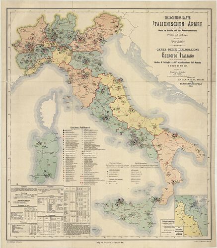
| Title | Dislocations-Karte der Italienischen Armee… im Frieden und im Kriege. – Karta delle dislocazioni dell’ Esercito Italiano … sia in tempo di pace che di guerra. |
| Main title | Mt.: Die Italienischen Besitzungen in Afrika (Massaua: olasz telepek Afrikában). |
| Subject | Az olasz hadsereg diszlokációs térképe háborúban és békében 1891-ben. |
343. Italien. Friedens-Dislocation der Italienischen Armee 1893. [B VII c 196/1]
Institute and Museum of Military History •
B VII c
•
B VII Olaszország
•
B I–XV. Európa
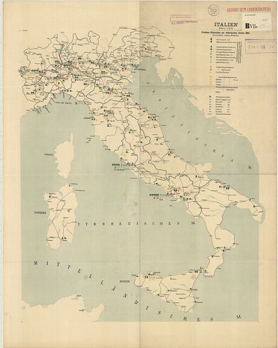
| Title | Italien. Friedens-Dislocation der Italienischen Armee 1893. |
| Main title | Olaszország: az olasz hadsereg békeidőbeli diszlokációs térképe 1893-ban. |
344. Dislokation der italienischen Gebirgstruppen im Sommer 1909. [B VII c 196/4]
Institute and Museum of Military History •
B VII c
•
B VII Olaszország
•
B I–XV. Európa
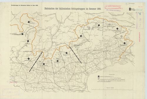
| Title | Dislokation der italienischen Gebirgstruppen im Sommer 1909. |
| Main title | Észak-Olaszország: a hegyi alakulatok diszlokációs térképe 1909 nyarán. |
345. Friedensdislokation der italienischen Armee. Frühjahr 1912. [B VII c 196/5]
Institute and Museum of Military History •
B VII c
•
B VII Olaszország
•
B I–XV. Európa
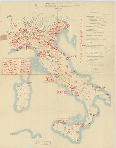
| Title | Friedensdislokation der italienischen Armee. Frühjahr 1912. |
| Main title | Olaszország: az olasz hadsereg békebeli elhelyezésének térképe 1912. tavaszán. |
346. Diocesi Padovana con tutta la sua estensione ne vicini terri... [B VII c 197]
Institute and Museum of Military History •
B VII c
•
B VII Olaszország
•
B I–XV. Európa

| Title | Diocesi Padovana con tutta la sua estensione ne vicini territori. |
| Main title | A Padovai egyházmegye és a szomszédos területek egy részének térképe 1720-ban. |
347. Carta della diocesi di Milano. Divisa in Regioni e Pievi. [B VII c 197/1]
Institute and Museum of Military History •
B VII c
•
B VII Olaszország
•
B I–XV. Európa
| Title | Carta della diocesi di Milano. Divisa in Regioni e Pievi. |
| Main title | A Milánói egyházmegye térképe 1800 körül. |
348. Rivista Mensile del Touring Club Italiano. Carta della guerr... [B VII c 198]
Institute and Museum of Military History •
B VII c
•
B VII Olaszország
•
B I–XV. Európa
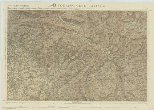
| Title | Rivista Mensile del Touring Club Italiano. Carta della guerra. Febbraio 1917. |
| Main title | F. 15. Udine-Tolmino. F. 16. Lubiana. F. 19. Gorozia-Trieste. F. 20. Adelsberg (Postojna). |
| Subject | Olaszország úthálózati térképe 1917-ben. |
349. Carte générale d’Italie pour servir á l’intelligence des opé... [B VII c 199]
Institute and Museum of Military History •
B VII c
•
B VII Olaszország
•
B I–XV. Európa
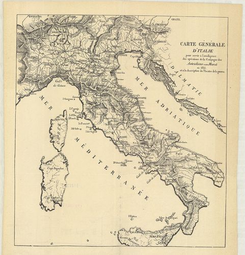
| Title | Carte générale d’Italie pour servir á l’intelligence des opérations de la Campagne des Autrichiens contre Murat en 1815 et á la description du Théatre de la guerre. |
| Main title | Olaszországi általános térképe úthálózattal, és az 1815. évi osztrák csapatok és Murat nápolyi király között lezajlott csata színhelye. |
350. Tirol u[nd] Oberitalien. Ravensteins Kriegskarte. Nr. 45. [B VII c 200]
Institute and Museum of Military History •
B VII c
•
B VII Olaszország
•
B I–XV. Európa
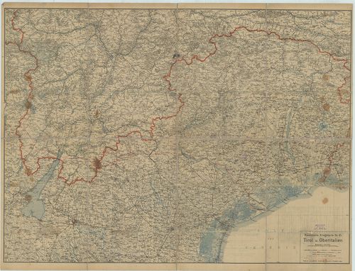
| Title | Tirol u[nd] Oberitalien. Ravensteins Kriegskarte. Nr. 45. |
| Main title | Tirol és Felső-Olaszország általános térképe 1910 körül, úthálózattal. |