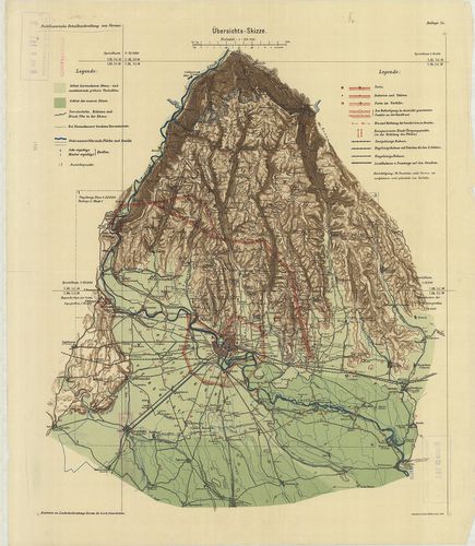
121. Carta Geografica della Provincia del Friuli. [B VII a 172]
Institute and Museum of Military History •
B VII a
•
B VII Olaszország
•
B I–XV. Európa
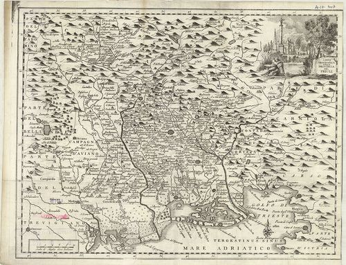
| Title | Carta Geografica della Provincia del Friuli. |
| Main title | Friuli tartomány földrajzi térképe a 18. században. |
122. Territorio Veronese. Tom. I. p. I. [B VII a 175]
Institute and Museum of Military History •
B VII a
•
B VII Olaszország
•
B I–XV. Európa
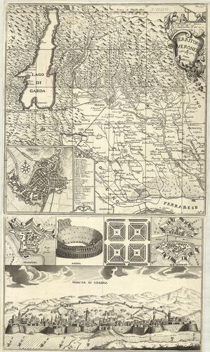
| Title | Territorio Veronese. Tom. I. p. I. |
| Main title | 3 mt.: 1. Verona. 2. Peschiera. 3. Legnano-várostérk. 3 kép. 1. Arena. 2. Fiera. (Vásártér.) 3. Veduta di Verona. (Verona látképe.) |
| Subject | Verona tartomány térképe 1745-ben. |
123. Il territorio Veronese e sua Diocese nei suo veri confini co... [B VII a 176]
Institute and Museum of Military History •
B VII a
•
B VII Olaszország
•
B I–XV. Európa
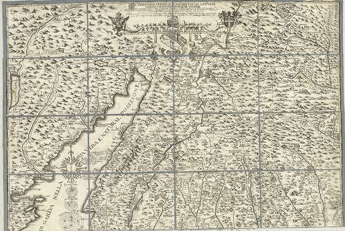
| Title | Il territorio Veronese e sua Diocese nei suo veri confini coi posti di publiche guardie… |
| Main title | Verona terület térképe az egyházmegye határával 1747 körül. |
124. Le Territoire de Verone. P. II. J. O. [B VII a 178]
Institute and Museum of Military History •
B VII a
•
B VII Olaszország
•
B I–XV. Európa

| Title | Le Territoire de Verone. P. II. J. O. |
| Main title | Verona tartomány térképe 1776-ban. |
125. Provincia di Verona Divisa nei 13 Distretti… [B VII a 180]
Institute and Museum of Military History •
B VII a
•
B VII Olaszország
•
B I–XV. Európa
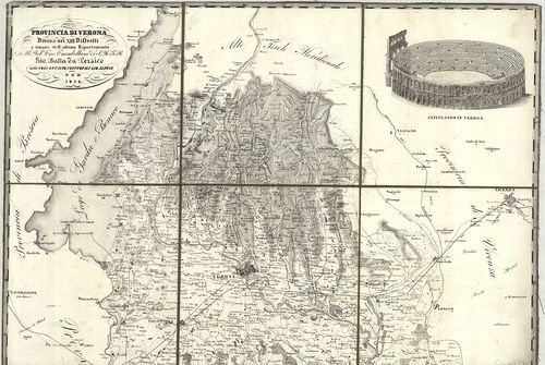
| Title | Provincia di Verona Divisa nei 13 Distretti… |
| Main title | Verona tartomány térképe 1838-ban. |
126. [Verona és környékének 3 kül. tartalmú térképe.] [B VII a 181]
Institute and Museum of Military History •
B VII a
•
B VII Olaszország
•
B I–XV. Európa
| Title | [Verona és környékének 3 kül. tartalmú térképe.] |
| Main title | „Fortificatorische Detailbeschreibung von Verona” mellékletei. Lásd: L J 31 jelzet alatt. |
127. Carta del Dipartimento de Bacchiglione… [B VII a 183]
Institute and Museum of Military History •
B VII a
•
B VII Olaszország
•
B I–XV. Európa
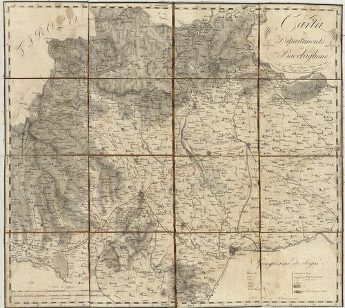
| Title | Carta del Dipartimento de Bacchiglione… |
| Main title | Bacchiglione megye térképe 1802 körül. |
128. Plan der Gegend zwischen Belluno und Feltre. [B VII a 185]
Institute and Museum of Military History •
B VII a
•
B VII Olaszország
•
B I–XV. Európa
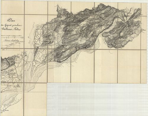
| Title | Plan der Gegend zwischen Belluno und Feltre. |
| Main title | Belluno és Feltre közti terület térképe 1850 körül. |
129. Manoeuvre-Terrain am Mincio. Detailkarte des Landestriches z... [B VII a 195]
Institute and Museum of Military History •
B VII a
•
B VII Olaszország
•
B I–XV. Európa
| Title | Manoeuvre-Terrain am Mincio. Detailkarte des Landestriches zwischen Brescia, Verona u. Illasi. |
| Main title | Mincio melletti hadgyakorlati terület térképe, Brescia, Verona és Illasi között 1840–41-ben. |
130. Manövre Terrain am Mincio, reambulirten Detailkarte. [B VII a 195/1]
Institute and Museum of Military History •
B VII a
•
B VII Olaszország
•
B I–XV. Európa
| Title | Manövre Terrain am Mincio, reambulirten Detailkarte. |
| Main title | Mincio melletti hadgyakorlati terület térképe Brescia, Verona és Illasti között 1859-ben. |
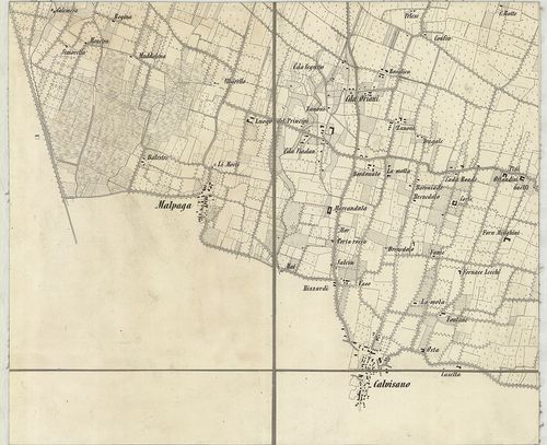
131. Plan des Manövrir-Terrains naechts Monselice. [B VII a 195/2]
Institute and Museum of Military History •
B VII a
•
B VII Olaszország
•
B I–XV. Európa
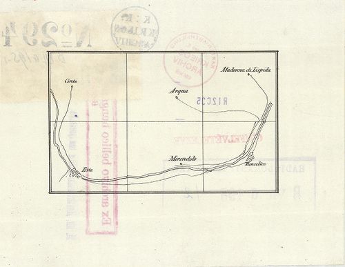
| Title | Plan des Manövrir-Terrains naechts Monselice. |
| Main title | A Monselice melletti gyakorlótértérképe a 19. század végén. |
132. [Északkelet-Olaszország: a Rigolato-Pontebba-Tarvisio és Tol... [B VII a 200/5]
Institute and Museum of Military History •
B VII a
•
B VII Olaszország
•
B I–XV. Európa
| Title | [Északkelet-Olaszország: a Rigolato-Pontebba-Tarvisio és Tolmezzo-Gemona közti terület általános térképe.] |
133. Gegend zwischen Verona, Peschiera und Mantova. [B VII a 202]
Institute and Museum of Military History •
B VII a
•
B VII Olaszország
•
B I–XV. Európa
| Title | Gegend zwischen Verona, Peschiera und Mantova. |
| Main title | Verona, Peschiera és Mantova közti terület térképe a 19. század közepén. |
134. Nuova Carta Corografica, o sia centro del gran teatro di gue... [B VII a 212]
Institute and Museum of Military History •
B VII a
•
B VII Olaszország
•
B I–XV. Európa
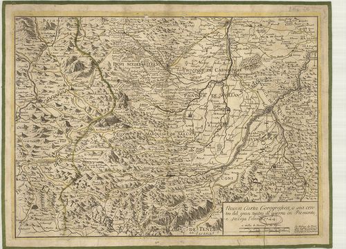
| Title | Nuova Carta Corografica, o sia centro del gran teatro di guerra in Piemonte, e Savoya. |
| Main title | Piemonte és Savoja tartomány földrajzi térképe 1744-ben. |
135. Piemonte diviso in quattro dipartiment [B VII a 213]
Institute and Museum of Military History •
B VII a
•
B VII Olaszország
•
B I–XV. Európa
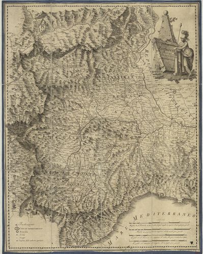
| Title | Piemonte diviso in quattro dipartiment |
| Main title | Piemonte tartomány térképe négy kerületre osztva 1799-ben. |
136. Carte des Vallées d’Oulx Exille Chaumont etc. Suse et de Pra... [B VII a 218]
Institute and Museum of Military History •
B VII a
•
B VII Olaszország
•
B I–XV. Európa
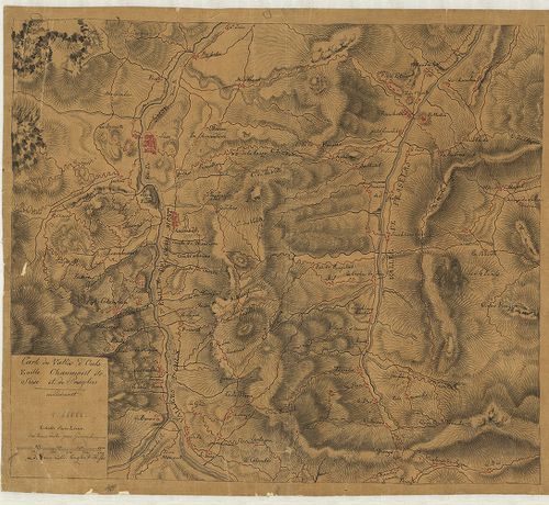
| Title | Carte des Vallées d’Oulx Exille Chaumont etc. Suse et de Pragelas en Piedmont. |
| Main title | Piemonte tartomány (Susa-Exilles-Ulzip-Pragetato környékének) térképe a 18. században. |
137. Carta de la Rivera de Genova con sus Verdaderos Confines y C... [B VII a 261]
Institute and Museum of Military History •
B VII a
•
B VII Olaszország
•
B I–XV. Európa
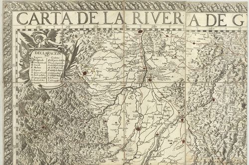
| Title | Carta de la Rivera de Genova con sus Verdaderos Confines y Caminos. – Topographia de la Liguria… |
| Main title | Liguria tartomány térképe 1685-ben. |
138. Karte von der Republik Genua. [B VII a 264]
Institute and Museum of Military History •
B VII a
•
B VII Olaszország
•
B I–XV. Európa
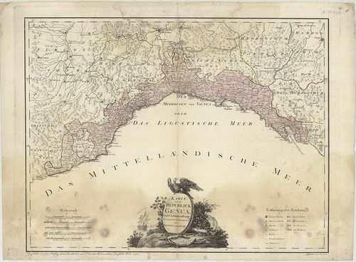
| Title | Karte von der Republik Genua. |
| Main title | A Genovai Köztársaság térképe 1796-ban. |
139. Carta topografica degli stati della Republica di Genova, sec... [B VII a 265]
Institute and Museum of Military History •
B VII a
•
B VII Olaszország
•
B I–XV. Európa
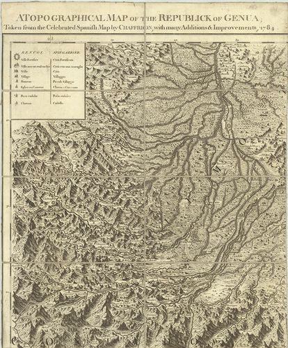
| Title | Carta topografica degli stati della Republica di Genova, secondo l’Originale del famoso Chaffrion con molte aumentazioni e Correzioni, 1784. – A topographical map of the Republick of Genua. – Carte topographique des Etats de la Republique de Genes. – Topographische charte sämbtlichen Länder, der Republic Genua. |
| Main title | 3 mt.: 1. Carte de l’Isle de Corse… (Korzika). 2. Carte de l’Isle de Sardaigne (Szardinia). 3. Isola di Caprara(Capraia-sz.). |
| Subject | A Genovai Köztársaság topográfiai térképe 1784-ben. |
140. Stato della Republica di Lucca. [B VII a 271]
Institute and Museum of Military History •
B VII a
•
B VII Olaszország
•
B I–XV. Európa
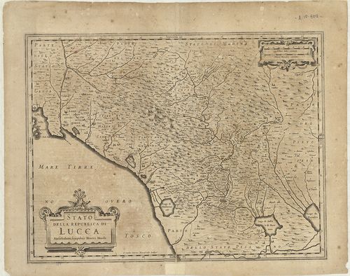
| Title | Stato della Republica di Lucca. |
| Main title | Lucca tartomány térképe 1642-ben. |