1. General karte über alla in Europa vorkommenden Eisenbahnen… ... [B I c 1]
Institute and Museum of Military History •
B I c
•
B I Európa
•
B I–XV. Európa
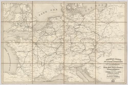
| Title | General karte über alla in Europa vorkommenden Eisenbahnen… Haupt-u. Poststrassen, Canälen u. Dampfschiffahrten… |
| Main title | Európa közlekedési térképe. |
2. Römisches Reich. [B I c 2]
Institute and Museum of Military History •
B I c
•
B I Európa
•
B I–XV. Európa
| Title | Römisches Reich. |
| Main title | Mt.: Krise und Niedergang des Röm. Reich. (III.–V. Jahrhundert.) (A Római-Birodalom hanyatlása és bukása, V.–III. században.) |
| Subject | A Római Birodalom térképe. |
3. Römisches Reich. [B I c 2/1]
Institute and Museum of Military History •
B I c
•
B I Európa
•
B I–XV. Európa
| Title | Römisches Reich. |
| Main title | Mt.: I A Római Birodalom válsága és hanyatlása a III.–V. században.] |
| Subject | A Római Birodalom. |
4. Imperio Romano. [B I c 2/2]
Institute and Museum of Military History •
B I c
•
B I Európa
•
B I–XV. Európa
| Title | Imperio Romano. |
| Main title | Mt.: Crisis y caida del Imperio Romano. (Siglos III.–V.) (A Római Birodalom válságai és bukása az V.–III. században.) |
| Subject | A Római Birodalom (Európa és Afrika északi partvidéke) térképe az V.–III. században. |
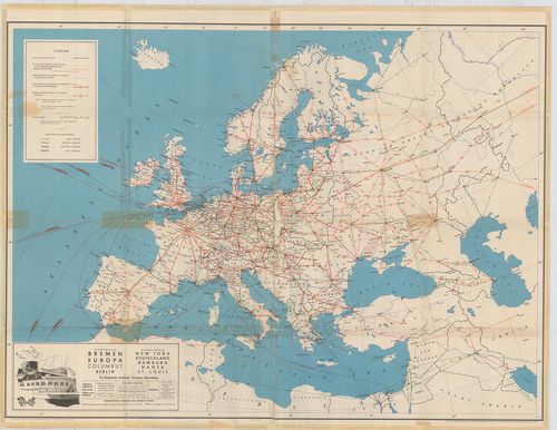
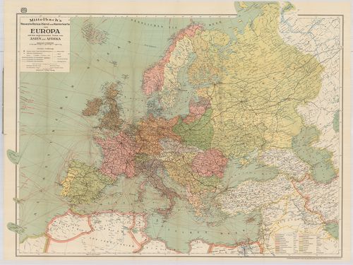
5. Eisenbahn- und Dampfschiffrouten-Karte von Europa [B I c 3]
Institute and Museum of Military History •
B I c
•
B I Európa
•
B I–XV. Európa
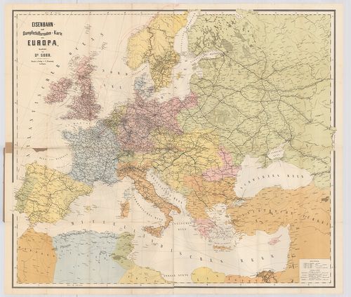
| Title | Eisenbahn- und Dampfschiffrouten-Karte von Europa |
| Main title | Európa közlekedési térképe 1881-ben. |
6. Európa in de zestiende eeuw. Brill’s Historische Wandkaarten... [B I c 4]
Institute and Museum of Military History •
B I c
•
B I Európa
•
B I–XV. Európa
| Title | Európa in de zestiende eeuw. Brill’s Historische Wandkaarten. |
| Main title | Európa a 16. században. |
7. Europa in de zeventiende eeuw. Brill’s Historische Wandkaart... [B I c 4/1]
Institute and Museum of Military History •
B I c
•
B I Európa
•
B I–XV. Európa
| Title | Europa in de zeventiende eeuw. Brill’s Historische Wandkaarten. |
| Main title | Európa a 17. században. |
8. Europa in de achttiende eeuw. Brill’s Historische Wandkaarte... [B I c 4/2]
Institute and Museum of Military History •
B I c
•
B I Európa
•
B I–XV. Európa
| Title | Europa in de achttiende eeuw. Brill’s Historische Wandkaarten. |
| Main title | 4 mt.: 1. Verdeling van Polen. (Lengyelország felosztása.) 2. Barriéresteden. (Országhatárok.) 3. [Gyarmatok eloszlása a földön.] 4. [Gyarmatok a mai USA területén.] |
| Subject | Európa a 18. században. |
9. Europa tijdens de Carolingen. Brill’s Historische Wandkaarte... [B I c 5]
Institute and Museum of Military History •
B I c
•
B I Európa
•
B I–XV. Európa
| Title | Europa tijdens de Carolingen. Brill’s Historische Wandkaarten. |
| Main title | Európa a Karolingok idején. (1000 előtt.) |
10. Europa: Die Umgestaltung durch Napoleon I. (1799–1815.) [B I c 6]
Institute and Museum of Military History •
B I c
•
B I Európa
•
B I–XV. Európa
| Title | Europa: Die Umgestaltung durch Napoleon I. (1799–1815.) |
| Main title | Európa I. Napoleon alatt 1799–1815-ig. |
11. Carte itinéraire de l’Europe. [B I c 7]
Institute and Museum of Military History •
B I c
•
B I Európa
•
B I–XV. Európa
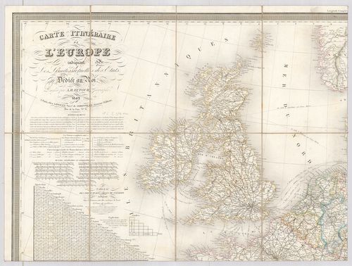
| Title | Carte itinéraire de l’Europe. |
| Main title | Európa közlekedési térképe 1842. |
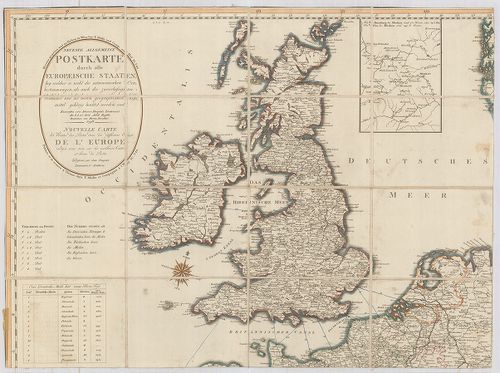
12. Neueste Allgemeine Postkarte von Europa … [B I c 8]
Institute and Museum of Military History •
B I c
•
B I Európa
•
B I–XV. Európa
| Title | Neueste Allgemeine Postkarte von Europa … |
| Main title | Mt.: [Moszkva környéke.] |
| Subject | Európa postaúthálózatának térképe 1805-ben. |
13. Neueste Allgemeine Postkarte durch alle Europaeische Staaten... [B I c 8/a]
Institute and Museum of Military History •
B I c
•
B I Európa
•
B I–XV. Európa
| Title | Neueste Allgemeine Postkarte durch alle Europaeische Staaten… Nouvelle Carte des Routes des Postes dans les différens États de l’Europe… Véste: Hieron. Benedicti. |
| Main title | Mt.: [Moszkva környéke] |
| Subject | Európa postaúthálózatának térképe 1798-ban. |
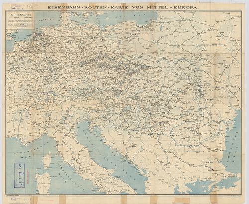
14. Vereinigte Eisenbahn-Routen- und Lademass-Karte von Mittel-E... [B I c 9]
Institute and Museum of Military History •
B I c
•
B I Európa
•
B I–XV. Európa
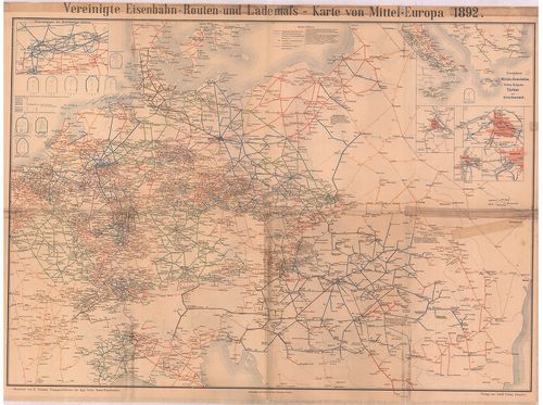
| Title | Vereinigte Eisenbahn-Routen- und Lademass-Karte von Mittel-Europa. |
| Main title | 6 mt.: 1. Eisenbahnen im Ruhr kohlen Gebiet 2. Eisenbahnen in Mittel-u. Unteritalien, Serbien, Bulgarien, Türkei und Griechenland 3. Wien, 4. Berlin, 5. Budapest, 6. Frankfurt. |
| Subject | Közép-Európa közlekedési térképe 1892-ben. |
15. Europa: Bündnissysteme Bismarcks (1871–1890). [B I c 10]
Institute and Museum of Military History •
B I c
•
B I Európa
•
B I–XV. Európa
| Title | Europa: Bündnissysteme Bismarcks (1871–1890). |
| Main title | Európa, a Bismarck-i szövetségi rendszer ideje alatt 1871–1890-ig. |
16. Europa 1939–1945. Brill’s Historische Wandkaarten. [B I c 11]
Institute and Museum of Military History •
B I c
•
B I Európa
•
B I–XV. Európa
| Title | Europa 1939–1945. Brill’s Historische Wandkaarten. |
| Main title | Mt.: [Az Ardenni ellentámadás 1944-ben.] |
| Subject | Európa (az Észak-Afrikai és Kis-Ázsiai harcok térképe) 1939–1945-ig. |
17. Telegraphen-Karte von Europa… [B I c 12]
Institute and Museum of Military History •
B I c
•
B I Európa
•
B I–XV. Európa
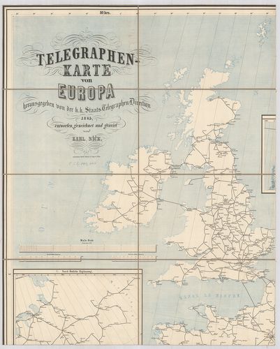
| Title | Telegraphen-Karte von Europa… |
| Main title | 2 mt.: 1. Nord-östliche Ergänzung 2. Nördliche Ergänzung. |
| Subject | Európa távíró térképe 1864-ben. |
18. Karte des Europaeischen Telegraphen-Netzes. [B I c 12/1]
Institute and Museum of Military History •
B I c
•
B I Európa
•
B I–XV. Európa
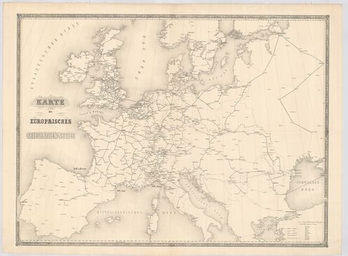
| Title | Karte des Europaeischen Telegraphen-Netzes. |
| Main title | Európa távíróhálózatának térképe. |
19. Eisenbahn-Post und Dampfschiffs-Karte von Europa. – Railway ... [B I c 13]
Institute and Museum of Military History •
B I c
•
B I Európa
•
B I–XV. Európa
| Title | Eisenbahn-Post und Dampfschiffs-Karte von Europa. – Railway Steam-Boat and Post Map of Europe. – Carte des Chemins de Fer voies navigables et Routes Postales de l’Europe. |
| Main title | 5 mt.: 1. Der Rhein von Mainz bis Wesel. 2. London 3. Paris. 4. Die Schweiz 5. Die belgischen Eisenbahnen. |
| Subject | Európa közlekedési térképe 1867-ben. |
20. Germanorum [et] Slavorum per medium aevum Orbis Christianus.... [B I c 14]
Institute and Museum of Military History •
B I c
•
B I Európa
•
B I–XV. Európa
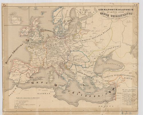
| Title | Germanorum [et] Slavorum per medium aevum Orbis Christianus. Regnorum quae exeunte anno 1100 fuere limitatio. |
| Main title | Európa történelmi térképe i. u. 1100-ban. |
21. Hauptverkehrslinien von Europa. [B I c 15]
Institute and Museum of Military History •
B I c
•
B I Európa
•
B I–XV. Európa
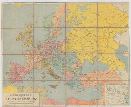
| Title | Hauptverkehrslinien von Europa. |
| Main title | 1 mt.: Eisenbahnkarte von Sibiren. (Szibériai vasútvonalak).Európa fő vasutainak térképe. |
22. Europa w okresie wypraw krzyżowych (XII–XIII w.) [B I c 16]
Institute and Museum of Military History •
B I c
•
B I Európa
•
B I–XV. Európa
| Title | Europa w okresie wypraw krzyżowych (XII–XIII w.) |
| Main title | 2 mt.: 1. Mapa gospodarcza Europy średniowiecznej. |
| Subject | (A középkori Európa gazdasági térképe.) 2. Ważniejsze wyprawy krzyżowe. (Keresztes hadjárat.) |
23. Europa in de Middeleeuwen 1300–1500. Brill’s Historische Wan... [B I c 17]
Institute and Museum of Military History •
B I c
•
B I Európa
•
B I–XV. Európa
| Title | Europa in de Middeleeuwen 1300–1500. Brill’s Historische Wandkaarten. |
| Main title | Mt.: De Bourgondische Nederlanden. (Burgundiai Németalföld, Hollandia.) |
| Subject | Európa a középkorban 1300–1500-ig. |
24. Europa 1815–1871. Brill’s Historische Wandkaarten. [B I c 18]
Institute and Museum of Military History •
B I c
•
B I Európa
•
B I–XV. Európa
| Title | Europa 1815–1871. Brill’s Historische Wandkaarten. |
| Main title | Mt.: Koninkrijk der Nederlanden 1815–1830. Belgie na 1830. (Hollandia 1813–1830-ig. Belgium 1830-ban.) |
| Subject | Európa 1815–1871-ig. |
25. Dislokationskarte der Heere Europas. [B I c 19]
Institute and Museum of Military History •
B I c
•
B I Európa
•
B I–XV. Európa
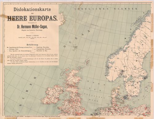
| Title | Dislokationskarte der Heere Europas. |
| Main title | Európai hadseregek elhelyezési térképe 1895-ben. |
26. Europa vor und nach dem ersten Weltkrieg 1914 und 1937. [B I c 20]
Institute and Museum of Military History •
B I c
•
B I Európa
•
B I–XV. Európa
| Title | Europa vor und nach dem ersten Weltkrieg 1914 und 1937. |
| Main title | Európa az I. Világháború alatt és után 1914–1937-ig. |
27. Neue Carte von Europa welche die merkwürdigsten Produckte un... [B I c 21]
Institute and Museum of Military History •
B I c
•
B I Európa
•
B I–XV. Európa
| Title | Neue Carte von Europa welche die merkwürdigsten Produckte und vornehmsten Handelsplätze nebst dem Flächen-Inhalt aller Europäischen Länder. |
| Main title | Európa kereskedelmi térképe 1782-ben. |
28. Europa zwischen den Weltkriegen. (1919–1939.) Putzger Wandka... [B I c 22]
Institute and Museum of Military History •
B I c
•
B I Európa
•
B I–XV. Európa
| Title | Europa zwischen den Weltkriegen. (1919–1939.) Putzger Wandkarten. 122/123. |
| Main title | Európa a két világháború között 1919–1939-ig. |
29. Europa-mapa gospodarcza. [B I c 23]
Institute and Museum of Military History •
B I c
•
B I Európa
•
B I–XV. Európa
| Title | Europa-mapa gospodarcza. |
| Main title | Európa gazdasági térképe 1962-ben. |
30. Druhá svetová vojna (1939–1945.) [B I c 24]
Institute and Museum of Military History •
B I c
•
B I Európa
•
B I–XV. Európa
| Title | Druhá svetová vojna (1939–1945.) |
| Main title | Mt.: [A II. Világháború hadműveletei az egész Világon.] |
| Subject | A II. Világháború hadműveletei Európában, 1939–1945-ig. |
31. Európa Nagy Lajos korában 1370–1380. [B I c 25]
Institute and Museum of Military History •
B I c
•
B I Európa
•
B I–XV. Európa
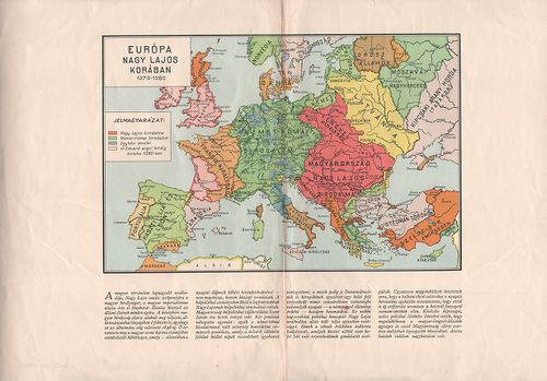
| Title | Európa Nagy Lajos korában 1370–1380. |
32. Imperivm Romanvm. Brill’s Historische Wandkaarten. [B I c 26]
Institute and Museum of Military History •
B I c
•
B I Európa
•
B I–XV. Európa
| Title | Imperivm Romanvm. Brill’s Historische Wandkaarten. |
| Main title | 2 mt.: 1. [Olaszországi tartományok.] 2. [Róma.] |
| Subject | A Római Birodalom térképe. |
33. Kruistochten. Brill’s Historische Wandkaarten. [B I c 27]
Institute and Museum of Military History •
B I c
•
B I Európa
•
B I–XV. Európa
| Title | Kruistochten. Brill’s Historische Wandkaarten. |
| Main title | 4 mt.: 1. [Izrael-Líbia partvidéke.] 2. [Jeruzsálem.] 3. Handel. (Kereskedelem.) 4. [A vallások kialakulása 1050-óta.] |
| Subject | A Keresztesháború Európa–Kis-Ázsia és Afrika északi partvidékén 1096–1270 között. |
34. De Franse Tijd. Brill’s Historische Wandkaarten. [B I c 28]
Institute and Museum of Military History •
B I c
•
B I Európa
•
B I–XV. Európa
| Title | De Franse Tijd. Brill’s Historische Wandkaarten. |
| Main title | 3 mt.: 1. Parijs in 1789. (Párizs 1789-ben.) 2. Die Veldtochten in Italie 1796–1797, 1799–1800. (Italiai hadjáratok.) 3. Expeditie Naar Egypte 1798. |
| Subject | A napoleoni hadjáratok Európában és Afrikában. |
35. Europa 1914–1918. Brill’s Historische Wandkaarten. [B I c 29]
Institute and Museum of Military History •
B I c
•
B I Európa
•
B I–XV. Európa
| Title | Europa 1914–1918. Brill’s Historische Wandkaarten. |
| Main title | Mt.: [Franciaországi hadszíntér.] |
| Subject | Európa az I. Világháború alatt 1914–1918-ban. |
36. Praktische Geschäfts und Reisekarte sämmtlicher Staaten von ... [B I c 30]
Institute and Museum of Military History •
B I c
•
B I Európa
•
B I–XV. Európa
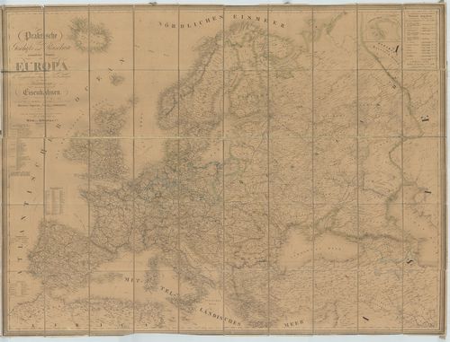
| Title | Praktische Geschäfts und Reisekarte sämmtlicher Staaten von Europa… Nebst einem Theile von Afrika u. Asien… |
| Main title | Európa és részben Afrika és Ázsia kereskedelmi utazási térképe 1862-ben. |
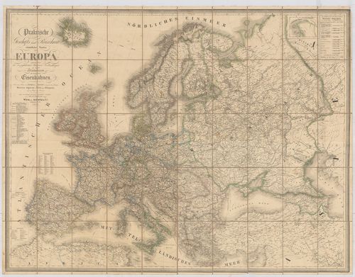
37. Praktische Geschäfts und Reisekarte sämmtlicher Staaten von ... [B I c 31]
Institute and Museum of Military History •
B I c
•
B I Európa
•
B I–XV. Európa
| Title | Praktische Geschäfts und Reisekarte sämmtlicher Staaten von Europa… Nebst einem Theile von Afrika u. Asien. |
| Main title | Európa és részben Afrika, Ázsia kereskedelmi, utazási térképe 1874-ben. |
38. Praktische Geschäts und Reisekarte. sämmtlicher Staaten von ... [B I c 32]
Institute and Museum of Military History •
B I c
•
B I Európa
•
B I–XV. Európa
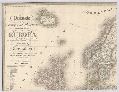
| Title | Praktische Geschäts und Reisekarte. sämmtlicher Staaten von Europa… Nebst einem Theile von Afrika u. Asien. |
| Main title | Európa és részben Afrika, Ázsia kereskedelmi, utazási térképe 1855-ben. |
39. Europa Politische Übersicht zu Beginn des 18. Jahrhunderts. [B I c 32/1]
Institute and Museum of Military History •
B I c
•
B I Európa
•
B I–XV. Európa
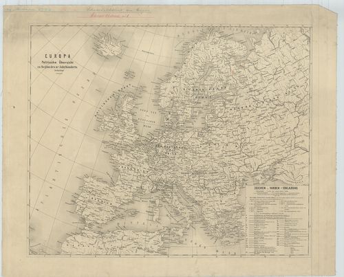
| Title | Europa Politische Übersicht zu Beginn des 18. Jahrhunderts. |
| Main title | Európa politikai térképe a 18. században. |
40. Praktische Geschäfts und Reisekarte. sämmtlicher Staaten von... [B I c 32/2]
Institute and Museum of Military History •
B I c
•
B I Európa
•
B I–XV. Európa
| Title | Praktische Geschäfts und Reisekarte. sämmtlicher Staaten von Europa… Nebst einem Theile von Afrika u. Asien. Véste: Dominik Bitter. |
| Main title | Európa és részben Afrika, Ázsia kereskedelmi utazási térképe 1859-ben. |
41. Internationale Güterverkehrskarte. Stand: 1. 7. 1960. [B I c 33]
Institute and Museum of Military History •
B I c
•
B I Európa
•
B I–XV. Európa
| Title | Internationale Güterverkehrskarte. Stand: 1. 7. 1960. |
| Main title | 2 mt.: 1. [Belgium–Luxemburg–Franciaország és NSZK határvidéke.] 2. [Norvégia–Svédország–Finnország és a SzU.] |
| Subject | Európa teher- és áruforgalmi térképe. 1960. 7. 1-jei állapot. |
42. Európa népei és nyelvei. [B I c 35]
Institute and Museum of Military History •
B I c
•
B I Európa
•
B I–XV. Európa
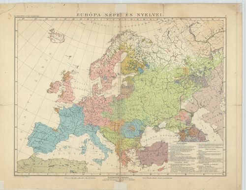
| Title | Európa népei és nyelvei. |
43. Pervaja Mirovaja vojna 1914–1918 gg. [B I c 36]
Institute and Museum of Military History •
B I c
•
B I Európa
•
B I–XV. Európa
| Title | Pervaja Mirovaja vojna 1914–1918 gg. |
| Main title | 3 mt.: 1. [A Világ térképe az I. Világháború időszakában.] 2. Zapadno-Evropejszkij front v 1918 g. (Nyugat-európai front 1918-ban.) 3. Nasztuplenie Ruszszkoj armii letom 1916g. (Orosz támadás 1916 nyarán.) |
| Subject | Az I. Világháború 1914–1918 térképe. |
44. Europa rozmieszczenie ludnosci. [B I c 37]
Institute and Museum of Military History •
B I c
•
B I Európa
•
B I–XV. Európa
| Title | Europa rozmieszczenie ludnosci. |
| Main title | Európa népsűrűsége 1962-ben. |
45. Europa w latach 1918–1939. [B I c 38]
Institute and Museum of Military History •
B I c
•
B I Európa
•
B I–XV. Európa
| Title | Europa w latach 1918–1939. |
| Main title | 3 mt. 1. Zwycięstwo rewolucji na Syberii i w Azji Srodkówej. (A forradalom győzelme Szibériában és Ázsiában.) 2. Wojna domowa iagresja Japonska w Chinach. (A polgárháború és Japán támadása Kínába.) 3. Swiat po pierwszej wojnie Imperialistycznej. (A világ az első világháború után.)Európa 1918 és 1939 közötti években. |
46. Europa od IX–XI wieku. [B I c 39]
Institute and Museum of Military History •
B I c
•
B I Európa
•
B I–XV. Európa
| Title | Europa od IX–XI wieku. |
| Main title | 2 mt.: 1. Podział Religijny przy końcu XI wieku. (Vallási felosztás a XI. század végén.) 2. Europa zachodnia w IX wieku (Népvándorlás a IX. században). |
| Subject | Európa a IX–XI. században. |
47. Evropa u prvoj polovici 19. stolječa (1815–1849.) [B I c 40]
Institute and Museum of Military History •
B I c
•
B I Európa
•
B I–XV. Európa
| Title | Evropa u prvoj polovici 19. stolječa (1815–1849.) |
| Main title | 2 mt.: 1. Industrijska Revolucija u 19. st. (Ipari forradalom a 19. szd.-ban.) 2. Ukidanje kmetstva prije francuske revolucije – za vrijeme francuske revolucije. (A jobbágyság felszabadítása a francia forradalom előtt és után Európában.) |
| Subject | Európa a 19. század. elején 1815–1849-ig. |
48. Evropa sredinom 18. stoljeca. [B I c 41]
Institute and Museum of Military History •
B I c
•
B I Európa
•
B I–XV. Európa
| Title | Evropa sredinom 18. stoljeca. |
| Main title | Európa a 18. század közepén. |
49. Polacy na frontach II wojny Swiatowej 1939–1945. [B I c 42]
Institute and Museum of Military History •
B I c
•
B I Európa
•
B I–XV. Európa
| Title | Polacy na frontach II wojny Swiatowej 1939–1945. |
| Main title | Európa a második világháború idején és a lengyel partizánok működési helyei. |
50. Polacy na frontach II Wojny Światowej 1939–1945. [B I c 42/1]
Institute and Museum of Military History •
B I c
•
B I Európa
•
B I–XV. Európa
| Title | Polacy na frontach II Wojny Światowej 1939–1945. |
| Main title | A II. Világháborúban a lengyelek tevékenysége Európában 1939–1945-ig. |
51. Evropa sz 1870 po 1914g. [B I c 43]
Institute and Museum of Military History •
B I c
•
B I Európa
•
B I–XV. Európa
| Title | Evropa sz 1870 po 1914g. |
| Main title | 5 mt.: 1. Franko-Pruszszkaja vojna i Parizsszkaja kommuna. (Francia–Porosz háború és a Párizsi kommün.) 2. Parizs v 1871g. (Bor’ba kommunarov sz Verszal’cami). (Parizs és Versailles Fr. népi felkelése.) 3. Balkanü vo vremja Ruszszko-Tureckoj vojnü 1877–1878gg. (Az orosz–török Balkánháború 1877 és 1878-ban.) 4. Pervaja Balkanszkaja vojna (9. X. 1912g.–30. V. 1913g.) (Az első Balkán háború 1912. okt. 9.–1913. máj. 30-ig.) 5. Vtoraja Balkanszkaja vojna (30. VI.–29. VII. 1913g.) (A második Balkán-háború 1913. jún. 30.–júl. 29.-ig.) |
| Subject | Európa 1870 és 1914 között. |
52. Evropa sz 1870 po 1914 g. [B I c 43/1]
Institute and Museum of Military History •
B I c
•
B I Európa
•
B I–XV. Európa
| Title | Evropa sz 1870 po 1914 g. |
| Main title | 3 mt.: 1. Parizsszkaja kommuna. (18. III.–28. V. 1871g.) (A párizsi kommün.) 2. Balkanü vo vremja Ruszszko-Tureckoj vojnü 1877–1878gg. (Az orosz–török balkáni háború 1877–1878-ig.) 3. Balkanszkie vojnü 1912–1913gg. (Az 1912–1913-as Balkán-háború.) |
| Subject | Európa 1870 és 1914 között. |
53. Evropa sz 1815 po 1870 g. – 3 térk.: 1. Evropa v 1815–1859 g... [B I c 44]
Institute and Museum of Military History •
B I c
•
B I Európa
•
B I–XV. Európa
| Title | Evropa sz 1815 po 1870 g. – 3 térk.: 1. Evropa v 1815–1859 gg. |
| Main title | 2. Ob’edinenie Germanii i Ob’edinenie Italii (1859–1871 gg.) |
| Subject | 3. 1 Internacional v Evrope. |
54. International personenverkehrskarte. [B I c 59]
Institute and Museum of Military History •
B I c
•
B I Európa
•
B I–XV. Európa
| Title | International personenverkehrskarte. |
| Main title | Európa vasúttérképe 1966-ban. |
55. Carte itinéraire des voies navigables de l’Europe. [B I c 60]
Institute and Museum of Military History •
B I c
•
B I Európa
•
B I–XV. Európa
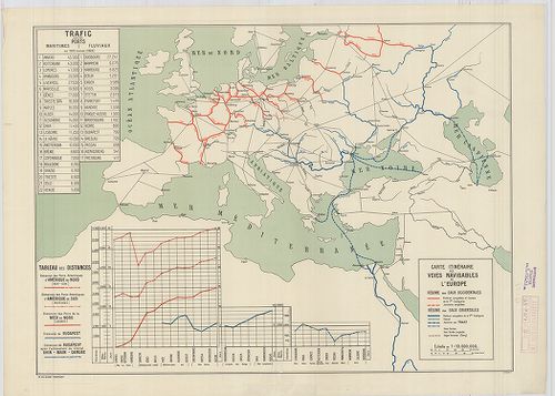
| Title | Carte itinéraire des voies navigables de l’Europe. |
| Main title | Európa légi útjainak térképe 1928. |
56. Európa vasúti térképe. [B I c 61]
Institute and Museum of Military History •
B I c
•
B I Európa
•
B I–XV. Európa
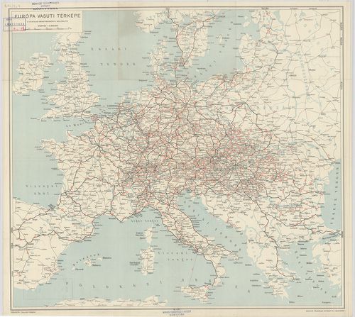
| Title | Európa vasúti térképe. |
57. Hauptverkehrslinien von Europa. [B I c 62]
Institute and Museum of Military History •
B I c
•
B I Európa
•
B I–XV. Európa
| Title | Hauptverkehrslinien von Europa. |
| Main title | 2 mt. 1. Eisenbahnlinien im nördlichen Böhmen. (Észak-Csehország vasútvonalai.) 2. Eisenbahnkarte von Sibirien. (Szibériai vasút, SzU.) 19 Lage der Bahnhöfe. (19 vasútforg. várostérképe.) Hátlapon: Eisenbahn-Routen-Karte von Mitteleuropa. (Közép-Európa vasút és úttérképe.) |
| Subject | Európa közlekedési térképe 1904-ben. |
58. Maps of Europe and Germany. Including railroad, steamship, a... [B I c 64]
Institute and Museum of Military History •
B I c
•
B I Európa
•
B I–XV. Európa
| Title | Maps of Europe and Germany. Including railroad, steamship, auto and air routes. |
| Main title | hátl.: Map of Germany. |
| Subject | Európa közlekedési térképe 1936-ban. |
59. Die Schnellzugslinien Europas. European Express Train Servic... [B I c 65]
Institute and Museum of Military History •
B I c
•
B I Európa
•
B I–XV. Európa
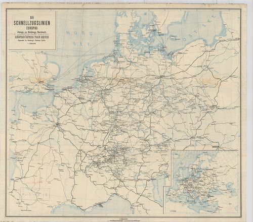
| Title | Die Schnellzugslinien Europas. European Express Train Service. |
| Main title | Mt.: Europa. Anlage zu Hobbings Kursbuch. |
| Subject | Nyugat- és Közép-Európa gyorsvonati vonalai a XX. század elején. |
60. Nivellements de précision. Lignes existant en Europa (Russie... [B I c 66]
Institute and Museum of Military History •
B I c
•
B I Európa
•
B I–XV. Európa
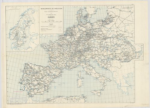
| Title | Nivellements de précision. Lignes existant en Europa (Russie exceptée) et en Afrique… |
| Main title | Európa úthálózati térképe 1903-ban. |
61. Európa rádió adóállomásai [B I c 67]
Institute and Museum of Military History •
B I c
•
B I Európa
•
B I–XV. Európa
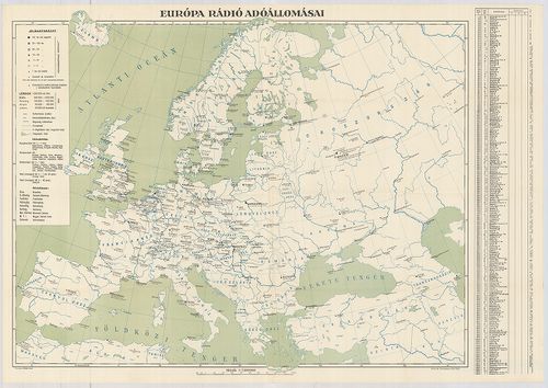
| Title | Európa rádió adóállomásai |
62. L’Europe en Automobile. Europe motoring. Through Europe. [B I c 68]
Institute and Museum of Military History •
B I c
•
B I Európa
•
B I–XV. Európa
| Title | L’Europe en Automobile. Europe motoring. Through Europe. |
| Main title | Európa autóúthálózatának térképe |
63. L’Europe en Automobile. – Europe motoring. – Through Europe. [B I c 69]
Institute and Museum of Military History •
B I c
•
B I Európa
•
B I–XV. Európa
| Title | L’Europe en Automobile. – Europe motoring. – Through Europe. |
| Main title | Európa autóúthálózatának térképe. |
64. Neueste Reise-Hand-Und Kontorkarte von Europa mit den angren... [B I c 70]
Institute and Museum of Military History •
B I c
•
B I Európa
•
B I–XV. Európa
| Title | Neueste Reise-Hand-Und Kontorkarte von Europa mit den angrenzenden Teilen von Asien und Afrika. |
| Main title | Európa és Ázsia, Afrika határos részeinek úthálózati térképe. |
65. Europa Gesamtkarte. [B I c 71]
Institute and Museum of Military History •
B I c
•
B I Európa
•
B I–XV. Európa
| Title | Europa Gesamtkarte. |
| Main title | Európa közlekedési térképe. |
66. Karte von Europa und Westasien. [B I c 78]
Institute and Museum of Military History •
B I c
•
B I Európa
•
B I–XV. Európa
| Title | Karte von Europa und Westasien. |
| Main title | Európa térképe 1940-ben. |
67. Magyar Királyi Lég-ügyi Hivatal Időjelző Központ. [B I c 79]
Institute and Museum of Military History •
B I c
•
B I Európa
•
B I–XV. Európa
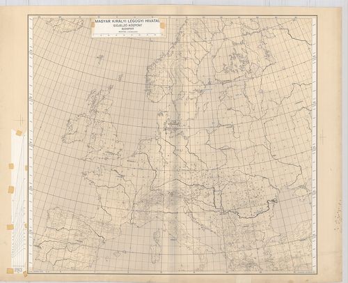
| Title | Magyar Királyi Lég-ügyi Hivatal Időjelző Központ. |
68. Schaubild von Europa mit bildlicher Darstellung der hauptsäc... [B I c 80]
Institute and Museum of Military History •
B I c
•
B I Európa
•
B I–XV. Európa
| Title | Schaubild von Europa mit bildlicher Darstellung der hauptsächlichsten Wirtschaftsgüter, Bodenschätze, Industriezentren. |
| Main title | Európa térképe gazdasági adatokkal 1940 körül. |
69. Angling in troubled Waters. – Der Fischfang im Trüben – La P... [B I c 85]
Institute and Museum of Military History •
B I c
•
B I Európa
•
B I–XV. Európa
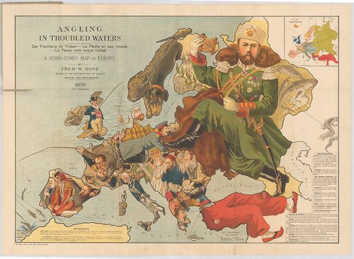
| Title | Angling in troubled Waters. – Der Fischfang im Trüben – La Peche en eau trouble – La Pesca nelle acque turbes. A Serio-Comic Map of Europe. |
| Main title | Mt.: Key Map of Europe. (Európa térképe.) |
| Subject | „Halászat a zavarosban" - tréfás rajz Európáról. 1899. |
70. G. Freytags Völkerkarte von Europa. [B I c 88]
Institute and Museum of Military History •
B I c
•
B I Európa
•
B I–XV. Európa
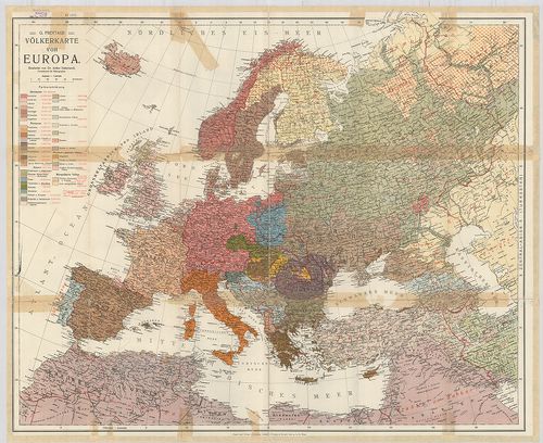
| Title | G. Freytags Völkerkarte von Europa. |
| Main title | Európa néprajzi térképe. |
71. Länder- und Völkerkarte Europas. [B I c 89]
Institute and Museum of Military History •
B I c
•
B I Európa
•
B I–XV. Európa
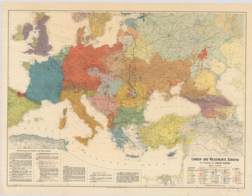
| Title | Länder- und Völkerkarte Europas. |
| Main title | Európa ország és néprajzi térképe. |
72. Nova karta Evrope. Po ryszkom lisztu „Novoe Zveno”. [B I c 90]
Institute and Museum of Military History •
B I c
•
B I Európa
•
B I–XV. Európa
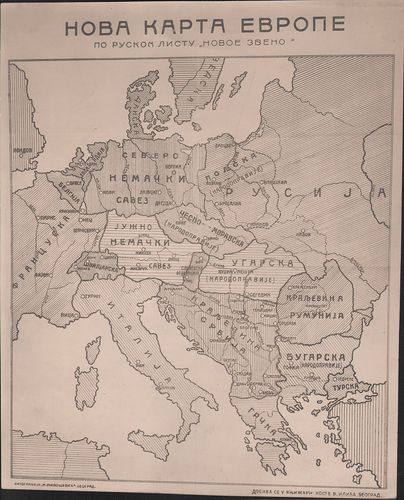
| Title | Nova karta Evrope. Po ryszkom lisztu „Novoe Zveno”. |
| Main title | Európa tervezett határrendezése az első világháború után. |
73. Europa etnografica. [B I c 94]
Institute and Museum of Military History •
B I c
•
B I Európa
•
B I–XV. Európa

| Title | Europa etnografica. |
| Main title | Európa néprajzi térképe 1940-ben. |
74. Groessen und Bevoelkerungs karte von Europa. [B I c 95]
Institute and Museum of Military History •
B I c
•
B I Európa
•
B I–XV. Európa
| Title | Groessen und Bevoelkerungs karte von Europa. |
| Main title | Európa népessége táblázatban, Németország részletezve. (Térkép nincs) |
75. Európa rádiótérképe. [B I c 100]
Institute and Museum of Military History •
B I c
•
B I Európa
•
B I–XV. Európa
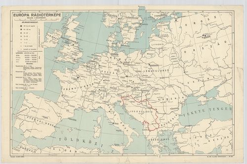
| Title | Európa rádiótérképe. |
76. Mapa radjokomunikacyjna Europy. [B I c 101]
Institute and Museum of Military History •
B I c
•
B I Európa
•
B I–XV. Európa
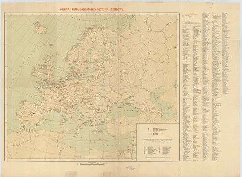
| Title | Mapa radjokomunikacyjna Europy. |
| Main title | Európa rádióállomásainak térképe 1936. |
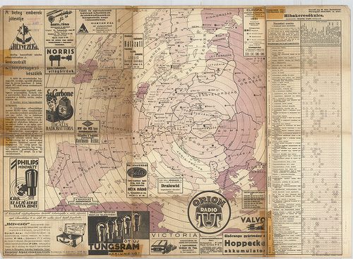
77. [Európa rádióállomásai.] [B I c 102/a]
Institute and Museum of Military History •
B I c
•
B I Európa
•
B I–XV. Európa
| Title | [Európa rádióállomásai.] |
78. [A világ rádióállomásai] [B I c 102/b]
Institute and Museum of Military History •
B I c
•
B I Európa
•
B I–XV. Európa

| Title | [A világ rádióállomásai] |
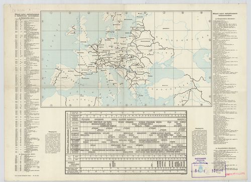
79. Európa rádióadó-állomásainak hullámhossz, kilowatt- és távol... [B I c 103]
Institute and Museum of Military History •
B I c
•
B I Európa
•
B I–XV. Európa
| Title | Európa rádióadó-állomásainak hullámhossz, kilowatt- és távolsági térképe. |
80. Übersichtskarte der Breiten- und Azimutbestimmungen. Carte d... [B I c 120]
Institute and Museum of Military History •
B I c
•
B I Európa
•
B I–XV. Európa
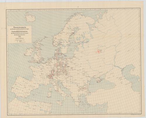
| Title | Übersichtskarte der Breiten- und Azimutbestimmungen. Carte demonstrative des déterminations astronomiques de latitude et d’azimut. 1904. |
| Main title | Európa térképe a földr. szélesség és azimut meghatározásokkal 1904-ben. |
81. Übersichtskarte der telegraphischen Längenbestimmungen. Cart... [B I c 121]
Institute and Museum of Military History •
B I c
•
B I Európa
•
B I–XV. Európa
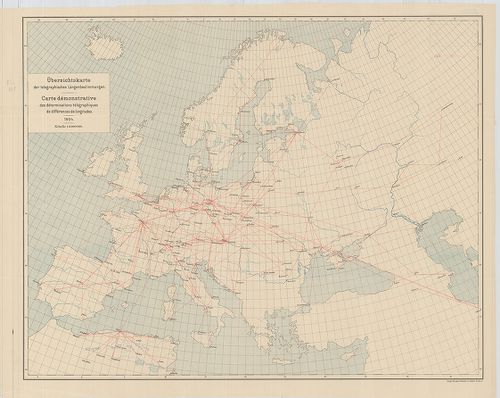
| Title | Übersichtskarte der telegraphischen Längenbestimmungen. Carte démonstrative des déterminations télégraphiques dex différences de longitudes. 1904. |
| Main title | Európa távíró vonalai 1904-ben. |
82. Übersichtskarte der Bestimmungen der Schwerkraft. Carte demo... [B I c 122]
Institute and Museum of Military History •
B I c
•
B I Európa
•
B I–XV. Európa
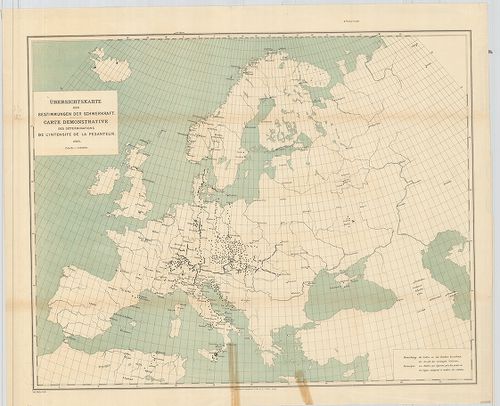
| Title | Übersichtskarte der Bestimmungen der Schwerkraft. Carte demonstrative des déterminations de lintensité de la pesanteur. |
| Main title | Európa térképe a meghatározott nehézségi erővel 1900-ban. |
83. Übersichtskarte für den Stand der Trigonometrischen Arbeiten... [B I c 123]
Institute and Museum of Military History •
B I c
•
B I Európa
•
B I–XV. Európa
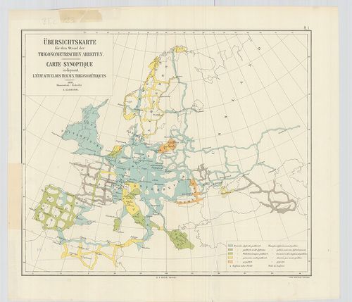
| Title | Übersichtskarte für den Stand der Trigonometrischen Arbeiten. Carte synoptique indiquant l’état actuel des travaux trigonométriques. |
| Main title | Európa térképe a háromszögelési munkák állásáról 1904-ben. |
84. Europe. Europa Mobil. [B I c 125]
Institute and Museum of Military History •
B I c
•
B I Európa
•
B I–XV. Európa
| Title | Europe. Europa Mobil. |
| Main title | Európa autóúttérképe. |
85. Grandes routes de trafic international. Routes de trafic nat... [B I c 126]
Institute and Museum of Military History •
B I c
•
B I Európa
•
B I–XV. Európa
| Title | Grandes routes de trafic international. Routes de trafic national. [Európa.] |
| Main title | Európa autóúttérképe. |
86. Klimaticseszkaja karta Evropü. Ucsebnaja karta. [B I c 127]
Institute and Museum of Military History •
B I c
•
B I Európa
•
B I–XV. Európa
| Title | Klimaticseszkaja karta Evropü. Ucsebnaja karta. |
| Main title | Európa éghajlati térképe. |
87. Prirodnüe zonü Evropü. Ucsebnaja karta. [B I c 128]
Institute and Museum of Military History •
B I c
•
B I Európa
•
B I–XV. Európa
| Title | Prirodnüe zonü Evropü. Ucsebnaja karta. |
| Main title | Európa természeti zónái. |
88. [Európa állatföldrajzi térképe.] [B I c 133]
Institute and Museum of Military History •
B I c
•
B I Európa
•
B I–XV. Európa
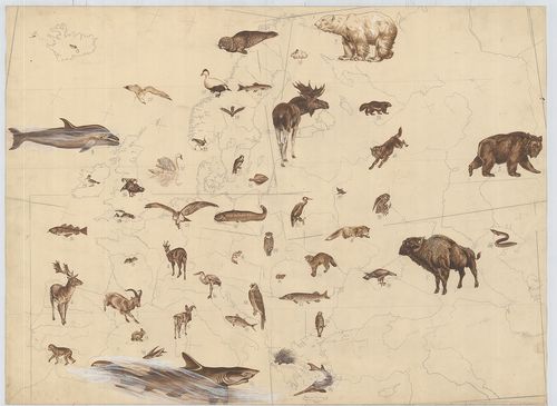
| Title | [Európa állatföldrajzi térképe.] |
89. Europa. Strassenatlas. [B I c 134]
Institute and Museum of Military History •
B I c
•
B I Európa
•
B I–XV. Európa
| Title | Europa. Strassenatlas. |
| Main title | Európa autóatlasza 1969-ben. |
90. Europa, mapa samochodowa. [B I c 135]
Institute and Museum of Military History •
B I c
•
B I Európa
•
B I–XV. Európa
| Title | Europa, mapa samochodowa. |
| Main title | 26 mt.: városáthajtási térképek. |
| Subject | Európa autóúttérképe 1965-ben. |
91. Evropa glavni avtomobilni putisa. [B I c 136]
Institute and Museum of Military History •
B I c
•
B I Európa
•
B I–XV. Európa
| Title | Evropa glavni avtomobilni putisa. |
| Main title | Európa autóúttérképe 1967-ben. |
92. Europa. Hospodařská mapa. [B I c 137]
Institute and Museum of Military History •
B I c
•
B I Európa
•
B I–XV. Európa
| Title | Europa. Hospodařská mapa. |
| Main title | 5 mt.: 1. Donecká panev. (A Dón-medence) 2. Ludnatost (Népsűrűség.) 3. Porúři, (Düsseldorf és környéke.) 4. Štředni Anglie. (Közép-Anglia) 5. Ostravsko-Karvinska a Hornoslezská panev. (Ostrava-Karviná és Hornoslezská-medence.) |
| Subject | Európa gazdaségi térképe 1961-ben. |
93. Europa carta stradale igda-turist. [B I c 138]
Institute and Museum of Military History •
B I c
•
B I Európa
•
B I–XV. Európa
| Title | Europa carta stradale igda-turist. |
| Main title | Európa autóúttérképe. |
94. Carta automobilistica d’Europa – Touring Club Haliano. [B I c 139]
Institute and Museum of Military History •
B I c
•
B I Európa
•
B I–XV. Európa
| Title | Carta automobilistica d’Europa – Touring Club Haliano. |
| Main title | Európa autóúttérképe 1965-ből. |
95. Imperium Romanum. [B I c 140]
Institute and Museum of Military History •
B I c
•
B I Európa
•
B I–XV. Európa
| Title | Imperium Romanum. |
| Main title | 1 mt.: Naše Krajiny |
| Subject | Csehország tartományi része a Római Birodalom idején. |
96. Übersichtskarte der Eisenbahnen in Europa. [B I c 141]
Institute and Museum of Military History •
B I c
•
B I Európa
•
B I–XV. Európa
| Title | Übersichtskarte der Eisenbahnen in Europa. |
| Main title | Mt.: Európa-Asien. |
| Subject | Európa vasúthálózati áttekintő térképe. |
97. Politisch-Geographische Grundlagen Europas-Flemming Friedens... [B I c 142]
Institute and Museum of Military History •
B I c
•
B I Európa
•
B I–XV. Európa
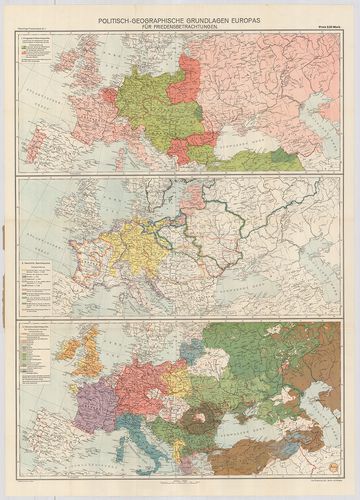
| Title | Politisch-Geographische Grundlagen Europas-Flemming Friedenskarten |
| Main title | 3 térk. 1. Európa háborús térkép 2. Európa történelmi térkép 3. Európa népességi térkép. |
| Subject | Európa politikai-földrajzi térképe 1917-ben. |
98. Európai háború kis térképe. [B I c 143]
Institute and Museum of Military History •
B I c
•
B I Európa
•
B I–XV. Európa
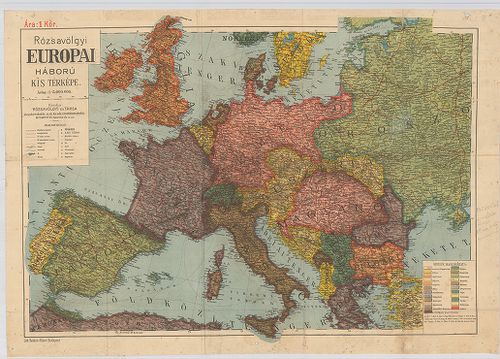
| Title | Európai háború kis térképe. |
99. Flemmings Übersichtskarte für den europäischen Kriegsschaupa... [B I c 144]
Institute and Museum of Military History •
B I c
•
B I Európa
•
B I–XV. Európa
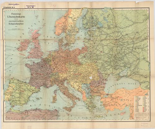
| Title | Flemmings Übersichtskarte für den europäischen Kriegsschaupaltz. |
| Main title | Az európai hadszíntér áttekintő térképe az első világháborúban. |
100. Ravensteins Karte des Deutschen Sperrgebietes für den uneing... [B I c 145]
Institute and Museum of Military History •
B I c
•
B I Európa
•
B I–XV. Európa
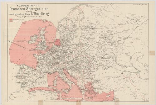
| Title | Ravensteins Karte des Deutschen Sperrgebietes für den uneingeschkränkten „U” Boot-Krieg. Ravensteins Kriegskarte. |
| Main title | Európa térképe. Tengeralattjáró háború a németek által korlátlanul lezárt Európa NY-i és D-i területein. |