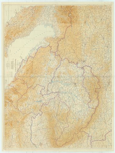
81. Übersichtskarte über den Stand der systematischen Lothabweic... [B II c 90]
Institute and Museum of Military History •
B II c
•
B II Európa, nagyobb részek és országcsoportok
•
B I–XV. Európa
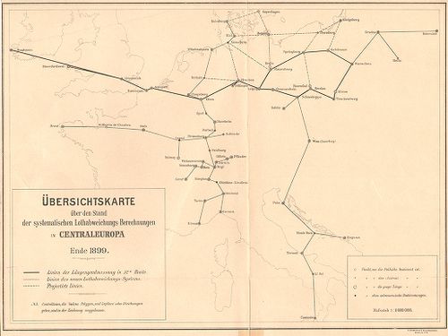
| Title | Übersichtskarte über den Stand der systematischen Lothabweichungs–Berechnungen in Centraleuropa. Ende 1899. |
| Main title | Közép-Európa rendszeres mérővonal-kiegyenlítési állásai 1899 végén. |
82. Luft-navigations Karte in Merkatorprojection. [B II c 91]
Institute and Museum of Military History •
B II c
•
B II Európa, nagyobb részek és országcsoportok
•
B I–XV. Európa
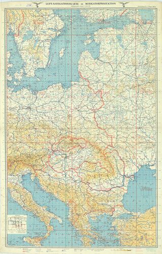
| Title | Luft-navigations Karte in Merkatorprojection. |
| Main title | Kelet- és Dél-Európa repülőtérképe 1940-ben (Keleti-tengertól a Balkán-félszigetig). |
83. Direzione generale per il turismo. [B II c 92]
Institute and Museum of Military History •
B II c
•
B II Európa, nagyobb részek és országcsoportok
•
B I–XV. Európa
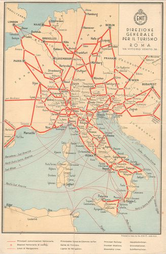
| Title | Direzione generale per il turismo. |
| Main title | Közép-Európa vasút- és hajóutak térképe 1935-ben. |
84. U. S. Army Air Forces. Special air navigation chart. (S. 132... [B II c 92/1]
Institute and Museum of Military History •
B II c
•
B II Európa, nagyobb részek és országcsoportok
•
B I–XV. Európa
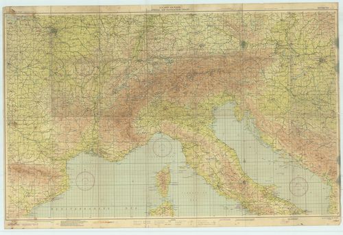
| Title | U. S. Army Air Forces. Special air navigation chart. (S. 132.) Paris to Rome 1944. |
| Main title | Közép-Európa repülőtérképe 1944-ben. |
85. Reichs-Luftkursbuch. 1929–30. [B II c 93]
Institute and Museum of Military History •
B II c
•
B II Európa, nagyobb részek és országcsoportok
•
B I–XV. Európa
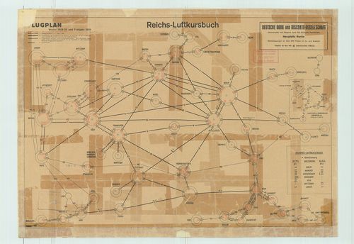
| Title | Reichs-Luftkursbuch. 1929–30. |
| Main title | Közép-Európai repülőjáratok útvonalai, Luft Hansa és más rep. társaságok, érkezései, indulásidők táblázata 1930-ban, a járatok vázlatával. |
86. Jancourt’s railway and steamship tourist map of Europe. [B II c 94]
Institute and Museum of Military History •
B II c
•
B II Európa, nagyobb részek és országcsoportok
•
B I–XV. Európa
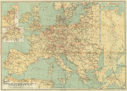
| Title | Jancourt’s railway and steamship tourist map of Europe. |
| Main title | 4 mt.: 1. [Nederland-Belgique] (Hollandia, Belgium) 2. [Schweiz] (Svájc) 3. [Európa] 4. From Europe to China and Japán via Reans-Siberia. (Szibéria–Kína–Japán vasúthálózat.) |
| Subject | Európa vasúti és hajózási térképe 1930 körül. |
87. Die Front im Osten. Karte der Deutsche Allgemeine Zeitung. [B II c 98]
Institute and Museum of Military History •
B II c
•
B II Európa, nagyobb részek és országcsoportok
•
B I–XV. Európa
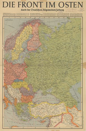
| Title | Die Front im Osten. Karte der Deutsche Allgemeine Zeitung. |
| Main title | Kelet-Európa 1941-ben. |
88. Deutsche Heereskarte. Operationskarte Ost-Blatt II. Ausg. Nr... [B II c 99]
Institute and Museum of Military History •
B II c
•
B II Európa, nagyobb részek és országcsoportok
•
B I–XV. Európa
| Title | Deutsche Heereskarte. Operationskarte Ost-Blatt II. Ausg. Nr. 4. |
| Main title | Közép-Európa hadműveleti térképe 1945-ben. |
89. Übersichtskarte über den Stand der Lotabweichungsberechnunge... [B II c 100]
Institute and Museum of Military History •
B II c
•
B II Európa, nagyobb részek és országcsoportok
•
B I–XV. Európa
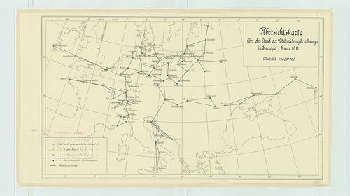
| Title | Übersichtskarte über den Stand der Lotabweichungsberechnungen in Europa, Ende 1911. |
| Main title | Európa mérővonal kiegyenlítési állásai 1911 végén. Geodéziai hálózat. |
90. Alpenländer, Autokarte-Road Map. – Alpine Countries – Pays A... [B II c 101]
Institute and Museum of Military History •
B II c
•
B II Európa, nagyobb részek és országcsoportok
•
B I–XV. Európa
| Title | Alpenländer, Autokarte-Road Map. – Alpine Countries – Pays Alpins, Carte Automobile – Paesi Alpini, Carta Stradale. |
| Main title | Az Alpok országainak autótérképe. |
91. Übersicht über die geographische Verteilung der Schwerestati... [B II c 102]
Institute and Museum of Military History •
B II c
•
B II Európa, nagyobb részek és országcsoportok
•
B I–XV. Európa
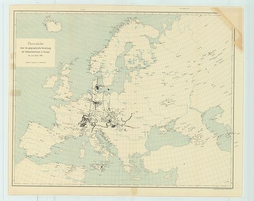
| Title | Übersicht über die geographische Verteilung der Schwerestationen in Europa, bis zum Jahre 1909. Blatt I. |
| Main title | Európa nehézségi állomásai 1909-ben. |
92. Csonkamagyarország és a környező államok közlekedési térképe... [B II c 104]
Institute and Museum of Military History •
B II c
•
B II Európa, nagyobb részek és országcsoportok
•
B I–XV. Európa
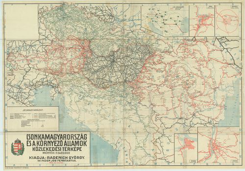
| Title | Csonkamagyarország és a környező államok közlekedési térképe. |
| Main title | 5 mt.: 1. Légi közlekedés. 2. Prága. |
| Subject | 3. Bukarest. |
93. Carte ethnographique de L’Europe Centrale. [B II c 105]
Institute and Museum of Military History •
B II c
•
B II Európa, nagyobb részek és országcsoportok
•
B I–XV. Európa
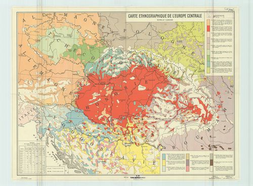
| Title | Carte ethnographique de L’Europe Centrale. |
| Main title | Közép-Európa néprajzi térképe 1938-ban. |
94. A dunai államok néprajzi térképe. [B II c 106]
Institute and Museum of Military History •
B II c
•
B II Európa, nagyobb részek és országcsoportok
•
B I–XV. Európa
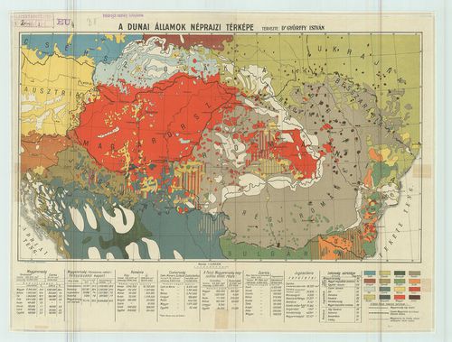
| Title | A dunai államok néprajzi térképe. |
95. A Duna völgy és környéke. [B II c 107]
Institute and Museum of Military History •
B II c
•
B II Európa, nagyobb részek és országcsoportok
•
B I–XV. Európa
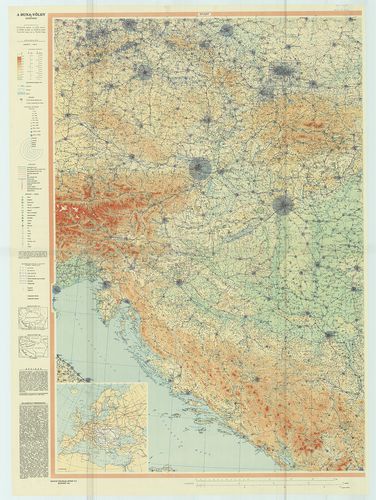
| Title | A Duna völgy és környéke. |
| Main title | Mt.: [Európa] |
| Subject | Országhatárok 1914-ben és 1930-ban. |
96. Ostalpen: Dolomiten – Tirol. Automobilkarte. „Alpina I.” [B II c 108]
Institute and Museum of Military History •
B II c
•
B II Európa, nagyobb részek és országcsoportok
•
B I–XV. Európa
| Title | Ostalpen: Dolomiten – Tirol. Automobilkarte. „Alpina I.” |
| Main title | Keleti Alpok: Dolomitok. Tirol autótérképe 1963-ban. |
97. Westalpen: Riviera. Provence Automobilkarte. „Alpina II.” [B II c 108/1]
Institute and Museum of Military History •
B II c
•
B II Európa, nagyobb részek és országcsoportok
•
B I–XV. Európa
| Title | Westalpen: Riviera. Provence Automobilkarte. „Alpina II.” |
| Main title | Nyugati-Alpok: Riviera, Provence autótérképe 1963-ban. |
98. Alpina I. Ostalpen, – Alpes Orientales, Dolomiti, – Veneto, ... [B II c 108/2]
Institute and Museum of Military History •
B II c
•
B II Európa, nagyobb részek és országcsoportok
•
B I–XV. Európa
| Title | Alpina I. Ostalpen, – Alpes Orientales, Dolomiti, – Veneto, Österreich. – Ostalpen, Dolomiti, – Veneto., – Tirol. Hallwag Strassenkarte – Road Map. |
| Main title | A Keleti-Alpok, a Dolomitok-Veneto vidék, Tirol és Ausztria úttérképe 1971-ben. |
99. Alpina II. Ovest-West. – Westalpen. Provence, – Riviera, – S... [B II c 108/3]
Institute and Museum of Military History •
B II c
•
B II Európa, nagyobb részek és országcsoportok
•
B I–XV. Európa
| Title | Alpina II. Ovest-West. – Westalpen. Provence, – Riviera, – Savoie. – Westlapen. Riviera, Provence, Savoie, Piemonte. Hallwag Carte Automobile – Autokarte. |
| Main title | A Nyugati-Alpok, Provence, – Savoie vidék, Piemont vidék és a Riviera autótérképe 1970-ben. |
100. Alpina III. Schweiz–Tirol–Oberitalie. – Zentralalpen. La Sui... [B II c 108/4]
Institute and Museum of Military History •
B II c
•
B II Európa, nagyobb részek és országcsoportok
•
B I–XV. Európa
| Title | Alpina III. Schweiz–Tirol–Oberitalie. – Zentralalpen. La Suisse-Alta Italia-Oberitalien. Hallwag. Strassenkarte. |
| Main title | A Közép-Alpok, Svájc és Felső-Olaszország úttérképe 1971-ben. |