921. A Középső- és Alsó-Duna medencék áttekintő térképe. [B III a 371]
Institute and Museum of Military History •
B III a
•
B III Balkán-félsziget
•
B I–XV. Európa
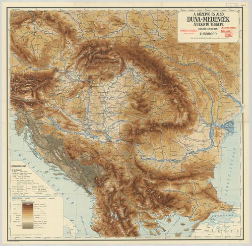
| Title | A Középső- és Alsó-Duna medencék áttekintő térképe. |
922. Plan zur Verbindung der untern Donau mit dem Adriatischen Me... [B III b 30]
Institute and Museum of Military History •
B III b
•
B III Balkán-félsziget
•
B I–XV. Európa
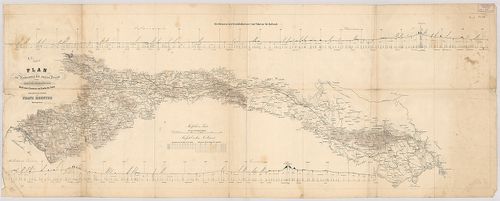
| Title | Plan zur Verbindung der untern Donau mit dem Adriatischen Meere durch eine Eisenbahn von Semlin bis Fiume. |
| Main title | Nivellement der Eisenbahntrace von Vukovar bis Karlstadt. (Vasútvonalmetszet Vukovar–Karlovac között. |
| Subject | Az Al-Duna és az Adriai-tenger vasúti összeköttetésének terve Zemun-tól Rijeka-ig. |
923. Plan des Donau-Stroms von Zemlin bis Ruszug. – Plan des Dona... [B III b 32]
Institute and Museum of Military History •
B III b
•
B III Balkán-félsziget
•
B I–XV. Európa
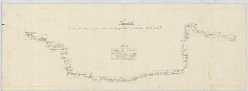
| Title | Plan des Donau-Stroms von Zemlin bis Ruszug. – Plan des Donau-Stroms Ruszug bis Ruszug. – Plan des Donau-Stroms Ruszug bis Sulina an dem Schwarzen Meere. |
| Main title | A Duna térképe Zimonytól a Fekete-tengerig 1779-ben. |
924. Die Donaustrecke von Báziás bis Turnu-Severinu mit der Strom... [B III b 33]
Institute and Museum of Military History •
B III b
•
B III Balkán-félsziget
•
B I–XV. Európa
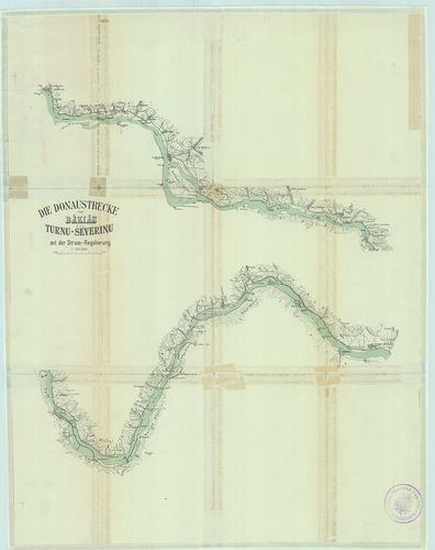
| Title | Die Donaustrecke von Báziás bis Turnu-Severinu mit der Strom-Regulierung. |
| Main title | Az Al-Duna szabályozási-terv térképe Báziástól–Turnu-Severinig 1900 körül. |
925. [Duna és partvidékének térképe a Kazán-szorostól a Fekete-te... [B III b 34]
Institute and Museum of Military History •
B III b
•
B III Balkán-félsziget
•
B I–XV. Európa
| Title | [Duna és partvidékének térképe a Kazán-szorostól a Fekete-tengerig.] |
926. Pregledna karta šumskih uprava: Pančevo, Bela Crkva, Delibla... [B III b 40]
Institute and Museum of Military History •
B III b
•
B III Balkán-félsziget
•
B I–XV. Európa
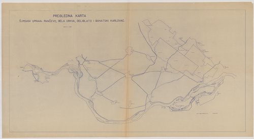
| Title | Pregledna karta šumskih uprava: Pančevo, Bela Crkva, Deliblato i Banatski Karlovad. |
| Main title | A Duna térképe Zimonytól Palánkáig 1938-ban. |
927. Pregledna karta šumske uprava: Backa Palanka. [B III b 40/1]
Institute and Museum of Military History •
B III b
•
B III Balkán-félsziget
•
B I–XV. Európa
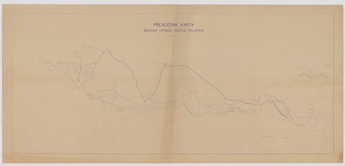
| Title | Pregledna karta šumske uprava: Backa Palanka. |
| Main title | A Duna térképe Vukovártól – Lokig 1938-ban. |
928. Pregledna karta šumskih uprava: Apatin, Bezdan i Doroslovo. [B III b 40/2]
Institute and Museum of Military History •
B III b
•
B III Balkán-félsziget
•
B I–XV. Európa
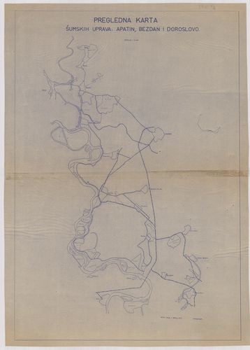
| Title | Pregledna karta šumskih uprava: Apatin, Bezdan i Doroslovo. |
| Main title | A Duna térképe Bezdántól–Almásig (Aljmaš) 1938-ban. |
929. Szliv gornjeg Dunava. – Szliv donjeg Dunava. [B III b 66]
Institute and Museum of Military History •
B III b
•
B III Balkán-félsziget
•
B I–XV. Európa
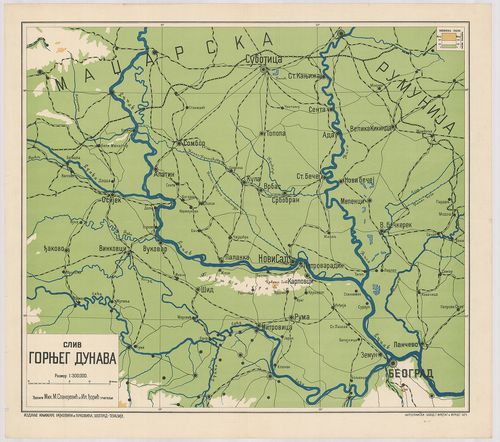
| Title | Szliv gornjeg Dunava. – Szliv donjeg Dunava. |
| Main title | A Duna térképe Jugoszlávia területén az 1920-as években. |
930. Die Donau von Bazias bis zur Mündung. [B III b 82]
Institute and Museum of Military History •
B III b
•
B III Balkán-félsziget
•
B I–XV. Európa
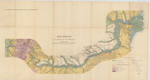
| Title | Die Donau von Bazias bis zur Mündung. |
| Main title | A Duna térképe Báziástól a torkolatig 1904-ben. |
931. Topographische Karte der Gegend zwischen der Donau, Abens, u... [B IV a 521/1]
Institute and Museum of Military History •
B IV a
•
B IV Német birodalom
•
B I–XV. Európa
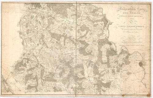
| Title | Topographische Karte der Gegend zwischen der Donau, Abens, und Iser. – Carte Topographique du Pays Entre le Danube, l’Abens, et l’Iser. |
| Main title | A Duna–Abens–Isar közötti terület topográfiai térképe 1811-ben. |
932. Théâtre des Opérations Entre le Danube et l’Isar en Avril 18... [B IV b 23]
Institute and Museum of Military History •
B IV b
•
B IV Német birodalom
•
B I–XV. Európa
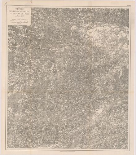
| Title | Théâtre des Opérations Entre le Danube et l’Isar en Avril 1809. |
| Main title | A Duna és Isar közötti terület katonai térképe a francia–bajor háború alatt 1807-ben. |
933. [Danubius Flus.] [B IV b 58]
Institute and Museum of Military History •
B IV b
•
B IV Német birodalom
•
B I–XV. Európa
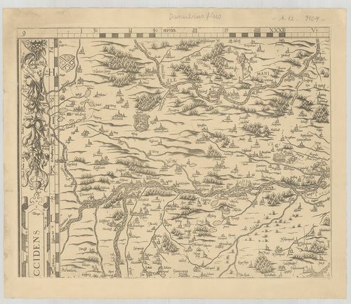
| Title | [Danubius Flus.] |
| Main title | A Duna térképe Dunawörth-től Ingolstadtig. |
934. Karte des Donaustroms von seinem Ursprung bis zum Ausfluss i... [B IV b 60/4]
Institute and Museum of Military History •
B IV b
•
B IV Német birodalom
•
B I–XV. Európa
| Title | Karte des Donaustroms von seinem Ursprung bis zum Ausfluss ins Schwarze Meer… |
| Main title | A Duna térképe a forrásvidéktől a Fekete-tengerig 1788-ban. |
935. Topographische Karte der Gegend zwischen der Donau, Abens un... [B IV b 143]
Institute and Museum of Military History •
B IV b
•
B IV Német birodalom
•
B I–XV. Európa
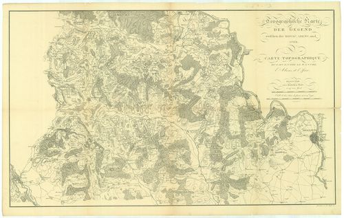
| Title | Topographische Karte der Gegend zwischen der Donau, Abens und Iser. – Carte Topographique du Pays Entre le Danube, l’Abens et l’Iser. |
| Main title | A Duna, Abens és Isar közötti terület topográfiai térképe 1811-ben. |
936. Post-Reise-Karte von Deutschland mit spezieller Angabe der E... [B IV c 79]
Institute and Museum of Military History •
B IV c
•
B IV Német birodalom
•
B I–XV. Európa
| Title | Post-Reise-Karte von Deutschland mit spezieller Angabe der Eisenbahn- und Dampschiffart-Verbindungen. – Carte-routiéres et postale de l’Allemagne |
Technical features: [...] térk D i részén a Duna Rajna Elba folyók hajózási térképe [...]
937. Archiducatus Austriae Inferioris Geographica et Nouiter Emen... [B IX a 241]
Institute and Museum of Military History •
B IX a
•
B IX Ausztria–Magyarország
•
B I–XV. Európa
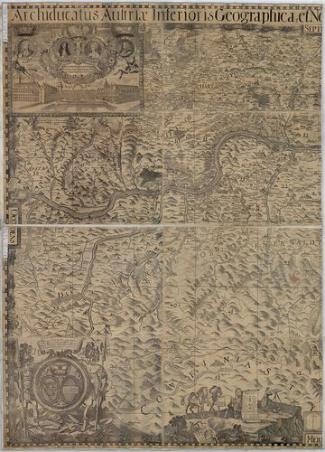
| Title | Archiducatus Austriae Inferioris Geographica et Nouiter Emendata Accuratissima Descriptio. |
| Main title | Alsó-Ausztria térképe 1697-ben. |
Technical features: [...] arcképe az Osztrák Kancellária a Duna látképe térképezés stb Vv
938. Archiducatus Austriae Inferioris accuratissima Geographica D... [B IX a 241/1]
Institute and Museum of Military History •
B IX a
•
B IX Ausztria–Magyarország
•
B I–XV. Európa
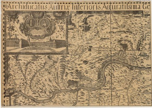
| Title | Archiducatus Austriae Inferioris accuratissima Geographica Descriptio… |
| Main title | Sarokrajzok: I. Lipót császár és Margarita császárné arcképe, az Osztrák kancellária, a Duna látképe, térképezés stb. |
| Subject | Alsó-Ausztria térképe 1670-ben. |
939. Montanae Civitates. [B IX a 483/3]
Institute and Museum of Military History •
B IX a
•
B IX Ausztria–Magyarország
•
B I–XV. Európa
| Title | Montanae Civitates. |
| Main title | Magyarország ÉNy-i részének - a Felvidék térképe a 17. században. (A Duna–Vág–Rimaszombat, Rimavská Sobota–Zólyom, Zvolen között.) |
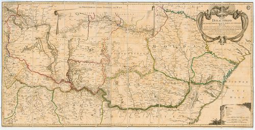
940. [A Duna–Tisza–Maros közének térképe.] [B IX a 489/1]
Institute and Museum of Military History •
B IX a
•
B IX Ausztria–Magyarország
•
B I–XV. Európa
| Title | [A Duna–Tisza–Maros közének térképe.] |