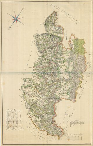
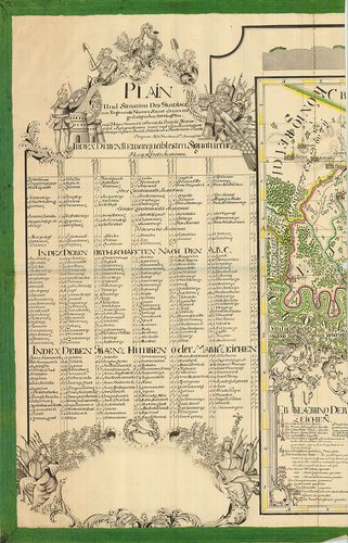
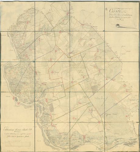
1341. Karte des Grossfürstenthums Siebenbürgen. [B IX a 1223]
Institute and Museum of Military History •
B IX a
•
B IX Ausztria–Magyarország
•
B I–XV. Európa
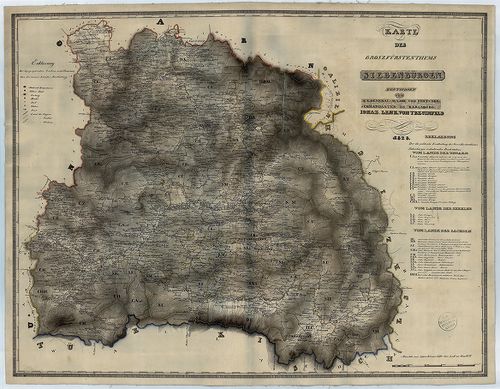
| Title | Karte des Grossfürstenthums Siebenbürgen. |
| Main title | Az Erdélyi Nagyfejedelemség térképe |
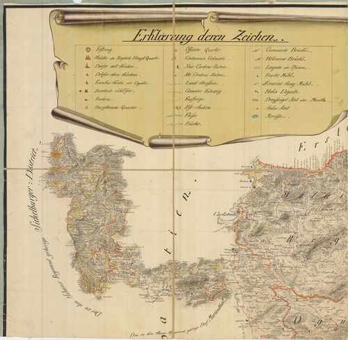
1342. Geographische Mappe des Grossfürstenthums Siebenbürgen. [B IX a 1226]
Institute and Museum of Military History •
B IX a
•
B IX Ausztria–Magyarország
•
B I–XV. Európa

| Title | Geographische Mappe des Grossfürstenthums Siebenbürgen. |
| Main title | Az Erdélyi Nagyfejedelemség földrajzi térképe |
1343. Charte des Carlstadter Generalats... [B IX a 1228]
Institute and Museum of Military History •
B IX a
•
B IX Ausztria–Magyarország
•
B I–XV. Európa
| Title | Charte des Carlstadter Generalats... |
| Main title | A Károlyvárosi Határőrvidék térképe az I. katonai felmérés 1791-es kiegészítése után. |
1344. Militair Carte des Varasdiner Generalats... [B IX a 1229]
Institute and Museum of Military History •
B IX a
•
B IX Ausztria–Magyarország
•
B I–XV. Európa
| Title | Militair Carte des Varasdiner Generalats... |
| Main title | A Varasdi Határőrvidék térképe. |
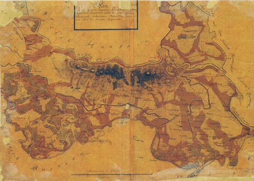
1345. Carte der Carlstadter Banal und Warasdiner Granz Regimenter ... [B IX a 1231]
Institute and Museum of Military History •
B IX a
•
B IX Ausztria–Magyarország
•
B I–XV. Európa
| Title | Carte der Carlstadter Banal und Warasdiner Granz Regimenter als auch des angranzenden Illyrien und Provinzial Croatien. |
| Main title | A Báni és Varasdi Határőrvidék térképe a határos illír és horvát területekkel. |
1346. Plan des löblichen Warasdiner-Sanct Geoger Regiments Bezirk. [B IX a 1232]
Institute and Museum of Military History •
B IX a
•
B IX Ausztria–Magyarország
•
B I–XV. Európa
| Title | Plan des löblichen Warasdiner-Sanct Geoger Regiments Bezirk. |
| Main title | A Szent György ezred területének térképe. |
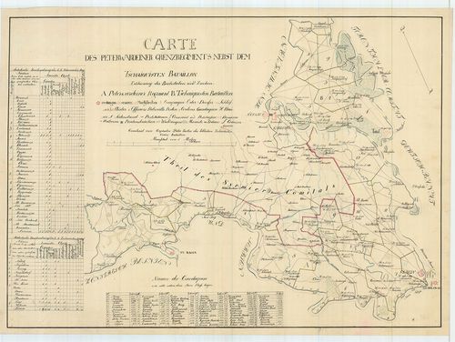
1347. Plan des in Syrmien liegenden Peterwardeiner granz Infanteri... [B IX a 1234]
Institute and Museum of Military History •
B IX a
•
B IX Ausztria–Magyarország
•
B I–XV. Európa
| Title | Plan des in Syrmien liegenden Peterwardeiner granz Infanterie Regiments ... |
| Main title | A Péterváradi Határőrezred területén fekvő Szerémség térképe. |
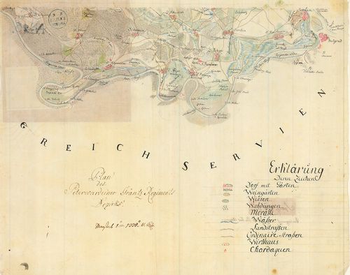
1348. Carta des Peterwardeiner Grenz Regiments nebst dem Tschaiqui... [B IX a 1235]
Institute and Museum of Military History •
B IX a
•
B IX Ausztria–Magyarország
•
B I–XV. Európa
| Title | Carta des Peterwardeiner Grenz Regiments nebst dem Tschaiquisten Bataillon. |
| Main title | A Péterváradi Határőrezred és a Csajkás ezred területe. |
1349. Plan des Peterwardeiner Granz-Regiments Bezirks. [B IX a 1238]
Institute and Museum of Military History •
B IX a
•
B IX Ausztria–Magyarország
•
B I–XV. Európa
| Title | Plan des Peterwardeiner Granz-Regiments Bezirks. |
| Main title | A Péterváradi Határőrvidék térképe. (Szlavón Határőrvidék része) |
1350. Plan und Situation des Gradiscaner Regiments... [B IX a 1239]
Institute and Museum of Military History •
B IX a
•
B IX Ausztria–Magyarország
•
B I–XV. Európa
| Title | Plan und Situation des Gradiscaner Regiments... |
| Main title | A Gradisca-i Katonai Hatáűrőrezred térképe. (Szlavón Határőrvidék része) |
1351. Karte des Gradiscaner Grenz Regiment. [B IX a 1241]
Institute and Museum of Military History •
B IX a
•
B IX Ausztria–Magyarország
•
B I–XV. Európa

| Title | Karte des Gradiscaner Grenz Regiment. |
| Main title | A Gradisca-i Katonai Hatáűrőrezred térképe. (Szlavón Határőrvidék része) |
1352. Carta des Peterwardeiner Militar-Districts zwischen Ratscha ... [B IX a 1245]
Institute and Museum of Military History •
B IX a
•
B IX Ausztria–Magyarország
•
B I–XV. Európa
| Title | Carta des Peterwardeiner Militar-Districts zwischen Ratscha und Zemlin. |
| Main title | A Péterváradi Katonai Körzet térképe Racsa és Zemlin között. |
1353. Karte des Grossfürtenthums Siebenbürgen... [B IX a 1247]
Institute and Museum of Military History •
B IX a
•
B IX Ausztria–Magyarország
•
B I–XV. Európa
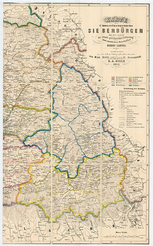
| Title | Karte des Grossfürtenthums Siebenbürgen... |
| Main title | Az Erdélyi Nagyfejedelemség térképe. |
1354. Plan des Rothen Thurner Passes. [B IX a 1254]
Institute and Museum of Military History •
B IX a
•
B IX Ausztria–Magyarország
•
B I–XV. Európa
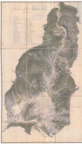
| Title | Plan des Rothen Thurner Passes. |
| Main title | A Vöröstorony-hágó térképe. |
1355. Plan des löbl. Kaiserl. Königl. Ansiedlenden Banater Deutsch... [B IX a 1263]
Institute and Museum of Military History •
B IX a
•
B IX Ausztria–Magyarország
•
B I–XV. Európa
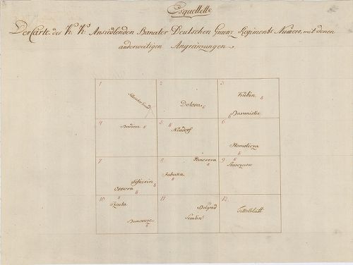
| Title | Plan des löbl. Kaiserl. Königl. Ansiedlenden Banater Deutschen Graenz Regiments.... |
| Main title | A Német Bánsági 12. határezred térképe. |
1356. Situations Plan des Wallach Illirisch Granz Infanterie Reg. ... [B IX a 1267]
Institute and Museum of Military History •
B IX a
•
B IX Ausztria–Magyarország
•
B I–XV. Európa
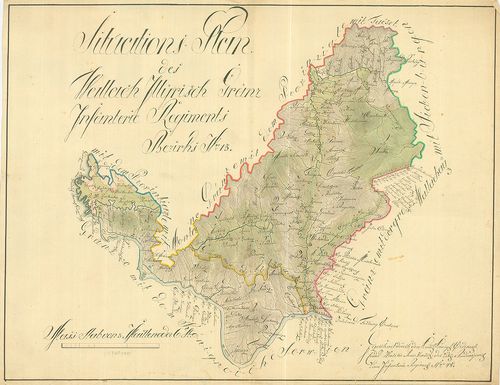
| Title | Situations Plan des Wallach Illirisch Granz Infanterie Reg. Bezirks No. 13. |
| Main title | A Oláh-Illír 13. határezred térképe. |
1357. Carte des Wallach-Illirischen Grenz Regiments Bezirks No. 13... [B IX a 1268]
Institute and Museum of Military History •
B IX a
•
B IX Ausztria–Magyarország
•
B I–XV. Európa
| Title | Carte des Wallach-Illirischen Grenz Regiments Bezirks No. 13. |
1358. Carte des Löbl. Wallach-Illyrischen Granz Regiment No. 13. [B IX a 1269]
Institute and Museum of Military History •
B IX a
•
B IX Ausztria–Magyarország
•
B I–XV. Európa
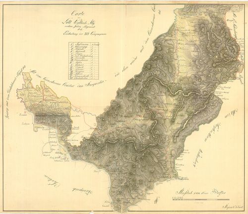
| Title | Carte des Löbl. Wallach-Illyrischen Granz Regiment No. 13. |
| Main title | A Oláh-Illír 13. határezred térképe. |
1359. Übersichts Carte des Illyrisch Banater Grenz Bataillons. [B IX a 1270]
Institute and Museum of Military History •
B IX a
•
B IX Ausztria–Magyarország
•
B I–XV. Európa
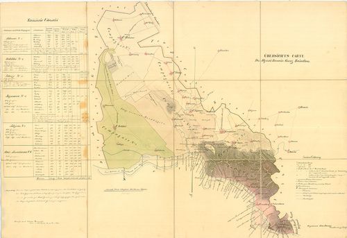
| Title | Übersichts Carte des Illyrisch Banater Grenz Bataillons. |
| Main title | Az Illír-Bánsági 14. határezred áttekintő térképe. |
1360. Carte des K. k. Deutsbanatischen Granz Regimenst No. 12. [B IX a 1273]
Institute and Museum of Military History •
B IX a
•
B IX Ausztria–Magyarország
•
B I–XV. Európa
| Title | Carte des K. k. Deutsbanatischen Granz Regimenst No. 12. |
| Main title | A Német-Bánsági 12. határezred térképe. |