1381. Karte des 2. Banal-Grenz-Regiments no. 11. [B IX a 1316]
Institute and Museum of Military History •
B IX a
•
B IX Ausztria–Magyarország
•
B I–XV. Európa
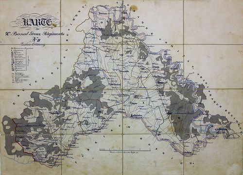
| Title | Karte des 2. Banal-Grenz-Regiments no. 11. |
| Main title | A két Bánsági Határőrvidék 11. gyalog határezred térképe. |
1382. Militair Charte eines Theil des Agramer Comitat… [B IX a 1317]
Institute and Museum of Military History •
B IX a
•
B IX Ausztria–Magyarország
•
B I–XV. Európa
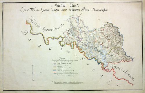
| Title | Militair Charte eines Theil des Agramer Comitat… |
| Main title | Zágráb megye egy részének katonai térképe. |
1383. Karte von dem Millitair District des Königreich Sclavonien u... [B IX a 1319]
Institute and Museum of Military History •
B IX a
•
B IX Ausztria–Magyarország
•
B I–XV. Európa
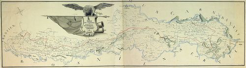
| Title | Karte von dem Millitair District des Königreich Sclavonien und Herzogthum Syrmien. |
| Main title | A Szlavón Határőrvidék és a Szerémség térképe. |
1384. Carte des Peterwardeiner Grenz Regiments und Tsaikisten Bat... [B IX a 1320]
Institute and Museum of Military History •
B IX a
•
B IX Ausztria–Magyarország
•
B I–XV. Európa
| Title | Carte des Peterwardeiner Grenz Regiments und Tsaikisten Battaillon. |
| Main title | A Péterváradi Határőrezred és a Csajkás ezred térképe. |
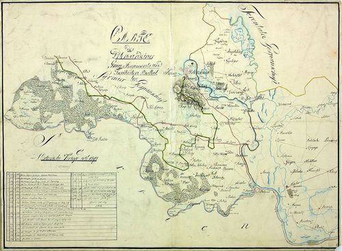
1385. Charte von der Lage des löbl. Broder Infanterie Grenz-Regime... [B IX a 1321]
Institute and Museum of Military History •
B IX a
•
B IX Ausztria–Magyarország
•
B I–XV. Európa
| Title | Charte von der Lage des löbl. Broder Infanterie Grenz-Regiments. |
| Main title | A Bródi határőr gyalogezred térképe. |
1386. Plan von der Laage des Kais. Königlichen Brooder Grenz Infan... [B IX a 1322]
Institute and Museum of Military History •
B IX a
•
B IX Ausztria–Magyarország
•
B I–XV. Európa
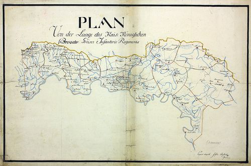
| Title | Plan von der Laage des Kais. Königlichen Brooder Grenz Infanterie Regiments. |
| Main title | A Bródi határőr gyalogezred térképe. |
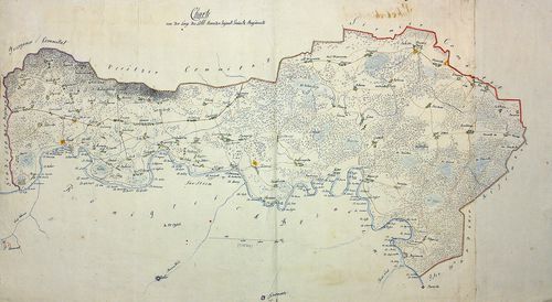
1387. Mappa und Territorium des k. k. Broder Gräntz Regiments No. ... [B IX a 1323]
Institute and Museum of Military History •
B IX a
•
B IX Ausztria–Magyarország
•
B I–XV. Európa
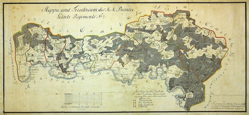
| Title | Mappa und Territorium des k. k. Broder Gräntz Regiments No. 7. |
| Main title | A Bródi 7. határőrezred térképe. |
1388. Charte des löb. Gradiscaner Regiments. [B IX a 1324]
Institute and Museum of Military History •
B IX a
•
B IX Ausztria–Magyarország
•
B I–XV. Európa
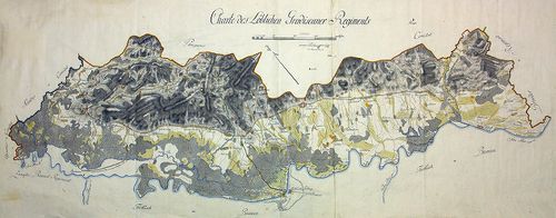
| Title | Charte des löb. Gradiscaner Regiments. |
| Main title | A Gradiscai ezred térképe. |
1389. Plan des Gradiscaner Regiments No. 8. [B IX a 1325]
Institute and Museum of Military History •
B IX a
•
B IX Ausztria–Magyarország
•
B I–XV. Európa
| Title | Plan des Gradiscaner Regiments No. 8. |
| Main title | A 8. Gradiscai ezred térképe. |
1390. Plan des in Syrmien liegenden Peterwardeiner Grenz-Infanteri... [B IX a 1328]
Institute and Museum of Military History •
B IX a
•
B IX Ausztria–Magyarország
•
B I–XV. Európa
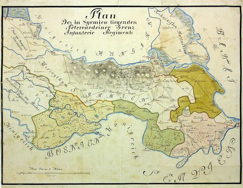
| Title | Plan des in Syrmien liegenden Peterwardeiner Grenz-Infanterie-Regiments. |
| Main title | A szerémségi Péterváradi határ-gyalogezred térképe. |
1391. Plan des in Herzogthum Syrmien liegenden Peterwardeiner -Inf... [B IX a 1329]
Institute and Museum of Military History •
B IX a
•
B IX Ausztria–Magyarország
•
B I–XV. Európa
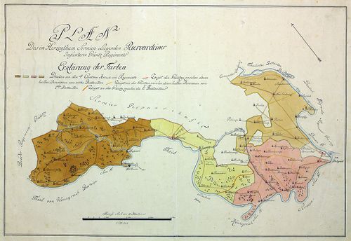
| Title | Plan des in Herzogthum Syrmien liegenden Peterwardeiner -Infanterie- Grenz -Regiments. |
| Main title | A szerémségi Péterváradi határ-gyalogezred térképe. |
1392. Plan des in Herzogthum Syrmien liegenden Peterwardeiner -Inf... [B IX a 1330]
Institute and Museum of Military History •
B IX a
•
B IX Ausztria–Magyarország
•
B I–XV. Európa
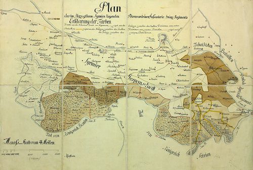
| Title | Plan des in Herzogthum Syrmien liegenden Peterwardeiner -Infanterie- Grenz -Regiments. |
| Main title | A szerémségi Péterváradi határ-gyalogezred térképe. |
1393. Plan des Slavonischen Peterwardeiner Gränz Regiments. [B IX a 1331]
Institute and Museum of Military History •
B IX a
•
B IX Ausztria–Magyarország
•
B I–XV. Európa
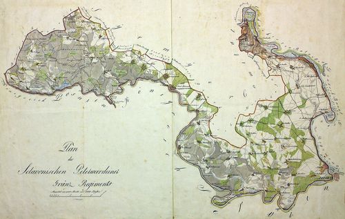
| Title | Plan des Slavonischen Peterwardeiner Gränz Regiments. |
| Main title | A szlavóniai Péterváradi határezred térképe. |
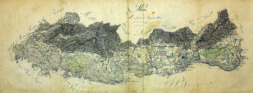
1394. Carte des Kais. König. Peterwardeiner Grenz-Regiments. [B IX a 1332]
Institute and Museum of Military History •
B IX a
•
B IX Ausztria–Magyarország
•
B I–XV. Európa
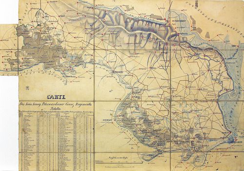
| Title | Carte des Kais. König. Peterwardeiner Grenz-Regiments. |
| Main title | A császári-királyi Péterváradi határezred térképe. |
1395. Plan aller Gründe des k. k. Tschaikisten Bataillons-Cantons-... [B IX a 1333]
Institute and Museum of Military History •
B IX a
•
B IX Ausztria–Magyarország
•
B I–XV. Európa
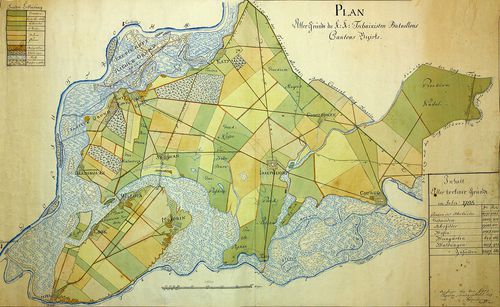
| Title | Plan aller Gründe des k. k. Tschaikisten Bataillons-Cantons-Bezirk. |
| Main title | A császári-királyi Csajkások térképe. |
1396. Plan des Tschaikisten Bataillons. [B IX a 1334]
Institute and Museum of Military History •
B IX a
•
B IX Ausztria–Magyarország
•
B I–XV. Európa
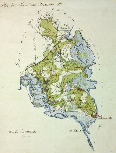
| Title | Plan des Tschaikisten Bataillons. |
| Main title | A Csajkás ezred térképe. |
1397. Plan des löblichen kaiserlichen königlichen Tschaikisten Gre... [B IX a 1335]
Institute and Museum of Military History •
B IX a
•
B IX Ausztria–Magyarország
•
B I–XV. Európa
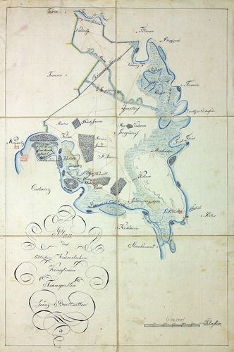
| Title | Plan des löblichen kaiserlichen königlichen Tschaikisten Grenz-Bataillons. |
| Main title | A Csajkás határezred térképe. |
1398. Plan des k. k. Czaikisten Grenz-Bataillons. [B IX a 1336]
Institute and Museum of Military History •
B IX a
•
B IX Ausztria–Magyarország
•
B I–XV. Európa
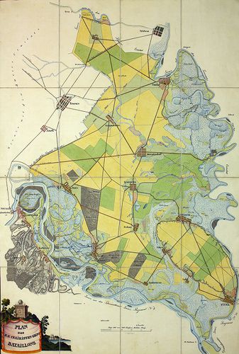
| Title | Plan des k. k. Czaikisten Grenz-Bataillons. |
| Main title | A Csajkás határezred térképe. |
1399. Plan des k. k. Czaikisten Grenz-Bataill. Bezirks. [B IX a 1338]
Institute and Museum of Military History •
B IX a
•
B IX Ausztria–Magyarország
•
B I–XV. Európa
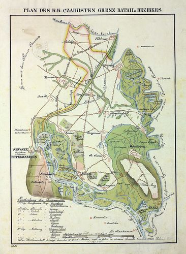
| Title | Plan des k. k. Czaikisten Grenz-Bataill. Bezirks. |
| Main title | A Csajkás határezred térképe. |
1400. Pozsony megye térképe. Karte des Comitates Pressburg. [B IX a 2003]
Institute and Museum of Military History •
B IX a 1401–2599 Magyarország megyetérképek
•
B IX Ausztria–Magyarország
•
B I–XV. Európa

| Title | Pozsony megye térképe. Karte des Comitates Pressburg. |