1. Óbuda és környékének térképvázlata (melléklet) [Budapest térképeinek katalógusa 2166]
Budapest City Archives •
Óbuda
•
Az 1873 előtti időszakra vonatkozó térképek leírása
•
Budapest térképeinek katalógusa
| Subject | Óbuda és környékének térképvázlata (melléklet) |
Contributor: Marsigli L Content: Vízvezeték madártávlati rajza Melléklet Marsigli Danubius Pannonico Myticus c könyvéhez [...]
2. Tab. VII, Sectio V. [Budapest térképeinek katalógusa 272]
Budapest City Archives •
Buda
•
Az 1873 előtti időszakra vonatkozó térképek leírása
•
Budapest térképeinek katalógusa
| Main title | Tab. VII, Sectio V. |
| Subject | Óbuda és Ercsi közötti terület áttekintő térképe (melléklet) |
Contributor: Marsigli Luigi Ferdinando Content: [...] oldalnézetben Ördög árok mocsár Melléklet Marsigli Danubius Pannonico Myticus c könyvéhez [...]
3. Mappa generalis in qua Danubii fl. Caetium montem inter et B... [S 80 - Nyomtatott térképek. - No. 1/1-19.]
National Archives of Hungary •
S 80 Térképek (18. sz.-20. sz.)
•
S Vízrajzi Intézet (18. sz.-20. sz.)
•
S – Térképtár
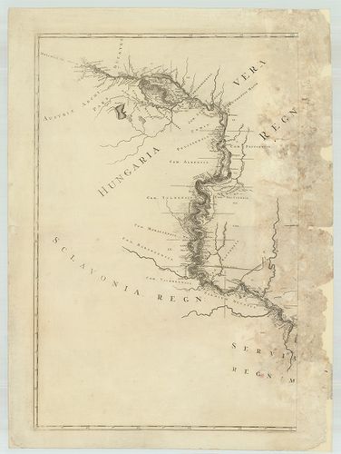
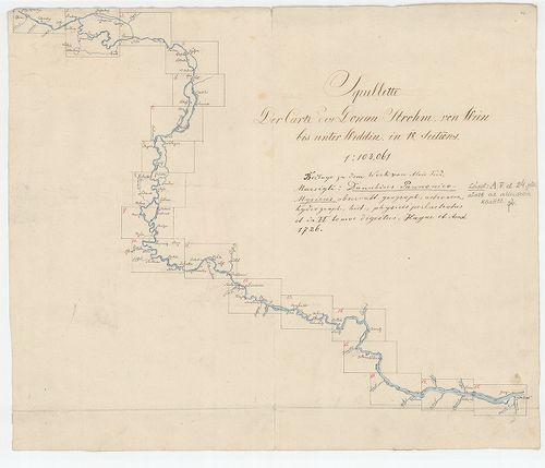
| Main title | Mappa generalis in qua Danubii fl. Caetium montem inter et Bulgariae flumen Jantram intercepti tractus integer in subsequentibus XVIII sectionibus divisim specialissime exhibendus repraesentatur ... |
| Subject | Nyomtatott térképek. - No. 1/1-19. A Duna Kahlenberg és Jantra között |
Contributor: Marsigli Luigi Ferdinando Technical features: [...] régi római sánc Eredeti megj Marsigli Danubius Pannonico Mysicus I VI [...] Amszterdam 1726 I kötet Megj Marsigli La Hongrie et la Danube [...]
4. Attacco di Buda proposto col dettaglio della gente, artigler... [H III c 137]
Institute and Museum of Military History •
H III c (1651–1700)
•
H III Újkori háborúk (1492–1789)
•
H Háborúk
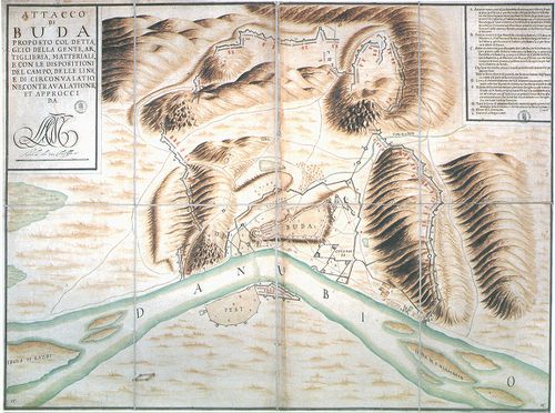
| Title | Attacco di Buda proposto col dettaglio della gente, artigleria, materiali e con le dispositioni del campo, delle linee di circonvalatione, contravalatione et approcci da L. F. C. M. |
| Main title | Buda és közvetlen környékének tervrajza a csapatok jelével, kiépített ostromárkokkal 1684–86-ból. |
Contributor: MARSIGLI Luigi Fernando
5. Mappa geographica, in qua universus tractus limitum immediat... [B IX c 632]
Institute and Museum of Military History •
B IX c
•
B IX Ausztria–Magyarország
•
B I–XV. Európa
| Title | Mappa geographica, in qua universus tractus limitum immediatorum caesareo-ottomanicarum prut nimirum in alma pace Carlovitzensi… |
| Main title | Földrajzi térkép, amely a császári és ottomán birodalmat elválasztó határokat teljes hosszukban bemutatja a karlócai békekötés után. |
Contributor: MARSIGLI A F
6. Mappa Geographico Limitanea in qua Imperiorum Caesarei et Ot... [B IX c 634]
Institute and Museum of Military History •
B IX c
•
B IX Ausztria–Magyarország
•
B I–XV. Európa
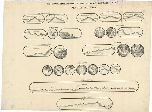
| Title | Mappa Geographico Limitanea in qua Imperiorum Caesarei et Ottomanici Confinia in almae pacis Carlovitzensis Congressu Decreta et a Duobus Utriusque Imperi Commissaris Intituta Solenni Expeditione… |
| Main title | A karlócai békekötésben meghatározott osztrák-török határvonal áttekintő térképe és felmérési szelvényei. |
Contributor: MARSIGLI A F
7. [A Duna Bécs és Giorgio közti szakaszának térképe.] [B IX b 112]
Institute and Museum of Military History •
B IX b
•
B IX Ausztria–Magyarország
•
B I–XV. Európa
| Title | [A Duna Bécs és Giorgio közti szakaszának térképe.] |
Contributor: MARSIGLI Luigi Ferdinando
8. Mappa Geographica Unnae Fluvii Tractum, a Kastanovitz...Terr... [B IX c 1433]
Institute and Museum of Military History •
B IX c
•
B IX Ausztria–Magyarország
•
B I–XV. Európa
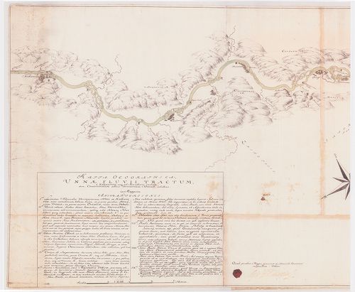
| Title | Mappa Geographica Unnae Fluvii Tractum, a Kastanovitz...Territorium Novense... |
| Main title | Az Una folyó térképe Kastanovitz-től Novi-ig. Határtérkép. |
Contributor: MARSIGLI L F MÜLLER J C [...]
9. Mappa, qua ostenduntur difficultates communicationis Sclavon... [B IX c 1431]
Institute and Museum of Military History •
B IX c
•
B IX Ausztria–Magyarország
•
B I–XV. Európa
| Title | Mappa, qua ostenduntur difficultates communicationis Sclavoniae et Croatiae evacuatis Jeszenovitz et Dubitza |
| Main title | Azon térkép, amelyen bemutatjuk, milyen közlekedési nehézségekkel kell szembenézni Jeszenovitz és Dubitza kiürítése után.Határtérkép. |
Contributor: MARSIGLI L F MÜLLER J C [...]
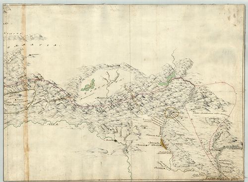
10. Mappa Chorographica per quam Communicatio Sclavoniae... [B IX a 1149]
Institute and Museum of Military History •
B IX a
•
B IX Ausztria–Magyarország
•
B I–XV. Európa
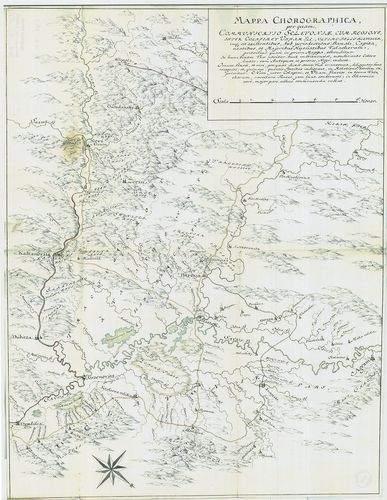
| Title | Mappa Chorographica per quam Communicatio Sclavoniae... |
| Main title | Földrajzi térkép, amelynek segítségével Szlavónia közlekedését ábrázolják. |
Contributor: MARSIGLI L F MÜLLER J C [...]
11. Mappa Lineae Limitaneae Particularis, Sirmiensis. [B IX a 1150]
Institute and Museum of Military History •
B IX a
•
B IX Ausztria–Magyarország
•
B I–XV. Európa
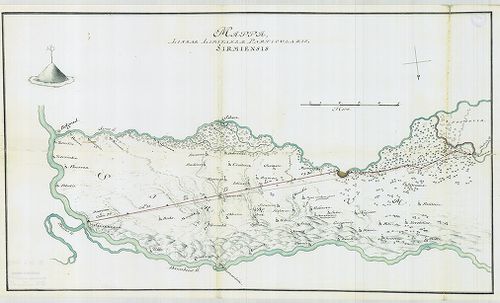
| Title | Mappa Lineae Limitaneae Particularis, Sirmiensis. |
| Main title | A szerémségi határszakasz résztérképe. |
Contributor: MARSIGLI L F MÜLLER J C [...]
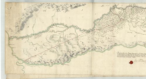
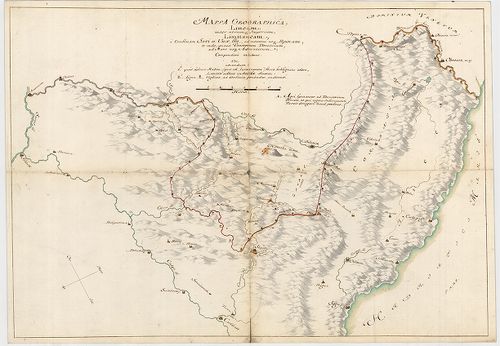
12. Mappa Geographica, Lineae Limitaneae partem Szluinensem comp... [B IX a 1151]
Institute and Museum of Military History •
B IX a
•
B IX Ausztria–Magyarország
•
B I–XV. Európa
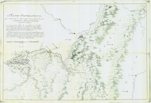
| Title | Mappa Geographica, Lineae Limitaneae partem Szluinensem compendiose exhibens... |
| Main title | Geográfiai térkép, amely a szluini határrészt ábrázolja. |
Contributor: MARSIGLI L F MÜLLER J C [...]
13. Tractus Unnae fl. inter Novi et Asperkanova Kula, Burgar, Tu... [B IX a 1152]
Institute and Museum of Military History •
B IX a
•
B IX Ausztria–Magyarország
•
B I–XV. Európa
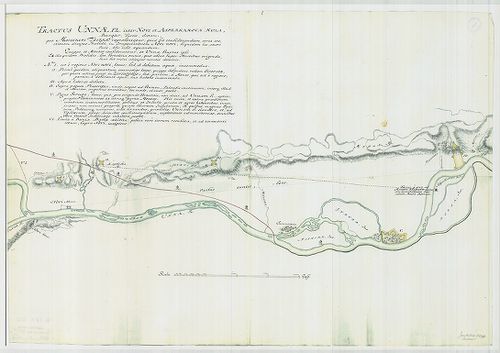
| Title | Tractus Unnae fl. inter Novi et Asperkanova Kula, Burgar, Turcis, dictam... |
| Main title | Az Una folyó Novi és a törökök által Burgar-nak nevezett Asperkanova Kula között. |
Contributor: MARSIGLI L F MÜLLER J C [...]
14. [Az Una folyó egy szakasza, Novi és környéke.] [B IX a 1153]
Institute and Museum of Military History •
B IX a
•
B IX Ausztria–Magyarország
•
B I–XV. Európa
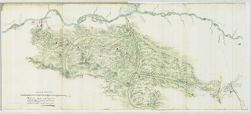
| Title | [Az Una folyó egy szakasza, Novi és környéke.] |
Contributor: MARSIGLI L F MÜLLER J C [...]
15. Mappa Geographica Facta in Ufum Commerciorum „Buda et Baja”. [B IX a 1175]
Institute and Museum of Military History •
B IX a
•
B IX Ausztria–Magyarország
•
B I–XV. Európa
| Title | Mappa Geographica Facta in Ufum Commerciorum „Buda et Baja”. |
| Main title | „Kereskedelmi útvonalak térképe” |
Contributor: MARSIGLI L F MÜLLER J C [...]
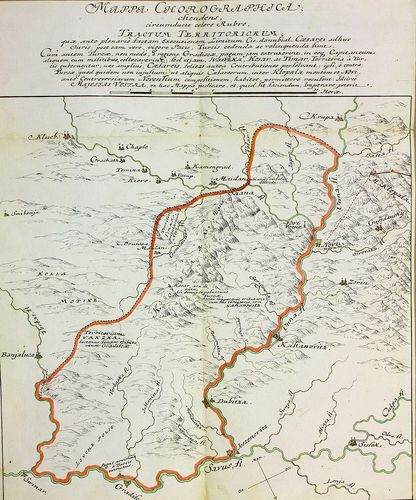
16. Mappa Chorographica otendens....Tractum Territoriorum…Pacis,... [B IX a 1294]
Institute and Museum of Military History •
B IX a
•
B IX Ausztria–Magyarország
•
B I–XV. Európa
| Title | Mappa Chorographica otendens....Tractum Territoriorum…Pacis, Turcis... |
| Main title | Földrajzi térkép, amely piros színnel keretezve azokat a területeket mutatja, amelyet a békeszerződés értelmében a törököknek kell átadni (Banja Luka, Gradisca, Novi közti terület). |
Contributor: MARSIGLI L F MÜLLER J C [...]
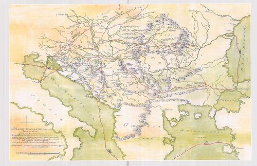
17. Mappa Generalis Regni Croatiae Totius. [B IX c 1430]
Institute and Museum of Military History •
B IX c
•
B IX Ausztria–Magyarország
•
B I–XV. Európa
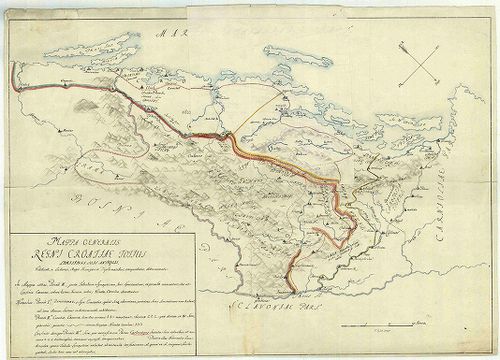
| Title | Mappa Generalis Regni Croatiae Totius. |
| Main title | Horvátország térképe..Határtérkép. |
Contributor: MARSIGLI L F MÜLLER J C [...]
18. Plan de Kastanoviz. [G I h 3592]
Institute and Museum of Military History •
G I h vár alaprajzok, város és környéktérképek, utikönyvek
•
G I Európa
•
G I–V. Úti térképek
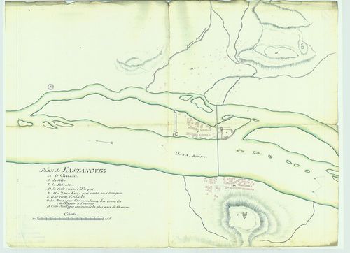
| Title | Plan de Kastanoviz. |
| Main title | Kasztanoviz helyszínrajza. |
Contributor: L F MARSIGLI J C MÜLLER
19. Mappa Geographica Lineae Limitaneae Particularis utriusque S... [B IX c 1436]
Institute and Museum of Military History •
B IX c
•
B IX Ausztria–Magyarország
•
B I–XV. Európa
| Title | Mappa Geographica Lineae Limitaneae Particularis utriusque Sirmiensis a Salankemen usque ad Confluxum Bozut fl.; et Savensis, inde ad Confluxum Unnae fl. |
| Main title | Földrajzi térkép, amely részletesen ábrázolja egyrészt Salankementől a Bozut folyó torkolatáig a szerémségi, másrészt innen az Una torkolatáig a szávai határvonalat. Határtérkép. |
Contributor: MARSIGLI L F MÜLLER J C [...]
20. Mappa Geographica Transylvaniam a Banatu Temisvariensi Separ... [B IX c 1404]
Institute and Museum of Military History •
B IX c
•
B IX Ausztria–Magyarország
•
B I–XV. Európa
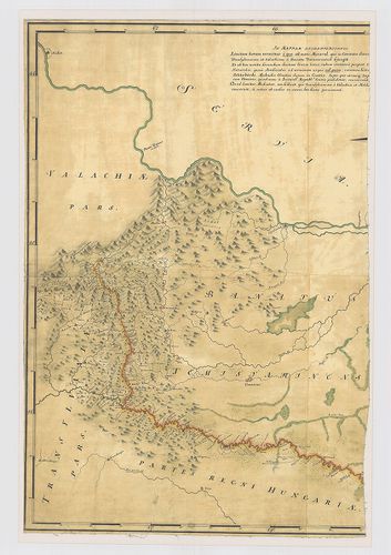
| Title | Mappa Geographica Transylvaniam a Banatu Temisvariensi Separantes Limites... |
| Main title | Erdély és a Temesi Bánság földrajzi térképe a határok feltüntetésével. Határtérkép. |
Contributor: MARSIGLI L F MÜLLER J C [...]
21. Mappa Geographica Lineae inter utrumque Imperium, Limitaneae... [B IX c 1434]
Institute and Museum of Military History •
B IX c
•
B IX Ausztria–Magyarország
•
B I–XV. Európa
| Title | Mappa Geographica Lineae inter utrumque Imperium, Limitaneae [...] a Confinio Triplici, usque ad Szluin [...] exhibens |
| Main title | Földrajzi térkép, amely a két birodalom között húzódó [...] határokat a hármas határtól Szluinig... mutatja. Határtérkép. |
Contributor: MARSIGLI L F MÜLLER J C [...]
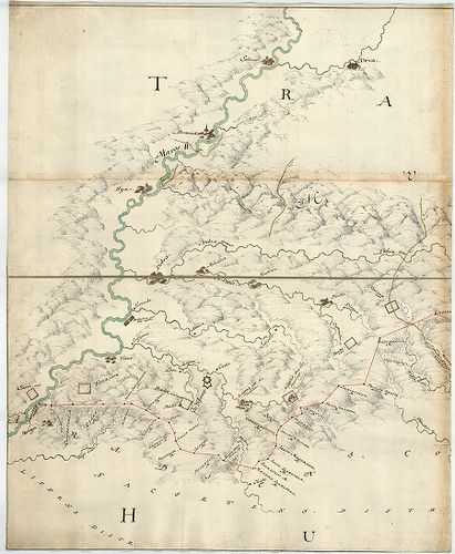
22. Limitum post Pacem Carlovitcensem A MDCXCVIII. Mappa Geograp... [B IX c 1421]
Institute and Museum of Military History •
B IX c
•
B IX Ausztria–Magyarország
•
B I–XV. Európa
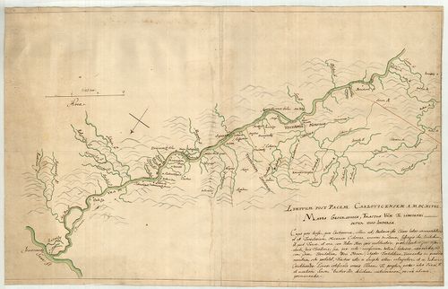
| Title | Limitum post Pacem Carlovitcensem A MDCXCVIII. Mappa Geographica, Tractus Unnae fl. Limitanei inter duo Imperia. |
| Main title | Az 1698. (sic!) évi Karlócai békeszerződés utáni határok földrajzi térképe, amely az Una folyónak a két birodalom közötti határszakaszát ábrázolja. Határtérkép. |
Contributor: MARSIGLI L F MÜLLER J C [...]
23. Mappa Geographica Unnae Fluvii Tractum, a Kastanovitz, usque... [B IX c 1422]
Institute and Museum of Military History •
B IX c
•
B IX Ausztria–Magyarország
•
B I–XV. Európa
| Title | Mappa Geographica Unnae Fluvii Tractum, a Kastanovitz, usque ad Monasterii rudera, item, Controversum adhuc Territorium Novense, exhibens. |
| Main title | Geográfiai térkép, amely az Una folyót Kastanovitztól a kolostor romjaiig, valamint a még vitatott novi-i területet ábrázolja. Határtérkép. |
Contributor: MARSIGLI L F MÜLLER J C [...]
24. Mappa Geographica; Lineam, inter utrumque Imperium, Limitane... [B IX c 1423]
Institute and Museum of Military History •
B IX c
•
B IX Ausztria–Magyarország
•
B I–XV. Európa
| Title | Mappa Geographica; Lineam, inter utrumque Imperium, Limitaneam, a Confluxu Savi et Unae ffl., ad montem usque Popinam, ad Mare usque Adriaticum; Compendiose exhibens |
| Main title | Földrajzi térkép, amely a két birodalom határvonalát a Száva és az Una folyók torkolatától a Popina hegyig, és innen a velencei fennhatóságú területekig, egészen az Adriai tengerig, vázlatosan bemutatja. Határtérkép. |
Contributor: MARSIGLI L F MÜLLER J C [...]
25. Mappa Geographica Tractus Unae fl. Limitanei inter Duo imper... [B IX c 1424]
Institute and Museum of Military History •
B IX c
•
B IX Ausztria–Magyarország
•
B I–XV. Európa
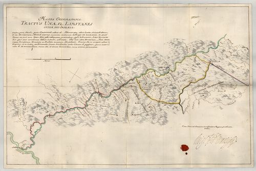
| Title | Mappa Geographica Tractus Unae fl. Limitanei inter Duo imperia... |
| Main title | Földrajzi térkép, amely az Una folyónak a két birodalom közötti szakaszát ábrázolja. Határtérkép. |
Contributor: MARSIGLI L F MÜLLER J C [...]
26. Mappa Geographica Tractus Limitanei a Sluin, usque ad, Tripl... [B IX c 1425]
Institute and Museum of Military History •
B IX c
•
B IX Ausztria–Magyarország
•
B I–XV. Európa
| Title | Mappa Geographica Tractus Limitanei a Sluin, usque ad, Triplicis Confinii, Punctum... |
| Main title | Szluintól a hármas határ pontjáig terjedő határszakasz geográfiai térképe... Határtérkép. |
Contributor: MARSIGLI L F MÜLLER J C [...]
27. Mappa Geographica, qua Praecautio contra Pestem instituenda ... [B IX c 1426]
Institute and Museum of Military History •
B IX c
•
B IX Ausztria–Magyarország
•
B I–XV. Európa
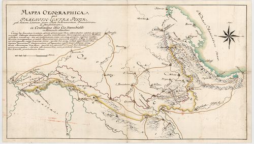
| Title | Mappa Geographica, qua Praecautio contra Pestem instituenda [...] ostenditur... |
| Main title | Földrajzi térkép, amelyen a pestis terjedésének megelőzésére hozandó intézkedéseket mutatjuk meg. Határtérkép. |
Contributor: MARSIGLI L F MÜLLER J C [...]
28. Mappa Geograph. Croatiae Inferior. Inter Unam, Colapim, et S... [B IX c 1427]
Institute and Museum of Military History •
B IX c
•
B IX Ausztria–Magyarország
•
B I–XV. Európa
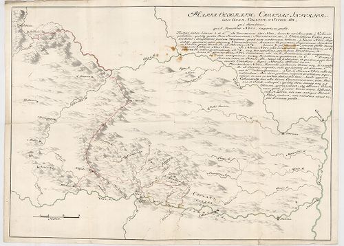
| Title | Mappa Geograph. Croatiae Inferior. Inter Unam, Colapim, et Savum, sitt., qua ostenditur, quid demolitio Novi, importare possit... |
Contributor: MARSIGLI L F MÜLLER J C [...]
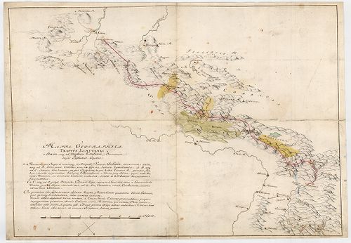
29. Mappa Geographica Lineae, ad Coranam, fl. Limitaneae, usque ... [B IX c 1428]
Institute and Museum of Military History •
B IX c
•
B IX Ausztria–Magyarország
•
B I–XV. Európa
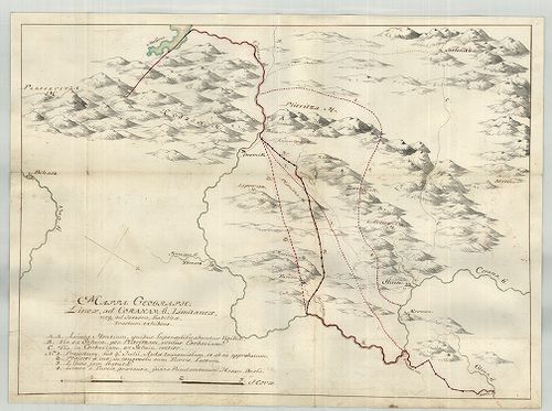
| Title | Mappa Geographica Lineae, ad Coranam, fl. Limitaneae, usque ad Jeszera [sic], stabilitae, tractum exhibens... |
| Main title | Földrajzi térkép, amely a Corana folyó mentén Jeszeraig futó végleges határszakaszt ábrázolja. Határtérkép. |
Contributor: MARSIGLI L F MÜLLER J C [...]
30. Mappa Limitanea Regni Croatiae... [B IX c 1429]
Institute and Museum of Military History •
B IX c
•
B IX Ausztria–Magyarország
•
B I–XV. Európa
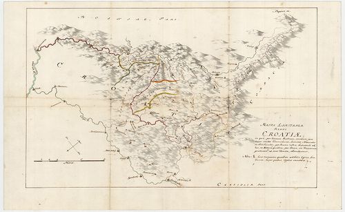
| Title | Mappa Limitanea Regni Croatiae... |
| Main title | Horvátország határtérképe... |
Contributor: MARSIGLI L F MÜLLER J C [...]
31. [Mappa Mercantilis] - Mappa Geographica facta in usum Commer... [B IX c 1408]
Institute and Museum of Military History •
B IX c
•
B IX Ausztria–Magyarország
•
B I–XV. Európa
| Title | [Mappa Mercantilis] - Mappa Geographica facta in usum Commerciorum. |
| Main title | Földrajzi térkép, amely kereskedők használatára készült.[Kereskedelmi térkép]. |
Contributor: MARSIGLI L F MÜLLER J C [...]
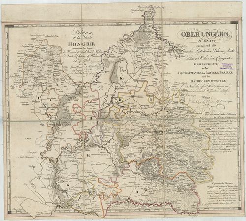
32. Budavár. Gróf Marsigli Alajos Ferdinand olasz hadi mérnök je... [H III c 146]
Institute and Museum of Military History •
H III c (1651–1700)
•
H III Újkori háborúk (1492–1789)
•
H Háborúk
| Title | Budavár. Gróf Marsigli Alajos Ferdinand olasz hadi mérnök jelentései és térképei Budavár 1684–1686-iki ostromairól, visszafoglalásáról és helyrajzáról. |
33. Tabula Hungaria et Regionum, quae praterae ab ea dependent, ... [B IX a 539/9]
Institute and Museum of Military History •
B IX a
•
B IX Ausztria–Magyarország
•
B I–XV. Európa
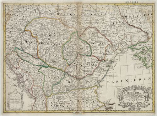
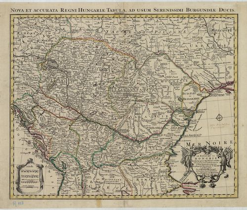
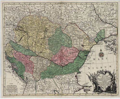
| Title | Tabula Hungaria et Regionum, quae praterae ab ea dependent, Delineata juxta magnum numerum annotationum… |
| Main title | Magyarország, a társországok és a Balkán-félsziget É-i államainak térképe 1720 körül. |
Technical features: Marsigli megfigyelései alapján Metsz Matthaus Seutter [...]
34. Carte Particuliere de la Hongrie de la Transilvanie de la Cr... [B IX a 539/1]
Institute and Museum of Military History •
B IX a
•
B IX Ausztria–Magyarország
•
B I–XV. Európa
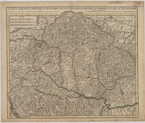
| Title | Carte Particuliere de la Hongrie de la Transilvanie de la Croatie et de la Sclavonie. |
| Main title | Magyarország, Erdély, Horvát-Szlavónia térképe 1717-ben, tartományi határszínezés. |
Technical features: Marsigli megfigyelései és más memoárok alapján [...]
35. Carte de la Hongrie et des Pays qui en dependoient autrefois... [B IX a 1021]
Institute and Museum of Military History •
B IX a
•
B IX Ausztria–Magyarország
•
B I–XV. Európa
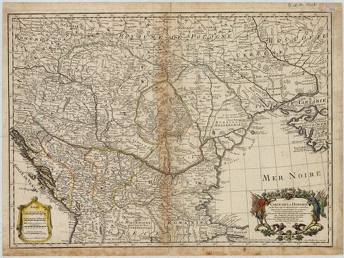
| Title | Carte de la Hongrie et des Pays qui en dependoient autrefois. |
| Main title | Magyarország és a társországok térképe. |
Technical features: Marsigli megfigyelései alapján Paris 1745 Delisle [...]
36. Le Royaume de Hongrie et des Pays qui en dependoient autreso... [B IX a 539/4]
Institute and Museum of Military History •
B IX a
•
B IX Ausztria–Magyarország
•
B I–XV. Európa
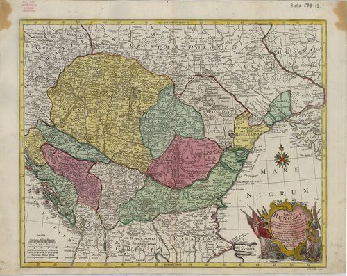
| Title | Le Royaume de Hongrie et des Pays qui en dependoient autresois… |
| Main title | Magyarország és a szomszédos területek térképe 1730 körül, tartományi határszínezés. |
Technical features: Marsigli és más szerzők megfigyelései alapján [...]
37. Carte Particuliere de la Hongrie de la Transilvanie de la Cr... [B IX a 539/2]
Institute and Museum of Military History •
B IX a
•
B IX Ausztria–Magyarország
•
B I–XV. Európa
| Title | Carte Particuliere de la Hongrie de la Transilvanie de la Croatie et de la Sclavonie. |
| Main title | Magyarország, Erdély, Horvát-Szlavónia térképe Delisle térképe alapján. |
Technical features: Marsigli megfigyelései és más memoárok alapján [...]
38. Tabula Hungaria et Regionum, quae praeterea ab ea dependent,... [B IX a 539/19]
Institute and Museum of Military History •
B IX a
•
B IX Ausztria–Magyarország
•
B I–XV. Európa
| Title | Tabula Hungaria et Regionum, quae praeterea ab ea dependent, Delineata juxta magnum numerum annotationum et mappas manuscriptas vel impressas… |
| Main title | Magyarország és a környező államok térképe a 18. században. |
Technical features: Marsigli megfigyelései alapján készült Metsz G [...]
39. Tabula Hungaria et Regionum quae praeterea ab ea dependent… [B IX a 512]
Institute and Museum of Military History •
B IX a
•
B IX Ausztria–Magyarország
•
B I–XV. Európa
| Title | Tabula Hungaria et Regionum quae praeterea ab ea dependent… |
| Main title | Magyarország és a társországok térképe 1760 körül. |
Technical features: Marsigli és G de L Isle [...]
40. Das Koenigreich Bosnien, und die Herzegovina (Rama) samt den... [S 68 - XII. - No. 60.]
National Archives of Hungary •
S 68 Festetics család (1645-1943)
•
S Családi fondokból kiemelt térképek (17. sz.-20. sz.)
•
S – Térképtár
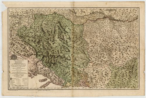
| Main title | Das Koenigreich Bosnien, und die Herzegovina (Rama) samt den angraenzenden Provinzen ... nach den militaerischen Handkarten des Prinzen Eugen der Grafen Kherenhüller, Marsigli und Pallavicini geographisch aufgetragen ... |
| Subject | XII. - No. 60. Bosznia, Hercegovina, Szerbia |