61. Italia carta automobilistica. Foglio 1. [B VII c 299]
Institute and Museum of Military History •
B VII c
•
B VII Olaszország
•
B I–XV. Európa
| Title | Italia carta automobilistica. Foglio 1. |
| Main title | Olaszország autótérképe 1963-ban. |
Technical features: Milano 1963 Uffucio Cartografico del Touring [...]
62. Carta prospettiva delle Comuni Censuarie della Dalmazia. [B IX a 450]
Institute and Museum of Military History •
B IX a
•
B IX Ausztria–Magyarország
•
B I–XV. Európa
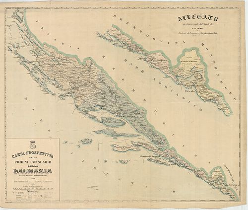
| Title | Carta prospettiva delle Comuni Censuarie della Dalmazia. |
| Main title | Mt. Allegato in doppia Scala del Circolo di Cattaro e dei Distretti di Raguza e Ragusavecchia. (Kataro, Kotor, – Ragusa, Dubrovnik, – Ragusavecchia, Ragusa-Óváros, Cavtat, ker.). |
| Subject | Dalmácia közigazgatási térképe 1853-ban, kerületi beosztással. |
Technical features: Metsz Gius epp Pezze Milano 1853 Stabilimento Civelli e C [...]
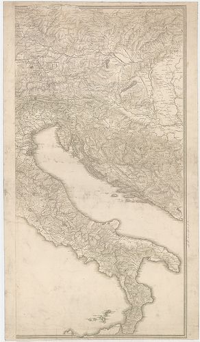
63. Carta Corografica D’ Italia. [B II c 181]
Institute and Museum of Military History •
B II c
•
B II Európa, nagyobb részek és országcsoportok
•
B I–XV. Európa
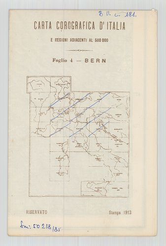
| Title | Carta Corografica D’ Italia. |
| Main title | 4.) Bern, 5.) München, 6.) Graz, 9. Torino–Milano. 10.) Venezia, 11.) Udine, 14.) Genova, 15.) Firenze, 16.) Ancona. |
64. Il Cervino e il Monte Rosa. [B VII c 266]
Institute and Museum of Military History •
B VII c
•
B VII Olaszország
•
B I–XV. Európa

| Title | Il Cervino e il Monte Rosa. |
| Main title | A Cervino és a Monte Rosa szirtek környékének turistatérképe 1900 körül. |
Technical features: Milano 19 Touring Club Italiano Ny [...]
65. La Riviera di Levante da Genova a Sestri. [B VII c 269]
Institute and Museum of Military History •
B VII c
•
B VII Olaszország
•
B I–XV. Európa
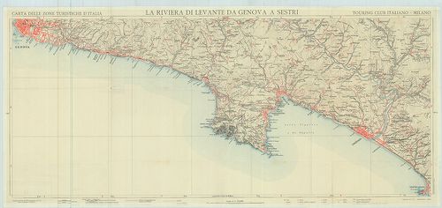
| Title | La Riviera di Levante da Genova a Sestri. |
| Main title | A Genova és Sestri közötti tengerpart térképe az 1900-as évek elején. |
Technical features: Milano 1900 Touring Club Italiano Ny [...]
66. Carta della Grecia Antica e Moderna. [B III a 101]
Institute and Museum of Military History •
B III a
•
B III Balkán-félsziget
•
B I–XV. Európa
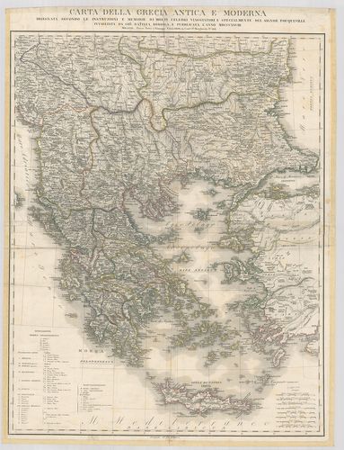
| Title | Carta della Grecia Antica e Moderna. |
| Main title | Görögország térképe 1828-ban. |
Technical features: Milano 1828 Pietro e Giuseppe Vallardi [...]
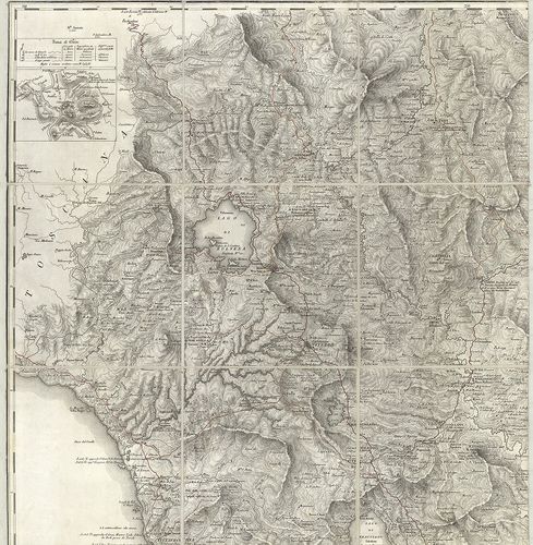
67. Val Gardena, Marmolada, Catinaccio, Gruppo di Sella. [B VII c 265]
Institute and Museum of Military History •
B VII c
•
B VII Olaszország
•
B I–XV. Európa

| Title | Val Gardena, Marmolada, Catinaccio, Gruppo di Sella. |
| Main title | A Gardena-völgy, Marmolada, Catinaccio és Sella szirtcsoportok turista térképe 1900 körül. |
Technical features: Milano 19 Touring Club Italiano Ny [...]
68. Italia Meridionale e Insulare. Guida Itineraria del Touring ... [B VII c 350]
Institute and Museum of Military History •
B VII c
•
B VII Olaszország
•
B I–XV. Európa
| Title | Italia Meridionale e Insulare. Guida Itineraria del Touring Club Italiano. Fascicolo III. |
Technical features: Milano 1901 Touring Club Italiano
69. Carta automobilistica d’Europa – Touring Club Haliano. [B I c 139]
Institute and Museum of Military History •
B I c
•
B I Európa
•
B I–XV. Európa
| Title | Carta automobilistica d’Europa – Touring Club Haliano. |
| Main title | Európa autóúttérképe 1965-ből. |
Technical features: Milano 1965 Letteraria del T C [...]
70. Italia meridionale. Foglio N. 3. [B VII c 300]
Institute and Museum of Military History •
B VII c
•
B VII Olaszország
•
B I–XV. Európa
| Title | Italia meridionale. Foglio N. 3. |
| Main title | Dél-Olaszország (Szicília nélkül) úttérképe 1963-ban. |
Technical features: Milano 1963 Ufficio Cartografico del Touring [...]
71. Marsch Karte der K. K. Armée in Italien und Frankreich in de... [H IV a 1518]
Institute and Museum of Military History •
H IV a (1700–1820)
•
H IV Újabbkori háborúk
•
H Háborúk
| Title | Marsch Karte der K. K. Armée in Italien und Frankreich in dem Feldzuge vom Jahr 1815. – Carte itineraria per le marce dell’ Esercito ImpeRe in Italia ed in Francia… 1815. |
| Main title | Olasz- és Franciaország úttérképe az 1815. évi osztrák hadműveletek idején. Útvonalak. Megerősített helyek. Postai és katonai állások. |
Technical features: Milano 181 K K Geogr Mil [...]
72. Italien Strassenatlas. – Italien Road Atlas. – Italia atlant... [B VII c 283]
Institute and Museum of Military History •
B VII c
•
B VII Olaszország
•
B I–XV. Európa
| Title | Italien Strassenatlas. – Italien Road Atlas. – Italia atlante stradale. – Italia atlas routier. |
| Main title | 1. Milano, 2. Génova, 3. Róma, 4. Firenze. |
| Subject | Olaszország úttérképe 1950 körül. |
73. Rivista Mensile del Touring Club Italiano. Carta della guerr... [B VII c 198]
Institute and Museum of Military History •
B VII c
•
B VII Olaszország
•
B I–XV. Európa
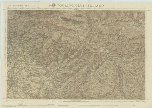
| Title | Rivista Mensile del Touring Club Italiano. Carta della guerra. Febbraio 1917. |
| Main title | F. 15. Udine-Tolmino. F. 16. Lubiana. F. 19. Gorozia-Trieste. F. 20. Adelsberg (Postojna). |
| Subject | Olaszország úthálózati térképe 1917-ben. |
Technical features: Milano 1917 Touring Club Italiano Ny [...]
74. Nuova Carta degli Stati Pontifici Meridionali. [B VII a 382]
Institute and Museum of Military History •
B VII a
•
B VII Olaszország
•
B I–XV. Európa
| Title | Nuova Carta degli Stati Pontifici Meridionali. |
| Main title | 2 mt.: 1. [Róma és környéke hegyrajza.] 2. Tavola Peutingeriana.] |
| Subject | A Pápai Állam térképe 1820-ban. |
Technical features: Milano 1820 K n
75. Carta del Dipartimento dell’Adige e di una parte dei Dip. ti... [B VII a 80/1]
Institute and Museum of Military History •
B VII a
•
B VII Olaszország
•
B I–XV. Európa
| Title | Carta del Dipartimento dell’Adige e di una parte dei Dip. ti Limitrofe. |
| Main title | Mantova környékének térképe. |
Technical features: Milano 1829 I R Istituto Geografico [...]
76. Lombardia I.-II. Guida-Itinerario dell' Italia. [B VII c 351]
Institute and Museum of Military History •
B VII c
•
B VII Olaszország
•
B I–XV. Európa
| Title | Lombardia I.-II. Guida-Itinerario dell' Italia. |
Technical features: Milano 1896 Touring Club Ciclistico Italiano [...]
77. Carta stradale dell’Italia. [B VII c 55]
Institute and Museum of Military History •
B VII c
•
B VII Olaszország
•
B I–XV. Európa
| Title | Carta stradale dell’Italia. |
| Main title | Olaszország úttérképe 1856-ban. |
Technical features: Milano 1856 Ferd inando Artaria e [...]
78. Carta della densitá media sino al livello del mare in Italia... [B VII c 281]
Institute and Museum of Military History •
B VII c
•
B VII Olaszország
•
B I–XV. Európa
| Title | Carta della densitá media sino al livello del mare in Italia. |
| Main title | Olaszország geofizikai térképe 1954-ben. |
Technical features: Milano 1955 Commissione Geodetica Italiana Ny [...]
79. Pianta topografica della R. a cittá di Venezia con XIX de su... [S 68 - XIII. - No. 68.]
National Archives of Hungary •
S 68 Festetics család (1645-1943)
•
S Családi fondokból kiemelt térképek (17. sz.-20. sz.)
•
S – Térképtár

| Main title | Pianta topografica della R. a cittá di Venezia con XIX de suoi principali prospetti ... |
| Subject | XIII. - No. 68. Velence (Venezia, I) |
Contributor: Milano
80. Italia – Italie – Italien – Italy – Automobilkarte – Carta A... [B VII c 307]
Institute and Museum of Military History •
B VII c
•
B VII Olaszország
•
B I–XV. Európa
| Title | Italia – Italie – Italien – Italy – Automobilkarte – Carta Automobilistica. |
| Main title | 4 mt.: 1. Lugano és a tavak vidéke 2. Milano. 3. Venezia (Velence) 4. Róma. |
| Subject | Olaszország autótérképe 1967-ben. |